Major Land Resource Area 032X
Northern Intermountain Desertic Basins
Accessed: 04/19/2024
Description
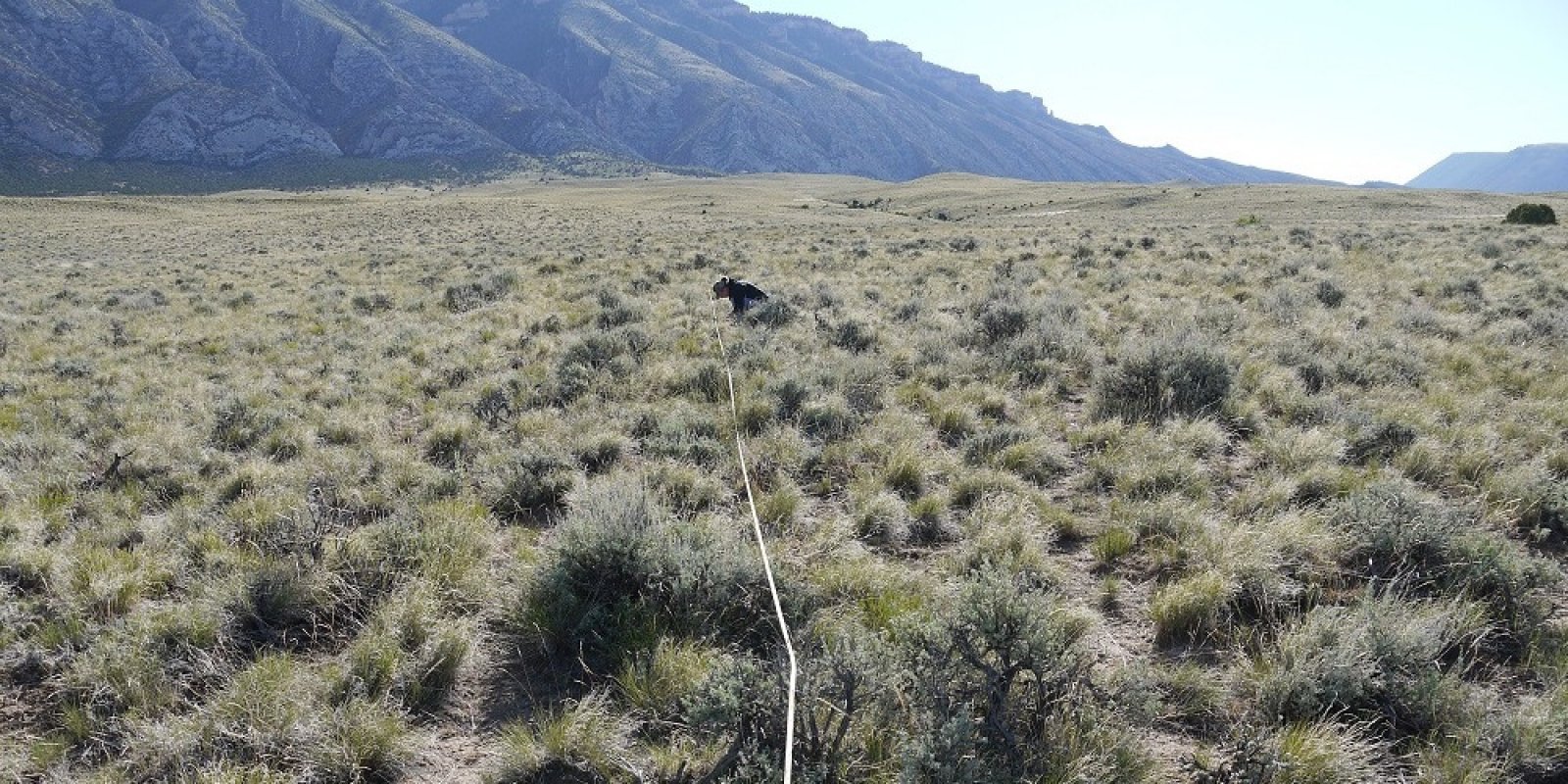
32—Northern Intermountain Desertic Basins MLRA 32 (fig. 32-1) is in Wyoming (95 percent) and Montana (5 percent). It makes up about 10,763 square miles (27,875 square kilometers). It consists of a syncline between anticlinal mountain ranges that encompasses both the Bighorn and Wind River Basins. The Bighorn Basin is bordered by MLRA 43B (Central Rocky Mountains) to the east, west, and south and MLRA 46 (Northern and Central Rocky Mountain Foothills) to the north. The Wind River Basin is bordered by MLRA 43B to the north, MLRA 46 to the west, and MLRA 34A (Cool Central Desertic Basins and Plateaus) to the south and east. Physiography The northern two-thirds of this MLRA, in the Bighorn Basin, is in the Middle Rocky Mountains province of the .Rocky Mountain System. This part of the MLRA is an elevated, dissected basin surrounded by mountain ranges to the east, west, and south. The Owl Creek and Bridger Mountains separate the northern two-thirds of the MLRA from the southern third. The southern third is in the Wind River Basin, an elevated, dissected plain with mountains to the north, west, and south. This part of the MLRA is in the Wyoming Basin province of the Rocky Mountain System. Some isolated low mountains are in each part of the MLRA. Elevation ranges from 3,600 to 7,300 feet (1,100 to 2,240 meters). Piedmont plains and pediments slope from the mountains to the stream terraces of the Wind River and Bighorn Basins. The plains are eroded to the clay shale bedrock in some areas, and there are areas of badlands. The Beaver and Wind Rivers join to form the Bighorn River in the southern third of this area. The Bighorn River cuts through the Owl Creek Mountains and continues into the northern part of the MLRA. The Shoshone and Greybull Rivers join the Bighorn River in the northern part of the area. Clark’s Fork of the Yellowstone River exits the area in the northwest corner. Geology The surface of this area is covered with old deposits of sand and gravel washed into the basins by the streams and rivers draining the surrounding mountains. The present-day rivers and streams have excavated old pediment surfaces, forming terraces. Alluvial fan deposits grade into the valley fill pediments. The igneous and sedimentary rocks exposed in the adjacent mountains occur beneath the surface of the Bighorn Basin. Tertiary sandstones and shales are exposed where the overlying alluvium has eroded away. Older sandstones, shales, and carbonate rocks are exposed as steeply dipping beds on the mountainsides. The core of most of the mountain ranges is granite. The granite may be exposed at the higher elevations along the margin of the basins. Climate The average annual precipitation in most parts of the basins is 7 to 12 inches (176 to 310 millimeters). It is as high as 22 inches (560 millimeters) in the higher areas within the basins. The maximum precipitation from frontal storms occurs in spring and fall. The surrounding mountain ranges block many of the regional precipitation events. The average annual temperature is 40 to 47 degrees F (4.6 to 8.5 degrees C). The temperature can vary widely within short periods because of the drainage of cooler mountain air into the basins. The freeze-free period averages 133 days and ranges from 110 to 155 days. Water The low and erratic precipitation provides only a small amount of the surface water used in this area. The Wind and Bighorn Rivers and their tributaries bring good-quality irrigation water into the area from the bordering mountains. A few reservoirs store water, but most of the surface water used is diverted directly from the streams. Supplies become scarce late in the growing season, from July through September. Deep artesian wells provide some water for irrigation on the eastern side of the Bighorn Basin. These wells are finished either in sandstone units in the Dakota Formation or in the carbonate rocks of the Madison Group. The well water is very hard. Ground water occurs in the alluvial basin fill deposits near the surface. This water can be soft to very hard. It is not used in the area. Soils The dominant soil orders are Aridisols and Entisols. The soils in the area dominantly have a mesic temperature regime, an aridic moisture regime, and mixed mineralogy. They generally are shallow to very deep, well drained, and loamy. The main soils and their series: Haplargids that formed in alluvium and slope alluvium on alluvial fans, fan remnants, and stream terraces (Griffy, Hiland, and Wallson series) Haplocalcids that formed in alluvium and colluvium on alluvial fans, fan remnants, and stream terraces (Emblem and Trook series) Haplocambids that formed in alluvium and colluvium on alluvial fans, fan remnants, stream terraces, and basin floor remnants (Kinnear, Pavillion, and Zigweid series) Natrargids that formed in alluvium or colluvium over residuum on alluvial fans, stream terraces, hills, fan remnants, and strath terraces (Effington, Muff, and Uffens series) Torrifluvents that formed in alluvium on flood plains, alluvial fans, and stream terraces (Lostwells and Youngston series) Torriorthents that formed in alluvium and colluvium on alluvial fans, fan remnants, stream terraces, and hills (Apron and Kishona series); that formed in residuum and colluvium on hills, escarpments, eroded fan remnants, side slopes, dip slopes, scarp slopes, and pediments (Greybull, Oceanet, Persayo, Shingle, and Worland series) Biological Resources This area supports shrub-grass vegetation. Big sagebrush, Gardner’s saltbush, rhizomatous wheatgrasses, Indian ricegrass, and needle and thread are the dominant species. Black sage, Gardner’s saltbush, and bluebunch wheatgrass are common on shallow soils in the uplands. Major wildlife species include antelope, coyote, jackrabbit, and sage grouse. Land Use Nearly one-half of this area is federally owned. The rest is in farms and ranches. Most of the land is used for grazing (fig. 32-2). The rangeland consists of desert shrubs and short grasses. About 5 percent of the area is irrigated. Most of the irrigated areas are used for alfalfa and other feed crops, but dry beans, malt barley, sugar beets, and corn are important cash crops. The major soil resource concerns are water erosion, water quality, rangeland health, and soil quality. Conservation practices on cropland include irrigation water management and installation of water-conserving irrigation systems. United States Department of Agriculture, Natural Resources Conservation Service. 2022. Land resource regions and major land resource areas of the United States, the Caribbean, and the Pacific Basin. U.S. Department of Agriculture, Agriculture Handbook 296.
Key publications
Geographic subunits
Land Resource Unit 1. 32X01 (WY): This LRU is the core of the Big Horn Basin, comprised of the eroded basin floor. As the LRU shifts toward the outer edges, aspect and relation to the major bodies of water and taller landforms create minor shifts in soil chemistry influencing the variety of ecological sites and to plant interactions. The extent of soils currently correlated to this ecological site does not fit within the digitized boundary. Many of the noted soils are provisional and will be reviewed and corrected in mapping update projects. Other map units are correlated as small inclusions within other MLRAs and LRUs based on elevation, landform, and biological references.
Land Resource Unit 2. 32X02 (WY): This LRU is the Wind River Basin within MLRA 32X. This LRU is tends to be just a fraction higher in elevation, slightly cooler (by 1-degree Celsius), and spring snowpack tends to persist longer into the spring than the Big Horn Basin (LRU 01). This LRU was originally divided into two LRU's - LRU C which was the core and LRU D which was the rim. With the most current standards, this LRU is divided into two Subsets. The extent of soils currently correlated to this ecological site does not fit within the current subset or LRU boundary. Many of the map units are correlated to ecological sites outside of this MLRA, but will be reviewed and corrected during mapping update projects.
Land Resource Unit Subunit A. 32X01A (WY): This Subset is the core of the Big Horn Basin and is comprised of eroded basin floor. As this LRU shifts towards the outer edges, aspect and relation to mountains create minor shifts in soil chemistry influencing the variety of ecological sites and plant interactions. Moisture Regime: Typic Aridic. Prior to 2012, there were map units that cross over to ustic aridic or ustic aridic was correlated into this core area. As progressive mapping continues and when the opportunity arises to do update projects, these overlapping map units will be corrected. Temperature Regime: Mesic Dominant Cover: Rangeland, with saltbush flats as the dominant vegetative cover for this LRU/ESD Representative Value (RV) Effective Precipitation: 5-9 inches (127 –229 mm) RV Frost-Free Days: 110-150 days
Land Resource Unit Subunit A. 32X02A (WY): This Subset is the core of the Wind River Basin and is comprised of eroded basin floor. As this LRU shifts towards the outer edges, aspect and relation to mountains create minor shifts in soil chemistry influencing the variety of ecological sites and plant interactions. Moisture Regime: Typic Aridic. Prior to 2012, there were map units that cross over to ustic aridic or ustic aridic was correlated into this core area. As progressive mapping continues and when the opportunity arises to do update projects, these overlapping map units will be corrected. Temperature Regime: Mesic Dominant Cover: Rangeland, with saltbush flats as the dominant vegetative cover for this LRU/ESD Representative Value (RV) Effective Precipitation: 5-9 inches (127 –229 mm) RV Frost-Free Days: 105-130 days
Land Resource Unit Subunit B. 32X01B (WY): This Subset is the rim of the Big Horn Basin and is comprised of eroded fan remnants and stream terraces. This subset is driven by the relation to the mountains creating minor shifts in soil chemistry influencing the variety of ecological sites and plant interactions. Moisture Regime: Ustic Aridic. Prior to 2012, there were map units that cross over to aridic ustic or ustic aridic was correlated into the core area. As progressive mapping continues and when the opportunity arises to do update projects, these overlapping map units will be corrected. Temperature Regime: Mesic Dominant Cover: Rangeland, with saltbush flats as the dominant vegetative cover for this LRU/ESD Representative Value (RV) Effective Precipitation: 10-14 inches (254 –355 mm) RV Frost-Free Days: 105-125 days
Land Resource Unit Subunit B. 32X02B (WY): This Subset is the rim of the Wind River Basin and is comprised of eroded fan remnants and stream terraces. This subset is driven by the relation to the mountains creating minor shifts in soil chemistry influencing the variety of ecological sites and plant interactions. Moisture Regime: Ustic Aridic Temperature Regime: Mesic Dominant Cover: Rangeland, with sagebrush steppe intermixed with saltbush flats, is the dominant vegetative cover. Representative Value (RV) Effective Precipitation: 10-14 inches (254 – 355 mm) RV Frost-Free Days: 85-115 days
Next steps
-
1
Select an ecological site
Select an ecological site using the list, keys, photos, briefcase, or quick search option located on this page. -
2
Explore the ecological site description
Next, learn more about the selected ecological site and its characteristic dynamics by browsing the ecological site description and exploring alternative state and transition model formats.
Ecological site list
-
i
Key Characteristics
- Site does not receive additional effective moisture¹
- Soil is non-saline, non-saline-sodic, or non-sodic
- Soil is moderately deep to very deep (≥ 20” (50 cm) to bedrock (lithic or paralithic contact)
- Soil is not skeletal in the upper 20” (50 cm) of the mineral soil surface
- Soil has ≥ 35% clay throughout the upper 20” (50 cm) of the mineral soil – may have a lighter textured cap or may decrease lower in the profile
- Soil has ≥ 35% clay starting within the upper 4” (10 cm) and continues throughout the upper 20” (50 cm) of mineral soil surface
-
i
Key Characteristics
- Site does not receive additional effective moisture¹
- Soil is non-saline, non-saline-sodic, or non-sodic
- Soil is moderately deep to very deep (≥ 20” (50 cm) to bedrock (lithic or paralithic contact)
- Soil is skeletal (≥ 35% rock fragments⁷ ) in the upper 20” (50 cm) of mineral soil surface
- Soil is skeletal starting within 8-20” (20-50 cm) of the mineral soil surface
- Soil has ≥ 18% but < 60% clay throughout the upper 20” (50 cm) of the mineral soil surface
- Fragments typically consisting of cobbles (fragments are dominantly > 3” (76 mm) but < 10” (250 mm) in diameter); few stones and boulders (0-5%) are present
-
i
Key Characteristics
- Site does not receive additional effective moisture¹
- Soil is non-saline, non-saline-sodic, or non-sodic
- Soil is moderately deep to very deep (≥ 20” (50 cm) to bedrock (lithic or paralithic contact)
- Soil is not skeletal in the upper 20” (50 cm) of the mineral soil surface
- Soil has ≥ 35% clay throughout the upper 20” (50 cm) of the mineral soil – may have a lighter textured cap or may decrease lower in the profile
- Abrupt clay increase⁶ to > 40% clay present within 4-8” (10-20 cm) of the mineral soil surface, severe surface cracking during dry conditions; plant dominated by birdfoot sagebrush
-
i
Key Characteristics
- Site does not receive additional effective moisture¹
- Soil is non-saline, non-saline-sodic, or non-sodic
- Soil is moderately deep to very deep (≥ 20” (50 cm) to bedrock (lithic or paralithic contact)
- Soil is skeletal (≥ 35% rock fragments⁷ ) in the upper 20” (50 cm) of mineral soil surface
- Soil is skeletal throughout the majority of the upper 20” (50 cm) of mineral soil surface
- Soil has < 18% clay; surface fragments and fragments in the soil profile are dominantly < 3” (76mm) in diameter, but may range in size
-
i
Key Characteristics
- Site does not receive additional effective moisture¹
- Soil is non-saline, non-saline-sodic, or non-sodic
- Soil is moderately deep to very deep (≥ 20” (50 cm) to bedrock (lithic or paralithic contact)
- Soil is not skeletal in the upper 20” (50 cm) of the mineral soil surface
- Soil has < 35% clay throughout the upper 20” (50 cm) of the mineral soil – may see individual horizons that are above 35% clay, but on average, the soil profile is less than 35% clays
- Soil has ≥ 18% but < 35% clay starting within the upper 8” (20 cm) of mineral soil surface⁴
- Soil is non-calcareous within 20” (50 cm) of the mineral soil surface
-
i
Key Characteristics
- Site does not receive additional effective moisture¹
- Soil is saline, saline-sodic, or sodic⁵ (SAR ≥ 13, or an EC ≥ 4 dS/m) in the upper 20” (50 cm) of the mineral soil surface; site is dominated by salt tolerant plants (i.e. Gardner’s saltbush, greasewood, alkali sacaton, alkali seepweed, etc)²
- Soil is shallow to very deep (≥10” (25 cm) to bedrock (lithic or paralithic contact))
- Soil has ≥ 18% but < 35% clay starting within 4” (10 cm) of the mineral soil surface
-
i
Key Characteristics
- Site does not receive additional effective moisture¹
- Soil is saline, saline-sodic, or sodic⁵ (SAR ≥ 13, or an EC ≥ 4 dS/m) in the upper 20” (50 cm) of the mineral soil surface; site is dominated by salt tolerant plants (i.e. Gardner’s saltbush, greasewood, alkali sacaton, alkali seepweed, etc)²
- Soil is shallow to very deep (≥10” (25 cm) to bedrock (lithic or paralithic contact))
- Soil has ≥ 35% clay starting within 4” (10 cm) of the mineral soil surface
-
i
Key Characteristics
- Site does not receive additional effective moisture¹
- Soil is saline, saline-sodic, or sodic⁵ (SAR ≥ 13, or an EC ≥ 4 dS/m) in the upper 20” (50 cm) of the mineral soil surface; site is dominated by salt tolerant plants (i.e. Gardner’s saltbush, greasewood, alkali sacaton, alkali seepweed, etc)²
- Soil is shallow to very deep (≥10” (25 cm) to bedrock (lithic or paralithic contact))
- Soil has < 18% clay starting within 4” (10 cm) of the mineral soil surface
-
i
Key Characteristics
- Site does not receive additional effective moisture¹
- Soil is non-saline, non-saline-sodic, or non-sodic
- Soil is moderately deep to very deep (≥ 20” (50 cm) to bedrock (lithic or paralithic contact)
- Soil is not skeletal in the upper 20” (50 cm) of the mineral soil surface
- Soil has < 35% clay throughout the upper 20” (50 cm) of the mineral soil – may see individual horizons that are above 35% clay, but on average, the soil profile is less than 35% clays
- Soil has < 18% clay throughout the upper 20” (50 cm) of mineral soil surface; may see clay increase below 8" (20 cm) of mineral soil surface
- Soil has < 15% clay starting within the upper 4” (10 cm) from the mineral soil surface and lacks structure; soil textures include coarse sands to loamy fine sand
-
i
Key Characteristics
- Site does not receive additional effective moisture¹
- Soil is non-saline, non-saline-sodic, or non-sodic
- Soil is moderately deep to very deep (≥ 20” (50 cm) to bedrock (lithic or paralithic contact)
- Soil is not skeletal in the upper 20” (50 cm) of the mineral soil surface
- Soil has < 35% clay throughout the upper 20” (50 cm) of the mineral soil – may see individual horizons that are above 35% clay, but on average, the soil profile is less than 35% clays
- Soil has < 18% clay throughout the upper 20” (50 cm) of mineral soil surface; may see clay increase below 8" (20 cm) of mineral soil surface
- Soil has < 18% clay starting within the upper 4” (10 cm) from the mineral soil surface; soil textures include loamy very fine sands to loams
-
i
Key Characteristics
- Site does not receive additional effective moisture¹
- Soil is saline, saline-sodic, or sodic⁵ (SAR ≥ 13, or an EC ≥ 4 dS/m) in the upper 20” (50 cm) of the mineral soil surface; site is dominated by salt tolerant plants (i.e. Gardner’s saltbush, greasewood, alkali sacaton, alkali seepweed, etc)²
- Soil is very shallow (< 10” (25 cm) to shale (lithic or paralithic contact)); productivity very low
- Site does not receive additional effective moisture¹
- Soil is saline, saline-sodic, or sodic⁵ (SAR ≥ 13, or an EC ≥ 4 dS/m) in the upper 20” (50 cm) of the mineral soil surface; site is dominated by salt tolerant plants (i.e. Gardner’s saltbush, greasewood, alkali sacaton, alkali seepweed, etc)
- Soil is very shallow (< 10” (25 cm) to shale (lithic or paralithic contact)); productivity very low
-
i
Key Characteristics
- Site does not receive additional effective moisture¹
- Soil is non-saline, non-saline-sodic, or non-sodic
- Soil is very shallow (< 10” (25 cm) or shallow (< 20” (50 cm) to bedrock (lithic or paralithic contact)
- Soil is shallow to bedrock
- Soil has ≥ 35% clay
-
i
Key Characteristics
- Site does not receive additional effective moisture¹
- Soil is non-saline, non-saline-sodic, or non-sodic
- Soil is very shallow (< 10” (25 cm) or shallow (< 20” (50 cm) to bedrock (lithic or paralithic contact)
- Soil is shallow to bedrock
- Soil has ≥ 18% but < 35% clay
-
i
Key Characteristics
- Site does not receive additional effective moisture¹
- Soil is non-saline, non-saline-sodic, or non-sodic
- Soil is very shallow (< 10” (25 cm) or shallow (< 20” (50 cm) to bedrock (lithic or paralithic contact)
- Soil is shallow to bedrock
- Soil has < 18% clay
-
i
Key Characteristics
- Site does not receive additional effective moisture¹
- Soil is non-saline, non-saline-sodic, or non-sodic
- Soil is moderately deep to very deep (≥ 20” (50 cm) to bedrock (lithic or paralithic contact)
- Soil is skeletal (≥ 35% rock fragments⁷ ) in the upper 20” (50 cm) of mineral soil surface
- Soil is skeletal starting within 8-20” (20-50 cm) of the mineral soil surface
- Soil has ≥ 18% but < 60% clay in the upper 10” (25 cm) of mineral soil, decreasing to < 18% clay within 10-20” (25-50 cm) of the mineral soil surface
- None to strong³ effervescence in the upper 4” (10 cm) of the mineral soil surface
-
i
Key Characteristics
- Site does not receive additional effective moisture¹
- Soil is non-saline, non-saline-sodic, or non-sodic
- Soil is moderately deep to very deep (≥ 20” (50 cm) to bedrock (lithic or paralithic contact)
- Soil is skeletal (≥ 35% rock fragments⁷ ) in the upper 20” (50 cm) of mineral soil surface
- Soil is skeletal throughout the majority of the upper 20” (50 cm) of mineral soil surface
- Soil has ≥ 18% but < 60% clay; surface fragments and fragments in the soil profile are dominantly ≥ 3” (76mm) in diameter but < 10” (250 mm), but may range in size
- None to strong³ effervescence in the upper 4” (10 cm) of mineral soil surface
-
i
Key Characteristics
- Site does not receive additional effective moisture¹
- Soil is non-saline, non-saline-sodic, or non-sodic
- Soil is very shallow (< 10” (25 cm) or shallow (< 20” (50 cm) to bedrock (lithic or paralithic contact)
- Soil is very shallow to bedrock, commonly on windswept ridges and escarpments, productivity very low (if productivity is higher than expected and > 35% rock fragments are present use II.B.2i.a.1) Gravelly (Gr)
-
i
Key Characteristics
- Site does not receive additional effective moisture¹
- Soil is non-saline, non-saline-sodic, or non-sodic
- Soil is moderately deep to very deep (≥ 20” (50 cm) to bedrock (lithic or paralithic contact)
- Soil is not skeletal in the upper 20” (50 cm) of the mineral soil surface
- Soil has ≥ 35% clay throughout the upper 20” (50 cm) of the mineral soil – may have a lighter textured cap or may decrease lower in the profile
- Soil has ≥ 35% clay starting within the upper 4” (10 cm) and continues throughout the upper 20” (50 cm) of mineral soil surface
-
i
Key Characteristics
- Site does not receive additional effective moisture¹
- Soil is non-saline, non-saline-sodic, or non-sodic
- Soil is moderately deep to very deep (≥ 20” (50 cm) to bedrock (lithic or paralithic contact)
- Soil is skeletal (≥ 35% rock fragments⁷ ) in the upper 20” (50 cm) of mineral soil surface
- Soil is skeletal starting within 8-20” (20-50 cm) of the mineral soil surface
- Soil has ≥ 18% but < 60% clay throughout the upper 20” (50 cm) of the mineral soil surface
- Fragments typically consisting of cobbles (fragments are dominantly > 3” (76 mm) but < 10” (250 mm) in diameter); few stones and boulders (0-5%) are present
-
i
Key Characteristics
- Site does not receive additional effective moisture¹
- Soil is non-saline, non-saline-sodic, or non-sodic
- Soil is moderately deep to very deep (≥ 20” (50 cm) to bedrock (lithic or paralithic contact)
- Soil is not skeletal in the upper 20” (50 cm) of the mineral soil surface
- Soil has ≥ 35% clay throughout the upper 20” (50 cm) of the mineral soil – may have a lighter textured cap or may decrease lower in the profile
- Abrupt clay increase⁶ to > 40% clay present within 4 8” (10 20 cm) of the mineral soil surface, severe surface cracking during dry conditions; plant dominated by birdfoot sagebrush
-
i
Key Characteristics
- Site does not receive additional effective moisture¹
- Soil is non-saline, non-saline-sodic, or non-sodic
- Soil is moderately deep to very deep (≥ 20” (50 cm) to bedrock (lithic or paralithic contact)
- Soil is skeletal (≥ 35% rock fragments⁷ ) in the upper 20” (50 cm) of mineral soil surface
- Soil is skeletal throughout the upper 20” (50 cm) of mineral soil surface
- Soil has < 18% clay; surface fragments and fragments in the soil profile are dominantly < 3” (76mm) in diameter, but may range in size
-
i
Key Characteristics
- Site does not receive additional effective moisture¹
- Soil is non-saline, non-saline-sodic, or non-sodic
- Soil is moderately deep to very deep (≥ 20” (50 cm) to bedrock (lithic or paralithic contact)
- Soil is skeletal (≥ 35% rock fragments⁷ ) in the upper 20” (50 cm) of mineral soil surface
- Soil is skeletal starting within 8-20” (20-50 cm) of the mineral soil surface
- Soil has ≥ 18% but < 60% clay throughout the upper 20” (50 cm) of the mineral soil surface
- Fragments typically consisting of stones and boulders (fragments > 10" (250 mm) in diameter), surface fragments (5-15%) are dominantly stones and boulders (specific to glacial outwash by Clark, WY; for other correlations use b) cobbly upland) -
- Site does not receive additional effective moisture¹
- Soil is non-saline, non-saline-sodic, or non-sodic
- Soil is moderately deep to very deep (≥ 20” (50 cm) to bedrock (lithic or paralithic contact)
- Soil is not skeletal in the upper 20” (50 cm) of the mineral soil surface
- Soil has < 35% clay throughout the upper 20” (50 cm) of the mineral soil – may see individual horizons that are above 35% clay, but on average, the soil profile is less than 35% clays
- Soil has ≥ 18% but < 35% clay starting within the upper 8” (20 cm) of mineral soil surface⁴
- Soil is calcareous (violent effervescence³) within 20” (50 cm) of the mineral soil surface
- Soil is calcareous within the upper 4” (10 cm) of mineral soil surface; calcium carbonate increases with depth⁴ (for soils between 4 and 8 inches start of calcareous layer, use STM to assist decision)
- Site does not receive additional effective moisture¹
- Soil is non-saline, non-saline-sodic, or non-sodic
- Soil is moderately deep to very deep (≥ 20” (50 cm) to bedrock (lithic or paralithic contact)
- Soil is skeletal (≥ 35% rock fragments⁷ ) in the upper 20” (50 cm) of mineral soil surface
- Soil is skeletal throughout the upper 20” (50 cm) of mineral soil surface
- Soil has ≥ 18% but < 60% clay; surface fragments and fragments in the soil profile are dominantly ≥ 3” (76mm) in diameter but < 10” (250 mm), but may range in size
- Violent³ effervescence starting within 4” (10 cm) of the mineral soil surface, calcium carbonate increases with depth
- Site does not receive additional effective moisture¹
- Soil is non-saline, non-saline-sodic, or non-sodic
- Soil is moderately deep to very deep (≥ 20” (50 cm) to bedrock (lithic or paralithic contact)
- Soil is skeletal (≥ 35% rock fragments⁷ ) in the upper 20” (50 cm) of mineral soil surface
- Soil is skeletal starting within 8-20” (20-50 cm) of the mineral soil surface
- Soil has ≥ 18% but < 60% clay in the upper 10” (25 cm) of mineral soil, decreasing to < 18% clay within 10-20” (25-50 cm) of the mineral soil surface
- Violent³ effervescence starting within 4” (10 cm) of the mineral soil surface, calcium carbonate increases with depth
- Site does not receive additional effective moisture¹
- Soil is non-saline, non-saline-sodic, or non-sodic
- Soil is moderately deep to very deep (≥ 20” (50 cm) to bedrock (lithic or paralithic contact)
- Soil is not skeletal in the upper 20” (50 cm) of the mineral soil surface
- Soil has < 35% clay throughout the upper 20” (50 cm) of the mineral soil – may see individual horizons that are above 35% clay, but on average, the soil profile is less than 35% clays
- Soil has ≥ 18% but < 35% clay starting within the upper 8” (20 cm) of mineral soil surface
- Soil is calcareous (violent effervescence³) within 20” (50 cm) of the mineral soil surface
- Soil is calcareous within the upper 8” (20 cm) of mineral soil, calcium carbonate increases with depth
-
i
Key Characteristics
- Site does not receive additional effective moisture¹
- Soil is non-saline, non-saline-sodic, or non-sodic
- Soil is moderately deep to very deep (≥ 20” (50 cm) to bedrock (lithic or paralithic contact)
- Soil is skeletal (≥ 35% rock fragments⁷ ) in the upper 20” (50 cm) of mineral soil surface
- Soil is skeletal throughout the majority of the upper 20” (50 cm) of mineral soil surface
- Soil has ≥ 18% but < 60% clay; surface fragments and fragments in the soil profile are dominantly ≥ 3” (76mm) in diameter but < 10” (250 mm), but may range in size
- Violent³ effervescence starting within 4” (10 cm) of the mineral soil surface, calcium carbonate increases with depth⁴
-
i
Key Characteristics
- Site does not receive additional effective moisture¹
- Soil is non-saline, non-saline-sodic, or non-sodic
- Soil is moderately deep to very deep (≥ 20” (50 cm) to bedrock (lithic or paralithic contact)
- Soil is not skeletal in the upper 20” (50 cm) of the mineral soil surface
- Soil has < 35% clay throughout the upper 20” (50 cm) of the mineral soil – may see individual horizons that are above 35% clay, but on average, the soil profile is less than 35% clays
- Soil has ≥ 18% but < 35% clay starting within the upper 8” (20 cm) of mineral soil surface
- Soil is non-calcareous within 20” (50 cm) of the mineral soil surface
-
i
Key Characteristics
- Site does not receive additional effective moisture¹
- Soil is non-saline, non-saline-sodic, or non-sodic
- Soil is moderately deep to very deep (≥ 20” (50 cm) to bedrock (lithic or paralithic contact)
- Soil is not skeletal in the upper 20” (50 cm) of the mineral soil surface
- Soil has < 35% clay throughout the upper 20” (50 cm) of the mineral soil – may see individual horizons that are above 35% clay, but on average, the soil profile is less than 35% clays
- Soil has ≥ 18% but < 35% clay starting within the upper 8” (20 cm) of mineral soil surface⁴
- Soil is calcareous (violent effervescence³) within 20” (50 cm) of the mineral soil surface
- Soil is calcareous starting within the upper 8-20” (20 to 50 cm) of the mineral soil surface⁴
- Site does not receive additional effective moisture¹
- Soil is non-saline, non-saline-sodic, or non-sodic
- Soil is moderately deep to very deep (≥ 20” (50 cm) to bedrock (lithic or paralithic contact)
- Soil is not skeletal in the upper 20” (50 cm) of the mineral soil surface
- Soil has < 35% clay throughout the upper 20” (50 cm) of the mineral soil – may see individual horizons that are above 35% clay, but on average, the soil profile is less than 35% clays
- Soil has ≥ 18% but < 35% clay starting within the upper 8” (20 cm) of mineral soil surface
- Soil is calcareous (violent effervescence³) within 20” (50 cm) of the mineral soil surface
- Soil is calcareous starting within the upper 8-20” (20 to 50 cm) of the mineral soil surface
-
i
Key Characteristics
- Site does not receive additional effective moisture¹
- Soil is saline, saline-sodic, or sodic⁵ (SAR ≥ 13, or an EC ≥ 4 dS/m) in the upper 20” (50 cm) of the mineral soil surface; site is dominated by salt tolerant plants(i.e. Gardner’s saltbush, greasewood, alkali sacaton, alkali seepweed, etc)
- Soil is shallow to very deep (≥10” (25 cm) to bedrock (lithic or paralithic contact))
- Soil has ≥ 18% but < 35% clay starting within 4” (10 cm) of the mineral soil surface
-
i
Key Characteristics
- Site does not receive additional effective moisture¹
- Soil is saline, saline-sodic, or sodic⁵ (SAR ≥ 13, or an EC ≥ 4 dS/m) in the upper 20” (50 cm) of the mineral soil surface; site is dominated by salt tolerant plants(i.e. Gardner’s saltbush, greasewood, alkali sacaton, alkali seepweed, etc)
- Soil is shallow to very deep (≥10” (25 cm) to bedrock (lithic or paralithic contact))
- Soil has ≥ 35% clay starting within 4” (10 cm) of the mineral soil surface
-
i
Key Characteristics
- Site does not receive additional effective moisture¹
- Soil is saline, saline-sodic, or sodic⁵ (SAR ≥ 13, or an EC ≥ 4 dS/m) in the upper 20” (50 cm) of the mineral soil surface; site is dominated by salt tolerant plants(i.e. Gardner’s saltbush, greasewood, alkali sacaton, alkali seepweed, etc)
- Soil is shallow to very deep (≥10” (25 cm) to bedrock (lithic or paralithic contact))
- Soil has < 18% clay starting within 4” (10 cm) of the mineral soil surface
-
i
Key Characteristics
- Site does not receive additional effective moisture¹
- Soil is non-saline, non-saline-sodic, or non-sodic
- Soil is moderately deep to very deep (≥ 20” (50 cm) to bedrock (lithic or paralithic contact)
- Soil is not skeletal in the upper 20” (50 cm) of the mineral soil surface
- Soil has < 35% clay throughout the upper 20” (50 cm) of the mineral soil – may see individual horizons that are above 35% clay, but on average, the soil profile is less than 35% clays
- Soil has < 18% clay throughout the upper 20” (50 cm) of mineral soil surface; may see clay increase below 8" (20 cm) of mineral soil surface
- Soil has < 15% clay starting within the upper 4” (10 cm) from the mineral soil surface and lacks structure; soil textures include coarse sands to loamy fine sands
-
i
Key Characteristics
- Site does not receive additional effective moisture¹
- Soil is non-saline, non-saline-sodic, or non-sodic
- Soil is moderately deep to very deep (≥ 20” (50 cm) to bedrock (lithic or paralithic contact)
- Soil is not skeletal in the upper 20” (50 cm) of the mineral soil surface
- Soil has < 35% clay throughout the upper 20” (50 cm) of the mineral soil – may see individual horizons that are above 35% clay, but on average, the soil profile is less than 35% clays
- Soil has < 18% clay throughout the upper 20” (50 cm) of mineral soil surface; may see clay increase below 8" (20 cm) of mineral soil surface
- Soil has < 18% clay starting within the upper 4” (10 cm) from the mineral soil surface; soil textures include loamy very fine sands to loams
-
i
Key Characteristics
- Site does not receive additional effective moisture¹
- Soil is saline, saline-sodic, or sodic⁵ (SAR ≥ 13, or an EC ≥ 4 dS/m) in the upper 20” (50 cm) of the mineral soil surface; site is dominated by salt tolerant plants(i.e. Gardner’s saltbush, greasewood, alkali sacaton, alkali seepweed, etc)
- Soil is very shallow (< 10” (25 cm) to shale (lithic or paralithic contact)); productivity very low
-
i
Key Characteristics
- Site does not receive additional effective moisture¹
- Soil is non-saline, non-saline-sodic, or non-sodic
- Soil is very shallow (< 10” (25 cm) or shallow (< 20” (50 cm) to bedrock (lithic or paralithic contact)
- Soil is shallow to bedrock
- Soil has ≥ 35% clay
-
i
Key Characteristics
- Site does not receive additional effective moisture¹
- Soil is non-saline, non-saline-sodic, or non-sodic
- Soil is very shallow (< 10” (25 cm) or shallow (< 20” (50 cm) to bedrock (lithic or paralithic contact)
- Soil is shallow to bedrock
- Soil has ≥ 18% but < 35% clay
-
i
Key Characteristics
- Site does not receive additional effective moisture¹
- Soil is non-saline, non-saline-sodic, or non-sodic
- Soil is very shallow (< 10” (25 cm) or shallow (< 20” (50 cm) to bedrock (lithic or paralithic contact)
- Soil is shallow to bedrock
- Soil has < 18% clay
-
i
Key Characteristics
- Site does not receive additional effective moisture¹
- Soil is non-saline, non-saline-sodic, or non-sodic
- Soil is moderately deep to very deep (≥ 20” (50 cm) to bedrock (lithic or paralithic contact)
- Soil is skeletal (≥ 35% rock fragments⁷ ) in the upper 20” (50 cm) of mineral soil surface
- Soil is skeletal starting within 8-20” (20-50 cm) of the mineral soil surface
- Soil has ≥ 18% but < 60% clay in the upper 10” (25 cm) of mineral soil, decreasing to < 18% clay within 10-20” (25-50 cm) of the mineral soil surface
- None to strong³ effervescence in the upper 4” (10 cm) of the mineral soil surface
-
i
Key Characteristics
- Site does not receive additional effective moisture¹
- Soil is non-saline, non-saline-sodic, or non-sodic
- Soil is moderately deep to very deep (≥ 20” (50 cm) to bedrock (lithic or paralithic contact)
- Soil is skeletal (≥ 35% rock fragments⁷ ) in the upper 20” (50 cm) of mineral soil surface
- Soil is skeletal starting within 8-20” (20-50 cm) of the mineral soil surface
- Soil has ≥ 18% but < 60% clay in the upper 10” (25 cm) of mineral soil, decreasing to < 18% clay within 10-20” (25-50 cm) of the mineral soil surface
- Violent³ effervescence starting within 4” (10 cm) of the mineral soil surface, calcium carbonate increases with depth⁴
- Site does not receive additional effective moisture¹
- Soil is non-saline, non-saline-sodic, or non-sodic
- Soil is moderately deep to very deep (≥ 20” (50 cm) to bedrock (lithic or paralithic contact)
- Soil is skeletal (≥ 35% rock fragments⁷ ) in the upper 20” (50 cm) of mineral soil surface
- Soil is skeletal starting within 8-20” (20-50 cm) of the mineral soil surface
- Soil has ≥ 18% but < 60% clay throughout the upper 20” (50 cm) of the mineral soil surface
- Fragments typically consisting of stones and boulders (fragments > 10” (250 mm) in diameter), surface fragments (5-15%) are dominantly stones and boulders (specific to glacial outwash by Clark, WY; for other correlations use 14b) -
-
i
Key Characteristics
- Site does not receive additional effective moisture¹
- Soil is non-saline, non-saline-sodic, or non-sodic
- Soil is moderately deep to very deep (≥ 20” (50 cm) to bedrock (lithic or paralithic contact)
- Soil is skeletal (≥ 35% rock fragments⁷ ) in the upper 20” (50 cm) of mineral soil surface
- Soil is skeletal throughout the upper 20” (50 cm) of mineral soil surface
- Soil has ≥ 18% but < 60% clay; surface fragments and fragments in the soil profile are dominantly ≥ 3” (76mm) in diameter but < 10” (250 mm), but may range in size
- None to strong³ effervescence in the upper 4” (10 cm) of mineral soil surface
-
i
Key Characteristics
- Site does not receive additional effective moisture¹
- Soil is non-saline, non-saline-sodic, or non-sodic
- Soil is very shallow (< 10” (25 cm) or shallow (< 20” (50 cm) to bedrock (lithic or paralithic contact)
- Soil is very shallow to bedrock, commonly on windswept ridges and escarpments, productivity very low (if productivity is higher than expected and > 35% rock fragments are present use II.B.2i.a.1) Gravelly (Gr)
-
i
Key Characteristics
- Site receives additional effective moisture¹ (If No, Go to II.)
- Site receives periodic overflow from adjacent slopes, but no water table within 78” (200 cm)
- Soil is non-saline, non-saline-sodic, or non-sodic, occur on floodplain steps, terraces, concave landscape positions, and positions lower in the landscape
- Soil has ≥ 35% clay in the upper 8” (20 cm) of mineral soil surface
-
i
Key Characteristics
- Site receives additional effective moisture¹ (If No, Go to II.)
- Site with a water table present for at least part of the growing season, site dominated by hydrophytic plants (ie. Wetland sedges, bulrushes, willows, tufted hairgrass, etc)
- Site has a seasonal water table
- Soil is non-saline, non-saline-sodic, or non-sodic
- Seasonal water table > 40” (100 cm) below the mineral soil surface; site regularly receives higher than normal soil moisture because of run in or stream overflow
- Site receives additional effective moisture¹ (If No, Go to II.)
- Site with a water table present for at least part of the growing season, site dominated by hydrophytic plants
- Site has a seasonal water table
- Soil is non-saline, non-saline-sodic, or non-sodic
- Seasonal water table > 40” (100 cm) below the mineral soil surface; site regularly receives higher than normal soil moisture because of run in or stream overflow
-
i
Key Characteristics
- Site receives additional effective moisture¹ (If No, Go to II.)
- Site receives periodic overflow from adjacent slopes, but no water table within 78” (200 cm)
- Soil is non-saline, non-saline-sodic, or non-sodic, occur on floodplain steps, terraces, concave landscape positions, and positions lower in the landscape
- Soil has < 35% clay in the upper 8” (20 cm) of mineral soil surface
-
i
Key Characteristics
- Site receives additional effective moisture¹ (If No, Go to II.)
- Site with a water table present for at least part of the growing season, site dominated by hydrophytic plants (ie. Wetland sedges, bulrushes, willows, tufted hairgrass, etc)
- Site has a seasonal water table
- Soil is saline, saline-sodic, or sodic⁵ (SAR ≥ 13, or an EC ≥ 4 dS/m) in the upper 4” (10 cm)) of mineral soil; salt tolerant plants dominate site (i.e. greasewood, alkali sacaton, Nuttall’s alkaligrass, alkli bluegrass, alkali cordgrass, inland saltgrass, etc)²
- Seasonal water table > 40” (100 cm) below mineral soil surface; site regularly receives higher than normal soil moisture because of run in or stream overflow
- Site receives additional effective moisture¹ (If No, Go to II.)
- Site with a water table present for at least part of the growing season, site dominated by hydrophytic plants
- Site has a seasonal water table
- Soil is saline, saline-sodic, or sodic⁵ (SAR ≥ 13, or an EC ≥≥ 4 dS/m) in the upper 4” (10 cm)) of mineral soil; salt tolerant plants dominate site (i.e. greasewood, alkali sacaton, Nuttall’s alkaligrass, alkli bluegrass, alkali cordgrass, inland saltgrass, etc)²
- Seasonal water table > 40” (100 cm) below mineral soil surface; site regularly receives higher than normal soil moisture because of run in or stream overflow
-
i
Key Characteristics
- Site receives additional effective moisture¹ (If No, Go to II.)
- Site receives periodic overflow from adjacent slopes, but no water table within 78” (200 cm)
- Soil is saline, saline-sodic, or sodic⁵; site typically occurs on stream terraces along incised channels, and is dominated by greasewood² and other salt tolerant plants (i.e. Gardner’s saltbush, alkali sacaton)²
-
i
Key Characteristics
- Site receives additional effective moisture¹ (If No, Go to II.)
- Site with a water table present for at least part of the growing season, site dominated by hydrophytic plants (ie. Wetland sedges, bulrushes, willows, tufted hairgrass, etc)
- Site has a seasonal water table
- Soil is saline, saline-sodic, or sodic⁵ (SAR ≥ 13, or an EC ≥ 4 dS/m) in the upper 4” (10 cm)) of mineral soil; salt tolerant plants dominate site (i.e. greasewood, alkali sacaton, Nuttall’s alkaligrass, alkli bluegrass, alkali cordgrass, inland saltgrass, etc)²
- Seasonal water table is between 12-40” (30-100 cm) below the soil surface
- Site receives additional effective moisture¹ (If No, Go to II.)
- Site with a water table present for at least part of the growing season, site dominated by hydrophytic plants
- Site has a seasonal water table
- Soil is saline, saline-sodic, or sodic⁵ (SAR ≥ 13, or an EC ≥≥ 4 dS/m) in the upper 4” (10 cm)) of mineral soil; salt tolerant plants dominate site (i.e. greasewood, alkali sacaton, Nuttall’s alkaligrass, alkli bluegrass, alkali cordgrass, inland saltgrass, etc)²
- Seasonal water table is between 12-40” (30-100 cm) below the soil surface
-
i
Key Characteristics
- Site receives additional effective moisture¹ (If No, Go to II.)
- Site with a water table present for at least part of the growing season, site dominated by hydrophytic plants (ie. Wetland sedges, bulrushes, willows, tufted hairgrass, etc)
- Site has a seasonal water table
- Soil is non-saline, non-saline-sodic, or non-sodic
- Seasonal water table is between 12-40” (30-100 cm) below the soil surface
- Site receives additional effective moisture¹ (If No, Go to II.)
- Site with a water table present for at least part of the growing season, site dominated by hydrophytic plants
- Site has a seasonal water table
- Soil is non-saline, non-saline-sodic, or non-sodic
- Seasonal water table is between 12-40” (30-100 cm) below the soil surface
-
i
Key Characteristics
- Site receives additional effective moisture¹ (If No, Go to II.)
- Site with a water table present for at least part of the growing season, site dominated by hydrophytic plants (ie. Wetland sedges, bulrushes, willows, tufted hairgrass, etc)
- Site has water above soil surface for part of the growing season, and a water table present within 0-12” (0-30 cm) annually
- Site receives additional effective moisture¹ (If No, Go to II.)
- Site with a water table present for at least part of the growing season, site dominated by hydrophytic plants
- Site has water above soil surface for part of the growing season, and a water table present within 0-12” (0-30 cm) annually
-
i
Key Characteristics
- Site does not receive additional effective moisture¹
- Soil is non-saline, non-saline-sodic, or non-sodic
- Soil is moderately deep to very deep (≥ 20” (50 cm) to bedrock (lithic or paralithic contact)
- Soil is not skeletal in the upper 20” (50 cm) of the mineral soil surface
- Soil has < 35% clay throughout the upper 20” (50 cm) of the mineral soil – may see individual horizons that are above 35% clay, but on average, the soil profile is less than 35% clays
- Soil has ≥ 18% but < 35% clay starting within the upper 8” (20 cm) of mineral soil surface
- Soil is non-calcareous within 20” (50 cm) of the mineral soil surface
-
i
Key Characteristics
- Site does not receive additional effective moisture¹
- Soil is saline, saline-sodic, or sodic⁵ (SAR ≥ 13, or an EC ≥ 4 dS/m) in the upper 20” (50 cm) of the mineral soil surface; site is dominated by salt tolerant plants (i.e. Gardner’s saltbush, greasewood, alkali sacaton, alkali seepweed, etc)
- Soil is shallow to very deep (≥10” (25 cm) to bedrock (lithic or paralithic contact))
-
i
Key Characteristics
- Site does not receive additional effective moisture¹
- Soil is non-saline, non-saline-sodic, or non-sodic
- Soil is moderately deep to very deep (≥ 20” (50 cm) to bedrock (lithic or paralithic contact)
- Soil is not skeletal in the upper 20” (50 cm) of the mineral soil surface
- Soil has < 35% clay throughout the upper 20” (50 cm) of the mineral soil – may see individual horizons that are above 35% clay, but on average, the soil profile is less than 35% clays
- Soil has < 18% clay throughout the upper 20” (50 cm) of mineral soil surface; may see clay increase below 8" (20cm) of mineral soil surface
- Soil has < 18% clay starting within the upper 4” (10 cm) from the mineral soil surface; soil textures include loamy very fine sands to loams
-
i
Key Characteristics
- Site does not receive additional effective moisture¹
- Soil is non-saline, non-saline-sodic, or non-sodic
- Soil is very shallow (< 10” (25 cm) or shallow (< 20” (50 cm) to bedrock (lithic or paralithic contact)
- Soil is shallow to bedrock
- Soil has ≥ 18% but < 35% clay
-
i
Key Characteristics
- Site does not receive additional effective moisture¹
- Soil is non-saline, non-saline-sodic, or non-sodic
- Soil is moderately deep to very deep (≥ 20” (50 cm) to bedrock (lithic or paralithic contact)
- Soil is not skeletal in the upper 20” (50 cm) of the mineral soil surface
- Soil has < 35% clay throughout the upper 20” (50 cm) of the mineral soil – may see individual horizons that are above 35% clay, but on average, the soil profile is less than 35% clays
- Soil has ≥ 18% but < 35% clay starting within the upper 8” (20 cm) of mineral soil surface
- Soil is non-calcareous within 20” (50 cm) of the mineral soil surface
-
i
Key Characteristics
- Site does not receive additional effective moisture¹
- Soil is saline, saline-sodic, or sodic⁵ (SAR ≥ 13, or an EC ≥ 4 dS/m) in the upper 20” (50 cm) of the mineral soil surface; site is dominated by salt tolerant plants (i.e. Gardner’s saltbush, greasewood, alkali sacaton, alkali seepweed, etc)
- Soil is shallow to very deep (≥10” (25 cm) to bedrock (lithic or paralithic contact))
-
i
Key Characteristics
- Site does not receive additional effective moisture¹
- Soil is non-saline, non-saline-sodic, or non-sodic
- Soil is moderately deep to very deep (≥ 20” (50 cm) to bedrock (lithic or paralithic contact)
- Soil is not skeletal in the upper 20” (50 cm) of the mineral soil surface
- Soil has < 35% clay throughout the upper 20” (50 cm) of the mineral soil – may see individual horizons that are above 35% clay, but on average, the soil profile is less than 35% clays
- Soil has < 18% clay throughout the upper 20” (50 cm) of mineral soil surface; clay may increase below 8" (20 cm) of mineral soil surface
- Soil has < 18% clay starting within the upper 4” (10 cm) from the mineral soil surface; soil textures include loamy very fine sands to loams
-
i
Key Characteristics
- Site does not receive additional effective moisture¹
- Soil is non-saline, non-saline-sodic, or non-sodic
- Soil is very shallow (< 10” (25 cm) or shallow (< 20” (50 cm) to bedrock (lithic or paralithic contact)
- Soil is shallow to bedrock
- Soil has ≥ 18% but < 35% clay starting within 4” (10 cm) of the mineral soil surface
-
i
Key Characteristics
- Site receives additional effective moisture¹ (If No, Go to II.)
- Site with a water table present for at least part of the growing season, site dominated by hydrophytic plants (ie. Wetland sedges, bulrushes, willows, tufted hairgrass, etc)
- Site has a seasonal water table
- Soil is saline, saline-sodic, or sodic⁵ (SAR ≥ 13, or an EC ≥ 4 dS/m) in the upper 4” (10 cm)) of mineral soil; salt tolerant plants dominate site (i.e. greasewood, alkali sacaton, Nuttall’s alkaligrass, alkli bluegrass, alkali cordgrass, inland saltgrass, etc)²
- Seasonal water table > 40” (100 cm) below mineral soil surface; site regularly receives higher than normal soil moisture because of run in or stream overflow
-
i
Key Characteristics
- Site receives additional effective moisture¹ (If No, Go to II.)
- Site receives periodic overflow from adjacent slopes, but no water table within 78” (200 cm)
- Soil is saline, saline-sodic, or sodic5; site typically occurs on stream terraces along incised channels, and is dominated by greasewood² and other salt tolerant plants (i.e. Gardner’s saltbush, alkali sacaton)²
-
i
Key Characteristics
- Site receives additional effective moisture¹ (If No, Go to II.)
- Site with a water table present for at least part of the growing season, site dominated by hydrophytic plants (ie. Wetland sedges, bulrushes, willows, tufted hairgrass, etc)
- Site has a seasonal water table
- Soil is saline, saline-sodic, or sodic⁵ (SAR ≥ 13, or an EC ≥ 4 dS/m) in the upper 4” (10 cm)) of mineral soil; salt tolerant plants dominate site (i.e. greasewood, alkali sacaton, Nuttall’s alkaligrass, alkli bluegrass, alkali cordgrass, inland saltgrass, etc)²
- Seasonal water table is between 12-40” (30-100 cm) below the soil surface
-
i
Key Characteristics
- Soil depth >8"
- Soils depth deep (>15”)
- Upland site that does not receive significant additional moisture as above
- Sites that are not saline and/or alkaline
- Sites without high volume of coarse fragments
- Soils textures are heavy and range from silty clay to heavy clay, slight to severe soil cracking in dry conditions. Textures range from silty clay through finer silty and sandy clay loams, soil cracking common during dry summer months, though not severe, big sagebrush more common woody species
-
i
Key Characteristics
- Soil depth >8"
- Soils depth deep (>15”)
- Upland site that does not receive significant additional moisture as above
- Sites that are not saline and/or alkaline
- Sites with a high volume of coarse fragments in top 20” (>35% by volume)
- Site occurs in a variety of upland positions, majority of coarse fragments greater than 3” in diameter found in abundance on surface, at least 35% volume of coarse fragments in top 20”, generally increasing with depth, bluebunch wheatgrass common
-
i
Key Characteristics
- Soil depth >8"
- Soils depth deep (>15”)
- Upland site that does not receive significant additional moisture as above
- Sites that are not saline and/or alkaline
- Sites with a high volume of coarse fragments in top 20” (>35% by volume)
- Site occurs along terrace breaks or steep slopes with the majority of coarse fragments from 2 mm to 3” in diameter covering 50-75% of surface and making up 40-50% volume in top 20”, may have lime horizon below 12 inches, bluebunch wheatgrass and variety of woody plants may be present, productivity low
-
i
Key Characteristics
- Soil depth very shallow (<8-10”), possibly with areas of exposed bedrock and pockets of deep soil OR deep heavy clay soils with a high concentration of exchangeable sodium throughout the profile
- Soils are very fine textured and have a high concentration of exchangeable sodium throughout the profile, birdfoot sagebrush common woody species
-
i
Key Characteristics
- Soil depth >8"
- Soils depth deep (>15”)
- Upland site that does not receive significant additional moisture as above
- Sites that are not saline and/or alkaline
- Sites without high volume of coarse fragments
- Soils not as above
- Soils not as above - sandy loams to clay loams, moderate textures
-
i
Key Characteristics
- Soil depth >8"
- Soils depth deep (>15”)
- Site that receives significant additional moisture from runoff of adjacent slopes or from intermittent/perennial streams or a water table
- Sites that are not saline and/or alkaline
- Site adjacent to intermittent/perennial stream and water table usually >3 feet (within rooting depth of woody plants, but not within rooting depth of herbaceous plants), cottonwoods or remnants thereof may be present
-
i
Key Characteristics
- Soil depth >8"
- Soils depth deep (>15”)
- Site that receives significant additional moisture from runoff of adjacent slopes or from intermittent/perennial streams or a water table
- Sites that are saline and/or alkaline
- Site adjacent to intermittent/perennial stream, occasionally receiving overflow water, and water table usually >3 feet (within rooting depth of woody plants, but not within rooting depth of herbaceous plants), greasewood and alkali sacaton common species
-
i
Key Characteristics
- Soil depth >8"
- Soils depth deep (>15”)
- Site that receives significant additional moisture from runoff of adjacent slopes or from intermittent/perennial streams or a water table
- Sites that are saline and/or alkaline
- Water table within rooting depth of herbaceous species (typically 20-40”) during some or most of the growing season, salt crusts can be found on ridges and mounds during dry periods, alkali sacaton & Nuttalls alkaligrass common species
-
i
Key Characteristics
- Soil depth >8"
- Soils depth deep (>15”)
- Upland site that does not receive significant additional moisture as above
- Sites that are saline and/or alkaline, Gardner's saltbush and/or winterfat common species
-
i
Key Characteristics
- Soil depth >8"
- Soils depth deep (>15”)
- Upland site that does not receive significant additional moisture as above
- Sites that are not saline and/or alkaline
- Sites without high volume of coarse fragments
- Soils not as above
- Soil textures are coarse and range from fine sandy loam to sand
- Soils coarse, loamy sand to sand textures, sometimes as dunes, dark or light colored, needle and thread and prairie sandreed are abundant species
-
i
Key Characteristics
- Soil depth >8"
- Soils depth deep (>15”)
- Upland site that does not receive significant additional moisture as above
- Sites that are not saline and/or alkaline
- Sites without high volume of coarse fragments
- Soils not as above
- Soil textures are coarse and range from fine sandy loam to sand
- Soils fine sandy loams, sandy loams, or loamy sands in texture, light or dark colored, needle and thread and Indian ricegrass are abundant species
-
i
Key Characteristics
- Soil depth very shallow (<8-10”), possibly with areas of exposed bedrock and pockets of deep soil OR deep heavy clay soils with a high concentration of exchangeable sodium throughout the profile
- Site not as above
- Site found in uplands, slopes typically 5-25%, WITH many outcrops of clay shale bedrock that may be saline and/or alkaline in various degrees, Gardner's saltbush common woody species
-
i
Key Characteristics
- Soil depth >8"
- Soil depth shallow (8-15”) OR may be deep (>15”), gravelly and/or cobbly soils on south and west facing slopes which react like shallow soils
- Silty clays or heavier textured soils over clay shale bedrock, soil may develop large cracks when dry, bud sagebrush, birdfoot sagebrush and Gardner’s saltbush common woody species
-
i
Key Characteristics
- Soil depth >8"
- Soil depth shallow (8-15”) OR may be deep (>15”), gravelly and/or cobbly soils on south and west facing slopes which react like shallow soils
- Soils not as above, including gravelly and/or cobbly soils on south and west facing slopes which react like shallow soils
- Very fine sandy loams to clay loam textured soils over various bedrock types (commonly limestone, siltstone, or shale)
-
i
Key Characteristics
- Soil depth >8"
- Soil depth shallow (8-15”) OR may be deep (>15”), gravelly and/or cobbly soils on south and west facing slopes which react like shallow soils
- Soils not as above, including gravelly and/or cobbly soils on south and west facing slopes which react like shallow soils
- Fine sandy loams or coarser textured soils over sandstone or sandy shale, needle and thread and Indian ricegrass common grass species on site
-
i
Key Characteristics
- Soil depth very shallow (<8-10”), possibly with areas of exposed bedrock and pockets of deep soil OR deep heavy clay soils with a high concentration of exchangeable sodium throughout the profile
- Site not as above
- Site not as above, upland with steep slopes (25-50%), commonly on windswept ridges, fractured bedrock of various types, and juniper occasionally found at higher elevations
-
i
Key Characteristics
- Soil depth >8"
- Soils depth deep (>15”)
- Site that receives significant additional moisture from runoff of adjacent slopes or from intermittent/perennial streams or a water table
- Sites that are not saline and/or alkaline
- Site poorly drained with water table above surface part of growing season, Nebraska sedge and willows common species
-
i
Key Characteristics
- Soil depth >8"
- Soils depth deep (>15”)
- Upland site that does not receive significant additional moisture as above
- Sites that are not saline and/or alkaline
- Sites without high volume of coarse fragments
- Soils textures are heavy and range from silty clay to heavy clay, slight to severe soil cracking in dry conditions. Textures range from silty clay through finer silty and sandy clay loams, soil cracking common during dry summer months, though not severe, big sagebrush more common woody species
-
i
Key Characteristics
- Soil depth >8"
- Soils depth deep (>15”)
- Upland site that does not receive significant additional moisture as above
- Sites that are not saline and/or alkaline
- Sites with a high volume of coarse fragments in top 20” (>35% by volume)
- Site occurs in a variety of upland positions, majority of coarse fragments greater than 3” in diameter found in abundance on surface, at least 35% volume of coarse fragments in top 20”, generally increasing with depth, bluebunch wheatgrass common
-
i
Key Characteristics
- Soil depth >8"
- Soils depth deep (>15”)
- Upland site that does not receive significant additional moisture as above
- Sites that are not saline and/or alkaline
- Sites with a high volume of coarse fragments in top 20” (>35% by volume)
- Site occurs along terrace breaks or steep slopes with the majority of coarse fragments from 2 mm to 3” in diameter covering 50-75% of surface and making up 40-50% volume in top 20”, may have lime horizon below 12 inches, bluebunch wheatgrass and variety of woody plants may be present, productivity low
-
i
Key Characteristics
- Soil depth very shallow (<8-10”), possibly with areas of exposed bedrock and pockets of deep soil OR deep heavy clay soils with a high concentration of exchangeable sodium throughout the profile
- Soils are very fine textured and have a high concentration of exchangeable sodium throughout the profile, birdfoot sagebrush common woody species
-
i
Key Characteristics
- Soil depth >8"
- Soils depth deep (>15”)
- Upland site that does not receive significant additional moisture as above
- Sites that are not saline and/or alkaline
- Sites without high volume of coarse fragments
- Soils not as above
- Soils not as above - sandy loams to clay loams, moderate textures
-
i
Key Characteristics
- Soil depth >8"
- Soils depth deep (>15”)
- Site that receives significant additional moisture from runoff of adjacent slopes or from intermittent/perennial streams or a water table
- Sites that are not saline and/or alkaline
- Site adjacent to intermittent/perennial stream and water table usually >3 feet (within rooting depth of woody plants, but not within rooting depth of herbaceous plants), cottonwoods or remnants thereof may be present
-
i
Key Characteristics
- Soil depth >8"
- Soils depth deep (>15”)
- Site that receives significant additional moisture from runoff of adjacent slopes or from intermittent/perennial streams or a water table
- Sites that are saline and/or alkaline
- Site not as above
- Site adjacent to intermittent/perennial stream, occasionally receiving overflow water, and water table usually >3 feet (within rooting depth of woody plants, but not within rooting depth of herbaceous plants), greasewood and alkali sacaton common species
-
 ProvisionalR032XY240WY/R032XY240WYSaline Lowland Drained (SLDr) 5-9” Wind River Basin Precipitation Zonei
Key Characteristics
- Soil depth >8"
- Soils depth deep (>15”)
- Site that receives significant additional moisture from runoff of adjacent slopes or from intermittent/perennial streams or a water table
- Sites that are saline and/or alkaline
- Site not as above
- Site receives periodic overflow from adjacent slopes, but it is typically channeled into gullies so that plants are not receiving benefit from additional moisture, greasewood and Gardner's saltbush common species, big sagebrush sometimes present
-
ProvisionalR032XY242WY/R032XY242WYSaline Subirrigated (SS) 5-9” Wind River Basin Precipitation Zonei
Key Characteristics
- Soil depth >8"
- Soils depth deep (>15”)
- Site that receives significant additional moisture from runoff of adjacent slopes or from intermittent/perennial streams or a water table
- Sites that are saline and/or alkaline
- Water table within rooting depth of herbaceous species (typically 20-40”) during some or most of the growing season, salt crusts can be found on ridges and mounds during dry periods, alkali sacaton & Nuttalls alkaligrass common species
-
i
Key Characteristics
- Soil depth >8"
- Soils depth deep (>15”)
- Upland site that does not receive significant additional moisture as above
- Sites that are saline and/or alkaline, Gardner's saltbush and winterfat common species
-
i
Key Characteristics
- Soil depth >8"
- Soils depth deep (>15”)
- Upland site that does not receive significant additional moisture as above
- Sites that are not saline and/or alkaline
- Sites without high volume of coarse fragments
- Soils not as above
- Soil textures are coarse and range from fine sandy loam to sand
- Soils coarse, loamy sand to sand textures, sometimes as dunes, dark or light colored, needle and thread and prairie sandreed are abundant species
-
i
Key Characteristics
- Soil depth >8"
- Soil depth shallow (8-15”) OR may be deep (>15”), gravelly and/or cobbly soils on south and west facing slopes which react like shallow soils
- Soils not as above, including gravelly and/or cobbly soils on south and west facing slopes which react like shallow soils
- Fine sandy loams or coarser textured soils
- Soils shallow (less than 20” to bedrock) intermingled with areas of Sands, Shallow Sandy and Sandy ecological sites. Bedrock is sandstone over soft shale bedrock, Desert wyethia is common on site
-
i
Key Characteristics
- Soil depth >8"
- Soils depth deep (>15”)
- Upland site that does not receive significant additional moisture as above
- Sites that are not saline and/or alkaline
- Sites without high volume of coarse fragments
- Soils not as above
- Soil textures are coarse and range from fine sandy loam to sand
- Soils fine sandy loams, sandy loams, or loamy sands in texture, light or dark colored, needle and thread and Indian Ricegrass are abundant species
-
i
Key Characteristics
- Soil depth very shallow (<8-10”), possibly with areas of exposed bedrock and pockets of deep soil OR deep heavy clay soils with a high concentration of exchangeable sodium throughout the profile
- Site not as above
- Site found in uplands, slopes typically 5-25%, WITH many outcrops of clay shale bedrock that may be saline and/or alkaline in various degrees, Gardner's Saltbush common woody species
-
i
Key Characteristics
- Soil depth >8"
- Soil depth shallow (8-15”) OR may be deep (>15”), gravelly and/or cobbly soils on south and west facing slopes which react like shallow soils
- Silty clays or heavier textured soils over clay shale bedrock, soil may develop large cracks when dry, bud sagebrush, birdfoot sagebrush and Gardner’s saltbush common woody species
-
i
Key Characteristics
- Soil depth >8"
- Soil depth shallow (8-15”) OR may be deep (>15”), gravelly and/or cobbly soils on south and west facing slopes which react like shallow soils
- Soils not as above, including gravelly and/or cobbly soils on south and west facing slopes which react like shallow soils
- Very fine sandy loams to clay loam textured soils over various bedrock types (commonly limestone, siltstone, or shale)
-
i
Key Characteristics
- Soil depth >8"
- Soil depth shallow (8-15”) OR may be deep (>15”), gravelly and/or cobbly soils on south and west facing slopes which react like shallow soils
- Soils not as above, including gravelly and/or cobbly soils on south and west facing slopes which react like shallow soils
- Fine sandy loams or coarser textured soils
- Fine sandy loams or coarser textured soils over sandstone or sandy shale, needle and thread and Indian ricegrass common grass species on site
-
i
Key Characteristics
- Soil depth very shallow (<8-10”), possibly with areas of exposed bedrock and pockets of deep soil OR deep heavy clay soils with a high concentration of exchangeable sodium throughout the profile
- Site not as above
- Site not as above, upland with steep slopes (25-50%), commonly on windswept ridges, fractured bedrock of various types, and Juniper occasionally found on at higher elevations
-
i
Key Characteristics
- Soil depth >8"
- Soils depth deep (>15”)
- Site that receives significant additional moisture from runoff of adjacent slopes or from intermittent/perennial streams or a water table
- Sites that are not saline and/or alkaline
- Site poorly drained with water table above surface part of growing season, Nebraska sedge and willows common species
-
i
Key Characteristics
- Upland Sites that are moderately deep to deep (>20”)
- Sites that are not saline and/or alkaline
- Sites without high volume of coarse fragments
- Soil textures are heavy, slight to severe soil cracking in dry conditions
- Soil textures range from silty clay through finer silty and sandy clay loams, soil cracking common during dry summer months, though not severe, big sagebrush more common, but sparse, with a lot of western wheatgrass
-
i
Key Characteristics
- Site in a lowland position that receives significant additional moisture from runoff of adjacent slopes or from intermittent/perennial streams or a water table (HIGH Productivity Potential)
- Sites that are not saline and/or alkaline
- Site not as above
- Site not as above
- Site not as above
- Site similar to above with heavy textured soils (finer portions of silty clay loams to sandy clay loams and clay loams), heavy presence of rhizomatous wheatgrasses
-
i
Key Characteristics
- Upland Sites that are moderately deep to deep (>20”)
- Sites that are not saline and/or alkaline
- Sites with a high volume of coarse fragments in top 20” (>35% by volume)
- Site occurs in a variety of upland positions, coarse fragments found in abundance on surface, at least 35% volume of coarse fragments in top 20”, generally increasing with depth, bluebunch wheatgrass, bitterbrush, and a variety of other shrubs, production higher
-
i
Key Characteristics
- Upland Sites that are moderately deep to deep (>20”)
- Sites that are not saline and/or alkaline
- Sites with a high volume of coarse fragments in top 20” (>35% by volume)
- Site occurs along terrace breaks or steep slopes with coarse fragments up to 10” diameter covering 50-75% of surface and making up 40-50% volume in top 20”, may have lime horizon below 12 inches, bluebunch wheatgrass and variety of woody plants may be present, productivity low
-
i
Key Characteristics
- Productivity is high
-
i
Key Characteristics
- Site in a lowland position that receives significant additional moisture from runoff of adjacent slopes or from intermittent/perennial streams or a water table (HIGH Productivity Potential)
- Sites that are not saline and/or alkaline
- Site not as above
- Site not as above
- Site in a lowland position, adjacent to intermittent/perennial stream and water table usually >3 feet (within rooting depth of woody plants, but not within rooting depth of herbaceous plants), cottonwoods or remnants thereof may be present, gravel bars and pockets of bare gravel often present, woods rose and other woody species common
-
i
Key Characteristics
- Site in a lowland position that receives significant additional moisture from runoff of adjacent slopes or from intermittent/perennial streams or a water table (HIGH Productivity Potential)
- Sites that are not saline and/or alkaline
- Site not as above
- Site not as above
- Site not as above
- Site receives periodic overflow from adjacent slopes, but without a water table within rooting depth of woody plants, basin big sagebrush, silver sagebrush, slender wheatgrass and/or canby bluegrass common
-
i
Key Characteristics
- Site in a lowland position that receives significant additional moisture from runoff of adjacent slopes or from intermittent/perennial streams or a water table (HIGH Productivity Potential)
- Sites that are saline and/or alkaline, dominated by salt tolerant species (greasewood, inland saltgrass, alkali sacaton, alkali muhly)
- Site not as above
- Site in a lowland position and water table usually >3 feet (within rooting depth of woody plants, but not within rooting depth of herbaceous plants), dominated by alkali sacaton, greasewood, inland saltgrass, basin wildrye (no big sagebrush on this site)
-
i
Key Characteristics
- Site in a lowland position that receives significant additional moisture from runoff of adjacent slopes or from intermittent/perennial streams or a water table (HIGH Productivity Potential)
- Sites that are saline and/or alkaline, dominated by salt tolerant species (greasewood, inland saltgrass, alkali sacaton, alkali muhly)
- Site not as above
- Site receives periodic overflow from adjacent slopes, but it is typically channeled into gullies so that plants are not receiving benefit from additional moisture, greasewood and Gardner's saltbush common species, big sagebrush sometimes present
- Upland Sites that are moderately deep to deep (>20”)
- Sites that are saline and/or alkaline
- Site receives periodic overflow from adjacent slopes, but water typically channeled into gullies so that plants are not receiving a lot of benefit from additional moisture, greasewood and Gardner's saltbush common species, big sagebrush sometimes present
-
i
Key Characteristics
- Site in a lowland position that receives significant additional moisture from runoff of adjacent slopes or from intermittent/perennial streams or a water table (HIGH Productivity Potential)
- Sites that are saline and/or alkaline, dominated by salt tolerant species (greasewood, inland saltgrass, alkali sacaton, alkali muhly)
- Water table within rooting depth of herbaceous species (typically 20-40”) during some or most of the growing season, dominated by grasses such as alkali sacaton, Nuttall’s alkaligrass, alkali bluegrass, alkali cordgrass, basin wildrye (typically no shrubs present)
-
i
Key Characteristics
- Upland Sites that are moderately deep to deep (>20”)
- Sites that are saline and/or alkaline
- Gardner's saltbush, winterfat common (if root restrictive layer present and production very low consider Shale site—Group II, 2)
-
i
Key Characteristics
- Upland Sites that are moderately deep to deep (>20”)
- Sites that are not saline and/or alkaline
- Sites without high volume of coarse fragments
- Soil textures not as above
- Soils fine sandy loams to loamy sands, light or dark colored, needle and thread and Indian ricegrass are abundant species
- Productivity is high
-
i
Key Characteristics
- Upland site that does not receive additional moisture as above
- Soil depth very shallow (<10”), shallow (10-20”) OR deep (>20”) on south and west facing slopes which react like shallow soils (LOW productivity potential)
- Soils very shallow (<10”), but include areas of exposed bedrock and pockets of deep soil, often on steep (up to 55%) south and west facing slopes with LOW productivity potential
- Bedrock is soft or hard clay shale bedrock that may be saline and/or alkaline in various degrees, Gardner’s saltbush common species, productivity very low
-
i
Key Characteristics
- Site not as above
- Silty clays or heavier textured soils over clay shale bedrock, birdfoot sagebrush, winterfat & Gardner’s saltbush
- Upland Sites that are moderately deep to deep (>20”)
- Sites that are not saline and/or alkaline
- Sites without high volume of coarse fragments
- Soil textures are heavy, slight to severe soil cracking in dry conditions
- Heavy clay soils (silty clays or clays), silty clays or heavier textured soils over clay shale bedrock, birdfoot sagebrush, winterfat & Gardner’s saltbush
-
i
Key Characteristics
- Very fine sandy loams to clay loam textured soils over various bedrock types (commonly limestone, siltstone, or shale)
-
i
Key Characteristics
- Upland Sites that are moderately deep to deep (>20”)
- Sites that are not saline and/or alkaline
- Sites without high volume of coarse fragments
- Soil textures not as above
- Soils fine sandy loams to loamy sands, light or dark colored, needle and thread and Indian ricegrass are abundant species
- Productivity is low
-
i
Key Characteristics
- Site in a lowland position that receives significant additional moisture from runoff of adjacent slopes or from intermittent/perennial streams or a water table (HIGH Productivity Potential)
- Sites that are not saline and/or alkaline
- Site not as above
- Water table within rooting depth of herbaceous species (typically above 20”) during part of the growing season, basin wildrye, shrubby cinquefoil, and willows may be present
-
i
Key Characteristics
- Upland site that does not receive additional moisture as above
- Soil depth very shallow (<10”), shallow (10-20”) OR deep (>20”) on south and west facing slopes which react like shallow soils (LOW productivity potential)
- Soils very shallow (<10”), but include areas of exposed bedrock and pockets of deep soil, often on steep (up to 55%) south and west facing slopes with LOW productivity potential
- Site not as above, commonly on windswept ridges, fractured bedrock of various types, and juniper occasionally found on at higher elevations, productivity very low, bluebunch wheatgrass (if productivity is high and coarse fragments are present, go to Gravelly or Shallow*)
-
i
Key Characteristics
- Site in a lowland position that receives significant additional moisture from runoff of adjacent slopes or from intermittent/perennial streams or a water table (HIGH Productivity Potential)
- Sites that are not saline and/or alkaline
- Site poorly drained with water table above surface part of growing season, Nebraska sedge and willows common species
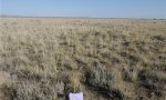
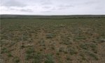
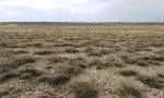
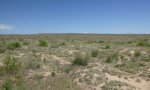
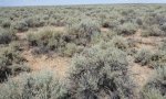
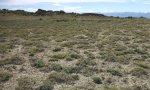
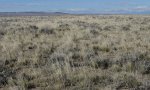
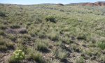
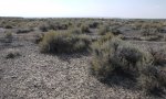
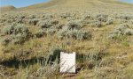
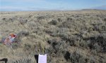
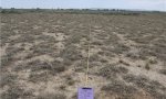
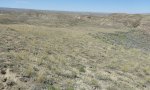
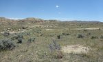
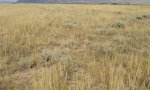
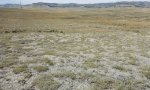
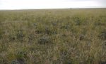
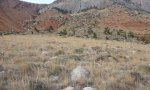
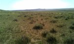
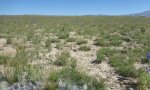
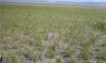
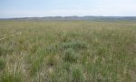
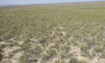
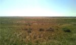
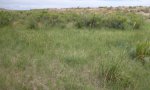
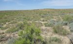
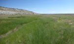
Ecological site map
Basemap
Find me
Find point
Full screen
Zoom in to display soil survey map units for an area of interest, and zoom out to display MLRAs. Select a map unit polygon to view ecological sites correlated to that map unit. View a brief description of an ecological site by clicking on its name in the map popup. Soil survey correlations may not be accurate, and ecological site classification of a location should always be verified in the field. Each selection may require the transfer of several hundred KB of data.
Ecological site keys
-
1 1. For areas that receive additional moisture through snow trapping, consider adjusting to a wetter LRU or Subset consistent with the vegetation observed for the site keyed. It is anticipated that most snow-trap sites will not have a water table.
-
2 2. Specific plant species listed in the key are not to be used as the only determining factor. Management or disturbance may have removed or altered the plant composition that could reflect the wrong ecological site.
-
3 3. Soils derived from Dolomite or similar geology may not react as “violently” as other calcareous parent materials; dolomite site may be limy or loamy calcareous with only a strong effervescence. Soils with <18% clays only need a CCE of 5% to be calcic or calcareous, while soils with >18% clays need a CCE of 15%.
-
4 4. Ecological site does not fit within one LRU, written to encompass Subset A and B, labeled as 032X01B or 032XB in the BHB.
-
5 5. Saline, saline sodic, and sodic soils have a pH of 7.9 to 9.0 and an EC (electrical conductivity) > 4 dS/m [dS/m = mmhos/cm]. Salts, including gypsum will lower the pH without affecting the EC, but may still fit into the salt effected sites. Soils that are sodic generally have a SAR of ≥ 13 typically have a pH of 8.8 or higher.
-
6 6. The Dense Clay ecological site will have a lighter textured cap or “A” horizon with an abrupt clay increase, commonly the clay percent will then decrease as move lower in the profile. The abrupt increase in the upper portion of the profile with significant cracking is the key for this site. The Clayey ecological site may have a lighter textured cap but typically maintains or increases in clay as move through the profile. The presence of birdfoot sagebrush and lack of Wyoming sagebrush is a plant indicator for the Dense Clay ecological site.
-
7 7. When calculating percent rock fragments in the profile to determine if a site is skeletal, pararock fragments (parachanners) are not considered, however, channers are. The difference between a parachanner and a channer is how “hard” the rock is. Soft flat fragments (ruptured by hand) are parachanners, while harder flat fragments are channers.
-
4 4. Ecological site does not fit within one LRU, written to encompass Subset A and B, labeled as 032X01B or 032XB in the BHB.
-
1 1. For areas that receive additional moisture through snow trapping, consider adjusting to a wetter LRU or Subset consistent with the vegetation observed for the site keyed. It is anticipated that most snow-trap sites will not have a water table
-
7 7. When calculating percent rock fragments in the profile to determine if a site is skeletal, pararock fragments (parachanners) are not considered, however, channers are. The difference between a parachanner and a channer is how “hard” the rock is. Soft flat fragments (ruptured by hand) are parachanners, while harder flat fragments are channers.
-
2 2. Specific plant species listed in the key are not to be used as the only determining factor. Management or disturbance may have removed or altered the plant composition that could reflect the wrong ecological site.
-
3 3. Soils derived from Dolomite or similar geology may not react as “violently” as other calcareous parent materials; dolomite site may be limy or loamy calcareous with only a strong effervescence. Soils with <18% clays only need a CCE of 5% to be calcic or calcareous, while soils with >18% clays need a CCE of 15%.
-
5 5. Saline, saline sodic, and sodic soils have a pH of 7.9 to 9.0 and an EC (electrical conductivity) > 4 dS/m [dS/m = mmhos/cm]. Salts, including gypsum will lower the pH without affecting the EC, but may still fit into the salt effected sites. Soils that are sodic generally have a SAR of ≥ 13 typically have a pH of 8.8 or higher.
-
6 6. The Dense Clay ecological site will have a lighter textured cap or “A” horizon with an abrupt clay increase, commonly the clay percent will then decrease as move lower in the profile. The abrupt increase in the upper portion of the profile with significant cracking is the key for this site. The Clayey ecological site may have a lighter textured cap but typically maintains or increases in clay as move through the profile. The presence of birdfoot sagebrush and lack of Wyoming sagebrush is a plant indicator for the Dense Clay ecological site.
-
4 4. Ecological site does not fit within one LRU, written to encompass Subset A and B (was C and D), labeled as 032X02B or 032XD for the WRB.
-
2 2. Specific plant species listed in the key are not to be used as the only determining factor. Management or disturbance may have removed or altered the plant composition that could reflect the wrong ecological site.
-
3 3. Soils derived from Dolomite or similar geology may not react as “violently” as other calcareous parent materials; dolomite site may be limy or loamy calcareous with only a strong effervescence. Soils with <18% clays only need a CCE of 5% to be calcic or calcareous, while soils with >18% clays need a CCE of 15%.
-
5 5. Saline, saline sodic, and sodic soils have a pH of 7.9 to 9.0 and an EC (electrical conductivity) > 4 dS/m [dS/m = mmhos/cm]. Salts, including gypsum will lower the pH without affecting the EC, but may still fit into the salt effected sites. Soils that are sodic generally have a SAR of ≥ 13 typically have a pH of 8.8 or higher.
-
6 6. 6The Dense Clay ecological site will have a lighter textured cap or “A” horizon with an abrupt clay increase, commonly the clay percent will then decrease as move lower in the profile. The abrupt increase in the upper portion of the profile with significant cracking is the key for this site. The Clayey ecological site may have a lighter textured cap but typically maintains or increases in clay as move through the profile. The presence of birdfoot sagebrush and lack of Wyoming sagebrush is a plant indicator for the Dense Clay ecological site.
-
7 7. When calculating percent rock fragments in the profile to determine if a site is skeletal, pararock fragments (parachanners) are not considered, however, channers are. The difference between a parachanner and a channer is how “hard” the rock is. Soft flat fragments (ruptured by hand) are parachanners, while harder flat fragments are channers.
-
1 1. For areas that receive additional moisture through snow trapping, consider adjusting to a wetter LRU or Subset consistent with the vegetation observed for the site keyed. It is anticipated that most snow-trap sites will not have a water table.
-
4 4. Ecological site does not fit within one LRU, written to encompass Subset A and B (was LRU C and D), labeled 032X02B or 032XD for the WRB.
-
1 1. For areas that receive additional moisture through snow trapping, consider adjusting to a wetter LRU or Subset consistent with the vegetation observed for the site keyed. It is anticipated that most snow-trap sites will not have a water table.
-
2 2. Specific plant species listed in the key are not to be used as the only determining factor. Management or disturbance may have removed or altered the plant composition that could reflect the wrong ecological site.
-
3 3. Soils derived from Dolomite or similar geology may not react as “violently” as other calcareous parent materials; dolomite site may be limy or loamy calcareous with only a strong effervescence. Soils with <18% clays only need a CCE of 5% to be calcic or calcareous, while soils with >18% clays need a CCE of 15%.
-
5 5. Saline, saline sodic, and sodic soils have a pH of 7.9 to 9.0 and an EC (electrical conductivity) > 4 dS/m [dS/m = mmhos/cm]. Salts, including gypsum will lower the pH without affecting the EC, but may still fit into the salt effected sites. Soils that are sodic generally have a SAR of ≥ 13 typically have a pH of 8.8 or higher.
-
6 6. The Dense Clay ecological site will have a lighter textured cap or “A” horizon with an abrupt clay increase, commonly the clay percent will then decrease as move lower in the profile. The abrupt increase in the upper portion of the profile with significant cracking is the key for this site. The Clayey ecological site may have a lighter textured cap but typically maintains or increases in clay as move through the profile. The presence of birdfoot sagebrush and lack of Wyoming sagebrush is a plant indicator for the Dense Clay ecological site.
-
7 7. When calculating percent rock fragments in the profile to determine if a site is skeletal, pararock fragments (parachanners) are not considered, however, channers are. The difference between a parachanner and a channer is how “hard” the rock is. Soft flat fragments (ruptured by hand) are parachanners, while harder flat fragments are channers.
Ecological site photos
Print Options
Sections
Font
Other
Briefcase
Add ecological sites and Major Land Resource Areas to your briefcase by clicking on the briefcase (![]() ) icon wherever it occurs. Drag and drop items to reorder. Cookies are used to store briefcase items between browsing sessions. Because of this, the number of items that can be added to your briefcase is limited, and briefcase items added on one device and browser cannot be accessed from another device or browser. Users who do not wish to place cookies on their devices should not use the briefcase tool. Briefcase cookies serve no other purpose than described here and are deleted whenever browsing history is cleared.
) icon wherever it occurs. Drag and drop items to reorder. Cookies are used to store briefcase items between browsing sessions. Because of this, the number of items that can be added to your briefcase is limited, and briefcase items added on one device and browser cannot be accessed from another device or browser. Users who do not wish to place cookies on their devices should not use the briefcase tool. Briefcase cookies serve no other purpose than described here and are deleted whenever browsing history is cleared.
Ecological sites
Major Land Resource Areas
The Ecosystem Dynamics Interpretive Tool is an information system framework developed by the USDA-ARS Jornada Experimental Range, USDA Natural Resources Conservation Service, and New Mexico State University.