
Natural Resources
Conservation Service
Ecological site AX001X04X401
Cryic Udic Forest
Last updated: 1/23/2025
Accessed: 02/08/2026
General information
Provisional. A provisional ecological site description has undergone quality control and quality assurance review. It contains a working state and transition model and enough information to identify the ecological site.
MLRA notes
Major Land Resource Area (MLRA): 001X–Northern Pacific Coast Range, Foothills, and Valleys
This long and narrow resource area stretches along the Pacific Border Province of the Pacific Mountain System in Oregon and Washington. The area is bounded by the Olympic Mountains on the north and the Klamath Mountains on the south. Most of the area consists of hills and low mountains with gentle to steep slopes. The parent materials are composed primarily of young Tertiary sedimentary rocks with some minor volcanic rocks. Glacial till and outwash deposits are found in the northern half of the area within Washington. In the far southern portion of the area, near the Klamath Mountains, the sedimentary rocks are older and some have been metamorphosed. The average annual precipitation ranges from 60 to 200 inches, increasing with elevation.
The dominant soil orders in this MLRA are Andisols, Inceptisols, and Ultisols. Soil depth ranges from shallow to very deep. While most soils in the area are well drained and occur on foothills, mountain slopes and ridges, floodplain and depressional soils can range from well drained to very poorly drained. Soil textures are typically medial, loamy, or clayey. The dominant soils in the area have a mesic or frigid soil temperature regime and a udic soil moisture regime; however, soils with an aquic soil moisture regime or cryic soil temperature regime do occur.
LRU notes
The Southern Pacific Coast Range land resource unit (LRU 4) of MLRA 1 is located in central to southern Oregon State. The LRU extends from the Siletz River to the Rogue River and is bounded on the west by MLRA 4a Sitka Spruce Belt and MLRA 2 Willamette and Puget Sound Valleys to the east. Several major rivers carved valleys through the landscape depositing more recent alluvium. These include the Alsea, Coos, Coquille, Green, Yachats, Siletz, Siuslaw, Umpqua, and Rogue Rivers.
Ecological site concept
This ecological site is found on the western Coast Range in the Pacific Northwest from central to southern Oregon. It is located on shoulder slopes and summits of mountains. Elevations are typically between 2,000 and 4,100 feet with slopes ranging from 3 to 90 percent.
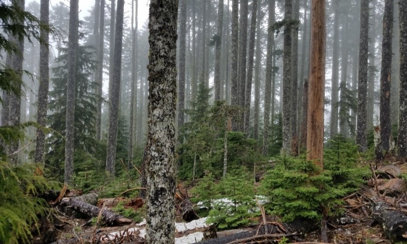
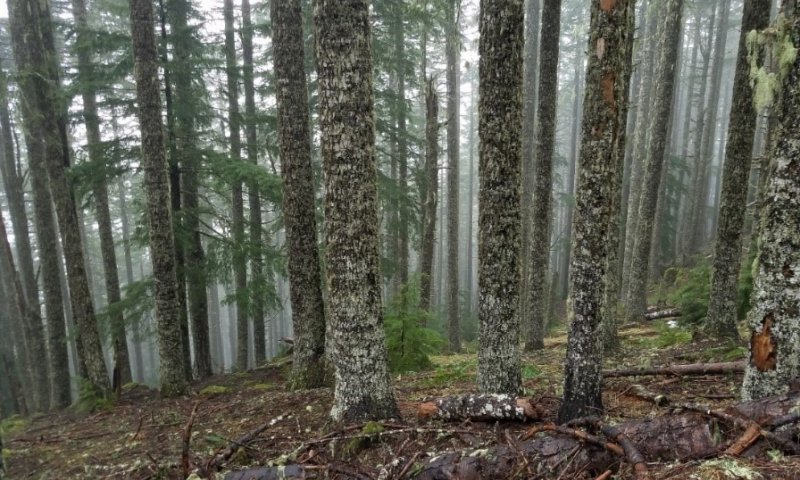
Pacific silver fir (Abies amabilis) and western hemlock (Tsuga heterophylla) are the most common overstory species with some noble fir (Abies procera), Douglas-fir (Pseudotsuga menziesii), and western white pine (Pinus monticola). Noble fir, Douglas-fir, and western white pine trees occur in younger forests and are relatively shade intolerant. Overtime, these trees are typically replaced by more shade tolerant species such as Pacific silver fir and western hemlock. Common understory shrubs may include black mountain huckleberry (Vaccinium membranaceum), rusty menziesia (Menziesia ferruginea), Cascade Oregongrape (Mahonia nervosa), and vine maple (Acer circinatum). The herbaceous layer is sparse, at times entirely absent. When present, they may include Oregon oxalis (Oxalis oregana), common beargrass (Xerophyllum tenax), deerfoot vanillaleaf (Achlys triphylla), western swordfern (Polystichum munitum), and twinflower (Linnaea borealis).
One discrete area of a noble fir dominated forest occurs within this ecological site. This site is known to occur at Marys Peak Scenic Botanical Area. This unique dynamic is attributed to the high frequency of intense windstorms which creates pockets of openings which are dominated and perpetuated by noble fir at Marys Peak (Hays, 2012). Trees within this area range from 150-200 years old and create a uniform and dense overstory. Oregon oxalis is the primary understory species within this community.
The most common natural disturbance on this ecological site is windthrow following large storms which create pockets of forest openings. In addition, western hemlock is highly susceptible to rot diseases such as; Armillaria ostoyae, Heterobasidion annosum, Phellinus weirii, and Echinodontium tinctorium which may exacerbate the extent and area of disturbance. The resulting openings in the canopy allow sunlight to reach the forest floor, benefiting the understory. Disturbance by fire is infrequent as a result of the high humidity and precipitation within the western hemlock zone; however, the site has a fire regime between 150-400 years and may experience stand replacing catastrophic wildfires (US Department of Agriculture, 2012).
Associated sites
| AX001X04X402 |
Frigid Udic Forest Cryic Udic Forest is located at higher elevations than Frigid Udic Forest. The significant presence of Pacific silver fir (Abies amabilis) is a good indicator for Cryic Udic Forest. |
|---|
Table 1. Dominant plant species
| Tree |
(1) Abies amabilis |
|---|---|
| Shrub |
(1) Menziesia ferruginea |
| Herbaceous |
(1) Oxalis oregana |
Legacy ID
F001XD401OR
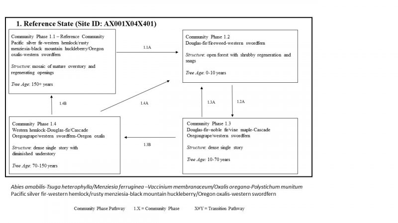
Click on box and path labels to scroll to the respective text.


