
Natural Resources
Conservation Service
Ecological site R015XF003CA
Very Shallow Loamy Foothills
Accessed: 02/07/2026
General information
Approved. An approved ecological site description has undergone quality control and quality assurance review. It contains a working state and transition model, enough information to identify the ecological site, and full documentation for all ecosystem states contained in the state and transition model.
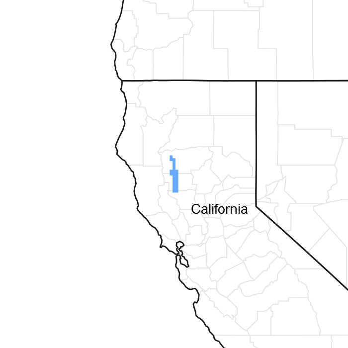
Figure 1. Mapped extent
Areas shown in blue indicate the maximum mapped extent of this ecological site. Other ecological sites likely occur within the highlighted areas. It is also possible for this ecological site to occur outside of highlighted areas if detailed soil survey has not been completed or recently updated.
MLRA notes
Major Land Resource Area (MLRA): 015X–Central California Coast Range
The Major Land Resource Area ((MLRA 15): This MLRA is an area of gently sloping to steep, low mountains. Precipitation is evenly distributed throughout fall, winter, and spring but is very low in summer. Elevation ranges from sea level to 2,650 feet (810 meters) in most of the area, but up to 4,950 feet (1,510 meters) in some of the mountains. The soils in the area dominantly have a thermic soil temperature regime, a xeric soil moisture regime, and mixed or smectitic mineralogy.
LRU Description: This Land Resource Unit (LRU), (designated by “15XF”) includes Blue Ridge in the northern California Coast Ranges and steep hills east of Blue Ridge and east of the Stony Creek fault, extending north to the Klamath Mountains down to the southern portion of Napa and Yolo Counties. The LRU is formed mostly from the Jurrasic and Cretaceous sandstone, and shale facies of the Great Valley sequence. This area includes north to south trending foothill slopes and alluvial back valleys. Soil temperature regime is mostly thermic, with some high elevation areas that are mesic, and soil moisture regime is xeric. Common vegetation includes introduced annual grasses and forbs, blue oak, chamise, ceanothus, manzanita and California foothill pine. Elevations generally range from 500 to 2400 feet. Rainfall levels drop quickly from the mountains to the foothills and valley due to the rain shadow effect. Annual precipitation generally averages from 16 to 40 inches. This ecological site is located with EPA Ecoregion 6f.
Classification relationships
This site may include the following Allen-Diaz Class: 1) Blue Oak/Grass (Allen Diaz et al., 1989). This site includes Blue Oak Woodland (BOW), (Mayer and Laudenslayer (Eds.) 1988). The Society for Range Management Cover Type for this site is Blue Oak Woodland (Shiflet (Ed.), 1994). This site includes the Quercus douglasii Woodland Alliance from the Manual of California Vegetation (Sawyer et al., (2nd Ed.) 2009).
Ecological site concept
This ecological site is found on strath terraces, shale benches and low ridges in foothill back valleys, and soil depth to a hard bedrock contact is 5-10 inches. These extremely shallow soils with very low soil moisture limit regeneration and survival of higher plants.
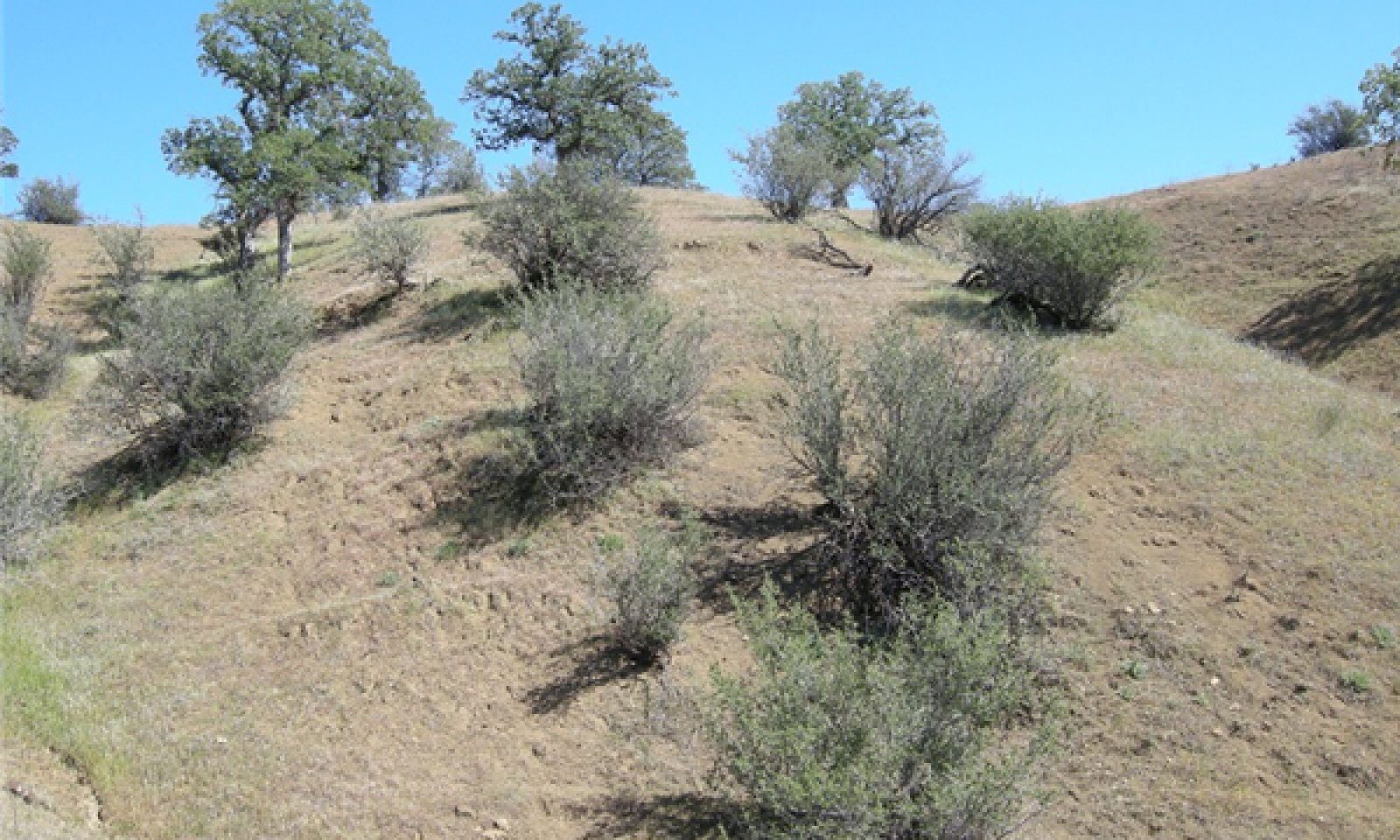
This ecological site is open grassland dominated by non-native annual forbs and grasses with scattered low cover of buckbrush (Ceanothus cuneatus), and very sparse blue oak (Quercus douglasii).
Associated sites
| R015XF004CA |
Shallow Loamy Foothills Ecological site R015XF004CA occurs on adjacent ridges and backslopes and is shallow in depth (10-20 inches). Vegetation is blue oak with a moderate cover of buckbrush and annual grasses and forbs. |
|---|
Table 1. Dominant plant species
| Tree |
(1) Quercus douglasii |
|---|---|
| Shrub |
(1) Ceanothus cuneatus |
| Herbaceous |
(1) Plantago erecta |
Physiographic features
This ecological site occurs on very shallow soils found on strath terraces, shale benches and low ridges in foothill back valleys (see the Physiographic Diagram). This site forms a mosaic with an associated ecological site, R015XF004CA, Shallow Loamy Foothills.
This site is predominately found at elevations ranging from 500 to 1,000 feet, however, it may be found up to 2,000 feet in elevation. Southeast and west aspects prevail and slopes typically range from 0 to 30 percent but may range up to 65 percent. Southeast and west facing slopes incur longer solar exposure during the midday and tend to be drier and warmer with increasing levels of evapotranspiration. Runoff class is high to very high.
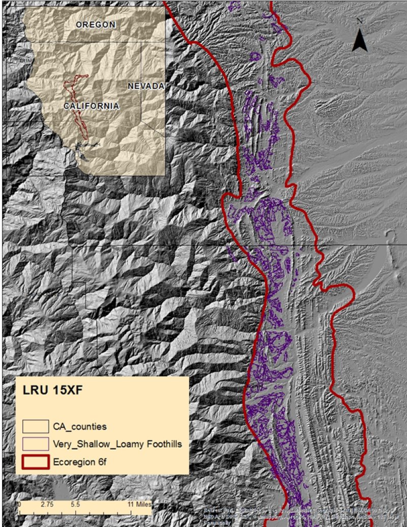
Figure 2. R015XF003CA - Very Shallow Loamy Foothills
Table 2. Representative physiographic features
| Landforms |
(1)
Hill
|
|---|---|
| Flooding frequency | None |
| Ponding frequency | None |
| Elevation | 500 – 1,000 ft |
| Slope | 30% |
| Aspect | SE, SW, W |
Climatic features
This ecological site has a Mediterranean climate characterized by hot summer temperatures and cool moist winters. Precipitation falls as rain during October through May. The northern part of the California Central Valley receives precipitation from winter storms from the Pacific Northwest. The timing, length and intensity of storms are highly variable and unpredictable.
Periodic drought may occur for months or years at a time, depending on the fluctuations of winds and ocean currents in the equatorial region of the Pacific Ocean (Quinn and Keeley, 2006).
The mean annual precipitation is 19 to 22 inches and the mean annual air temperature is 58 to 63 degrees Fahrenheit. The frost-free period averages 220 days. The freeze-free period averages 275 days. One climate station was utilized for this ecological site, Stony Gorge Reservoir. The northern extent of this site tends to be slightly wetter and warmer than the central and southern areas.
Table 3. Representative climatic features
| Frost-free period (average) | 220 days |
|---|---|
| Freeze-free period (average) | 275 days |
| Precipitation total (average) | 22 in |
Figure 3. Monthly precipitation range
Figure 4. Monthly average minimum and maximum temperature
Figure 5. Annual precipitation pattern
Figure 6. Annual average temperature pattern
Climate stations used
-
(1) STONY GORGE RSVR [USC00048587], Elk Creek, CA
Influencing water features
A loamy soil texture, very shallow soil depth and low soil cover dramatically affect infiltration and overland flow on this ecological site. This site is found in complex with gullied areas. Soils are somewhat excessive to excessively drained, with rapid permeability. The shale is often steeply tilted allowing water to penetrate quickly. Slope shape is primarily concave downslope and convex across slope, allowing water to be shed rapidly off the site. Runoff is greater and subsequently weathered material is more easily removed by erosion.
Soil features
The loamy soils typically associated with this ecological site occur on strath terraces, shale benches and low ridges in foothill back valleys formed in residuum from shale and sandstone sources. They are very shallow over a hard bedrock contact at 5-10 inches. Available water is very low at 1 to 2 inches.
Surface textures are shaly loam and channery clay loam. There are no surface gravels < 3 inches. There are no surface fragments > 3 inches. Subsurface gravels by volume as a whole are variable and may range from 15 to 18 percent; larger fragments > 3 inches by volume range from 3 to 12 percent.
Soil characteristics are the over-riding factor that controls the production and species composition on this ecological site. A very shallow soil depth reduces the water storage capacity of the soil profile, and excessive drainage and low soil cover lends itself to increased erosive potential on this site, especially on the steeper slopes.
The associated soil series that are 15 percent or greater of any one map unit are:
Lodo (Loamy, mixed, superactive, thermic Lithic Haploxerolls).
This ecological site is correlated with the following map units and soil components in MLRA 15:
CA021; Glenn County, California:
LmD; Lodo-Gullied land complex, 10 to 30 percent slopes; Lodo
LmE; Lodo-Gullied land complex, 30 to 50 percent slopes; Lodo
LsD; Lodo-Tehama clay loams, 10 to 30 percent slopes; Lodo
LsE; Lodo-Tehama clay loams, 30 to 50 percent slopes; Lodo
LoD; Lodo-Millsap-Gullied land complex, 10 to 30 percent slopes; Lodo
LoE; Lodo-Millsap-Gullied land complex, 30 to 65 percent slopes; Lodo
LtD; Lodo-Tehama-Gullied land complex, 10 to 30 percent slopes; Lodo
LtE; Lodo-Tehama-Gullied land complex, 30 to 50 percent slopes; Lodo
MyE2; Millsholm-Lodo complex, 30 to 50 percent slopes, eroded; Lodo
CA645; Tehama County, California:
HmE: Hillgate-Lodo complex, 3 to 50 percent slopes
LfD; Lodo-Millsholm complex, 10 to 30 percent slopes; Lodo
LfE; Lodo-Millsholm complex, 30 to 50 percent slopes; Lodo
LfF; Lodo-Millsholm complex, 50 to 65 percent slopes; Lodo
CA607: Shasta County, California
HmEte: Hillgate-Lodo complex, 3 to 50 percent slopes
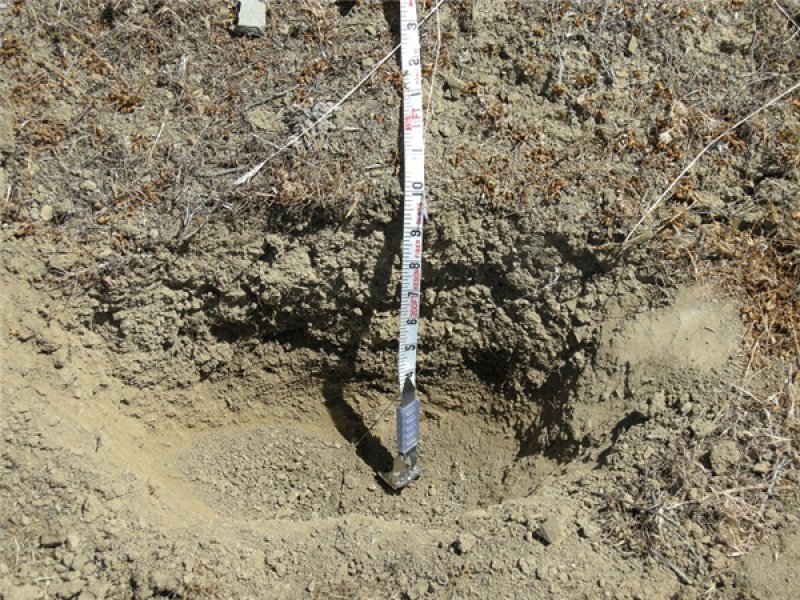
Figure 7. Lodo Soil
Table 4. Representative soil features
| Parent material |
(1)
Residuum
–
shale
|
|---|---|
| Surface texture |
(1) Loam (2) Clay loam |
| Drainage class | Somewhat excessively drained |
| Permeability class | Rapid |
| Soil depth | 5 – 10 in |
| Surface fragment cover <=3" | Not specified |
| Surface fragment cover >3" | Not specified |
| Available water capacity (0-40in) |
1 in |
| Electrical conductivity (0-40in) |
Not specified |
| Sodium adsorption ratio (0-40in) |
Not specified |
| Soil reaction (1:1 water) (0-40in) |
6 – 7 |
| Subsurface fragment volume <=3" (Depth not specified) |
15 – 18% |
| Subsurface fragment volume >3" (Depth not specified) |
3 – 12% |
Ecological dynamics
Disturbance dynamics
Disturbance is defined as “any relatively discrete event in time that disrupts ecosystem, community, or population structure and changes resource pools, substrate availability, or the physical environment” (Pickett and White, 1985); it may be natural or anthropogenic in origin.
Historic Influences:
Historically the interaction of several disturbance agents including fire, intensive grazing, invasive species and drought has influenced and shaped the environment of this ecological site.
Prior to the 1880’s fire frequency in grasslands was approximately every 1-5 years (Greenlee and Langenheim, 1990) although in some cases areas were burned more frequently, almost every year (Stromberg et al., 2007). Native Americans regularly used fire to manage vegetation communities to provide food and fiber (McCleary 2004).
Intensive year-round grazing by cattle impacted many soils during the late 1800’s, resulting in reduced vegetative cover and soil compaction in some areas. A series of droughts and floods in the 1860s devastated many cattle herds, and when recovery occurred in the 1870’s, sheep-raising had largely replaced cattle-ranching (Seibert, 2003). High densities of sheep grazing that occurred during that period reduced litter and plant cover, leaving some areas barren due to a higher number of concentrated animals over a longer season. The grazing effects were worsened by burning practices that were more frequent and intense and resulted in permanent soil loss in open areas (Tehama County Watershed Assessment, 2010).
Continuous grazing is believed to have promoted native forb dominance. Introduced annual forbs and grasses have unique adaptations that give them a competitive advantage over native species. Some of these plant adaptations include high seed production, fast early season growth and the ability to set seed in drought years (Stromberg et al., 2007).
Current Influences:
Fire: Fire suppression over the last century and intensive grazing have reduced fire frequency in many types of grassland (Stromberg et al., 2007). On this ecological site natural regeneration of shrubs is largely fire-dependent and the lack of fire has resulted in shrub decadence and low recruitment. Buckbrush is an obligate seeder, requiring fire for seed germination that is enhanced by scarification and charate (League, 2005, Abrahamson, 2014). Blue oak is considered a weak sprouter following fire, and sprouting declines with age (Burns and Honkala 1990, McDonald 1990). This sites sparse vegetative cover would have difficulty carrying fire across the landscape. The extent of this ecological site has no record of being burned in recent history.
Drought: Droughts of varying lengths are common occurrences in a Mediterranean ecosystem, however the most recent drought period, now in its fourth year is unprecedented in California’s climate record (Griffin and Anchukaitis, 2014).
Increased temperature and evaporation will likely have a significant effect on species composition and productivity on this droughty site, favoring tap-rooted species and decreasing overall production. Oak regeneration is virtually absent on this site due to unfavorable water conditions.
Grazing: Early seasonal drying of this very shallow soil restricts the length of grazing period to early spring. Low residual dry matter in the fall may shift plant communities on this ecological site creating conditions that favor forbs and clovers over grasses (George et al., 1985).
Climate Change: In California‘s Mediterranean climate evaporative demand and rainfall are out of synch with one another (Miller et al., 2012). During peak demand in the spring, water is quickly depleted from the soil profile and grasses senesce. After that period the only moisture available to woody plants is through root access to groundwater. Groundwater has been shown to be a critical link to blue oak survival over the prolonged summer drought period (Miller et al., 2010). In very shallow soils that dry out quickly, ground water stores may be accessed sooner and utilized for a longer period than on deeper soils. Periods of drought could lead to a drop in ground water levels and eventual tree and shrub mortality (Miller et al., 2010).
The influence of climate change on vegetation has been widely debated. Some climate models indicate that decreasing precipitation and increasing temperature could result in a potential shift in the blue oak type to the north and shrinking of the overall range of the species. This change in range is thought to be a potential result of increasing moisture stress with changing climate (Kueppers, et al., 2005). Although there are many other factors that influence plant communities, climate related effects include the potential for a changed fire regime and more favorable conditions for species invasions (Stromberg, et al., 2007).
State and transition model
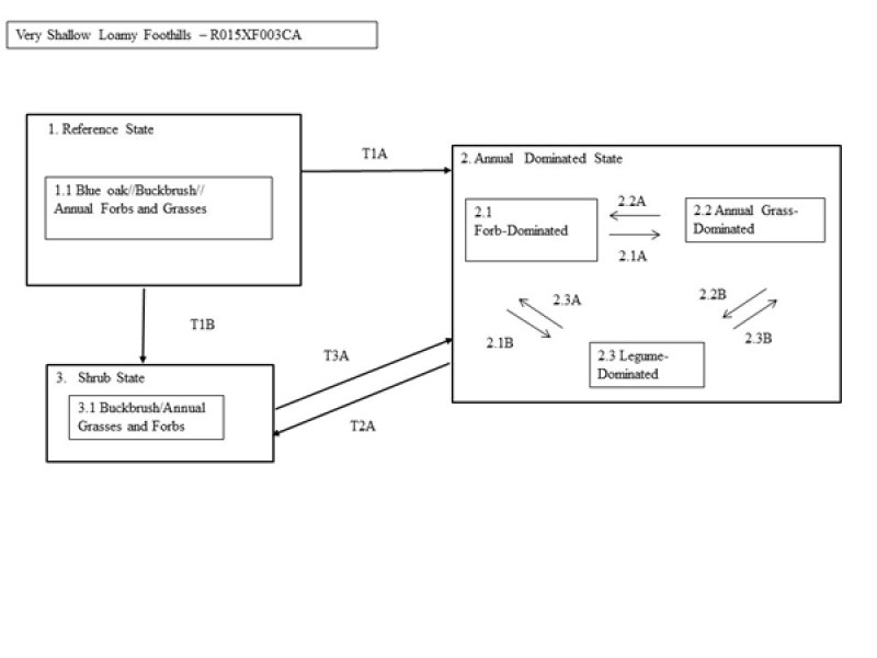
Figure 8. R015XF003CA - Very Shallow Loamy Foothills
More interactive model formats are also available.
View Interactive Models
More interactive model formats are also available.
View Interactive Models
Click on state and transition labels to scroll to the respective text
Ecosystem states
State 1 submodel, plant communities
State 2 submodel, plant communities
State 3 submodel, plant communities
State 1
Reference State
State 1 represents the reference community and describes the ecological potential for this site. States and Community Phases included in this document include those previously recognized by Fire Resource Assessment Program (State of California, FRAP, 1998) and other entities, as a result of the use of ordination software and professional consensus (Allen-Diaz et al., 1989; Vayssieres and Plant, 1998 and George et al., 1993). The reference state for this ecological site has one community phase. Found on dry south and southwest-facing slopes, this site has a very sparse blue oak overstory is primarily composed of a grass and forb understory with scattered trees and shrubs. Representation of the Reference State is lacking except on the steepest slopes due the impacts of past management. Long fire-free periods have resulted in a shrub component that is often mature and even decadent, with low natural regeneration. While it has been demonstrated that buckbrush can regenerate in the absence of fire (League, 2005), long-term fire suppression or exclusion has led to eventual decadence and a decline in shrub abundance. Oaks are efficient water users, adapted to very low moisture conditions by virtue of their small leaf size, the regulation of water loss through the leaf stomata and by tapping into water below fractured rock (Baldocchi et al, 2007). Trees and shrubs on this site compete intensively for limited available water and growing space. Shrub cover slows water runoff rates, improving water storage. This available water may be present later in the growing season due to decreased evaporation and shading, maintaining moisture longer than under just grasses alone (Gill and Burke, 1999). Some deeply rooted trees and shrubs may also induce hydraulic lift, transporting water to the upper soil layers (Richards and Cadewell, 1987, Caldwell et al, 1998, Ishikawa and Bledsoe, 2000, Liste and White, 2008), supporting the development of neighboring plants. Nutrients are also concentrated around shrub bases from litter fall and from sediment capture via movement of soil particles. The duration of vegetation successional stages varies greatly, and lacks sufficient research to gain better estimates. It has been estimated by some research that for some similar ecological sites, it may take at least 50 years (Mayer and Laudenslayer, 1988). Blue oak growth is slow and variable. Most stands of blue oak range from 80 to 100 years of age (Kertis et al, 1993). There are remnant older blue oak specimens that may range to over 450 years of age (Stahle et al, 2013) in more remote or steep locations. Mature brush development can take 10 to 15 years. Wildlife may have limited use of this site for foraging during the spring; resting or escape cover are generally lacking.
Community 1.1
Blue oak//Buckbrush//Annual Forbs and Grasses

Figure 9. Reference Community Phase 1.1 Lodo soil. J. Welles, 2015
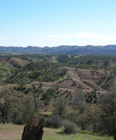
Figure 10. Community Phase 1.1 Landscape. Welles, 2015
The Reference Community Phase 1.1 is dominated by annual forbs and grasses, an overstory of isolated blue oak, with very low density cover of buckbrush (Ceanothus cuneatus). The roots of blue oak (Quercus douglasii) are able to penetrate fractured bedrock, however their growth is very stunted. Annuals are dominated by a variety of tap-rooted forbs that include dotseed plantain (Plantago erecta), popcorn flower (Plagiobothrys spp.), and filaree species (Erodium botrys and/or Erodium cicutarium), with lesser amounts of annual grasses such as red brome (Bromus rubens) and wild oat (Avena fatua) intermixed. Other forbs and herbaceous plants present may include buckwheat (Eriogonum spp.), clover (Trifolium spp.), bluedicks (Dichelostemma capitatum), miniature lupine (Lupinus bicolor) and yellow star-thistle (Centaurea solstitis). Tap-rooted forbs are well adapted to capture and reach moisture on this droughty site. With the lack of fire and continuous grazing over the last century, buckbrush has dwindled in abundance, and is becoming decadent on many sites. Buckbrush is extremely drought tolerant and may adapt to shallow soils where moisture is limiting (League, 2005), though its form is stunted and cover is sparse. This at-risk community phase may reach a threshold where all blue oak or shrub cover is eliminated from the site, resulting in an annual-dominated state (State 2) or a shrub-dominated state (State 3). Browsing by cattle, drought and clearing may greatly reduce or eliminate blue oak and buckbrush on this landscape. Once the seed source and conditions for natural regeneration of blue oak are removed, the result is permanent degradation of the original reference condition. No known restoration activities exist that could return oak on the landscape once it has been removed.
Figure 11. Annual production by plant type (representative values) or group (midpoint values)
Table 5. Annual production by plant type
| Plant type | Low (lb/acre) |
Representative value (lb/acre) |
High (lb/acre) |
|---|---|---|---|
| Forb | 261 | 652 | 717 |
| Shrub/Vine | 24 | 241 | 265 |
| Grass/Grasslike | 55 | 138 | 152 |
| Tree | 30 | 60 | 66 |
| Total | 370 | 1091 | 1200 |
Table 6. Ground cover
| Tree foliar cover | 0-1% |
|---|---|
| Shrub/vine/liana foliar cover | 0-1% |
| Grass/grasslike foliar cover | 0-1% |
| Forb foliar cover | 0-1% |
| Non-vascular plants | 0% |
| Biological crusts | 0% |
| Litter | 36-45% |
| Surface fragments >0.25" and <=3" | 1-2% |
| Surface fragments >3" | 0-1% |
| Bedrock | 0-1% |
| Water | 0% |
| Bare ground | 42-60% |
Figure 12. Plant community growth curve (percent production by month). CA1501, Annual rangeland (Normal Production Year). Growth curve for a normal (average) production year resulting from the production year starting in November and extending into early May. Growth curve is for oak-woodlands and associated annual grasslands..
| Jan | Feb | Mar | Apr | May | Jun | Jul | Aug | Sep | Oct | Nov | Dec |
|---|---|---|---|---|---|---|---|---|---|---|---|
| J | F | M | A | M | J | J | A | S | O | N | D |
| 0 | 10 | 25 | 40 | 5 | 0 | 0 | 0 | 0 | 0 | 10 | 10 |
Figure 13. Plant community growth curve (percent production by month). CA1502, Annual rangeland (Favorable Production Year). Growth curve for a favorable production year resulting from the production year starting in October and extending through May. Growth curve is for oak-woodlands and associated annual grasslands..
| Jan | Feb | Mar | Apr | May | Jun | Jul | Aug | Sep | Oct | Nov | Dec |
|---|---|---|---|---|---|---|---|---|---|---|---|
| J | F | M | A | M | J | J | A | S | O | N | D |
| 0 | 10 | 20 | 30 | 25 | 0 | 0 | 0 | 0 | 5 | 5 | 5 |
Figure 14. Plant community growth curve (percent production by month). CA1503, Annual rangeland (Unfavorable Production Year). Growth curve for an unfavorable production year resulting from the production year starting in October and extending through May. Growth curve is for oak-woodlands and associated annual grasslands..
| Jan | Feb | Mar | Apr | May | Jun | Jul | Aug | Sep | Oct | Nov | Dec |
|---|---|---|---|---|---|---|---|---|---|---|---|
| J | F | M | A | M | J | J | A | S | O | N | D |
| 0 | 15 | 70 | 5 | 0 | 0 | 0 | 0 | 0 | 0 | 5 | 5 |
State 2
Annual-Dominated State
This is the state most widely represented on the landscape. The Annual-Dominated Grassland State is greatly influenced by the timing and amount of precipitation and the amount of residual dry matter (George et al., 2001a). Currently species composition and productivity of the annual-dominated grassland and understory grasses and forbs vary greatly within and between years. Annual dominated systems have shallow root structures that dry out quickly during rapid spring growth and evapotranspiration, quickly depleting soil moisture. Annuals use available water primarily in the top 1 foot of soil, however filaree and other forbs may also be able to use a substantial amount of water at soil depths (George et al., 2001). Although nutrient leaching from grassland systems is variable, nutrients that are moved beyond the shallow root systems of the annual grasses are lost to leaching. Water infiltration may be more rapid in grasslands than in shrub-dominated landscapes. Low soil cover contributes to increased erosion on this ecological site.
Community 2.1
Forb-Dominated
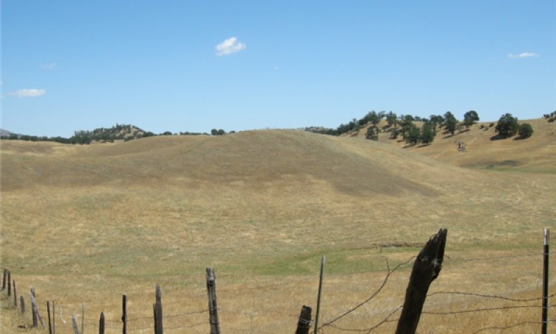
Figure 15. Lodo soil landscape, midground. J. Welles, 2013
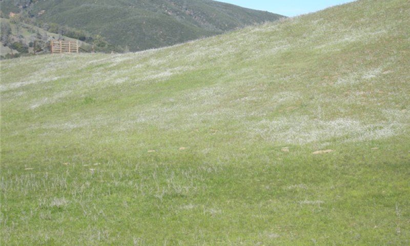
Figure 16. Community Phase 2.1. J. Welles, 2014
The non–native annual filarees or redstem or longbeak stork’s bill (Erodium botrys and Erodium circutarium) dominate this community phase. Other forbs and herbaceous plants present may include pincushion plant (Navarretia spp.), buckwheat (Eriogonum spp.), clover (Trifolium spp.), bluedicks (Dichelostemma capitatum), dotseed plantain (Plantago erecta), yellow star-thistle (Centaurea solstitis) and dove weed (Croton setigeris). Continuous grazing and drought contribute to low residual dry matter on this site. Low residual dry matter may contribute to domination of filarees and clover species (George et al., 1985, 2001). Filaree is a pioneer on disturbed sites that provide an ideal substrate for new colonization or expansion of the non-native plant community. Filaree is adapted to drought by virtue of seed banking which may remain viable for many years until conditions are favorable (Fryer, 2007). Often when a dry period follows the first rains, drought tolerant self-burial seed species are favored (Young et al., 1981). Erodium presence may be reduced if rains come early and are followed by severe drought stress (Bartolome, 1979). Filaree seed dispersal mechanisms which include the ability to drill into the ground or to disperse up to a half meter away via the twisting awns serve to enhance its invasive capacity (Evangilista, Hotton and Dumais, 2011). Dove weed (Croton setigerus) also increases in disturbed areas. In one study, nitrogen and phosphorus availability was found to be low in filaree dominated areas (Eviner and Chapin, 2001). The taprooted filaree contributes to a very low and low soil surface and subsurface cohesion or structure, presumably due to a lack of a root mat (Eviner and Chapin, 2001). Filaree provides forage early in the growing season but rapidly disintegrates after maturity (Pitt and Heady, 1978). Increases in runoff and soil erosion from low residual dry matter may act as a feedback that reduces available water and increases the amount of exposed ground (Briske et al., 2006).
Community 2.2
Annual Grass-Dominated
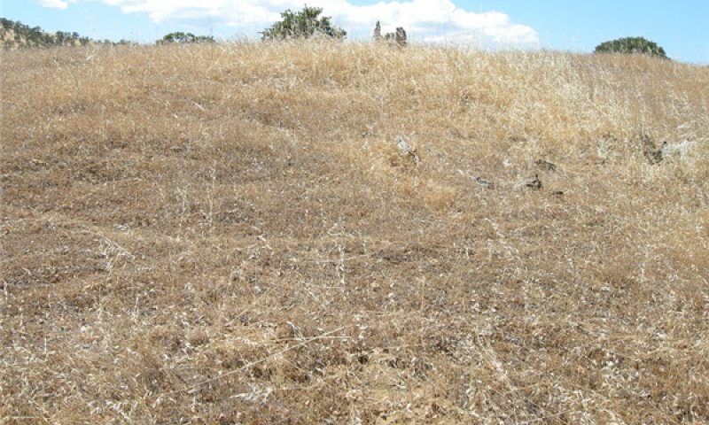
Figure 17. Annual Grass-dominated Community Phase 2.2. J. Welles, 2013.
Grass dominated years occur when rainfall is well-distributed or greater than normal or with late spring rains (George et al., 1985). Common grass species found in this community phase include red brome (Bromus rubens) and soft brome (Bromus hordeaceus) and very sparsely scattered wild oats (Avena fatua). Common forbs include red stem stork’s bill (Erodium botrys), rose clover (Trifolium hirtum) and some yellow star-thistle (Centauria solstitialis). Red brome is common on south slopes that are dry; it’s shallow root system and intolerance to shade enable it to successfully compete well with other grasses. Large seed annual grasses such as wild oat had lower biomass in areas where litter is low due to increased light and lower moisture. Grasses provide beneficial effects on soil structure by virtue of their rooting system, increasing the movement of water and oxygen through the soil (Eviner and Chapin, 2001). Sufficient litter or residue is required for good germination of grass species (Young et al., 1981) and leaving greater amounts may favor grass dominance (George et al., 1985). The lack or presence of plant litter affects soil moisture, temperature, and potential seed dispersal (Amatangelo, Dukes, and Field, 2008) which may lead to changes in species composition over time. Mulch also improves soil fertility and increases infiltrations as well (Heady, 1956).
Community 2.3
Legume-Dominated
Rose clover (Trifolim hirtum) is frequently found in this community phase. Legume domination or clover years may be favored with early rains and adequately spaced rainfall thereafter (George et al., 1985). Legumes add nitrogen to the soil, increasing fertility, but may increase potential for nutrient leaching and attract gophers (Eviner and Chapin, 2001). Legumes also increase nitrogen availability early in the growing season, as opposed to grasses that maintain nitrogen later into the growing season.
Pathway 2.1A
Community 2.1 to 2.2


Grass-dominated years occur when rainfall is well-distributed or greater than normal or with late spring rains (George et al., 1985). Sufficient litter or residue is required for good germination of grass species (Young et al., 1981) and leaving greater amounts may favor grass dominance (George et al., 1985). The lack or presence of plant litter affects soil moisture, temperature, and potential seed dispersal (Amatangelo, Dukes, and Field, 2008) which may lead to changes in species composition over time. Grass often dominates with residual dry matter accumulation as a result of favorable weather or low grazing activity (George, 2001). Mulch also improves soil fertility and increases infiltrations as well (Heady, 1956). In one study, large seed annual grasses such as Avena fatua had lower biomass in areas where litter was removed, due to increased light and lower moisture and forb density increased with decreasing litter cover.
Pathway 2.1B
Community 2.1 to 2.3
Legume or clover years may be favored with early rains and regularly distributed rainfall throughout the growing season from November through April (George et al., 1985). Dry autumn weather followed by precipitation in late fall or early winter may contribute to legume domination or clover plant community over grasses (Pitt and Heady, 2005). Rose clover (Trifolium hirtum) or minature lupine (Lupinus bicolor) are commonly found in this community phase.
Pathway 2.2A
Community 2.2 to 2.1


Easily disturbed soils provide an ideal substrate for new colonization or expansion of the non-native plant community. Drought, heavy grazing and fire are triggers that may also result in filaree dominated understory. The non–native annual filarees (Erodium botrys and Erodium circutarium) are pioneers on disturbed sites. Following a fire, filaree may dominate the site for up to three years (Parsons and Stohlgren 1989, McDougald et al., 1991).
Pathway 2.2B
Community 2.2 to 2.3
Legume domination or clover years may be favored with early rains and adequately spaced rainfall thereafter (George et al., 1985).
Pathway 2.3A
Community 2.3 to 2.1
Disturbed soils provide an ideal substrate for new colonization or expansion of the non-native plant community. Drought, heavy grazing and fire are triggers that may result in filaree dominated understory. Forb density increases with low litter cover, as decreasing litter results in increased light and lower moisture conditions.
Pathway 2.3B
Community 2.3 to 2.2
Grass dominated years occur when rainfall is well-distributed or greater than normal or with late spring rains (George et al., 1985). Sufficient litter or residue is required for good germination of grass species (Young et al., 1981) and leaving greater amounts may favor grass dominance (George et al., 1985).
State 3
Shrub State
Loss of blue oak through conversion, severe fire or poor oak regeneration and senescence of mature oaks could lead to a shrub-dominated state. Shrub species such as buckbrush require moderate to severe fire to scarify the seed coat to produce abundant regeneration. Available water may be present later in the growing season under shrubs due to decreased evaporation and shading, maintaining moisture longer than under just grasses and forbs alone (Gill and Burke, 1999). Some deeply rooted trees and shrubs may also induce hydraulic lift, transporting water to the upper soil layers (Richards and Cadewell, 1987, Caldwell et al, 1998, Ishikawa and Bledsoe, 2000, Liste and White, 2008), supporting the development of neighboring plants. Nutrients are concentrated around shrub bases from litter fall and from sediment capture via movement of soil particles. As development of the shrub community progresses, inter-shrub native and non-native herbaceous vegetation decreases, and less understory vegetation is remaining.
Community 3.1
Buckbrush//Annual Forbs and Grasses
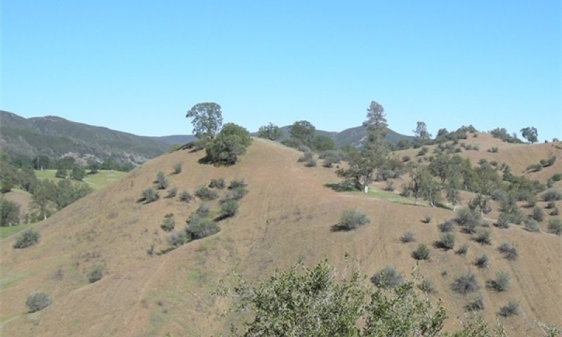
Figure 18. Community Phase 3.1 on south-facing slope. J. Welles
Buckbrush maintains viable seed in the soil for extended periods of time and primarily regenerates following fire when temperatures crack the hard seed coating (League, 2005). Buckbrush is a nitrogen-fixing plant that gives it a competitive advantage in nutrient deficient soils. The increase in water storage and nutrients from litter fall and movement of soil particles have a positive influence on grass and forb growth immediately surrounding shrub bases. The composition of annual grasses and forbs is influenced by the timing and amount of precipitation and the amount of residual dry matter (George et al., 2001a). Annual forbs and grasses dominate and are comprised primarily of filaree species (Erodium botrys and Erodium circutarium) and grasses are dominated by red brome (Bromus rubens) and wild oat (Avena fatua). Other forbs and herbaceous plants present may include buckwheat (Eriogonum spp.), clover (Trifolium spp.), bluedicks (Dichelostemma capitatum), dotseed plantain (Plantago erecta), yellow star-thistle (Centaurea solstitis) and popcorn flower (Plagiobothrys spp.).
Transition 1A
State 1 to 2
Continuous grazing and clearing are triggers that may eliminate blue oak and buckbrush across the landscape. Indicators of a change in structure and function on this site would include a lack of reproduction in shrubs and trees and a reduction in cover. Insect predators and high temperatures may result in significant buckbrush seed mortality and reduction of the seedbank (O’Neil and Parker, 2005). Seed of buckbrush is also highly preferred by small mammals (League, 2004), and the low level of non-fire recruitment of buckbrush on this site may also be a function of very low soil moisture.
Transition 1B
State 1 to 3
Moderate to severe fire or conversion are the triggers that kill blue oak and stimulates buckbrush seed to germinate by scarifying the seed “banked” in the soil (League, 2005). While buckbrush may have very limited natural regeneration without fire, fire-stimulated regeneration is more abundant; historic photos of the area indicate that shrub density was previously of greater extent with more frequent fire than under current conditions.
Transition 2A
State 2 to 3
Moderate to severe fire stimulates buckbrush seed to germinate. Buckbrush usually requires fire in order to scarify the seed “banked” in the soil (League, 2005). Mechanical disturbance also may also occasionally act to scarify seed and facilitate germination, though to a much lesser degree (Bonner et al., 2008). First year survival of buckbrush seedlings may be very low (League, 2005) due to drought conditions.
Transition 3A
State 3 to 2
The lack of fire, browsing by cattle, drought and clearing may trigger the elimination of buckbrush on the landscape.
Additional community tables
Table 7. Community 1.1 plant community composition
| Group | Common name | Symbol | Scientific name | Annual production (lb/acre) | Foliar cover (%) | |
|---|---|---|---|---|---|---|
|
Forb
|
||||||
| 1 | Forbs | 287–675 | ||||
| dotseed plantain | PLER3 | Plantago erecta | 66–286 | 1–5 | ||
| bluedicks | DICA14 | Dichelostemma capitatum | 40–123 | 0–1 | ||
| whiskerbrush | LECI18 | Leptosiphon ciliatus | 0–69 | 0–1 | ||
| stork's bill | ERODI | Erodium | 0–63 | 0–20 | ||
| common fiddleneck | AMMEI2 | Amsinckia menziesii var. intermedia | 0–45 | 0–1 | ||
| miniature lupine | LUBI | Lupinus bicolor | 0–34 | 0–5 | ||
| popcornflower | PLAGI | Plagiobothrys | 12–30 | 1–10 | ||
| yellow star-thistle | CESO3 | Centaurea solstitialis | 0–13 | 0–5 | ||
| clover | TRIFO | Trifolium | 0–12 | 0–1 | ||
|
Grass/Grasslike
|
||||||
| 2 | Grasses | 138–235 | ||||
| red brome | BRRU2 | Bromus rubens | 123–220 | 1–15 | ||
| annual fescue | VUMY | Vulpia myuros | 0–15 | 0–1 | ||
|
Shrub/Vine
|
||||||
| 3 | Shrubs | 160–321 | ||||
| buckbrush | CECU | Ceanothus cuneatus | 160–321 | 1–5 | ||
|
Tree
|
||||||
| 4 | Trees | 20–60 | ||||
| blue oak | QUDO | Quercus douglasii | 20–60 | 1–2 | ||
Interpretations
Animal community
Wildlife
Oak savannas may provide essential habitat elements for a variety of wildlife species. Due to the natural mosaic of grassland, shrubs and trees, a variety of micro-habitats are provided, meeting some of the reproductive, foraging and/or cover requirements for wildlife. In one study in central California, habitat elements that included shrubs, grass and down wood were positively associated with the abundance of small mammals, and shrub cover and litter weight with abundance of birds and reptiles (Tieje et al 1997). Bird species have essential habitat elements that include large oak trees with associated cavities and acorns, snags, shrubs, grasses and forbs, brush piles and water (Zack, 2002).
Community Phase 1.1 provides sparse vegetation with limited forage and cover due to very shallow soils. The scattered trees found on the landscape may be described as “keystone structures” in that their contribution to ecosystem structure and function is substantial compared to the space they occupy (Manning, Fischer and Lindenmayer, 2006). Some key ecological functions they provide include tree cover, connectivity for other trees and animals, and restoration “centers” in an otherwise open landscape. All of these functions serve to enhance ecosystem function and biodiversity. Even though lower cover and hiding areas supports less animal diversity, this ecological site provides important links to other surrounding oak woodland habitat.
Of the 632 terrestrial vertebrates (amphibians, reptiles, birds, and mammals) native to California, over 300 species use oak savannas for food, cover and reproduction, including at least 120 species of mammals, 147 species of birds and approximately 60 species of amphibians and reptiles (Tietje et al., 2005). Common species on this site include Beechey ground squirrels (Spermophilus beecheyi) and Audubon cottontail (Sylvilagus audubonii vallicola), and coyote (Canis latrans). A rich rodent and rabbit population is an important food source for common predators including: bobcat (Lynx rufus californicus) and the Pacific rattlesnake (Crotalus viridis oreganus).
Bird species have essential habitat elements met in savannas that include some large oak trees with associated cavities and acorns and grasses and forbs (Zack, 2002). Oak trees provide important over-wintering environments for large numbers of Neotropical migratory birds such as flycatchers, vireos, and warblers. Acorn woodpeckers (Melanerpes formicivoris) and western scrub jays (Aphelocoma californica) forage heavily on acorns, and oak titmice (Baeolophus inornatus), western bluebirds (Sialia Mexicana) and tree swallows (Tachycineta bicolor) nest in the cavities of oaks. Many types of hawks and owls use oak savannas for the abundance of prey found in the landscape.
Grazing and Browsing
The main problems for livestock production on this site is the early seasonal drying of the soil profile causing forage quality to decline rapidly in early spring.
Filaree is important forage for cattle, horses, and domestic sheep; yields vary depending upon soil moisture (Howard, 1992).
Acorns are a critical food source for deer, which migrate from high-elevation dry summer ranges to blue oak woodland for fall and winter forage (Burns and Honkala 1990). Acorns are eaten by at least a dozen species of songbirds, several upland game birds, rodents, black-tailed deer, feral and domestic pig, and all other classes of livestock (Adams et al., 1992; Duncan and Clawson 1980; Sampson and Jespersen 1963). Bobcats, foxes and coyotes spend time searching for prey in oak savannas (Pavlik, et al., 1992).
Hydrological functions
The watersheds associated with these sites are drained by intermittent streams that only flow during the wet season. In dry years these intermittent streams may not flow at all. Runoff on these soils is medium to high and soil erosion hazard is moderate to very high.
Recreational uses
Hunting, horseback riding, all-terrain vehicle riding are common recreational pursuits.
Wood products
This site would offer no wood products.
Other products
Native Americans have historically used and managed the blue oak savannas for food and fiber. The gathering of native plants such as bulbs and corms, grasses and brush for food, medicine and crafts that is still practiced today (Anderson, 2005). These gathering methods sustained local plant populations and promoted plant diversity.
Other information
Oak Restoration:
Due to the very shallow nature of these soils and low available water, oak restoration is not favorable on this site.
Native Grass Restoration:
Due to very shallow soil depths native grass restoration is not possible on this site.
Supporting information
Inventory data references
Information utilized to develop the Ecological Site Concept and plant communities includes the following:
Glenn County - Existing Range Production Summary Data
- Range 417, Lodo soil, 1981
- Ecological Site Inventory Plot Data:
-2 Line Point Intercepts
-3 step-point traverses
-3 Double sampling production plot locations
Type locality
| Location 1: Glenn County, CA | |
|---|---|
| Township/Range/Section | T20N R7W S12 |
| UTM zone | N |
| UTM northing | 4384451.2 |
| UTM easting | 534677.68 |
| General legal description | Approximately ¾ mile from County Road 309. NW ¼ of the NE ¼ Section 12, T.20N., R.7W. |
Other references
Allen-Diaz, B., R. E. Rand, B. Holzman and A. J. Martin, 1989. Report on Rangeland Cover Type Descriptions for California Hardwood Rangelands. Forest and Rangeland Resources Assessment Program, Calif. Dep. of Forestry and Fire Protection, Sacramento, Calif. 318 pgs.
Amatangelo, K.L., J.F. Dukes, C. B. Field. 2008. Responses of a California annual grassland to litter manipulation. Journal of Vegetation Science doi: 10.3170/2008-8-18415, published online 7 April 2008 © IAVS; Opulus Press Uppsala
Adams, Theodore E., P. B. Sands, W.H. Weitkamp, and N. K. McDougald. 1992. Oak seedling establishment on California rangelands. J. Range Manage. 45: 93-98.
Anderson, M. Kat, Tending the Wild. Native American Knowledge and the Management of California’s Natural Resources. University of California Press 2005.
Arno, S.F. and S. Allison-Bunnel. 2002. Flames in Our Forest, Disaster or Renewal? Island Press.227 pgs.
Baker, H.G. Sources of the naturalized grasses and herbs in California. In: Huenneke, L.F. and H.A. Mooney (Ed.). 1989. Grassland Structure and Function: California Annual Grassland. Kluwer Academic Publishers, Dordrecht, Netherlands. Pg. 29-38.
Barbour, M.G. and J. Major, Terrestrial Vegetation of California. 1977. John Wiley and Sons, Inc.
Bartolome, J. W. 1987. California grassland and oak savannah. Rangelands 9:122-125.
Bartolome, J.W., W.F. Frost, N.K. McDougald and M. Connor. 2002. California guidelines for residual dry matter (RDM) management on coastal and foothill annual rangelands. Rangeland Monitoring Series. Publ. 8092, Div. of Agr. and Nat Res., Univ. of Calif. 8pp.
Bartolome, J.W. 1979. Germination and
Seedling Establishment in California Annual Grassland. Journal of Ecology. Vol.67, No. 1, 7 pgs.
Block, W. M. and M. L. Morrison. 1990. Wildlife diversity of the Central Sierra foothills. Calif. Agric. 44:19-22.
Bolsinger, C. L. 1988. The hardwoods of California's timberlands, woodlands, and savannas. Res. Bull. PNW-RB-148. Portland, OR: U.S. Department of Agriculture, Forest Service, Pacific Northwest Research Station. 148 p.
Briske, D.D., Fulendorf, S.D., and F.E. Smiens. 2006. A Unified Framework for Assessment and Application of Ecological Thresholds. Rangeland Ecolgy and Management 59(3) May 2006. Pp. 225-236.
Burcham, L. T. 1957. California Rangeland. Div. Forestry, Sacramento, Calif. 261 pgs.
Burns, R. M. and B. H. Honkala. (Eds.) 1990. Silvics of North America (Vol 2): Hardwoods. Agric. Handbook 654. USDA Forest. Service, Washington D.C. 877 p.
Corbin, J. D. and D’Antonio, C. M. 2004. Competition between native perennial and exotic annual grasses: Implications for an historical invasion. Ecology 85:1273-1283.
Daniel, J.A., K. Potter, W. Altom, H. Aljoe, and R. Stevens. 2002. Long-Term Grazing Density Impacts on Soil Compaction. Transactions of the ASAE, 45:1911-1915.
D’Odorico, P., G.S. Okin, and B.T. Bestelmeyer. 2012. A synthetic review of feedbacks and drivers of shrub encroachment in arid grasslands. In: Ecohydrology 5, pgs. 520-530. Wiley Online Library.
Duncan, D. A., N. K. McDougal and S. E. Westfall. 1987. Long Term Changes From Different Uses of Foothill Hardwood Rangelands. Gen. Tech. Report PSW-100, Berkeley California. Pacific Southwest Range and Experiment Station, Forest Service, U.S. Department of Agriculture.
Duncan, D. A. and W.J. Clawson. 1980. Livestock utilization of California’s oak woodlands. In: Plumb, Timothy R., (technical coordinator). Proceedings of the symposium on the ecology, management, and utilization of California oaks. Gen. Tech. Rep. PSW-44. U.S. Dep. of Agr. For. Serv. Pacific Southwest Forest and Range Exp. Sta., Berkeley, CA. Pgs. 306-313.
Evangilista, D., S. Hutton, J. Dumais. 2011. The mechanics of explosive dispersal and self-burial in the seeds of filaree in Erodium cicutarium (Geraniaceae). The Journal of Experimental Biology 214, 521-529 . Published by The Company of Biologists Ltd. doi:10.1242/jeb.050567
Eviner, V.T. and F.S. Chapin III, 2001. Plant species provide vital ecosystem functions for sustainable agriculture, rangeland management and restoration. California Agriculture, Volume 55, Number 6. Pgs. 54-59.
Frost, W. E., J.W. Bartolome and J. M. Connor. 1997. Understory Canopy Relationships in oak woodlands and savannas. USDA Forest Service Gen. Tech. Rep. PSW-GTR-160.
Fryer, J. L. 2007. Quercus douglasii. In: Fire Effects Information System, [Online]. U.S. Department of Agriculture, Forest Service, Rocky Mountain Research Station, Fire Sciences Laboratory (Producer). Available: http://www.fs.fed.us/database/feis/ [2013, February 19].
Gill, R.A., and I.C. Burke, 1999. Ecosystem consequences of plant life form changes at three sites in the semiarid United States. Oecologia (1999) 121:551-563.
Greenlee, J. M., and J. H. Langenheim, 1980. The history of wildfires in the region of Monterey Bay. California State Department of Parks and Recreation, Sacramento.
Griffin, D., and K. J. Anchukaitis (2014), How unusual is the 2012–2014 California drought?, Geophys. Res. Lett., 41, 9017–9023, doi:10.1002/2014GL062433.
Heady, H. F. 1956. Changes in a California Annual Plant Community Induced by Manipulation of Natural Mulch. In Ecology, Vol.7, No.4. pgs. 798-812.
Howard, J. L. 1992. Erodium cicutarium. In: Fire Effects Information System, [Online]. U.S. Department of Agriculture, Forest Service, Rocky Mountain Research Station, Fire Sciences Laboratory (Producer). Available: http://www.fs.fed.us/database/feis/ [2013, February 19].
Garrison and Standiford, 1997. A Post-Hoc Assessment of the Impacts to Wildlife Habitat from Wood Cutting in Blue Oak Woodlands in the Northern Sacramento Valley. USDA Forest Service Gen. Tech. Rep. PSW-GTR-160.
George, M., J. Bartolome, N. McDougald, M. Connor, C. Vaughn and G. Markegard. 2001a. Annual Range Forage Production. ANR Publ. 8018, Div. of Agric. And Nat. Res., Univ. of Calif., Oakland, Calif. 9 pgs.
George, M., G. Nader, N. McDougald, M. Connor, and B. Frost. 2001b. Annual Rangeland Forage Quality. ANR Publ. 8022, Div. of Agric. And Nat. Res., Univ. of Calif., Oakland, Calif. 13 pgs.
George, M., W. Frost, N. J. McDougald, M. Connor, J. Bartolome, R. Standiford, J. Maas, and R. Timm. Livestock and grazing management. In: Standiford, Richard (tech. coord.) 1996. Guidelines for Managing California’s Hardwood Rangelands. ANR Publ 3368, Div. of Agric. And Nat. Res., Univ. of Calif., Oakland, Calif. pp. 51-67.
George, M., J. Clawson, J. Menke, and J. Bartolome. 1985. Annual Grassland Forage Productivity. 1985. In: Rangelands 7(1), 3 pgs.
George, M. 1993. ESDs https://esis.sc.egov.usda.gov/
Kimmins, J.R. 1987. Forest Ecology. Macmillan Publishing Company. 531 pgs.
League, K. R. 2005. Ceanothus cuneatus. In: Fire Effects Information System, [Online]. U.S. Department of Agriculture, Forest Service, Rocky Mountain Research Station, Fire Sciences Laboratory (Producer). Available: http://www.fs.fed.us/database/feis/ [2013, February 19].
Manning, A. D., J. Fischer, D. B. Lindenmayer. (2006) Scattered trees are keystone structures - implications for conservation, Biological Conservation, 132, 311-321
Mayer K. E., and W. F. Laudenslayer. (Eds.) 1988. A guide to wildlife habitats of California. California Dept. of Forestry and Fire Protection, Sacramento.
McCreary, D. D. 2001. Regenerating rangeland oaks in California. ANR Publ. 21601, Div. of Agric. And Nat. Res., Univ. of Calif., Oakland, Calif. 62 pgs.
McCreary, D. D. 2004. Fire in California’s Oak Woodlands. University of California Cooperative Extension. 8pgs.
McClaran, M.P. 1986. Age structure of Quercus douglasii in relation to livestock grazing and fire. Ph.D. Dissertation. Univ. of Calif., Berkeley. 119 pp.
McDougald, N.K. W.E. Frost, and W.J. Clawson. 1991. Estimating the cost of replacing forage losses on annual rangeland. Leaflet 21494. Division of Agric. and Nat. Res., Univ. of Calif., Oakland, Calif.
Michaelides, K., Lister, D.L., Wainwright, J., and A.J. Parsons. 2012. Linking runoff and erosion dynamics to nutrient fluxes in a degrading dryland landscape. Journal of Geophysical Research, Vol. 117, G00N15, doi 10.1029/2012JG002071, 2012
Miller, G.R., Chen, X., Rubin, Y., Ma, S., and D. D. Baldochii. Ground water uptake by woody vegetation in a semi-arid oak savanna. Water Resource Research. Vol. 46, W10503, http://dx.doi.org/10.1029/2009WR008902
Miller, G. R., Cable, J. M., McDonald, A.K., Bond, B., Franz, T.E., Wang, L., Gou, S., Tyler, A.P., Zou, C.B., and R.L. Scott. 2012. Ecohydrology 5. 200-220. (2012) Published online 7 July 2011 in Wiley Online Library. (wileyonlinelibrary.com) DOI 10/1002/eco.245
O’Neil, S.E., and T. Parker. 2005. Factors contributing to the soil seed bank size of two obligate seeding ceanothus species in northern California. Madrono. Vol.52, No. 3, pp.182-190, 2005.
Parsons, D.J and T.K. Stohlgren. 1989. Effects of varying fire regimes on annual grasslands in the southern Sierra Nevada of California. Madroño, 36:154-168.
Pavlik, B.M., P.C. Muick, S. Johnson, and M. Popper. 1991. Oaks of California. Cachuma Press, Inc. Los Olivos, Calif. 184 pgs.
Pickett, S. T. and White, P. S. 1985. The Ecology of Natural Disturbance and Patch Dynamics. Orlando, Fla.: Academic Press
Pillsbury, N. H.; J. Verner, and W. D. Tietje, technical coordinators. 1997. Proceedings of a symposium on oak woodlands: ecology, management, and urban interface issues; 19-22 March 1996; San Luis Obispo, CA Gen. Tech. Rep. PSW-GTR-160. Albany, CA: U.S. Department of Agriculture, Forest Service, Pacific Southwest Research Station; 738 p.
Pitt, M. D. and H. F. Heady. 1978. Responses of Annual Vegetation to Temperature and Rainfall Patterns in Northern California. Ecology, Vol.59, No.2, pgs. 336-350.
Quinn, R.D. and S.C. Keeley. Introduction to California Chapparal. 2006. University of California Press. 322 pgs.
Richards, J.H., and M.M Cadewell, 1987. Hydraulic lift: Substantial nocturnal water transport between soil layers by Artemisia tridentate roots. Oecologia (Berlin) (1987) 73:486-489
Sampson, A. W. and B. S. Jespersen. 1963. California range brushlands and browse plants. Univ. of Calif. Div. of Agr. Sci., Berkeley, CA. 162 pgs.
Sawyer, J.O., T. Keeler-Wolf, J. Evens, 2009. A Manual of California Vegetation. California Native Plant Society Press.
Siebert, J., Editor. 2003. Agriculture: Dimensions and Issues Information Series, Giannini Foundation of Agricultural Economics, UC Berkeley University of California, Berkeley California http://www.escholarship.org/uc/item/9145n8m1
State of California, Cal. Dep. For. and Fire Protection (CALFIRE) FRAP Publication: State and Transition Models for California’s Rangelands. http://frap.fire.ca.gov/projects/hardwood_expert/building_state/overview2.htm
Stromberg, M. R., J.D. Corbin and C.M. D’Antonio. Editors. 2007. California Grasslands: Ecology and Management. University of California Press, Berkeley and Los Angeles, CA. 390 pgs.
Sweitzer, R. A. and D. H. van Vuren. 2002. Rooting and Foraging Effects of Wild Pigs on Tree Regeneration and Oak Survival in California’s Oak Woodland Ecosystems. USDA Forest Service Gen. Tech. Rep. PSW-GTR-184.
Tehama County Watershed Assessment, 2010. Red Bluff, CA. 541 Pgs. http://www.tehamacountyrcd.org/library/publications/tewa/tehEastAssmt.pdf
Tietje, W., K. Purcell, and S. Drill. Oak woodlands as wildlife habitat. In: Giusti, G. A., D. McCreary, D., and R. B. Standiford (ed). 2005. A Planner’s Guide for Oak Woodlands, 2nd Ed. ANR Publ. 3491, Div. of Agric. and Nat. Res., Univ. of Calif., Oakland, Calif. pp 15-31.
Tugel, A. J. and J. R. Brown, 2001. State and Transition Ecosystem Models – Application to Soil Survey and Dynamic Soil Properties Databases. In: Proceedings of the National Cooperative Soil Survey Conference -2001. June 25-29, 2001, Ft. Collins, CO
University of California Agriculture ~ California Agriculture ~ January-March 2007 http://calag.ucop.edu/0701JFM/resup02.html
http://ucanr.org/sites/asi/db/covercrops.cfm?crop_id=33. August 18, 2014.
Vayssieres M.P. and R.E. Plant. 1998. Identification of vegetation state-and-transition domains in California's hardwood rangelands. FRAP Publication, California Department of Forestry and Fire Protection. Sacramento, CA.
Witty, J.A., R.C. Graham, K. R. Hubbert, J.A. Doolittle, and J.A. Wald. 2003. Contributions of water supply from the weathered bedrock zone to forest soil quality. Elsevier. Geoderma 114. Pgs. 389-400.
Young, J.A., Evans, R.A., Raguse, C.A. and Larson, J.R., 1981. Germinable Seeds and Periodicity of Germination in Annual Grasslands.
Zack, S. 2002. Oak Woodland Bird Conservation Plan, A Strategy for Protecting and Managing Oak Woodland Habitats and Associated Birds in California. California Partners in Flight. V.2.0
Contributors
Judy Welles
Rangeland health reference sheet
Interpreting Indicators of Rangeland Health is a qualitative assessment protocol used to determine ecosystem condition based on benchmark characteristics described in the Reference Sheet. A suite of 17 (or more) indicators are typically considered in an assessment. The ecological site(s) representative of an assessment location must be known prior to applying the protocol and must be verified based on soils and climate. Current plant community cannot be used to identify the ecological site.
| Author(s)/participant(s) | Judy Welles, Ryan Miebach |
|---|---|
| Contact for lead author | Chico Soil Survey Office, Chico, CA |
| Date | 06/24/2015 |
| Approved by | |
| Approval date | |
| Composition (Indicators 10 and 12) based on | Annual Production |
Indicators
-
Number and extent of rills:
Rilling may occur on slopes greater than 30 percent. -
Presence of water flow patterns:
Water flow patterns are typically downslope for 200-400 feet. -
Number and height of erosional pedestals or terracettes:
Erosion pedestals and terracettes may occur. -
Bare ground from Ecological Site Description or other studies (rock, litter, lichen, moss, plant canopy are not bare ground):
40-60% bare ground, Average -
Number of gullies and erosion associated with gullies:
Some gullying noted in steep map units. -
Extent of wind scoured, blowouts and/or depositional areas:
None noted. -
Amount of litter movement (describe size and distance expected to travel):
Steep to very steep slope gradient, with little litter movement noted, as not much is normally generated on this site. Oak leaves would be approximately 1 by 2 inches, forbs 1 by 1/10 inches, grasses 2 by 1/10 inch. -
Soil surface (top few mm) resistance to erosion (stability values are averages - most sites will show a range of values):
The soil surface is medium to fine textured and has weak structure and is easily eroded. Vegetative cover is very low. The Erosion Hazard Rating is moderate to very high. -
Soil surface structure and SOM content (include type of structure and A-horizon color and thickness):
A--0 to 7 inches; grayish brown (2.5Y 5/2) shaly clay loam, very dark grayish brown (2.5Y 3/2)
SOM 0.5-3.0 percent (Note, this is very high for this site, and not considered representative) -
Effect of community phase composition (relative proportion of different functional groups) and spatial distribution on infiltration and runoff:
Forbs>>>>Shrubs>>Grass>>Trees
Low cover of most functional groups leads to moderate permeability and moderate to rapid runoff.
A few trees and shrubs intercept rainfall slowing infiltration process. Cover of forbs and grasses aids infiltration and decreases runoff, especially on slopes less than 30 percent. Steeper slopes have less cover, less infiltration and higher runoff. -
Presence and thickness of compaction layer (usually none; describe soil profile features which may be mistaken for compaction on this site):
None noted or measured. -
Functional/Structural Groups (list in order of descending dominance by above-ground annual-production or live foliar cover using symbols: >>, >, = to indicate much greater than, greater than, and equal to):
Dominant:
Annual and Perennial Forbs
Trees. QUDO
Additional:
Sub-dominant:
BuckbrushOther:
Annual Grasses and Blue oakAdditional:
-
Amount of plant mortality and decadence (include which functional groups are expected to show mortality or decadence):
All forbs and grasses show rapid mortality due to early seasonal drying of the soil profile. Blue oak would not be expected to have more than 1-2 percent mortality. -
Average percent litter cover (%) and depth ( in):
-
Expected annual annual-production (this is TOTAL above-ground annual-production, not just forage annual-production):
Line transect data in a 80 percent of normal year predicts for Unfavorable, RV and Favorable Years a 375, 1090 and 1200 pounds per acre dry weight.
-
Potential invasive (including noxious) species (native and non-native). List species which BOTH characterize degraded states and have the potential to become a dominant or co-dominant species on the ecological site if their future establishment and growth is not actively controlled by management interventions. Species that become dominant for only one to several years (e.g., short-term response to drought or wildfire) are not invasive plants. Note that unlike other indicators, we are describing what is NOT expected in the reference state for the ecological site:
Medusahead and yellow star-thistle are present, however there is not much potential for these invasives to become dominant or codominant because they prefer deeper finer textured soils. -
Perennial plant reproductive capability:
No potential for perennials due to the very shallow nature of the soil profile.
Print Options
Sections
Font
Other
The Ecosystem Dynamics Interpretive Tool is an information system framework developed by the USDA-ARS Jornada Experimental Range, USDA Natural Resources Conservation Service, and New Mexico State University.
Click on box and path labels to scroll to the respective text.