Natural Resources
Conservation Service
Ecological site R016XB002CA
Salt-Affected, Stratified, Fluventic
Accessed: 04/02/2025
General information
Provisional. A provisional ecological site description has undergone quality control and quality assurance review. It contains a working state and transition model and enough information to identify the ecological site.

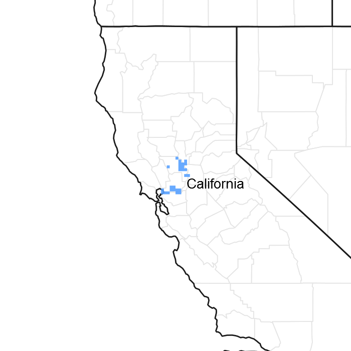
Figure 1. Mapped extent
Areas shown in blue indicate the maximum mapped extent of this ecological site. Other ecological sites likely occur within the highlighted areas. It is also possible for this ecological site to occur outside of highlighted areas if detailed soil survey has not been completed or recently updated.
MLRA notes
Major Land Resource Area (MLRA): 016X–California Delta
16 – California Delta
Most of this area is in the California Trough Section of the Pacific Border Province of the Pacific Mountain System. A small part at the west edge of the area is in the California Coast Ranges Section of the same province and division. This MLRA was originally the conjoined flood plain along the Sacramento and San Joaquin Rivers. As sediment from these rivers built up in San Pablo Bay, a delta formed, creating many streams that divide this nearly level area into “islands.” Strong levees and drainage systems are needed to protect the islands from flooding. Elevation of the islands ranges from below sea level to slightly above sea level. This area is underlain by interbedded marine, estuarine, and fine-grained non-marine sediments transported to the delta by the Sacramento and San Joaquin Rivers as they flowed into San Pablo Bay. As the sediments built up, a delta formed and freshwater mixed with brackish water in marshes and on flood plains. As the marsh vegetation became covered with new sediments, the organic matter content in the soils built up to very high levels. When drained and exposed to the air, these peaty soils oxidize and shrink and then subside.
This provisional land resource unit (LRU) 16B is loosely tied to the Suisun Bay area and is distinguished from the inland LRU 16A by increased levels of water salinity and the effects of salinity on ecological sites within that area.
Classification relationships
Using the December 2010 draft EPA ecoregion level IV: 7j, Delta polygon mostly closely overlaps with MLRA 16.
MLRA 16 mostly aligns with the USFS (1997) ecological subsection 262AI, Great Valley, Delta.
Ecological site concept
This site is a complex patchwork of salt-affected, upland and facultative wetland plant communities that are primarily adapted to fluctuating water tables influenced primarily by tidal events.
Found in floodplain locations and alluvial fans on slopes ranging from 0 to 2%.
The soils are characterized by thermic entisols and mollisols with stratified primarily fluventic sediments, with fine-silty textures, derived from alluvium.
Drainage is poor.
Salinity is relatively high and will have significant impacts on vegetation and management response.
Associated sites
| R016XB001CA |
Tidally-Influenced, Salt-Affected 016XB001 is most immediately effected by tidal surface waters and is largely comprised of organic soils. |
|---|
Table 1. Dominant plant species
| Tree |
Not specified |
|---|---|
| Shrub |
(1) Atriplex lentiformis |
| Herbaceous |
(1) Distichlis spicata |
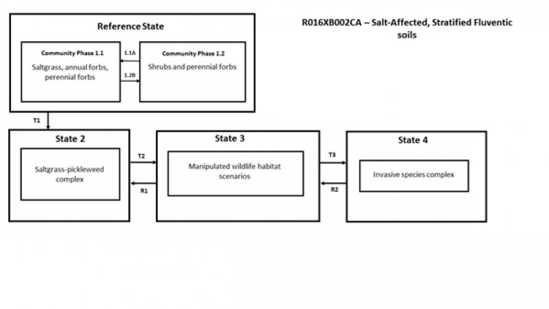
Click on box and path labels to scroll to the respective text.
