
Natural Resources
Conservation Service
Ecological site F022AC006CA
Moderately Deep Cryic Sandy Till
Accessed: 02/08/2026
General information
Approved. An approved ecological site description has undergone quality control and quality assurance review. It contains a working state and transition model, enough information to identify the ecological site, and full documentation for all ecosystem states contained in the state and transition model.

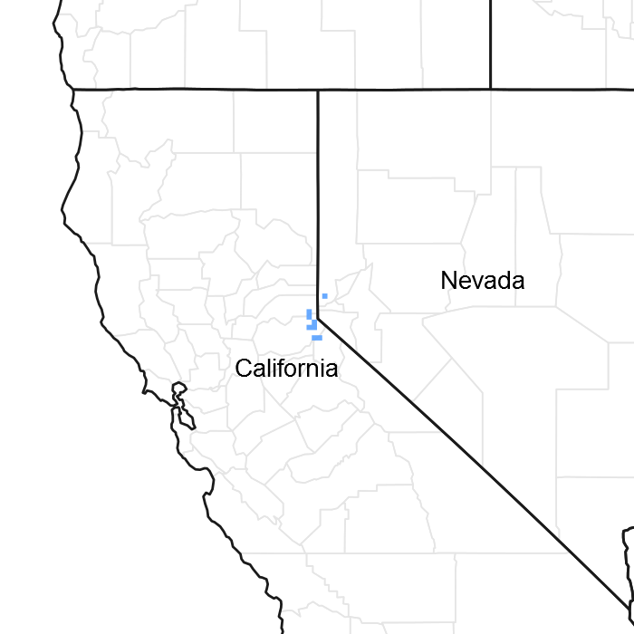
Figure 1. Mapped extent
Areas shown in blue indicate the maximum mapped extent of this ecological site. Other ecological sites likely occur within the highlighted areas. It is also possible for this ecological site to occur outside of highlighted areas if detailed soil survey has not been completed or recently updated.
MLRA notes
Major Land Resource Area (MLRA): 022A–Sierra Nevada and Tehachapi Mountains
MLRA 22A
Major Land Resource Area 22A, Sierra Nevada Mountains, is located predominantly in California and a small section of western Nevada. The area lies completely within the Sierra Nevada Section of the Cascade-Sierra Mountains Province. The Sierra Nevada range has a gentle western slope, and a very abrupt eastern slope. The Sierra Nevada consists of hilly to steep mountains and occasional flatter mountain valleys. Elevation ranges between 1,500 and 9,000 ft throughout most of the range, but peaks often exceed 12,000 ft. The highest point in the continental US occurs in this MLRA (Mount Whitney, 14,494 ft). Most of the Sierra Nevada is dominated by granitic rock of the Mesozoic age, known as the Sierra Nevada Batholith. The northern half is flanked on the west by a metamorphic belt, which consists of highly metamorphosed sedimentary and volcanic rocks. Additionally, glacial activity of the Pleistocene has played a major role in shaping Sierra Nevada features, including cirques, arêtes, and glacial deposits and moraines. Average annual precipitation ranges from 20 to 80 inches in most of the area, with increases along elevational and south-north gradients. Soil temperature regime ranges from mesic, frigid, and cryic. Due to the extreme elevational range found within this MLRA, Land Resource Units (LRUs) were designated to group the MLRA into similar land units.
LRU "C" Northern Sierra Subalpine: Elevations are typically between 7,800 and 9,800 feet. The frost free period is between 30 and 90 days, MAAT is between 35 and 44 degrees, MAP is between 45 and 65 inches. Soils are typically cryic, but frigid soils may occur at lower elevations on southern aspects. Forests are dominated by whitebark pine (Pinus albicaulis), Sierra lodgepole pine (Pinus contorta spp. murrayana), mountain hemlock (Tsuga mertensiana) and/or California red fir (Abies magnifica).
Classification relationships
Forest Alliance = Pinus contorta ssp. murrayana – Lodgepole pine forest; Association = tentatively Pinus contorta ssp. murrayana. (Sawyer, John O., Keeler-Wolf, Todd, and Evens, Julie M. 2009. A Manual of California Vegetation. 2nd ed. California Native Plant Society Press. Sacramento, California.)
Ecological site concept
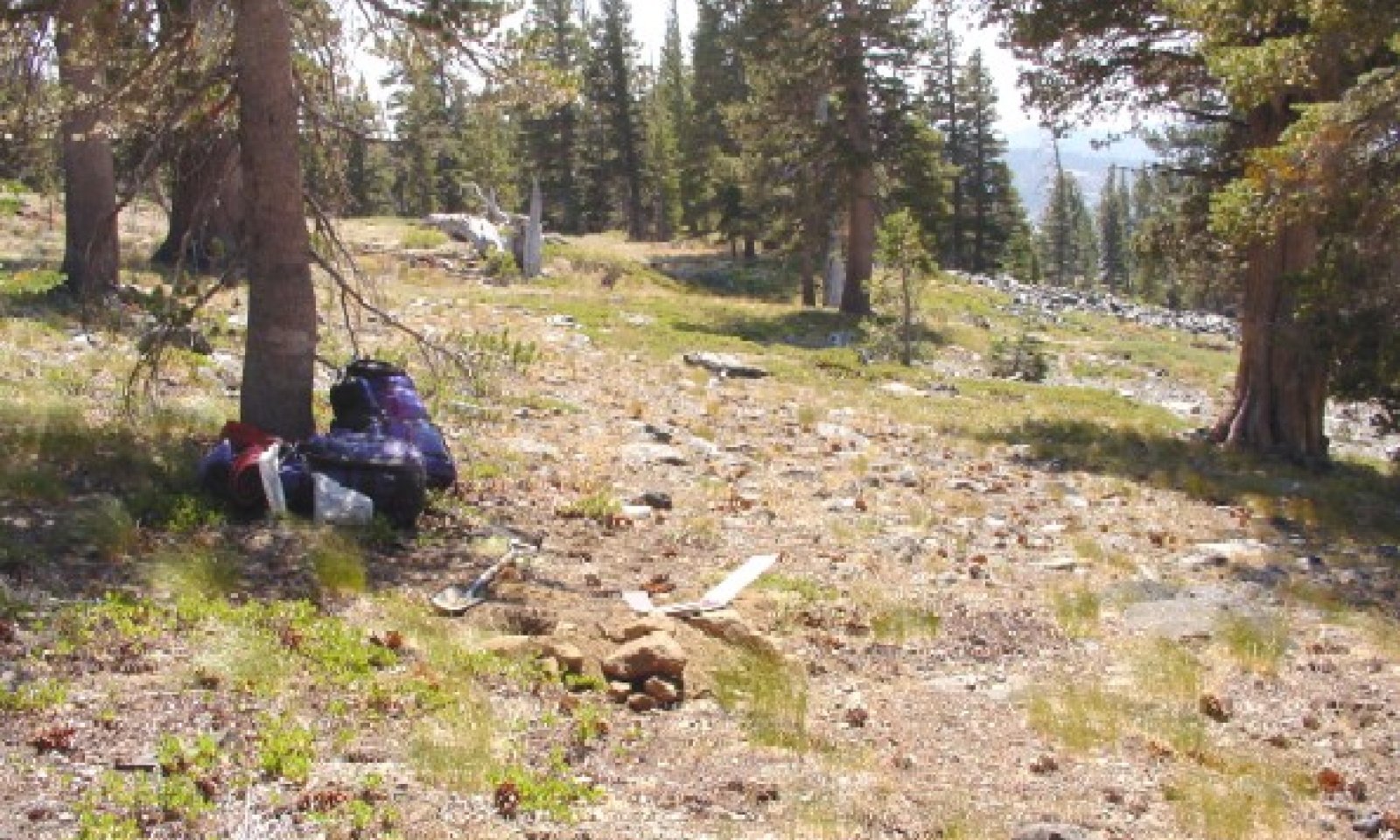
This site occurs on gently to steep subalpine, south-facing mountain slopes at elevations typically between 7,600 and 9,000 feet. Slopes are typically between 9 and 30 percent. Soils are derived from volcanic parent material, and are moderately deep over dense glacial till. This dense layer inhibits roots and water movement, which favors dominance by Sierra lodgepole pine (Pinus contorta var. murrayana), which is shallow-rooted and tolerant of saturated soils. The vegetation is relatively open, as the root-restrictive layer limits forest density. California red fir (Abies magnifica) and western white pine (Pinus monticola) are important secondary species. Moist soils support a productive understory, which is dominated by greenleaf fescue (Festuca viridula) and lupines (Lupinus sp.).
Associated sites
| F022AC007CA |
North-Facing Cryic Loamy Mountain Slopes This site occurs on adjacent north-facing slopes with moderately deep, andic soils. Vegetation is subalpine mixed conifer forest with mountain hemlock (Tsuga mertensiana), red fir (Abies magnifica), western white pine (Pinus monticola), and lodgepole pine (Pinus contorta var. murrayana). Understory density and composition is variable with site moisture, but purple mountainheath (Phyllodoce breweri) and rose meadowsweet (Spiraea splendens) are common. |
|---|---|
| F022AE007CA |
Frigid, Sandy, Moraines And Hill Slopes Occurs at lower elevations on moraines and hillslopes with moderately deep to very deep soils derived from glacial outwash and till. Vegetation is a dense Jeffrey pine (Pinus jeffreyi) - white fir (Abies magnifica) forest. |
| F022AX101CA |
Moist Colluvial Headwater System Occurs on adjacent headwater swales and first order streams. A complex of vegetation community types is present, and quaking aspen (Populus tremuloides) is a characteristic species. |
| R022AA200CA |
Alpine Scree Occurs at higher elevations, above treeline, on windswept alpine slopes and ridges with very shallow to moderately deep, sandy skeletal granitic soils. The sparse vegetation consists of dwarf forbs and grasses. |
| R022AC202CA |
Shallow Andesite Ridge Occurs on adjacent slopes with loamy shallow soils over andesitic bedrock. The vegetation is a low productivity shrubland dominated by low sagebrush (Artemisia arbuscula). |
| R022AE213CA |
Steep Rubbly Slope Occurs on lower elevation slopes with at least 50 percent cover of rubbleland. Vegetation is a shrubland comprised of dense patches dominated by huckleberry oak (Quercus vaccinifolia) and greenleaf manzanita (Arctostaphylos patula). |
Similar sites
| F022AF003CA |
Frigid, Loamy, Fragipan, Outwash This site occurs at lower elevations on gently sloping outwash. Soils are very deep with a shallow weak fragipan that causes a perched water table. Vegetation is a dense Sierra lodgepole pine (Pinus contorta var. murrayana) forest with a sparse grassy understory. |
|---|---|
| F022AX100CA |
Frigid, Sandy, Moist, Outwash Fan This site occurs on gently sloping outwash with very deep, poorly drained soils formed in alluvium from glacial outwash fans. The vegetation is a Sierra lodgepole pine (Pinus contorta var. murrayana) forest with a productive understory of willows and forbs. |
| F022AC007CA |
North-Facing Cryic Loamy Mountain Slopes This site occurs on north-facing slopes with moderately deep skeletal, andic soils. Mountain hemlock (Tsuga mertensiana), red fir (Abies magnfica), and western white pine (Pinus monticola) are co-dominant with Sierra lodgepole pine (Pinus contorta var. murrayana). |
| F022AF001CA |
Frigid Sandy Outwash Plain Gentle Slopes This site occurs at lower elevations on gently sloping glacial outwash. Soils are deep over a silica cemented horizon. The vegetation is an open Sierra lodegepole pine forest (Pinus contorta var. murrayana) with scattered western juniper (Juniperus grandis) and a grassy understory. |
| F022AC005CA |
Cryic Sheltered, Moist Sandy Mountain Slopes This site is found on north-facing slopes with deep, sandy skeletal soils, over decomposed granite. The vegetation is a mixed subalpine forest, with lodgepole pine (Pinus contorta var. murrayana), mountain hemlock (Tsuga mertensiana), red fir (Abies magnifica), and western white pine (Pinus monticola). Purple mountainheath (Phyllodoce breweri) and rose meadowsweet (Spiraea splendens) are common in the understory. |
Table 1. Dominant plant species
| Tree |
(1) Pinus contorta var. murrayana |
|---|---|
| Shrub |
Not specified |
| Herbaceous |
(1) Festuca viridula |
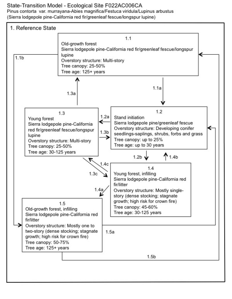
Click on box and path labels to scroll to the respective text.

