Frigid Loamy Flood Plains
Scenario model
Current ecosystem state
Select a state
Management practices/drivers
Select a transition or restoration pathway
- Transition 1A More details
- Restoration pathway 2A More details
- Transition 2A More details
- Restoration pathway 3A More details
-
No transition or restoration pathway between the selected states has been described
Target ecosystem state
Select a state
Description
This state is a single thread C type channel set in a broad valley bottom with gentle slopes associated with Holocene alluvial deposits. C channels are considered slightly entrenched and have a moderate to high width to depth ratio. Sinuosity is moderate to high, resulting in a well-defined meandering channel. The slope is low gradient and point bar formation and riffle/pool morphology are common features. C channels tend to be wide and shallow with a well-defined floodplain and may have alluvial terraces of abandoned floodplains.
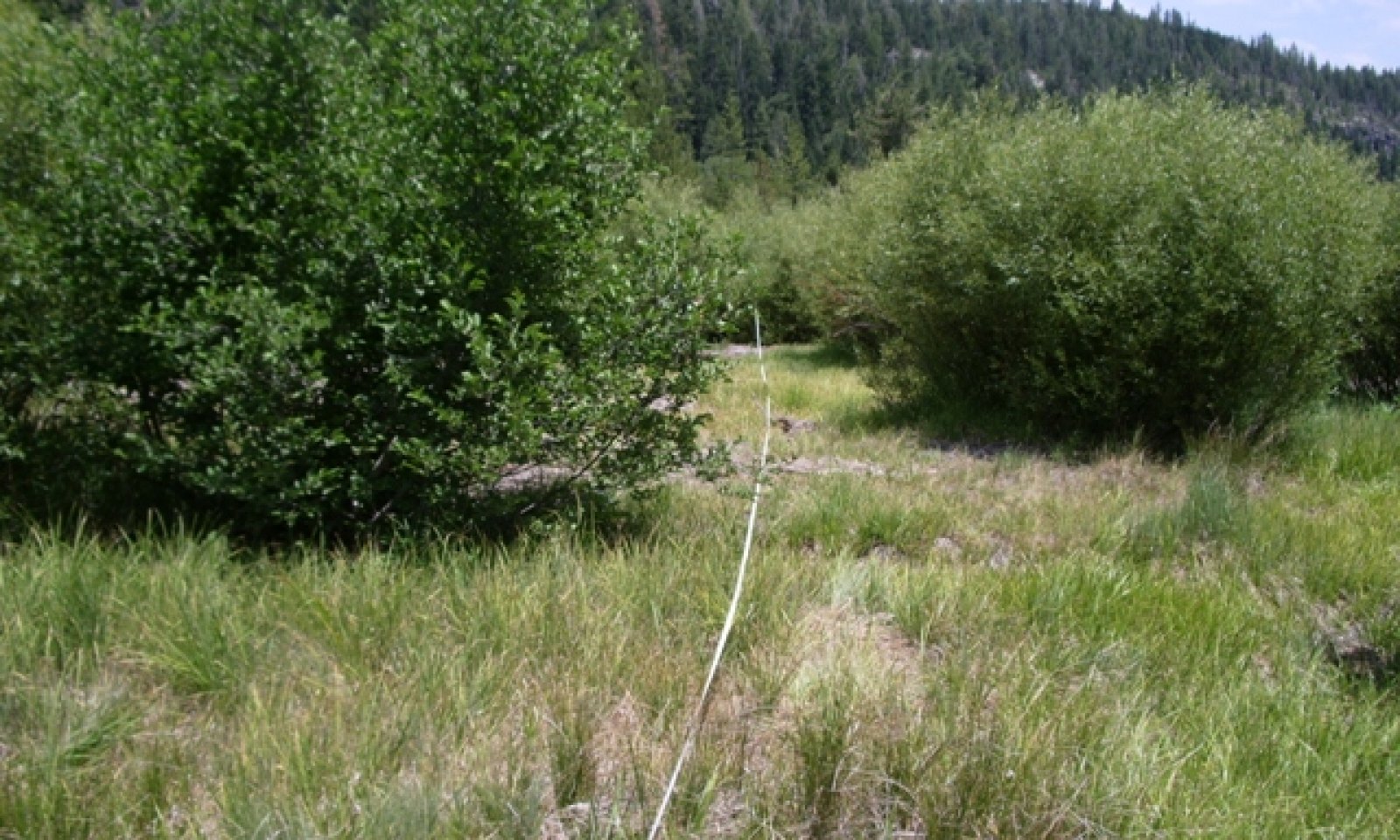
Obligate wetland species dominate the site in the undisturbed community phase. A shrub community comprised of thinleaf alder is found on the stream banks of the active channel while a mixed community of thinleaf alder/Lemmon’s willow is found on the floodplains. A pioneer plant community of native herbs is found on recently exposed substrate, generally along the stream channel, but may also be found on upper side channels. The adjacent upland habitat is coniferous forest of Sierra lodgepole pine and white fir.
Submodel
Description
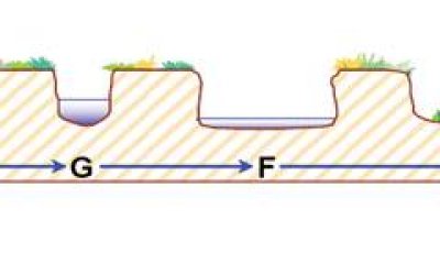
Additional stream classification data is required to determine which channel types are expressed as the C channel evolves in response to disturbance. In a typical succession scenario, the “C” type channel in State 1 down-cuts into an entrenched low gradient “G” type channel that naturally begins to widen over time into an entrenched “F” type channel. The plant community components associated with these possible successional channel types is not known. However, deeply incised “G” and “F” channels generally lose the wetland obligate species and become dominated by upland grass, shrub and/or forest plant communities. As the water table lowers at the site, the adjacent conifer community of Sierra lodgepole and white fir would encroach and reduce the thinleaf alder and mixed willow riparian community. Upland grass species like blue wildrye and western neeedlegrass would begin to dominate the native herbaceous community.
Submodel
Description
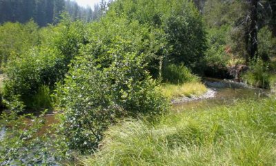
This C Channel has re-established a floodplain and natural sinuosity. It is constrained by the old flood plain, which is now a hydrologically disconnected terrace.
Submodel
Mechanism
This transition can occur naturally as the “C” type channel in State 1 down-cuts through the valley bottom. The channel on this site supports cobble-bottom (C3), gravel-bottom (C4), and sand-bottom (C5) reaches which have moderate to very high erosion potentials, respectively. Bank erosion is a natural river adjustment process and can as the result of mass wasting, liquification, freeze-thaw, fluvial entrainment, and ice scour. The glacial outwash and alluvial deposits in the U-shaped valley bottom are gradually eroded through these processes.
This transition can also be initiated by a disturbance that alters the hydrology of the site or impacts the vegetation along the stream bank. Alterations that can affect the hydrology of this site include channel realignment and/or confinement, culvert installations, and road construction. Such alterations straightened the channel, eliminating its ability to meander. This increases the shear stress along the stream bank, which accelerates stream bank erosion, thereby increasing sediment supply and decreasing sediment transport capacity. As the channel straightens it has a shorter course down the valley, creating a steeper gradient. The stream may adjust by headcutting into the base level of the channel until it establishes a new gradient through the meadow. As the stream bed is lowered, so is the water table in the meadow. The new larger and steeper channel can contain more flow, reducing the frequency of flooding and the extent of the floodplain, creating terraces. Cattle grazing and/or the seeding of non-native grass for forage can cause a similar entrenchment of the channel but through a different mechanism. When cattle reduce vegetation and trample the exposed stream banks, the resulting erosion also leads to eventual straightening and headcutting of the channel. Likewise, when non-native grasses displace the native riparian sedges and rushes, the stabilizing root mats that help prevent erosion are also removed.
Mechanism
Additional stream classification data is required to determine which channel types are expressed in State 2 as the C channel evolves in response to disturbance. Without this data it is not possible to identify the restoration pathway for the intermediate phase of the stream succession scenario.
Mechanism
This transition occurs when continued sediment deposition in the broadly entrenched “F” type channel allows the riparian vegetation to reestablish on the new floodplain. The vegetation increases channel stability and eventually channel sinuosity returns and a new meandering channel will develop that is constrained by the old floodplain.
Mechanism
The processes that have altered this stream system may be natural or human-influenced. If the primary reason for channel adjustment is a result of natural erosion through alluvial deposits as a result of uplift, the channel should be fairly well readjusted and left alone. However, if human caused disturbance has caused the erosion, then restoration procedures should be considered.
The goal of restoration is to return the channel to its full potential, which is defined as the best channel condition, based on quantifiable morphological characteristics of that stream type. For a constrained C channel the goal is to raise the water table, increase the channel sinuosity, and re-establish riparian vegetation on the stream banks to reduce bank erosion. Each segment of the stream channel should be surveyed to determine the evolutionary stages of channel adjustment and evaluate the potential for natural recovery. If natural recovery does not seem likely, a thorough stream departure analysis can determine the feasibility of restoration, anticipate response to future changes in management, and develop appropriate restoration designs.
Model keys
Briefcase
Add ecological sites and Major Land Resource Areas to your briefcase by clicking on the briefcase (![]() ) icon wherever it occurs. Drag and drop items to reorder. Cookies are used to store briefcase items between browsing sessions. Because of this, the number of items that can be added to your briefcase is limited, and briefcase items added on one device and browser cannot be accessed from another device or browser. Users who do not wish to place cookies on their devices should not use the briefcase tool. Briefcase cookies serve no other purpose than described here and are deleted whenever browsing history is cleared.
) icon wherever it occurs. Drag and drop items to reorder. Cookies are used to store briefcase items between browsing sessions. Because of this, the number of items that can be added to your briefcase is limited, and briefcase items added on one device and browser cannot be accessed from another device or browser. Users who do not wish to place cookies on their devices should not use the briefcase tool. Briefcase cookies serve no other purpose than described here and are deleted whenever browsing history is cleared.
Ecological sites
Major Land Resource Areas
The Ecosystem Dynamics Interpretive Tool is an information system framework developed by the USDA-ARS Jornada Experimental Range, USDA Natural Resources Conservation Service, and New Mexico State University.


