Natural Resources
Conservation Service
Ecological site R028AY202UT
Semidesert Alkali Loam (Black Greasewood)
Accessed: 12/21/2024
General information
Provisional. A provisional ecological site description has undergone quality control and quality assurance review. It contains a working state and transition model and enough information to identify the ecological site.
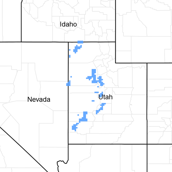
Figure 1. Mapped extent
Areas shown in blue indicate the maximum mapped extent of this ecological site. Other ecological sites likely occur within the highlighted areas. It is also possible for this ecological site to occur outside of highlighted areas if detailed soil survey has not been completed or recently updated.
MLRA notes
Major Land Resource Area (MLRA): 028A–Ancient Lake Bonneville
MLRA 28A occurs in Utah (82%), Nevada (16%), and Idaho (2%). It makes up about 36,775 square miles (95,246 square kilometers). A large area west and southwest of Great Salt Lake is a salty playa. This area is the farthest eastern extent of the Great Basin Section of the Basin and Range Province of the Intermontane Plateaus. It is an area of nearly level basins between widely separated mountain ranges trending north to south. The basins are bordered by long, gently sloping alluvial fans. The mountains are uplifted fault blocks with steep side slopes. Most of the valleys are closed basins containing sinks or playa lakes. Elevation ranges from 3,950 to 6,560 feet (1,204 to 2000 meters) in the basins and from 6,560 to 11,150 feet (1996 to 3398 meters) in the mountains. Much of the MLRA has alluvial valley fill and playa lakebed deposits at the surface from pluvial Lake Bonneville, which dominated this MLRA 13,000 years ago. A level line of remnant lake terraces on some mountain slopes indicates the former extent of this glacial lake. The Great Salt Lake is what remains of the pluvial lake.
Mountains in the interior of this MLRA consist of tilted blocks of marine sediments from Cambrian to Mississippian age. Scattered outcrops of Tertiary continental sediments and volcanic rocks are throughout the area. The average annual precipitation is 5 to 12 inches (13 to 30 cm) in the valleys and is as much as 49 inches (124 cm) in the mountains. Most of the rainfall in the southern LRU occurs as high-intensity, convective thunderstorms during the growing season (April through September). The driest period is from midsummer to early autumn in the northern LRU. Precipitation in winter typically occurs as snow. The average annual temperature is 39 to 53 °F (4 to 12 °C). The freeze-free period averages 165 days and ranges from 110 to 215 days, decreasing in length with elevation. The dominant soil orders in this MLRA are Aridisols, Entisols, and Mollisols. The soils in the area dominantly have a mesic or frigid soil temperature regime, an aridic or xeric soil moisture regime, and mixed mineralogy. They generally are well drained, loamy or loamy-skeletal, and very deep.
LRU: Basin and Range North
The Basin and Range North LRU exhibits dry summer with stronger xeric patterns than the Basin and Range South LRU. Ranges in the north LRU are about 50 percent Paleozoic sedimentary/metasedimentary (limestone/quartzite dominant) and about 10 percent Tertiary volcanics. The basin floors are between 4,200 and 5,100 feet (1280 to 1554 meters) in elevation. Pinyon and juniper sites have a greater percentage of Utah juniper (Juniperus osteosperma) in the plant community than pinyon pine (Pinus edulis or monophylla). The Basin and Range North have few semidesert ecological sites with Utah juniper. Cool season grasses, such as bluebunch wheatgrass, are dominant in the plant community, while warm season grasses are largely absent or a small component of the plant community.
Classification relationships
USDA-NRCS: MLRA: 28A Great Salt Lake Area> LRU: Basin and Range North> Ecological Zone> Semidesert> ESD Semidesert Alkali Loam (Greasewood)
EPA Ecoregion: North American Deserts> Cold Deserts> Central Basin and Range> Shadscale-Dominated Saline Basins, Sagebrush Basins and Slopes
Ecological site concept
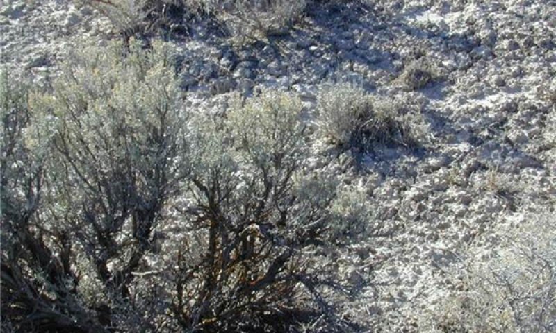
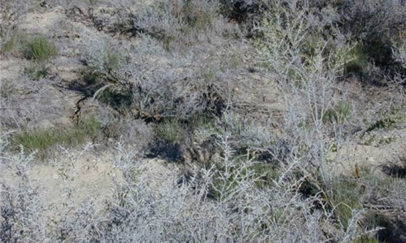
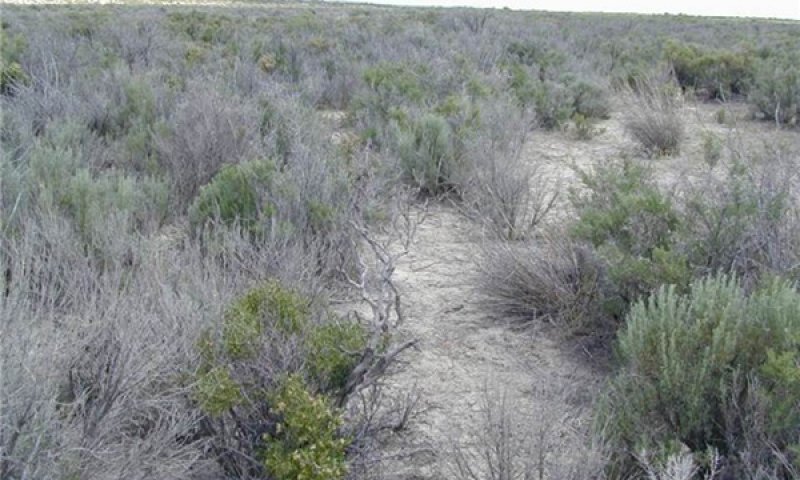
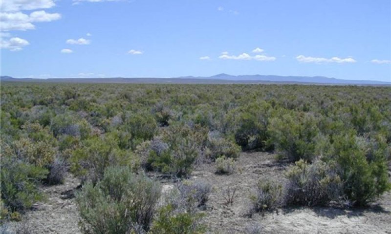
This ecological site occurs in the broad ectone between the Semidesert Loam (Wyoming big sagebrush) and Alkali Flat (Greasewood) site. This site typically contains both greasewood and Wyoming sagebrush. Greasewood increases as the ecotone nears the Alkali Flat site and Wyoming big sagebrush increases as it nears Semidesert Loam.
Associated sites
R028AY004UT |
Alkali Flat (Black Greasewood) This site typicall occurs adjacent to the site, but lower on the landscape. |
---|---|
R028AY220UT |
Semidesert Loam (Wyoming Big Sagebrush) This site typically occurs adjacent to the site higher on the landscape |
Similar sites
R028AY008NV |
SODIC TERRACE 8-10 P. Z. This site occurs in Nevada's portion of 28A and is similar in plant community composition with the exception of basin wildrye (Leymus cinereus). |
---|---|
R028AY004UT |
Alkali Flat (Black Greasewood) This site is dominated by black greasewood with little to no Wyoming sagebrush. |
R028AY220UT |
Semidesert Loam (Wyoming Big Sagebrush) This site is dominated by Wyoming sagebrush with litte to no greasewood. |
Table 1. Dominant plant species
Tree |
Not specified |
---|---|
Shrub |
(1) Artemisia tridentata var. wyomingensis |
Herbaceous |
Not specified |
Physiographic features
This site occurs on lake fans and fan terraces (typically on riser). It is commonly found on slopes from 0 to 5 percent with low to medium runoff.
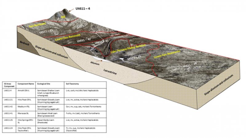
This site occurs on Pleistocene Lake Bonneville terrace lacustrine deposits and alluvium from sandstone and limestone. This site occurs on lake terraces and fan remnants. It is commonly found on slopes from 0 to 5 percent with low to medium runoff. Aspect has little effect on site dynamics. See block diagram below (SS-Area-Component UT611-41)
Figure 2. Block Diagram
Table 2. Representative physiographic features
Landforms |
(1)
Fan remnant
(2) Lake terrace |
---|---|
Flooding frequency | None to very rare |
Ponding frequency | None |
Elevation | 4,250 – 5,800 ft |
Slope | 5% |
Aspect | Aspect is not a significant factor |
Climatic features
The climate is semi-arid and characterized by cold snowy winters and warm dry summers. The average annual precipitation is 8 to 12 inches. Approximately 70 percent comes as rain from March through October. On the average, June through September are the driest months and March through May are the wettest months.
Mean Annual Air Temperature: 45-52
Mean Annual Soil Temperature: 47-54
Table 3. Representative climatic features
Frost-free period (average) | 119 days |
---|---|
Freeze-free period (average) | 147 days |
Precipitation total (average) | 10 in |
Figure 3. Monthly precipitation range
Figure 4. Monthly average minimum and maximum temperature
Figure 5. Annual precipitation pattern
Figure 6. Annual average temperature pattern
Influencing water features
Soil features
The soil is deep and well drained. It formed in alluvium derived mainly from tuffaceous sandstone and limestone parent materials. Rock fragments are less than 15 percent by volume in the soil profile. Between the 11 and 38 inch depth is an accumulation of sodium salts and between 19 and 60 inches is a zone of carbonate and silica accumulation. Permeability is slow to moderately rapid and runoff is medium. The high amounts of sodium salts and silica cementation are the limiting soil factors affecting plant growth.
Soils are moderately to strongly affected by salts. Sodium is the most common salt, but others may be present. Water intake rates are slow to moderately slow, available water holding capacity is very low to high, and runoff is low to medium. The soil moisture regime is aridic bordering on xeric.
A representative soil series is Medburn, classified as a Coarse-loamy, mixed, superactive, calcareous, mesic Xeric Torriorthents. Diagnostic horizons include an ochric epipedon from the soil surface to 20 centimeters. Clay content in the particle control section averages 5 to 18 percent. Rock fragments range from 0 to 25 percent. Reaction is moderately alkaline to strongly alkaline. Effervescence is slightly to strongly effervescent. Lithology consists of alluvium derived mainly from limestone and welded tuff over lacustrine deposits.
This site has been correlated to the following soil components:
Box Elder County, Western: Kunzler, Mellor
Fairfield-Nephi Area: Woodrow
Tooele Area: Manassa, Medburn, Taylorsflat
Table 4. Representative soil features
Parent material |
(1)
Alluvium
–
sandstone
(2) Lacustrine deposits – limestone |
---|---|
Surface texture |
(1) Loam (2) Silt loam (3) Fine sandy loam |
Family particle size |
(1) Loamy |
Drainage class | Well drained |
Permeability class | Slow to moderately rapid |
Soil depth | 60 in |
Surface fragment cover <=3" | 11% |
Surface fragment cover >3" | Not specified |
Available water capacity (0-40in) |
1.3 – 7.1 in |
Calcium carbonate equivalent (0-40in) |
1 – 40% |
Electrical conductivity (0-40in) |
4 mmhos/cm |
Sodium adsorption ratio (0-40in) |
30 |
Soil reaction (1:1 water) (0-40in) |
7.9 – 9 |
Subsurface fragment volume <=3" (Depth not specified) |
11% |
Subsurface fragment volume >3" (Depth not specified) |
Not specified |
Ecological dynamics
This site is a broad ecotone between Alkali Flat (Greasewood) 028AY004UT and Semidesert Loam (Wyoming big sagebrush) 028AY220UT that occurs on lake terraces and fan remnants. Greasewood increases as the ecotone nears the Alkali Flat site and Wyoming big sagebrush (Artemisia tridentata ssp. Wyomingensis) increases as it nears Semidesert Loam.
Black greasewood (Sarcobatus vermiculatus) is classified as a phreatophyte (Eddleman 2002), and its distribution is well correlated with the distribution of groundwater (Mozingo 1987). Black greasewood stands develop best where moisture is readily available, either from surface or subsurface runoff (Brown 1965). Black greasewood is usually a deep-rooted shrub but has some shallow roots near the soil surface; the maximum rooting depth can be determined by the depth to a saturated zone (Harr and Price 1972).
Wyoming big sagebrush, the most drought tolerant of the big sagebrushes, is generally long-lived; therefore it is not necessary for new individuals to recruit every year for perpetuation of the stand. Infrequent large recruitment events and simultaneous low, continuous recruitment is the foundation of population maintenance (Noy-Meir 1973). Survival of the seedlings is dependent on adequate moisture conditions.
Native insect outbreaks are also important drivers of ecosystem dynamics in sagebrush communities. Climate is generally believed to influence the timing of insect outbreaks especially a sagebrush defoliator, Aroga moth (Aroga websteri). Aroga moth infestations have occurred in the Great Basin in the 1960s, early 1970s, and are ongoing in Nevada and Utah (Bentz et al. 2008. Bolshakova 2014). Thousands of acres of big sagebrush have been impacted, with partial to complete die-off observed. Aroga moth can partially or entirely kill individual plants or entire stands of big sagebrush (Furniss and Barr 1975).
The perennial bunchgrasses generally have somewhat shallower root systems than the shrubs, but root densities are often as high as or higher than those of shrubs in the upper 0.5 m but taper off more rapidly than shrubs. Common bunchgrasses in this site are bottlebrush squirreltail (Elymus elymoides) and Indian ricegrass (Achnatherum hymenoides) , both are tolerant to drier conditions that exist on this site.
These communities often exhibit the formation of microbiotic crusts within the interspaces between shrubs. These crusts influence the soils on these sites and their ability to reduce erosion and increase infiltration; they may also alter the soil structure and possibly increase soil fertility (Fletcher and Martin 1948, Williams 1993). Finer-textured soils such as silts tend to support more microbiotic cover than coarse-textured soils (Anderson 1982). Disturbance such as hoof action from inappropriate grazing and cheatgrass invasion can reduce biotic crust integrity (Anderson 1982, Ponzetti et al. 2007) and increase erosion.
Annual non-native species such as halogeton (Halogeton glomeratus), Russian thistle (Salsola iberica) , and cheatgrass (Bromus tectorum) invade these sites where competition from perennial species is decreased. This ecological site has low resilience to disturbance and resistance to invasion. Increased resilience increases with elevation, aspect, increased precipitation and increased nutrient availability. Five possible stable states have been identified for this site.
Fire Ecology:
Fire is a rare disturbance in salt-desert shrub communities likely occurring in years with above-average production. Black greasewood may be killed by severe fires, but can resprout after low to moderate severity fires (Robertson 1983, West 1994). Sheeter (1968) reported that following a Nevada wildfire, black greasewood sprouts reached approximately 2.5 feet within 3 years. Grazing and other disturbance may result in increased biomass production due to sprouting and increased seed production, also leading to greater fuel loads (Sanderson and Stutz 1994). Higher production sites would have experienced fire more frequently than lower production sites.
Wyoming big sagebrush is easily killed by fire (Blaisdell 1953). Wyoming big sagebrush only regenerates from seed. Repeated fires may eliminate the onsite seed source; reinvasion into these areas may be extremely slow (Bunting et al. 1987). Reestablishment after fire may require 50-120 or more years (Baker 2006). Even then, up to 25 years after fire, Wyoming big sagebrush typically has less than 5% of pre-fire cover (Baker 2011). However, the introduction and expansion of cheatgrass has dramatically altered the fire regime (Balch et al. 2013), therefore altering restoration potential of Wyoming big sagebrush communities (Evans and Young 1981). Sites with low abundances of native perennial grasses and forbs typically have reduced resiliency following disturbance and are less resistant to invasion or increases in cheatgrass (Miller et al 2013).
Indian ricegrass are fairly fire tolerant (Wright 1985), which is likely due to its low culm density and below ground plant crowns. Vallentine (1989) cites several studies in the sagebrush zone that classified Indian ricegrass as being slightly damaged from late summer burning. Indian ricegrass has also been found to reestablish on burned sites through seed dispersed from adjacent unburned areas (Young 1983, West 1994).
State and transition model
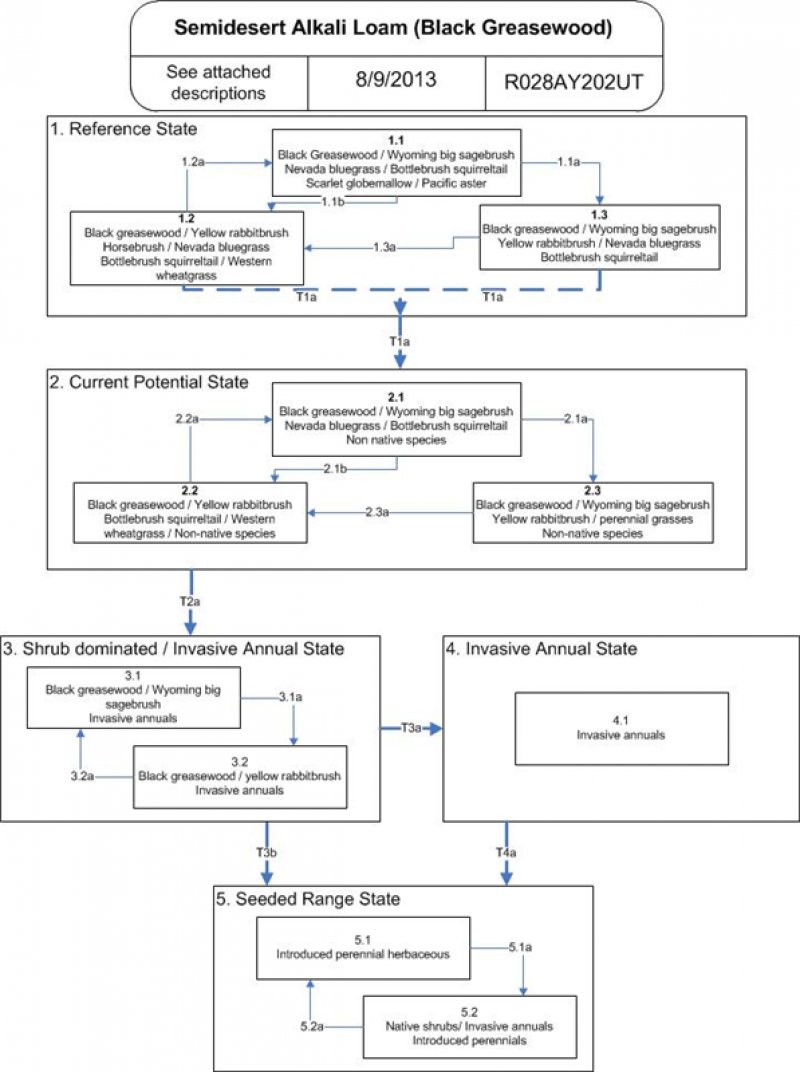
Figure 7. R028AY202UT State and Transition Model
More interactive model formats are also available.
View Interactive Models
More interactive model formats are also available.
View Interactive Models
Click on state and transition labels to scroll to the respective text
State 1 submodel, plant communities
State 2 submodel, plant communities
State 3 submodel, plant communities
State 4 submodel, plant communities
State 5 submodel, plant communities
State 1
Reference State
The Reference State 1 is a representative of the natural range of variability under pristine conditions. The Reference State has three general community phases; a shrubgrass dominant phase, a perennial grass dominant phase and a shrub dominant phase. State dynamics are maintained by interactions between climatic patterns and disturbance regimes. Negative feedbacks enhance ecosystem resilience and contribute to the stability of the state. These include the presence of all structural and functional groups, low fine fuel loads, and retention of organic matter and nutrients. Plant community phase changes are primarily driven by fire, periodic drought and/or insect or disease attack.
Community 1.1
Black greasewood-Wyoming big sagebrush/squirreltail
This community is dominated by Black greasewood and Wyoming big sagebrush in the shrub layer. Bottlebrush squirreltail dominates the herbaceous layer with significant amounts of Nevada bluegrass and Indian ricegrass commonly present. Typical forbs include Scarlet globemallow and Pacific aster. Shadscale and Yellow rabbitbrush are other important shrubs. Percent composition by air-dry weight is 35% grass, 10% forbs, and 50% shrubs. Natural fire frequency is estimated to be 40 to 50 years.
Figure 8. Annual production by plant type (representative values) or group (midpoint values)
Table 5. Annual production by plant type
Plant type | Low (lb/acre) |
Representative value (lb/acre) |
High (lb/acre) |
---|---|---|---|
Shrub/Vine | 110 | 316 | 440 |
Grass/Grasslike | 70 | 201 | 280 |
Forb | 20 | 58 | 80 |
Total | 200 | 575 | 800 |
Table 6. Ground cover
Tree foliar cover | 0% |
---|---|
Shrub/vine/liana foliar cover | 20-40% |
Grass/grasslike foliar cover | 10-20% |
Forb foliar cover | 5% |
Non-vascular plants | 0% |
Biological crusts | 0% |
Litter | 0% |
Surface fragments >0.25" and <=3" | 0% |
Surface fragments >3" | 0% |
Bedrock | 0% |
Water | 0% |
Bare ground | 0% |
Table 7. Canopy structure (% cover)
Height Above Ground (ft) | Tree | Shrub/Vine | Grass/ Grasslike |
Forb |
---|---|---|---|---|
<0.5 | – | – | – | – |
>0.5 <= 1 | – | – | – | 0-10% |
>1 <= 2 | – | – | 15-25% | – |
>2 <= 4.5 | – | 35-45% | – | – |
>4.5 <= 13 | – | – | – | – |
>13 <= 40 | – | – | – | – |
>40 <= 80 | – | – | – | – |
>80 <= 120 | – | – | – | – |
>120 | – | – | – | – |
Figure 9. Plant community growth curve (percent production by month). UT2021, PNC. Excellent Condition.
Jan | Feb | Mar | Apr | May | Jun | Jul | Aug | Sep | Oct | Nov | Dec |
---|---|---|---|---|---|---|---|---|---|---|---|
J | F | M | A | M | J | J | A | S | O | N | D |
0 | 0 | 5 | 15 | 40 | 30 | 5 | 5 | 0 | 0 | 0 | 0 |
Community 1.2
Black greasewood / yellow rabbitbrush
Wyoming big sagebrush decreases significantly in the community, Black greasewood also decreases initially but is a vigorous sprouter with fire. Yellow rabbitbrush and, at times, Smooth horsebrush increase in the community and much of the excess fine fuel accumulation is removed. Bottlebrush squirreltail, Nevada bluegrass, Indian ricegrass and other cool season bunchgrasses flourish, Western wheatgrass increases. Fire tolerant shrubs may persist as dominants in the community for 30 years or longer. Percent composition by air-dry weight is 40% grass, 10% forbs, and 50% shrubs.
Community 1.3
Wyoming sagebrush / Black greasewood
Black greasewood, Wyoming big sagebrush and Yellow rabbitbrush increase in percent composition. Shrubs become old and decadent. Bottlebrush squirreltail, Indian ricegrass and Nevada bluegrass begin to lose vigor due to increased shrub competition and are becoming dense with old vegetation. Percent composition by air-dry weight is 30% grass, 5% forbs, and 65% shrubs.
Pathway 1.1b
Community 1.1 to 1.2
Recent fire occurrence (1 – 30 years).
Pathway 1.1a
Community 1.1 to 1.3
Extended period of time without a major disturbance such as fire; insect infestation; or prolonged drought. Fire frequency extends well beyond the 40 to 50 year average for the site.
Pathway 1.2a
Community 1.2 to 1.1
Normal fire frequency of 40 – 50 years returns on the site.
Pathway 1.3a
Community 1.3 to 1.2
Recent fire occurrence (1 – 30 years).
State 2
Current Potential State
Plant communities in this state can include both native and non-native species. This state is irreversibly changed from the reference state because the non-native species will now remain a permanent part of the community.
Community 2.1
Black greasewood/Wyoming sagebrush/nevada bluegrass/Bottlebrush squirreltail/non native species
This community is dominated by Black greasewood and Wyoming big sagebrush in the shrub layer. Shadscale and Yellow rabbitbrush are also present. Bottlebrush squirreltail dominates the herbaceous layer with significant amounts of Nevada bluegrass and Indian ricegrass. Typical forbs include Scarlet globemallow and Pacific aster. This community is dominated by native species but include non-native species. Percent composition by air-dry weight is 35% grass, 10% forbs, and 50% shrubs. Natural fire frequency is estimated to be 40 to 50 years.
Community 2.2
Black greasewood/yellow rabbitbrush/ bottlebrush squirreltail/ western wheatgrass/non-native species
Fire tolerant shrubs including black greasewood, yellow rabbitbrush, and horsebrush increase and dominate the shrub layer. Wyoming big sagebrush decreases because it is not a fire tolerant species. Bottlebrush squirreltail, Nevada bluegrass, and other native cool season bunchgrasses are significantly reduced. Western wheatgrass and galleta may also decrease. This community is similar to community phase 1.2, except with the inclusion of non-native species.
Community 2.3
Black greasewood/Wyoming sagebrush/yellow rabbitbrush/perennial grasses/non-native species
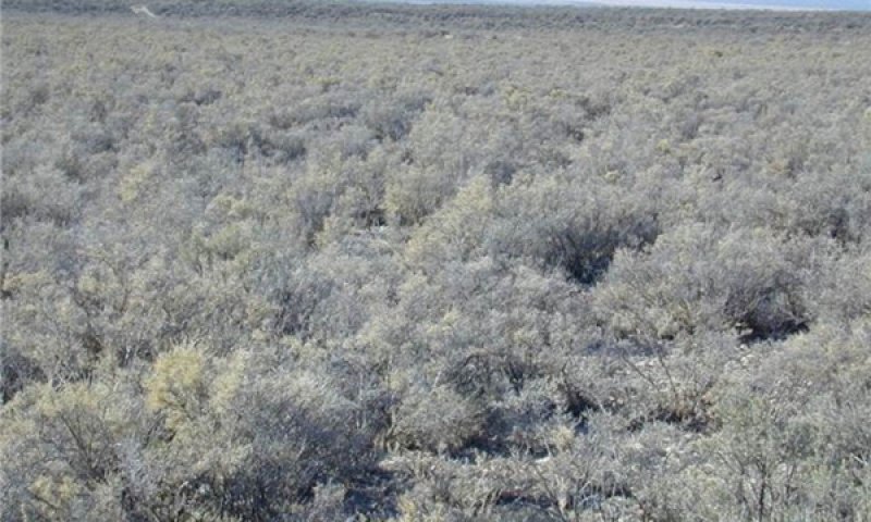
Fire has been excluded from this community past the typical fire frequency. Black greasewood, Wyoming big sagebrush and yellow rabbitbrush dominate the overstory; shadscale may increase if present. Bottlebrush squirreltail, Nevada bluegrass, Indian ricegrass and other native bunchgrasses are significantly reduced; Western wheatgrass and James galleta begin to decrease. Bare ground may dominate the interspaces in some communities. This community is similar to 1.3, except for the non-native species that are present, but do not dominate the site.
Pathway 2.1b
Community 2.1 to 2.2
Recent fire occurrence (1 to 30 years).
Pathway 2.1a
Community 2.1 to 2.3
Improper grazing (including season long, overstocking, wrong season, etc.) and/or drought that remove annual and perennial fine fuels from the site, lessening the potential for fire to occur. Fire frequency extends beyond the 40 to 50 year average.
Pathway 2.2a
Community 2.2 to 2.1
Fire frequency returns to within the normal range for the community.
Pathway 2.3a
Community 2.3 to 2.2
Recent fire occurrence (1 – 30 years).
State 3
Shrub dominated / Invasive annual state
Native shrubs dominate this state with an understory of invasive annuals. Native herbaceous plants have been removed either from poor management and/or change in fire return interval.
Community 3.1
Black greasewood/Wyoming sagebrush/invasive annuals
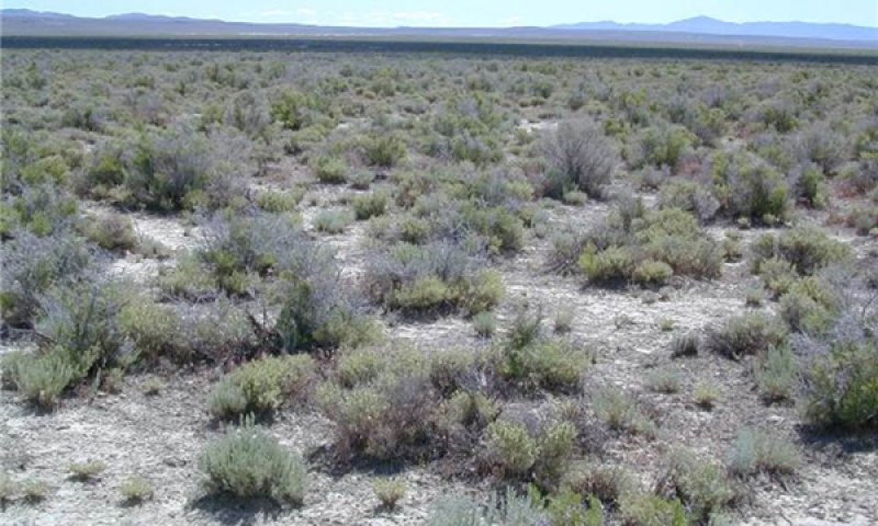
Black greasewood, Wyoming big sagebrush and Yellow rabbitbrush dominate the shrub layer and the community. Rubber rabbitbrush and Shadscale may occur in significant numbers. Remaining Bottlebrush squirreltail, Nevada bluegrass and other perennial herbaceous vegetation is mostly found only in protected locations under shrubs. Invasive, non-native grasses and weeds including cheatgrass, annual mustards, redstem storksbill, etc. dominate the understory.
Community 3.2
Black greasewood/yellow rabbitbrush/invasive annuals
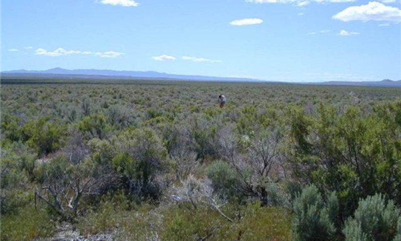
Black greasewood, Yellow rabbitbrush and, at times, Smooth horsebrush dominate the shrub layer. These fire tolerant shrubs persist as dominants in this community with fire periods reoccurring at intervals of 10 to 30 years or less. Broom snakeweed may be an episodic dominant species when conditions are favorable. Bottlebrush squirreltail, Nevada bluegrass and other native bunchgrasses are significantly reduced or not found; invasive annuals including cheatgrass, annual mustards, redstem storksbill, etc. dominate the understory.
Pathway 3.1a
Community 3.1 to 3.2
Long-term improper grazing (including season long, overstocking, wrong season, etc.) and/or drought that remove annual and perennial fine fuels from the site, lessening the potential for fire to occur.
Pathway 3.2a
Community 3.2 to 3.1
Time since fire
State 4
Invasive annual state
Invasive annuals dominate this state. This can occur from a decrease in the fire return interval, with fire occuring more freqently than typical for the site. This increase in the occurance of fire can make it difficult even for shrubs that sprout like greasewood and rabbitbrush to survive. Frequent fires favor the establishment and dominance of annual species, like cheatgrass. Once annual species are dominant, this increases the likelihood of the site to be burned on a regual basis because of the increase in fine fuels.
Community 4.1
Invasive annuals
Dominance of annual grasses and forbs increases fire frequency interval. More frequent fires again establish annual species decreasing the shrub cover or elimiating shrubs from the site.
State 5
Seeded range state
This state is seeded to species that may be composed of introduced and native species. Shrubs may or may not be present in this state, but are typically present from natural regeneration. Invasive annual species are also typcially present.
Community 5.1
Introduced perennial herbaceous
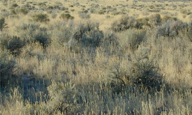
This state is seeded to rangeland species that may be composed of introduced, native or combination species. Shrubs are reduced but may occupy a portion of the site because of natural regeneration. Invasive annual grasses and weedy forb species, primarily cheatgrass and various annual mustards may be present in the seeding. Successful range seedings are typically resistant to fire.
Community 5.2
Native shrubs/invasive annuals/introduced perennials
This state is present after either a failed seeding or a poorly managed one. Site may be herbaceous or may be returning to shrubs. The state is primarily composed of Black greasewood and other native shrub species, invasive annual grasses and weedy forb species, mostly cheatgrass and various annual mustards are also able to reinvade this site. Broom snakeweed may be an episodic dominant species when conditions are favorable.
Pathway 5.1a
Community 5.1 to 5.2
Seeding is not well established; improper grazing (including season long, overstocking, wrong season, etc.) and/or drought reduce any perennial grasses established. Highly combustible fine fuels from invasive annuals shorten the fire frequency on the site. Fire frequency is typically 10 – 20 years.
Pathway 5.2a
Community 5.2 to 5.1
Site receives excellent grazing management over a long period of time. Highly combustible fine fuels from invasive annuals continue to dominate the community resulting in a shortened fire frequency. Fire frequency is typically 10 – 20 years. Seeded perennial vegetation slowly recovers.
Transition T1a
State 1 to 2
Long-term improper grazing (including season long, overstocking, wrong season, etc.); and/or prolonged drought that remove fine fuels from the site lessening the potential for fire to occur. This allows both sprouting and non-sprouting shrubs such as Black greasewood, Yellow Rabbitbrush, Horsebrush and Wyoming big sagebrush to increase. Shrubs may become decadent due to age. Bottlebrush squirreltail, Nevada bluegrass and other perennial bunchgrasses lose vigor and decrease in the community due to shrub competition and grazing pressure. Western wheatgrass and James galleta may increase. Bare ground may increase and dominate the interspaces. The threshold is crossed when there is an introduction of non native species, primarily cheatgrass and various annual mustards, which become established in the community. Invasive species may become established under any circumstances, even in the abscence of grazing.
Transition 2a
State 2 to 3
Sustained, long-term improper grazing (including season long, overstocking, wrong season, etc.) and/or prolonged drought; major reduction of perennial fine fuels resulting in the continued lengthening of fire period resulting in a dense shrub layer; near elimination of native perennial vegetation, and an increase in invading annuals. Black greasewood, Wyoming big sagebrush and Yellow rabbitbrush dominate the shrub layer and may be decadent due to age. Bottlebrush squirreltail and other perennial bunchgrasses are significantly reduced due to increased shrub competition and/or heavy grazing pressure. The threshold is crossed when invasive annuals such as cheatgrass, annual mustards and other invasive species dominate the understory.
Transition 3a
State 3 to 4
Increase in fire return interval that kills the shrub overstory.
Transition 3b
State 3 to 5
The mechanical and/or chemical treatment of shrubs and seeding of introduced, native or combination rangeland species.
Transition 4a
State 4 to 5
Seeding native or non-native grasses and forbs.
Additional community tables
Table 8. Community 1.1 plant community composition
Group | Common name | Symbol | Scientific name | Annual production (lb/acre) | Foliar cover (%) | |
---|---|---|---|---|---|---|
Shrub/Vine
|
||||||
1 | Primary Shrubs | 195–293 | ||||
greasewood | SAVE4 | Sarcobatus vermiculatus | 98–163 | – | ||
Wyoming big sagebrush | ARTRW8 | Artemisia tridentata ssp. wyomingensis | 98–130 | – | ||
3 | Secondary Shrubs | 33–65 | ||||
Shrub (>.5m) | 2SHRUB | Shrub (>.5m) | 33–65 | – | ||
shadscale saltbush | ATCO | Atriplex confertifolia | 7–20 | – | ||
green molly | BAAM4 | Bassia americana | 7–20 | – | ||
yellow rabbitbrush | CHVIS5 | Chrysothamnus viscidiflorus ssp. viscidiflorus var. stenophyllus | 7–20 | – | ||
rubber rabbitbrush | ERNAN5 | Ericameria nauseosa ssp. nauseosa var. nauseosa | 7–20 | – | ||
winterfat | KRLA2 | Krascheninnikovia lanata | 7–20 | – | ||
bud sagebrush | PIDE4 | Picrothamnus desertorum | 7–20 | – | ||
desert princesplume | STPI | Stanleya pinnata | 7–20 | – | ||
spineless horsebrush | TECA2 | Tetradymia canescens | 7–20 | – | ||
Grass/Grasslike
|
||||||
2 | Primary Grasses | 163–260 | ||||
squirreltail | ELEL5 | Elymus elymoides | 98–130 | – | ||
Sandberg bluegrass | POSE | Poa secunda | 33–65 | – | ||
Indian ricegrass | ACHY | Achnatherum hymenoides | 33–65 | – | ||
1 | Secondary Grasses | 33–65 | ||||
Grass, perennial | 2GP | Grass, perennial | 33–65 | – | ||
basin wildrye | LECI4 | Leymus cinereus | 33–65 | – | ||
western wheatgrass | PASM | Pascopyrum smithii | 7–20 | – | ||
James' galleta | PLJA | Pleuraphis jamesii | 7–20 | – | ||
sand dropseed | SPCR | Sporobolus cryptandrus | 7–20 | – | ||
Forb
|
||||||
2 | Forbs | 33–65 | ||||
Forb, perennial | 2FP | Forb, perennial | 33–65 | – | ||
cutleaf daisy | ERCO4 | Erigeron compositus | 33–65 | – | ||
spiny phlox | PHHO | Phlox hoodii | 7–65 | – | ||
scarlet globemallow | SPCO | Sphaeralcea coccinea | 7–33 | – | ||
Pacific aster | SYCHC | Symphyotrichum chilense var. chilense | 7–33 | – | ||
freckled milkvetch | ASLE8 | Astragalus lentiginosus | 7–33 | – | ||
fivehorn smotherweed | BAHY | Bassia hyssopifolia | 7–10 | – | ||
Douglas' dustymaiden | CHDO | Chaenactis douglasii | 7–10 | – | ||
bastard toadflax | COUM | Comandra umbellata | 7–10 | – |
Interpretations
Animal community
This site is suited for sheep and cattle grazing during fall, winter, and spring.
Wildlife using this site include golden eagle (spring and fall), jack rabbit, desert cottontail, prairie dog, pronghorn antelope, and mule deer.
This is a short list of the more common species found. Many other species are present as well and migratory birds are present at times.
Hydrological functions
The soil series is in hydrologic groups B and C and the hydrologic curve numbers are 61 and 74 for good vegetation condition.
Recreational uses
This site is used for hiking and upland game hunting.
Wood products
None
Supporting information
Other references
SE ¼, SE ¼; Section 31, Township 12N, Range 14W
Anderson, D. C., K. T. Harper, and S. R. Rushforth. 1982. Recovery of cryptogamic soil crusts from Grazing on Utah winter ranges. Journal of Range Management 35:355-359.
Balch, J. K., B. A. Bradley, C. M. D'Antonio, and J. Gómez-Dans. 2013. Introduced annual grass increases regional fire activity across the arid western USA (1980–2009). Global Change Biology 19:173-183.
Baker, W. L. 2006. Fire and restoration of sagebrush ecosystems. Wildlife Society Bulletin 34:177-185.
Baker, W. L. 2011. Pre-euro-American and recent fire in sagebrush ecosystems. Pages 185-201 in S. T. Knick and J. W. Connelly, editors. Greater sage-grouse: ecology and conservation of a landscape species and its habitats. University of California Press, Berkeley, California.
Bates, J. D., Svejcar, T., Miller, R. F., & Angell, R. A. 2006. The effects of precipitation timing on sagebrush. Journal of Arid Environments 64(4): 670-697.
Benson, B., D. Tilley, D. Ogle, L. St. John, S. Green, J. Briggs. 2011. Plant Guide: Black Greasewood. In: Plants database. U. S. Department of Agriculture, Natural Resources Conservation Service, Boise, ID.
Bich, B. S., J. L. Butler, and C. A. Schmidt. 1995. Effects of differential livestock use on key plant species and rodent populations within selected Oryzopsis hymenoides/Hilaria jamesii communities of Glen Canyon National Recreation Area. The Southwestern Naturalist 40:281-287.
Blaisdell, J. P. 1953. Ecological effects of planned burning of sagebrush-grass range on the upper Snake River Plains. US Dept. of Agriculture.
Brown, R. W. 1965. The distribution of plant communities in the Badlands of southeastern Montana. Dissertation. Montana State University, Bozeman, Montana.
Booth, D. T., C. G. Howard, and C. E. Mowry. 2006. 'Nezpar' Indian ricegrass: description, justification for release, and recommendations for use. Rangelands Archives 2:53-54.
Bunting, S. C., B. M. Kilgore, and C. L. Bushey. 1987. Guidelines for prescribed burning sagebrush-grass rangelands in the northern Great Basin. US Department of Agriculture, Forest Service, Intermountain Research Station Ogden, UT, USA.
Cook, C. W. 1962. An evaluation of some common factors affecting utilization of desert range species. Journal of Range Management 15:333-338.
Cook, C. W. and R. D. Child. 1971. Recovery of desert plants in various states of vigor. Journal of Range Management 24:339-343.
Eddleman, L. E. 2002. Sarcobatus vermiculatus (Hook.) Torr.: Black greasewood. .in F. T. Bonner, editor. Woody plant seed manual. Department of Agriculture, Forest Service, Washington, DC. Evans, R. A. and J. A. Young. 1978. Effectiveness of rehabilitation practices following wildfire in a degraded big sagebrush-downy brome community. Journal of RangeManagement 31:185-188.
Fire Effects Information System (Online; http://www.fs.fed.us/database/feis/plants/).
Fletcher, J. E. and W. P. Martin. 1948. Some Effects of Algae and Molds in the Rain- Crust of Desert Soils. Ecology 29:95-100.
Furniss, M. M. and W. F. Barr. 1975. Insects affecting important native shrubs of the northwestern United States. US Intermountain Forest And Range Experiment Station
USDA Forest Service General Technical Report INT INT-19.
Ganskopp, D. C. 1986. Tolerances of Sagebrush, Rabbitbrush, and Greasewood to Elevated Water Tables. Journal of Range Management 39:334-337.
Groeneveld, D. P. 1990. Shrub rooting and water acquisition to threatened shallow groundwater habitats in the Owens Valley, California. . Pages 221-237 in Proceedings -- symposium on cheatgrass invasion, shrub die-off, and other aspects of shrub biology and management Gen. Tech. Rep. INT-276. U.S. Department of Agriculture, Forest Service, Intermountain Research Station, Las Vegas, NV.
Groeneveld, D. P. and D. E. Crowley. 1988. Root system response to flooding in three desert shrub species. Functional Ecology 2:491-497.
Harr, R. D. and K. R. Price. 1972. Evapotranspiration from a Greasewood-Cheatgrass community. Water Resources Research 8:1199-1203.
Krall, J. L., J. R. Stroh, C. S. Cooper, and S. R. Chapman. 1971. Effect of time and extent of harvesting basin wildrye. Journal of Range Management:414-418.
Miller, R. F., J. C. Chambers, D. A. Pyke, F. B. Pierson, and C. J. Williams. 2013. A review of fire effects on vegetation and soils in the Great Basin Region: response and ecological site characteristics.
Mozingo, H. N. 1987. Shrubs of the Great Basin: A Natural History. Pages 67-72 in H. N. Mozingo, editor. Shrubs of the Great Basin. University of Nevada Press, Reno NV.
National Oceanic and Atmospheric Administration. 2004. The North American Monsoon. Reports to the Nation. National Weather Service, Climate Prediction Center. Available online: http://www.weather.gov/
Noy-Meir, I. 1973. Desert Ecosystems: Environment and Producers. Annual Review of Ecology and Systematics 4:25-51.
Paysen, T. E., R. J. Ansley, J. K. Brown, G. J. Gottfried, S. M. Haase, M. G. Harrington, M. G. Narog, S. S. Sackett, and R. C. Wilson. 2000. Fire in western shrubland, woodland, and grassland ecosystems. Wildland fire in ecosystems: Effects of fire on flora. Gen. Tech. Rep. RMRS-GTR-42-vol 2:121-159.
Pearson, L. 1964. Effect of harvest date on recovery of range grasses and shrubs. Agronomy Journal 56:80-82.
Pearson, L. C. 1965. Primary production in grazed and ungrazed desert communities of eastern Idaho. Ecology 46:278-285.
Ponzetti, J. M., B. McCune, and D. A. Pyke. 2007. Biotic Soil Crusts in Relation to Topography, Cheatgrass and Fire in the Columbia Basin, Washington. The Bryologist 110:706-722.
Quinones, F. A. 1981. Indian ricegrass evaluation and breeding. Bulletin 681. Page 19. New Mexico State University, Agricultural Experiment Station, Las Cruces, NM.
Robertson, J. 1983. Greasewood (Sarcobatus vermiculatus (Hook.) Torr.). Phytologia 54:309-324.
Romo, J. T. 1984. Water relations in Artemisia tridentata subsp. wyomingensis, Sarcobatus vermiculatus, and Kochia prostrata. Oregon State University, Corvallis, OR.
Roundy, B. A. 1985. Emergence and Establishment of Basin Wildrye and Tall Wheatgrass in Relation to Moisture and Salinity. Journal of Range Management 38:126-131.
Sanderson, S. C. and H. C. Stutz. 1994. Woody chenopods useful for rangeland reclamation in western North America. Pages 374-378 in Proceedings-- ecology and management of annual rangelands. Gen. Tech. Rep. INT-GTR-313. U.S. Department of Agriculture, Forest Service, Intermountain Research Station, Boise, ID.
Sheeter, G.R. 1968. Secondary succession and range improvements after wildfire in northeastern Nevada. Reno, NV: University of Nevada. 203 p. Thesis.
Smith, M. A., J. D. Rodgers, J. L. Dodd, and Q. D. Skinner. 1992. Habitat selection by cattle along an ephemeral channel. Journal of Range Management 45:385-390.
Stubbendieck, J. L. 1985. Nebraska Range and Pasture Grasses: (including Grass-like Plants). University of Nebraska, Department of Agriculture, Cooperative Extension Service, Lincoln, NE.
Vallentine, J. F. 1989. Range Development and Improvements. Academic Press, Inc.
West, N. E. 1994. Effects of fire on salt-desert shrub rangelands.in Proceedings-- Ecology and Management of Annual Rangelands, General Technical Report INT-313. USDA Forest Service, Intermountain Research Station, Boise, ID.
Williams, J. D. 1993. Influence of microphytic crusts on selected soil physical and hydrologic properties in the Hartnet Draw, Capital Reef National Park Utah. Utah State University.
Wright, H. A. 1971. Why squirreltail is more tolerant to burning than needle-and-thread. Journal of Range Management 24:277-284
Wright, H. A. 1985. Effects of fire on grasses and forbs in sagebrush-grass communities. Pages 12-21 in Rangeland Fire Effects; A Symposium: Boise, ID, USDI-BLM.
Wright, H. A. and A. W. Bailey. 1982. Fire Ecology: United States and southern Canada. Wiley & Sons.
Young, J. A. and R. A. Evans. 1981. Germination of Great Basin wildrye seeds collected from native stands. Agron. J. 73:917-920.
Young, J. A., R. A. Evans, and P. T. Tueller. 1976. Great Basin plant communities pristine and grazed. Holocene environmental change in the Great Basin. Nevada Archeological Survey Research Paper 6:186-215.
Young, R. P. 1983. Fire as a vegetation management tool in rangelands of the intermountain region. Pages 18-31 in Managing intermountain rangelands - improvement of range and wildlife habitats. USDA, Forest Service.
Contributors
David J. Somorville, GR
Keith Wadman (S&TM) And Sarah Quistberg
Acknowledgments
T.K. Stingham and P. Novack-Echinique with the ecological dynamics narrative.
Rangeland health reference sheet
Interpreting Indicators of Rangeland Health is a qualitative assessment protocol used to determine ecosystem condition based on benchmark characteristics described in the Reference Sheet. A suite of 17 (or more) indicators are typically considered in an assessment. The ecological site(s) representative of an assessment location must be known prior to applying the protocol and must be verified based on soils and climate. Current plant community cannot be used to identify the ecological site.
Author(s)/participant(s) |
Jack Alexander, Range Specialist, Synergy Resource Solutions, Inc. Julia Kluck, Soil Scientist, Synergy Resource Solutions, Inc. Shane Green, State Range Specialist, Utah NRCS |
---|---|
Contact for lead author | Shane Green, Shane.Green@ut.usda.gov |
Date | 02/08/2010 |
Approved by | Shane A. Green |
Approval date | |
Composition (Indicators 10 and 12) based on | Annual Production |
Indicators
-
Number and extent of rills:
No rills present. Very minor rill development may occur in sparsely vegetated areas. If rills are present, they should be widely spaced and not connected. Rill development may increase following large storm events, but should begin to heal during the following growing season. Frost heaving will accelerate recovery. Rill development may increase when run inflow enters site from adjacent sites that produce large amounts of runoff (i.e. steeper sites, slickrock, rock outcrop). Site is essentially level and rills do not form. -
Presence of water flow patterns:
Water flow patterns will be short (2-5’), narrow (<1’), and meandering; interrupted by plants and exposed rocks. Slight to no evidence of erosion or deposition associated with flow patterns. -
Number and height of erosional pedestals or terracettes:
Plants may have small pedestals (1-3”) where they are adjacent to water flow patterns, but without exposed roots. Terracettes should be few and stable. Terracettes should be small (1-3”) and show little sign of active erosion. Some plants may appear to have a pedestal but rather than be formed by erosion, the only place litter accumulates and soil collects is at plant bases forming the appearance of a pedestal.
Well-developed biological crusts may appear pedestalled, but are actually a characteristic of the crust formation. Some plants may appear to have a pedestal but rather than be formed by erosion, the only place litter accumulates and soil collects is at plant bases forming the appearance of a pedestal. -
Bare ground from Ecological Site Description or other studies (rock, litter, lichen, moss, plant canopy are not bare ground):
25 – 30% bare ground (soil with no protection from raindrop impact). Herbaceous communities are most likely to have lower values. As species composition by shrubs increases, bare ground is likely to increase. Poorly developed biological soil crust that is susceptible to raindrop splash erosion should be recorded as bare ground. Very few if any bare spaces of greater than 1 square foot. -
Number of gullies and erosion associated with gullies:
No gullies present. -
Extent of wind scoured, blowouts and/or depositional areas:
Very minor evidence of active wind-generated soil movement. Wind scoured (blowouts) and depositional areas are rarely present. If present they have muted features and are mostly stabilized with vegetation and/or biological crust. Gravel or desert pavement protects the site from wind scour. -
Amount of litter movement (describe size and distance expected to travel):
Most litter resides in place with some redistribution caused by water and wind movement. Very minor litter removal may occur in flow patterns and rills with deposition occurring at points of obstruction. The majority of litter accumulates at the base of plants. Some leaves, stems, and small twigs may accumulate in soil depressions adjacent to plants. Woody stems are not likely to move. -
Soil surface (top few mm) resistance to erosion (stability values are averages - most sites will show a range of values):
This site should have an erosion rating of 5 or 6 under plant canopies and a rating of 4 to 5 in the interspaces with an average rating of 5 using the soil stability kit test. -
Soil surface structure and SOM content (include type of structure and A-horizon color and thickness):
This description is based on the modal soil (Medburn FSL, Saline 2-4%, soil survey area: 611, Tooele). This site has 4correlated soils, resulting in variation of each of these attributes. Unless working on a location with the modal soil, it is critical to supplement this description with the soil-specific information from the published soil survey.
Soil surface horizon is typically 8 inches deep. Structure is typically weak medium subungular blocky. Color is typically pale brown (10YR 6/3), brown (10YR 4/3) moist. An ochric horizon extends to a depth of 8 inches. An ochric horizon typically extends to a depth of 2 to 10 inches. The ochric horizon is a surface horizon lacking fine stratification and which is either light colored, or thin, or has an low organic carbon content, or is massive and (very) hard when dry. The A horizon would be expected to be more strongly developed under plant canopies. It is important if you are sampling to observe the A horizon under plant canopies as well as the interspaces.
-
Effect of community phase composition (relative proportion of different functional groups) and spatial distribution on infiltration and runoff:
Bunchgrasses important for increasing infiltration and reducing runoff. Litter plays a role in increasing infiltration and decreasing runoff. Plants provide microhabitat for seedlings, catch litter and soil, and slow raindrops and runoff. Vascular plants and/or well-developed biological soil crusts (where present) will break raindrop impact and splash erosion. Spatial distribution of vascular plants and interspaces between well-developed biological soil crusts (where present) provide detention storage and surface roughness that slows runoff allowing time for infiltration. Interspaces between plants and any well-developed biological soil crusts (where present) may serve as water flow patterns during episodic runoff events, with natural erosion expected in severe storms. When perennial grasses decrease, reducing ground cover and increasing bare ground, runoff is expected to increase and any associated infiltration reduced. -
Presence and thickness of compaction layer (usually none; describe soil profile features which may be mistaken for compaction on this site):
None. Naturally occurring soil horizons may be harder than the surface and should not be considered as compaction layers. -
Functional/Structural Groups (list in order of descending dominance by above-ground annual-production or live foliar cover using symbols: >>, >, = to indicate much greater than, greater than, and equal to):
Dominant:
squirreltail, greasewood, Wyoming big sagebrushSub-dominant:
Sandberg bluegrass, Indian ricegrassOther:
The perennial grass/sprouting shrub (greasewood) functioning group is expected on this site.Additional:
In the northern portion of the MLRA cool-season perennial grasses (Indian ricegrass, needle and thread) dominate. In the southernmost portion of the MLRA warm-season perennial grasses (galleta, sand dropseed) dominate. The two groups share dominance in the middle portion of the MLRA.
Functional/structural groups may appropriately contain non-native species if their ecological function is the same as the native species in the reference state (e.g. crested wheatgrass and Russian wildrye may substitute for mid stature cool season perennial native bunchgrasses.). Biological soil crust is variable in its expression on this site and is measured as a component of ground cover. Forbs can be expected to vary widely in their expression in the plant community based upon departures from average growing conditions. -
Amount of plant mortality and decadence (include which functional groups are expected to show mortality or decadence):
During years with average to above average precipitation, there should be very little recent mortality or decadence apparent in either the shrubs or grasses. Some mortality of bunchgrass and other shrubs may occur during very severe (long-term) droughts. There may be partial mortality of individual bunchgrasses and shrubs during less severe drought. Long-lived species dominate site. Open spaces from disturbance are quickly filled by new plants through seedlings and reproductive reproduction (tillering). -
Average percent litter cover (%) and depth ( in):
Litter cover includes litter under plants. Most litter will be fine litter. Depth should be 1-2 leaf thickness in the interspaces and up to 1/2” under canopies. Litter cover may increase to 20-30% following years with favorable growing conditions. Excess litter may accumulate in absence of disturbance. Vegetative production may be reduced if litter cover exceeds 40%. -
Expected annual annual-production (this is TOTAL above-ground annual-production, not just forage annual-production):
575 #/acre.
Even the most stable communities exhibit a range of production values. Production will vary between communities and across the MRLA. Refer to the community descriptions in the ESD. Production will differ across the MLRA due to the naturally occurring variability in weather, soils, and aspect. The biological processes on this site are complex; therefore, representative values are presented in a land management context. -
Potential invasive (including noxious) species (native and non-native). List species which BOTH characterize degraded states and have the potential to become a dominant or co-dominant species on the ecological site if their future establishment and growth is not actively controlled by management interventions. Species that become dominant for only one to several years (e.g., short-term response to drought or wildfire) are not invasive plants. Note that unlike other indicators, we are describing what is NOT expected in the reference state for the ecological site:
Snakeweed, halogeton, and Russian thistle -
Perennial plant reproductive capability:
All perennial plants should have the ability to reproduce sexually or asexually, except in drought years. Density of plants indicates that plants reproduce at level sufficient to fill available resource. Within capability of site there are no restrictions on seed or vegetative reproductive capacity.
Print Options
Sections
Font
Other
The Ecosystem Dynamics Interpretive Tool is an information system framework developed by the USDA-ARS Jornada Experimental Range, USDA Natural Resources Conservation Service, and New Mexico State University.
Click on box and path labels to scroll to the respective text.