Natural Resources
Conservation Service
Ecological site R028BY001NV
WET MEADOW 10-14 P.Z.
Last updated: 2/19/2025
Accessed: 04/09/2026
General information
Provisional. A provisional ecological site description has undergone quality control and quality assurance review. It contains a working state and transition model and enough information to identify the ecological site.
MLRA notes
Major Land Resource Area (MLRA): 028B–Central Nevada Basin and Range
MLRA 28B occurs entirely in Nevada and comprises about 23,555 square miles (61,035 square kilometers). More than nine-tenths of this MLRA is federally owned. This area is in the Great Basin Section of the Basin and Range Province of the Intermontane Plateaus. It is an area of nearly level, aggraded desert basins and valleys between a series of mountain ranges trending north to south. The basins are bordered by long, gently sloping to strongly sloping alluvial fans. The mountains are uplifted fault blocks with steep sideslopes. Many of the valleys are closed basins containing sinks or playas. Elevation ranges from 4,900 to 6,550 feet (1,495 to 1,995 meters) in the valleys and basins and from 6,550 to 11,900 feet (1,995 to 3,630 meters) in the mountains.
The mountains in the southern half are dominated by andesite and basalt rocks that were formed in the Miocene and Oligocene. Paleozoic and older carbonate rocks are prominent in the mountains to the north. Scattered outcrops of older Tertiary intrusives and very young tuffaceous sediments are throughout this area. The valleys consist mostly of alluvial fill, but lake deposits are at the lowest elevations in the closed basins. The alluvial valley fill consists of cobbles, gravel, and coarse sand near the mountains in the apex of the alluvial fans. Sands, silts, and clays are on the distal ends of the fans.
The average annual precipitation ranges from 4 to 12 inches (100 to 305 millimeters) in most areas on the valley floors. Average annual precipitation in the mountains ranges from 8 to 36 inches (205 to 915 millimeters) depending on elevation. The driest period is from midsummer to midautumn. The average annual temperature is 34 to 52 degrees F (1 to 11 degrees C). The freeze-free period averages 125 days and ranges from 80 to 170 days, decreasing in length with elevation.
The dominant soil orders in this MLRA are Aridisols, Entisols, and Mollisols. The soils in the area dominantly have a mesic soil temperature regime, an aridic or xeric soil moisture regime, and mixed or carbonatic mineralogy. They generally are well drained, loamy or loamyskeletal, and shallow to very deep.
Nevada’s climate is predominantly arid, with large daily ranges of temperature, infrequent severe storms and heavy snowfall in the higher mountains. Three basic geographical factors largely influence Nevada’s climate: continentality, latitude, and elevation. The strong continental effect is expressed in the form of both dryness and large temperature variations. Nevada lies on the eastern, lee side of the Sierra Nevada Range, a massive mountain barrier that markedly influences the climate of the State. The prevailing winds are from the west, and as the warm moist air from the Pacific Ocean ascend the western slopes of the Sierra Range, the air cools, condensation occurs and most of the moisture falls as precipitation. As the air descends the eastern slope, it is warmed by compression, and very little precipitation occurs. The effects of this mountain barrier are felt not only in the West but throughout the state, as a result the lowlands of Nevada are largely desert or steppes.
The temperature regime is also affected by the blocking of the inland-moving maritime air. Nevada sheltered from maritime winds, has a continental climate with well-developed seasons and the terrain responds quickly to changes in solar heating. Nevada lies within the midlatitude belt of prevailing westerly winds which occur most of the year. These winds bring frequent changes in weather during the late fall, winter and spring months, when most of the precipitation occurs.
To the south of the mid-latitude westerlies, lies a zone of high pressure in subtropical latitudes, with a center over the Pacific Ocean. In the summer, this high-pressure belt shifts northward over the latitudes of Nevada, blocking storms from the ocean. The resulting weather is mostly clear and dry during the summer and early fall, with occasional thundershowers. The eastern portion of the state receives noteworthy summer thunderstorms generated from monsoonal moisture pushed up from the Gulf of California, known as the North American monsoon. The monsoon system peaks in August and by October the monsoon high over the Western U.S. begins to weaken and the precipitation retreats southward towards the tropics (NOAA 2004).
Ecological site concept
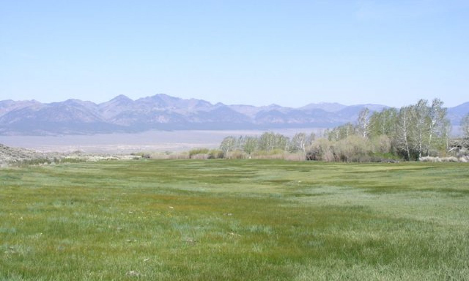
This site occurs on floodplains, stream terraces, and lake plains. Slopes of 0 to 2 percent are typical. Elevations are 5100 to 7500 feet.
The soils associated with this site are very deep, poorly drained, and have high available water holding capacity. These soils are characterized by a mollic epipedon and a water table at or near the surface early in the spring that usually stabilizes at 10 to 30 inches during the growing season. This site experiences occasional, brief flooding in the spring by stream overflow or unconfined runoff from surrounding areas.
The reference plant community is characterized by a dense stand of perennial grasses, grass-like plants, and perenial forbs; dominated by Nevada bluegrass, alkali bluegrass, sedges, and rushes.
Associated sites
| R028BY002NV |
SALINE MEADOW This site occurs lake terraces. Slopes are less than 2 percent and elevations range from 4400 to 6800 feet. The soils associated with this site are very deep, poorly drained, and strongly salt and sodium affected. Soils are characterized by a ochric epipedon and decreasing salinity with depth. The water table is near the surface for short periods in the early spring, but usually stabilizes at depths below 40 inches during the growing season. |
|---|---|
| R028BY003NV |
LOAMY BOTTOM 10-14 P.Z. This site occurs on drainageways and inset fans. Slope gradients of 0 to 2 percent are most typical and elevations range from 4500 to 7600 feet. Soils associated with this site are very deep, well drained and derived from mixed alluvium. They typically have a mollic epipedon and a mesic temperature regime. |
| R028BY044NV |
WETLAND This site occurs on lake plains adjacent to springs, seeps, sloughs or ponds. Slope gradients of 0 to 8 percent but slopes of 0 to 2 percent are most typical. Elevations are 5500 to 6200 feet. The soils associated with this site are very deep and poorly to somewhat poorly drained. Soils are saturated during most of the year, with the water table above or very near the surface continuously. These soils have poor aeration and are high in organic matter. The soils have an aquic moisture regime that borders on xeric. |
| R028BY081NV |
MOIST FLOODPLAIN This site occurs on flood plains and stream terrace. Slope gradients range from 0 to 15 percent, but slopes of 0 to 4 percent are most typical. Elevations are 4000 to 6800 feet. The soils associated with this site are typically very deep, fertile and have a very low to high available water capacity. The soils are poorly drained to excessively drained and runoff is medium to very high. Ponding occurs in some areas. Flooding, and a seasonally high water table at or near the soil surface, supply additional moisture for plant growth. |
Similar sites
| R028BY050NV |
WET SODIC BOTTOM DISP dominant plant. |
|---|---|
| R028BY022NV |
WET MEADOW 14+ P.Z. Dominated by DECE. |
| R028BY099NV |
WET ALKALI MEADOW CACA4 dominant plant. |
| R028BY012NV |
WET SALINE MEADOW Dominated by PSSM |
| R028BY095NV |
DRY MEADOW 12-16 P.Z. PONE3-PHAL2 codominant grasses. |
| R028BY098NV |
WET CLAY BASIN Not a stable plant community; intermittently ponded lake bed or basin landscape positions. |
| R028BY100NV |
DRY MEADOW 6-10 P.Z. POA ssp. and MURI dominant grasses; basin floor landscape positions. |
| R028BY002NV |
SALINE MEADOW Dominated by SPAI-SPGR; less productive site. |
Table 1. Dominant plant species
| Tree |
Not specified |
|---|---|
| Shrub |
Not specified |
| Herbaceous |
(1) Poa |

Click on box and path labels to scroll to the respective text.