Saline Upland Loamy (SUL) Big Horn Basin Rim
Scenario model
Current ecosystem state
Select a state
Management practices/drivers
Select a transition or restoration pathway
- Transition T1A More details
- Transition T1B More details
- Transition T1C More details
- Restoration pathway R2A More details
- Transition T2A More details
- Transition T2B More details
- Transition T3A More details
- Restoration pathway R3A More details
- Restoration pathway R4A More details
- Transition T5A More details
-
No transition or restoration pathway between the selected states has been described
Target ecosystem state
Select a state
State 1
Reference


Description
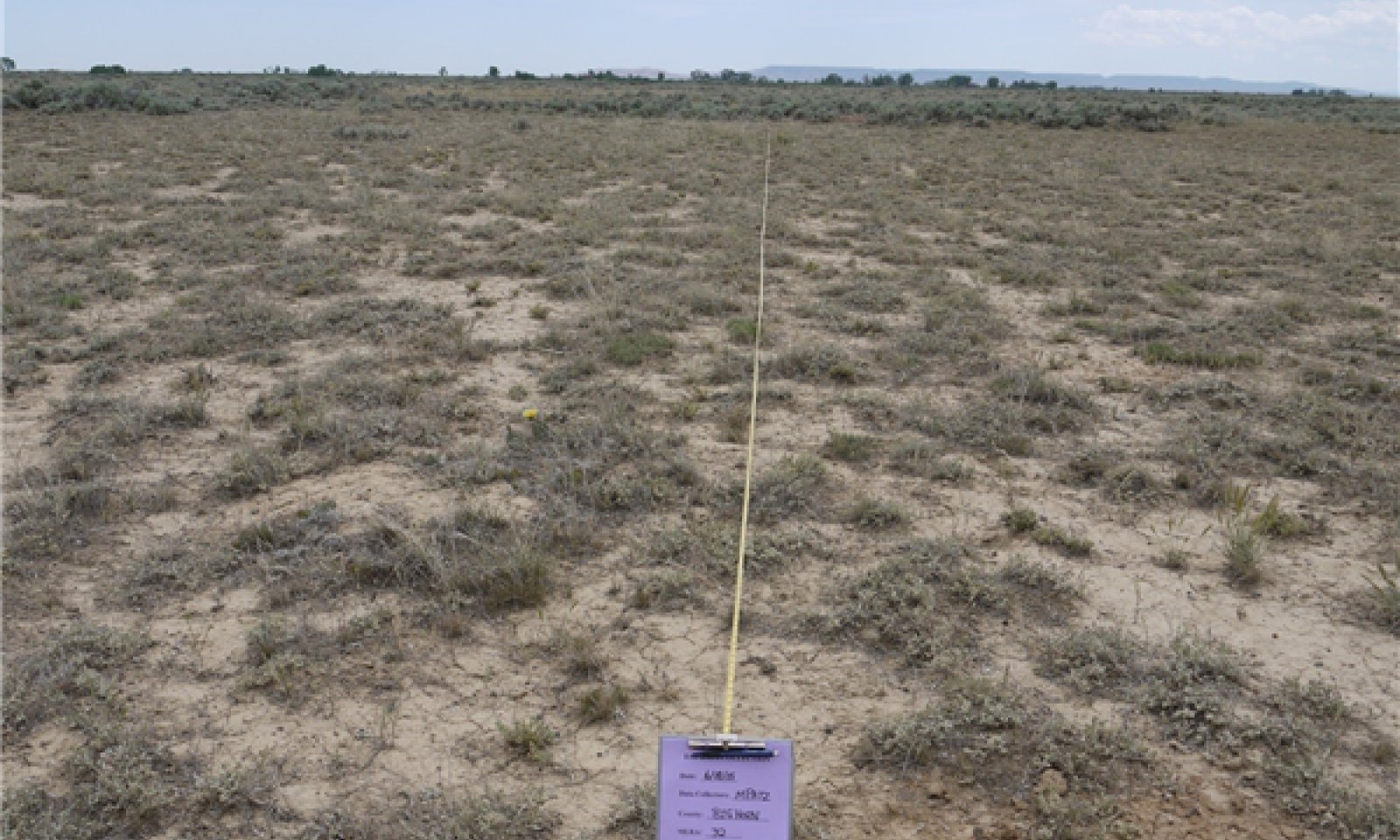
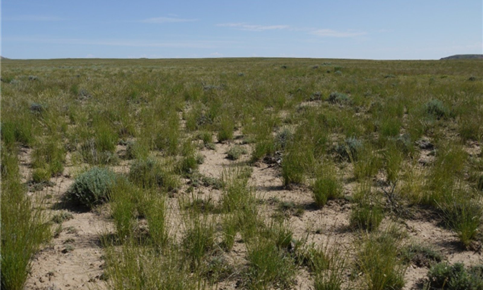
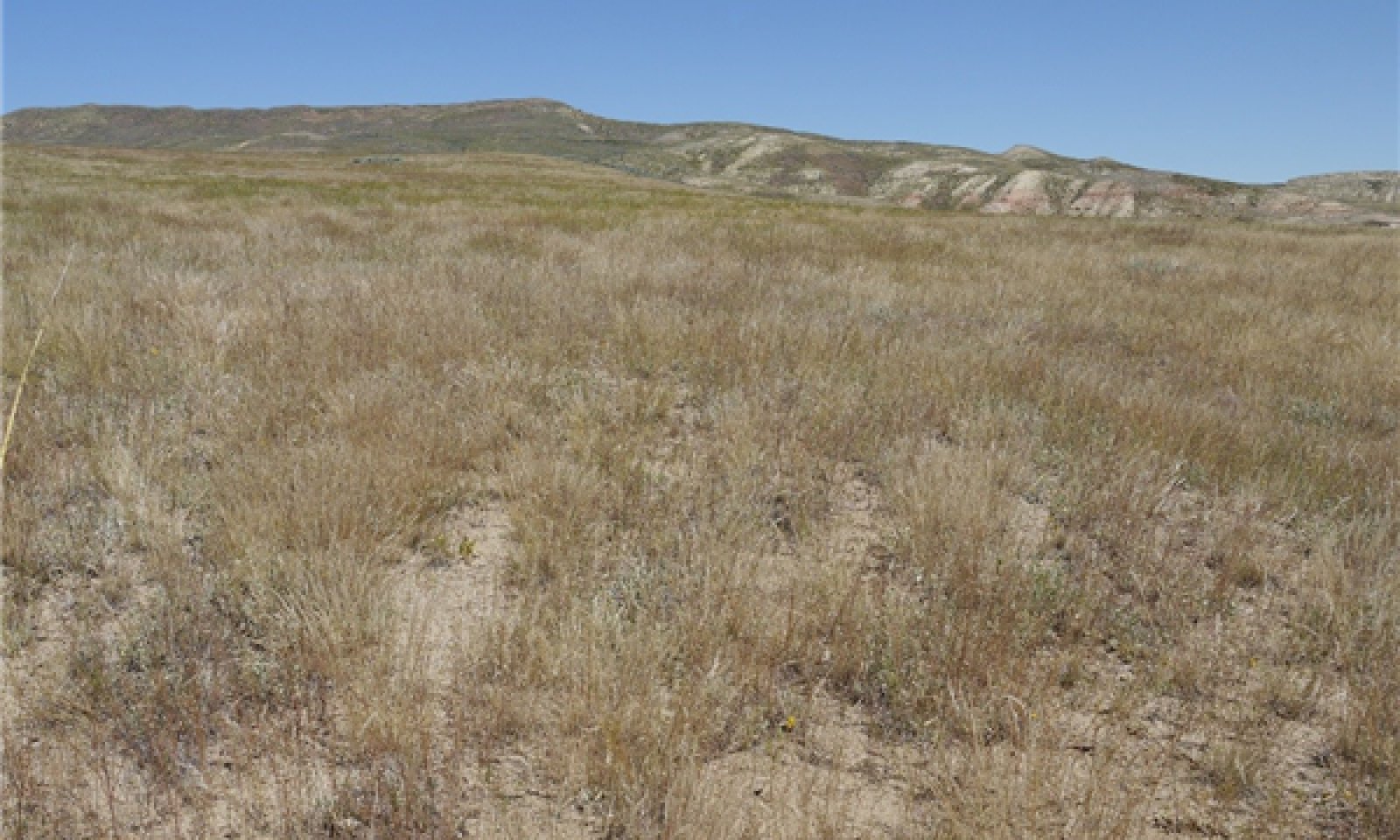
Saline/sodic soils within the fine-loamy particle size class, including influences from gypsum and calcium carbonate accumulations, support plant communities that are dominated by Gardner's Saltbush, Birdfoot Sagebrush, and in some locations Greasewood and Winterfat. These dominant low sub-shrubs comprise approximately 40% of the production on the site. The grasses, composing 50% of the plant community, are predominately Bottlebrush Squirreltail and Indian Ricegrass. As the sites transition, Sandberg Bluegrass and Blue Grama will begin to increase. Needleandthread and Western Wheatgrass are minor contributors in this State. The forb component is minor with only 10% of the production comprised by a select few forbs. A variety of biscuitroots/desert parsleys (Lomatiums), wild onion, milkvetches, and asters are found within this State. The general ground cover is open with bare ground consisting of 25 to 40%, but it is stable. The drought tolerance of this state allows for a wide flexibility in production and composition shifts from year to year, but maintains the base diversity for each community phase.
Submodel
State 2
Saltbush/Perennial Grasses


Description
A combination of environmental and utilization disturbances has reduced the flexibility of the plant community leading to the shift to the Saltbush/Perennial Grasses State (State 2). Mid-stature cool season grasses, commonly bluegrasses, and low-stature warm season grasses (Blue grama) have increased in composition, reducing the diversity. Although the state is stable with approximately 30% ground cover by Gardner's Saltbush or salt tolerant shrubs, the production is slightly reduced.
The trend noted during sampling was an increase of annual forbs with the decrease of Indian ricegrass and Bottlebrush squirreltail. Current and historic data has documented extreme swings in productivity between years (on an 8-10 year pattern) for Sandberg Bluegrass and Gardner's Saltbush specifically, but also for many of the species present. (Based on a 50 year data set). This swing in production can provide a false sense that a threshold has been crossed, when in actuality, it is a natural response to drought/climatic changes. These changes are what allow the Reference State and this state (State 2) to be sustainable.
The trend noted during sampling was an increase of annual forbs with the decrease of Indian ricegrass and Bottlebrush squirreltail. Current and historic data has documented extreme swings in productivity between years (on an 8-10 year pattern) for Sandberg Bluegrass and Gardner's Saltbush specifically, but also for many of the species present. (Based on a 50 year data set). This swing in production can provide a false sense that a threshold has been crossed, when in actuality, it is a natural response to drought/climatic changes. These changes are what allow the Reference State and this state (State 2) to be sustainable.
Submodel
Description
The management and climatic interactions that are hypothesized to have led to the Saltbush/Bare ground dominated state may not be clear cut. It is recognized that with continued pressure and drought conditions, the productivity and sustainability of most perennial grasses will decrease leaving a shrub dominated state, and that in the absence of invasive species, this community can persist on the landscape.
It was documented with soil/ecological site correlation data, which many of the communities that fit this definition were found to have a heavier textured soil (Clayey or Fine). The slow infiltration and sealing potential of soils of this nature helps to clarify the plant community. There were sites, however, that were classified as fine-loamy that were dominated by this community that were a product of management and drought.
Submodel
State 4
Invaded


Description
The Saline Upland site has proven to be more resistant to invasion by many of the aggressive weedy species threatening the rangelands today. However, there are a few species that still present issues as more land is disturbed by development, continued drought, and shifts in use patterns. Halogeton poses the greatest threat, with Cheatgrass (Downy Brome), whitetop (hoary cress), and a variety of Knapweed and thistles holding their niches on the landscape. The persistence, resistance and resilience of specific communities within this state will be discussed further below.
Submodel
Description
Energy development/mining, gravel/borrow pits, farming, irrigation canals/drainage laterals, and roads are only a few of the land uses that have had an impact on these arid, salt-affected landscapes. Much of this site is deemed unfit or non-productive; attempts to reclaim are marginal, and many attempts have failed. Historic attempts to improve productivity has altered the resilience and response pathways, affecting the site potential and stability. Specific reference will be discussed below.
Submodel
Mechanism
Drought, Frequent or Severe Grazing – Extended periods of drought have the ability to weaken the plant community's resilience, forcing the community over the threshold into the next state. Drought with added stress of frequent or severe grazing can expedite the process, removing the key species leaving the site dominated by the less desirable herbaceous species. Any combination of these factors will reduce or remove the key bunchgrasses, Indian ricegrass and Bottlebrush squirreltail, and leave a Sandberg bluegrass or Blue grama dominated site.
Mechanism
Frequent and Severe Grazing, Severe Ground Disturbance, Drought - The combination of frequent and severe grazing, especially when drought is a factor, continues the process of decreasing the forbs and grasses within the community. The desirable herbaceous species may become very sparse or are removed leaving a saltbush dominated community. Extended long periods of drought alone, or severe ground disturbance, will remove or inhibit the sustainability of the herbaceous component of this community.
Mechanism
Frequent and Severe Grazing, Drought, Non-Use, or Ground Disturbance (with Seed Source Present) – Halogeton, Cheatgrass (Downy Brome), and many of the invasive weeds that are present in the Big Horn Basin are drought tolerant and able to establish in poor soils and growing conditions. The barren, open canopy that is typical with Saline Upland landscapes are a prime target for these invaders. Given any level of disturbance, whether it is from heavy and frequent grazing use, drought or other ground disturbances, if there is a seed source present, these invaders will find a niche for establishment. The dispersed nature of salt affected soils, especially in the absence of compaction by hoof action or traffic, allows for any variety of invasive species to quickly transition the reference state into an invaded state.
Mechanism
Long-term Prescribed Grazing – Given time and favorable conditions, Indian Ricegrass and Bottlebrush Squirreltail are able to re-establish when seed sources were within the area. With these factors, the ability for the Saltbush/Perennial Grasses state to transition back to the Saltbush/Bunchgrass state (Reference) may take a substantial amount of time, but it is able to recover with only minor inputs. When a sod-type community has established, it may take significant hoof impact or mechanical measures to break the root mats to allow other more desirable natives to establish. This ground disturbance will or can alter the hydrology and structure of the soils, preventing the improved community from responding the same to management and disturbance regimes. Studies completed on BLM lands within the Big Horn Basin in the late 1950's helped to demonstrate this concept, where contour furrows have altered the hydrology of rangelands for over 60 years.
Relevant conservation practices
| Practice | External resources |
|---|---|
|
Integrated Pest Management (IPM) |
|
|
Prescribed Grazing |
|
|
Grazing Management Plan - Applied |
Mechanism
Frequent and Severe Grazing, Repeated Ground Disturbance, Drought – Continued stress on the a degraded community of perennial herbaceous species with decreased diversity and resilience to changing conditions opens the transition from the Saltbush/Perennial grasses to a Saltbush/Bare Ground dominated community (State 3). Stressors such as over-use, repeated disturbance (recreation, mining) or prolonged drought are key triggers forcing the community over the threshold to the next State.
Mechanism
Drought, Ground Disturbance, Frequent or Severe Grazing or Non-use with a seed source present – The vulnerability of this state to transition to an invaded state is increased as the canopy is opened with further disturbance, drought or grazing use. No use is also a factor, because of the nature of the soils to become dispersed (loose) and open to seedling establishment. If the seed source is present (in the area), drought or abnormal precipitation patterns as well as non-use provide the opportunity for invasive species to establish. Many of the sources of disturbance (recreational vehicles, animals, and development activities provide a source to bring invasive species into an area.
Mechanism
Drought, Frequent or Severe Grazing, Non-Use, or Ground Disturbance with a seed source present – Once the community has transitioned into a saltbush dominated state, productivity and functionality are at risk. If further disturbance occurs (be it from over-use, human impacts, or environmental), saltbush will begin to decrease and invasive species will increase in dominance, forcing this community to transition into an invaded state. The effect of this plant composition shift is a decrease in hydrologic function and increase in the erosional hazard within the community.
Mechanism
Grazing Land Mechanical Treatment or Rangeland Seeding with Prescribed Grazing - The large scale success of contour furrowing on the rangelands with a mixture of crested wheatgrass and other introduced/cultivated species has shown that this landscape can be restored to a functional community using improved varieties and selective grazing land mechanical treatments. Once established, management is required to encourage establishment and to sustain the species. Once the soil is disturbed there is a risk of erosion until seedling establishment can occur. Management of undesired species (noxious or invasive weed species) will need to be completed to ensure that the community is restored to an acceptable composition. Seedbed preparation and ground disturbance by any mechanical means will alter the soil structure and hydrology of an area, preventing the location from returning to Reference (Community Phase 1.1 and 1.2). Although, they may appear similar, post disturbance response to management is altered from reference and so is recognized as a reclaimed or restored community (State 5).
Relevant conservation practices
| Practice | External resources |
|---|---|
|
Critical Area Planting |
|
|
Grazing Land Mechanical Treatment |
|
|
Range Planting |
|
|
Heavy Use Area Protection |
|
|
Integrated Pest Management (IPM) |
|
|
Upland Wildlife Habitat Management |
|
|
Early Successional Habitat Development/Management |
|
|
Native Plant Community Restoration and Management |
|
|
Prescribed Grazing |
|
|
Grazing Management Plan - Applied |
Mechanism
Integrated Pest Management, Grazing Land Mechanical Treatment, or Rangeland Seeding with Prescribed Grazing – Once a community has degraded to an invaded state, especially if Cheatgrass or Knapweeds are dominant; eradication is not a feasible option, preventing restoration to a Reference state. An invaded site, however, can be restored to a functional plant community through intensive and integrated pest management and grazing land mechanical treatments. Removal of or reducing existing populations and establishment of forage species that are desirable and able to tolerate/compete with the invasive species helps to improve the function of the landscape. When a community has been significantly invaded, losing all of the key grazing species, re- seeding the site to a competitive species may be the only option. Establishment will be slow and the variety of available seed sources for salt-affected soil conditions is minimal, but small scale projects have been achieved with marginal success.
Relevant conservation practices
| Practice | External resources |
|---|---|
|
Critical Area Planting |
|
|
Grazing Land Mechanical Treatment |
|
|
Range Planting |
|
|
Heavy Use Area Protection |
|
|
Integrated Pest Management (IPM) |
|
|
Upland Wildlife Habitat Management |
|
|
Early Successional Habitat Development/Management |
|
|
Livestock Use Area Protection |
|
|
Native Plant Community Restoration and Management |
|
|
Prescribed Grazing |
|
|
Invasive Plant Species Control |
|
|
Agrichemical Handling Facility |
|
|
Grazing Management Plan - Applied |
Mechanism
Drought, Severe and Frequent Grazing, Ground Disturbance, or Non-Use with seed source present – Loose soils as a result of no hoof action during non-use or the decrease in key herbaceous species due to severe and frequent grazing, drought or disturbance opens the canopy and provides opportunity for invasive species to establish. With continued stress or addition of undesirable species will weaken this community even further.
Model keys
Briefcase
Add ecological sites and Major Land Resource Areas to your briefcase by clicking on the briefcase (![]() ) icon wherever it occurs. Drag and drop items to reorder. Cookies are used to store briefcase items between browsing sessions. Because of this, the number of items that can be added to your briefcase is limited, and briefcase items added on one device and browser cannot be accessed from another device or browser. Users who do not wish to place cookies on their devices should not use the briefcase tool. Briefcase cookies serve no other purpose than described here and are deleted whenever browsing history is cleared.
) icon wherever it occurs. Drag and drop items to reorder. Cookies are used to store briefcase items between browsing sessions. Because of this, the number of items that can be added to your briefcase is limited, and briefcase items added on one device and browser cannot be accessed from another device or browser. Users who do not wish to place cookies on their devices should not use the briefcase tool. Briefcase cookies serve no other purpose than described here and are deleted whenever browsing history is cleared.
Ecological sites
Major Land Resource Areas
The Ecosystem Dynamics Interpretive Tool is an information system framework developed by the USDA-ARS Jornada Experimental Range, USDA Natural Resources Conservation Service, and New Mexico State University.


