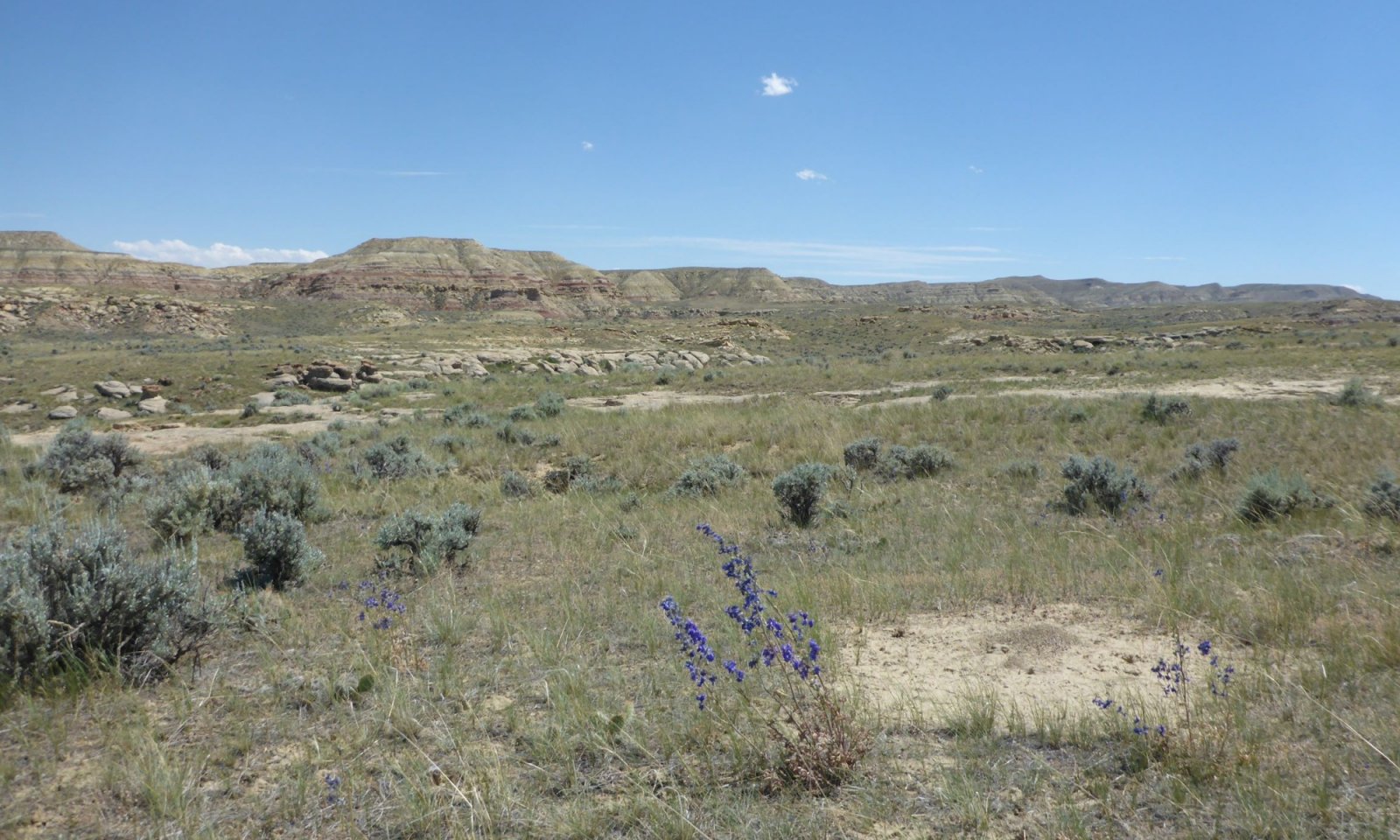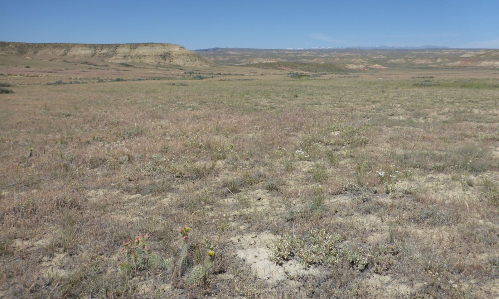
Saline Upland Sandy (SUS) Big Horn Basin Rim
Scenario model
Current ecosystem state
Select a state
Management practices/drivers
Select a transition or restoration pathway
-
Transition T1-2
Drought or shifts in timing of precipitation alone, or with frequent and/or severe grazing, will transition this site from a bunchgrass dominated to a tillering grass dominated community.
More details -
Transition T1-3
Ground disturbances, with a seed source present, open this canopy to invasive species such as cheatgrass. Drought and frequent and severe grazing can expedite the transition.
More details -
Transition T2-3
Ground and canopy disturbances with a seed source present allow the establishment of invasive species in the community. Disturbances can include drought, continuous season-long grazing, and/or recreation.
More details -
Restoration pathway R3-4
Integrated pest management (weed control), seedbed preparation and seeding, with long term management post treatment are needed to restore the invaded community so a near reference community.
More details -
Transition T4-3
Drought, frequent and severe grazing, with on going ground disturbances with introduction of a seed source can revert this state to an invaded state.
More details -
No transition or restoration pathway between the selected states has been described
Target ecosystem state
Select a state
State 1
Saltbush/Bunchgrasses


Description
The Reference Communities (1.1 and 1.2) for this State have developed under moderate use throughout the year by large ungulates. Although these sites do not provide a large quantity of forage, the value of the saltbush and the interspersed grasses provides a food source for spring and fall grazing when other sites are sensitive.
Characteristics and indicators
This state is characterized by a dominance of Gardner's saltbush and a mixture of mid-stature bunchgrasses and some rhizomatous species. A variety of forbs are present in these communities.
Resilience management
The Saltbush/Bunchgrasses State is easily shifted when disturbance occurs and is hard to re-establish once disturbed. However, the ecological site is well adapted to the climatic conditions, allowing quick recovery from drought, making it sustainable.
Submodel
Description
State 2, Saltbush/Sod-formers State, is a prominant plant community group on the landscape. There are several working theories as to why, but the blue grama sod that is the indicator for this plant community is the key to this State. Blue grama forms in small but dense clumps or patches on the ground, altering hydrology and limiting the productivity of the site. The intermixed populations of forbs and Gardner's saltbush with plains pricklypear are the other components to this plant community.
Characteristics and indicators
Low-stature warm-season grasses, commonly (blue grama), and low-stature cool-season grasses (prairie junegrass) have increased in composition, reducing the diversity. Although the state is stable with approximately 30% ground cover by Gardner's Saltbush or salt tolerant shrubs, the production is slightly reduced. The trend noted during sampling was an increase of annual forbs with the decrease of Indian ricegrass and Bottlebrush squirreltail.
Resilience management
A combination of environmental and utilization disturbances has reduced the flexibility of the plant community leading to the shift to the Saltbush/Perennial Grasses State (State 2). Current and historic data has documented extreme swings in productivity between years (on an 8-10 year pattern) for Sandberg Bluegrass and Gardner's Saltbush specifically, but also for many of the species present. (Based on a 50 year data set). This swing in production can provide a false sense that a threshold has been crossed, when in actuality, it is a natural response to drought/climatic changes. These changes are what allow the Reference State and this state (State 2) to be sustainable.
Submodel
State 3
Saltbush/Invaded


Description
The Saline Upland site has proven to be more resistant to invasion by many of the aggressive weedy species threatening the rangelands today. However, there are a few species that still present issues as more land is disturbed by development, continued drought, and shifts in use patterns. Cheatgrass (downy brome) poses the greatest threat, with halogeton, and a variety of annual forbs holding their niches in the community. The persistence, resistance and resilience of specific communities within this state will be discussed further below.
Characteristics and indicators
Gardner's saltbush is fairly constant in the community with shifts in productivity of individual plants under different stress conditions. The composition of native and invasive herbaceous species is the indicator for this community. A threshold of 5% composition of a non-native invader species was established to mark when a community has crossed into this State. As this community continues to degrade, the invasive species will increase.
Resilience management
Once non-native species, specifically cheatgrass, invades the saltbush community, it is difficult to remove, and successful eradication without significant alteration has not been achieved at this time. As the invasive species become dominant in the community, the state becomes resistant to change and is very resilient to further disturbance.
Submodel
Description
The majority of the sites identified have been impacted by vehicle use (roads/trails), including recreational vehicles. The level and extent of disturbance varies from the clayey and loamy counterparts to this ecological site. Climate, degree of disturbance, type of disturbance and the resources surrounding each location must be considered with this state. Also, the size of the community is generally small and in difficult areas to access with equipment, making the overall footprint and need to reclaim lower in priority than other larger scale ecological sites.
Characteristics and indicators
This state is to capture areas where surface disturbance has removed the native vegetation or where the site has been treated to improve/enhance the native community resulting in a non-native composition.
Resilience management
Climatic conditions and soil limitations restrict the feasibility of manipulating the native vegetation or degraded sites with much success.. The coarse soil textures make this ecological site susceptible to erosion, by wind especially, reducing the viability of seeds and seedlings in the early stages of establishment. Intensity and timing of precipitation has proved risky and nearly impossible to achieve a high level of success
Submodel
Mechanism
Drought, Frequent or Severe Grazing – Extended periods of drought have the ability to weaken the plant community's resilience, forcing the community over the threshold into the next state. Drought with added stress of frequent or severe (continuous, season-long) grazing can expedite the process, removing the key species (Indian ricegrass, needle and thread), leaving the site dominated by tillering grass species (blue grama). Review of long term exclosure data also shows a natural shift to blue grama that is correlating with shifts in the precipitation occurring later in the season with warming spring temperatures. This is still under review to determine other factors influencing this transition.
Constraints to recovery
The mat-forming blue grama alters hydrology and creates a difficult environment for other natives to compete. The dense root system also makes blue grama highly tolerable to grazing and hoof impacts, making it difficult to remove or effectively reduce its composition in the community.
Mechanism
Frequent and Severe Grazing, Drought, Non-Use, or Ground Disturbance (with Seed Source Present) – Halogeton, cheatgrass (downy brome), and many of the invasive weeds that are present in the Big Horn Basin are drought tolerant and able to establish in poor soils and growing conditions. The barren, open canopy that is typical with Saline Upland landscapes are a prime target for these invaders. Given any level of disturbance, whether it is from heavy and frequent grazing use, drought or other ground disturbances, if there is a seed source present, these invaders will find a niche for establishment. The dispersed nature of salt affected soils, especially in the absence of compaction by hoof action or traffic, allows for any variety of invasive species to quickly transition the reference state into an invaded state.
Constraints to recovery
The inability to eradicate most invasive species, specifically cheatgrass, block the recovery of this state to another state without major soil disturbances, seeding and high intensity weed management. A successful trial has not occurred on these soil-limited communities.
Mechanism
Drought, Ground Disturbance, Frequent or Severe Grazing or Non-use with a seed source present – The vulnerability of this state to transition to an invaded state is increased as the canopy is opened with further disturbance, drought or grazing use. If the seed source is present (in the area), drought or abnormal precipitation patterns provide the opportunity for invasive species to establish. Many of the sources of disturbance (recreational vehicles, animals, and development activities) provide a source to bring invasive species into an area.
Constraints to recovery
The difficulty of removing or reducing the composition of the non-native or invasive species and encouraging the establishment of native species is the major factor limiting the ability to return the invaded community back to the previous state.
Mechanism
Integrated Pest Management, Grazing Land Mechanical Treatment, or Rangeland Seeding with Prescribed Grazing – Once a community has degraded to an invaded state, especially if cheatgrass is dominant; eradication is not a feasible option, preventing restoration to a Reference state. An invaded site, however, can be restored to a functional plant community through intensive and integrated pest management and grazing land mechanical treatments. Removal of or reducing existing populations and establishment of forage species that are desirable and able to tolerate/compete with the invasive species helps to improve the function of the landscape. When a community has been significantly invaded, losing all of the key grazing species, re- seeding the site to a competitive species may be the only option. Establishment will be slow and the variety of available seed sources for salt-affected soil conditions is minimal, but small scale projects have been achieved with marginal success.
Relevant conservation practices
| Practice | External resources |
|---|---|
|
Critical Area Planting |
|
|
Prescribed Grazing |
|
|
Grazing Land Mechanical Treatment |
|
|
Range Planting |
|
|
Upland Wildlife Habitat Management |
|
|
Native Plant Community Restoration and Management |
|
|
Integrated Pest Management Plan - Written |
Mechanism
Drought, Severe and Frequent Grazing, Ground Disturbance, or Non-Use with seed source present – Loose soils as a result of no hoof action during non-use or the decrease in key herbaceous species due to severe and frequent grazing, drought or disturbance opens the canopy and provides opportunity for invasive species to establish. With continued stress or addition of undesirable species will weaken this community even further.
Constraints to recovery
Weed removal or control is the main constraint to recovery for this community and state.
Model keys
Briefcase
Add ecological sites and Major Land Resource Areas to your briefcase by clicking on the briefcase (![]() ) icon wherever it occurs. Drag and drop items to reorder. Cookies are used to store briefcase items between browsing sessions. Because of this, the number of items that can be added to your briefcase is limited, and briefcase items added on one device and browser cannot be accessed from another device or browser. Users who do not wish to place cookies on their devices should not use the briefcase tool. Briefcase cookies serve no other purpose than described here and are deleted whenever browsing history is cleared.
) icon wherever it occurs. Drag and drop items to reorder. Cookies are used to store briefcase items between browsing sessions. Because of this, the number of items that can be added to your briefcase is limited, and briefcase items added on one device and browser cannot be accessed from another device or browser. Users who do not wish to place cookies on their devices should not use the briefcase tool. Briefcase cookies serve no other purpose than described here and are deleted whenever browsing history is cleared.
Ecological sites
Major Land Resource Areas
The Ecosystem Dynamics Interpretive Tool is an information system framework developed by the USDA-ARS Jornada Experimental Range, USDA Natural Resources Conservation Service, and New Mexico State University.


