Natural Resources
Conservation Service
Ecological site R035XB022NM
Loamy Upland 6-10"p.z. sodic
Accessed: 12/21/2025
General information
Provisional. A provisional ecological site description has undergone quality control and quality assurance review. It contains a working state and transition model and enough information to identify the ecological site.

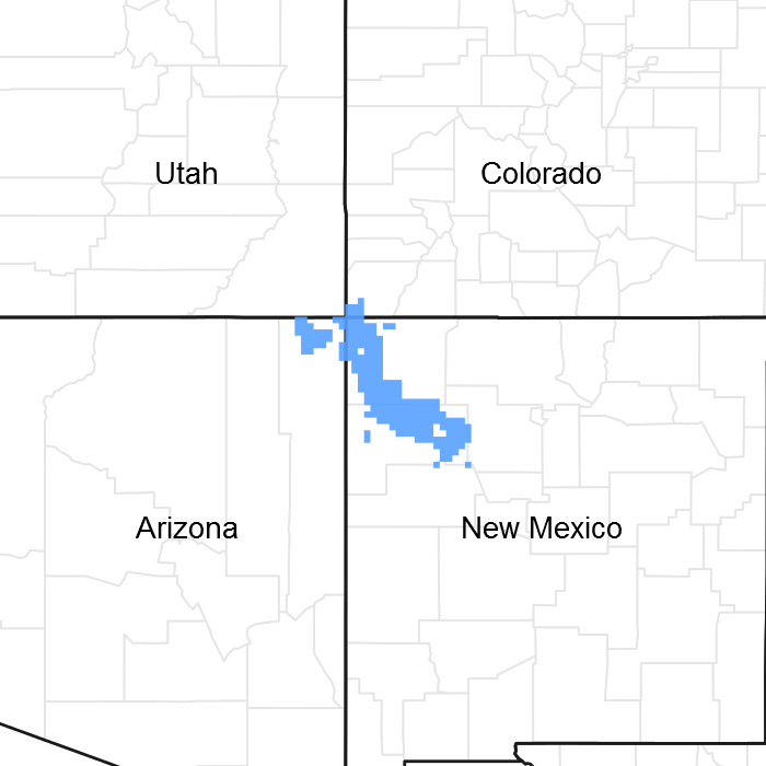
Figure 1. Mapped extent
Areas shown in blue indicate the maximum mapped extent of this ecological site. Other ecological sites likely occur within the highlighted areas. It is also possible for this ecological site to occur outside of highlighted areas if detailed soil survey has not been completed or recently updated.
MLRA notes
Major Land Resource Area (MLRA): 035X–Colorado Plateau
“ATTENTION: This ecological site meets the requirements for PROVISIONAL (if not more). A provisional ecological site is established after ecological site concepts are developed and an initial state-and-transition model is drafted. A provisional ecological site typically will include literature reviews, land use history information, legacy data (prior approved range site descriptions, forage suitability groups, woodland suitability groups, etc.,), and includes some soils data, and estimates for canopy and/or species composition by weight,. A provisional ecological site provides the conceptual framework of soil-site correlation for the development of the ESD. For more information about this ecological site, please contact your local NRCS office.”
Ecological site concept
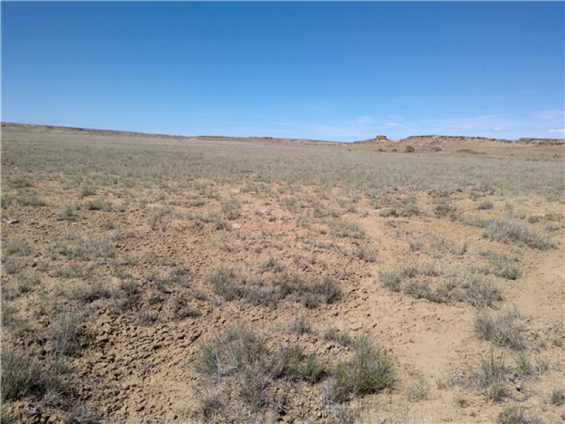
This site has a plant community made up primarily of grasses, shrubs, and annual forbs. In the reference plant community, warm-season plants dominate, but there are also some cool-season plants. Alkali sacaton and Mound saltbush are abundant on the site because of the high sodium in the soil.
Plant species most likely to invade or increase on this site when it deteriorates are Russian thistle, Powell's saltweed, mound saltbush, and globemallow. Desirable species decrease if continuously grazed during their growing season, allowing an increase in sodium-tolerant annuals like Powell's saltweed and invasion by Russian thistle.
The soils are shallow to very deep and are well drained. They were formed in alluvium and residuum derived from sandstone and shale. Surface textures include loam, clay loam, sandy clay loam, and fine sandy loam. The subsoil has textures of silty clay, silty clay loam, fine sandy loam, loam, sandy clay loam, clay, channery sandy clay loam, and clay loam. Soft sandstone or shale occurs between 18 and 60 inches. Permeability is very slow to moderately slow. Available water holding capacity is very low to low. Runoff is low to very high, and the hazard of water erosion is slight to severe. The hazard of soil blowing is moderate to severe. The soils are slightly to moderately saline (EC 4-16), moderately to strongly sodic (SAR 13-30+), or neutral to very strongly alkaline (pH 6.6 to 9.4).
Mean annual precipitation varies from 6 to 10 inches. The site does not receive any additional run-in moisture, but may on occasion flood. With the sealing capacity of the soil, flooding events run off rapidly and is not available as extra moisture necessarily to plants.
Table 1. Dominant plant species
| Tree |
Not specified |
|---|---|
| Shrub |
(1) Atriplex obovata |
| Herbaceous |
(1) Sporobolus airoides |
Click on box and path labels to scroll to the respective text.
