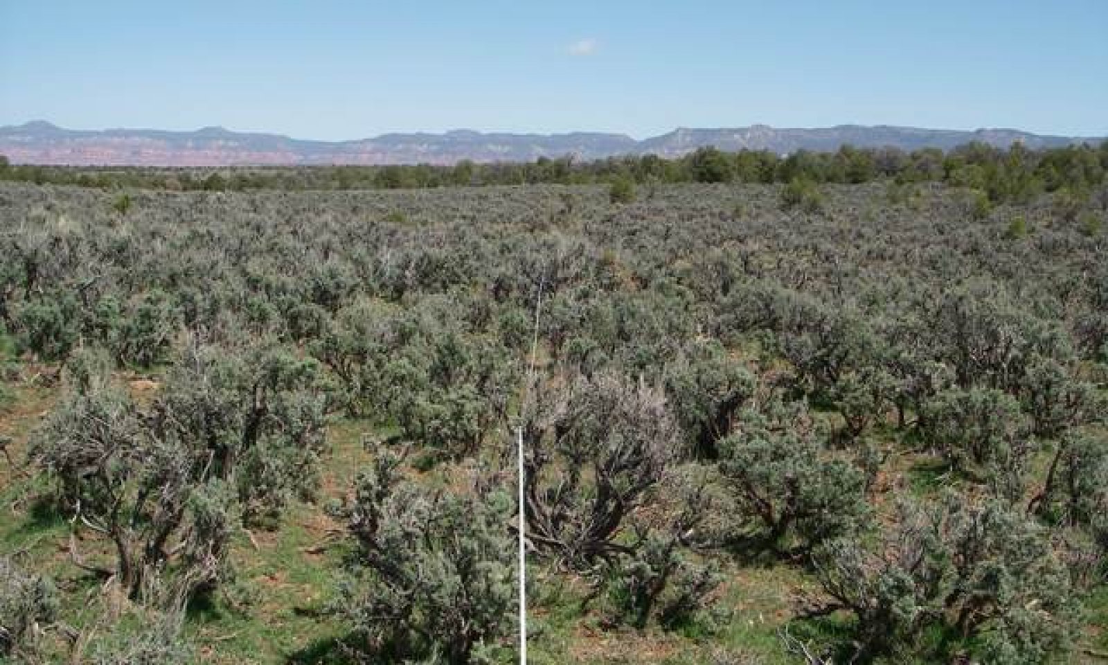
Loamy Upland 13-17" p.z.
Scenario model
Current ecosystem state
Select a state
Management practices/drivers
Select a transition or restoration pathway
- Transition T1A More details
- Restoration pathway R2A More details
-
No transition or restoration pathway between the selected states has been described
Target ecosystem state
Select a state
Description
This is a grassland / shrub mix. The approximate total production breakdown is grasses are 60-70%, forbs 1-5%, shrubs 25-35% and trees 0-4%.
Western wheatgrass, squirreltail, muttongrass and blue grama are the dominant grasses and Wyoming big sagebrush is the dominant shrub.
Submodel
Description
2.2 Trees (mostly pinyon pine) is invading the site. Disturbed understory, lack of fire and favorable climatic conditions have opened up the site to this tree invasion. Left unchecked the trees and shrubs will dominate the site and the understory becomes less productive with less quality forage plant species. It takes tree and shrub treatments along with careful management which might include some re-seeding to move back to a more desired plant communty. There are times when drought and insect damage reduce tree densities,also. There may be very little to a few percent of non-native plants. Introduction of non-native annuals species creates an irreversible change in the plant community
Submodel
Model keys
Briefcase
Add ecological sites and Major Land Resource Areas to your briefcase by clicking on the briefcase (![]() ) icon wherever it occurs. Drag and drop items to reorder. Cookies are used to store briefcase items between browsing sessions. Because of this, the number of items that can be added to your briefcase is limited, and briefcase items added on one device and browser cannot be accessed from another device or browser. Users who do not wish to place cookies on their devices should not use the briefcase tool. Briefcase cookies serve no other purpose than described here and are deleted whenever browsing history is cleared.
) icon wherever it occurs. Drag and drop items to reorder. Cookies are used to store briefcase items between browsing sessions. Because of this, the number of items that can be added to your briefcase is limited, and briefcase items added on one device and browser cannot be accessed from another device or browser. Users who do not wish to place cookies on their devices should not use the briefcase tool. Briefcase cookies serve no other purpose than described here and are deleted whenever browsing history is cleared.
Ecological sites
Major Land Resource Areas
The Ecosystem Dynamics Interpretive Tool is an information system framework developed by the USDA-ARS Jornada Experimental Range, USDA Natural Resources Conservation Service, and New Mexico State University.
