Shallow Sand Rock Pocket (Utah Juniper/Two-Needle Pinyon)
Scenario model
Current ecosystem state
Select a state
Management practices/drivers
Select a transition or restoration pathway
- Transition T1A More details
- Transition T1B More details
- Transition T2B More details
- Transition T2A More details
-
No transition or restoration pathway between the selected states has been described
Target ecosystem state
Select a state
Description
The reference state was determined by study of rangeland relic areas, areas protected from excessive disturbance, and areas under land use influences, such as grazing and recreation. Literature reviews, trends in plant community dynamics, and historical accounts are also considered.
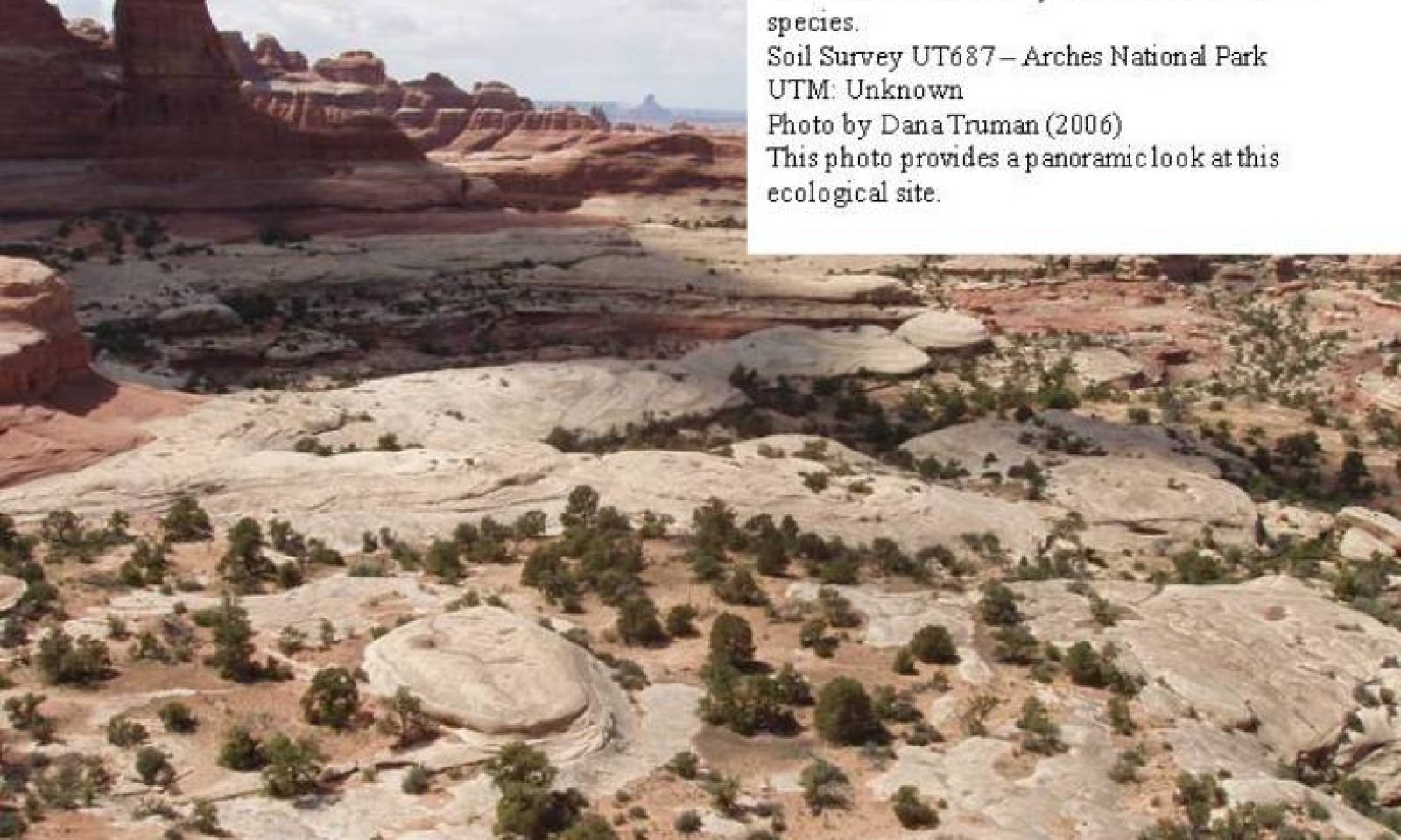
The reference state represents the historic plant communities and natural ecological dynamics of the Shallow Sand Rock Pocket, Utah juniper/Two-needle pinyon site. This state includes the biotic communities that become established on the ecological site if all successional sequences are completed under current climatic conditions; natural disturbances are inherent in its development. This state is dominated by an overstory of Utah juniper and Two-needle pinyon, and a mixture of shrubs with shadscale, blackbrush and littleleaf mahogany being the most common. Perennial cool season grasses may also not be present depending on soil development. The primary disturbance mechanism is weather fluctuations. The reference state is self sustaining and resistant to change due to high resistance to natural disturbances and high resilience following natural disturbances. When natural disturbances occur, the rate of recovery is relatively rapid due to niches being filled with highly adapted native vegetation.
Reference State: Community phases disturbed by climate fluctuations.
Indicators: A site dominated by various shrub species , where James galleta and Indian ricegrass and sand dropseed may also be present.
Feedbacks: Extended drought resulting in a reduction of native perennial plant vigor. Normal fluctuations in weather allowing for the maintenance of both shrubs and perennial grasses.
At-risk Community Phase: All communities are at risk when nutrients are available for invasive plants to establish. Plant community 1.1 is especially at risk due to limited production and cover of understory grasses.
Trigger: Introduction of invasive plants to fill available niches.
Submodel
State 2
Current Potential State


Description
This current potential state is composed of the same two community phases described in the Reference State. Community phase 1.1 describes the "shrub dominated" aspect while Community phase 1.2 describes the more "herbaceous" aspect. Non-native and/or Invasive species now occupy these communities. Management needs to recognize and account for these species. A transitional threshold has been crossed and a return to the Reference State is not feasible.
Reference State: Community phases disturbed by climate fluctuations.
Indicators: A site dominated by various shrub species , where James galleta and Indian ricegrass and sand dropseed may also be present. Non-native species are now present in the stand.
Feedbacks: Extended drought resulting in a reduction of native perennial plant vigor. Normal fluctuations in weather allowing for the maintenance of both shrubs and perennial grasses.
At-risk Community Phase: All communities are at risk when nutrients are available for invasive plants to establish. Plant community 1.1 is especially at risk due to limited production and cover of understory grasses.
Trigger: Spread of invasive plants to fill available niches.
Submodel
Description
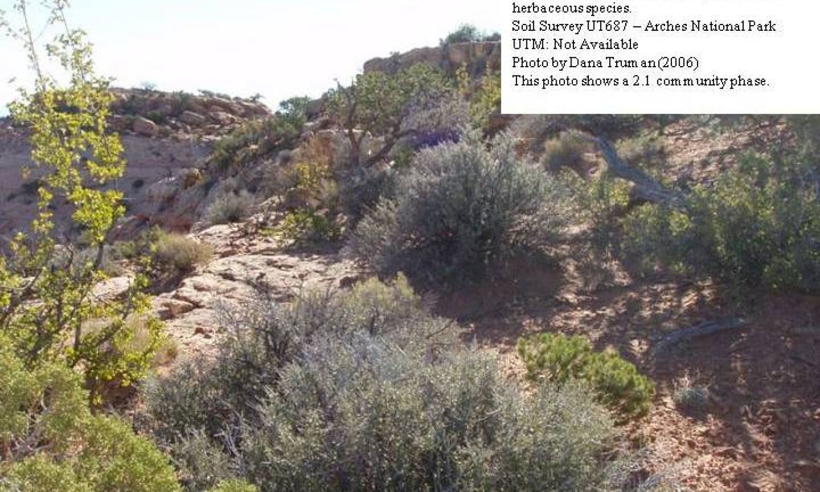
This phase of the ecological site is characterized by an overstory of old Utah juniper and Two-needle pinyon. Shrubs may or may not be present in the understory. Where present that are usually widely scattered. Blackbrush, Littleleaf mahogany, Singleleaf ash and Mexican cliffrose commonly occur. Perennial grasses and forbs are mostly missing. Cheatgrass, Red brome, and Russian thistle may be present. The appearance of most forbs is episodic in nature and is closely tied to precipitation events.
Submodel
Mechanism
This pathway describes the affects of the presence of a seed source of invasive and/or non-native species that become established by any combination of surface spot fire activity, drought, and improper livestock grazing. A threshold is passed when invasive and/or non-native species become established.
Mechanism
This pathway describes the affects of any combination of drought, improper livestock grazing, and heavy wildlife browsing that is sufficient to significantly reduce or eliminate native herbaceous understory species. Some annual invasive and/or non-native species may be present. A threshold is passed when native herbaceous species are significantly reduced and/or are not able to regenerate themselves.
Mechanism
This pathway describes the affects of any combination of drought, improper livestock grazing, and heavy wildlife browsing that is sufficient to significantly reduce or eliminate native herbaceous understory species. Annual invasive and/or non-native species may be present. A threshold is passed when native herbaceous species are significantly reduced and/or are not able to regenerate themselves.
Mechanism
This pathway describes the affects of any combination of surface spot fire activity, drought, heavy wildlife browsing and improper livestock grazing that allows the site to transition into a eroded state. A threshold is passed when invasive and/or non-native species dominate the community.
Model keys
Briefcase
Add ecological sites and Major Land Resource Areas to your briefcase by clicking on the briefcase (![]() ) icon wherever it occurs. Drag and drop items to reorder. Cookies are used to store briefcase items between browsing sessions. Because of this, the number of items that can be added to your briefcase is limited, and briefcase items added on one device and browser cannot be accessed from another device or browser. Users who do not wish to place cookies on their devices should not use the briefcase tool. Briefcase cookies serve no other purpose than described here and are deleted whenever browsing history is cleared.
) icon wherever it occurs. Drag and drop items to reorder. Cookies are used to store briefcase items between browsing sessions. Because of this, the number of items that can be added to your briefcase is limited, and briefcase items added on one device and browser cannot be accessed from another device or browser. Users who do not wish to place cookies on their devices should not use the briefcase tool. Briefcase cookies serve no other purpose than described here and are deleted whenever browsing history is cleared.
Ecological sites
Major Land Resource Areas
The Ecosystem Dynamics Interpretive Tool is an information system framework developed by the USDA-ARS Jornada Experimental Range, USDA Natural Resources Conservation Service, and New Mexico State University.


