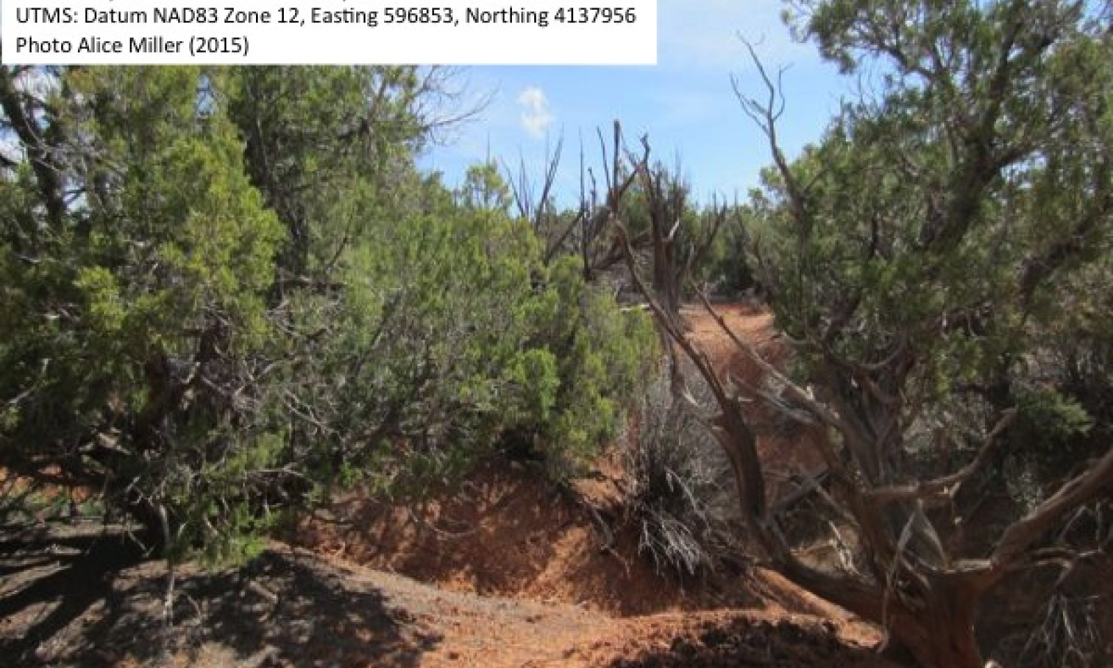
Upland Dissected Slope (Twoneedle Pinyon-Utah Juniper)
Scenario model
Current ecosystem state
Select a state
Management practices/drivers
Select a transition or restoration pathway
- Transition T1A More details
-
No transition or restoration pathway between the selected states has been described
Target ecosystem state
Select a state
Description
The reference state was determined by literature review, historical accounts, reports, and observations of trends in plant community dynamics.
The reference state represents the plant communities and ecological dynamics of this ecological site under pre-settlement conditions and a natural disturbance regime (which likely included early land-clearing by the Anasazi). The plant communities of the reference state were similar to those of the current potential state (State 2), and were characterized by a sparse canopy of Utah juniper and twoneedle pinyon, with a very sparse understory (West 1979). Early land-use by the Anasazi could have contributed to episodes of arroyo cutting and soil erosion. Infrequent stand clearing fires would have created stands of shrublands and woodlands in different phases of succession. Cheatgrass was not present in the reference state. The primary disturbances included infrequent fire, fluctuations in precipitation, prehistoric land-use, and native ungulate browsing. Plant communities will naturally shift among the four phases with very infrequent fire and climatic fluctuations. Anasazi clearing could have caused shifts to community phase 1.4.
Reference State: Plant communities influenced by fire, browse, climate fluctuations between wet and dry periods, and Anasazi land-use.
Indicators: Dominance by Utah juniper and twoneedle pinyon with a sparse shrub layer of Wyoming big sagebrush and roundleaf buffaloberry, with stands of plant communities representing different phases of succession present over the landscape.
Feedbacks: Very infrequent stand-clearing fire and light browse pressure allows for a self-sustaining woodland with herbaceous and shrub successional phases.
At-risk Community Phase: Community phase 1.4 is particularly susceptible to invasion by cheatgrass due to a lack of competition and extensive bare soil; however all phases are susceptible to invasion, especially with heavy grazing, browse or other disturbances that remove vegetative cover and disturb soils.
Trigger: Improper livestock grazing and introduction of invasive species.
Submodel
Description
This state represents the current potential of this ecological site, and in addition to very infrequent fire and climate fluctuations, the dynamics include disturbance by livestock and invasive species, which may alter the fire regime. Land-clearing (chaining) for livestock improvement has also occurred. The interpretive state will shift among the four phases with very infrequent fire and climatic fluctuations. Cheatgrass invasion may result in a shortened fire rotation, maintaining a herbaceous community phase (e.g. D'Antonio and Vitousek 1992), but since this has not been observed in this ecological site, an altered grassland state is not included in the state and transition model. Livestock grazing impacts and vegetation removal may have accelerated erosion and channel cutting in some areas; however erosional processes have been a part of the dynamics of this site since prehistoric times (West 1979). Areas severely altered by erosion were not observed, so an eroded state is not included in the state and transition model. Managers should be aware of the possibility of an eroded state with severe soil disturbance and vegetation removal.
Current Potential State: Plant communities influenced by very infrequent fire, climate fluctuations between wet and dry periods, livestock grazing, invasive species, and land-clearing. Off-road vehicle use and tree harvesting may also impact this state.
Indicators: Dominance by Utah juniper and twoneedle pinyon with a sparse shrub layer of Wyoming big sagebrush and roundleaf buffaloberry, with stands of plant communities representing different phases of succession present over the landscape. Cheatgrass is often present.
Feedbacks: Very infrequent stand-clearing fire and light browse and grazing pressure allow for a self-sustaining woodland with herbaceous and shrub successional phases. Cheatgrass is naturalized throughout the system.
At-risk Community Phase: Community 2.4 is especially at risk of cheatgrass dominance, which may create a cycle of repeat burning that maintains a grassland state.
Submodel
Model keys
Briefcase
Add ecological sites and Major Land Resource Areas to your briefcase by clicking on the briefcase (![]() ) icon wherever it occurs. Drag and drop items to reorder. Cookies are used to store briefcase items between browsing sessions. Because of this, the number of items that can be added to your briefcase is limited, and briefcase items added on one device and browser cannot be accessed from another device or browser. Users who do not wish to place cookies on their devices should not use the briefcase tool. Briefcase cookies serve no other purpose than described here and are deleted whenever browsing history is cleared.
) icon wherever it occurs. Drag and drop items to reorder. Cookies are used to store briefcase items between browsing sessions. Because of this, the number of items that can be added to your briefcase is limited, and briefcase items added on one device and browser cannot be accessed from another device or browser. Users who do not wish to place cookies on their devices should not use the briefcase tool. Briefcase cookies serve no other purpose than described here and are deleted whenever browsing history is cleared.
Ecological sites
Major Land Resource Areas
The Ecosystem Dynamics Interpretive Tool is an information system framework developed by the USDA-ARS Jornada Experimental Range, USDA Natural Resources Conservation Service, and New Mexico State University.


