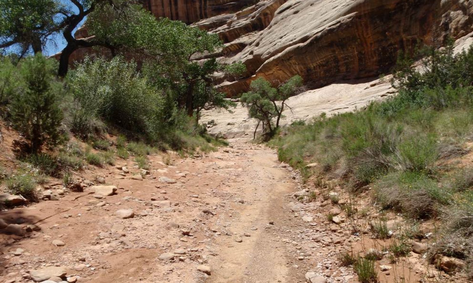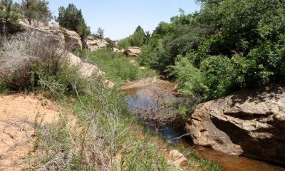
Southwestern Plateau Riparian Complex Intermittent (Valley Type IV - F4/B4C Stream Type)
Scenario model
Current ecosystem state
Select a state
Management practices/drivers
Select a transition or restoration pathway
-
Transition T1A
Entrenchment disturbance
More details -
Transition T2A
Establishment of stabilizing vegetation
More details -
Transition T3A
Entrenchment disturbance
More details -
No transition or restoration pathway between the selected states has been described
Target ecosystem state
Select a state
State 1
Reference Channels


Description
The Reference Channels state is characterized as a B4c/F4 channel. There are two phases identified in this state, F4 and B4c channel. The F4 channel may evolve into a B4c channel through sediment deposition in the channel. This is believed to occur when there is enough valley fill to create an expanded floodplain and a low terrace. This occurs through a community pathway where no transition is crossed. Both channels are considered stable. The freshly deposited sediment is colonized by plants either through seed or rhizomes. The material on the stream banks is fine material (sand) that is more susceptible to erosion when not held together by roots, especially from rhizomatous plants and shrubs. Movement to any other channel type indicates a threshold has been crossed and the channel will not change back to an F4/B4c channel in phase 1.1 or 1.2 without major inputs of money or energy.
The channel can be an F1 channel where the canyon is narrow and there is exposed bedrock. These channels will not change due to the bedrock control.
Plant communities exist on specific fluvial surfaces (PCC1 on stream banks/floodplains and PCC2 on floodplain-step and PCC3 on low terraces). These communities may exist over the entire length of the site and vary slightly to moderately in plant community composition.
PC1: Common reed/Baltic Rush, Bank Zone/Floodplain, Phases: 1.1; 1.2; 3.1; 3.2
PC2: Coyote willow/Yellow willow, Overbank Zone/Floodplain-step, Phases: 1.1; 1.2; 2.1; 3.1; 3.2
PC3: Fremont cottonwood/Narrowleaf cottonwood, Terrace, Phases: 1.1; 1.2; 2.1; 3.1; 3.2
Plant Community 1 is frequently disturbed by flash flooding. Shrubs and trees are generally not found within this plant community because of the close proximity to the stream channel and scouring floods. Herbaceous plants can establish between flooding events and can often come up though sediment if they are buried during a flood event. Coyote willow is sometimes found within this community because it is able to expand through rhizomes and grow under conditions that it would not be able to germinate (Anderson 2006). Roots of graminoids and coyote willow hold the stream banks during typical flood events, but may be scoured during large floods. This community is generally found around meander bends or on point bars.
Plant Community 2 is maintained by flooding and is located in the overbank zone and floodplain step. Willows tend to have flexible branches that are able to bend with the force of water without much damage to the plant (Karrenberg et al. 2002; McBride & Stahan 1984). Coyote willow (Salix exigua) is drought resistant and very tolerant of flooding (Anderson 2006) an essential characteristic in the dry environment of south eastern Utah. Willow seeds are non-dormant and quickly lose viability. Seedlings generally establish close enough to a water supply and far enough from the channel to be protected from scouring during floods (Anderson 2006). Once established, vegetative clones can expand perpendicular to the stream channel, developing closer to the water source (Anderson 2006). Branches can resprout if buried by sediment and they may also regenerate vegetatively from broken stems and roots (Anderson 2006). Coyote willow is shade intolerant and is shaded out once cottonwoods grow tall enough to dominate the overstory (Karrenberg et al. 2002). Seedlings of willow and cottonwood require the same germination conditions of bare and moist soil, so they often germinate together. Initially, willows grow faster than cottonwood, but given time cottonwood overtops the willows. Cottonwood is not the dominant overstory in this plant community because it is scoured before it can grow to maturity, in response to being too close to the channel. Young cottonwood was found scattered on this fluvial surface but was not dominant and may not grow to maturity.
This community initially develops on floodplain steps and may become established on exposed depositional sand bars. Establishment of this community depends on periodic flooding for maintenance and growth. As sediment and debris become trapped among woody stems, the bar becomes more stable. This community occurs on flood plains with sufficient sediment deposition. Downed wood is sparse. Stands usually occur about one meter above the current channel on point bars and low floodplains.
After a large flood event in some parts of this MLRA in 2003, willow stands were severely damaged and all that remained after the event were sparse stands of coyote willow. Before the flood, yellow willow was generally co-dominant and stands were dense (Coles et al. 2008).
Fremont cottonwood is the dominant overstory plant in plant community component three. Narrowleaf cottonwood occurs within this community, but is not as prevalent as Fremont cottonwood. These two species are known to hybridize, creating the hybrid Populus xhinckleyana (Eckenwalder 1984).
Intermittent flooding maintains this stream terrace. Flooding only reaches this terrace during high flows that generally occur in the summer monsoon season. Cottonwoods have been documented to establish on these higher terraces (Johnson et al. 1976; Stromberg et al. 1997). Spring flooding is required for cottonwood seedling establishment and this does not occur every year (Lytle & Merritt 2004). Given the uniform age class of the cottonwood trees present, such flooding occurs every 50 years. Fremont cottonwood flowers from February to early March allowing the seed to be dispersed late spring (May), optimally on the receding limb of the spring flood stage. Seeds established during this stage of flooding are not typically susceptible to subsequent flooding and the soil is generally moist enough to allow germination (Braatne et al. 1996, Rood et al. 2007). Germination may occur more often, but establishment and survival past seeding stage in to young stage is unlikely to occur every year. Due to the deep water table in PCC3, understory species are not riparian obligates and only those species that are deep rooted, such as cottonwood, can access the water table. Cottonwoods generally only germinate on freshly deposited sediment and will generally not germinate in an area already covered by vegetation (Rood et al 2007). Fluvial disturbance is essential in maintaining cottonwood communities. Fremont cottonwoods generally establish from seed and not asexual reproduction, and because of this they are generally found on channels that are affected by moderate flows (Rood et al 2007). Fire is unlikely to be a driving force in this plant community because of the location in deep canyons and discontinuous vegetation along the channel. Fremont cottonwoods are not regenerated by fire and mature trees can be top-killed by moderate fires (Taylor 2000).
Mature Fremont cottonwood stands are generally found on middle to upper terraces (2-3 meters above the existing channel) that do not flood yearly (Coles et al. 2008). Mature cottonwoods live to maturity in the location because the plants have time to establish between large flood events (Irvine 1976). Young narrowleaf cottonwood and the hybrid occur at a lower elevation, generally just outside of PC2. Terraces at this elevation above the stream channel are rarely flooded, except in severe flooding that occurs every 100 years. Floods of this magnitude can reach this terrace and remove understory vegetation. The understory is often dominated by upland species. Stands occurring on lower terraces may have mesic understory, but there are subject to more frequent flooding and scouring events. If flooding has not removed litter, there is generally a high litter cover and a low cover of downed wood. There is little soil development occurring on these terraces because of flooding disturbance. Some stands may be high enough above the current channel, they are not self-perpetuating because the conditions are too dry and the flooding is too infrequent.
Plant community composition is listed by group, group one for PC1, group two for PC2 and group three for PC3.
Submodel
Description
This state occurs when disturbances (to phases in State 1 or State 3) remove bank stabilizing vegetation which leads to destabilization of banks and bed. G4c channel evolves from the B4c channel by downcutting through the fine bed material. Disturbance could include large floods that scour vegetation below flood prone area. Increased erosion of banks and bed result in vertical instability and especially lateral instability. This site also has sections that are bedrock controlled that will not deepen vertically. In this situation the stream channel will erode laterally.
In this state the stream becomes disconnected from the floodplains. Stream bank vegetation (PC1) is removed and some floodplain vegetation is also removed (PC2). This channel morphology may also be the result of a large sediment pulse that is deposited in the channel, that intermittent flow is unable to carry downstream.
Submodel
Description
The channels in this state are stable analogues (stable channels that have similar morphology as state 1 channels) that have re-established some floodplain connection during bankfull flows. These channels also have the potential to express all plant communities. The lower channels may have established after several incremental entrenchment and widening events, as evidenced by floodplains and terraces.
Stable analogue B4c/F4 channel succession within state 3 is similar to state 1, but at a lower elevation. These stable analogue channel types are at risk of crossing a threshold back to state 2 if sediment and flow do not remain in balance.
Submodel
Mechanism
Disturbance to channel to cause entrenchment (loss of vegetation, unnaturally high or frequent flows)
Mechanism
Establishment of stabilizing vegetation over time since large flood event
Model keys
Briefcase
Add ecological sites and Major Land Resource Areas to your briefcase by clicking on the briefcase (![]() ) icon wherever it occurs. Drag and drop items to reorder. Cookies are used to store briefcase items between browsing sessions. Because of this, the number of items that can be added to your briefcase is limited, and briefcase items added on one device and browser cannot be accessed from another device or browser. Users who do not wish to place cookies on their devices should not use the briefcase tool. Briefcase cookies serve no other purpose than described here and are deleted whenever browsing history is cleared.
) icon wherever it occurs. Drag and drop items to reorder. Cookies are used to store briefcase items between browsing sessions. Because of this, the number of items that can be added to your briefcase is limited, and briefcase items added on one device and browser cannot be accessed from another device or browser. Users who do not wish to place cookies on their devices should not use the briefcase tool. Briefcase cookies serve no other purpose than described here and are deleted whenever browsing history is cleared.
Ecological sites
Major Land Resource Areas
The Ecosystem Dynamics Interpretive Tool is an information system framework developed by the USDA-ARS Jornada Experimental Range, USDA Natural Resources Conservation Service, and New Mexico State University.


