Natural Resources
Conservation Service
Ecological site F038XB229AZ
Sandy Bottom 16-20 (QUERC)
Last updated: 9/05/2019
Accessed: 02/12/2026
General information
Provisional. A provisional ecological site description has undergone quality control and quality assurance review. It contains a working state and transition model and enough information to identify the ecological site.

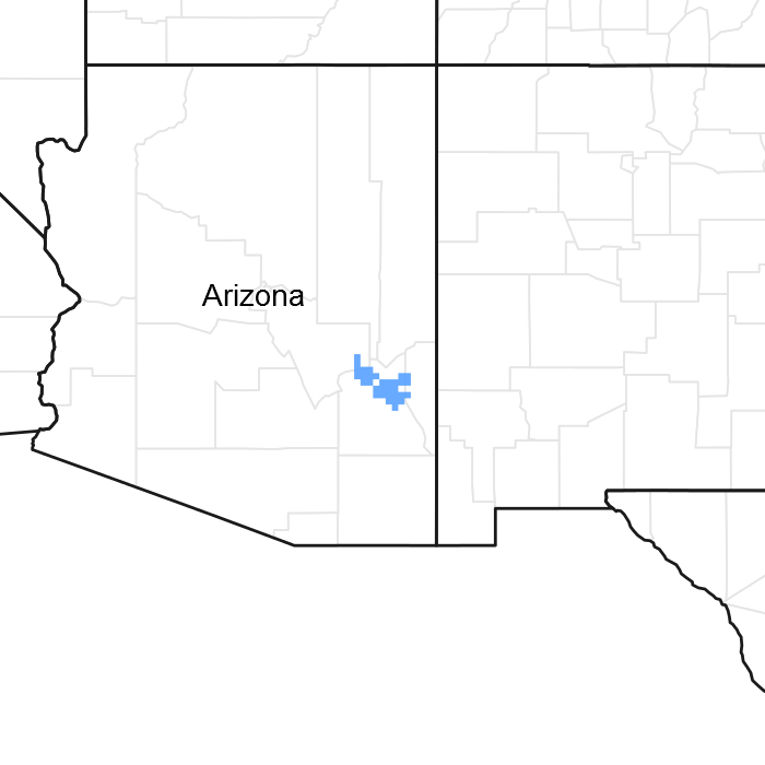
Figure 1. Mapped extent
Areas shown in blue indicate the maximum mapped extent of this ecological site. Other ecological sites likely occur within the highlighted areas. It is also possible for this ecological site to occur outside of highlighted areas if detailed soil survey has not been completed or recently updated.
MLRA notes
Major Land Resource Area (MLRA): 038X–Mogollon Transition South
AZ 38.2 - Middle Mogollon Transition
Elevations range from 4,000 to 5,500 feet and precipitation averages 16 to 20 inches per year. Vegetation includes turbinella oak, Wright silktassel, hollyleaf buckthorn, desert buckbrush, one-seed juniper, alligator juniper, pinyon, algerita, sugar sumac, prairie junegrass, blue grama, curly mesquite, bottlebrush squirreltail, muttongrass, cane beardgrass, plains lovegrass, and bullgrass. The soil temperature regime ranges from thermic to mesic and the soil moisture regime is aridic ustic. This MLRA occurs within the Transition Zone Physiographic Province and is characterized by canyons and structural troughs or valleys. Igneous, metamorphic, and sedimentary rock classes occur on rough mountainous terrain in association with less extensive sediment filled valleys exhibiting little integrated drainage.
Ecological site concept
This site generally occurs on higher benches adjacent to riverwash
Table 1. Dominant plant species
| Tree |
(1) Quercus |
|---|---|
| Shrub |
(1) Fallugia paradoxa |
| Herbaceous |
(1) Muhlenbergia rigens |
Click on box and path labels to scroll to the respective text.