
Natural Resources
Conservation Service
Ecological site F038XC315AZ
Ponderosa Pine - Gray Oak Forest 20-25" p.z. (PIPO, QUGR3)
Last updated: 5/07/2020
Accessed: 12/21/2025
General information
Provisional. A provisional ecological site description has undergone quality control and quality assurance review. It contains a working state and transition model and enough information to identify the ecological site.
MLRA notes
Major Land Resource Area (MLRA): 038X–Mogollon Transition South
AZ 38.3 – Upper Mogollon Transition
Elevations range from 5100-7000 feet and precipitation averages 20 to 27 inches per year. Vegetation includes Gambel oak, Arizona white oak, Emory oak, pinyon, alligator juniper, one seed juniper, Arizona cypress, ponderosa pine, shrubby buckwheat, sacahuista, skunkbush sumac, Wright silktassle, blue grama, sideoats grama, muttongrass, western wheatgrass, and bottlebrush squirreltail. The soil temperature regime is mesic and the soil moisture regime is typic ustic. This unit occurs within the Transition Zone Physiographic Province and is characterized by canyons and structural troughs or valleys. Igneous, metamorphic and sedimentary rock classes occur on rough mountainous terrain in association with less extensive sediment filled valleys exhibiting little integrated drainage.
Associated sites
| R038XC316AZ |
Clayey Slopes 20-24" Clayey Slopes 20-24" p.z. is a deep soil site that has 10-20 very old, 2-4 foot Diameter at Root Crown (DRC) parent trees with a majority of the interspaces being occupied with trees less than 12” DRC and occasional ponderosa pine trees in cooler/wetter microclimate sites near the ecotone between the two sites. In the reference state the interspaces are dominated by herbaceous species, primarily warm season grasses. |
|---|---|
| R038XC317AZ |
Volcanic Hills 20-24" Volcanic Hills 20-24" p.z. is a shallow soil site that has 10-20 very old, 2-4 foot Diameter at Root Crown (DRC) parent trees with a majority of the interspaces being occupied with trees less than 12” DRC and occasional ponderosa pine trees in cooler/wetter microclimate sites near the ecotone between the two sites. In the reference state the interspaces are dominated by a mixture of shrubs and herbaceous species. |
| F038XC314AZ |
Ponderosa Pine - Gambel Oak Forest 20-25" p.z. (PIPO, QUGA) The Ponderosa pine-Gambel oak forest ecological site has gambel oak as the sub dominant tree versus gray oak. |
| R038XC303AZ |
Clay Loam Upland 20-24" p.z. The Clayloam Upland site is an alligator juniper savanna site and more commonly a woodland with high levels of more recent historical (80-100 years) juniper invasion that occurs at elevations below the ponderosa pine forests. Woodlands typically have 3-5 very old, 2-4 foot Diameter at Root Crown (DRC) parent trees with a majority of the interspaces being occupied with trees less than 12” DRC and occasional ponderosa pine trees in cooler/wetter microclimate sites near the ecotone between the two sites. |
Table 1. Dominant plant species
| Tree |
(1) Pinus ponderosa |
|---|---|
| Shrub |
Not specified |
| Herbaceous |
(1) Bouteloua curtipendula |
Physiographic features
This site occurs at the upper elevations of the Mogollon Transition zone, south of the Mogollon Rim in central Arizona. It occurs on gentle to rugged mountain slopes, ridge-tops and mesa sides
Table 2. Representative physiographic features
| Landforms |
(1)
Alluvial fan
(2) Mountain slope (3) Ridge |
|---|---|
| Flooding frequency | None |
| Elevation | 5,800 – 7,200 ft |
| Slope | 5 – 40% |
| Aspect | N, E, S |
Climatic features
Precipitation in this common resource area averages 20 to 25 inches annually. Precipitation is lower and temperatures are cooler in the eastern part of the MLRA. The winter-summer rainfall ratio ranges from about 60/40% in the western part of the area to 45/55% in the eastern part. Summer rains fall July through September; and are from high-intensity convective thunderstorms. This moisture originates primarily from the Gulf of Mexico, but can come from the remnants of Pacific hurricanes in September. Winter moisture is frontal, originates in the north Pacific, and falls as rain or snow in widespread storms of low intensity and long duration. Snowfall ranges from 11 to 22 inches per year and can occur from November through April. May and June are the driest months of the year. Humidity is generally low all year.
Average annual air temperatures range from 45 to 57 degrees F (mesic temperature regime). Daytime temps in the summer are commonly in the mid 80's in the eastern portion of the MLRA and the low to mid 90's in the western portion. Freezing temperatures are common from October through April. The actual precipitation, available moisture and temperature varies, depending on, region, elevation, rain shadow effect and aspect.
Table 3. Representative climatic features
| Frost-free period (average) | 167 days |
|---|---|
| Freeze-free period (average) | 188 days |
| Precipitation total (average) | 25 in |
Figure 1. Monthly precipitation range
Figure 2. Monthly average minimum and maximum temperature
Influencing water features
There are no water features associated with this site.
Soil features
It is generally recognized that rainfall will override multiple soil properties in ponderosa pine forests (Craig Ziegler, Forester, USDA NRCS West National Technology Support Center, personal communication, 24 May 2011). While not the norm for Ecological Site Descriptions the soils of this site have highly variable soil depths that range from shallow to deep and are generally clayey throughout. They are well drained. They formed in residuum and alluvium from basalt, andesite and related volcanic tuffs and ash. The surface textures are loam to clayloam. The effective rooting depth is 16 to 40 inches. Runoff is slow on dry soils, but is moderate to high on moist soils. The erosion hazard is slight unless heavy traffic causes trailing and compaction. Soil series mapped include: from SSA-675 San Carlos IR Area - MU's Broliar-14, Dedal-14, 54 & 66, Docdee-66, Gavilan family-35, Lithic Haplustolls-48, Pachic Argiustolls-54, Paymaster family-57 & 56 and Pocomate family-32.
Table 4. Representative soil features
| Parent material |
(1)
Residuum
–
basalt
(2) Alluvium – andesite |
|---|---|
| Surface texture |
(1) Gravelly loam (2) Gravelly clay loam (3) Very cobbly loam |
| Family particle size |
(1) Clayey |
| Drainage class | Well drained |
| Permeability class | Moderately slow to slow |
| Soil depth | 15 – 60 in |
| Surface fragment cover <=3" | 5 – 10% |
| Surface fragment cover >3" | 15 – 30% |
| Available water capacity (0-40in) |
1.6 – 6.1 in |
| Calcium carbonate equivalent (0-40in) |
5% |
| Electrical conductivity (0-40in) |
2 mmhos/cm |
| Sodium adsorption ratio (0-40in) |
2 |
| Soil reaction (1:1 water) (0-40in) |
6.6 – 7.2 |
| Subsurface fragment volume <=3" (Depth not specified) |
15 – 30% |
| Subsurface fragment volume >3" (Depth not specified) |
30 – 60% |
Ecological dynamics
The Reference Plant Community defined by USDA NRCS is the plant community that existed at the time of European immigration and settlement on the North American continent. Since plant species composition was seldom described in detail in early accounts, the Reference Plant Community described in this ecological site description is the best condition plant community in terms of production and diversity which is currently found on the landscape.
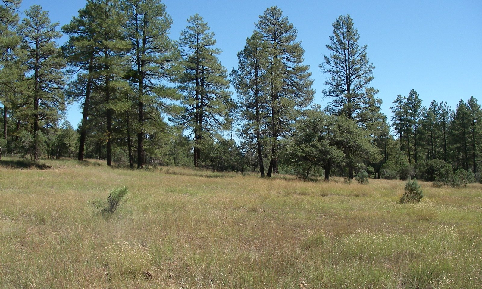
The Reference Plant Community is a forest dominated by ponderosa pine (PIPO) in the overstory with variable amounts of gray oak that range from shrubs to trees and an herbaceous understory of grasses and forbs. This site occurs well below the 8500 foot elevation that Dick-Peddie (1999) suggests has borderline climate for forests described in his Lower Montane Coniferous Forest plant communities or associations in New Mexico. The site occurs at the lowest and warmest elevation where ponderosa pine forests develop and sideoats grama is the dominant perennial grass found in the reference plant community. Historically periodic wildfires were important in maintaining this plant community. These fires are recorded in fire scars of tree rings and averaged from 4-11 years on the east side of Major Land Resource Area (MLRA) 38 (Kaib 2001). Tree densities and cover increase and herbaceous production decreases in the absence of fire for prolonged periods. The length of time required for the depletion of perennial grass seed bank is unknown however substantial areas have been treated in the eastern part of this Land Resource Unit (LRU) with minimal perennial grass response. Forbs and woody species are the primary species to respond in treated areas. The interactions of drought, fire and continuous livestock grazing can, over time, result in the loss of palatable perennial grasses.
Historic fires no doubt readily consumed significant quantities of tree leaf litter and the suppression of fire for decades significantly increases the amount of leaf litter or duff around trees. Pine trees commonly send fine roots into the O horizon and portions of this duff and the application of prescribed burning after forest thinning has the potential to kill large numbers of trees when consuming this duff (Egan 2011). The incremental removal of duff by burning when trees are dormant (late fall) and when deeper layers of duff are moist significantly reduces the chance that fine roots will be destroyed in southwestern ponderosa pine forests (Egan 2011). This is best accomplished by several burns over a period of a decade; the first 1-2 burns spaced 4 years apart (Egan 2011). Burning should not be applied when below average summer rains have dried substantial depths of the duff. Seeding is required in most instances where the perennial grass component has been absent for substantial periods.
Schussman and Smith (2006) suggest that PIPO/bunchgrass “Plant Associations” by the USFS (1997) could be grouped based on the presence of bunchgrasses for the purposes of State & Transition (S&T) Model Development. This is more broad an approach than used by USDA NRCS in Land Resource Unit (LRU) classification. A state is defined as a stable plant community that requires significant inputs to revert or change to another state. Soil survey ecological site correlation on the San Carlos Apache Reservation by NRCS revealed that sites at lower and warmer elevations had the potential for significant production of sideoats grama (presently most commonly replaced by blue grama) and placed these soils into MLRA 38. Soil map units in upper and cooler elevations had a dominance of mountain muhly or screwleaf muhly in the herbaceous community which more closely represented plant communities in the upper portions of the Black River watershed on the Apache-Sitgreaves National Forest in the heart of MLRA 39. As such, these soils were correlated to MLRA 39 ecological site descriptions and are not captured in this site description. Moir et al (1997) combined the associations of USFS (1997) into 3 groups that likely approximate precipitation/temperature regime breaks but do not facilitate interpretations for ESD’s.
The grouping of several plant associations of USFS (1997) does have logic and potential utility and these associations are very likely captured within a state of this sites S&T Model or contained somewhere within the transitions between major plant communities described in the S&T Model. For example, the best condition understory plant community observed in the reference plant community of this ecological site description had nearly 400 pounds per acre of sideoats grama. Sideoats grama being replaced by other grass species when subjected to continuous high intensity herbivory is well documented in other ESD’s in MLRA 38 and MLRA 41 in Arizona. Blue grama, well known for its ability to withstand heavy herbivory, is one of the common grasses to replace sideoats grama on non limy soils in the upper elevations of MLRA 41 and MLRA 38 in Arizona. USFS (1997) describes a PIPO/BOGR2 plant association where blue grama is the dominant herbaceous component. Based on observations in LRU 38-2 & 38-3 and MLRA 41 it is very plausible high intensity herbivory has resulted in grasses such as sideoats grama being succeeded by blue grama in the PIPO/BOGR2 association. As such, the PIPO/BOGR2 plant association described by USFS (1997) is State 2 of this sites S&T Model.
Gray oak and Arizona white oak both occur throughout Arizona. However, the number of specimens of each species deposited at the University of Arizona and Arizona State University herbariums is fairly disproportionate by region. A majority of gray oak specimens that are deposited in these herbariums are from central Arizona. Conversely, a majority of Arizona white oak specimens that are deposited in these herbariums are from southern Arizona. Arizona white oak readily hybridizes with gray oak in the northern part of gray oaks distribution (Vines 1960). These species are relatively difficult to tell apart based on the vegetative key of Kearney & Peebles (1960) and are very likely ecological equivalents. Gray oak or significant amounts of gray x white oak hybrids are likely dominants in central Arizona. As such, the PIPO/QUAR, typic phase and PIPO/QUAR, BOGR phase of USFS (1997) is very likely captured within this ecological site description. USFS (1997) acknowledges the difficulty in distinguishing white and gray oak in the PIPO-QUGR3 association and the possibility that these two species would be combined as one species in future forest association treatments.
This ESD does not document alligator juniper as a Major Climax tree species as does USFS (1997) in the PIPO/QUAR plant association. USFS (1997) defines a Major Climax species as a species that is “clearly regenerating successfully and surviving to maturity in late and advanced stages of succession”. The Historic Climax Plant Community or Reference Plant Community of ESD’s is a community that developed or is maintained by natural disturbances such as drought, fire, grazing, and insects (USDA NRCS 2003). Ecological Site Descriptions for Land Resource Unit 38-3 only consider juniper as a climax tree where very old, large diameter parent trees are found. These parent trees are typically 2 foot and more commonly upwards of 4 foot Diameter at Root Crown (DRC). These specimens are rarely found at greater than 2-3 per acre in the ponderosa pine forests and typically this only occurs near the ecotone between the alligator juniper savannas (USDA NRCS Ecological Site Description R038XC303AZ) and the more pure ponderosa pine forests. This equates to approximately 6-8% canopy cover with a canopy diameter of approximately 40 feet and 2-3 trees per acre; not enough to consider this species a Major Climax species in this site description. A comparison of 1930’s era aerial photos in central Arizona to present photos indicates the ability of alligator juniper to increase in a short time period in the presence of aggressive fire suppression or the inability of natural fires to spread where extreme herbivory has interrupted fine fuel continuity. The absence of large quantities of very large/old alligator juniper in ponderosa pine forests is indicative that small diameter trees (generally less than 12” DRC) are invading from the seed source of adjacent historic juniper savannas. The mechanisms leading to the invasion by alligator juniper, progression to a sexually mature age, and subsequent regeneration is likely similar to those that have led to the present condition of increased stem densities and cover of ponderosa pine forests; the absence of the historic fire regime during the last 80-100 years. The application of prescribed fire by the Clifton Ranger District is extremely effective at killing alligator junipers less than 3 feet tall in the juniper savannas and grasslands that occur at elevations below the ponderosa pine forests of LRU 38-3. Fires burning in the ponderosa pine forests at historic fire return intervals very likely killed alligator juniper seedlings and saplings preventing them from being more than a trace in the community.
Tree production in this MLRA is highly variable with different soil depths. No clear relationship exists as a function of depth, rock fragments, or available water holding capacity (AWC). Ponderosa pine Site Indices of soils < 20" tend to be very low, in the range of 60-65. However, ponderosa pine has a Site Index around 74 in the vicinity of the 10” deep Lithic Haplustoll soil (MU48) type location of the San Carlos Apache soil survey. The following lists soil AWC’s and Site Indices of trees in the vicinity of type locations for the soils:
Broliar AWC=2.2-3.7” SI=70
Dedal AWC=0.8-2.0” SI=54-60
Gavilan family AWC=3.5-5.3” SI=73
Lithic Haplustoll AWC=0.9-1.3” SI=74
Pachic Argiustoll AWC=4.8-7.5” SI=65
Paymaster AWC=4.0-6.5” SI=80
Docdee AWC=1.0-1.7” SI=50
This ecological site description does not capture low productivity sites where ponderosa pine occurs outside of its typical temperature/moisture regime, i.e. more uniform forest stands. These areas are most commonly observed as microsites of alligator juniper savannas or areas where juniper has increased to form woodlands. These microsites are most commonly concentrated runoff areas that collect overland flow which increase effective soil moisture in these locations or cold air drainages through the aforementioned juniper communities. These communities are captured as a state in the upper elevations of the Clayloam Upland, 20-25” p.z. ESD (R038XC303AZ).
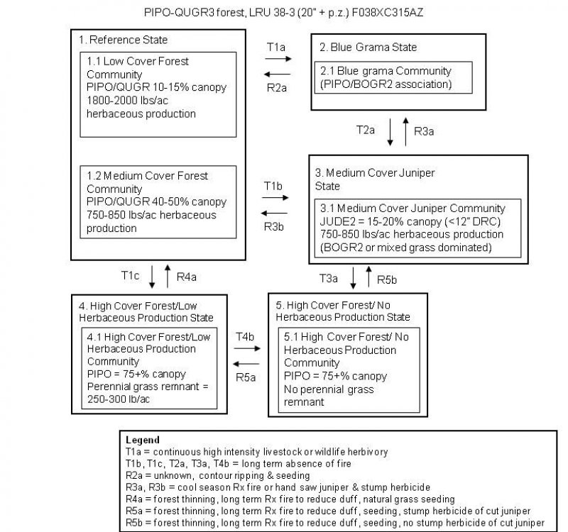
State & Transition Models can be developed using several different measures. This site could potentially be described using understory shrub and tree dynamics as is the common practice of foresters. However, the exact mechanisms driving shrub and tree dynamics have not been well investigated in this MLRA. The tree cover/ herbaceous production relationship is relatively easy to characterize in plant communities where woody species increase. This is the measure used in the following model since the presence or absence of herbaceous plants and their relative amounts has significant implications in the restoration of this plant community; especially attempts to restore low intensity understory fire to this community.
State and transition model
More interactive model formats are also available.
View Interactive Models
More interactive model formats are also available.
View Interactive Models
Click on state and transition labels to scroll to the respective text
State 1 submodel, plant communities
State 2 submodel, plant communities
State 3 submodel, plant communities
State 4 submodel, plant communities
State 5 submodel, plant communities
State 1
Reference State
The Reference State is a low (10-15%) to Medium (45-55%)canopy cover forest with herbaceous production ranging from 1900-2000 lbs/ac with low tree canopy cover to 750-850 lbs/ac with medium tree canopy cover.
Community 1.1
Low Cover Forest Community

The Reference Plant Community (RPC) is ponderosa pine forest with gray oak as a subdominant tree and a grassland understory. Sideoats and blue grama are dominant at lower elevations and cool season grasses like bottlebrush squirreltail, prairie junegrass, and muttongrass are dominant at upper elevations. A flora of native annual and perennial forbs exists in the plant community. Forb composition is highly variable from year to year and also varies with the timing and quantity of precipitation. Periodic, naturally occurring, wildfires were important in maintaining the potential plant community. At upper elevations near precipitation zone boundaries the northern slopes will have more productive forests as in MLRA 39. At lower precipitation zone boundaries steeper sloped southern exposures can develop 15-20% canopy of pinyon pine and have low productivity ponderosa pine. In the RPC, ponderosa pine canopy most likely ranged from 10 to 50%, gray oak understory is 2-5% canopy. This assumption is based on herbaceous sampling of a best condition reference site with 45% tree cover, 800 lbs/acre of uniformly distributed herbaceous production (fall 2007), the absence of ladder fuels, and the high probability of a tree seedling & sapling destroying ground fire. The Tonto NF burned this plant community south of Timber Camp during the fall of 2008 with minimal ponderosa pine canopy fire. Alligator juniper trees upwards of 12-15 feet tall on the fringes of this community were top killed. As of August 2011 most juniper trees > 12” DRC are not re-sprouting. Most smaller diameter juniper trees, 10-15 feet tall and < 12" DRC, are re-sprouting very poorly with only 18" tall sprouts. The repeated burning of alligator juniper to attempt to exhaust sprouting buds has not been thoroughly investigated. However, sprouts do not appear to be originating from adventitious buds based on the Clifton Ranger District Fire Management Officer’s observation of 70-80% kill following 1-2 prescribed fires where trees that have been hand sawn and are re-sprouting in the juniper savanna communities at the elevations below the ponderosa pine plant community. Mortality has been highest using fall and winter burns.
Forest overstory. The over-story of the plant community is dominated by Ponderosa Pine. Sub-dominant over-story is gray oak. Areas sampled have over-story canopy cover varying form 10 to 75% in mature stands of trees.
Forest understory. Open canopy areas are dominated by perennial grasses. Warm season grasses and cool season grasses are equally important in the plant community. Forbs and shrubs are minor components in the RPC but increase as tree canopy cover increases. Forb composition is highly variable from year to year and also varies with the timing and quantity of precipitation.
Figure 3. Annual production by plant type (representative values) or group (midpoint values)
Table 5. Annual production by plant type
| Plant type | Low (lb/acre) |
Representative value (lb/acre) |
High (lb/acre) |
|---|---|---|---|
| Grass/Grasslike | 600 | 850 | 1000 |
| Forb | 50 | 100 | 200 |
| Tree | 0 | 10 | 20 |
| Shrub/Vine | 0 | 10 | 20 |
| Total | 650 | 970 | 1240 |
Table 6. Ground cover
| Tree foliar cover | 10-55% |
|---|---|
| Shrub/vine/liana foliar cover | 0-5% |
| Grass/grasslike foliar cover | 60-90% |
| Forb foliar cover | 10-25% |
| Non-vascular plants | 0% |
| Biological crusts | 0% |
| Litter | 50-70% |
| Surface fragments >0.25" and <=3" | 1-10% |
| Surface fragments >3" | 15-30% |
| Bedrock | 5-10% |
| Water | 0% |
| Bare ground | 1-10% |
Table 7. Canopy structure (% cover)
| Height Above Ground (ft) | Tree | Shrub/Vine | Grass/ Grasslike |
Forb |
|---|---|---|---|---|
| <0.5 | – | – | 20-35% | 5-20% |
| >0.5 <= 1 | – | – | 20-35% | 5-10% |
| >1 <= 2 | – | – | 10-20% | – |
| >2 <= 4.5 | 5-10% | 0-5% | – | – |
| >4.5 <= 13 | – | – | – | – |
| >13 <= 40 | – | – | – | – |
| >40 <= 80 | – | – | – | – |
| >80 <= 120 | – | – | – | – |
| >120 | – | – | – | – |
Community 1.2
Medium Cover Forest Community
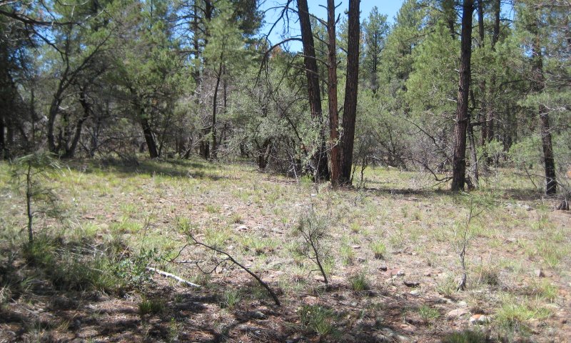
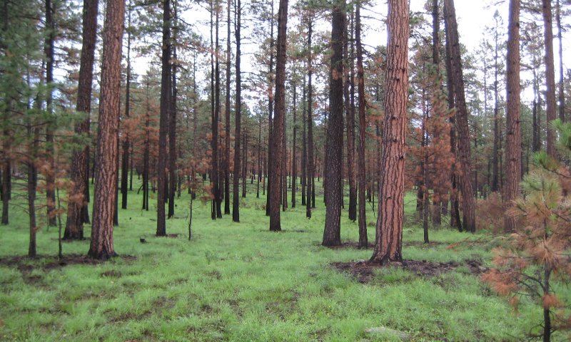
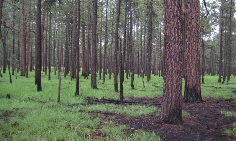
Ponderosa pine canopy cover approaches 40-50%. Gray oak canopy is 2-5%. Herbaceous production is 750-850 lbs per acre. Total herbaceous biomass is approximately 1000 lbs/ac. All other plant community characteristics are the same as the 1.1 Low Cover Forest Community. Although the understory grass composition of Figure 1 and 2 is different from the RPC, the assumption that ponderosa pine canopy cover could be as high as 50% in the RPC is partially validated by these figures which are representative of several areas that were part of burnout operations during extreme drought conditions of the Wallow fire in early June 2011. The precise time of day these locations were burned is uncertain. Remote Automated Weather Station (RAWS) humidity data for the 24 hour period surrounding the time the areas were burned (June 2) ranged from 10-21% at the closest weather stations located at Alpine and Greer, AZ. The community in Figure 1 had 51% ponderosa pine canopy, 122 trees per acre > 6” DBH, and understory herbaceous regrowth approaching 1200-1300 lbs/ac in late August 2011. Figure 2 is located approximately 2 miles from Figure 1 and has 53% ponderosa pine canopy cover, 138 trees/ac > 6” DBH, and understory herbaceous regrowth approaching 1300-1400 lb/ac in late August 2011. The exact type of fire that burned these communities is uncertain however they most likely experienced short flame lengths from backfires as they were part of burnout operations along Forest Road 25 during the Wallow fire. It is highly unlikely head fires could reach mature tree canopies in these communities since these areas have very little regeneration that have been able to form ladder fuels into mature tree canopies due to periodic burning of the understory in the last 20 years.
State 2
Blue Grama State
Ponderosa pine canopy ranges from 10-55%. Sideoats grama and often times cool season grasses are severely reduced and replaced by blue grama.
Community 2.1
Blue grama Community
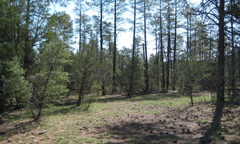
Ponderosa pine canopy ranges from 10-75%. Sideoats grama has been severely reduced from the community. Remnants of the species are found in very rocky areas that are not easily accessed by livestock or wildlife. Blue grama is the dominant warm season grass and often times the principal grass species. It is inferred that given blue grama’s high tolerance of close grazing that continuous high intensity herbivory is the principal mechanism. This assumption is partially validated in that the reference plant community is only found at considerable distances from permanent water.
State 3
Medium Cover Juniper State
Alligator juniper increases in number of trees per acre and canopy cover.
Community 3.1
Medium Cover Juniper community
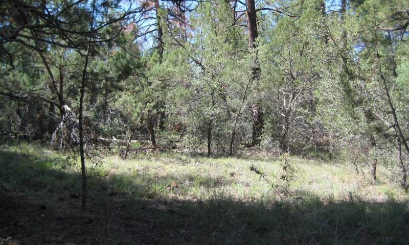
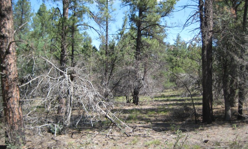
Ponderosa pine (PIPO) canopy is 40-50%. Juniper canopy is 15-20% and can overlap with PIPO canopy. On a best condition site, in terms of herbaceous production, herbaceous production is reduced to 800 lbs/ac due to the absence of fire and increase in tree cover. Perennial grass production is 75% of total production. There are moderate amounts of ladder fuels that would likely result in a stand destroying fire if ignition occurs in summer. The Tonto NF burned this plant community south of Timber Camp during the fall of 2008 with minimal ponderosa pine canopy fire. Alligator juniper trees upwards of 12-15 feet tall on the fringes of this community were top killed. As of August 2011 most juniper trees > 12” DRC are not re-sprouting. Most smaller diameter juniper trees, 10-15 feet tall and < 12" DRC, are re-sprouting very poorly with only 18" tall sprouts.
State 4
High Cover Forest/Low Herbaceous Production State
Tree canopy cover increases to approximately 75%. Herbaceous production is reduced to approximately 500 lbs/ac.
Community 4.1
High Cover Forest/Low Herbaceous Production Community
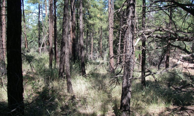
Ponderosa pine canopy cover is 70-75%. On a best condition site, in terms of herbaceous production, herbaceous production is reduced to 500 lbs/ac due to the absence of fire and increase in tree cover. Perennial grass production is 250-300 lbs/ac. However, in most areas the perennial grass understory has been lost with this level of tree canopy cover. There are high amounts of ladder fuels that would likely result in a stand destroying fire with summer ignition.
State 5
High Cover Forest/ No Herbaceous Production State
Tree canopy cover is approximately 75%. Herbaceous production is absent or reduced to less than 25 lbs/ac.
Community 5.1
High Cover Forest/ No Herbaceous Production Community
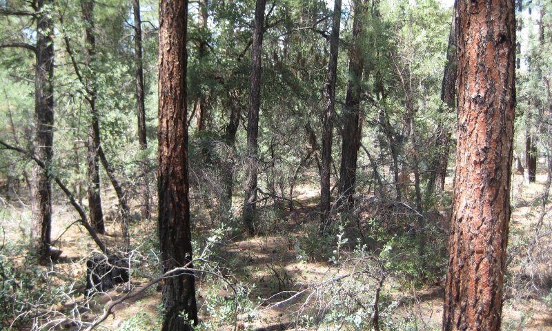
Ponderosa pine canopy cover is 70-75%. Herbaceous production is absent or reduced to less than 25 lbs/ac due to the absence of fire and increase in tree cover. There are high amounts of ladder fuels that would likely result in a stand destroying fire with summer ignition.
Transition T1a
State 1 to 2
Continuous high intensity livestock or wildlife herbivory reduces most perennial grass vigor to the point that blue grama being highly tolerant of heavy herbivory is the dominant grass species.
Transition T1b
State 1 to 3
The long term absence of fire either through aggressive fire suppression or heavy herbivory reducing fine fuel continuity allows juniper to germinate and grow to maturity. In most cases this occurs at the lowest elevations of the site where ponderosa pine forests are adjacent to alligator juniper savannas (Ecological Site number R038XC303AZ). However, where any seed dispersal mechanism is in place, this can occur throughout the sites elevation range. The invasion by juniper can become self perpetuating if fires are not allowed to burn the site and kill young individuals as is common for most woody species in mixed grass/woody plant communities adapted to periodic fire.
Transition T1c
State 1 to 4
The long term absence of fire either through aggressive fire suppression or heavy herbivory reducing fine fuel continuity allows ponderosa pine to germinate and grow to maturity. Historic fires regularly reduced this germination though direct mortality by consuming significant portions of above ground tissue. There is some research that suggests very high density and productive herbaceous understory plant communities out compete woody species seedlings, however frequent fire alone as documented in trees ring fire scars would have been sufficient to kill most regeneration. As seen in Figures 1 and 2 of Community 1.2. , herbaceous production and continuity is typically severely restricted near the base of very large diameter trees. As these trees died of old age this environment very likely could have provided favorable germination locations for replacement trees that would have a micro site where fire intensities would have been lower than adjacent areas with high fine fuel continuity.
Transition T2a
State 2 to 1
The long term exclusion of fire allows juniper to germinate and often times reach sexual maturity and develop 15-20% canopy cover.
Restoration pathway R2a
State 2 to 1
This restoration pathway is unknown. In blue grama dominated grasslands surrounding Springerville, AZ the competitive nature of blue grama sod is only broken and other species are allowed to establish where livestock pipelines have been ripped into the soil. Similar dynamics were observed in the Quemado, NM area. Ripping, where practical, between thinned stands & seeding may be the only potential restoration pathway.
Restoration pathway R3b
State 3 to 1
This restoration pathway has not been applied and is inferred based on overall vegetation structural similarities. The only vegetation difference is sideoats grama is still dominant in the plant community and is not negatively affected by fire. Fall application of prescribed fire to prevent fire from spreading into upper ponderosa pine canopies.
Restoration pathway R3a
State 3 to 2
The application of prescribed fire in the fall where juniper trees have approached 15-20 feet in height and are near the lower canopy of younger ponderosa pine trees reduces the ability of fire to spread into the upper forest canopy. Blue grama is the dominant herbaceous species and maintains its dominance following application of fire.
Transition T3a
State 3 to 5
The long term exclusion of fire allows juniper and ponderosa pine to germinate and often times reach sexual maturity. Juniper canopy cover approaches 15-20% and ponderosa pine canopy approaches 75+%. This level of shading and likely competition reduces herbaceous production of most areas to less than 25 lbs/ac.
Restoration pathway R4a
State 4 to 3
Application of forest stand improvement followed by the incremental removal of pine leaf litter or duff by burning when trees are dormant (late fall) and when deeper layers of duff are moist significantly reduces the chance that fine roots will be destroyed in southwestern ponderosa pine forests (Egan 2011). This is best accomplished by several burns over a period of a decade; the first 1-2 burns spaced 4 years apart (Egan 2011).
Transition T4a
State 4 to 5
Continued dominance of ponderosa pine reduces the ability of the herbaceous understory to persist.
Restoration pathway R5b
State 5 to 3
Application of forest stand improvement (forest thinning) followed by the incremental removal of pine leaf litter or duff by burning when trees are dormant (late fall) and when deeper layers of duff are moist significantly reduces the chance that fine roots will be destroyed in southwestern ponderosa pine forests (Egan 2011). This is best accomplished by several burns over a period of a decade; the first 1-2 burns spaced 4 years apart (Egan 2011). Top killing of alligator juniper without the application of stump herbicide may allow it to persist in the community if fire is not effective at killing it. Seeding after O horizon or mineral soil is exposed is required to reestablish the herbaceous understory vegetation.
Restoration pathway R5a
State 5 to 4
Application of forest stand improvement (forest thinning) followed by the incremental removal of pine leaf litter or duff by burning when trees are dormant (late fall) and when deeper layers of duff are moist significantly reduces the chance that fine roots will be destroyed in southwestern ponderosa pine forests (Egan 2011). This is best accomplished by several burns over a period of a decade; the first 1-2 burns spaced 4 years apart (Egan 2011). The application of stump herbicide to cut juniper immediately after cutting will kill most plants. Rates of application should be obtained from herbicide manufacturers. Seeding after O horizon or mineral soil is exposed is required to reestablish the herbaceous understory vegetation.
Additional community tables
Table 8. Community 1.1 plant community composition
| Group | Common name | Symbol | Scientific name | Annual production (lb/acre) | Foliar cover (%) | |
|---|---|---|---|---|---|---|
|
Grass/Grasslike
|
||||||
| 1 | dominant warm season grasses | 300–450 | ||||
| sideoats grama | BOCU | Bouteloua curtipendula | 200–400 | – | ||
| blue grama | BOGR2 | Bouteloua gracilis | 100–300 | – | ||
| 2 | dominant cool season grasses | 250–500 | ||||
| western wheatgrass | PASM | Pascopyrum smithii | 50–300 | – | ||
| squirreltail | ELEL5 | Elymus elymoides | 10–200 | – | ||
| prairie Junegrass | KOMA | Koeleria macrantha | 50–200 | – | ||
| muttongrass | POFE | Poa fendleriana | 30–50 | – | ||
| 3 | Miscellaneous perennial grasses | 0–10 | ||||
| Arizona threeawn | ARAR6 | Aristida arizonica | 0–1 | – | ||
| Fendler's threeawn | ARPUF | Aristida purpurea var. fendleriana | 0–1 | – | ||
| spidergrass | ARTET | Aristida ternipes var. ternipes | 0–1 | – | ||
| pine dropseed | BLTR | Blepharoneuron tricholepis | 0–1 | – | ||
| nodding brome | BRAN | Bromus anomalus | 0–1 | – | ||
| common wolfstail | LYPH | Lycurus phleoides | 0–1 | – | ||
| longtongue muhly | MULO | Muhlenbergia longiligula | 0–1 | – | ||
| little bluestem | SCSC | Schizachyrium scoparium | 0–1 | – | ||
| 4 | Annual Grasses | 10–50 | ||||
| pullup muhly | MUFI2 | Muhlenbergia filiformis | 10–50 | – | ||
|
Forb
|
||||||
| 5 | Perennial Forbs | 60–175 | ||||
| Wright's goldenrod | SOWR | Solidago wrightii | 0–140 | – | ||
| Cooley's bundleflower | DECO2 | Desmanthus cooleyi | 5–50 | – | ||
| weakleaf bur ragweed | AMCO3 | Ambrosia confertiflora | 5–25 | – | ||
| redroot buckwheat | ERRA3 | Eriogonum racemosum | 1–15 | – | ||
| silver dwarf morning-glory | EVSE | Evolvulus sericeus | 1–2 | – | ||
| pineywoods geranium | GECAC3 | Geranium caespitosum var. caespitosum | 0–2 | – | ||
| white sagebrush | ARLU | Artemisia ludoviciana | 0–2 | – | ||
| winged buckwheat | ERAL4 | Eriogonum alatum | 0–2 | – | ||
| dwarf stickpea | CAHU | Calliandra humilis | 0–1 | – | ||
| rose heath | CHER2 | Chaetopappa ericoides | 0–1 | – | ||
| Arizona thistle | CIAR3 | Cirsium arizonicum | 0–1 | – | ||
| prairie clover | DALEA | Dalea | 0–1 | – | ||
| pussytoes | ANTEN | Antennaria | 0–1 | – | ||
| Carruth's sagewort | ARCA14 | Artemisia carruthii | 0–1 | – | ||
| Torrey's craglily | ECFL | Echeandia flavescens | 0–1 | – | ||
| aromatic false pennyroyal | HEHY | Hedeoma hyssopifolia | 0–1 | – | ||
| pingue rubberweed | HYRI | Hymenoxys richardsonii | 0–1 | – | ||
| Wright's deervetch | LOWR | Lotus wrightii | 0–1 | – | ||
| New Mexico groundsel | PANEN | Packera neomexicana var. neomexicana | 0–1 | – | ||
| toadflax penstemon | PELI2 | Penstemon linarioides | 0–1 | – | ||
| Pinos Altos Mountain bean | PHPA7 | Phaseolus parvulus | 0–1 | – | ||
| Fendler's globemallow | SPFE | Sphaeralcea fendleri | 0–1 | – | ||
| 6 | Annual Forbs | 0–10 | ||||
| longleaf false goldeneye | HELOA2 | Heliomeris longifolia var. annua | 0–50 | – | ||
| spreading fleabane | ERDI4 | Erigeron divergens | 1–20 | – | ||
| Wright's bird's beak | COWR2 | Cordylanthus wrightii | 0–2 | – | ||
| owl's-clover | ORTHO | Orthocarpus | 0–2 | – | ||
| sawtooth sage | SASU7 | Salvia subincisa | 0–1 | – | ||
| American bird's-foot trefoil | LOUNU | Lotus unifoliolatus var. unifoliolatus | 0–1 | – | ||
| mountain tansymustard | DEINI | Descurainia incana ssp. incana | 0–1 | – | ||
| ragleaf bahia | BADI | Bahia dissecta | 0–1 | – | ||
| trailing fleabane | ERFL | Erigeron flagellaris | 0–1 | – | ||
| buckwheat | ERIOG | Eriogonum | 0–1 | – | ||
| common sunflower | HEAN3 | Helianthus annuus | 0–1 | – | ||
|
Shrub/Vine
|
||||||
| 7 | Miscellaneous shrubs | 0–20 | ||||
| Fendler's ceanothus | CEFE | Ceanothus fendleri | 0–10 | – | ||
| gray oak | QUGR3 | Quercus grisea | 0–5 | – | ||
| skunkbush sumac | RHTR | Rhus trilobata | 0–1 | – | ||
| wax currant | RICE | Ribes cereum | 0–1 | – | ||
| bastardsage | ERWR | Eriogonum wrightii | 0–1 | – | ||
| broom snakeweed | GUSA2 | Gutierrezia sarothrae | 0–1 | – | ||
|
Tree
|
||||||
| 8 | Tree | 5–20 | ||||
| ponderosa pine | PIPO | Pinus ponderosa | 5–10 | 15–55 | ||
| gray oak | QUGR3 | Quercus grisea | 0–10 | 2–5 | ||
| alligator juniper | JUDE2 | Juniperus deppeana | 0–10 | 0–1 | ||
| Rocky Mountain juniper | JUSC2 | Juniperus scopulorum | 0–1 | 0–1 | ||
| twoneedle pinyon | PIED | Pinus edulis | 0–1 | 0–1 | ||
Interpretations
Animal community
In some years this site is suitable for grazing year round, however many years have high snowfall that can limit livestock use. Slopes greater than 30% and areas with very cobbly surfaces limit grazing use by cattle. Areas of rock outcrop and rock slides form barriers to livestock movement.
Drainages with high amounts of exposed rock outcrop can hold substantial water in summer time and allow livestock to forage in substantial areas away from constructed water developments. However, in drought years water development is very important. The site is susceptible to erosion in overgrazed areas like bed-grounds, livestock trails and lower slopes adjacent to water.
The site has good habitat diversity for a great variety of mountain wildlife species. It is a foraging area for elk.
Hydrological functions
When the soils are dry this site produces little runoff. It produces significant runoff only when heavy rain falls on snow or moist soils.
Recreational uses
Hunting, camping, horseback riding, backpacking, rock hounding, photography.
Wood products
Saw timber is produced on moderately deep to deep soils and at higher elevations. Limited harvest of fuel-wood, fence posts and stays from juniper and oak species.
Non federal timber producers in this Land Resource Unit have a target basal area of 40 square feet per acre in thinning efforts. Ponderosa pine is typically not managed for even age production in wildland settings, however, at 40 square feet /acre the following are the approximate number of stems per acre for a given average tree diameter (DBH):
Average tree size (DBH) : Stems/Ac
6" DBH : 204 stems/ac
8" DBH : 117 stems/ac
10" DBH : 73 stems/ac
12" DBH : 51 stems/ac
14" DBH : 9 stems/ac
Table 9. Representative site productivity
| Common name | Symbol | Site index low | Site index high | CMAI low | CMAI high | Age of CMAI | Site index curve code | Site index curve basis | Citation |
|---|---|---|---|---|---|---|---|---|---|
| ponderosa pine | PIPO | 50 | 80 | 38 | 69 | – | – | – |
Supporting information
Type locality
| Location 1: Graham County, AZ | |
|---|---|
| Township/Range/Section | T1S R24E S12 |
| General legal description | Dedal soil location: 1,525 feet north and 1,845 feet west of southeast corner of Section 12, Township 1 S, Range 24 E |
Other references
Dick-Peddie, William A. 1993. New Mexico Vegetation: Past, Present, and Future. University of New Mexico Press.
Egan, Dave. 2011. Protecting Old Trees from Prescribed Burning. Working Paper No. 24. Ecological Restoration Institute. Northern Arizona University. Flagstaff, Arizona.
Kaib, Mark. 2001. Fire history in Mogollon province ponderosa pine forests of San Carlos Apache Tribe. Laboratory of Tree Ring Research, The University of Arizona. Tucson, AZ.
Kearney, Thomas H. and Robert H. Peebles. 1960. Arizona Flora. Univerity of California Press. Berkley and Los Angeles California.
Moir, William H., B. Geils, M.A. Benoit, and D. Scurlock. 1997. Ecology of Southwestern Ponderosa Pine Forests. Pages 3-27 in Block, William M. and D.M. Finch, tech. ed. Songbird ecology in southwestern ponderosa pine forests: a literature review. Gen Tech. Rep. RM-GTR-292. Fort Collins, CO. U.S. Dept. of Agriculture, Forest Service, Rocky Mountain Forest and Range Experiment Station. 152p.
Schussman, H. and E. Smith. 2006. Historic Range of Variation and State and Transition Modeling of Historic and Current Landscape Conditions for Potential Natural Vegetation Types of the Southwest. The Nature Conservancy. Southwest Forest Assessment Project.
USDA NRCS. 2003. National Range and Pasture Handbook, Chapter 3. United States Department of Agriculture Natural Resources Conservation Service.
USFS. 1997. Plant Associations of Arizona and New Mexico, edition 3. Volume 1: Forests. United States Department of Agriculture Forest Service, Southwest Region. 291 p.
Vines, Robert A. 1960. Trees, Shrubs, and Woody Vines of the Southwest. University of Texas Press, Austin and London. 1103 p.
Contributors
Dave Womack
Larry D. Ellicott
Approval
Scott Woodall, 5/07/2020
Rangeland health reference sheet
Interpreting Indicators of Rangeland Health is a qualitative assessment protocol used to determine ecosystem condition based on benchmark characteristics described in the Reference Sheet. A suite of 17 (or more) indicators are typically considered in an assessment. The ecological site(s) representative of an assessment location must be known prior to applying the protocol and must be verified based on soils and climate. Current plant community cannot be used to identify the ecological site.
| Author(s)/participant(s) | |
|---|---|
| Contact for lead author | |
| Date | 09/10/2022 |
| Approved by | Scott Woodall |
| Approval date | |
| Composition (Indicators 10 and 12) based on | Annual Production |
Indicators
-
Number and extent of rills:
-
Presence of water flow patterns:
-
Number and height of erosional pedestals or terracettes:
-
Bare ground from Ecological Site Description or other studies (rock, litter, lichen, moss, plant canopy are not bare ground):
-
Number of gullies and erosion associated with gullies:
-
Extent of wind scoured, blowouts and/or depositional areas:
-
Amount of litter movement (describe size and distance expected to travel):
-
Soil surface (top few mm) resistance to erosion (stability values are averages - most sites will show a range of values):
-
Soil surface structure and SOM content (include type of structure and A-horizon color and thickness):
-
Effect of community phase composition (relative proportion of different functional groups) and spatial distribution on infiltration and runoff:
-
Presence and thickness of compaction layer (usually none; describe soil profile features which may be mistaken for compaction on this site):
-
Functional/Structural Groups (list in order of descending dominance by above-ground annual-production or live foliar cover using symbols: >>, >, = to indicate much greater than, greater than, and equal to):
Dominant:
Sub-dominant:
Other:
Additional:
-
Amount of plant mortality and decadence (include which functional groups are expected to show mortality or decadence):
-
Average percent litter cover (%) and depth ( in):
-
Expected annual annual-production (this is TOTAL above-ground annual-production, not just forage annual-production):
-
Potential invasive (including noxious) species (native and non-native). List species which BOTH characterize degraded states and have the potential to become a dominant or co-dominant species on the ecological site if their future establishment and growth is not actively controlled by management interventions. Species that become dominant for only one to several years (e.g., short-term response to drought or wildfire) are not invasive plants. Note that unlike other indicators, we are describing what is NOT expected in the reference state for the ecological site:
-
Perennial plant reproductive capability:
Print Options
Sections
Font
Other
The Ecosystem Dynamics Interpretive Tool is an information system framework developed by the USDA-ARS Jornada Experimental Range, USDA Natural Resources Conservation Service, and New Mexico State University.
Click on box and path labels to scroll to the respective text.