

Natural Resources
Conservation Service
Ecological site R038XB204AZ
Granitic Hills 16-20" p.z.
Accessed: 01/16/2026
General information
Provisional. A provisional ecological site description has undergone quality control and quality assurance review. It contains a working state and transition model and enough information to identify the ecological site.
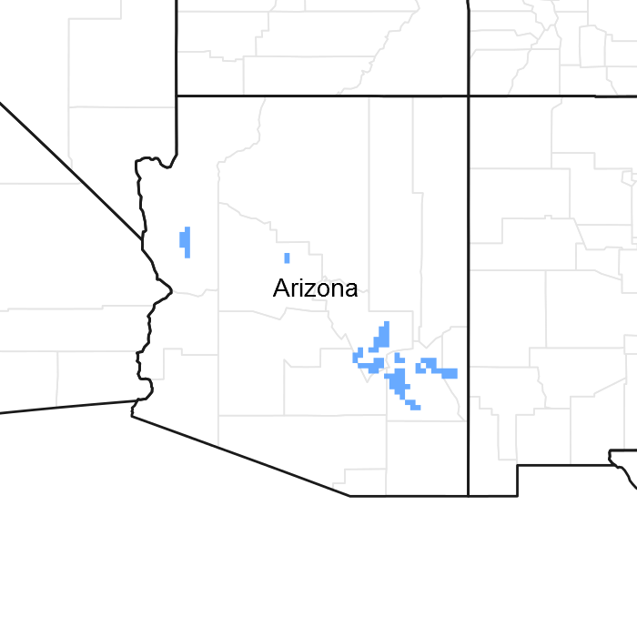
Figure 1. Mapped extent
Areas shown in blue indicate the maximum mapped extent of this ecological site. Other ecological sites likely occur within the highlighted areas. It is also possible for this ecological site to occur outside of highlighted areas if detailed soil survey has not been completed or recently updated.
MLRA notes
Major Land Resource Area (MLRA): 038X–Mogollon Transition South
AZ 38.2 - Middle Mogollon Transition
Elevations range from 4000 to 5500 feet and precipitation averages 16 to 20 inches per year. Vegetation includes turbinella oak, Wright silktassel, hollyleaf buckthorn, desert buckbrush, one-seed juniper, alligator juniper, pinyon, algerita, sugar sumac, prairie junegrass, blue grama, curly mesquite, bottlebrush squirreltail, muttongrass, cane beardgrass, plains lovegrass and bullgrass. The soil temperature regime ranges from thermic to mesic and the soil moisture regime is aridic ustic. This unit occurs within the Transition Zone Physiographic Province and is characterized by canyons and structural troughs or valleys. Igneous, metamorphic and sedimentary rock classes occur on rough mountainous terrain in association with less extensive sediment filled valleys exhibiting little integrated drainage.
Associated sites
| R038XA104AZ |
Granitic Hills 12-16" p.z. Granitic Hills 12-16" p.z. |
|---|---|
| R038XB215AZ |
Clayey Hills 16-20" p.z. Clayey Hills 16-20" p.z. |
Similar sites
| R038XB215AZ |
Clayey Hills 16-20" p.z. Clayey Hills 16-20" p.z. North aspect has high canopy cover of shrubs but a very high component of herbaceous production on both aspects |
|---|
Table 1. Dominant plant species
| Tree |
Not specified |
|---|---|
| Shrub |
(1) Quercus turbinella |
| Herbaceous |
Not specified |
Physiographic features
This site occurs in the mid to upper elevations of the Mogollon Transition zone south of the Mogollon Rim in central Arizona. It occurs on rugged mountain slopes, ridge-tops and mesa sides.
Table 2. Representative physiographic features
| Landforms |
(1)
Hill
(2) Mountain slope (3) Ridge |
|---|---|
| Flooding frequency | None |
| Elevation | 1,341 – 1,707 m |
| Slope | 15 – 70% |
| Aspect | N, E, W |
Climatic features
Precipitation in this common resource area averages 16 to 20 inches annually. The winter-summer rainfall ratio ranges from about 60/40% in the western part of the area to 45/55% in the eastern part. Summer rains fall July through September; and are from high-intensity, convective, thunderstorms. This moisture originates primarily from the Gulf of Mexico, but can come from the remnants of Pacific hurricanes in September. Winter moisture is frontal, originates in the north Pacific, and falls as rain or snow in widespread storms of low intensity and long duration. Snowfall ranges from 5 to 35 inches per year and can occur from November through April. Snow seldom persists for more than a week. May and June are the driest months of the year. Humidity is moderate to low all year. Average annual air temperatures range from 51 to 60 degrees F (thermic temperature regime). Daytime temperatures in the summer are commonly in the low 90’s. Freezing temperatures are common from October through April. The actual precipitation, available moisture and temperature vary, depending on, region, elevation, rain shadow effect and aspect.
Table 3. Representative climatic features
| Frost-free period (average) | 180 days |
|---|---|
| Freeze-free period (average) | 240 days |
| Precipitation total (average) | 508 mm |
Figure 2. Monthly precipitation range
Figure 3. Monthly average minimum and maximum temperature
Influencing water features
There are no water features associated with this site.
Soil features
Granite is the dominant parent material for the ecological site in this Common Resource Area. These are shallow soils (10-20") formed on acid igneous parent material (granite) and its extrusive counterpart, rhyolite. Soils are also formed over arkose, schist, gneiss, and diabase. Bedrock is usually slightly weathered into grus material at the soil juncture. They are non-calcareous, coarse textured, and have well developed covers of gravels and cobbles. Rock and gravel covers are light colored. Numerous areas of rock outcrop occur intermingled with soil areas. Outcrops can be as high as 25% of the area. Plant-soil moisture relationships are fair on soils over slightly weathered parent material to good on highly weathered parent material. While soil development may be minimal in shallow soils, granites in California chaparral can be weathered to 30 feet deep with roots of shrubs to at least this depth. Water holding capacity of these parent materials ranged from 0.1 to 0.8 inch per foot of material depending on degree of weathering (Graham and Jones 1992). Soil erosion hazard is slight due to a very high density of shrubs and gravel, cobble and rock covers.
The soils mapped on this site include: SSA627 Southern Mohave County MU 42 Far, SSA663 Gila-Duncan Area MU 35 Mokiak & SSA675 San Carlos IR Area MU's 42 haplastalfs, 51 & 90 Nugget, 89 & 90 Turquoise, 89 Coppercan and 97 Budlamp and Woodcutter.
Table 4. Representative soil features
| Surface texture |
(1) Very gravelly sandy loam (2) Gravelly sandy loam (3) Very cobbly sandy loam |
|---|---|
| Family particle size |
(1) Loamy |
| Drainage class | Well drained |
| Permeability class | Moderately rapid to moderate |
| Soil depth | 13 – 51 cm |
| Surface fragment cover <=3" | 30 – 60% |
| Surface fragment cover >3" | 5 – 25% |
| Available water capacity (0-101.6cm) |
1.52 – 6.1 cm |
| Calcium carbonate equivalent (0-101.6cm) |
0 – 5% |
| Electrical conductivity (0-101.6cm) |
0 – 2 mmhos/cm |
| Sodium adsorption ratio (0-101.6cm) |
0 – 2 |
| Soil reaction (1:1 water) (0-101.6cm) |
7.4 – 8 |
| Subsurface fragment volume <=3" (Depth not specified) |
35 – 65% |
| Subsurface fragment volume >3" (Depth not specified) |
0 – 20% |
Ecological dynamics
The Chaparral State is the Reference Plant Community. Turbinella oak is the dominant shrub species over much of this MLRA. Manzanita is the next most common species. Turbinella oak is a vigorous root sprouting species after most fires. Manzanita germinates readily following fire (USFS Fire Effects Information System) and can become the dominant species in isolated patches. Wildfire is a natural component in this plant community but return intervals are relatively long. Estimates of fire return intervals are from 50-100 years (Pase, Charles P.; Lindenmuth, A. W., Jr. 1971, USFS Fire Effects Information System). Pinyon and juniper can occupy areas of this site throughout its elevation range. Pinyon pine 20-30 feet tall can occur at canopy levels of 10-20% throughout the entire elevation range of this site. This species is fire sensitive and will only occur in areas that have not burned in substantial lengths of time.
Perennial grasses and forbs are a minor component in the reference plant community. However, in some locations following fire perennial and annual species increase for a period of 10-20 years until sprouting shrub species regain their dominance in the plant community. The plant community may need up to 20 years before it can burn again (USFS Fire Effects Information System).
Slope is site differentiating at elevations near the Land Resource Unit (LRU) boundaries. Warmer aspects at the lower elevations appear like LRU 38-1 plant communities. Cooler aspects at the upper elevations develop fair covers of ponderosa pine, Arizona cypress and alligator juniper.
State and transition model
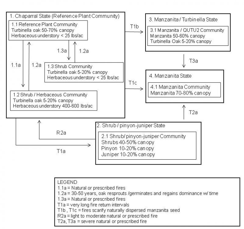
More interactive model formats are also available.
View Interactive Models
More interactive model formats are also available.
View Interactive Models
Click on state and transition labels to scroll to the respective text
State 1 submodel, plant communities
State 2 submodel, plant communities
State 3 submodel, plant communities
State 4 submodel, plant communities
State 1
Chaparral State
Three dominant plant communities cycle in this state with fire being the main driver between communities. Turbinella oak is the dominant shrub and the Reference Plant Community is the dominant community in most of Land Resource Unit 38-2. Wildfire is a natural component in this plant community but return intervals are relatively long. Estimates of fire return intervals are from 50-100 years (Pase, Charles P.; Lindenmuth, A. W., Jr. 1971, USFS Fire Effects Information System). Shortly after fire burns the Reference Community a Shrub / Herbaceous Community can develop with a mixture of perennial and annual herbaceous species. This community is short lived and within 20 years shrubs return as the dominant in canopy cover. This community has been observed on the Bar F Bar Ranch south of Globe, AZ near the transition with LRU 38-1 where perennial grass potential is higher. This community should be able to occur at the transition between this site and LRU 38-3 where perennial grass potential is also high. In the mid elevations of the LRU, this site may not have the potential to produce an herbaceous response after fire burns the community, due to the lack of proximity to a herbaceous seed source. This community has been observed on the MF Ranch south of the Pinto Valley Mine in Gila County.
Community 1.1
Reference Plant Community

Figure 4. 1.1 Reference Plant Community
The Reference Plant Community is chaparral dominated by evergreen shrubs. Turbinella oak is the dominant shrub species over much of this MLRA. Manzanita, mountain mahogany, sugar sumac, shunkbush sumac, Wright silktassel, redberry buckthorn, desert buckbrush and banana yucca are the next most common species with no clear soil related pattern to their abundance. Desert buckbrush has experienced very high mortality on the site; as much as 90% canopy mortality has occurred. Emory oak tends to occur where veins of metamorphic rock like quartzite and schist occur within granite. Wait a bit bush is also a vigorous resprouting species. Some areas can see significant increases in this species after burning. Based on research in Arizona chaparral plant communities, Pase and Granfelt (1977) suggest frequent burning before manzanita becomes sexually mature as a strategy to maintain low amounts of the species. However, they acknowledge in the absence of fine fuels in the true chaparral communities it is difficult or impossible for the communities to support frequent fire due to the slow rate the woody species accumulate litter, dead stems, and other woody fuels needed to carry fire. This slow rate of woody fuel accumulation to support fire is likely the logic behind the suggestion of 50-100 year fire return intervals. A majority of Charlie Pase's research was conducted in the elevational zone where shrubs are the naturally dominant plants and where Lehmann lovegrass was seeded as the herbaceous plant supporting fires. This is in contrast to the naturally occurring mixed grass/shrub communities found in LRU 38-1 where herbaceous production is a normal occurrence capable of supporting more frequent fire return intervals. The exact mechanisms of the development of Arizona chaparral have not been elucidated or specified. However, given the historic name the expected community is chaparral. Deeply weathered granites likely being able to hold 0.1 to 0.8 inch of water per foot of parent material depending on degree of weathering as Graham and Jones (1992) found in California chaparral gives this ecological site a predisposition to supporting species like shrubs that have the ability to extract deep moisture. Highly weathered parent material and typically shallow soil has a tendency to favor shrubs versus herbaceous species over time. As such, areas that have not burned in this plant community in 50-100 years have a trace amount of herbaceous species in the plant community. Perennial grasses and forbs are a minor component in the reference plant community. However, in some locations following fire perennial and annual species increase for a period of 10-20 years until sprouting shrub species regain their dominance in the plant community. The plant community may need up to 20 years before it can burn again (USFS Fire Effects Information System) but likely 50-80 years before enough dry woody material can accumulate to create the high intensity burns that characterize fires in this LRU. Production of shrubs and trees is difficult to determine with high levels of accuracy. The following production values were determined using belt transects, USDA NRCS Range Technical Note No. 52 - Arizona and the following weight units where no production data were available: Arctostaphylos pungens = 921 grams per 4’ x 4’ x 4’ volume; Ceanothus greggii = 92 grams per 16” x 16” x 16” volume; Garrya wrightii = 69 grams per 16” x 16” x 16” volume; Rhamnus crocea = 31 grams per 10" x 10” x 10” volume; Rhus ovata = 57 grams per 16” x 16” x 16” volume; Cercocarpus montanus = 62 grams per 18” x 18” x 18” volume.
Figure 5. Annual production by plant type (representative values) or group (midpoint values)
Table 5. Annual production by plant type
| Plant type | Low (kg/hectare) |
Representative value (kg/hectare) |
High (kg/hectare) |
|---|---|---|---|
| Shrub/Vine | 813 | 1289 | 1771 |
| Tree | 90 | 168 | 226 |
| Grass/Grasslike | – | 6 | 28 |
| Forb | – | 6 | 22 |
| Total | 903 | 1469 | 2047 |
Table 6. Ground cover
| Tree foliar cover | 5-15% |
|---|---|
| Shrub/vine/liana foliar cover | 50-80% |
| Grass/grasslike foliar cover | 0-1% |
| Forb foliar cover | 0-1% |
| Non-vascular plants | 0% |
| Biological crusts | 0% |
| Litter | 30-40% |
| Surface fragments >0.25" and <=3" | 50-60% |
| Surface fragments >3" | 5-25% |
| Bedrock | 0% |
| Water | 0% |
| Bare ground | 5-10% |
Table 7. Canopy structure (% cover)
| Height Above Ground (m) | Tree | Shrub/Vine | Grass/ Grasslike |
Forb |
|---|---|---|---|---|
| <0.15 | – | – | – | – |
| >0.15 <= 0.3 | – | – | – | 0-1% |
| >0.3 <= 0.6 | – | – | 0-1% | 0-1% |
| >0.6 <= 1.4 | – | 15-25% | – | – |
| >1.4 <= 4 | – | 50-60% | – | – |
| >4 <= 12 | 5-15% | – | – | – |
| >12 <= 24 | – | – | – | – |
| >24 <= 37 | – | – | – | – |
| >37 | – | – | – | – |
Community 1.2
Shrub / Herbaceous Community
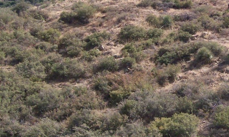
Figure 6. 1.2 Shrub / Herbaceous Community
10-15 years have passed since last fire. Sprouting shrubs like turbinella oak have regained their dominance. One year old turbinella oak seedlings are very fire resistant; 48% are able to survive a high intensity fire and 91% are able to survive a low intensity fire (Pase 1965) and where present contribute to recovery of the chaparral aspect of the site.
Community 1.3
Burned Shrub Community
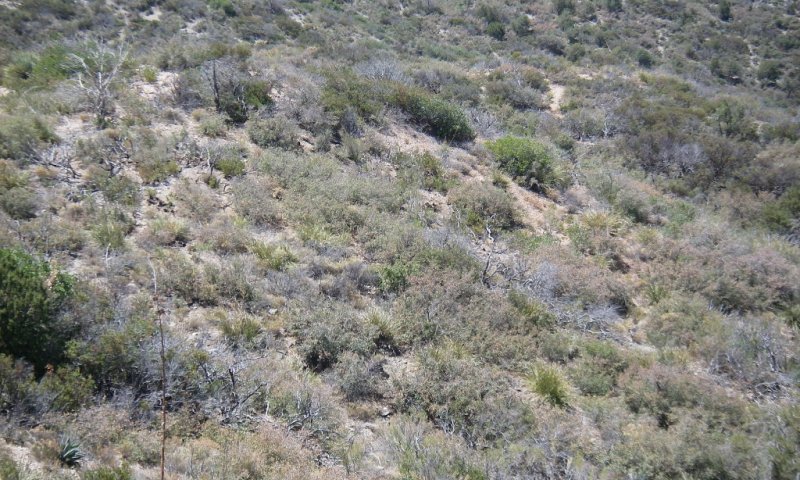
Figure 7. 1.3 Burned Shrub Community
This plant community occurs after natural or prescribed fire burns the mid elevations of the LRU where there is an absence of a perennial grass seed source. There is minimal to no herbaceous response following fires. This is contrasted with the Shrub / Herbaceous Community that has been observed near the transition with LRU 38-1 where mixed grass/shrub plant communities are the Reference Plant Communities of many ecological sites.
Pathway 1.1a
Community 1.1 to 1.2


Low to moderate intensity natural or prescribed fire reduces shrub cover for 10-20 year period. Perennial and annual grass and forb species increase in abundance during this period. After 10-15 years these herbaceous species are reduced to approximately 400-600 lbs/acre. Shrubs have regained their dominance with turbinella oak as the dominant shrub.
Pathway 1.3a
Community 1.1 to 1.3


Low to moderate intensity natural or prescribed fire reduces shrub cover for 10-20 year period. There is little to no herbaceous species response in the interspaces of burned shrubs. After 10-15 years these shrubs have regained their dominance with turbinella oak as the dominant shrub.
Pathway 1.2a
Community 1.2 to 1.1


20+ years have passed since fire has burned the site. Turbinella oak has resprouted and in combination with other shrubs eventually cover 70-90% of the site. As shrub canopy increases herbaceous species gradually decrease to less than 25 lbs per acre.
State 2
Shrub / Pinyon-Juniper State
Pinyon and juniper establish and persist in absence of fire.
Community 2.1
Shrub / pinyon-juniper community
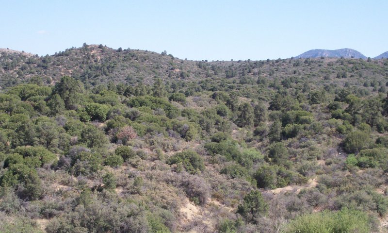
Figure 8. 2.1 Shrub / pinyon-juniper Community
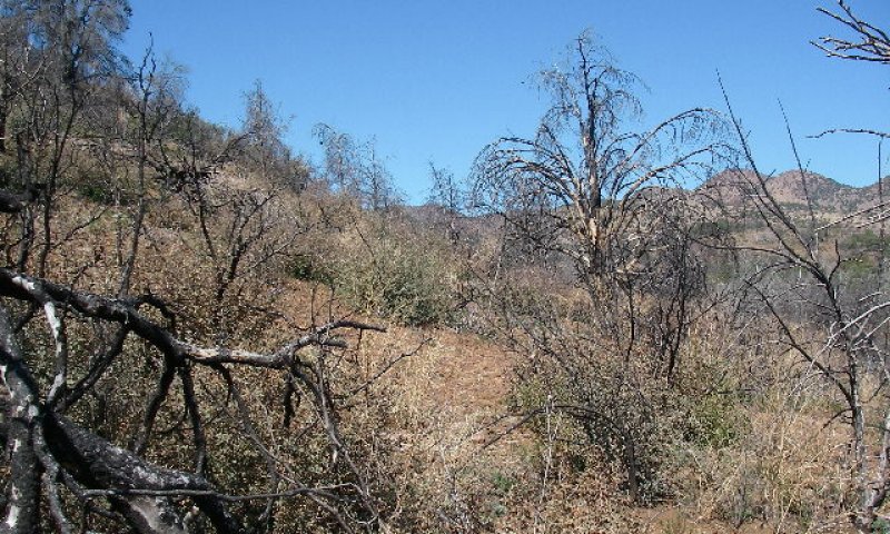
Figure 9. Pinyon burn. QUTU2 at 15% cover, 2 yrs postburn
The pinyon and juniper community can occupy areas of this site throughout the ecological sites elevation range. Pinyon pine 20-30 feet tall can occur at canopy levels of 10-20% on this site. Alligator juniper occurs in trace amounts at the lower elevations and increases in abundance at the upper elevations of the site. The dominant juniper species is one seed or red berry juniper. Since these species are fire sensitive this only occurs in areas that have not burned in substantial lengths of time. Pinyon trees 200 years old have been observed on the site based on tree core data (D. Robinett, personal communication).
State 3
Manzanita / Turbinella State
Manzanita is the dominant shrub, turbinella oak has less than 20% canopy.
Community 3.1
Manzanita / turbinella oak Community
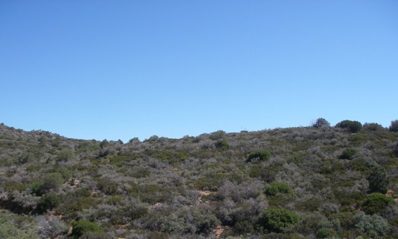
Figure 10. 3.1 Manzanita / turbinella oak Community
Naturally dispersed manzanita seed is scarified by fires (USFS Fire Effects Information System) and becomes the dominant plant in patches of the site. Moderate fire intensities kill a moderate level of turbinella oak and it regenerates to less than 20% canopy cover (A. Medina, personal communication). Low to moderate fire intensities when the site burns again allow turbinella oak to maintain itself in the community. Perennial grasses and forbs are a minor component in the mature plant community. However, immediately following fire at the lower elevations of the site perennial and annual species increase for a period of 10-20 years until shrub species regain their dominance in the plant community. Mid and upper elevations of the site may see no increase in herbaceous species unless they are in proximity to a seed source. The plant community may need up to 20 years before it can burn again (USFS Fire Effects Information System) but likely 50-80 years before enough dry woody material can accumulate to create the high intensity burns that characterize fires in this LRU.
State 4
Manzanita State
Manzanita dominates the site. Other shrubs only occur in trace amounts.
Community 4.1
Manzanita Community
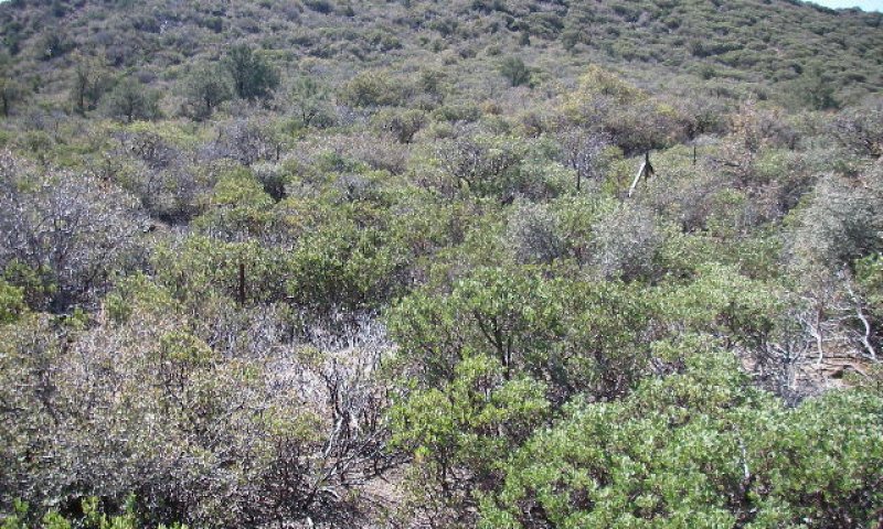
Figure 11. 4.1 Manzanita Community
Naturally dispersed manzanita seed is scarified by fires and becomes the dominant plant on the site. High intensity fire kills very high amounts or all turbinella oak and it becomes minor or absent from the community. This is likely a stable state with no restoration pathway (A. Medina, personal communication) in most instances. A restoration pathway may exist on small scales on private land. Areas of the Pinal Mountains in Gila County that were dominated by manzanita and experimentally treated with herbicide in the 1960’s and 1970’s are now dominated by oak and other species (Andy Casillas, personal communication). This is possible due to the absence of fire scarifying the seed of manzanita and other species germinating in the absence of fire on the site. This would not likely be possible on large scales on federally administered lands due to the aversion to apply herbicides on federal lands where this plant community occurs.
Transition T1a
State 1 to 2
Pinyon pine and juniper germinate and persist on the site in the absence of fire.
Transition T1c
State 1 to 3
Severe fire intensity kills high levels of turbinella oak and scarify abundant manzanita seed on site so manzanita becomes the dominant or only shrub on site.
Transition T1b
State 1 to 3
The exact mechanism is poorly understood. Turbinella oak regenerates to less than 20% canopy cover and abundant manzanita seed on the site is scarified and it becomes the dominant shrub. The maintenance of turbinella oak in the community is likely only possible from low to moderate fire intensities not completely root killing the species as occurs in Transition 1c.
Restoration pathway R2a
State 2 to 1
This is not necessarily a desirable restoration pathway due to human use of pinyon nuts but can be achieved through lower intensity wildfires or the application of lower intensity prescribed fire. Examples of this pathway are seen south of 7 Mile Wash along Hwy 60 where an auto catalytic converter ignited herbaceous fuels that spread to an adjacent hillside with 20-30% canopy of pinyon. Turbinella oak has persisted on the site and has resprouted vigorously.
Transition T2a
State 2 to 4
Severe fire intensity kills high amounts of turbinella oak and scarifies abundant manzanita seed and manzanita becomes the dominant or only shrub on the site.
Transition T3a
State 3 to 4
High intensity fire kills high amounts of turbinella oak and scarify abundant manzanita seed and manzanita becomes the dominant or only shrub on site.
Additional community tables
Table 8. Community 1.1 plant community composition
| Group | Common name | Symbol | Scientific name | Annual production (kg/hectare) | Foliar cover (%) | |
|---|---|---|---|---|---|---|
|
Shrub/Vine
|
||||||
| 1 | Dominant Shrub | 476–729 | ||||
| Sonoran scrub oak | QUTU2 | Quercus turbinella | 476–729 | 38–79 | ||
| 2 | Other Shrubs | 179–785 | ||||
| pointleaf manzanita | ARPU5 | Arctostaphylos pungens | 6–269 | 2–25 | ||
| redberry buckthorn | RHCR | Rhamnus crocea | 56–157 | 1–10 | ||
| Wright's silktassel | GAWR3 | Garrya wrightii | 22–101 | 5–10 | ||
| catclaw mimosa | MIACB | Mimosa aculeaticarpa var. biuncifera | 11–78 | 1–7 | ||
| skunkbush sumac | RHTR | Rhus trilobata | 22–50 | 1–15 | ||
| desert ceanothus | CEGR | Ceanothus greggii | 39–50 | 1–3 | ||
| sugar sumac | RHOV | Rhus ovata | 17–45 | 1–5 | ||
| alderleaf mountain mahogany | CEMO2 | Cercocarpus montanus | 6–34 | 2–6 | ||
| 4 | Succulents | 157–247 | ||||
| banana yucca | YUBA | Yucca baccata | 112–135 | 4–10 | ||
| sacahuista | NOMI | Nolina microcarpa | 45–112 | 4–10 | ||
| 5 | Trace Shrubs | 0–11 | ||||
| fairyduster | CAER | Calliandra eriophylla | 0–6 | 0–1 | ||
| bastardsage | ERWR | Eriogonum wrightii | 0–6 | 0–1 | ||
| broom snakeweed | GUSA2 | Gutierrezia sarothrae | 0–2 | 0–1 | ||
| Wright's deervetch | LOWR | Lotus wrightii | 0–1 | – | ||
| red barberry | MAHA4 | Mahonia haematocarpa | 0–1 | – | ||
| turpentine bush | ERLA12 | Ericameria laricifolia | 0–1 | – | ||
|
Tree
|
||||||
| 3 | Trees | 67–226 | ||||
| Emory oak | QUEM | Quercus emoryi | 67–146 | 5–15 | ||
| twoneedle pinyon | PIED | Pinus edulis | 0–34 | 0–2 | ||
| singleleaf pinyon | PIMO | Pinus monophylla | 0–34 | 0–2 | ||
| Arizona white oak | QUAR | Quercus arizonica | 0–17 | 0–9 | ||
| redberry juniper | JUCO11 | Juniperus coahuilensis | 0–11 | 0–1 | ||
| oneseed juniper | JUMO | Juniperus monosperma | 0–11 | 0–1 | ||
| alligator juniper | JUDE2 | Juniperus deppeana | 0–6 | 0–1 | ||
| gray oak | QUGR3 | Quercus grisea | 0–2 | 0–2 | ||
|
Grass/Grasslike
|
||||||
| 6 | Trace Grasses | 0–28 | ||||
| sideoats grama | BOCU | Bouteloua curtipendula | 0–6 | – | ||
| blue grama | BOGR2 | Bouteloua gracilis | 0–6 | – | ||
| plains lovegrass | ERIN | Eragrostis intermedia | 0–2 | – | ||
| green sprangletop | LEDU | Leptochloa dubia | 0–2 | – | ||
| bullgrass | MUEM | Muhlenbergia emersleyi | 0–1 | – | ||
| muttongrass | POFE | Poa fendleriana | 0–1 | – | ||
| curly-mesquite | HIBE | Hilaria belangeri | 0–1 | – | ||
| prairie Junegrass | KOMA | Koeleria macrantha | 0–1 | – | ||
| squirreltail | ELEL5 | Elymus elymoides | 0–1 | – | ||
| black grama | BOER4 | Bouteloua eriopoda | 0–1 | – | ||
| purple threeawn | ARPU9 | Aristida purpurea | 0–1 | – | ||
|
Forb
|
||||||
| 7 | Trace Perennial Forbs | 0–11 | ||||
| brownfoot | ACWR5 | Acourtia wrightii | 0–1 | – | ||
| white sagebrush | ARLU | Artemisia ludoviciana | 0–1 | – | ||
| perennial rockcress | ARPE2 | Arabis perennans | 0–1 | – | ||
| bluedicks | DICA14 | Dichelostemma capitatum | 0–1 | – | ||
| New Mexico groundsel | PANE7 | Packera neomexicana | 0–1 | – | ||
| desert penstemon | PEPS | Penstemon pseudospectabilis | 0–1 | – | ||
| desert globemallow | SPAM2 | Sphaeralcea ambigua | 0–1 | – | ||
| 8 | Trace Annual Forbs | 0–11 | ||||
| western tansymustard | DEPI | Descurainia pinnata | 0–1 | – | ||
Interpretations
Animal community
Due to the very dense nature of shrub cover this plant community has very light use by larger prey species of wildlife. Deer do occupy this site but their densities are not the same as adjacent more open habitats. Elk will come out of adjacent ponderosa pine and alligator juniper communities and use the site where mountain mahogany is abundant. Bear do occupy this site and take advantage of manzanita berries in season.
This site is suitable for grazing year round, but is not easily traversed by livestock due to the very high density of shrubs. Livestock grazing use is concentrated on south slopes, canyon bottoms and ridgetops. Very dense north slopes are little used. Slopes greater than 50% and areas with very cobbly surfaces limit grazing use by cattle. Areas of rock outcrop and rock slides form barriers to livestock movement. The site is not very susceptible to erosion due to its very high canopy of shrubs and the minimal impact livestock grazing has on these shrubs.
Hydrological functions
This site has very rough surfaces, due to a high cover of gravels, cobbles and stones, which act to hold water on the site. It produces little runoff from rainfall due to the high canopy cover of shrubs. It produces significant runoff only when heavy rain falls on snow or moist soils.
Recreational uses
Hunting, camping, horseback riding, backpacking, rock hounding, photography.
Wood products
Limited harvest of fuel-wood, fence posts and stays from pinyon, juniper and oak species.
Other products
There is some native harvest of food plants like; acorns, juniper berries, pinyon nuts, grass nuts, thistle, and mescal.
There is some harvest of beargrass and skunkbush sumac as fiber for basket making.
There is some harvest of pinyon pine, pitch for waterproofing baskets.
There is some harvest of herbaceous sage for a variety of uses.
Supporting information
Other references
Graham, Robert C. and Jones, David P. 1992. Water-holding characteristics of weathered granite rock. Final report submitted to USDA Forest Service, Angeles National Forest by Department of Soil & Environmental Sciences, University of California, Riverside.
Pase, C. P. And G. E. Granfelt. 1977. The use of fire on Arizona rangelands. Arizona Interagency Range Committee Publication No. 4, 15p. Fort Collins, CO: USDA Forest Service. Rocky Mtn. Forest & Range Experiment Station.
Pase, Charles P.; Lindenmuth, A. W., Jr. 1971. Effects of prescribed fire on vegetation and sediment in oak-mountain mahogany chaparral. Journal of Forestry. 69: 800-805.
Pase, Charles P. 1965. Shrub seedling regeneration after controlled burning and herbicidal treatment of dense pringle manzanita chaparral. Res. Note RM-56. Fort Collins, CO: U.S. Department of Agriculture, Forest Service, Rocky Mountain Forest and Range Experiment Station. 2 p.
USFS Fire Effects Information System available online at: http://www.fs.fed.us/database/feis/
Contributors
Dave Womack
Larry D. Ellicott
Rangeland health reference sheet
Interpreting Indicators of Rangeland Health is a qualitative assessment protocol used to determine ecosystem condition based on benchmark characteristics described in the Reference Sheet. A suite of 17 (or more) indicators are typically considered in an assessment. The ecological site(s) representative of an assessment location must be known prior to applying the protocol and must be verified based on soils and climate. Current plant community cannot be used to identify the ecological site.
| Author(s)/participant(s) | Dave Womack, Ed Holloway, Emilio Carrillo, Scott Stratton, Katie Cline |
|---|---|
| Contact for lead author | USDA NRCS Tucson Area Office |
| Date | 05/04/2007 |
| Approved by | Byron Lambeth |
| Approval date | |
| Composition (Indicators 10 and 12) based on | Annual Production |
Indicators
-
Number and extent of rills:
Uncommon on most of this site. Some areas with moderately deep soils and low rock fragment cover may have rills in the few areas between shrub interspaces in the climax plant community. -
Presence of water flow patterns:
Indiscrete and uncommon; probably cover no more than 10% of area; flow paths are very short, usually less than 1 foot in length on high gravel cover sites that have burned. Flow paths are nearly unobservable when shrub canopy is at its highest before burning. Flow paths (>1ft.) and rills (short lived) can occur in the interspaces on moist soils following intense precipitation events; these flow paths are highly sinuous around litter accumlations under shrub canopies. Heavy trailing by livestock and wildlife may lead to extended flow patterns, terracettes and litter dams that are stable once established. -
Number and height of erosional pedestals or terracettes:
Pedestals do not exist on most of the site because of high shrub cover or rock fragments. Pedestals and terracettes are uncommon on mod deep soils with low rock cover due to the dominance of shrub cover. -
Bare ground from Ecological Site Description or other studies (rock, litter, lichen, moss, plant canopy are not bare ground):
10-20%. -
Number of gullies and erosion associated with gullies:
Infrequent but these do occur from historic and geologic erosion. Gullies are easily formed if extremely high rainfall events occur 0-15 years after this site burns. Shrub cover returns to nearly pre-burn levels in 10-15 years. -
Extent of wind scoured, blowouts and/or depositional areas:
None present on this site. Canopy gaps > 2-4 feet are very rare on this site. -
Amount of litter movement (describe size and distance expected to travel):
All litter size classes stay in place.
-
Soil surface (top few mm) resistance to erosion (stability values are averages - most sites will show a range of values):
No slake test done. Expect values of 1-3 in canopy interspaces, and 4 - 6 under plant canopies. -
Soil surface structure and SOM content (include type of structure and A-horizon color and thickness):
Not applicable. Surface soil organic matter is primarily concentrated under shrub canopies and not easily affected by management. -
Effect of community phase composition (relative proportion of different functional groups) and spatial distribution on infiltration and runoff:
Cover estimated as: Canopy 50-70%, Basal 5-10%, Litter 60-80% (primarily under shrubs), and Gravel 5-60% (on mod deep soils gravels tend to be < 1/8” diameter); 90-95% of canopy cover is shrubs, 0-1% perennial grasses, 0-1% perennial forbs. Cover is well dispersed throughout site and canopy cover so dense transecting the site often requires stepping on shrubs. -
Presence and thickness of compaction layer (usually none; describe soil profile features which may be mistaken for compaction on this site):
None present on this site. -
Functional/Structural Groups (list in order of descending dominance by above-ground annual-production or live foliar cover using symbols: >>, >, = to indicate much greater than, greater than, and equal to):
Dominant:
shrubs >> treesSub-dominant:
succulents >> sub shrubsOther:
annual forbs > annual grasses > perennial grassAdditional:
-
Amount of plant mortality and decadence (include which functional groups are expected to show mortality or decadence):
10-15% canopy mortality of most shrubs and trees. Some areas have high mortality of juniper and Arizona Cypress due to prolonged drought. Desert buck brush has 80-90 mortality. Pinyon pine has variable mortality across the CRA, primarily on shallower sites and induced by drought and bug kill. -
Average percent litter cover (%) and depth ( in):
Litter recover restricted to beneath shrubs. -
Expected annual annual-production (this is TOTAL above-ground annual-production, not just forage annual-production):
805 lbs/acre unfavorable precipitation, 1,310 lbs/acre normal precipitation, 1,827 lbs/acre favorable precipitation. -
Potential invasive (including noxious) species (native and non-native). List species which BOTH characterize degraded states and have the potential to become a dominant or co-dominant species on the ecological site if their future establishment and growth is not actively controlled by management interventions. Species that become dominant for only one to several years (e.g., short-term response to drought or wildfire) are not invasive plants. Note that unlike other indicators, we are describing what is NOT expected in the reference state for the ecological site:
Red brome, wild oats, and Boer Lovegrass primarily after a fire. Wait-a-bit has a fair representation in the plant community and can increase significantly after fire. -
Perennial plant reproductive capability:
All shrubs except desert buckbrush (CEGR) are not affected even following several years of prolonged drought period for region. CEGR has 80-90% canopy mortality.
Print Options
Sections
Font
Other
The Ecosystem Dynamics Interpretive Tool is an information system framework developed by the USDA-ARS Jornada Experimental Range, USDA Natural Resources Conservation Service, and New Mexico State University.
Click on box and path labels to scroll to the respective text.