
Natural Resources
Conservation Service
Ecological site R039XA143AZ
Cinder Cones 17-22"
Last updated: 4/06/2020
Accessed: 02/12/2026
General information
Provisional. A provisional ecological site description has undergone quality control and quality assurance review. It contains a working state and transition model and enough information to identify the ecological site.
MLRA notes
Major Land Resource Area (MLRA): 039X–Mogollon Transition North
SITE FEATURES
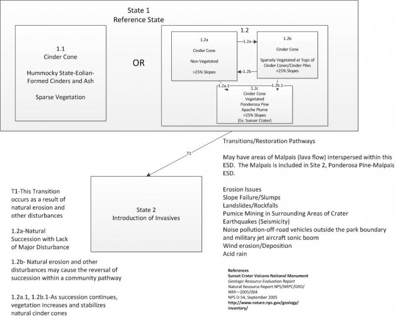
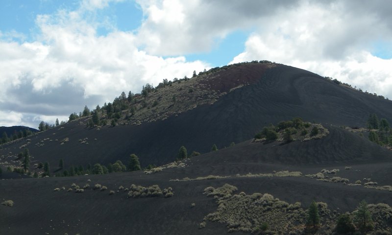
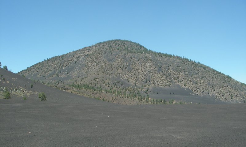
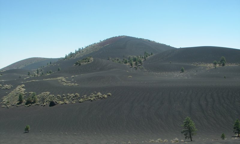
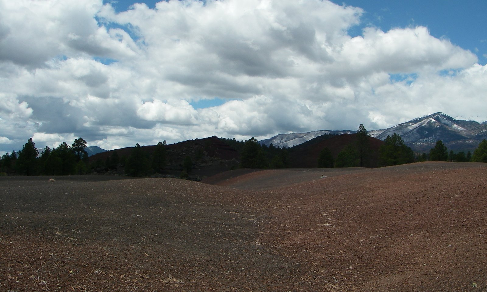
Site is essentially without vegetation on the lower slopes of cinder cones. At the top and upper slopes, this site may have patchy communities of Ponderosa pine and Apache plume.
MLRA CHARACTERISTICS-THESE ARE GENERAL STATEMENTS
AZ 39.1 Mogollon Plateau Coniferous Forests
Elevations range from 7000 to 12,500 feet and precipitation averages 20 to 35 inches per year. Vegetation includes ponderosa pine, Gambel oak, Arizona walnut, sycamore, Douglas fir, blue spruce, Arizona fescue, sheep fescue, mountain muhly, muttongrass, junegrass, pine dropseed, and dryland sedges. The soil temperature regime ranges from mesic to frigid and the soil moisture regime ranges from typic ustic to udic ustic. This unit occurs within the Colorado Plateau Physiographic Province and is characterized by a sequence of flat to gently dipping sedimentary rocks eroded into plateaus, valleys and deep canyons. Sedimentary rock classes dominate the plateau with volcanic fields occurring for the most part near its margin.
Associated sites
| R039XA129AZ |
Clay Bottom 17-22" |
|---|---|
| R039XA141AZ |
Cindery-Ashy Upland 17-22" |
| R039XA142AZ |
Cinders-Lava Flow Upland 17-22" |
Table 1. Dominant plant species
| Tree |
(1) Pinus ponderosa |
|---|---|
| Shrub |
(1) Fallugia paradoxa |
| Herbaceous |
Not specified |
Click on box and path labels to scroll to the respective text.
