Natural Resources
Conservation Service
Ecological site F041XA112AZ
Sandy Wash 16-20" p.z. woodland
Last updated: 4/09/2021
Accessed: 04/15/2026
General information
Provisional. A provisional ecological site description has undergone quality control and quality assurance review. It contains a working state and transition model and enough information to identify the ecological site.
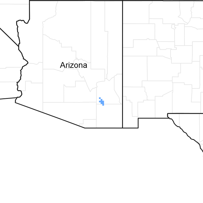
Figure 1. Mapped extent
Areas shown in blue indicate the maximum mapped extent of this ecological site. Other ecological sites likely occur within the highlighted areas. It is also possible for this ecological site to occur outside of highlighted areas if detailed soil survey has not been completed or recently updated.
MLRA notes
Major Land Resource Area (MLRA): 041X–Madrean Archipelago
AZ 41.1 – Mexican Oak-Pine Forest and Oak Savannah
Elevations range from 4500 to 10,700 feet and precipitation ranges from 16 to 30 inches. Vegetation includes Emory oak, Mexican blue oak, Arizona white oak, one-seed juniper, alligator juniper, sacahuista, California bricklebush, skunkbush sumac, Arizona rosewood, wait-a-bit mimosa, sideoats grama, blue grama, purple grama, wooly bunchgrass, plains lovegrass, squirreltail, and pinyon ricegrass. The soil temperature regime ranges from thermic to mesic and the soil moisture regime ranges from aridic ustic to typic ustic. This unit occurs within the Basin and Range Physiographic Province and is characterized by numerous mountain ranges that rise abruptly from broad, plain-like valleys and basins. Igneous and metamorphic rock classes dominate the mountain ranges and sediments filling the basins represent combinations of fluvial, lacustrine, colluvial and alluvial deposits.
Ecological site concept
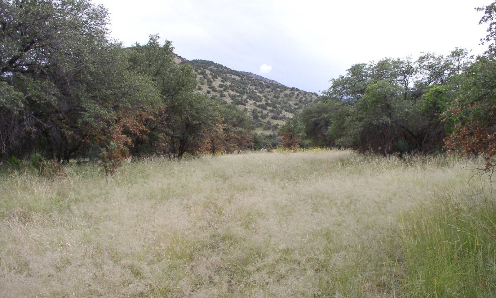
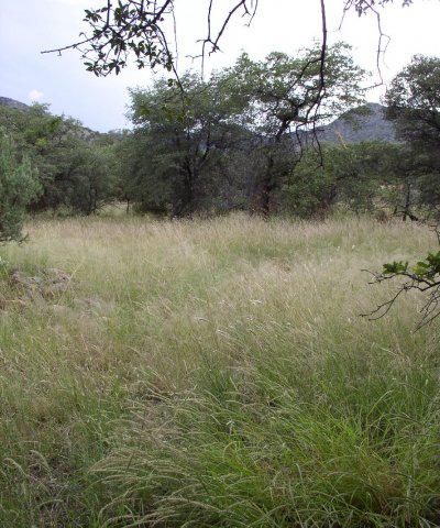
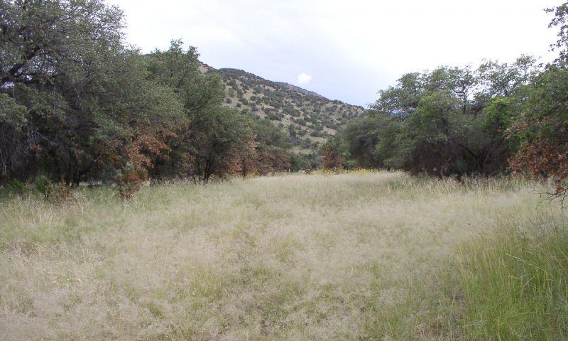
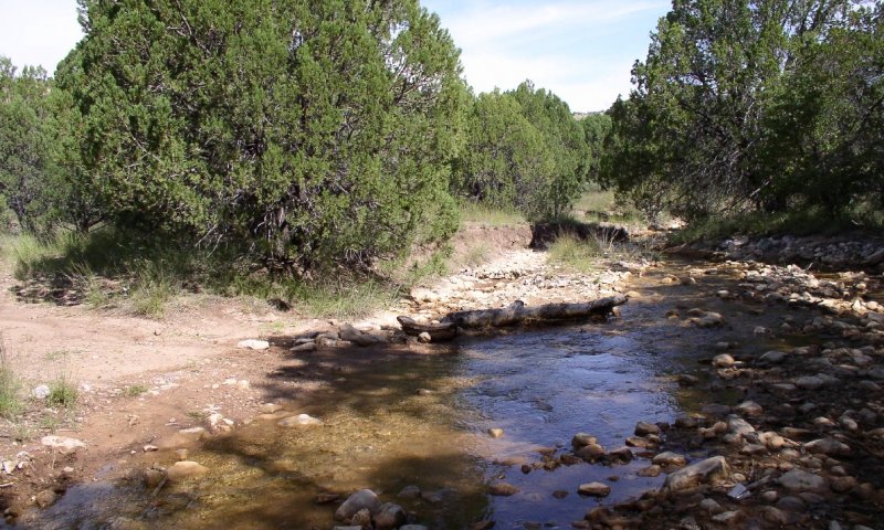
Sandy Wash, woodland, 16-20" p.z., is a gallery woodland dominated by oak trees (Emory and Arizona white oak). The sub-surface water table is seasonal; however, plants benefit from additional moisture received as rainfall run-off. Soils are sandy.
Associated sites
| F041XA113AZ |
Sandy Bottom 16-20" p.z. woodland |
|---|---|
| R041XA102AZ |
Shallow Hills 16-20" p.z. |
| R041XA107AZ |
Loamy Slopes 16-20" p.z. |
| R041XA108AZ |
Loamy Upland 16-20" p.z. |
| R041XA110AZ |
Sandy Loam Upland 16-20" p.z. |
| R041XA111AZ |
Volcanic Hills 16-20" p.z. |
Similar sites
| R041XC316AZ |
Sandy Wash 12-16" p.z. |
|---|
Table 1. Dominant plant species
| Tree |
(1) Quercus emoryi |
|---|---|
| Shrub |
Not specified |
| Herbaceous |
(1) Bouteloua curtipendula |
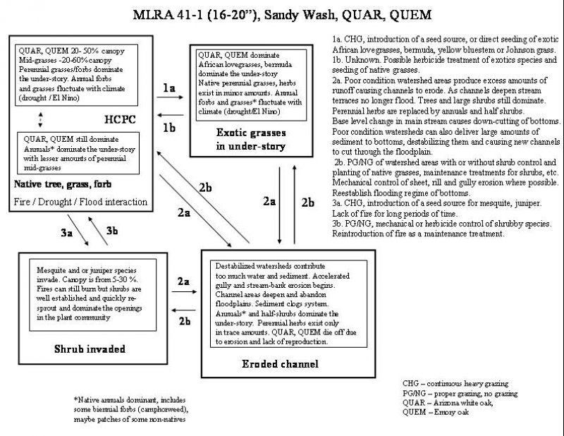
Click on box and path labels to scroll to the respective text.