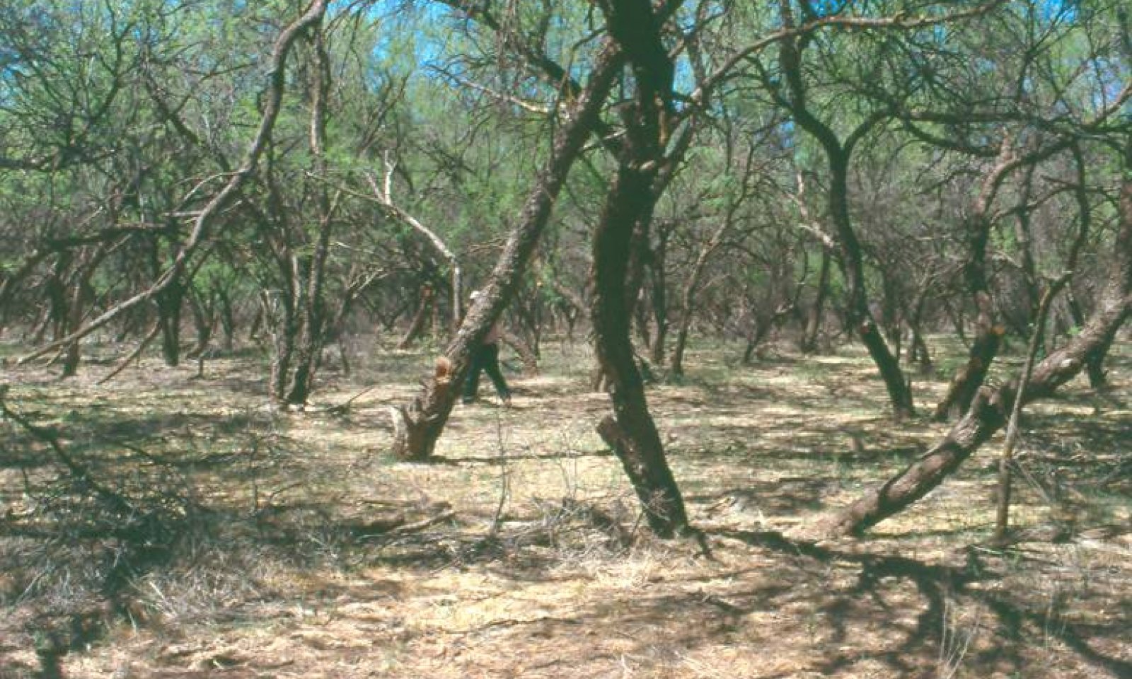
Loamy Bottom, Woodland 12-16" p.z.
Scenario model
Current ecosystem state
Select a state
Management practices/drivers
Select a transition or restoration pathway
- Transition T1A More details
- Transition T1B More details
- Transition T1C More details
- Transition T1D More details
- Restoration pathway R2A More details
- Transition T2A More details
- Restoration pathway R3A More details
- Restoration pathway R3A More details
- Restoration pathway R4A More details
- Transition T4A More details
- Transition T4A More details
- Transition T5A More details
- Transition T5B More details
- Transition T5C More details
-
No transition or restoration pathway between the selected states has been described
Target ecosystem state
Select a state
Mechanism
Mesquite clearing for either wood harvest or cultivation. Irrigation abandoned, greythorn, other shrubs with shrubby mesquite form a scrubland. Water table intact.
Mechanism
Water-table depleted by groundwater pumping to greater than 60 feet. Mature mesquites die back to a shrubby growth that rainfall can support. No return, if pumping is associated with urban areas or development.
Mechanism
Introduction of a seed source for non native annuals likeLondon rocket, foxtail barley, red brome and rescue brome.
Mechanism
Sedimentation of main stream system will cause water-tables to rise, eventually drowning out mesquite. Water tables are within rooting depth (20 feet) of sacaton. Gullies and stream channels fill with sediment and flooding resumes. Site returns to sacaton potential with PG/NG, see site description R041XC312AZ.
Mechanism
50 to 100 years with no further mesquite harvest or control to go back to mature mesquite trees rooted 50 foot deep.
Mechanism
Sedimentation of main stream system will cause water-tables to rise, eventually drowning out mesquite. Water tables are within rooting depth (20 feet) of sacaton. Gullies and stream channels fill with sediment and flooding resumes. Site returns to sacaton potential with PG/NG, see site description R041XC312AZ.
Mechanism
Cessation of groundwater pumping may allow water tables to rise over time to within 50 feet of the surface. Time depends on depth of depletion and amount of pumping reduced. This will not occur in urban or developing areas.
Mechanism
Cessation of groundwater pumping may allow water tables to rise over time to within 50 feet of the surface. Time depends on depth of depletion and amount of pumping reduced. This will not occur in urban or developing areas.
Mechanism
Unknown, possible herbicide control of exotic annuals.
Mechanism
Water-table depleted by groundwater pumping to greater than 60 feet. Mature mesquites die back to a shrubby growth that rainfall can support. No return, if pumping is associated with urban areas or development.
Mechanism
Sedimentation of main stream system will cause water-tables to rise, eventually drowning out mesquite. Water tables are within rooting depth (20 feet) of sacaton. Gullies and stream channels fill with sediment and flooding resumes. Site returns to sacaton potential with PG/NG, see site description R041XC312AZ.
Mechanism
Gully and stream erosion deepen channels and lower water-table to more than 20 feet from the surface. Sacaton thins out, mesquite increases and slowly forms a mature bosque.
Mechanism
Gully and stream erosion deepen channels and lower water-table to more than 20 feet from the surface. Sacaton thins out, mesquite increases and slowly forms a mature bosque.
Model keys
Briefcase
Add ecological sites and Major Land Resource Areas to your briefcase by clicking on the briefcase (![]() ) icon wherever it occurs. Drag and drop items to reorder. Cookies are used to store briefcase items between browsing sessions. Because of this, the number of items that can be added to your briefcase is limited, and briefcase items added on one device and browser cannot be accessed from another device or browser. Users who do not wish to place cookies on their devices should not use the briefcase tool. Briefcase cookies serve no other purpose than described here and are deleted whenever browsing history is cleared.
) icon wherever it occurs. Drag and drop items to reorder. Cookies are used to store briefcase items between browsing sessions. Because of this, the number of items that can be added to your briefcase is limited, and briefcase items added on one device and browser cannot be accessed from another device or browser. Users who do not wish to place cookies on their devices should not use the briefcase tool. Briefcase cookies serve no other purpose than described here and are deleted whenever browsing history is cleared.
Ecological sites
Major Land Resource Areas
The Ecosystem Dynamics Interpretive Tool is an information system framework developed by the USDA-ARS Jornada Experimental Range, USDA Natural Resources Conservation Service, and New Mexico State University.


