
Natural Resources
Conservation Service
Ecological site R070CY115NM
Breaks
Last updated: 10/21/2024
Accessed: 04/27/2025
General information
Provisional. A provisional ecological site description has undergone quality control and quality assurance review. It contains a working state and transition model and enough information to identify the ecological site.
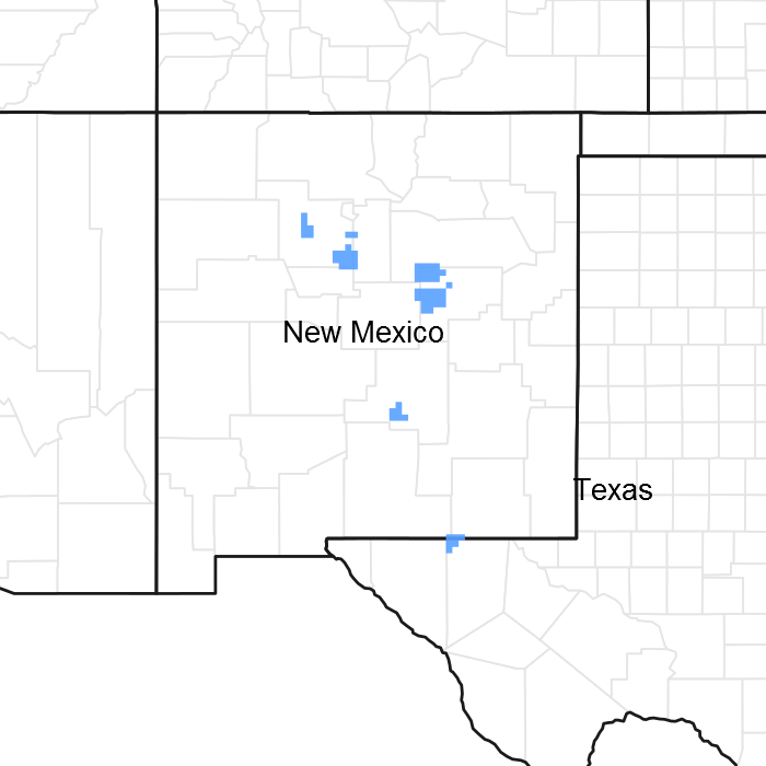
Figure 1. Mapped extent
Areas shown in blue indicate the maximum mapped extent of this ecological site. Other ecological sites likely occur within the highlighted areas. It is also possible for this ecological site to occur outside of highlighted areas if detailed soil survey has not been completed or recently updated.
MLRA notes
Major Land Resource Area (MLRA): 042C–Central New Mexico Highlands
Major Land Resource Area (MLRA): 070C–Central New Mexico Highlands
Major Land Resource Area (MLRA) 70C - will become 42C - is a high elevation portion of central New Mexico that is the convergence of four major physiographic provinces: Basin and Range, Southern Rocky Mountains, Great Plains, and Colorado Plateau. As such, it contains parts or characteristics of each, though tectonically, as a region, it is the easternmost extent of the Basin and Range Province and, more specifically, a structural expression of the Rio Grande Rift. It consists mostly of rangeland with some forested areas associated with numerous disconnected mountain ranges such as the Guadalupe, Sacramento, and Manzano Mountains. Other major physiographic features include the Galisteo Basin or the enclosed Estancia Basin, the structural Chupadera and Glorieta Mesas, and the piedmonts of the Buchanan and Guadalupe Mesas.
Ecological site concept
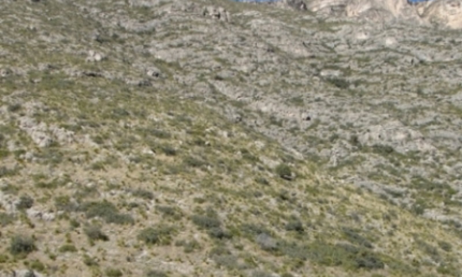
The site occurs on very steep mountain escarpments with a rough, dissected topography. Slopes range from 40-95 percent.
The site consists of very shallow or shallow, well drained, and moderately permeable soils over slowly permeable limestone bedrock.
Associated sites
| F042CY020TX |
Limestone Mountain (North Aspect) 20-26" PZ Limestone Mountain (North Aspect) is on steep north facing slopes mostly above 2,286 m in elevation. Soils are mostly shallow to limestone bedrock and clayey. The reference plant community is a mixed conifer forest. |
|---|---|
| F042CY021TX |
Limestone Mountain (South Aspect) 20-26" PZ The Limestone Mountain (South Aspect) occurs on mountain slopes and ridgetops, at elevations generally above 2,286 m. Aspects are predominantly south facing or neutral. Soils are mostly shallow to limestone bedrock, gravelly, and loamy. The reference plant community is a ponderosa pine savanna. |
| R070CY102NM |
Shallow Limestone Shallow Limestone occurs on limestone hills with 10 to 50 percent slope gradient. Soils are shallow to limestone bedrock. HCPC is mixed prairie grassland with scattered forbs, shrubs, and trees. |
| R042CY745TX |
Limestone Canyon Bottomland Limestone Canyon is a flood plain, stream terrace, arroyo, or basin floor with very gravelly or cobbly soils. HCPC is mainly riparian woodlands but vegetation is variable due to different soil conditions. |
| R042AD001NM |
Loamy, Dry Mixed Prairie Can be adjacent to and in a higher position. |
| R070CY109NM |
Loamy Loamy is a flood plain, stream terrace, arroyo, or basin floor with nongravelly or cobbly soils. HCPC is mixed prairie grassland with scattered shrubs, forbs, and trees. |
Similar sites
| R042AE278TX |
Limestone Hill and Mountain, Mixed Prairie More productive and site supports oak, juniper, and pinyon trees. |
|---|---|
| R042AC249TX |
Limestone Hill and Mountain, Desert Grassland Less productive and lacks abundance of mesic grass species. |
Table 1. Dominant plant species
| Tree |
Not specified |
|---|---|
| Shrub |
Not specified |
| Herbaceous |
Not specified |
Physiographic features
The site occurs on very steep mountain escarpments with a rough, dissected topography. Aspect is mostly south, east, and west (90-270°). Elevation ranges from 4600-8700 feet. Slopes range from 40-95 percent and have a very high runoff potential. Exposed bedrock is common throughout the site. Species composition varies with elevation, aspect, and soil differences.
Table 2. Representative physiographic features
| Landforms |
(1)
Escarpment
|
|---|---|
| Flooding frequency | None |
| Ponding frequency | None |
| Elevation | 1,402 – 2,621 m |
| Slope | 40 – 95% |
| Aspect | E, S, W |
Climatic features
The climate of the area is "semi-arid continental."
The average annual precipitation ranges from 13 to 16 inches. Variations of 5 inches, more or less, are not uncommon. Seventy-five percent of the precipitation falls from April to October. Most of the summer precipitation comes in the form of high intensity-short duration thunderstorms.
Temperatures are characterized by distinct seasonal changes and large annual and diurnal temperature changes. The average annual temperature is about 50 degrees F with extremes of -29 degrees F in the winter and 103 degrees F in the summer.
The average frost-free season is 130 to 160 days. The last killing frost falling in early May and the first killing frost in early October.
Both temperature and precipitation favor warm-season perennial species. However, about 40 percent of the annual precipitation falls at a time favorable to cool-season plant growth. The soils of this site can store water from winter and early spring moisture for use by cool-season species. This allows the cool-season species to occupy an important component of this site. Strong wind from the west and southwest that blow from February to June can rapidly dry the soil profile during a critical period for cool-season plant growth.
Climate data was obtained from http://www.wrcc.sage.dri.edu/summary/climsmnm.html web site using 50% probability for freeze-free and frost-free seasons using 28.5 degrees F and 32.5 degrees F respectively.
Table 3. Representative climatic features
| Frost-free period (average) | 173 days |
|---|---|
| Freeze-free period (average) | 187 days |
| Precipitation total (average) | 406 mm |
Figure 2. Monthly precipitation range
Figure 3. Monthly average minimum and maximum temperature
Influencing water features
This is an upland site, and is not associated with water features or wetlands. During heavy rain events, this site may receive run-on moisture from landforms above and contribute runoff to landforms below.
Soil features
The site consists of very shallow or shallow, well drained, and moderately permeable soils over slowly permeable limestone bedrock. Soils formed in both colluvium and residuum on mountain flanks and escarpments. Generally, the soils formed from colluvium are deeper and are more productive than those formed over residuum. All horizons have a high percentage of gravels and cobbles, averaging over 35 percent by volume. Typically, the surface layer is dark grayish brown and very gravelly clay loam about 7 inches thick. The underlying material from 7 to 17 inches is indurate limestone bedrock. The soil component and associated map unit correlated to this site is:
Guadalupe Mountains National Park Soil Survey Project:
Lostpeak-Rock outcrop complex, 40 to 95 percent slopes.
New Mexico:
TBD
Table 4. Representative soil features
| Parent material |
(1)
Residuum
–
limestone
(2) Colluvium – limestone |
|---|---|
| Surface texture |
(1) Very gravelly clay loam (2) Stony loam (3) Stony silt loam |
| Family particle size |
(1) Loamy |
| Drainage class | Well drained |
| Permeability class | Very slow to moderately slow |
| Soil depth | 10 – 38 cm |
| Surface fragment cover <=3" | 10 – 35% |
| Surface fragment cover >3" | 10 – 25% |
| Available water capacity (0-101.6cm) |
0 – 5.08 cm |
| Calcium carbonate equivalent (0-101.6cm) |
40 – 80% |
| Electrical conductivity (0-101.6cm) |
0 – 2 mmhos/cm |
| Sodium adsorption ratio (0-101.6cm) |
0 |
| Soil reaction (1:1 water) (0-101.6cm) |
7.9 – 8.4 |
| Subsurface fragment volume <=3" (Depth not specified) |
30 – 40% |
| Subsurface fragment volume >3" (Depth not specified) |
4 – 15% |
Ecological dynamics
The Breaks ecological site is characterized by several mountain shrub community potentials due to variability in elevation, soil depth and texture, aspect, and topography. Plant communities include a sotol with scattered wavyleaf oak, mountain mahogany dominated community, and a wavyleaf oak dominated community.
All communities tend to occur within one very stable state. The most influential driver affecting plant community dynamics is fire. Vegetation on this site, also referred to as chaparral, experiences stand-replacing fires measured in decades (Wright 1990; Paysen et al. 2000). The buildup of litter and dry conditions following a fire will take at least 10-15 years the area is ready to burn again (Wright 1990). Since chaparral tends to replace chaparral after fire, species composition can change depending on post-fire seed bank composition, individual species morphology, and severity of the fire (NPS 2005). Generally, the dynamic is from a more closed or dense shrubland to an open shrubland phase and vice versa within a stable state.
Other disturbances such as prolonged droughts will negatively affect annual productivity. Grazing and/or browsing by domestic sheep and goats probably does not influence the site enough to cause significant phase changes because of the long and near vertical escarpments with abundant rocks outcrops protecting vegetation and the long distance to water. Historically, desert bighorn sheep and mule deer were probably the major grazers/browsers. Mule deer still occur on the site and bighorn sheep are being reintroduced in nearby areas.
The following diagram suggests general pathways that the vegetation on this site might follow. There are other plant communities and states not shown on the diagram. This information is intended to show what might happen in a given set of circumstances; it does not mean that this would happen the same way in every instance. Local professional guidance should always be sought before pursuing a treatment scenario.
State and transition model

More interactive model formats are also available.
View Interactive Models
More interactive model formats are also available.
View Interactive Models
Click on state and transition labels to scroll to the respective text
Ecosystem states
State 1 submodel, plant communities
State 1
Shrubland State
Dense Shrub Community is variable due to the variations in plants environments multiple mountain shrubland communities are grouped into this general plant community phase. In general, the Dense Shrub Communities (1.1) phase is the potential of the site in absence of natural fires for a period of at least 10 years. Vegetation has recovered from fires, fuels have built up, and the phase is ready to burn naturally again. Annual production ranges from 1425 to 2800 pounds per acre. The Open Shrub Community is a grouping of multiple mountain shrub communities that have recently burned (< 10 years). Species composition, relative percentages of grasses and shrubs will differ due to variations in local environments (soils, topography, elevation, and aspect). In general, these communities will have a lower canopy cover of shrubs when comparing similar environments that have not burned. Individual plant morphology, local seed bank, and the severity of the fire will dictate species composition in the years following a fire.
Community 1.1
Dense Shrub Community

Figure 4. 1.1 Dense Shrub Community - Landscape View
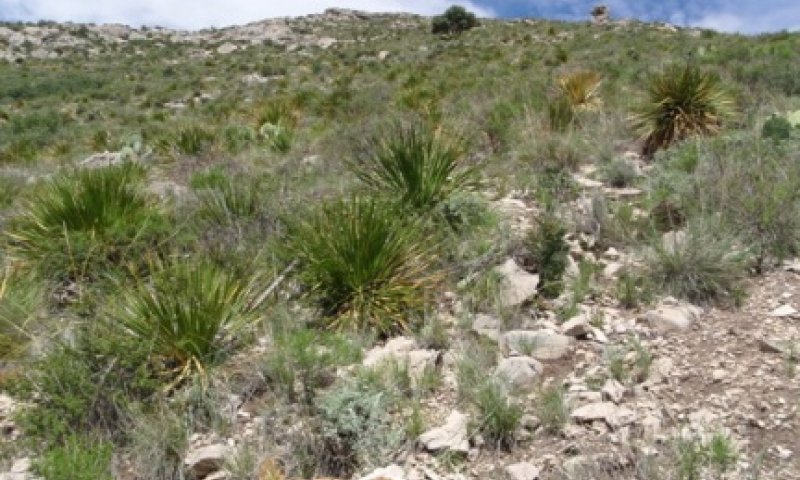
Figure 5. 1.1 Dense Shrub Community - Sotol Dominant
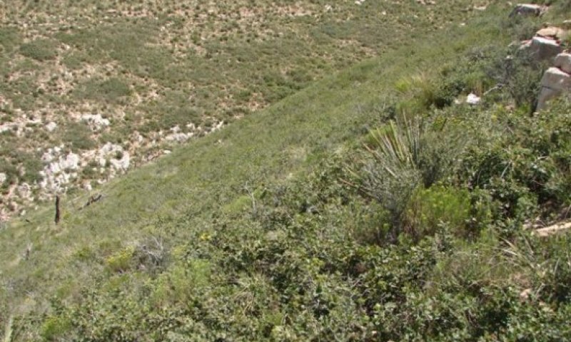
Figure 6. 1.1 Dense Shrub Community - Wavyleaf Oak Dominant
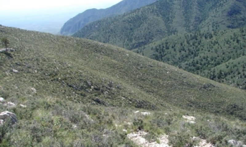
Figure 7. 1.1 Dense Shrub Community - Mountain Mahogany
Due to the numerous variations in plants environments multiple mountain shrubland communities are grouped into this general plant community phase. In general, the Dense Shrub Communities (1.1) phase is the potential of the site in absence of natural fires for a period of at least 10 years. Vegetation has recovered from fires, fuels have built up, and the phase is ready to burn naturally again. Canopy cover of shrubs ranges from 35-90 percent depending on local environments. Canopy cover of grasses ranges from 30-80 percent. Total ground cover, which includes foliar and basal cover, rock fragments, and litter is high ranging from 85- 99 percent. Annual production ranges from 1425 to 2800 pounds per acre. Colluvial soils tend to be deeper than residual soils and usually support abundant grasses such as New Mexico muhly, bull muhly, sideoats grama, and little bluestem relative to shrubs. Common shrubs scattered among the grasses include sacahuista, sotol, banana yucca, and wavyleaf oak. Soils that are very shallow (<10”), usually formed from residuum, support a higher percentage of shrubs relative to grasses. The species composition of shrubs, however, will differ based on soil-moisture relationships resulting from differences in elevation, aspect, or topographic position. Sotol, mariola, skeletonleaf goldeneye, lechuguilla, and pricklypear are more abundant at lower elevations. Mountain mahogany will dominate very shallow and usually loamier soils on south facing slopes at very high elevations. Many of the shrubs found at lower elevations are rare in this community. Desert ceanothus can be found throughout all elevations. A wavyleaf oak dominated shrubland is also found on several aspects at high elevations or on mesic areas at lower elevations. Finer textured soils with better water holding capacity tend to be associated with this community (Bunting 1978 and USDA- NRCS). This community phase is very resilient and stable. Droughts or wet years will cause fluctuations in annual productivity. Fire is the only driver identified to cause temporary changes in shrub canopy cover and/or possible species composition changes depending on the severity of the fire, individual plant morphology and seed bank.
Figure 8. Annual production by plant type (representative values) or group (midpoint values)
Table 5. Annual production by plant type
| Plant type | Low (kg/hectare) |
Representative value (kg/hectare) |
High (kg/hectare) |
|---|---|---|---|
| Shrub/Vine | 897 | 1289 | 1681 |
| Grass/Grasslike | 673 | 897 | 1345 |
| Forb | 28 | 56 | 112 |
| Tree | – | – | – |
| Total | 1598 | 2242 | 3138 |
Table 6. Ground cover
| Tree foliar cover | 8-12% |
|---|---|
| Shrub/vine/liana foliar cover | 3-8% |
| Grass/grasslike foliar cover | 0% |
| Forb foliar cover | 0% |
| Non-vascular plants | 0% |
| Biological crusts | 0% |
| Litter | 5-10% |
| Surface fragments >0.25" and <=3" | 0% |
| Surface fragments >3" | 0% |
| Bedrock | 0% |
| Water | 0% |
| Bare ground | 15-40% |
Table 7. Canopy structure (% cover)
| Height Above Ground (m) | Tree | Shrub/Vine | Grass/ Grasslike |
Forb |
|---|---|---|---|---|
| <0.15 | – | 2-10% | 5-10% | 1-3% |
| >0.15 <= 0.3 | – | 3-10% | 5-20% | 1-2% |
| >0.3 <= 0.6 | – | 5-25% | 15-30% | – |
| >0.6 <= 1.4 | – | 20-45% | 5-20% | – |
| >1.4 <= 4 | – | – | – | – |
| >4 <= 12 | – | – | – | – |
| >12 <= 24 | – | – | – | – |
| >24 <= 37 | – | – | – | – |
| >37 | – | – | – | – |
Figure 9. Plant community growth curve (percent production by month). NM4315, R070CY115NM Breaks HCPC. R070CY115NM Breaks HCPC Mixed warm/cool=season, short, mid and tall grassland with a major shrubs component and minor forb component. .
| Jan | Feb | Mar | Apr | May | Jun | Jul | Aug | Sep | Oct | Nov | Dec |
|---|---|---|---|---|---|---|---|---|---|---|---|
| J | F | M | A | M | J | J | A | S | O | N | D |
| 0 | 0 | 5 | 7 | 10 | 15 | 25 | 25 | 8 | 5 | 0 | 0 |
Community 1.2
Open Shrub Community
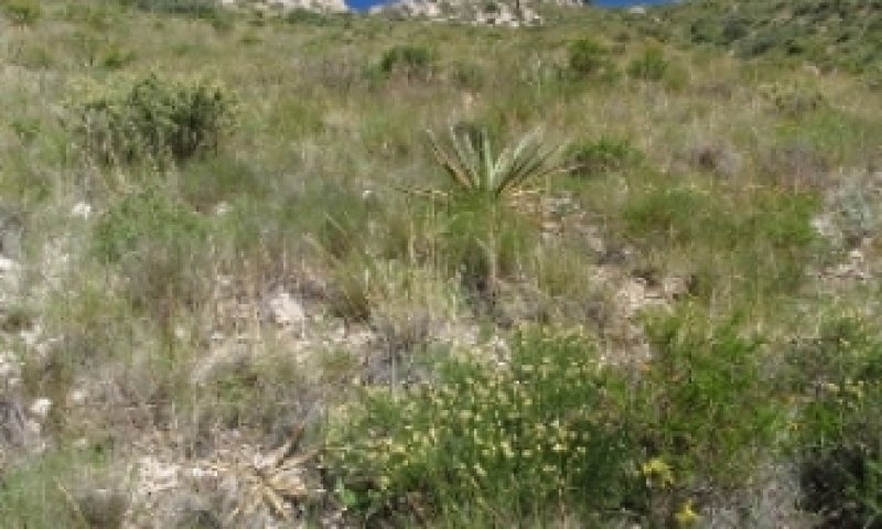
Figure 10. 1.2 Open Shrub Community
The Open Shrub Community Phase 1.2 is a grouping of multiple mountain shrub communities that have recently burned (< 10 years). Species composition, relative percentages of grasses and shrubs will differ due to variations in local environments (soils, topography, elevation, and aspect). In general, these communities will have a lower canopy cover of shrubs when comparing similar environments that have not burned. Individual plant morphology, local seed bank, and the severity of the fire will dictate species composition in the years following a fire. In a fire study within the Guadalupe Mountains, skeletonleaf goldeneye was more frequent on burned than on unburned sites (Ahlstrand, 1978). Also, sotol, lechuguilla, and sacahuista suffered losses in excess of 50% on burned sites (Ahlstrand, 1978). The ability of sotol and other plants to survive fire is dependent upon individual plant morphology and the frequency and severity of fire. Mature sotol can contribute to fire travel since they can burn for hours and can spread fire by falling and rolling downhill (USFS). Desert ceanothus plants are usually killed by fire (Keeley et al. 1978; Zammit, 1992), but they are fire dependent because ceanothus seeds need heat stimulation from fire to germinate (Zammit, 1992). Wavyleaf oak, on the other hand, sprouts prolifically following top-kill by fire and has the potential to return to its pre-fire phase in one year with favorable rainfall and minimal herbivory. Other communities with mixed shrubs will have varying responses following a fire.
Pathway 1.1A
Community 1.1 to 1.2


Fire, either lightning induced or accidental, is the most influential driver causing a community phase change from phase 1.1 Dense Shrub Community to phase 1.2 Open Shrub Community. The severity of the fire influences post fire community composition.
Pathway 1.2A
Community 1.2 to 1.1


Lack of fire or fire suppression will help allow natural succession to occur return the more open shrub community (1.2) back to its potential of a denser shrub community (1.1). The rate of recovery will depend on the extent to which the site has been disturbed.
Additional community tables
Table 8. Community 1.1 plant community composition
| Group | Common name | Symbol | Scientific name | Annual production (kg/hectare) | Foliar cover (%) | |
|---|---|---|---|---|---|---|
|
Grass/Grasslike
|
||||||
| 1 | Midgrasses | 135–269 | ||||
| sideoats grama | BOCU | Bouteloua curtipendula | 67–224 | – | ||
| little bluestem | SCSC | Schizachyrium scoparium | 67–224 | – | ||
| 2 | Short/Midgrasses | 101–202 | ||||
| blue grama | BOGR2 | Bouteloua gracilis | 56–196 | – | ||
| hairy grama | BOHI2 | Bouteloua hirsuta | 22–67 | – | ||
| plains lovegrass | ERIN | Eragrostis intermedia | 34–67 | – | ||
| common wolfstail | LYPH | Lycurus phleoides | 22–67 | – | ||
| 3 | Shortgrasses | 202–404 | ||||
| New Mexico muhly | MUPA2 | Muhlenbergia pauciflora | 84–280 | – | ||
| bullgrass | MUEM | Muhlenbergia emersleyi | 56–168 | – | ||
| curlyleaf muhly | MUSE | Muhlenbergia setifolia | 34–67 | – | ||
| slimflower muhly | MUTE | Muhlenbergia tenuiflora | 34–67 | – | ||
| pine muhly | MUDU | Muhlenbergia dubia | 34–67 | – | ||
| 4 | Shortgrasses | 34–67 | ||||
| black grama | BOER4 | Bouteloua eriopoda | 45–101 | – | ||
| slim tridens | TRMU | Tridens muticus | 11–34 | – | ||
| threeawn | ARIST | Aristida | 11–34 | – | ||
| 5 | Cool-season bunchgrasses | 67–135 | ||||
| New Mexico feathergrass | HENE5 | Hesperostipa neomexicana | 50–112 | – | ||
| prairie Junegrass | KOMA | Koeleria macrantha | 6–34 | – | ||
| pinyon ricegrass | PIFI | Piptochaetium fimbriatum | 6–34 | – | ||
| needle and thread | HECO26 | Hesperostipa comata | 6–34 | – | ||
|
Shrub/Vine
|
||||||
| 6 | Dominant Shrubs | 488–942 | ||||
| pungent oak | QUPU | Quercus pungens | 448–897 | – | ||
| alderleaf mountain mahogany | CEMO2 | Cercocarpus montanus | 224–785 | – | ||
| desert ceanothus | CEGR | Ceanothus greggii | 112–448 | – | ||
| plains lovegrass | ERIN | Eragrostis intermedia | 45–135 | – | ||
| 7 | Subdominant Shrubs | 247–471 | ||||
| resinbush | VIST | Viguiera stenoloba | 56–140 | – | ||
| fragrant sumac | RHAR4 | Rhus aromatica | 28–112 | – | ||
| eggleaf silktassel | GAOV | Garrya ovata | 28–112 | – | ||
| algerita | MATR3 | Mahonia trifoliolata | 28–112 | – | ||
| Rio Grande saddlebush | MOSC | Mortonia scabrella | 28–112 | – | ||
| mariola | PAIN2 | Parthenium incanum | 28–112 | – | ||
| prairie Junegrass | KOMA | Koeleria macrantha | 45–90 | – | ||
| pinyon ricegrass | PIFI | Piptochaetium fimbriatum | 45–90 | – | ||
| Big Bend barometerbush | LEMI4 | Leucophyllum minus | 11–84 | – | ||
| rough jointfir | EPAS | Ephedra aspera | 11–84 | – | ||
| javelina bush | COER5 | Condalia ericoides | 11–84 | – | ||
| featherplume | DAFO | Dalea formosa | 6–56 | – | ||
| damianita | CHME3 | Chrysactinia mexicana | 6–56 | – | ||
| Guadalupe rabbitbrush | CHSP3 | Chrysothamnus spathulatus | 6–56 | – | ||
| Arizona honeysuckle | LOAR | Lonicera arizonica | 6–56 | – | ||
| mock orange | PHILA | Philadelphus | 6–56 | – | ||
| catclaw mimosa | MIACB | Mimosa aculeaticarpa var. biuncifera | 6–56 | – | ||
| 8 | Fibrous/Succulents | 247–471 | ||||
| green sotol | DALE2 | Dasylirion leiophyllum | 112–336 | – | ||
| Texas sacahuista | NOTE | Nolina texana | 56–140 | – | ||
| Havard's century plant | AGHA | Agave havardiana | 56–140 | – | ||
| banana yucca | YUBA | Yucca baccata | 56–140 | – | ||
| tree cholla | CYIMI | Cylindropuntia imbricata var. imbricata | 28–112 | – | ||
| pricklypear | OPUNT | Opuntia | 28–112 | – | ||
| Graminoid (grass or grass-like) | 2GRAM | Graminoid (grass or grass-like) | 27–45 | – | ||
|
Forb
|
||||||
| 9 | Perennial Forbs | 28–112 | ||||
| Forb, perennial | 2FP | Forb, perennial | 11–28 | – | ||
| bundleflower | DESMA | Desmanthus | 3–11 | – | ||
| buckwheat | ERIOG | Eriogonum | 3–11 | – | ||
| broom snakeweed | GUSA2 | Gutierrezia sarothrae | 3–11 | – | ||
| needleleaf bluet | HOACP2 | Houstonia acerosa var. polypremoides | 3–11 | – | ||
| plains blackfoot | MELE2 | Melampodium leucanthum | 3–11 | – | ||
| menodora | MENOD | Menodora | 3–11 | – | ||
| beardtongue | PENST | Penstemon | 3–11 | – | ||
| polygala | POLYG | Polygala | 3–11 | – | ||
| longstalk greenthread | THLO | Thelesperma longipes | 3–11 | – | ||
| noseburn | TRAGI | Tragia | 3–11 | – | ||
| 10 | Annual Forbs | 0–11 | ||||
| Forb, annual | 2FA | Forb, annual | 0–11 | – | ||
| woolly plantain | PLPA2 | Plantago patagonica | 0–3 | – | ||
Interpretations
Supporting information
Inventory data references
Information presented here has been developed from NRCS clipping, composition, plant cover, soils data and ecological interpretations gained by field observation.
Several counties in New Mexico were inventoried: Chaves, DeBaca, Guadalupe, Lincoln, San Miguel, Santa Fe, and Torrance.
Other references
References:
1. Hart, C.R., T. Garland, A.C. Barr, B.B. Carpenter, and J.C. Reagor. 2003. Toxic plants of Texas. Texas Cooperative Extension publication, Texas A&M Press, College Station.
2. Ludwig, J.A. and Muldavin, E. 2000. Vegetation change and surface erosion in desert grasslands of Otero Mesa, southern New Mexico: 1982 to 1995. American Midland Naturalist 144:273-285.
3. McNamee, G. 2008. Otero Mesa: preserving America’s wildest grassland. University of New Mexico Press, Albuquerque, NM.
4. USDA, Natural Resources Conservation Service, “Plants Database,” http://plants.usda.gov/ (accessed August 2009).
Data collection for this site was done in conjunction with the progressive soil surveys within the Pecos-Canadian Plains and Valleys 70 Major Land Resource Area of New Mexico.
The following individual contributed in the development of this ecological site revision:
Justin Clary, Rangeland Management Specialist, NRCS, Temple, TX
Joe Franklin, Zone Rangeland Management Specialist, NRCS, San Angelo, TX
Gary Fuentes, District Conservationist, NRCS, Van Horn, TX
Lynn Loomis, Soil Scientist, NRCS, Marfa, TX
Mark Moseley, Rangeland Management Specialist, NRCS, Boerne, TX
Carlos Villarreal, Soil Scientist, NRCS, Marfa, TX
Contributors
Christine Bishop
Don Sylvester
Elizabeth Wright
John Tunberg
Michael Margo, RMS, NRCS, Marfa, Texas
Approval
Kendra Moseley, 10/21/2024
Rangeland health reference sheet
Interpreting Indicators of Rangeland Health is a qualitative assessment protocol used to determine ecosystem condition based on benchmark characteristics described in the Reference Sheet. A suite of 17 (or more) indicators are typically considered in an assessment. The ecological site(s) representative of an assessment location must be known prior to applying the protocol and must be verified based on soils and climate. Current plant community cannot be used to identify the ecological site.
| Author(s)/participant(s) | |
|---|---|
| Contact for lead author | |
| Date | 04/27/2025 |
| Approved by | Kendra Moseley |
| Approval date | |
| Composition (Indicators 10 and 12) based on | Annual Production |
Indicators
-
Number and extent of rills:
-
Presence of water flow patterns:
-
Number and height of erosional pedestals or terracettes:
-
Bare ground from Ecological Site Description or other studies (rock, litter, lichen, moss, plant canopy are not bare ground):
-
Number of gullies and erosion associated with gullies:
-
Extent of wind scoured, blowouts and/or depositional areas:
-
Amount of litter movement (describe size and distance expected to travel):
-
Soil surface (top few mm) resistance to erosion (stability values are averages - most sites will show a range of values):
-
Soil surface structure and SOM content (include type of structure and A-horizon color and thickness):
-
Effect of community phase composition (relative proportion of different functional groups) and spatial distribution on infiltration and runoff:
-
Presence and thickness of compaction layer (usually none; describe soil profile features which may be mistaken for compaction on this site):
-
Functional/Structural Groups (list in order of descending dominance by above-ground annual-production or live foliar cover using symbols: >>, >, = to indicate much greater than, greater than, and equal to):
Dominant:
Sub-dominant:
Other:
Additional:
-
Amount of plant mortality and decadence (include which functional groups are expected to show mortality or decadence):
-
Average percent litter cover (%) and depth ( in):
-
Expected annual annual-production (this is TOTAL above-ground annual-production, not just forage annual-production):
-
Potential invasive (including noxious) species (native and non-native). List species which BOTH characterize degraded states and have the potential to become a dominant or co-dominant species on the ecological site if their future establishment and growth is not actively controlled by management interventions. Species that become dominant for only one to several years (e.g., short-term response to drought or wildfire) are not invasive plants. Note that unlike other indicators, we are describing what is NOT expected in the reference state for the ecological site:
-
Perennial plant reproductive capability:
Print Options
Sections
Font
Other
The Ecosystem Dynamics Interpretive Tool is an information system framework developed by the USDA-ARS Jornada Experimental Range, USDA Natural Resources Conservation Service, and New Mexico State University.
Click on box and path labels to scroll to the respective text.