Natural Resources
Conservation Service
Ecological site R053CY039SD
Deep Marsh
Last updated: 1/22/2024
Accessed: 07/17/2024
General information
Provisional. A provisional ecological site description has undergone quality control and quality assurance review. It contains a working state and transition model and enough information to identify the ecological site.
MLRA notes
Major Land Resource Area (MLRA): 053C–Southern Dark Brown Glaciated Plains
The Southern Dark Brown Glaciated Plains (53C) is located within the Northern Great Plains Region. It is entirely in South Dakota encompassing about 3,990 square miles (Figure 1). The elevation ranges from 1,300 to 2,300 feet. The MLRA is level to gently rolling till plains including many areas of potholes. A terminal moraine occurs in the southern end of the MLRA. Moderately steep and steep slopes are adjacent to the major valleys. The headwaters of many creeks in central South Dakota occur in the high-lying MLRA. (USDA-NRCS 2006).
The dominant soil orders in this MLRA is Mollisols and Inceptisols. The soils in the area dominantly have a mesic soil temperature regime, an ustic soil moisture regime, and mixed or smectitic mineralogy. They generally are very deep, well drained, or moderately well drained, and are loamy or clayey. This area supports natural prairie vegetation characterized by western wheatgrass (Pascopyrum smithii), big bluestem (Andropogon gerardii), needleandthread (Hesperostipa comata), and green needlegrass (Nassella viridula). Little bluestem (Schizachyrium scoparium), sideoats grama (Bouteloua curtipendula), and prairie sandreed (Calamovilfa longifolia) are important species on steeper sites. Western snowberry (Symphoricarpos occidentalis) and prairie rose (Rosa arkansana) are commonly dispersed throughout the area. (USDA-NRCS 2006).
Classification relationships
Major Land Resource Area (MLRA): Southern Dark Brown Glaciated Plains (53C) (USDA-NRCS 2006)
USFS Subregions: Northeastern Glaciated Plains Section (331E); Missouri Coteau Subsection (331Ea); Western Great Plains Section (331F); Missouri Breaks Subsection (331Fe); Western Glaciated Plains Section (332B); Southern Missouri Coteau Slope Subsection (332Bd, 332Be); North Central Great Plains Section (332D); Southern Missouri Coteau Slope Subsection (332Dd); Southern Missouri Coteau Subsection (332De) - (Cleland et al. 2007).
US EPA Level IV Ecoregion: Missouri Coteau (42a); Southern Missouri Coteau (42e); Southern Missouri Coteau Slope (42f) - (USEPA 2013)
Ecological site concept
The Deep Marsh ecological site typically represents the central portion of a wetland basin or depression on a glaciated prairie landscape with standing water up to 5 feet deep, and at least some tall, emergent vegetation like cattails, bulrushes, and reeds. In most years there is at least some standing water but in drought years the basin surface may dry out yet retain groundwater within 1 foot of the surface. Ponded water conditions and very slow permeability strongly influences the soil-water-plant relationship. Most uncultivated wetland basins in this MLRA have concentric bands of distinctly different vegetation corresponding with changes in soil and water depth.
Associated sites
| R053CY001SD |
Shallow Marsh These sites occur in a basin or closed depression. Soils are very poorly drained and the site will pond water until early summer in most years. The central concept soil series is Parnell, but other series are included. |
|---|---|
| R053CY002SD |
Linear Meadow These sites occur in drainageways or along the edges of closed depressions. Soils are poorly and very poorly drained and have a water table within 0 to 2 feet of the soil surface that persists longer than the wettest part of the growing season, typically until the month of August. The central concept soil series are Lawet, but other series are included. |
| R053CY010SD |
Loamy These sites occur on upland areas. The soils are well drained and have less than 40 percent clay in the surface and subsoil. The central concept soil series are Agar, Glenham, and Highmore, but other series are included. |
| R053CY019SD |
Closed Depression These sites occur in slight depressions on nearly level slopes in the upland areas. Soils are poorly drained and may have a claypan (columnar structure) within 6 inches of the soil surface or an abrupt texture change within 12 inches of the soil surface. The central concept soil series are Hoven and Plankinton, but other series are included. |
Similar sites
| R053CY001SD |
Shallow Marsh The Shallow Marsh site is in a similar landscape position, but the site ponds water until early summer in most years. |
|---|
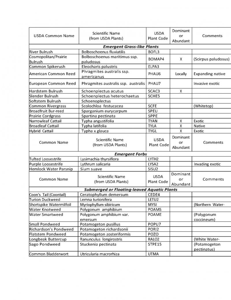
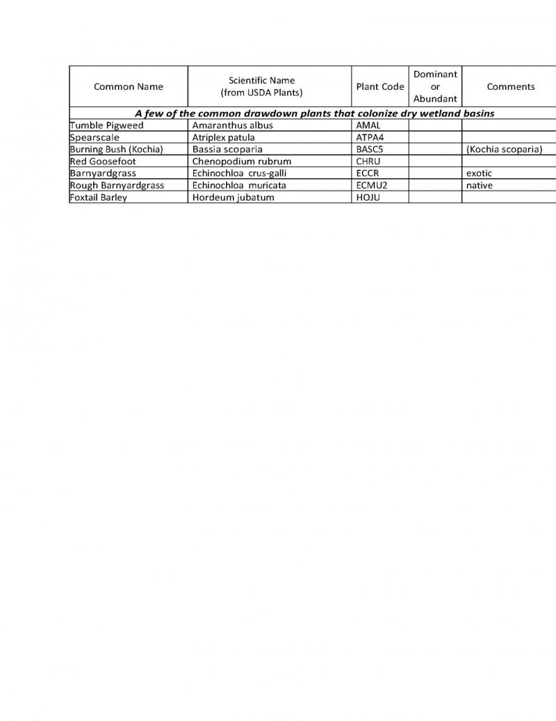
Table 1. Dominant plant species
| Tree |
Not specified |
|---|---|
| Shrub |
Not specified |
| Herbaceous |
(1) Typha |

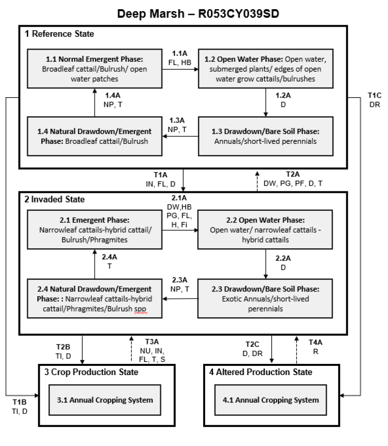
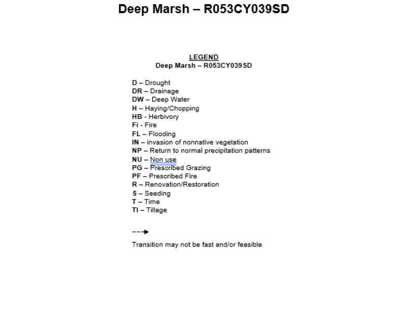
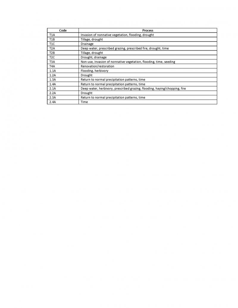
Click on box and path labels to scroll to the respective text.