
Natural Resources
Conservation Service
Ecological site F057XY002MN
Wet Depressional Forest
Last updated: 10/03/2023
Accessed: 02/07/2026
General information
Provisional. A provisional ecological site description has undergone quality control and quality assurance review. It contains a working state and transition model and enough information to identify the ecological site.
MLRA notes
Major Land Resource Area (MLRA): 057X–Northern Minnesota Gray Drift
The Northern Minnesota Gray Drift (57) is located within the Northern Lakes Forest and Forage Region. This area is entirely in north-central Minnesota and makes up about 9,785 square miles (Figure 1). The entire area is covered by Wisconsin-age glacial drift. The glacial deposits are from four major ice lobes-Des Moines, Rainy, Superior, and Wadena. The landscape developed through a series of glaciations and the subsequent retreating and wasting of the ice sheets, which resulted in a complex pattern of moraines, outwash plains, drumlins, lake plains and drainages. Lakes, ponds and marshes are common. The thickness of the glacial till ranges from 90 to 185 meters. Some areas of these deposits are overlain by outwash or lacustrine sediments. Some depressional areas have an accumulation of organic matter. The organic deposits are more than 2.5 meters thick in some areas. Elevation ranges from 300 to 500 meters across the area. (USDA-NRCS 2006)
The dominant soil orders in this MLRA are Alfisols, Entisols, and Histisols, with some Mollisols in the westernmost part of the area. The soils in the area have a frigid soil temperature regime; aquic or udic soil moisture regime, and mixed mineralogy. Their natural drainage class is related to landscape position. In general, the Alfisols formed in till on moraines, Entisols formed in outwash on moraines and outwash plains, and Histosols formed in organic material over outwash or till on moraines or outwash plains. (USDA-NRCS 2006)
Classification relationships
Major Land Resource Area (MLRA): Northern Minnesota Gray Drift (57) (USDA Handbook 296, 2006)
USFS Subregions: Northern Minnesota Drift & Lake Plain Section (212N); Chippewa Plains Subsection (212Na), Pine Moraines & Outwash Plains Subsections (212Nc), St. Louis Moraines Subsection (212Nb); Minnesota & NE Iowa Morainal Section (222M); Hardwood Hills Subsection (222Ma); Northern Superior Uplands Section (212L); Nashwauk Uplands Subsection (212Lc); Northern Minnesota & Ontario Peatlands Section (212M); Littlefork-Vermillion Uplands Subsection (212Ma) (Cleland et al. 2007).
US EPA Level IV Ecoregion: Itasca and St. Louis Moraines (50q); Chippewa Plains (50r); Nashwauk/Marcell Moraines and Uplands (50s); Alexandria Moraines and Detroit Lakes Outwash Plain (51j); McGrath Till Plain and Drumlins (51k); Wadena/Todd Drumlins and Osakis Till Plain (51l) (U.S. Environmental Protection Agency, 2013)
Ecological site concept
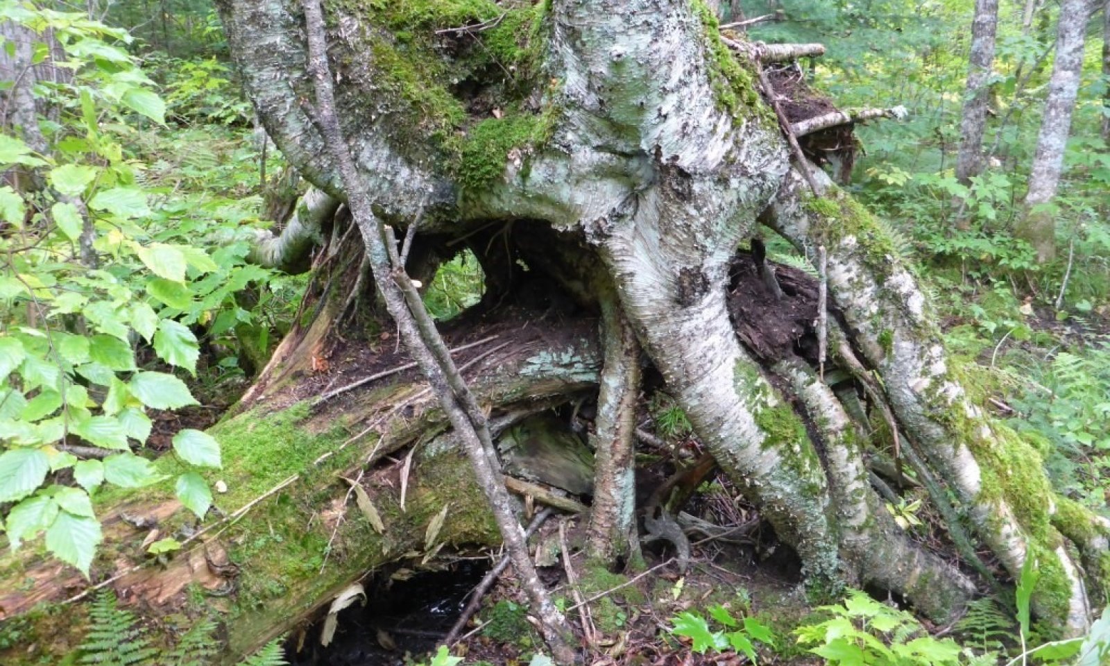
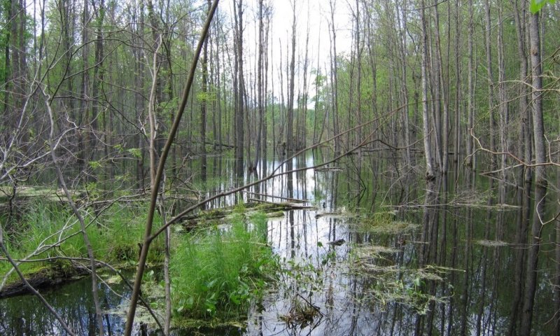
Wet Depressional Forest are widespread throughout the entire MLRA 57, and typically occur in shallow wetland basins, closed depressions and along drainage ways. These wet depressional sites are generally in narrow transition zones between uplands sites with mineral parent materials and peatland sites with organic parent material. Soil surface layers are typically mucky-modified surface textures or muck less than 8” thick over variable parent materials.
Associated sites
| R057XY001MN |
Marsh These sites occur on level or slightly concave landscape positions in closed depressions, shallow wetland basins, drainage ways, and adjacent to open water along lakeshore, ponds, and near streams. They are very poorly drained soils and are frequently ponded and inundated with water for very long duration. Soil surface textures are typically muck or mucky-modified surface layers over variable parent materials. The central concept soil series is Cathro, frequently ponded but other series are included. |
|---|---|
| F057XY003MN |
Peatland These sites occur in shallow wetland basins, closed depressions and along drainage ways. Soils are occasionally ponded with standing water in spring but tend to recede by late summer. Soil surface layers are typically muck 8 to 16” thick over variable parent materials. The central concept soil series are Histic Humaquepts like Hamre, Haug, Sax, Sago but other series are included. |
| R057XY005MN |
Open Peatland These sites occur on level to gently sloping surfaces. Open Peatlands have high water table levels that remain near the surface throughout the growing season, preventing the establishment of significant tree cover. These sites are typically groundwater recharged, and are highly influenced by the abundant concentration of minerals in the ground water that has percolated through the highly calcareous parent material in the region. Soils have greater than 16” of organic material and soil pH values are greater than 4.5. The organic material ranges in decomposition from muck, mucky peat to peat textures underlain by variable parent material. The central concept soil series are Typic and Terric Histosols like Cathro, Markey, Seelyeville and Rifle but other series are included. |
Similar sites
| F057XY016MN |
Flood Plain Forest These site occur on occasionally or annually flooded sites on terraces and floodplains of streams and rivers. Soils consist of stratified alluvium which vary widely from silty to fine sandy soils on the occasionally flooded river terraces to coarser textured alluvium on the active floodplain sites. Soils on the active floodplain positions are annually flooded, somewhat poorly to poorly drained soils with grey soil color or grey-mottles shallow within the soil profile indicative of high local water tables, and are subject to scouring and deposition from floodwater. The better drained rarely to occasionally flooded river terrace sites are moderately well drained to poorly drained on river terraces along medium or large rivers. The central concept soil series is Fairdale, Fordum and Pengilly |
|---|
Table 1. Dominant plant species
| Tree |
(1) Fraxinus nigra |
|---|---|
| Shrub |
(1) Acer spicatum |
| Herbaceous |
(1) Caltha palustris |
Click on box and path labels to scroll to the respective text.
Ecosystem states
| T1A | - | Flooding or excess inundation on-site from beaver, roads, or other hydrological alterations within the watershed |
|---|---|---|
| T1B | - | Removal of tree canopy resulting in loss of evapotranspiration and elevated water levels. |
| T2A | - | Drainage of open water/diversion of water off-site. |
| R3A | - | Absence of disturbance (75+ years), removal of non-native species, and natural regeneration/plantings. |
| T3A | - | Flooding or inundation caused by beaver, roads, or other hydrological alterations within the watershed |
State 1 submodel, plant communities
| 1.1A | - | Stand-replacing windthrow, disease, or pest outbreak. |
|---|---|---|
| 1.2A | - | Succession/Time without major disturbance (75+ years) |
State 2 submodel, plant communities
State 3 submodel, plant communities
| 3.1A | - | Increasing ponding and soil saturation. |
|---|---|---|
| 3.2A | - | Decreasing ponding and soil saturation |

