Limy Clay
Scenario model
Current ecosystem state
Select a state
Management practices/drivers
Select a transition or restoration pathway
- Transition 1A More details
- Transition 1B More details
- Transition 5A More details
- Restoration pathway 2A More details
- Transition 5A More details
- Transition 5A More details
-
No transition or restoration pathway between the selected states has been described
Target ecosystem state
Select a state
Description
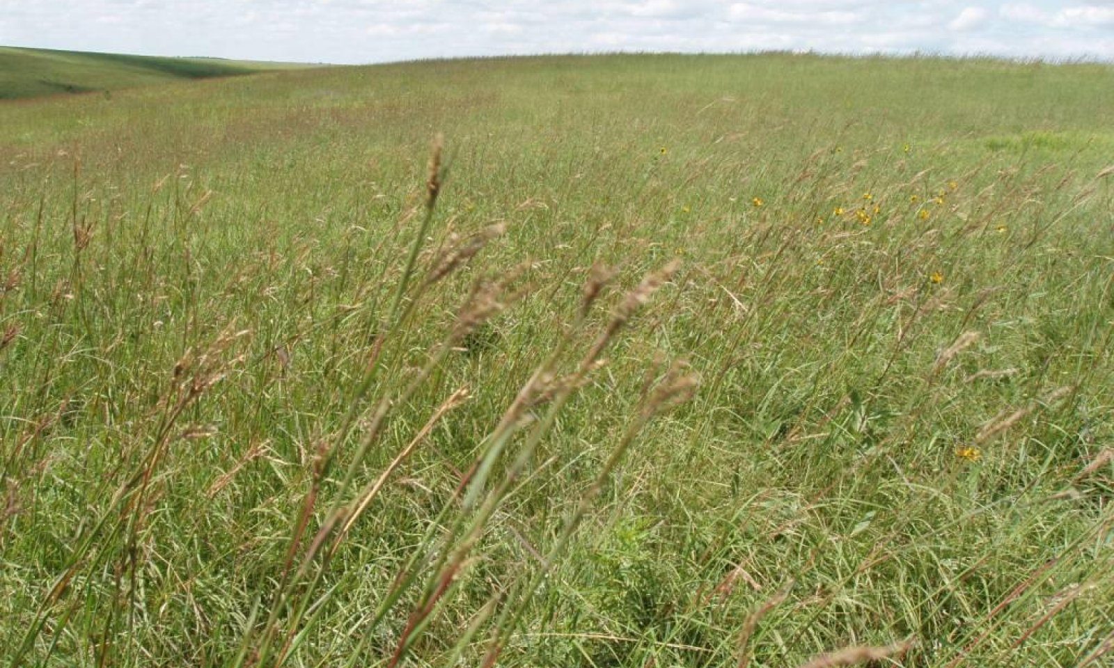
This State represents what is believed to show the natural range of variability that dominated the dynamics of the ecological site prior to European settlement. This site, in reference, is dominated by a mix of warm- and cool-season grasses. Grazing or lack of grazing is the primary drivers between plant community phases. Depending on the season of use, continuous seasonal grazing can push this plant community to warm-season dominated or a cool-season dominated grassland. Non-use and no fire will result in heavy litter accumulations and the invasion of non-native cool-season grasses.
Submodel
Description
This State has a significant amount of Kentucky bluegrass or smooth brome in the plant community but they have not become the dominate species. Preliminary studies would tend to indicate that when Kentucky bluegrass exceeds 30 percent of the plant community and native grasses represent less than 40 percent of the plant community composition the ecological process will be dominated by Kentucky bluegrass. Plant communities dominated by Kentucky bluegrass have significantly less cover and diversity of native grasses and forb species. (Toledo, D. et al., 2014). This State is at risk of transitioning to a bluegrass dominated State, however at this point in time, a bluegrass dominated State does not appear to occur on this Ecological Site in MLRA 63A.
Submodel
Description
In extreme cases, heavy continuous grazing, heavy disturbance, or frequent and sever defoliation can cause this site to erode down to shale chips. At this point a significant amount of the most of the top soil is lost and the plant communities can look very much like those on a Shallow Porous Clay Ecological Site.
Submodel
Description
This State occurs through cultivation and or seeding to perennial pasture forage grasses/legumes. This State includes two separate vegetation states that are highly variable in nature. They are derived through three distinct management scenarios, and are not related successionally. Infiltration, runoff and soil erosion varies depending on the vegetation present on the site.
Submodel
Mechanism
Invasion of non-native cool season grasses, heavy continuous season-long grazing or non-use and no fire for extended periods will convert this plant community to the Native/Invaded State (2.0).
Mechanism
Heavy continuous grazing, heavy disturbance or frequent and sever defoliation resulting in erosion and significant soil loss.
Mechanism
This State (4.0), is the result of the cultivation and abandonment or seeding of perennial forage species.
Mechanism
Prescribed burning followed by long-term prescribed grazing may shift this plant community back to the Reference State. This transition may not be rapid or meet management goals.
Mechanism
This State is the result of the cultivation and abandonment or seeding of perennial forage species.
Model keys
Briefcase
Add ecological sites and Major Land Resource Areas to your briefcase by clicking on the briefcase (![]() ) icon wherever it occurs. Drag and drop items to reorder. Cookies are used to store briefcase items between browsing sessions. Because of this, the number of items that can be added to your briefcase is limited, and briefcase items added on one device and browser cannot be accessed from another device or browser. Users who do not wish to place cookies on their devices should not use the briefcase tool. Briefcase cookies serve no other purpose than described here and are deleted whenever browsing history is cleared.
) icon wherever it occurs. Drag and drop items to reorder. Cookies are used to store briefcase items between browsing sessions. Because of this, the number of items that can be added to your briefcase is limited, and briefcase items added on one device and browser cannot be accessed from another device or browser. Users who do not wish to place cookies on their devices should not use the briefcase tool. Briefcase cookies serve no other purpose than described here and are deleted whenever browsing history is cleared.
Ecological sites
Major Land Resource Areas
The Ecosystem Dynamics Interpretive Tool is an information system framework developed by the USDA-ARS Jornada Experimental Range, USDA Natural Resources Conservation Service, and New Mexico State University.
