Choppy Sands
Scenario model
Current ecosystem state
Select a state
Management practices/drivers
Select a transition or restoration pathway
-
Transition T1A
Multiple disturbances including heavy, concentrated grazing, prolonged drought, wildfire.
More details -
Transition T1B
Woody encroachment with no fire or brush management.
More details -
Restoration pathway R2A
Long-term (>10 years) prescribed grazing with adequate growing season recovery periods.
More details -
Restoration pathway R3A
Prescribed fire, wildfire, timber harvest, brush management.
More details -
No transition or restoration pathway between the selected states has been described
Target ecosystem state
Select a state
Description
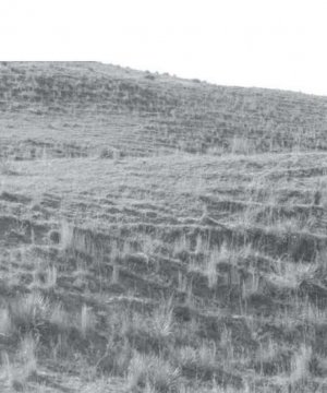
The Reference State (1) describes the range of vegetative community that occur on the Choppy Sands ecological site where the range of natural variability under historic conditions and disturbance regimes is mostly intact. The Reference State developed under the combined influences of climatic conditions, periodic fire activity, grazing by large herbivores, and impacts from small mammals and insects. High perennial grass cover and production allows for increased soil moisture retention, vegetative production and overall soil quality.
The Reference State includes the Reference Community (1.1), the Degraded Native Grass Community (1.2), and the At-Risk Community (1.3). The Reference Community serves as a description of the native plant community that naturally occurs on the site when the natural disturbance regimes are intact or closely mimicked by management practices. The Degraded Native Grass and At-Risk Communities result from management actions that are unfavorable for a healthy Reference Community. All community phases are susceptible to eastern redcedar invasion and subject to crossing a threshold into the Invaded Woody State (3).
Submodel
Description
The Eroded State (2) can occur when any community in the Reference State (1) is subjected to multiple heavy disturbances including heavy grazing, livestock concentration, wildfire, and multi-year drought. The disturbances remove plant and litter cover, causing large bare areas to develop. The resulting wind erosion produces large areas of blowing sand. The Eroded State includes the Active Blowout Community (2.1) and the Early Seral Community (2.2).
Submodel
Description
The Invaded Woody State (3) is the result of woody encroachment. Once the tree canopy cover reaches 15 percent with an average tree height exceeding five feet, the threshold to the Invaded Woody State has been crossed. Woody species are increasing due to the lack of prescribed fire, brush management, or other woody tree removal. Typical ecological impacts are a loss of native grasses, reduced diversity of functional and structural groups, reduced forage production, and reduced soil quality.
Prescribed burning, wildfire, timber harvest and brush management will move the Invaded Woody State toward a grass dominated state. The Invaded Woody State includes one community, the Invaded Woody Community (3.1).
Submodel
Mechanism
This threshold from the Reference State (1) to the Eroded State (2) is crossed as a result of multiple heavy disturbances such as heavy grazing with wildfire, multi-year drought, or other disturbance. These multiple disturbances create large areas of bare ground resulting in wind erosion that will create areas of blowing sand (blowouts) with very little plant cover. Concentration of livestock in areas such as fence corners, mineral feeders, water tanks, and trailing can all be factors in starting a blowout.
Mechanism
Disruption of the natural fire regime and the encroachment of invasive exotic and native woody species can cause the Reference State (1) to transition to the Invaded Woody State (3).
Mechanism
Long-term (more than ten years) prescribed grazing which includes short periods of concentrated short-term animal impact (such as feeding hay on the blowout) and adequate, growing season recovery periods will return the Eroded State (2) to the Reference State (1). This restoration is a long-term process and will typically take more than ten years to return the plant community to the Reference State.
Mechanism
Prescribed burning, wildfire, harvest, and brush management will move the Invaded Woody State (3) to the Reference State (1). The forb component may initially increase following tree removal. Ongoing brush management such as hand cutting, chemical spot treatments, or periodic prescribed burning is required to prevent a return to the Invaded Woody State. The heavier the existing canopy cover, the greater the energy input required to return to the Reference State by management practices. The amount of time required for this restoration to occur depends on the severity and duration of the encroachment.
Model keys
Briefcase
Add ecological sites and Major Land Resource Areas to your briefcase by clicking on the briefcase (![]() ) icon wherever it occurs. Drag and drop items to reorder. Cookies are used to store briefcase items between browsing sessions. Because of this, the number of items that can be added to your briefcase is limited, and briefcase items added on one device and browser cannot be accessed from another device or browser. Users who do not wish to place cookies on their devices should not use the briefcase tool. Briefcase cookies serve no other purpose than described here and are deleted whenever browsing history is cleared.
) icon wherever it occurs. Drag and drop items to reorder. Cookies are used to store briefcase items between browsing sessions. Because of this, the number of items that can be added to your briefcase is limited, and briefcase items added on one device and browser cannot be accessed from another device or browser. Users who do not wish to place cookies on their devices should not use the briefcase tool. Briefcase cookies serve no other purpose than described here and are deleted whenever browsing history is cleared.
Ecological sites
Major Land Resource Areas
The Ecosystem Dynamics Interpretive Tool is an information system framework developed by the USDA-ARS Jornada Experimental Range, USDA Natural Resources Conservation Service, and New Mexico State University.

