Major Land Resource Area 077C
Southern High Plains, Southern Part
Accessed: 04/06/2026
Next steps
-
1
Select an ecological site
Select an ecological site using the list, keys, photos, briefcase, or quick search option located on this page. -
2
Explore the ecological site description
Next, learn more about the selected ecological site and its characteristic dynamics by browsing the ecological site description and exploring alternative state and transition model formats.
Ecological site list
-
i
Key Characteristics
- Site does NOT receive additional moisture from runoff
- Soil depth moderately deep to very deep (>20” (50cm)) without root restricting layer that inhibits the productivity potential
- Soils NOT affected by chemistry
- Loam and clay loam Surface, slopes 0 to 5 percent or less, moderately alkaline, Deep to Very Deep, nearly level to moderately sloping upland plateau.
-
i
Key Characteristics
- Site that receives significant additional moisture from runoff of adjacent slopes or intermittent/perennial streams or a water table
- Soils without strong saline soil
- loamy soil texture (18-35% clay), along stream flood plains
-
i
Key Characteristics
- Site does NOT receive additional moisture from runoff
- Soil depth moderately deep to very deep (>20” (50cm)) without root restricting layer that inhibits the productivity potential
- Soils affected by chemistry
- Soils highly calcareous (>15% CCE) violent effervescence. Soils are NOT skeletal (>35% by volume) in the subsoil, below 20”(50cm)
-
i
Key Characteristics
- Site that receives significant additional moisture from runoff of adjacent slopes or intermittent/perennial streams or a water table
- Soils without strong saline soil
- clayey soil texture (>35% clay), in closed basin depressions
-
i
Key Characteristics
- Site does NOT receive additional moisture from runoff
- Soil depth moderately deep to very deep (>20” (50cm)) without root restricting layer that inhibits the productivity potential
- Soils affected by chemistry
- Soils highly calcareous (>15% CCE) violent effervescence. Soils are skeletal (>35% by volume) in the subsoil, below 20”(50cm)
-
i
Key Characteristics
- Site does NOT receive additional moisture from runoff
- Soil depth moderately deep to very deep (>20” (50cm)) without root restricting layer that inhibits the productivity potential
- Soils NOT affected by chemistry
- Fine Sand and Loamy Fine Sand Surface, slopes 0 to 5 percent or less, Duned ridges, little structure
-
i
Key Characteristics
- Site does NOT receive additional moisture from runoff
- Soil depth moderately deep to very deep (>20” (50cm)) without root restricting layer that inhibits the productivity potential
- Soils NOT affected by chemistry
- Loamy Fine Sand and fine Sand Surface, slopes 5 percent or less, uplands and shallow swales
-
i
Key Characteristics
- Site does NOT receive additional moisture from runoff
- Soil depth moderately deep to very deep (>20” (50cm)) without root restricting layer that inhibits the productivity potential
- Soils NOT affected by chemistry
- Fine Sandy Loam surface, slopes 5 percent or less, uplands and in shallow playas or depressions and swales
-
i
Key Characteristics
- Site does NOT receive additional moisture from runoff
- Soils are very shallow to shallow (8-20"(20-50cm))
- Soils are very shallow (<10”(25cm) to root restricting layer
-
i
Key Characteristics
- Site does NOT receive additional moisture from runoff
- Soil depth moderately deep to very deep (>20” (50cm)) without root restricting layer that inhibits the productivity potential
- Soils NOT affected by chemistry
- Fine Sand and Loamy Fine Sand Surface, slopes 2 percent or less, nearly level to gently undulating plains
-
i
Key Characteristics
- Site does NOT receive additional moisture from runoff
- Soils are very shallow to shallow (8-20"(20-50cm))
- Soil depth shallow (10-20” (25-50cm)) with a sandy soil texture
-
i
Key Characteristics
- Site that receives significant additional moisture from runoff of adjacent slopes or intermittent/perennial streams or a water table
- Site moderately to strongly saline (>8mmhos/cm) within 20” (50cm) and dominated by salt tolerant species
Ecological site map
Basemap
Find me
Find point
Full screen
Zoom in to display soil survey map units for an area of interest, and zoom out to display MLRAs. Select a map unit polygon to view ecological sites correlated to that map unit. View a brief description of an ecological site by clicking on its name in the map popup. Soil survey correlations may not be accurate, and ecological site classification of a location should always be verified in the field. Each selection may require the transfer of several hundred KB of data.
Ecological site keys
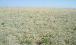
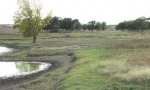
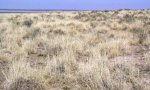
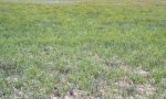
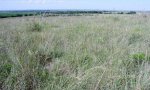
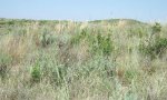
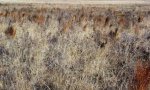
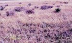
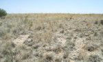
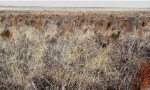
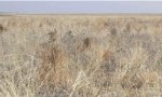
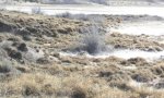
Ecological site photos
Print Options
Sections
Font
Other
Briefcase
Add ecological sites and Major Land Resource Areas to your briefcase by clicking on the briefcase (![]() ) icon wherever it occurs. Drag and drop items to reorder. Cookies are used to store briefcase items between browsing sessions. Because of this, the number of items that can be added to your briefcase is limited, and briefcase items added on one device and browser cannot be accessed from another device or browser. Users who do not wish to place cookies on their devices should not use the briefcase tool. Briefcase cookies serve no other purpose than described here and are deleted whenever browsing history is cleared.
) icon wherever it occurs. Drag and drop items to reorder. Cookies are used to store briefcase items between browsing sessions. Because of this, the number of items that can be added to your briefcase is limited, and briefcase items added on one device and browser cannot be accessed from another device or browser. Users who do not wish to place cookies on their devices should not use the briefcase tool. Briefcase cookies serve no other purpose than described here and are deleted whenever browsing history is cleared.
Ecological sites
Major Land Resource Areas
The Ecosystem Dynamics Interpretive Tool is an information system framework developed by the USDA-ARS Jornada Experimental Range, USDA Natural Resources Conservation Service, and New Mexico State University.