Sand Hills 12-17" PZ
Scenario model
Current ecosystem state
Select a state
Management practices/drivers
Select a transition or restoration pathway
-
Transition T1A
Absence of disturbance and natural regeneration over time, may be coupled with excessive grazing pressure
More details -
Restoration pathway R2A
Adequate rest from defoliation and removal of woody canopy, followed by reintroduction of historic disturbance regimes
More details -
No transition or restoration pathway between the selected states has been described
Target ecosystem state
Select a state
State 1
Grassland State


Description
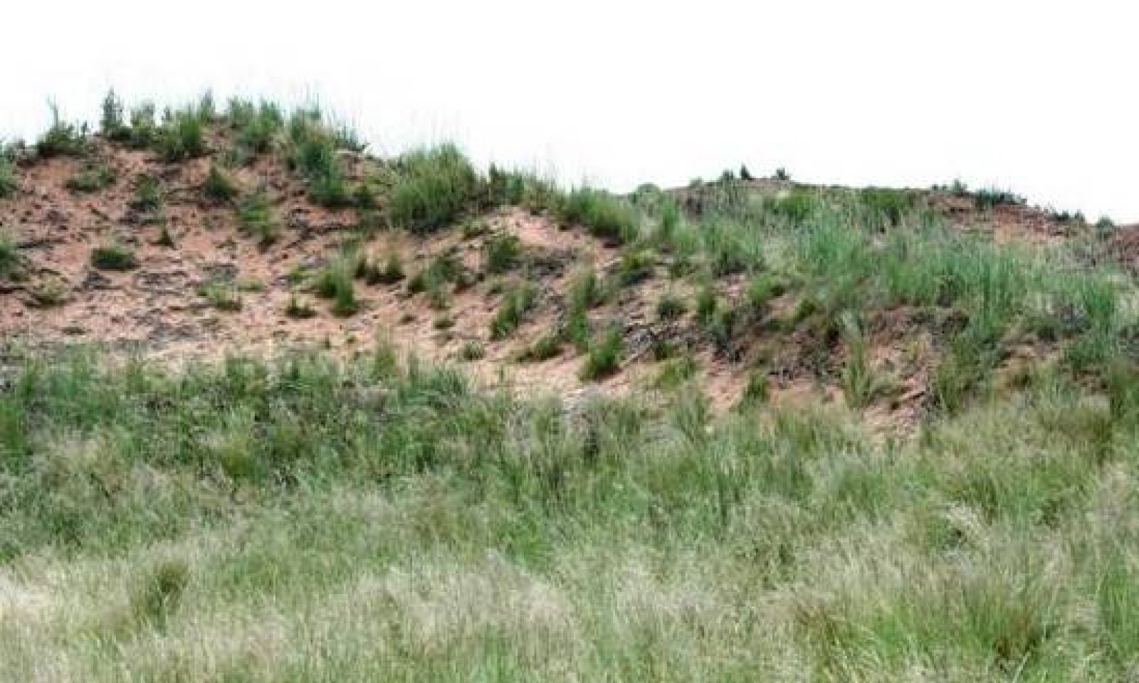
This site is a tallgrass prairie dotted with sparse stands of shinoak. The duned areas produce a greater variety of tall bunchgrasses than the flatter areas of the site with a strong midgrass component scattered throughout the entire site. The Tallgrass/Midgrass/Shrubs Community (1.1) was a mixture of tallgrasses (50 percent), midgrasses (25 percent), shortgrasses (5 percent), shrubs (15 percent) and perennial forbs (5 percent). The amount of annual forbs found was dependent on the moisture situation in a given year.
Heavy or even moderately heavy continuous grazing with domestic livestock for prolonged periods will usually see the most palatable plants pressured severely. As retrogression proceeds, this site will move towards the Shortgrass/Shrub Community (1.2). Tallgrasses and midgrasses decline as shortgrass species and the shrub component increase. Heavy disturbance by hoof action to the soil surface can and usually do cause an increase in annual species. Bare areas will increase with wind erosion common throughout the site.
Submodel
Description
Sand shinoak will be the dominant shrub with sand sagebrush common throughout the site. Some sand hills sites may see a major increase in yucca plants. Many of the sand hills sites in this MLRA have seen an invasion of mesquite and broom snakeweed on the flatter slopes. Un-palatable shortgrass species will appear on the site. Numerous bare areas will be scattered throughout the site. Under extreme conditions, this site deteriorates to active dunes and blowouts which are very difficult to re-vegetate.
Submodel
Mechanism
If heavy continuous grazing continues for extended periods, along with periodic droughts, retrogression will move towards a Shrub Community (2.1). In extreme cases, shrubs will dominate with annuals filling the bare interspaces.
Mechanism
Restoration of the Shrubland State (2.0) to the Grassland State (1.0) requires prescribed grazing (3 - 5 consecutive years with deferment during the growing season), extensive brush and pest management and re-seeding with adapted native grass species. The success of re-seeding is totally dependent on timely and effective rainfall.
Relevant conservation practices
| Practice | External resources |
|---|---|
|
Brush Management |
|
|
Prescribed Grazing |
|
|
Range Planting |
|
|
Integrated Pest Management (IPM) |
Model keys
Briefcase
Add ecological sites and Major Land Resource Areas to your briefcase by clicking on the briefcase (![]() ) icon wherever it occurs. Drag and drop items to reorder. Cookies are used to store briefcase items between browsing sessions. Because of this, the number of items that can be added to your briefcase is limited, and briefcase items added on one device and browser cannot be accessed from another device or browser. Users who do not wish to place cookies on their devices should not use the briefcase tool. Briefcase cookies serve no other purpose than described here and are deleted whenever browsing history is cleared.
) icon wherever it occurs. Drag and drop items to reorder. Cookies are used to store briefcase items between browsing sessions. Because of this, the number of items that can be added to your briefcase is limited, and briefcase items added on one device and browser cannot be accessed from another device or browser. Users who do not wish to place cookies on their devices should not use the briefcase tool. Briefcase cookies serve no other purpose than described here and are deleted whenever browsing history is cleared.
Ecological sites
Major Land Resource Areas
The Ecosystem Dynamics Interpretive Tool is an information system framework developed by the USDA-ARS Jornada Experimental Range, USDA Natural Resources Conservation Service, and New Mexico State University.


