Sandy 12-17" PZ
Scenario model
Current ecosystem state
Select a state
Management practices/drivers
Select a transition or restoration pathway
-
Transition T1A
Absence of disturbance and natural regeneration over time, may be coupled with excessive grazing pressure
More details -
Restoration pathway R2A
Adequate rest from defoliation and removal of woody canopy, followed by reintroduction of historic disturbance regimes
More details - Restoration pathway R2B More details
-
No transition or restoration pathway between the selected states has been described
Target ecosystem state
Select a state
State 1
Grassland State


Description
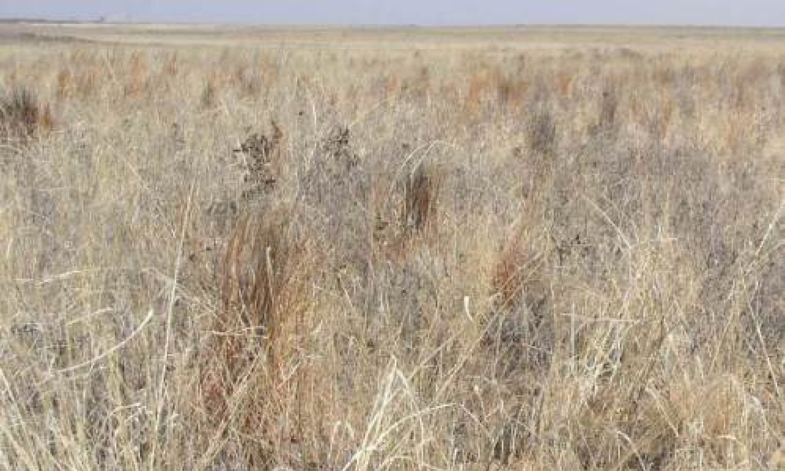
The Tall/Midgrass Community (1.1) is the interpretive or "reference" plant community for the Sandy Ecological Site. Herbivory by migrating bison and indigenous antelope influenced the plant composition and structure, but not as much as frequent and intense wildfires and recurring long droughts, which kept woody species in check. Havard oak motts were widely scattered in protected areas, but probably made up less than ten percent of the plant canopy. Sand sagebrush, broom snakeweed and yucca were also typical, but infrequent, shrubs. Little and sand bluestem along with mesa and giant dropseeds were the dominant or co-dominant grasses throughout the site depending on variations in soils and water relations. Also occurring on the site, but in smaller amounts, were midgrasses cane and silver bluestems, black grama, sideoats grama, plains bristlegrass, and spike dropseed. Common forbs found on the site include prairie clover, dotted gayfeather, wild alfalfa, catclaw sensitivebriar and bundleflower. The Tall-Midgrass Grassland community produced from 1,000 to 2,500 pounds of biomass annually.
The Midgrass/Shrubs Invading Community (1.2) is the result of the interaction of overgrazing, reduction in intensity and frequency of fires and possibly climate change. The reduction in vegetative structure and ground cover resulting from continued overgrazing as well as reduction in fire frequency and intensity allows the shrubs to become established. Havard oak, mesquite, broom snakeweed and sand sagebrush increase in density and cover, varying from 10 to 20 percent ground cover. Sand dropseed, hooded windmillgrass and perennial three-awns begin replacing the more palatable tall and midgrasses found in the reference community. Most forbs such as gaura, groundsels, palofoxia and wild buckwheat persist in the Midgrass/Shrubs Invading Community. Annual yield ranges from 800 to 2,300 pounds.
Submodel
State 2
Shrubland State


Description
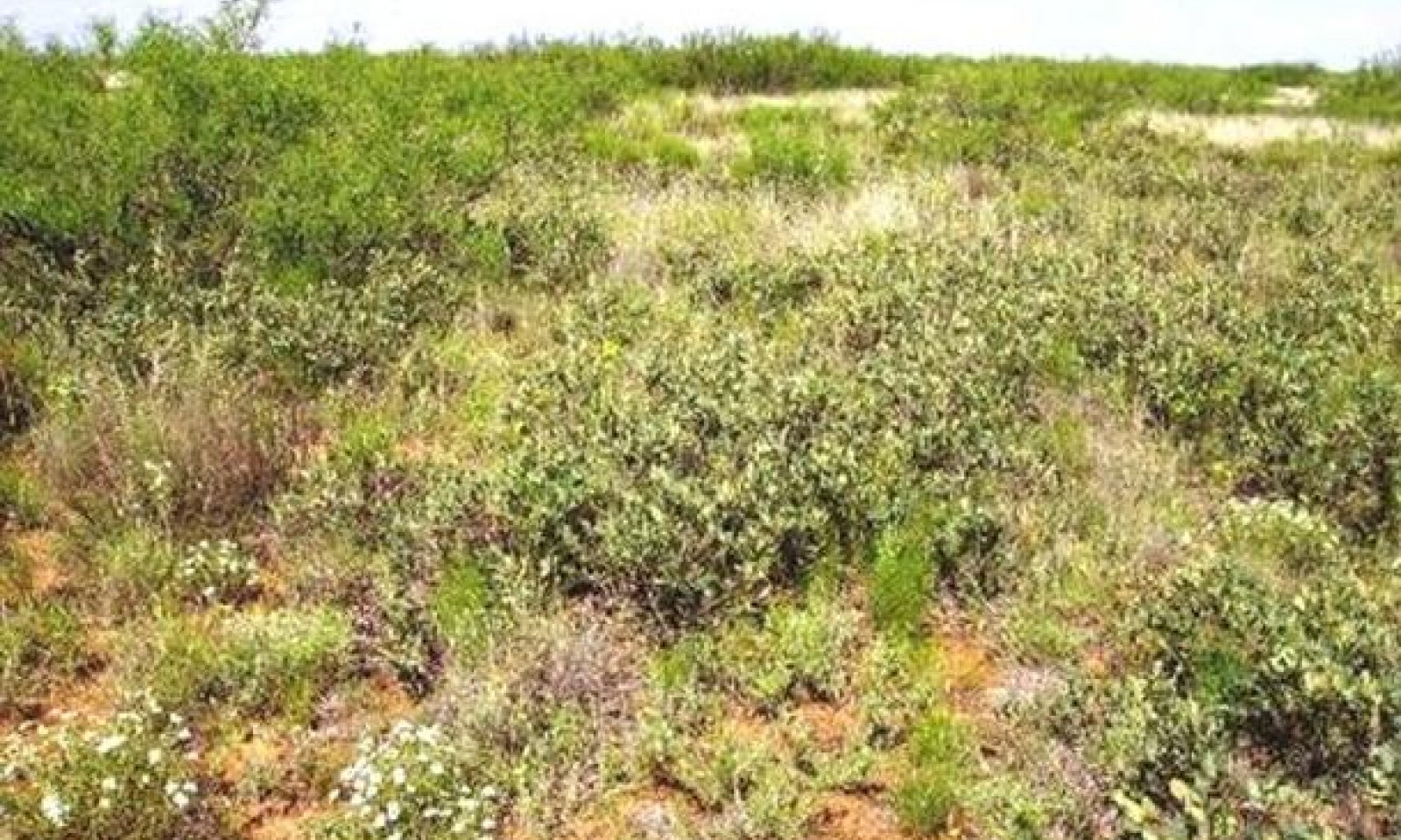
The Mixed Shortgrass/Shrub Community supports a 20 to 45 percent woody canopy cover with mesquite, Havard oak, sand sagebrush, broom snakeweed and yucca the most common shrubs. Havard oak generally dominates on deep fine sand areas and mesquite on loamy fine sand portions. This plant type is the result of selective overgrazing by livestock and the differential response of plants to defoliation over a long period of time. There is a continued decline in diversity of the grassland component and an increase in woody species and unpalatable forbs.
The Shrub/Shortgrass/Annuals Community is the result of many years of overgrazing, lack of periodic fires and little brush management. Havard oak and mesquite dominate the Shrub/Shortgrass/Annuals Community, which is essentially a dense shrubland. Under extreme conditions of overgrazing and drought, the site deteriorates to active dunes and blowouts. Common understory shrubs are broom snakeweed, yucca and sand sagebrush. With continued heavy grazing and no brush control, the shrubs can approach 70 percent or more ground cover. Short-grasses and low quality annual and perennial forbs occupy the woody plant interspaces.
Submodel
Mechanism
Heavy Continuous Grazing, No Fires, and No Brush Management practices cause the Grassland State to shift into the Shrubland State.
Mechanism
The trend cannot be reversed from the Shrubland State (Mixed Shortgrass/Shrub) to the Grassland State with good grazing management alone. Accelerated brush management practices along with range planting and prescribed grazing is required to return this plant type to grassland (Midgrass/Shrubs Invading).
Relevant conservation practices
| Practice | External resources |
|---|---|
|
Brush Management |
|
|
Prescribed Grazing |
|
|
Range Planting |
Mechanism
The trend cannot be reversed from the Shrubland State (Shrub/Shortgrass/Annuals) to the Grassland State with good grazing management alone. Accelerated reclamation practices, brush management practices along with range planting and prescribed grazing is required to return this plant type to grassland (Midgrass/Shrubs Invading).
Relevant conservation practices
| Practice | External resources |
|---|---|
|
Brush Management |
|
|
Prescribed Burning |
|
|
Prescribed Grazing |
|
|
Range Planting |
|
|
Integrated Pest Management (IPM) |
Model keys
Briefcase
Add ecological sites and Major Land Resource Areas to your briefcase by clicking on the briefcase (![]() ) icon wherever it occurs. Drag and drop items to reorder. Cookies are used to store briefcase items between browsing sessions. Because of this, the number of items that can be added to your briefcase is limited, and briefcase items added on one device and browser cannot be accessed from another device or browser. Users who do not wish to place cookies on their devices should not use the briefcase tool. Briefcase cookies serve no other purpose than described here and are deleted whenever browsing history is cleared.
) icon wherever it occurs. Drag and drop items to reorder. Cookies are used to store briefcase items between browsing sessions. Because of this, the number of items that can be added to your briefcase is limited, and briefcase items added on one device and browser cannot be accessed from another device or browser. Users who do not wish to place cookies on their devices should not use the briefcase tool. Briefcase cookies serve no other purpose than described here and are deleted whenever browsing history is cleared.
Ecological sites
Major Land Resource Areas
The Ecosystem Dynamics Interpretive Tool is an information system framework developed by the USDA-ARS Jornada Experimental Range, USDA Natural Resources Conservation Service, and New Mexico State University.

