Sandy Loam 12-17" PZ
Scenario model
Current ecosystem state
Select a state
Management practices/drivers
Select a transition or restoration pathway
-
Transition T1A
Absence of disturbance and natural regeneration over time, may be coupled with excessive grazing pressure
More details -
Restoration pathway R2A
Adequate rest from defoliation and removal of woody canopy, followed by reintroduction of historic disturbance regimes
More details - Restoration pathway R2B More details
-
No transition or restoration pathway between the selected states has been described
Target ecosystem state
Select a state
State 1
Grassland State


Description
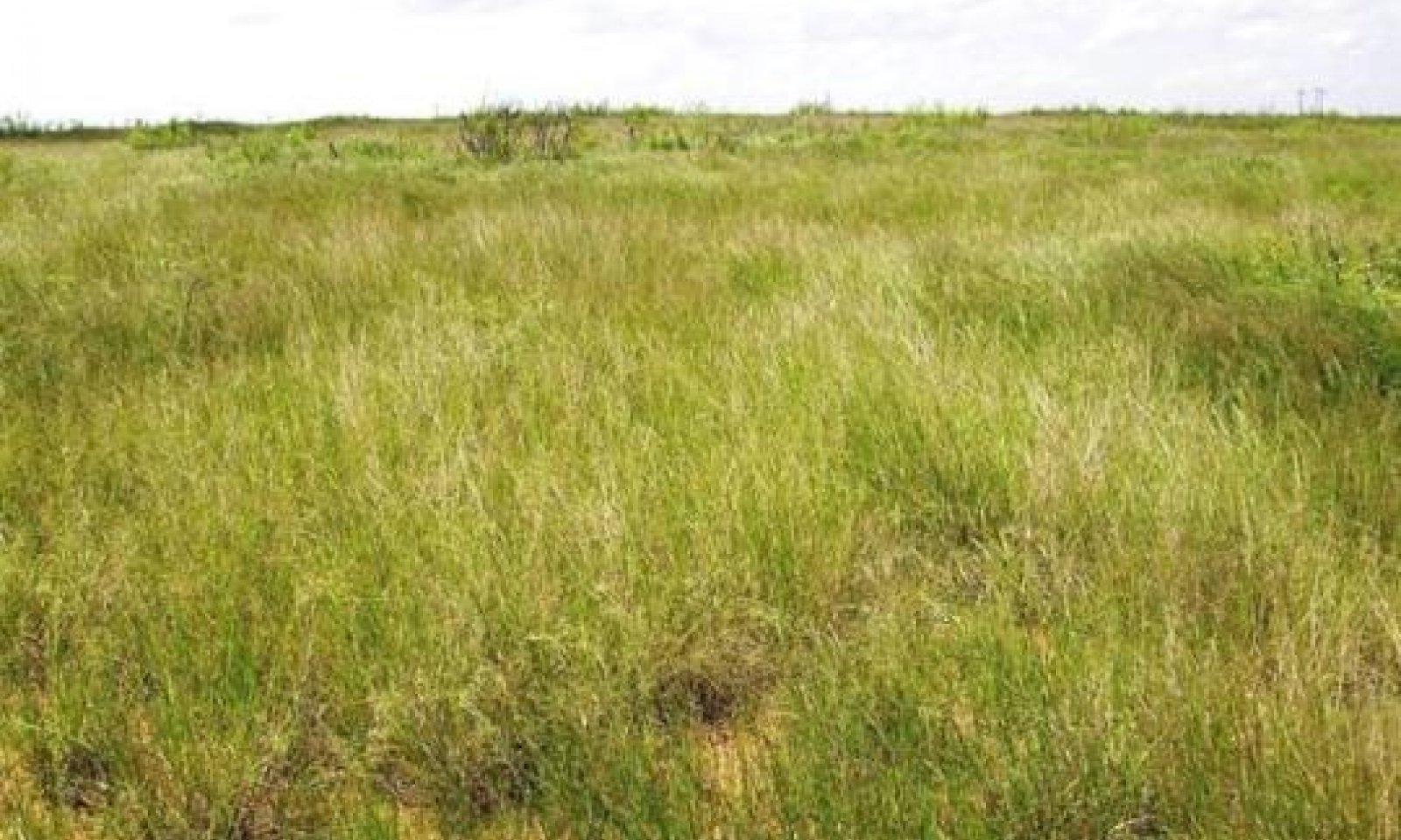
The Short/Midgrass Community (1.1) is the interpretive or "reference" plant community for the Sandy Loam Ecological Site. Herbivory by migrating bison and indigenous antelope influenced the plant composition and structure, but not as much as frequent and intense wildfires and recurring long-term droughts, which kept woody species in check. A variety of short and midgrasses comprised most of the production. The plant community is characterized by sideoats grama, black grama, blue grama and plains bristlegrass. Cane and silver bluestem, Arizona cottontop and vine mesquite are locally abundant. Perennial three-awns, hairy grama, fall witchgrass, sand dropseed and buffalograss are common shortgrasses. Four-winged saltbush, lotebush, catclaw and yucca are infrequent, shrubs. Gaura, dotted gayfeather, sleepy daisy, western ragweed, croton, and prairie sunflower are characteristic forbs. This community produces from 1,200 to 2,200 pounds of biomass annually, depending upon soil property variation and the amount of precipitation.
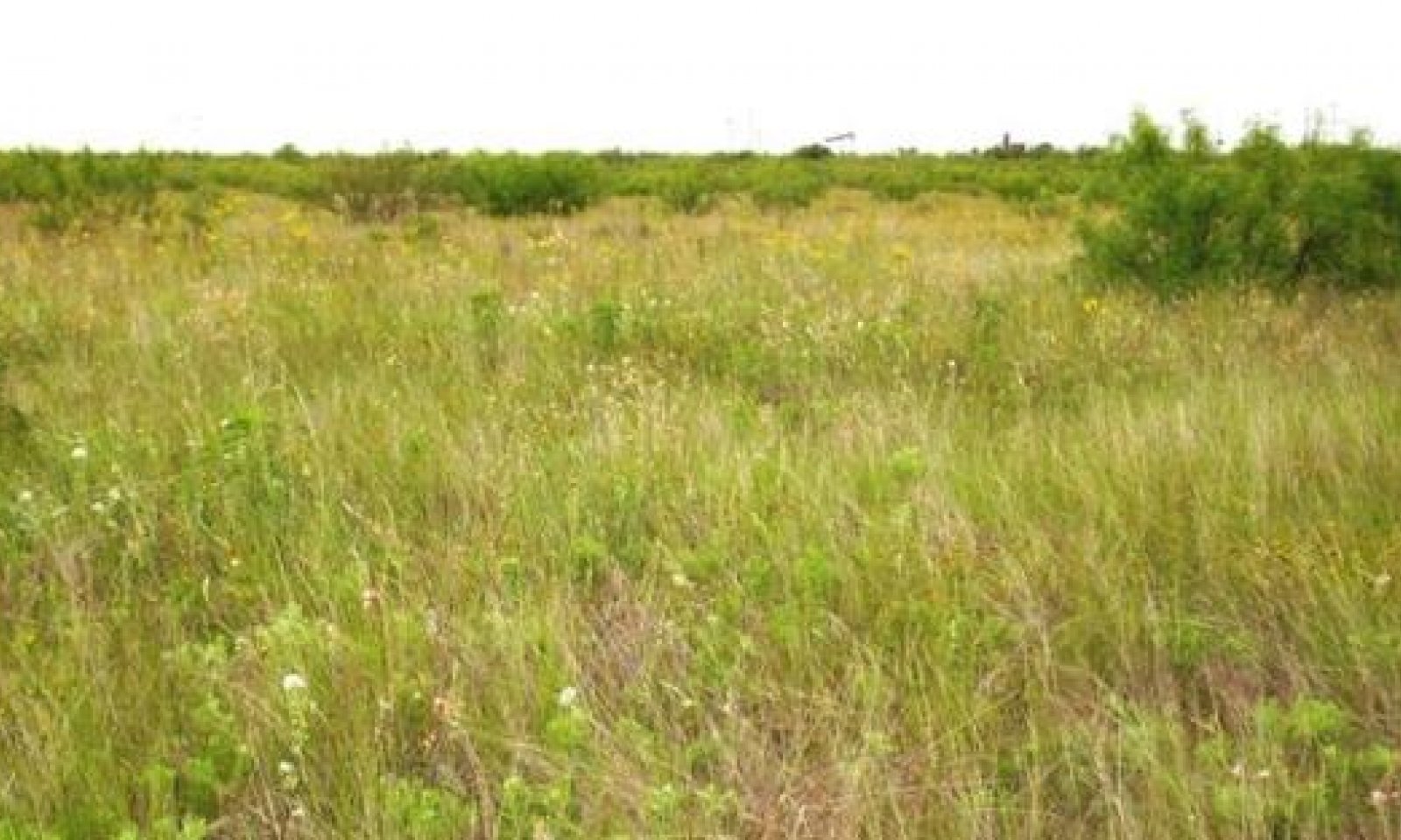
The Shortgrass Dominant/Invading Shrubs Community (1.2) is shortgrass dominated grassland. It is being encroached by woody species that had been held at low densities by repeated fires, droughts and competition from a vigorous grass component. Shrubby species are increasing in density because continuous heavy grazing by livestock has reduced grass cover, caused reduction of soil cover and reduced the frequency and/or intensity of fires. Selective grazing and differential response of plants to defoliation also causes changes in composition of the plant community. Typically, mesquite, catclaw acacia and yucca are early and persistent invaders. Broom snakeweed and four-winged saltbush are also common. The preferred midgrasses are being replaced by the more grazing resistant hooded windmillgrass, hairy grama, fall witchgrass and threeawns. Most of the reference grama species, bristlegrasses and feathery bluestems persist in this phase. The perennial forbs found in the reference plant community are still present, although in lesser amounts. Annual primary production is reduced slightly ranging from 1000 to 2000 pounds per acre.
Submodel
State 2
Shrubland State


Description
The Shortgrass/Shrubland Community (2.1) supports a 15 to 35 percent woody canopy with mesquite, catclaw acacia, broom snakeweed and yucca the most common shrubs. Mesquite generally dominates although broom snakeweed can be locally dominant. This plant type is primarily the result of the interaction of selective overgrazing by livestock, the differential response of plants to defoliation and a reduction in the intensity and frequency of fires over a long period of time. Total plant production declines somewhat, being approximately 800 to 1800 pounds per acre.
The Shrub/Shortgrass/Annuals Community (2.2) is a shrubland resulting from many years of overgrazing, lack of periodic fires and little brush management. Mesquite generally dominates, but broom snakeweed, yucca, sand sagebrush, condalia, and catclaw acacia are common. With continued heavy grazing and no brush control, the shrubs can approach 70 percent or more ground cover. Shortgrasses and low quality annual and perennial forbs occupy the woody plant interspaces. Grasses and forbs make up 25 percent or less of the annual herbage production.
Submodel
Mechanism
With Heavy Continuous Grazing, No Fire, and No Brush Management, the Grassland State will be converted into the Shrubland State.
Mechanism
Prescribed grazing, Brush Management, and Prescribed Grazing are several conservation practices that can be implemented for the shift from the Shortgrass/Shrubland Community to the Shortgrass Dominant/Invading Shrubs Community.
Relevant conservation practices
| Practice | External resources |
|---|---|
|
Brush Management |
|
|
Prescribed Burning |
|
|
Prescribed Grazing |
Mechanism
Reclamation, Prescribed Grazing, Brush Management, and Range Planting are required conservation practices in order to reclaim the Shrub/Shortgrass/Annuals Community back to the Short/Midgrass Community.
Relevant conservation practices
| Practice | External resources |
|---|---|
|
Brush Management |
|
|
Prescribed Burning |
|
|
Prescribed Grazing |
|
|
Grazing Land Mechanical Treatment |
|
|
Range Planting |
Model keys
Briefcase
Add ecological sites and Major Land Resource Areas to your briefcase by clicking on the briefcase (![]() ) icon wherever it occurs. Drag and drop items to reorder. Cookies are used to store briefcase items between browsing sessions. Because of this, the number of items that can be added to your briefcase is limited, and briefcase items added on one device and browser cannot be accessed from another device or browser. Users who do not wish to place cookies on their devices should not use the briefcase tool. Briefcase cookies serve no other purpose than described here and are deleted whenever browsing history is cleared.
) icon wherever it occurs. Drag and drop items to reorder. Cookies are used to store briefcase items between browsing sessions. Because of this, the number of items that can be added to your briefcase is limited, and briefcase items added on one device and browser cannot be accessed from another device or browser. Users who do not wish to place cookies on their devices should not use the briefcase tool. Briefcase cookies serve no other purpose than described here and are deleted whenever browsing history is cleared.
Ecological sites
Major Land Resource Areas
The Ecosystem Dynamics Interpretive Tool is an information system framework developed by the USDA-ARS Jornada Experimental Range, USDA Natural Resources Conservation Service, and New Mexico State University.

