Ecological dynamics
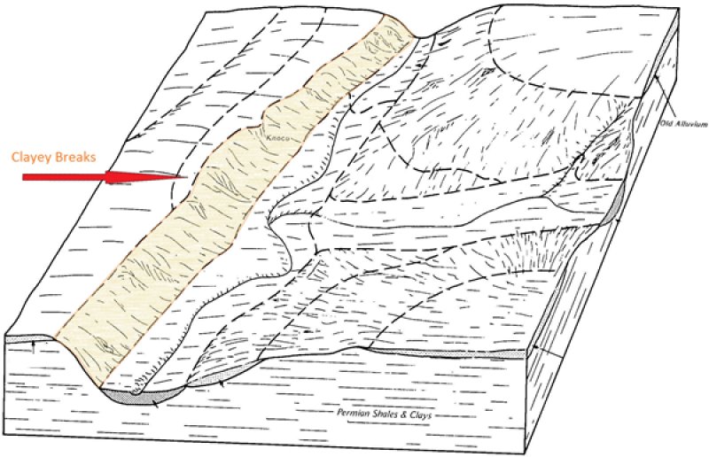
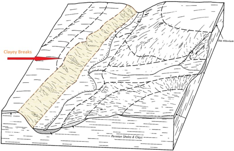
The vegetation within the reference state is a mixture of grasses, forbs, shrubs, and a few trees. The percent of bare ground can sometimes be fairly high in comparison to adjacent sites. Aspect, climate, soil depth, percent slope, and disturbance factors are all important determinants in the overall species composition and production of the plant community. This is especially true for a Clayey Breaks site. Generally the north and east facing exposures have a greater variety of plants present and slightly higher production due to slightly cooler and wetter conditions. Forage production is generally less than sites with deeper soil resources. Accessibility is limited due to steep slopes.
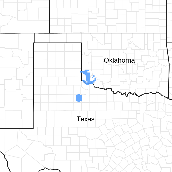
Midgrass, tallgrass, and shortgrass species are found on the site along with several species of forbs and shrubs. Little bluestem (Schizachyrium scoparium) and sideoats grama Bouteloua curtipendula) are often the most common grasses; however, other grasses such as hairy grama (Bouteloua hirsuta), blue grama (Bouteloua gracilis), and perennial three-awn (Aristida purpurea) are also found on the shallower areas. Big bluestem (Andropogon gerardii), Indiangrass (Sorghastrum nutans), and dropseed species (Sporobolus spp.) are usually found in crevices and deeper soil areas. Common shrubs are feather dalea (Dalea spp.), skunkbush sumac (Rhus tribolata), and redberry juniper (Juniperus pinchotii). Areas occur within the site where the shrubs may be quite prominent and make up a fairly large percent of the total biomass; and there will be areas where grasses and forbs dominate. This site is not a preferred grazing area for most domestic livestock due to accessibility (steep slopes) and shallow soils. Therefore, this site is seldom heavily grazed. Browsing wildlife species such as white tailed deer frequent this site because of the good variety of forbs and shrubs providing food and cover in the canyons. A considerable amount of geologic erosion usually takes place on this site; therefore, any amount of native plant cover that can be supported is desirable. Both natural and anthropogenic fire played a role in the ecology of this site as is true for most Central Rolling Red Plains sites. The general effects of these fires were woody plant suppression and increased vigor of herbaceous plants. However, some of the steeper slopes and canyon walls escaped fire altogether. In general, the rocky soils and steep terrain of this site have much more influence on the plant community than does any external ecological influence. The sparse vegetation and lower production affects fine fuel continuity, and the heat generated by natural fire may have limited the degree of damage to woody plants. It is important to note that it might take this site longer to recover from a burn than most associated sites due to sparse plant density and droughty soils. Since the site is not normally heavily grazed, the overall ecological condition will not be affected as much due to animal use. There are places where on the most accessible part of the site, there is evidence of grazing by cattle. The grazing tends to be somewhat seasonal and for shorter duration than more productive less sloping terrain. However, if the site were grazed by goats instead of cattle, then overgrazing and browsing could be more of a potential problem. Most species of deer utilize the site readily, but in most places , deer populations are not dense enough to place a lot of pressure on primary browse. In most cases, this site is more important for wildlife habitat than for livestock grazing.
A State and Transition Diagram for the Clayey Breaks site is depicted below. Descriptions of each state, transition, and pathway follow the model. Experts base this model on available experimental research, field observations, professional consensus, and interpretations. It is likely to change as knowledge increases.
Plant communities will differ across the MLRA because of the natural variability in weather, soils, and aspect. The Reference State may not always be the management goal. The biological processes on this site are complex. Therefore, representative values are presented in a land management context. The species lists are representative and are not botanical descriptions of all species occurring,
or potentially occurring, on this site. They are not intended to cover every situation or the full range of conditions, species, and responses for the site.
State 1
Reference State
This is the reference ecological state for the Clayey Breaks site. It represents the natural range of variability within the plant community over the course of its development. It takes into consideration the variability in precipitation patterns from year to year and the frequency and timing of fires. During wetter periods, the overall production and species composition of the site may differ from long dry periods. Also, the site may have burned consecutive years during some periods and not burned at all for multiples years. These variation in plant community diversity and structure are considered normal and expected on the site.
Community 1.1
Shortgrass/Midgrass
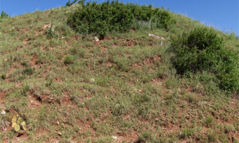
Figure 11. Clayey Breaks Reference State
This plant community is part of the natural variability of the Clayey Breaks site. It is co-dominated by warm season midgrasses and shortgrasses. Tallgrass species are often present in areas of deeper soil resources and can make up a significant amount of herbaceous production. Many perennial native forbs are present along with many different species of woody shrubs. Periodic fires have historically kept the woody canopy cover under 30 percent. Some areas of higher canopy may exist around rocky outcrops or barren areas that are protected from fire.
Due to the slope of the Clayey Breaks site, it is rarely used by grazing animals. Grazing is usually possible only on the footslopes where the Clayey Breaks site transitions to a different site. Browsing wildlife species and domestic goats may utilize the site much more than cattle or horses.
There is very limited production data on these sites but estimates have been made. Overall annual production (woody and herbaceous) on the Clay Breaks site is estimated to range from 900 to 1,500 pounds per acre.
Community 1.2
Shortgrass/Annuals/Shrubs
This plant community is part of the natural variability of the Clayey Breaks site. There is an increase in shortgasses and annual forbs as the vigor of the midgrass and tallgrass species has declined. Perennial forbs may also decline leading to increased bare ground and the opportunistic annual plants. Increased shrub canopy may also occur in this community depending on time since fire.
Pathway 1.1A
Community 1.1 to 1.2
With prolonged dry periods, the plant community may shift towards community 1.2. Fire exclusion can also contribute to this shift by allowing woody species canopy to expand.
Pathway 1.2A
Community 1.2 to 1.1
With periodic fire and favorable growing season moisture, this plant community may shift back to plant community 1.1.
State 2
Shrub Dominated
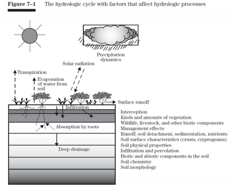
This ecological state is the result of long term fire exclusion. Without periodic fires to suppress the woody species, they have increased in canopy size and abundance. Several ecological process are altered as a result. The hydrologic cycle is disrupted by both rainfall interception and excessive use by the more prolific shrub species. Energy flow is dominated by the shrubs which can shade out many of the other herbaceous plants. Overall biomass production may be similar to the reference state, however the majority is made up of woody species production.
Community 2.1
Shrub Dominated
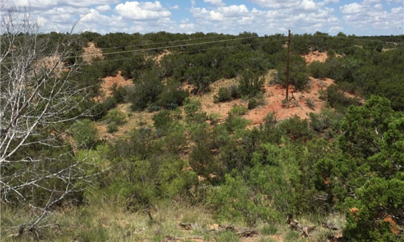
Figure 12. Shrub Dominated
Transition T1A
State 1 to 2
With long term fire exclusion (10+ years), this site may transition to a shrub dominated ecological state. Without fire or alternative brush management methods, the woody species will begin to dominate the ecological processes.
Restoration pathway R2A
State 2 to 1
It is believed that this shrub dominated state can be returned to the reference state. This restoration must involve the reintroduction of fire through prescribed burning. Potentially, other brush management practices may be needed in order to expedite the processes. Caution should be used if any mechanical brush treatment is applied as the erosion potential may be high on the steep slopes. Depending on weather patterns, fuel continuity, and remaining reference state species, this process could take many years(10+).


