
Natural Resources
Conservation Service
Ecological site R078CY006OK
Clayey Breaks
Last updated: 9/15/2023
Accessed: 11/21/2024
General information
Provisional. A provisional ecological site description has undergone quality control and quality assurance review. It contains a working state and transition model and enough information to identify the ecological site.
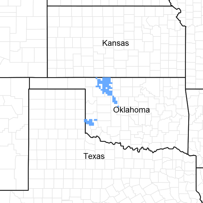
Figure 1. Mapped extent
Areas shown in blue indicate the maximum mapped extent of this ecological site. Other ecological sites likely occur within the highlighted areas. It is also possible for this ecological site to occur outside of highlighted areas if detailed soil survey has not been completed or recently updated.
MLRA notes
Major Land Resource Area (MLRA): 078C–Central Rolling Red Plains, Eastern Part
MLRA 78C is characterized by moderately dissected, rolling plains with prominent ridges and valleys and numerous terraces adjacent to dissecting streams. Loamy and clayey soils are generally deep, well drained, and developed in soft, calcareous sandstones, siltstones, and shales in red beds of Permian age. Characteristic red soils have formed in most of the area because of the underlying Permian red-bed sedimentary rocks.
Classification relationships
This ecological site is correlated to soil components at the Major Land Resource Area (MLRA) level which is further described in USDA Ag Handbook 296.
Ecological site concept
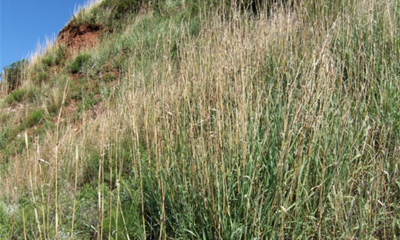
This site is composed of steep, shallow soils on breaks and escarpments. Vegetation can vary depending on slope, aspect, and precipitation but is generally dominated by short and midgrass species. Perennial forbs and some tallgrass species persist in some areas and shrubs have historically been limited to 10% canopy cover by periodic fires. This site is often browsed by wildlife species and not typically subject to grazing by cattle, however, some instances may occur. As fire is removed from the lanscape, brush canopy may increase. This site is quite sensitive to periods of drought due to the shallow clay soils.
Associated sites
| R078CY038OK |
Gyp Some sites with steep slopes but Gypsum visible at surface. Cornick, Cottonwood soils. |
|---|
Similar sites
| R078CY005OK |
Loamy Breaks Burson, Deepwood, Quinlan, Spikebox, and Woodward soils. Deeper soils support a tallgrass dominated HPC. |
|---|---|
| R078BY094TX |
Clayey Breaks Similar site in MLRA 78B. |
Table 1. Dominant plant species
| Tree |
Not specified |
|---|---|
| Shrub |
(1) Rhus aromatica |
| Herbaceous |
(1) Bouteloua curtipendula |
Physiographic features
These sites are located along clayey ridges and escarpments with slopes ranging from 12-40%. With slopes in this range, land use and management practices are quite limited when compared to adjacent sites.
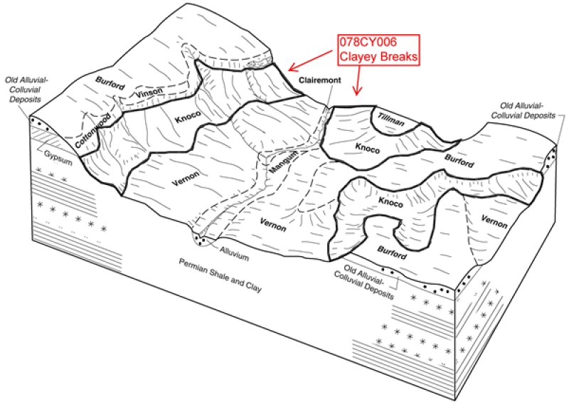
Figure 2. cbp
Table 2. Representative physiographic features
| Landforms |
(1)
Plains
> Hill
(2) Plains > Escarpment |
|---|---|
| Runoff class | Very high |
| Flooding frequency | None |
| Ponding frequency | None |
| Elevation | 305 – 701 m |
| Slope | 12 – 40% |
| Water table depth | 191 – 203 cm |
| Aspect | Aspect is not a significant factor |
Climatic features
The extent of this ecological site is confined to northwestern Oklahoma and Southwestern Kansas. Specifically form Barber County, KS south to Blain County, OK. The weather is alternately influenced by cold dry air from the Arctic Circle in the winter, and warm moist air from the Gulf of Mexico in spring and early summer. Seasonal changes are gradual with spring being a season of variable weather. Large precipitation events are commonly brought on by thunderstorms that may contain hail and high winds. Approximately 75 percent of the rainfall occurs during the warm season, and much of it comes in storms of high intensity and short duration in May and June. These rains can be particularly erosive on sites where vegetation is sparse. Summers are generally hot with low humidity and typically last longer than the winters. Occasional droughts are to be expected and are a reoccurring part of the ecosystem. Lack of rainfall along with hot dry winds often curtails forage production during July and August. Fall has periods of temperate weather interspersed with moderate to heavy rains, along with cooler temperatures that can dip below freezing especially towards the end of fall. Winter is typically moderate with cold winds from the north and infrequent storms can bring bitterly cold temperatures and snow to the area, but are commonly short lived.
Table 3. Representative climatic features
| Frost-free period (characteristic range) | 163-195 days |
|---|---|
| Freeze-free period (characteristic range) | 192-217 days |
| Precipitation total (characteristic range) | 660-686 mm |
| Frost-free period (actual range) | 161-199 days |
| Freeze-free period (actual range) | 191-219 days |
| Precipitation total (actual range) | 660-711 mm |
| Frost-free period (average) | 182 days |
| Freeze-free period (average) | 204 days |
| Precipitation total (average) | 686 mm |
Figure 3. Monthly precipitation range
Figure 4. Monthly minimum temperature range
Figure 5. Monthly maximum temperature range
Figure 6. Monthly average minimum and maximum temperature
Figure 7. Annual precipitation pattern
Figure 8. Annual average temperature pattern
Climate stations used
-
(1) ANSON 3ESE [USC00410268], Anson, TX
-
(2) VERNON [USC00419346], Vernon, TX
-
(3) CLINTON SHERMAN AP [USW00003932], Dill City, OK
-
(4) MUTUAL [USC00346139], Mutual, OK
-
(5) COLDWATER [USC00141704], Coldwater, KS
Influencing water features
Well drained >20% slope with high run-off. No Influencing Water Features.
Wetland description
NA
Soil features
The soils associated with this ecological site consist of very shallow and shallow, well drained, very slowly permeable soils that formed in residuum over dense non-cemented claystone bedrock of Permian age. These soils are on very steep ridges, sideslopes, and erosional footslopes on uplands of the Central Rolling Red Plains (MLRA 78C). Slopes range from 12 to 40 percent.
Representative Soils:
These soils associated with site generally include components of Knoco, Badlands, and/or Rock Outcrop.
Table 4. Representative soil features
| Parent material |
(1)
Residuum
–
claystone
|
|---|---|
| Surface texture |
(1) Clay (2) Silty clay loam (3) Clay loam |
| Drainage class | Well drained |
| Permeability class | Slow to very slow |
| Depth to restrictive layer | 10 – 25 cm |
| Soil depth | 10 – 51 cm |
| Surface fragment cover <=3" | 0% |
| Surface fragment cover >3" | 0% |
| Available water capacity (0-101.6cm) |
1.52 – 4.06 cm |
| Calcium carbonate equivalent (0-101.6cm) |
1 – 15% |
| Electrical conductivity (0-101.6cm) |
0 – 4 mmhos/cm |
| Sodium adsorption ratio (0-101.6cm) |
0 – 8 |
| Soil reaction (1:1 water) (0-101.6cm) |
6.6 – 8.4 |
| Subsurface fragment volume <=3" (Depth not specified) |
0 – 9% |
| Subsurface fragment volume >3" (Depth not specified) |
0 – 1% |
Ecological dynamics
The reference plant community is a mixture of grasses, forbs, shrubs, and a few trees. They percent of bare ground can sometimes be fairly high in comparison to adjacent sites. Aspect, climate, soil depth, percent slope, and disturbance factors are all important determinants in the overall species composition and production of the plant community. This is especially true for a Clayey Breaks site. Generally the north and east facing exposures have a greater variety of plants present and slightly higher production due to more mesic conditions. Forage production is generally less than sites with deeper soil resources. Accessibility is limited due to steep slopes.
Midgrass, tallgrass, and shortgrass species are found on the site along with several species of forbs and shrubs. Little bluestem (Schizachyrium scoparium), sideoats grama (Bouteloua curtipendula), and are often the most common grasses; however, other grasses such as hairy grama (Bouteloua hirsuta), blue grama (Bouteloua gracilis), perennial three-awn (Aristida purpurea) and are also found on the shallower areas. Big bluestem (Andropogon gerardii), Indiangrass (Sorghastrum nutans), and dropseed species (Sporobolus spp.) are usually found in crevices and deeper soil areas. Common shrubs are feather dalea (Dalea spp.), skunkbush sumac (Rhus tribolata), and eastern redcedar (Juniperus virginiana). Areas occur within the site where the shrubs may be quite prominent and make up a fairly large percent of the total biomass; and there will be areas where grasses and forbs dominate. This site is not a preferred grazing area for most domestic livestock due to accessibility (steep slopes) and shallow soils. Therefore, this site is seldom heavily grazed. Browsing wildlife species such as white tailed deer frequent this site because of the good variety of forbs and shrubs providing food and cover in the canyons. A considerable amount of geologic erosion usually takes place on this site; therefore, any amount of native plant cover that can be supported is desirable.
Both natural and anthropogenic fire played a role in the ecology of this site as is true for most Central Rolling Red Plains sites. The general effects of these fires were woody plant suppression and increased vigor of herbaceous plants. However, some of the steeper slopes and canyon walls escaped fire altogether. In general, the rocky soils and steep terrain of this site have much more influence on the plant community than does any external ecological influence. The sparse vegetation and lower production affects fine fuel continuity, and the heat generated by natural fire may have limited the degree of damage to woody plants. It is important to note that it might take this site longer to recover from a burn than most associated sites due to sparse plant density and droughty soils.
Since the site is not normally heavily grazed, the overall ecological condition will not be affected as much due to animal use. There are places where on the most accessible part of the site, there is evidence of grazing by cattle. The grazing tends to be somewhat seasonal and for shorter duration than more productive less sloping terrain. However, if the site were grazed by goats instead of cattle, then overgrazing and browsing could be more of a potential problem. Most species of deer utilize the site readily, but in most places in MLRA 78C, deer populations are not dense enough to place a lot of pressure on primary browse. In most cases, this site is more important for wildlife habitat than for livestock grazing.
State and transition model
More interactive model formats are also available.
View Interactive Models
Click on state and transition labels to scroll to the respective text
Ecosystem states
| T1A | - | Absence of disturbance and natural regeneration over time, may be coupled with excessive grazing pressure |
|---|---|---|
| R2A | - | Adequate rest from defoliation, followed by reintroduction of historic disturbance regimes |
State 2 submodel, plant communities
State 1
Grassland State
Dominant plant species
-
little bluestem (Schizachyrium scoparium), grass
-
sideoats grama (Bouteloua curtipendula), grass
Community 1.1
Midgrass/Tallgrass/Shortgrass (Reference Community)

Figure 9. 1.1 Midgrass/Tallgrass/Shortgrass Comunity HPC
This is the reference plant community for this site. It is difficult to predict and describe a definite plant community for this site because the amounts of actual soil material present, the degree of slope, and site aspect are highly variable; and all of these factors can have a significant influence on each site's plant community developement. In the HPC, midgrasses were usually the dominant species. However, tallgrasses can also be the dominant species if soil depth allows. Occassionally, the site can have a good percentage of bare ground. Sideoats grama can sometimes be the dominant grass; but when sideoats grama is present in significant amounts, the soils are usually deep enough for tallgrasses such as big bluestem and Indiangrass to thrive enough in crevices, pockets, and swales of greater soil depth to be co-dominant. On sites where there are no deep soils, tallgrasses may not be found, forbs may be prominent, and shortgrasses such as buffalograss, blue grama, and hairy grama will be dominant. Moderate amounts of forbs are usually present and are usually will distributed. Shrubs make up approximately 5-10% of the production, but may be localized in occurrence. This plant community is relatively stable and shifts very little from year to year barring anthropogenic disturbence.However, active erosion can also have a significant effect on the plant community.
Figure 10. Annual production by plant type (representative values) or group (midpoint values)
Table 5. Annual production by plant type
| Plant type | Low (kg/hectare) |
Representative value (kg/hectare) |
High (kg/hectare) |
|---|---|---|---|
| Grass/Grasslike | 583 | 841 | 1104 |
| Forb | 78 | 106 | 135 |
| Shrub/Vine | 34 | 50 | 67 |
| Tree | 22 | 34 | 45 |
| Microbiotic Crusts | 11 | 17 | 17 |
| Total | 728 | 1048 | 1368 |
Figure 11. Plant community growth curve (percent production by month). OK0002, Native Warm Season - North Oklahoma. This is the estimated growth curve for the northern half of Oklahoma where mean annual air temperatures are less than 60 degrees F. Plant growth can vary from year to year dependening on air temperature and timing and amount of precipitation. These figures are merely a representative example for warm season native plants in the geographic area..
| Jan | Feb | Mar | Apr | May | Jun | Jul | Aug | Sep | Oct | Nov | Dec |
|---|---|---|---|---|---|---|---|---|---|---|---|
| J | F | M | A | M | J | J | A | S | O | N | D |
| 0 | 0 | 3 | 15 | 20 | 30 | 10 | 6 | 10 | 6 | 0 | 0 |
Community 1.2
Midgrass/Shortgrass Dominant Community with remnant Tallgrasses and a few Trees and Shrubs
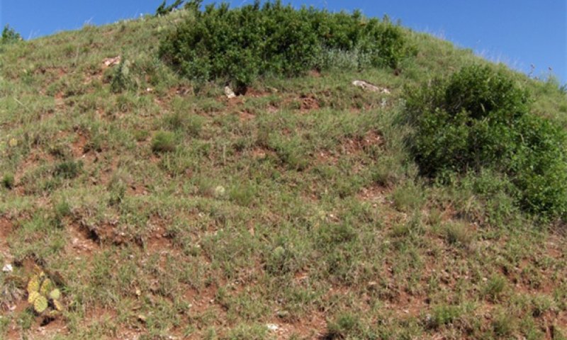
Figure 12. 1.2 Midgrass/Shortgrass Community
Midgrasses and shortgrasses with little bluestem and a few other tallgrasses remaining. Bare ground is increased and active erosion is evident. Yucca, skunkbush, and other shrub species will increase. More of a barren looking site than the reference community.
Figure 13. Annual production by plant type (representative values) or group (midpoint values)
Table 6. Annual production by plant type
| Plant type | Low (kg/hectare) |
Representative value (kg/hectare) |
High (kg/hectare) |
|---|---|---|---|
| Grass/Grasslike | 336 | 560 | 785 |
| Forb | 84 | 112 | 224 |
| Shrub/Vine | 56 | 73 | 90 |
| Tree | 45 | 56 | 67 |
| Total | 521 | 801 | 1166 |
Figure 14. Plant community growth curve (percent production by month). OK0002, Native Warm Season - North Oklahoma. This is the estimated growth curve for the northern half of Oklahoma where mean annual air temperatures are less than 60 degrees F. Plant growth can vary from year to year dependening on air temperature and timing and amount of precipitation. These figures are merely a representative example for warm season native plants in the geographic area..
| Jan | Feb | Mar | Apr | May | Jun | Jul | Aug | Sep | Oct | Nov | Dec |
|---|---|---|---|---|---|---|---|---|---|---|---|
| J | F | M | A | M | J | J | A | S | O | N | D |
| 0 | 0 | 3 | 15 | 20 | 30 | 10 | 6 | 10 | 6 | 0 | 0 |
Pathway 1.1A
Community 1.1 to 1.2


Increased soil erosion, coupled with the abscence of fire and proper grazing management(if applicable) can cause the reference community to shift to a midgrass/shortgrass dominated plant community.
Pathway 1.2A
Community 1.2 to 1.1


Through development and implementation of a prescribed burning and prescribed grazing program, the Midgrass/Shortgrass dominated community can be reverted to the Reference Community. This community shift may take a many years in order to produce the fuel loads that are required to successfully implement a prescribed burn. It is important to properly manage fine fuel load as part of the planning of the prescribed burn to ensure the objectives are met.
Conservation practices
| Prescribed Burning | |
|---|---|
| Prescribed Grazing |
State 2
Shrubland/Woody Invasion State
The following narrative describes the plant community within the Shrubland/Woody State. This state has 25% or greater canopy cover by invasive woody species with a decreasing herbaceous component.
Dominant plant species
-
eastern redcedar (Juniperus virginiana), tree
Community 2.1
Shrubland/Shortgrass Community
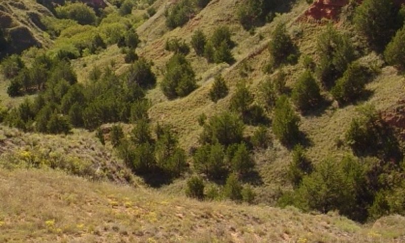
Figure 15. 2.1 Woody Invasion
The plant community for the Clayey Breaks ecological site is now in a state of shrub and tree dominance. It has been invaded by eastern redcedar, mesquite, and other woody plants. Invasive woody species dominate the midgrasses, shortgrasses, yucca, and skunkbush sumac. There are fewer forbs in this plant community. It has reached 25% or more woody species canopy cover. The common woody species is eastern redcedar (Juniperus virginiana).
Figure 16. Plant community growth curve (percent production by month). OK0002, Native Warm Season - North Oklahoma. This is the estimated growth curve for the northern half of Oklahoma where mean annual air temperatures are less than 60 degrees F. Plant growth can vary from year to year dependening on air temperature and timing and amount of precipitation. These figures are merely a representative example for warm season native plants in the geographic area..
| Jan | Feb | Mar | Apr | May | Jun | Jul | Aug | Sep | Oct | Nov | Dec |
|---|---|---|---|---|---|---|---|---|---|---|---|
| J | F | M | A | M | J | J | A | S | O | N | D |
| 0 | 0 | 3 | 15 | 20 | 30 | 10 | 6 | 10 | 6 | 0 | 0 |
Transition T1A
State 1 to 2
With continous disturbances through heavy grazing (if applicable), erosion, fire suppression, long term drought, and/or encroachment by Juniper and/or Mesquite; the Grassland state will transition to a Shrubland/Woody Invasion state.
Restoration pathway R2A
State 2 to 1
Through development and initiation of a prescribed fire and brush management program, the Shrubland/Invasion state may be restored to a Grassland state. It is important to remember that fine fuel management is an very important when planning a prescribed burn on these sites due to the sparse grasses that occur in the Shrubland/Invasion state. Depending on precipitation patterns, this restoration can can take many years.
Conservation practices
| Brush Management | |
|---|---|
| Prescribed Burning |
Additional community tables
Table 7. Community 1.1 plant community composition
| Group | Common name | Symbol | Scientific name | Annual production (kg/hectare) | Foliar cover (%) | |
|---|---|---|---|---|---|---|
|
Grass/Grasslike
|
||||||
| 1 | Tallgrasses | 207–392 | ||||
| little bluestem | SCSC | Schizachyrium scoparium | 0–269 | – | ||
| Indiangrass | SONU2 | Sorghastrum nutans | 0–56 | – | ||
| big bluestem | ANGE | Andropogon gerardii | 0–56 | – | ||
| switchgrass | PAVI2 | Panicum virgatum | 0–56 | – | ||
| 2 | Mid/Shortgrasses | 375–712 | ||||
| sideoats grama | BOCU | Bouteloua curtipendula | 112–269 | – | ||
| blue grama | BOGR2 | Bouteloua gracilis | 56–106 | – | ||
| hairy grama | BOHI2 | Bouteloua hirsuta | 56–106 | – | ||
| silver beardgrass | BOLAL2 | Bothriochloa laguroides ssp. laguroides | 0–106 | – | ||
| fall witchgrass | DICO6 | Digitaria cognata | 0–106 | – | ||
| Texas bluegrass | POAR | Poa arachnifera | 0–106 | – | ||
| dropseed | SPORO | Sporobolus | 0–106 | – | ||
| slim tridens | TRMUE | Tridens muticus var. elongatus | 0–106 | – | ||
| Wright's threeawn | ARPUW | Aristida purpurea var. wrightii | 0–106 | – | ||
|
Forb
|
||||||
| 4 | Forbs | 78–135 | ||||
| white sagebrush | ARLU | Artemisia ludoviciana | 0–34 | – | ||
| yellow sundrops | CASE12 | Calylophus serrulatus | 0–34 | – | ||
| rose heath | CHER2 | Chaetopappa ericoides | 0–34 | – | ||
| blacksamson echinacea | ECAN2 | Echinacea angustifolia | 0–34 | – | ||
| longleaf buckwheat | ERLO5 | Eriogonum longifolium | 0–34 | – | ||
| stiffleaf false goldenaster | HESTS | Heterotheca stenophylla var. stenophylla | 0–34 | – | ||
| trailing krameria | KRLA | Krameria lanceolata | 0–34 | – | ||
| dotted blazing star | LIPU | Liatris punctata | 0–34 | – | ||
| plains blackfoot | MELE2 | Melampodium leucanthum | 0–34 | – | ||
| evening primrose | OENOT | Oenothera | 0–34 | – | ||
| pricklypear | OPUNT | Opuntia | 0–34 | – | ||
| yellow nailwort | PAVI4 | Paronychia virginica | 0–34 | – | ||
| Fendler's penstemon | PEFE | Penstemon fendleri | 0–34 | – | ||
| James' holdback | POJA5 | Pomaria jamesii | 0–34 | – | ||
| slimflower scurfpea | PSTE5 | Psoralidium tenuiflorum | 0–34 | – | ||
| diamond-flowers | STNI6 | Stenaria nigricans | 0–34 | – | ||
| alderleaf mountain mahogany | CEMO2 | Cercocarpus montanus | 0–17 | – | ||
| jointfir | EPHED | Ephedra | 0–17 | – | ||
| broom snakeweed | GUSA2 | Gutierrezia sarothrae | 0–17 | – | ||
| twistspine pricklypear | OPMA2 | Opuntia macrorhiza | 0–17 | – | ||
| skunkbush sumac | RHTR | Rhus trilobata | 0–17 | – | ||
| yucca | YUCCA | Yucca | 0–17 | – | ||
|
Shrub/Vine
|
||||||
| 5 | Shrub/Vine | 34–67 | ||||
| eastern redcedar | JUVI | Juniperus virginiana | 0–22 | – | ||
| honey mesquite | PRGL2 | Prosopis glandulosa | 0–22 | – | ||
| featherplume | DAFO | Dalea formosa | 0–17 | – | ||
| broom snakeweed | GUSA2 | Gutierrezia sarothrae | 0–17 | – | ||
| Nuttall's sensitive-briar | MINU6 | Mimosa nuttallii | 0–17 | – | ||
| fragrant sumac | RHAR4 | Rhus aromatica | 0–17 | – | ||
| smooth sumac | RHGL | Rhus glabra | 0–17 | – | ||
| soapweed yucca | YUGL | Yucca glauca | 0–17 | – | ||
|
Tree
|
||||||
| 6 | Tree | 22–45 | ||||
| common hackberry | CEOC | Celtis occidentalis | 0–22 | – | ||
| eastern redcedar | JUVI | Juniperus virginiana | 0–22 | – | ||
Interpretations
Animal community
The Clayey Breaks site is used by deer for cover and browsing. Small mammals and predators also frequent the site. Many species of songbirds utilize this site, especially if a juniper community is present. Cattle seasonally graze the more accessible parts of this site, but because of slope, they graze Clayey Break areas less frequently than associated sites. Woody plant species may be desirable if the site is to be managed for deer habitat. White-tailed deer prefer interspersed mosaic shrub and tree cover.
Hydrological functions
Runoff is rapid from this site due to little infiltration and steep slopes. Runoff eventually reaches the drainages below.
Recreational uses
Hunting, Camping, Hiking, Birdwatching, Photography, Horseback Riding
Wood products
Eastern redcedar grows in sufficient amount in some locations to be a source for fence posts. Furniture, oils, lumber, mulch, cedar fiber, and many knick knack items are made from eastern redcedar. Mesquite can be used for cooking wood and charcoal.
Supporting information
Inventory data references
NRCS FOTG-Section II of the FOTG Range Site Descriptions and numerous historical accounts of vegetative conditions at the time of early settlement in the area were used in the developement of this site description. Vegetation inventories were made at several site locations for support documentation.
NRCS-FOTG Section II-Range Site Descriptions
NRCS-NRI 417 data
NRCS Clipping Data summaries over a 20 year period
Type locality
| Location 1: Major County, OK | |
|---|---|
| General legal description | Gloss Mountain Park, State of Oklahoma, West of Orienta, Oklahoma |
Other references
USDA, Natural Resources Conservation Service Range Site Descriptions
USDA, Natural Resources Conservation Service Soil Survey Reports, Oklahoma
Technical Reviewers:
Harry Fritzler, Range Specialist, Norman, OK
Mark Moseley, Range Specialist, Boerne, TX
Brandon Reavis, Range Specialist, Stillwater, OK
Contributors
Colin Walden, Range Specialist(ESI), Stillwater, OK
Dr. Jack Eckroat, Grazing Lands Specialist, NRCS, Oklahoma
PES Edits by Tyson Morley, MLRA Soil Scientist, Altus, Oklahoma
Approval
Bryan Christensen, 9/15/2023
Acknowledgments
Site Development and Testing Plan
Future work, as described in a Project Plan, to validate the information in this Provisional Ecological Site Description is needed. This will include field activities to collect low, medium and high intensity sampling, soil correlations, and analysis of that data. Annual field reviews should be done by soil scientists and vegetation specialists. A final field review, peer review, quality control, and quality assurance reviews of the ESD will be needed to produce the final document.
Annual reviews of the Project Plan are to be conducted by the Ecological Site Technical Team.
Rangeland health reference sheet
Interpreting Indicators of Rangeland Health is a qualitative assessment protocol used to determine ecosystem condition based on benchmark characteristics described in the Reference Sheet. A suite of 17 (or more) indicators are typically considered in an assessment. The ecological site(s) representative of an assessment location must be known prior to applying the protocol and must be verified based on soils and climate. Current plant community cannot be used to identify the ecological site.
| Author(s)/participant(s) | Mark Moseley, Colin Walden(Update) |
|---|---|
| Contact for lead author | NRCS, 100 USDA, Suite 206, Stillwater, Oklahoma 74074 |
| Date | 06/12/2008 |
| Approved by | Bryan Christensen |
| Approval date | |
| Composition (Indicators 10 and 12) based on | Annual Production |
Indicators
-
Number and extent of rills:
Very few rills. -
Presence of water flow patterns:
Distinct, particularly on steeper slopes. Not usually more than 1 foot deep. -
Number and height of erosional pedestals or terracettes:
Common, around small rocks and around bunchgrasses, but usually not more than 1 – 2 inches deep. -
Bare ground from Ecological Site Description or other studies (rock, litter, lichen, moss, plant canopy are not bare ground):
25-35% bare ground;Rock = 2 - 25% -
Number of gullies and erosion associated with gullies:
Shallow soil limits formation of anything but small gullies. Usually these are on steeper slopes, are rounded, less than 1 – 2 feet deep and 2 – 3 feet wide. Geologic erosion occurs on this site. -
Extent of wind scoured, blowouts and/or depositional areas:
None -
Amount of litter movement (describe size and distance expected to travel):
Litter can move 1- 3 feet after a high intensity rainfall event. It is difficult to maintain litter on exposed soil, particularly on the high slopes portion. -
Soil surface (top few mm) resistance to erosion (stability values are averages - most sites will show a range of values):
Stability score 5 – 6 -
Soil surface structure and SOM content (include type of structure and A-horizon color and thickness):
Very gravelly clay; low SOM; Refer to Soil Series description. -
Effect of community phase composition (relative proportion of different functional groups) and spatial distribution on infiltration and runoff:
Mid-grass (little bluestem, sideoats grama), short grass/shrub community randomly dispersed. Slopes and very slowly permeable soils result in high runoff. -
Presence and thickness of compaction layer (usually none; describe soil profile features which may be mistaken for compaction on this site):
No compaction layer but fine texture and hard structure can be mistaken for compaction layer. -
Functional/Structural Groups (list in order of descending dominance by above-ground annual-production or live foliar cover using symbols: >>, >, = to indicate much greater than, greater than, and equal to):
Dominant:
Warm-season Midgrasses>Warm-season Tallgrasses(If soil resources allow)Sub-dominant:
Warm-season Shortgrasses>Forbs>Shrubs/VinesOther:
TreesAdditional:
Aspect and Slope will have significant affect on Functional/Structural Groups -
Amount of plant mortality and decadence (include which functional groups are expected to show mortality or decadence):
Due to the droughty nature of this site, some mortality will occur, especially with three-awns, sideoats grama and little bluestem. Death loss could be around 10%, higher in extremely dry, hot years. -
Average percent litter cover (%) and depth ( in):
Litter is predominantly herbaceous -
Expected annual annual-production (this is TOTAL above-ground annual-production, not just forage annual-production):
650-1200 pounds per acre -
Potential invasive (including noxious) species (native and non-native). List species which BOTH characterize degraded states and have the potential to become a dominant or co-dominant species on the ecological site if their future establishment and growth is not actively controlled by management interventions. Species that become dominant for only one to several years (e.g., short-term response to drought or wildfire) are not invasive plants. Note that unlike other indicators, we are describing what is NOT expected in the reference state for the ecological site:
Eastern redcedar and Mesquite can become invasive -
Perennial plant reproductive capability:
All plants should be capable of reproduction at least every 2-3 years, except during periods of prolonged drought conditions, heavy natural herbivory or intense wildfires.
Print Options
Sections
Font
Other
The Ecosystem Dynamics Interpretive Tool is an information system framework developed by the USDA-ARS Jornada Experimental Range, USDA Natural Resources Conservation Service, and New Mexico State University.
Click on box and path labels to scroll to the respective text.
Ecosystem states
| T1A | - | Absence of disturbance and natural regeneration over time, may be coupled with excessive grazing pressure |
|---|---|---|
| R2A | - | Adequate rest from defoliation, followed by reintroduction of historic disturbance regimes |