
Natural Resources
Conservation Service
Ecological site R078CY083OK
Shallow Upland
Last updated: 9/15/2023
Accessed: 02/07/2026
General information
Provisional. A provisional ecological site description has undergone quality control and quality assurance review. It contains a working state and transition model and enough information to identify the ecological site.
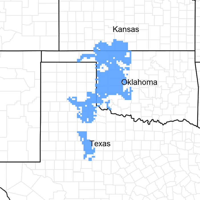
Figure 1. Mapped extent
Areas shown in blue indicate the maximum mapped extent of this ecological site. Other ecological sites likely occur within the highlighted areas. It is also possible for this ecological site to occur outside of highlighted areas if detailed soil survey has not been completed or recently updated.
MLRA notes
Major Land Resource Area (MLRA): 078C–Central Rolling Red Plains, Eastern Part
MLRA 78C is characterized by moderately dissected, rolling plains with prominent ridges and valleys and numerous terraces adjacent to dissecting streams. Loamy and clayey soils are generally deep, well drained, and developed in calcareous and gypsiferous sediments of Permian age.
This MLRA overlaps other land classifications systems including Level IV EPA Ecoregions 27q “Rolling Red Hills”, 27l “Pleistocene Sand Dunes”, and 27h “Red Prairie”. Duck & Fletcher game types within MLRA 78C include “Tallgrass Prairie”, “Mixedgrass Eroded Plains”, and “Sandsage Grassland”.
This particular ecological site may be part of alternative vegetation descriptions including:
Landfire: Central Mixedgrass Praire
Grasslands of OK(Harland): Mixed Praire
FDGC code: V.A.5.N.c. SCHIZACHYRIUM SCOPARIUM - BOUTELOUA CURTIPENDULA HERBACEOUS ALLIANCE
Shiflet Rangeland cover types of the US: Bluestem-Grama SRM 709 & SRM 604
LRU notes
NA
Classification relationships
This ecological site is correlated to soil components at the Major Land Resource Area (MLRA) level which is further described in USDA Ag Handbook 296.
Ecological site concept
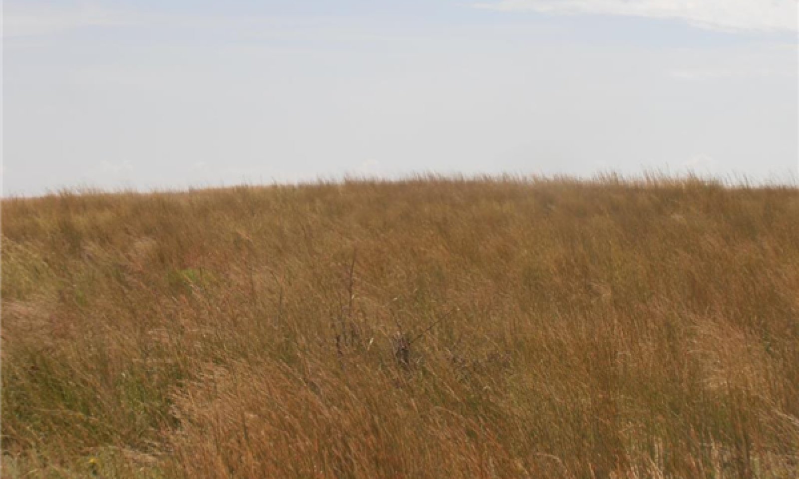
The Shallow Upland ecological site consists of a mixture of native grasses, forbs, and very few woody species. This plant community evolved through periods of grazing, fire, and drought. Therefore, many of the species that occur are somewhat tolerant to these disturbances and vary in production over time. Historically, the site was dominated by midgrass and tallgrass species, with a variety of forbs and legumes. Shortgrasses persist on the site. However, they only become dominant following periods of increased disturbance (i.e.: abusive grazing or long term drought). Woody species are usually limited by soil depth and historical fire. There are some invasive woody plants that can tolerate these soil limitations and will increase in the absence of fire. The primary woody invader is Eastern Redcedar (Juniperus virginiana). This plant is native to Oklahoma but not necessarily native to the shallow upland ecological site.
It is important to note that while the soils of the shallow upland ecological are not well suited for cultivation, many of these sites were farmed at some point in the past. Often, these cultivated fields were abandoned or reseeded to native (CRP/Soil Bank) or introduced grass species. Some of these “oldfields” may contain plant communities that appear similar to those of the reference state. However, soil properties, plant species, and range health attributes have been altered through cultivation. Therefore, careful examination of each site should be conducted to ensure an accurate evaluation of the present ecological state.
As the soil associated with this site is often mapped in a complex with deeper soils, it is important to perform onsite soils investigations to determine the correct site description for use in your evaluation.
Associated sites
| R078CY005OK |
Loamy Breaks Similar soils. Occurs on slopes greater than 20%. More bare ground and potential for erosion. |
|---|---|
| R078CY056OK |
Loamy Upland Deep soils of similar texture. Potential for greater amount of annual production. Often mapped as a Mapunit Complex with Shallow Upland soils. |
Similar sites
| R078CY005OK |
Loamy Breaks Similar soils. Occurs on slopes greater than 20%. More bare ground and potential for erosion. |
|---|---|
| R078CY067OK |
Red Shale Shallow soils over siltstone |
Table 1. Dominant plant species
| Tree |
Not specified |
|---|---|
| Shrub |
(1) Rhus aromatica |
| Herbaceous |
(1) Schizachyrium scoparium |
Physiographic features
This ecological site occurs on gently sloping to moderately steep shallow soils located on ridges and escarpments.
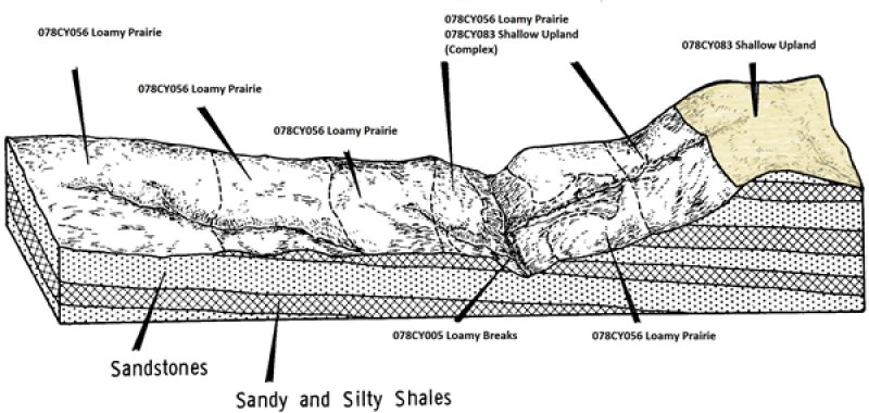
Figure 2. Shallow Upland Landscape
Table 2. Representative physiographic features
| Landforms |
(1)
Plains
> Hill
(2) Plains > Escarpment |
|---|---|
| Runoff class | Medium to high |
| Flooding frequency | None |
| Ponding frequency | None |
| Elevation | 1,000 – 2,500 ft |
| Slope | 1 – 25% |
| Ponding depth |
Not specified |
| Aspect | Aspect is not a significant factor |
Climatic features
MLRA 78C lies within the subtropical sub-humid climate regime. This regime is characterized by rapid changes in temperature; marked extremes, both daily and annual; and rather erratic rainfall. The weather is alternately influenced by cold dry air from the Arctic Circle, and warm moist air from the Gulf of Mexico.
Seasonal changes are gradual. Spring is a season of variable weather and relatively high precipitation with prevailing winds from the southwest. Summers are generally hot with low humidity. Fall has long periods of pleasant weather interspersed with moderate to heavy rains. Winter is open and moderate to cold with winds from the north and infrequent snows.
Wind speeds average more than eleven miles an hour with prevailing southern winds. Rather strong winds can occur in all months of the year. While strong gusty winds occur, severe dust storms are rare.
Approximately 75 percent of the rainfall occurs during the warm season, and much of it comes in storms of high intensity and short duration in May and June. These rains can be particularly erosive on sites where vegetation is sparse. Occasional droughts are to be expected. Lack of rainfall and hot, dry winds often curtail forage production during July and August.
Table 3. Representative climatic features
| Frost-free period (characteristic range) | 145-163 days |
|---|---|
| Freeze-free period (characteristic range) | 184-195 days |
| Precipitation total (characteristic range) | 26-29 in |
| Frost-free period (actual range) | 142-181 days |
| Freeze-free period (actual range) | 177-204 days |
| Precipitation total (actual range) | 25-30 in |
| Frost-free period (average) | 156 days |
| Freeze-free period (average) | 190 days |
| Precipitation total (average) | 27 in |
Figure 3. Monthly precipitation range
Figure 4. Monthly minimum temperature range
Figure 5. Monthly maximum temperature range
Figure 6. Monthly average minimum and maximum temperature
Figure 7. Annual precipitation pattern
Figure 8. Annual average temperature pattern
Climate stations used
-
(1) CLINTON [USC00341909], Clinton, OK
-
(2) TALOGA [USC00348708], Taloga, OK
-
(3) WAYNOKA [USC00349404], Waynoka, OK
-
(4) MEDICINE LODGE [USC00145173], Medicine Lodge, KS
-
(5) WILMORE 16SE [USC00148914], Coldwater, KS
-
(6) FREEDOM [USC00343358], Freedom, OK
-
(7) REYDON 2SSE [USC00347579], Reydon, OK
-
(8) COLDWATER [USC00141704], Coldwater, KS
-
(9) HAMMON 3 SSW [USC00343871], Elk City, OK
-
(10) MUTUAL [USC00346139], Mutual, OK
-
(11) HOBART MUNI AP [USW00093986], Hobart, OK
-
(12) ARNETT 3NE [USC00340332], Arnett, OK
-
(13) BUFFALO 2 SSW [USC00341243], Buffalo, OK
-
(14) FORT SUPPLY 3SE [USC00343304], Fort Supply, OK
Influencing water features
There are no influencing water features on these upland sites.
Wetland description
NA
Soil features
Soils are mapped for each county within the MLRA. Mapunits are representations of the major soil series component(s) and named accordingly. Each Mapunit is spatially represented on a digital soils map as polygons of different shapes and sizes. Within these Mapunits, there are often minor soil series components included. These minor components are soils that occur within a Mapunit polygon but are of small extent (15% or less of the Mapunit area). However, it is difficult to separate these minor soils spatially due to the scale of soil mapping.
Ecological sites are correlated at the component level of the soil survey. Therefore, a single Mapunit may contain multiple Ecological Sites just as it may contain multiple soil components. This is important to understand when investigating soils and Ecological Sites. A soil survey Mapunit may be correlated to a single Ecological Site based on the major component; however, there may be inclusional areas of additional Ecological Sites which are correlated to the minor components of that particular soil Mapunit.
Representative soils for this site include:
Quinlan Loam
The Quinlan series consists of shallow, well drained, moderately rapid to moderately permeable soils that formed in loamy residuum weathered from noncemented, calcareous sandstone bedrock of Permian age. These soils are on nearly level to steep ridges and escarpments in the Central Rolling Red Plains. The Quinlan series is often mapped with deeper soils as one component of a mapunit complex.
Note: There may be inclusions of other soils that because of mapping scale are not divided out. These may include some areas of the Woodward or Deepwood series (Loamy Prairie R078CY056OK). Also, transitional areas where slopes exceed 20% are correlated to Loamy Breaks R078CY005OK.
Table 4. Representative soil features
| Parent material |
(1)
Residuum
–
calcareous sandstone
|
|---|---|
| Surface texture |
(1) Loam (2) Silt loam (3) Silty clay loam |
| Family particle size |
(1) Loamy |
| Drainage class | Well drained |
| Permeability class | Moderately slow to moderately rapid |
| Depth to restrictive layer | 7 – 20 in |
| Soil depth | 3 – 20 in |
| Surface fragment cover <=3" | 2% |
| Surface fragment cover >3" | Not specified |
| Available water capacity (0-40in) |
1.6 – 4.4 in |
| Calcium carbonate equivalent (0-40in) |
15% |
| Electrical conductivity (0-40in) |
1 mmhos/cm |
| Sodium adsorption ratio (0-40in) |
4 |
| Soil reaction (1:1 water) (0-40in) |
6.1 – 8.4 |
| Subsurface fragment volume <=3" (Depth not specified) |
2% |
| Subsurface fragment volume >3" (Depth not specified) |
Not specified |
Ecological dynamics
The information in this ecological site description (ESD), including the state-and-transition model (STM), was developed using archeological and historical data, professional experience, and scientific studies. The information is representative of a complex set of plant communities. Not all scenarios or plants are included. Key indicator plants, animals, and ecological processes are described to inform land management decisions.
The Shallow Upland ecological site is a common site occurring on shallow soils across the northern half of MLRA 78C. The plant communities within the reference ecological state are composed of primarily herbaceous plant species. Native warm season grasses dominate the plant communities, along with native forbs and very few woody species. These plant communities evolved under disturbances from both fire and grazing. Historical fire return intervals averaged between 3 to 5 years. However, this is only an estimated average. It is important to remember that some areas may have experienced annual burning for a period of time and much longer fire return intervals at a different time. Aside from fire frequencies, the severity and season of these fires also varied. The majority of the historical grazing impacts on these sites were the results of migratory bison herds. These herds often followed the fires in order to graze the fresh, palatable regrowth. Therefore, the season and severity of grazing impacts also varied. This relationship between fire and grazing impact led to a shifting mosaic of grasslands. The variability in plant communities within this historical grassland state is reflected in State 1 of this ESD’s State and Transition Diagram.
In the absence of periodic fire, woody species become more abundant. This is especially true if eastern redcedar (Juniperus virginiana) has encroached onto the site. As these woody species begin to grow and reproduce unrestricted by fire, the site may cross a threshold in to a Woody state (State 2).
The ecological and hydrological function of the woody state is much different than the reference grassland state. Water infiltration is altered when invasive woody species increase in canopy cover. This dense canopy. Especially the eastern redcedar, will intercept rainfall that will never reach the soil surface. These woody species may also compete with other native species for water that is already limited in the upper soil profile. . When woody species approach and 30 percent canopy, grazing access may be restricted. At this canopy level, plant community diversity is reduced which limits habitat quality for livestock and wildlife species.
Other ecological states that might exist on this site are the “Cultivated State” and the “Eroded State”. These alternative states are the result of sodbusting and subsequent farming of the shallow upland soils. Eroded sites vary substantially in production and composition. Soil mapunits may be mapped at different “levels” of erosion and may not exhibit much consistency across the landscape. Also many sites have been re-seeded to a mix of native species and may not contain the diversity of species that occur in the reference ecological state. Site-specific data will need to be collected to inventory the kinds and types of plants present on eroded sites before implementing the planning process or in grazing plans.
A state-and-transition model diagram for the Shallow Upland ecological site is shown after this narrative. The descriptions of each state, transition, community phase, and community pathway follow the model. The model is based on expert evaluation of available experimental research, field observations, professional consensus, and interpretations. It is likely to change as knowledge increases.
Plant community response differs across MLRA 78C because of the naturally occurring variability in weather, soils, and aspect. The reference community phase is not necessarily the management goal. Other vegetative states may be desired plant communities if range health assessments are in the moderate category and above. The biological processes on this site are complex. Representative values are therefore presented in a land management context. The species lists are representative. They are not botanical descriptions of all species occurring, or potentially occurring, on this site. The species lists are not intended to cover every situation or the full range of conditions, species, and responses for the site.
Percent species composition by weight, percent canopy cover, and other metrics may be described. Most observers find it easier to visualize or estimate percent canopy for woody species (trees and shrubs) than to visualize or estimate production by weight. Because of the influence of shade and interception of rainfall, canopy cover can drive the transitions between communities and states. Species composition by dry weight is used for describing the herbaceous community and the community as a whole. Woody species are included in species composition for the site.
State and transition model
More interactive model formats are also available.
View Interactive Models
Click on state and transition labels to scroll to the respective text
Ecosystem states
| T1B | - | Absence of disturbance and natural regeneration over time, may be coupled with excessive grazing pressure |
|---|---|---|
| T1A | - | Extensive soil disturbance followed by seeding |
| R2A | - | Adequate rest from defoliation and removal of woody canopy, followed by reintroduction of historic disturbance regimes |
| T3A | - | Loss of soil and site stability |
State 1 submodel, plant communities
State 2 submodel, plant communities
State 3 submodel, plant communities
State 4 submodel, plant communities
State 1
Grassland (R)
The Grassland ecological state is the reference state for the shallow upland site. This state and the associated plant community phases represent the historical variability within this ecological site. These plant communities evolved under disturbance for periodic grazing and fire events; therefore woody species, when present, were generally limited to 10% canopy cover.
Community 1.1
Mixedgrass(R)

Figure 9. Reference community. Quinlan soils. Dewey County, OK
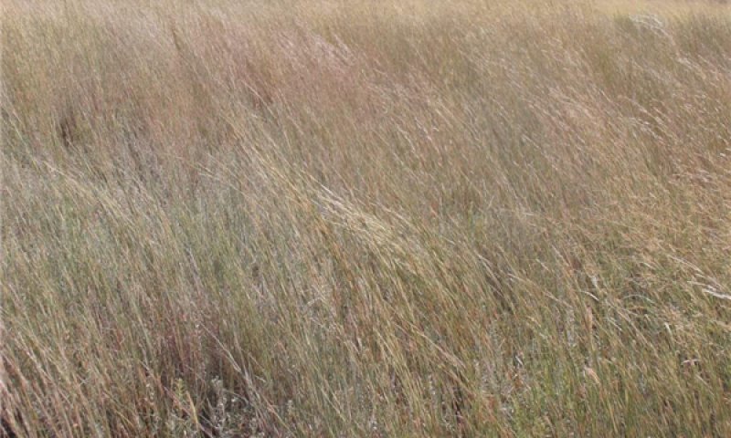
Figure 10. Reference community. Quinlan soils. Dewey County, OK. Note encroaching Eastern Redcedar.
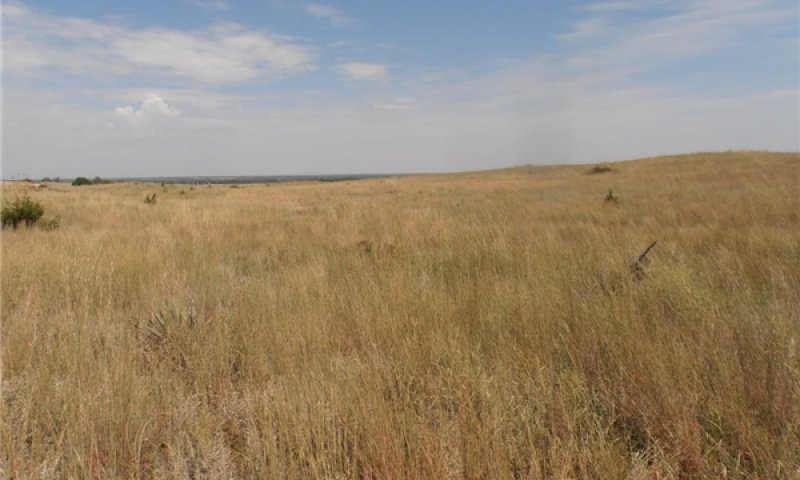
Figure 11. Reference community. Quinlan soils. Dewey County, OK. Note encroaching Eastern Redcedar.
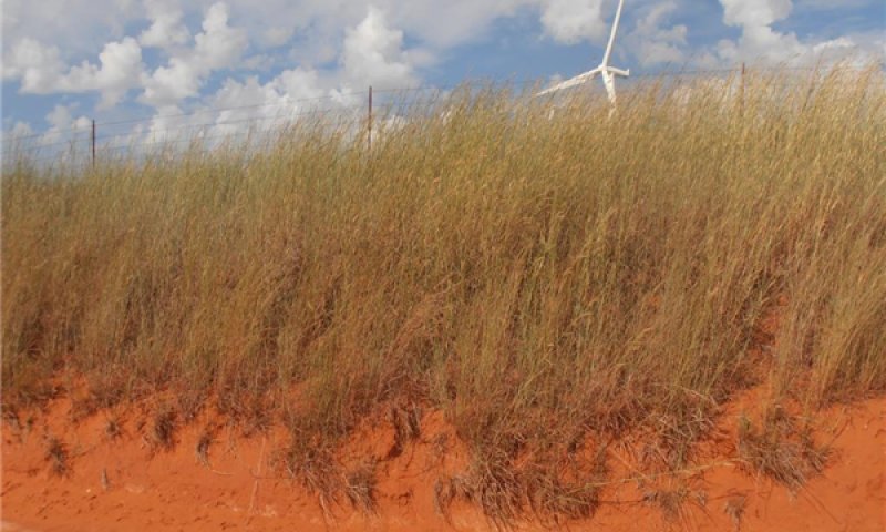
Figure 12. Ungrazed Sand Bluestem. Quinlan soils. Dewey County, OK
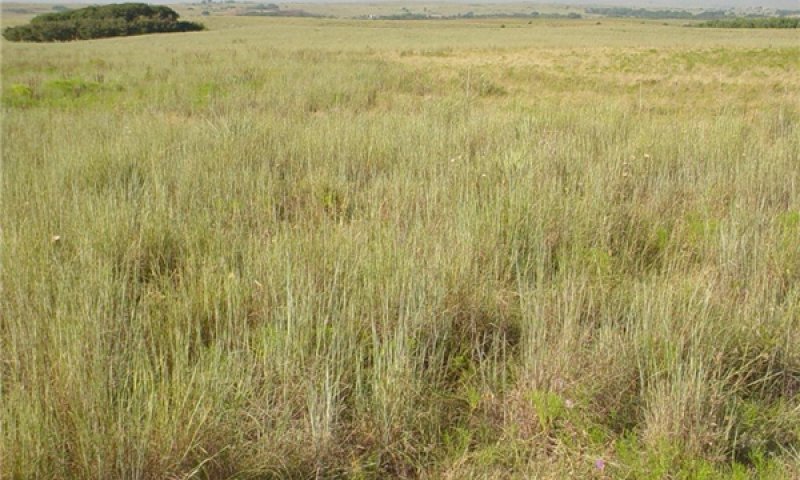
Figure 13. Quinlan soils. Reference community phase.
This Mixedgrass plant community is the reference community for this site. It is the community phase that is used to classify this ecological site. Although this community phase may not always be the management goal, it is the diagnostic community phase serving as a baseline for metrics, such as range health determinations. This plant community is dominated by native midgrass and tallgrass species. These grasses are fire, grazing, and drought tolerant as they have evolved under all three disturbances. The primary tallgrass species are sand bluestem (Andropogon hallii), Switchgrass (Panicum virgatum), and Indiangrass (Sorghastrum nutans). Native midgrasses include Little Bluestem (Schizachirium scoparium), Sideoats Grama (Bouteloua curtipendula), and Dropseeds (Sporobolus spp.). There may be a variety of forbs and legumes within this plant community depending on precipitation, bare ground, and time since fire. Common legumes include Catclaw Sensitive Briar (Mimosa nuttalli), Slimflower Scurfpea (Psoralidium tenuiflorum), and Milkvetch (Astragalus spp.). Other forbs in the reference plant community may include Sunflowers (Helianthus spp.), Asters (Symphyotrichum spp.), Penstemons (Penstemon spp.), Blazingstars (Liatris spp.), and many other species. Woody species have been historically limited within this community due to periodic fires. However, small amounts of Soapweed Yucca (Yucca glauca), Fragrant Sumac (Rhus aromatica), Sand Sagebrush (Artimisia filifolia), and Prickly pear cactus (Opuntia macrorhiza) may be present. This plant community requires periodic disturbances through fire and grazing in order to persist. Fire helps to maintain the woody species in a low stature, control their spread, and stimulate herbaceous regrowth; while grazing impacts are important to stimulate plant growth, nutrient cycling, and maintain ecological function. Many species present in this community are quite suitable for livestock grazing, while others provide excellent wildlife habitat for certain species. However, without proper management, this plant community may shift to an alternative community phase. Proper grazing management strategies should include site specific stocking rates, periodic growing season rest, and a contingency plan for drought situations. Implementation of a prescribed burning program is also required to maintain this plant community. A fire return interval of three to five years should be adequate, depending on specific producer objectives. Alternative chemical brush management strategies may be substituted, however, this will often result in negative effects on the diversity of the herbaceous plant community. The following species cover, structure, and production tables have been developed using collected data and professional knowledge. As with anything in nature, there is a large amount of variability from year to year even within a relatively stable plant community. This is true for both vegetative production as well as foliar cover produced by a plant species. The following figures are to be viewed only as a representation of the estimated potential for a given species. As more data is collected and measurement methods are refined some values may be updated through future revisions.
Figure 14. Annual production by plant type (representative values) or group (midpoint values)
Table 5. Annual production by plant type
| Plant type | Low (lb/acre) |
Representative value (lb/acre) |
High (lb/acre) |
|---|---|---|---|
| Grass/Grasslike | 1008 | 1764 | 2520 |
| Forb | 120 | 210 | 300 |
| Shrub/Vine | 60 | 105 | 150 |
| Tree | 12 | 21 | 30 |
| Total | 1200 | 2100 | 3000 |
Table 6. Ground cover
| Tree foliar cover | 0-1% |
|---|---|
| Shrub/vine/liana foliar cover | 0-10% |
| Grass/grasslike foliar cover | 50-75% |
| Forb foliar cover | 15-30% |
| Non-vascular plants | 0% |
| Biological crusts | 0% |
| Litter | 0-10% |
| Surface fragments >0.25" and <=3" | 0-2% |
| Surface fragments >3" | 0% |
| Bedrock | 0% |
| Water | 0% |
| Bare ground | 0-20% |
Table 7. Canopy structure (% cover)
| Height Above Ground (ft) | Tree | Shrub/Vine | Grass/ Grasslike |
Forb |
|---|---|---|---|---|
| <0.5 | – | 0-5% | 40-60% | 30-50% |
| >0.5 <= 1 | – | 0-5% | 55-75% | 20-40% |
| >1 <= 2 | – | 0-5% | 60-80% | 5-25% |
| >2 <= 4.5 | – | 0-10% | 70-90% | 0-10% |
| >4.5 <= 13 | – | 0-10% | 10-30% | 0-1% |
| >13 <= 40 | – | – | – | – |
| >40 <= 80 | – | – | – | – |
| >80 <= 120 | – | – | – | – |
| >120 | – | – | – | – |
Figure 15. Plant community growth curve (percent production by month). OK0001, Native, Warm Season Grasses. Typically, the summer growing season for warm season grasses begins April 5 to 15 and ends October 15 to 25. Nearly three-fourths of the season production will occur before the first of July. This varies from year to year depending upon temperatures and precipitation..
| Jan | Feb | Mar | Apr | May | Jun | Jul | Aug | Sep | Oct | Nov | Dec |
|---|---|---|---|---|---|---|---|---|---|---|---|
| J | F | M | A | M | J | J | A | S | O | N | D |
| 0 | 1 | 5 | 10 | 20 | 30 | 10 | 5 | 10 | 6 | 2 | 1 |
Community 1.2
Midgrass
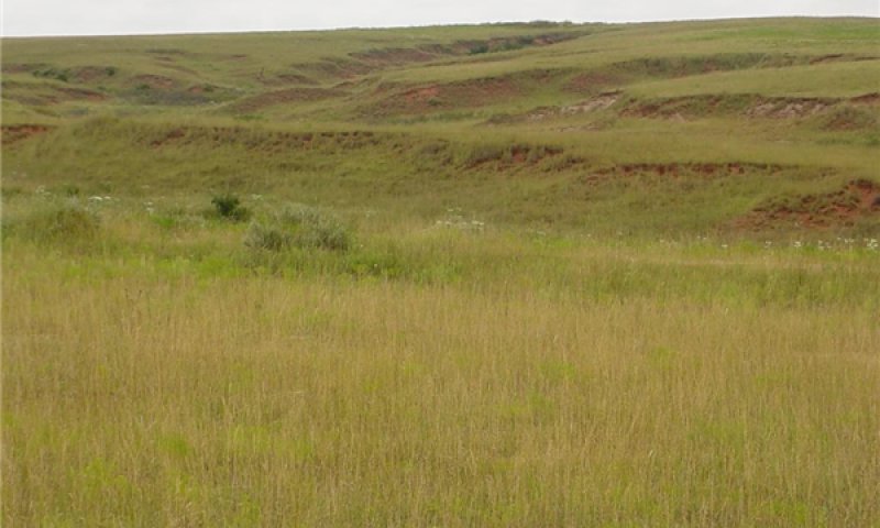
Figure 16. Quinlan soils Harper County, OK Community Phase 1.2
This plant community is dominated by warm season midgrass species. These include Little Bluestem, Sideoats Grama, and Dropseed species. Also present in this community, are a variety of forbs including Sunflowers, Western Ragweed (Ambrosia psilostachya), Asters, and Common Broomweed (Amphiachyris dracunculoides). Shortgrass species occur throughout the plant community and some palatable legumes and tallgrass species may persist but are of low vigor as sunlight energy is not captured if abusive grazing removes leaf material. There is typically greater than 20 percent bare ground and less litter associated with this community than the reference community. Careful grazing management should be followed in order to ensure adequate fuel loads if prescribed fire will be implemented on this community phase. This plant community is less suited for rainfall interception and infiltration due to the lack of deep rooted tallgrasses and increased bare ground which may lead to increased runoff.
Community 1.3
Midgrass/Shortgrass
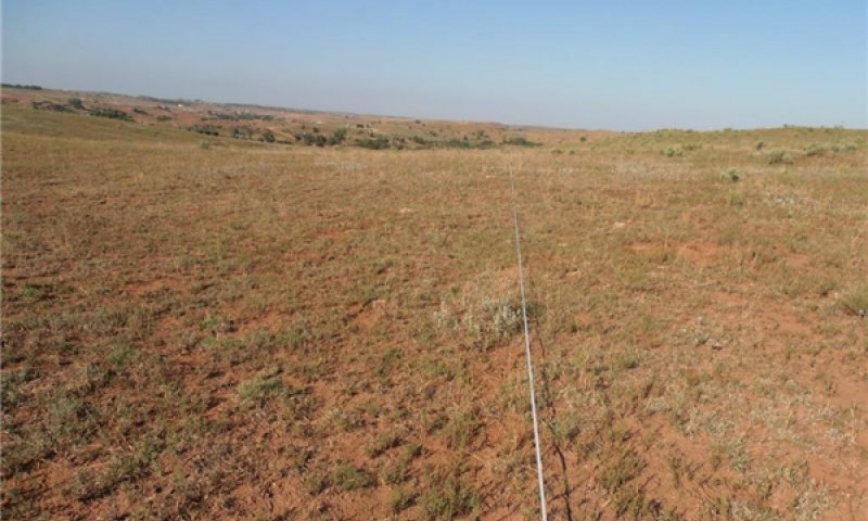
Figure 17. Quinlan soils. Community 1.3. Woods County, OK
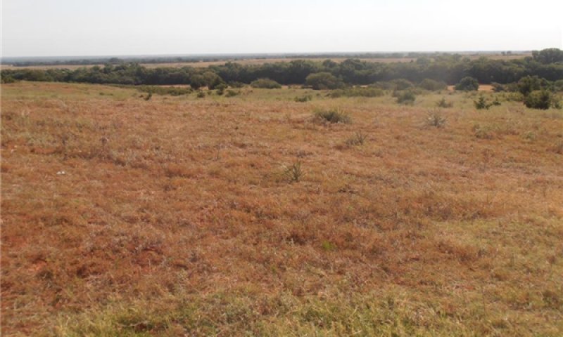
Figure 18. Quinlan soils. Community 1.3. Dewey County, OK
The Midgrass/Shortgrass plant community is the result of long term abusive grazing practices. The species most favorable to grazing animals have been eliminated. Sunlight is now being absorbed by the remaining grasses that have low growing points. These include shortgrass species such as Buffalograss (Bouteloua dactyloides), Hairy Grama (Buoteloua hirsuta), and Blue Grama (Bouteloua gracilis). Occurring with these grazing tolerant shortgrasses are unpalatable midgrass species like Silver Bluestem (Bothriocloa laguroides) and Dropseeds. Sideoats Grama will persist in this community although the vigor is greatly reduced. Bare ground has increased to 20 percent or greater, which is favorable for annual grass and forb reproduction. These annual forbs include Common Broomweed and Annual Buckwheat (Eriogonum annuum). This community is at increased risk of invasion by introduced brome species such as Cheatgrass (Bromus tectorum), Japanese Brome (Bromus japonicas), and Rescuegrass (Bromus catharticus). This site is also at a higher risk of brush invasion due to the lack of fuels to carry a prescribed fire. The reduced ground cover associated with this plant community increases the potential for runoff and subsequent erosion. Infiltration rates will be decreased along with the hydrologic function of the site.
Pathway 1.1A
Community 1.1 to 1.2


If the Shallow upland site is subjected to abusive grazing for multiple growing seasons and the more palatable tallgrass species are not allowed adequate recovery, the plant community will begin to transition to a Midgrass dominated plant community(1.2). This community shift may also occur as a result of long term drought as the Midgrass and Shortgrass species are better adapted to dry climates. This pathway is not a one-way street and it is important to remember that this community shift occurred often, historically, and represents the variability within this Reference Sate.
Pathway 1.2A
Community 1.2 to 1.1


With adequate rest (grazing deferment to restore leaf area) and growing conditions, the midgrass plant community will begin to shift back to the mixed-grass community (1.1). As the more palatable tallgrasses, legumes, and forbs regain vigor, they may begin to reproduce and increase in abundance.
Pathway 1.2B
Community 1.2 to 1.3


If grazing pressure is heavy enough to exceed the carrying capacity of the plant community, without adequate rest the remaining palatable grasses and forbs will begin to decline. These species will be replaced by opportunistic annual species. As this community shift occurs, the feasibility of implementing prescribed fire will diminish and woody species will increase within the plant community.
Pathway 1.3A
Community 1.3 to 1.2


With adequate rest (grazing deferment) and growing conditions, this plant community may shift back to the midgrass dominated plant community (1.2). In order for this community shift to occur, the remnant tall and midgrass species must have an opportunity to regain vigor without abusive grazing pressure.
State 2
Woody
This ecological state is the result of the exclusion of fire or alternative brush management from the ecosystem. The removal of this disturbance has resulted in the invasion of woody species, predominately Eastern Redcedar. These evergreen trees have crept into the native grass plant community and now exceed 30% canopy coverage. The hydrology of this site has been altered by this change in vegetation type, and the cedar trees are outcompeting the other species for available resources.
Community 2.1
Woody/Midgrass
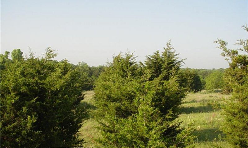
Figure 19. Quinlan soils. Community phase 2.1
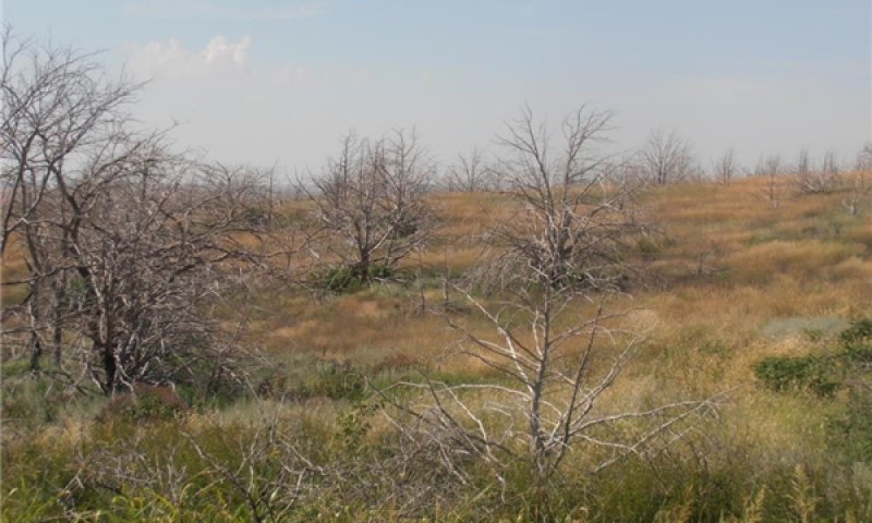
Figure 20. Quinlan soils. Community 2.1 after wildfire. Dewey County, OK
The Woody/Midgrass community has been invaded by Eastern Redcedar in Photo 1. These trees have grown and reproduced rapidly in the absence of fire and they are able to outcompete many of the herbaceous plants for soil resources, including nutrients and water. Native grasses and forbs will persist between trees. However, if stocking rates are not adjusted, added grazing pressure will continue to reduce the vigor of the remaining herbaceous community. It may be very difficult to implement a prescribed burn on this plant community if fine fuel loads are not adequate to carry the fire. It is important to note that this plant community may continue to be encroached upon by Eastern Redcedar even in the absence of grazing.
Community 2.2
Juniper Woodland
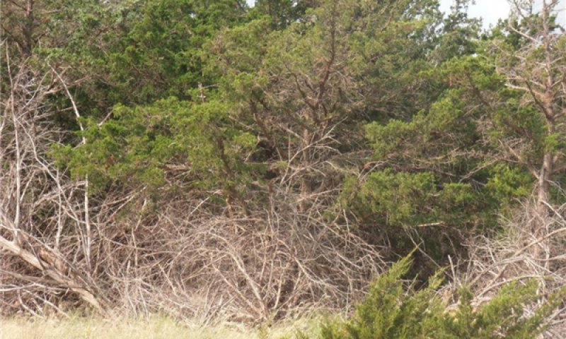
Figure 21. Quinlan soils. Community 2.2. Dewey county, OK
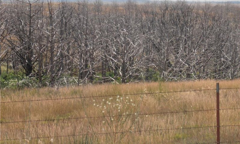
Figure 22. Quinlan soils. Community 2.2 after wildfire. Dewey County, OK
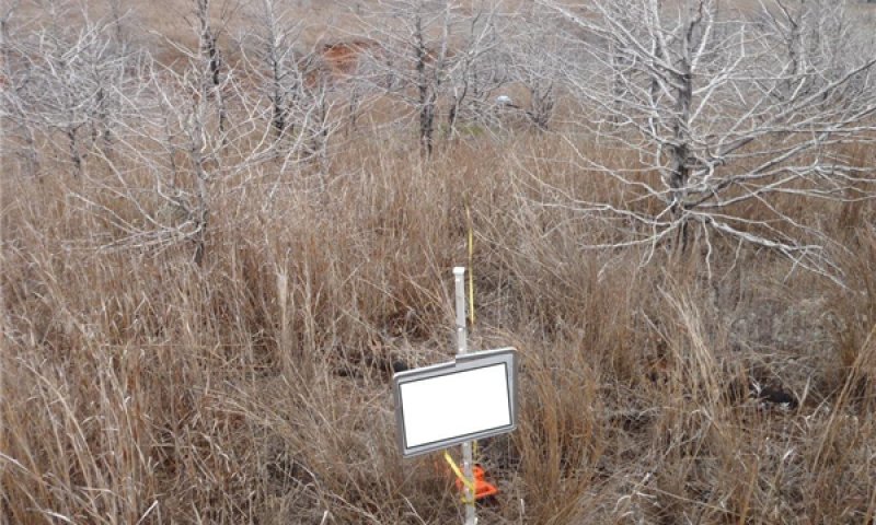
Figure 23. Quinlan soils. Dewey County, OK approx. 2 years after wildfire.
This plant community is dominated by Eastern Redcedar. The herbaceous plant community is relegated to small areas between trees that are exposed to sunlight. Areas under these trees are covered with cedar duff that restricts other plant growth because of sunlight restrictions and completion for soil moisture. There is little grazing value on this plant community due to the diminished herbaceous plant community. Some wildlife species will utilize this plant community for cover, however, there are very few food producing plants remaining.
Pathway 2.1A
Community 2.1 to 2.2


In the absence of fire or alternative brush management, the encroaching woody species will continue to expand and dominate this plant community. With no intervention, the, the community will shift towards a Juniper Woodland (2.1). Most of the sunlight energy is now being utilized by the juniper rather than by native grasses and forbs.
State 3
Cultivated
The site has been cultivated and worked up for farming. The soil structure, soil health, hydrology, and plant community has been significantly altered.
Community 3.1
Cropland
This plant community can vary from site to site depending on the production system. Most sites in production are planted to small grains with the rare exception of canola or sorghum. Refer to Ag extension publications or Soil Survey crop production reports for soil specific crop yield data.
State 4
Eroded
The driver for this ecological state is cultivation. As a result of this cultivation and subsequent rainfall events, at least 25 percent of the original A horizon (Topsoil) of the soil profile has been lost through erosion. Farming practices have ceased and the site has been planted to perennial cover. Most commonly, these perennial species are Old World Bluestem (Bothriochloa ischaemum), Bermudagrass (Cynodon dactylon), or a native grass mixture. There is a large amount of variability within the vegetative production and species present on these eroded sites. This is primarily determined by the amount of the A horizon remaining intact in the soil profile, the duration of the cultivation, and time since cultivation ended. It may take many years of vegetative cover to develop the amount of organic matter and soil structure necessary for plant vigor to return. While some species will thrive on these eroded sites, it is important to remember that the ecological function of these sites will never return to the quality of the reference state.
Community 4.1
Go Back/Range Seeding
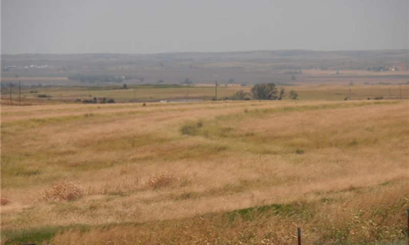
Figure 24. Community 4.1. Quinlan soils. Dewey County, OK
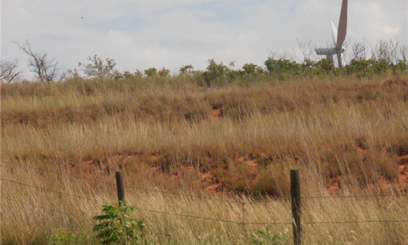
Figure 25. Eroded Quinlan soils. Community 4.1 Dewey County, OK
This plant community consists of predominately native grasses and few forbs and legumes. The site has either been abandoned (from cultivation) or has been reseeded to native plants. Many of these sites were enrolled in conservation programs such as CRP or Soil Bank as an incentive to reduce soil erosion on soils not suited for cultivation. In turn, these sites were seeded to a mixture of native grasses, forbs, and legumes. However, the species composition of these plantings was widely varied. Other sites were merely abandoned and the persisting native species allowed to re-establish. In both cases, the percentage of grasses, forbs, and legume vary greatly from site to site, as well as, the overall vegetative production of the site.
Community 4.2
Tame Pasture
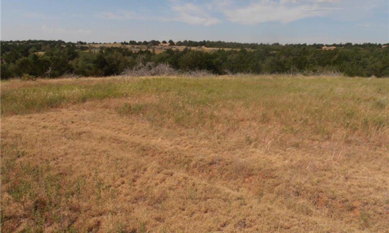
Figure 26. Community 4.2 Low vigor Old World Bluestem. Quinlan soils. Dewey County, OK
This plant community is composed of introduced perennial grass species. The shallow upland site has been reseeded once cultivation has ceased. Many of these sites were enrolled in conservation programs such as CRP or Soil Bank as an incentive to reduce soil erosion on soils not suited for cultivation. To fulfill the requirements of the respective program, the sites were planted to perennial grass species. The most common species being Old World Bluestem (Bothriochloa ischaemum), an introduced species known for its productivity, drought tolerance, and ease of establishment. Another species planted on these eroded sites is Bermudagrass (Cynodon dactylon). However, this species was not a common choice for planting at the time as early cultivars where not as cold tolerant and drought tolerant as the Old World Bluestem species. These “tame pasture” species respond well to fertilizer and provide good production with proper management. However, many sites were planted and not managed. This has led to many sites being dominated by forbs species that are not desirable for cattle grazing. Like all eroded sites, there is a high amount of variability in plant species and vegetative production from site to site. The potential production of tame grasses may be increased with management inputs such as fertilizer and irrigation. However, it is important to note that both species mentioned within this narrative have been known to move offsite and potentially invade native ecosystems.
Transition T1B
State 1 to 2
With the exclusion of fire, this site is susceptible to invasion by woody species. While there may be a significant increase in woody plants present in the reference state (Yucca, Sumac, etc.) the principal invader on this site is Eastern Redcedar. This species of tree may invade a site regardless of the grazing pressure and current plant community phase. It grows rapidly and reproduces vigorously. Once the seed source is introduced, this species can swiftly outcompete other native species for resources
Transition T1A
State 1 to 3
Some of these sites were “broke out” for farming purposes during the early to mid-1900s. While the soils on these sites are not suitable for sustained cultivated crops, many original homesteaders were required by law to farm a commodity crop. Others farmed these sites not understanding their limitations or the consequences. With the development of terraces, contour farming, and other erosion control measures, there are still occurrences where the shallow upland site is in current crop production.
Restoration pathway R2A
State 2 to 1
The restoration of the woody state (2) to the grassland state (1) requires proper planning to ensure a successful restoration. This process may take many years depending on the degradation of the herbaceous plant community and prior management practices. To restore the herbaceous plant community of the grassland state, the woody species must be removed to restore sunlight to the herbaceous understory and to remove completion for soil moisture. This may be done through mechanical treatment or prescribed fire. Mechanical treatment (cutting) may be more costly than other methods; however, it is usually a much quicker process. It is important to remember that once the woody species are cut, they must be removed from the site by burning, mulching, or another method. While the skeletons of the cut trees will restrict grazing pressure and allow herbaceous species to grow ungrazed, skeletons also provide a perch for bird species that spread seeds of these invasive trees. These skeletons also restrict access of other equipment, personnel, and some wildlife species. If prescribed burning is considered as an option for removal of the woody species, careful considerations should be made. Depending on the canopy coverage, size of trees, and fine fuel loads; a prescribed fire may not accomplish the objectives. Many times these are so large that they can only be controlled by a wildfire.
Transition T3A
State 3 to 4
Continued cultivation coupled with significant rainfall events has led to soil erosion. This is an irreversible process and the loss of soil is permanent. To address this issue, many cultivated sites have been reseeded to perennial grass cover in hopes of reducing erosion. The reestablishment of permanent vegetation transitions this site to the “Eroded” state.
Additional community tables
Table 8. Community 1.1 plant community composition
| Group | Common name | Symbol | Scientific name | Annual production (lb/acre) | Foliar cover (%) | |
|---|---|---|---|---|---|---|
|
Grass/Grasslike
|
||||||
| 1 | Tallgrasses | 400–1200 | ||||
| big bluestem | ANGE | Andropogon gerardii | 0–400 | – | ||
| sand bluestem | ANHA | Andropogon hallii | 0–400 | – | ||
| switchgrass | PAVI2 | Panicum virgatum | 100–400 | – | ||
| Indiangrass | SONU2 | Sorghastrum nutans | 80–225 | – | ||
| Grass, native | 2GN | Grass, native | 0–115 | – | ||
| 2 | Cool Season Grasses | 40–130 | ||||
| western wheatgrass | PASM | Pascopyrum smithii | 10–35 | – | ||
| Texas bluegrass | POAR | Poa arachnifera | 10–35 | – | ||
| Heller's rosette grass | DIOL | Dichanthelium oligosanthes | 10–35 | – | ||
| Canada wildrye | ELCA4 | Elymus canadensis | 5–20 | – | ||
| sixweeks fescue | VUOC | Vulpia octoflora | 0–15 | – | ||
| Grass, native | 2GN | Grass, native | 0–15 | – | ||
| 3 | Midgrass/Shortgrass | 500–1300 | ||||
| sideoats grama | BOCU | Bouteloua curtipendula | 100–350 | – | ||
| little bluestem | SCSC | Schizachyrium scoparium | 100–350 | – | ||
| blue grama | BOGR2 | Bouteloua gracilis | 40–120 | – | ||
| hairy grama | BOHI2 | Bouteloua hirsuta | 40–120 | – | ||
| dropseed | SPORO | Sporobolus | 20–70 | – | ||
| Grass, native | 2GN | Grass, native | 0–50 | – | ||
| buffalograss | BODA2 | Bouteloua dactyloides | 10–40 | – | ||
| silver beardgrass | BOLA2 | Bothriochloa laguroides | 10–40 | – | ||
| fall witchgrass | DICO6 | Digitaria cognata | 10–40 | – | ||
| plains lovegrass | ERIN | Eragrostis intermedia | 10–40 | – | ||
| hairy woollygrass | ERPI5 | Erioneuron pilosum | 10–40 | – | ||
| witchgrass | PACA6 | Panicum capillare | 10–40 | – | ||
| thin paspalum | PASE5 | Paspalum setaceum | 10–40 | – | ||
| purple threeawn | ARPU9 | Aristida purpurea | 10–40 | – | ||
| prairie threeawn | AROL | Aristida oligantha | 0–15 | – | ||
| 4 | Grasslikes | 5–30 | ||||
| sedge | CAREX | Carex | 5–30 | – | ||
|
Forb
|
||||||
| 5 | Forbs | 100–280 | ||||
| beeblossom | GAURA | Gaura | 0–30 | – | ||
| sunflower | HELIA3 | Helianthus | 0–30 | – | ||
| hairy false goldenaster | HEVI4 | Heterotheca villosa | 0–20 | – | ||
| Carolina woollywhite | HYSC | Hymenopappus scabiosaeus | 0–20 | 0– | ||
| bush morning-glory | IPLE | Ipomoea leptophylla | 0–20 | – | ||
| trailing krameria | KRLA | Krameria lanceolata | 0–20 | – | ||
| blazing star | LIATR | Liatris | 0–20 | – | ||
| blazingstar | MENTZ | Mentzelia | 0–20 | – | ||
| evening primrose | OENOT | Oenothera | 0–20 | – | ||
| beardtongue | PENST | Penstemon | 0–20 | – | ||
| groundcherry | PHYSA | Physalis | 0–20 | – | ||
| plantain | PLANT | Plantago | 0–20 | – | ||
| blackeyed Susan | RUHI2 | Rudbeckia hirta | 0–20 | – | ||
| azure blue sage | SAAZ | Salvia azurea | 0–20 | – | ||
| skullcap | SCUTE | Scutellaria | 0–20 | – | ||
| compassplant | SILA3 | Silphium laciniatum | 0–20 | – | ||
| nightshade | SOLAN | Solanum | 0–20 | – | ||
| goldenrod | SOLID | Solidago | 0–20 | – | ||
| aster | SYMPH4 | Symphyotrichum | 0–20 | – | ||
| stemmy four-nerve daisy | TESC2 | Tetraneuris scaposa | 0–20 | – | ||
| bluejacket | TROH | Tradescantia ohiensis | 0–20 | – | ||
| branched noseburn | TRRA5 | Tragia ramosa | 0–20 | – | ||
| vervain | VERBE | Verbena | 0–20 | – | ||
| hoary false goldenaster | HECA8 | Heterotheca canescens | 0–20 | – | ||
| blanketflower | GAILL | Gaillardia | 0–20 | – | ||
| Forb, annual | 2FA | Forb, annual | 0–20 | – | ||
| Forb, perennial | 2FP | Forb, perennial | 0–20 | – | ||
| Cuman ragweed | AMPS | Ambrosia psilostachya | 0–20 | – | ||
| field sagewort | ARCA12 | Artemisia campestris | 0–20 | – | ||
| tarragon | ARDR4 | Artemisia dracunculus | 0–20 | – | ||
| white sagebrush | ARLU | Artemisia ludoviciana | 0–20 | – | ||
| entireleaf Indian paintbrush | CAIN13 | Castilleja indivisa | 0–20 | – | ||
| purple poppymallow | CAIN2 | Callirhoe involucrata | 0–20 | – | ||
| yellow sundrops | CASE12 | Calylophus serrulatus | 0–20 | – | ||
| tickseed | COREO2 | Coreopsis | 0–20 | – | ||
| croton | CROTO | Croton | 0–20 | – | ||
| Engelmann's daisy | ENPE4 | Engelmannia peristenia | 0–20 | – | ||
| prairie fleabane | ERST3 | Erigeron strigosus | 0–20 | – | ||
| shaggy dwarf morning-glory | EVNU | Evolvulus nuttallianus | 0–10 | – | ||
|
Shrub/Vine
|
||||||
| 6 | Shrub | 60–150 | ||||
| Chickasaw plum | PRAN3 | Prunus angustifolia | 10–50 | – | ||
| fragrant sumac | RHAR4 | Rhus aromatica | 10–50 | – | ||
| Shrub, other | 2S | Shrub, other | 0–25 | – | ||
| leadplant | AMCA6 | Amorpha canescens | 0–25 | – | ||
| sand sagebrush | ARFI2 | Artemisia filifolia | 0–15 | – | ||
| soapweed yucca | YUGL | Yucca glauca | 5–15 | – | ||
| twistspine pricklypear | OPMA2 | Opuntia macrorhiza | 5–10 | – | ||
|
Tree
|
||||||
| 7 | Trees | 0–30 | ||||
| sugarberry | CELA | Celtis laevigata | 0–30 | – | ||
Table 9. Community 2.1 plant community composition
| Group | Common name | Symbol | Scientific name | Annual production (lb/acre) | Foliar cover (%) |
|---|
Interpretations
Animal community
This site is suited for the production of domestic livestock and provides habitat for native wildlife and certain species of exotic wildlife. Cow-calf operations are the primary livestock enterprise although stocker cattle are also common. Sustainable stocking rates have declined drastically over the past 100 years because of deterioration of the historic plant community. Initial starting stocking rates should be determined with the landowner or decision maker based on the merits of the existing plants for the desired animals.
Many species will utilize the Shallow Upland site for at least a portion of their habitat needs but rely on a more extensive landscape to meet all their needs. Some animals may only utilize one plant community of the Shallow Upland site to fulfill their habitat needs.
Smaller mammals include many kinds of rodents, jackrabbit, cottontail rabbit, raccoon, skunks, opossum, and armadillo. Mammalian predators include coyote, fox, and bobcat. Many species of snakes and lizards are native to the site.
Many species of birds are found on this site including game birds, songbirds, and birds of prey. Major game birds that are economically important are Rio Grande turkey, bobwhite quail, and mourning dove. Turkey prefers plant communities with substantial amounts of shrubs and trees interspersed with grassland. Quail prefer plant communities with a combination of low shrubs, bunch grass, bare ground, and low successional forbs. The different species of songbirds vary in their habitat preferences. In general, habitat that provides a diversity of grasses, forbs, shrubs, vines and trees, and a complex of grassland, savannah, shrubland, and woodland will support a variety and abundance of songbirds. Birds of prey are important to keep the numbers of rodents, rabbits, and snakes in balance. The different plant communities of the site will sustain different species of raptors.
Hydrological functions
Grassland State:
In the reference state, rangeland hydrologic function should be functioning to its capacity. The composition of tallgrasses and midgrasses, deep rooted perennial forbs, and litter, provides for good rainfall interception and percolation into the rooting zone. Runoff should be minimal with the exception of areas on steeper slopes. Ground surface cover is adequate to prevent excessive drying during years of normal precipitation.
As the plant community shift to a midgrass/shortgrass dominated community, the hydrologic function is decreased. During this plant community phase, there is increased runoff and occasional litter movement and rills will be present.
Woody State:
With a transition to the woody state, the hydrology of this site is greatly altered. As the woody species invade, they intercept most of the precipitation, restricting its movement into the soil profile. Also, woody invaders such as Eastern Redcedar are evergreen species with extensive root structure and high water requirements. These plants grow year-round and have the ability to pull water from the soil that otherwise would be available to herbaceous plants.
Cultivated State:
Once a shallow upland site is cultivated, the soil structure is lost and the site is prone to water erosion. This erosion is common after heavy rainfall events. The surface of these plowed fields is prone to crusting which restricts the water from percolating into the soil surface. Soil organic matter is also depleted with cultivation.
Eroded State:
In the eroded state, the soil/site stability has been degraded. With the reseeding of perennial plants, rainfall percolation will slowly improve from the cultivated state. However, it will most likely never return to the level of the reference state. It will take many years for litter accumulation and soil organic matter to be restored, therefore surface crusting, compacted layers, and runoff will be common.
Quinlan soils are in Hydrologic Group D
Recreational uses
Shallow Prairie sites can be used for many recreational activities such as sightseeing, hunting, bird watching, camping, and horseback riding.
Supporting information
Inventory data references
Information presented has been derived from NRCS clipping data, research from Oklahoma State University, field observations and measurements by trained range personnel. Most of the clipping data was gathered by a team consisting of a range conservationist and a soil scientist and was site/soil specific. Yields were taken at the end of the growing season and, as near as possible, were obtained from areas that were un-grazed that year. Clipping data repository is in the NRCS State Office in Stillwater, OK.
The concepts defined were originated as SCS Range Site Descriptions in the 1960s. Subsequent draft ESDs for this site have been developed through the mid 2000s. This report is the product of an ecological site development project initiated by the Stillwater, OK soil survey office in colaboration with staff from the NRCS Oklahoma Ecological Sciences section.
Other references
Bestelmeyer, B. T., Brown, J. R., Havstad, K. M., Alexander, R., Chavez, G., & Herrick, J. E. (2003). Development and use of state-and-transition models for rangelands. Journal of Range Management, 114-126.
Fuhlendorf, S. D., Engle, D. M., Kerby, J. A. Y., & Hamilton, R. (2009). Pyric herbivory: rewilding landscapes through the recoupling of fire and grazing. Conservation Biology, 23(3), 588-598.
Harlan, J. R. (1957). Grasslands of Oklahoma.
McIlvain, E. H., & Savage, D. A. (1951). Eight-year comparisons of continuous and rotational grazing on the Southern Plains Experimental Range. Journal of Range Management, 42-47.
National Soil Information System (NASIS). Accessed 2013
Shantz, H. L. (1923). The natural vegetation of the Great Plains region. Annals of the Association of American Geographers, 13(2), 81-107.
Shiflet, T. N. (1994). Rangeland cover types of the United States (Vol. 152). Denver, CO, USA: Society for Range Management.
USDA NRCS Plants Database. Online.
USDA-SCS Oklahoma Range Site Descriptions(1960s)
Contributors/Reviewers:
Brandon Reavis(QC) - Range Management Specialist, OK
Harry Fritzler - Range Management Specialist, OK
Denise Turner - Range Management Specialist, OK
David Kraft - Range Management Specialist, KS
Mark Moseley(QA) - Ecological Site Specialist - Soil Survey Region 9
Contributors
Colin Walden, Range Specialist, Stillwater, OK
Dr. Jack Eckroat, Grazing Lands Specialist, NRCS, Oklahoma
PES Edits by Tyson Morley, MLRA Soil Scientist, Altus, Oklahoma
Approval
Bryan Christensen, 9/15/2023
Rangeland health reference sheet
Interpreting Indicators of Rangeland Health is a qualitative assessment protocol used to determine ecosystem condition based on benchmark characteristics described in the Reference Sheet. A suite of 17 (or more) indicators are typically considered in an assessment. The ecological site(s) representative of an assessment location must be known prior to applying the protocol and must be verified based on soils and climate. Current plant community cannot be used to identify the ecological site.
| Author(s)/participant(s) | Kay Anderson, Mark Moseley, David Kraft, Jack Eckroat, Harry Fritzler, Steve Glasgow.Revisions by Colin Walden and Brandon Reavis 2014. |
|---|---|
| Contact for lead author | 100 USDA, Suite 206, Stillwater, Oklahoma |
| Date | 02/27/2015 |
| Approved by | |
| Approval date | |
| Composition (Indicators 10 and 12) based on | Annual Production |
Indicators
-
Number and extent of rills:
There are very few, if any, rills. -
Presence of water flow patterns:
Some evidence of soil deposition only on steeper slopes among areas of bare ground between plants, particularly after significant rain events, but water usually flows evenly over this site. -
Number and height of erosional pedestals or terracettes:
Very uncommon. Restricted to steeper portion of the site. -
Bare ground from Ecological Site Description or other studies (rock, litter, lichen, moss, plant canopy are not bare ground):
There is some variability on these sites. Average less than 20% bare ground on this site. Depending on time since fire. -
Number of gullies and erosion associated with gullies:
None. Some gullies possible in drains, but usually associated with adjacent "Loamy Breaks" site. -
Extent of wind scoured, blowouts and/or depositional areas:
None. -
Amount of litter movement (describe size and distance expected to travel):
Uniform distribution of litter. Litter rarely moves more than 12 inches on flat surfaces or more than 2 feet on steeper slopes except during intense storms. -
Soil surface (top few mm) resistance to erosion (stability values are averages - most sites will show a range of values):
Surface soil stabilized (Stability Score 5 – 6). Stability scores based on a minimum of 6 samples tested. -
Soil surface structure and SOM content (include type of structure and A-horizon color and thickness):
A--0 to 8 inches; reddish brown (5YR 5/4) loam, reddish brown (5YR 4/4) moist; weak medium granular structure; slightly hard, friable; many fine roots; slightly effervescent; moderately alkaline; gradual wavy boundary. (4 to 12 inches thick) -
Effect of community phase composition (relative proportion of different functional groups) and spatial distribution on infiltration and runoff:
Representative plant community intact. At least 60% coverage of tall/midgrasses slow runoff and promote infiltration into soil profile. -
Presence and thickness of compaction layer (usually none; describe soil profile features which may be mistaken for compaction on this site):
There is no compaction layer. -
Functional/Structural Groups (list in order of descending dominance by above-ground annual-production or live foliar cover using symbols: >>, >, = to indicate much greater than, greater than, and equal to):
Dominant:
Warm Season Midgrass & TallgrassSub-dominant:
Cool Season Grasses,Forbs, Shortgrasses, ShrubOther:
Additional:
-
Amount of plant mortality and decadence (include which functional groups are expected to show mortality or decadence):
Highly variable, but usually averages ~10% unless subjected to prolonged drought. -
Average percent litter cover (%) and depth ( in):
Litter should cover >60% of the area between plants with accumulations of ½ inch. -
Expected annual annual-production (this is TOTAL above-ground annual-production, not just forage annual-production):
Annual production is 1200 - 3000lbs/acre.
-
Potential invasive (including noxious) species (native and non-native). List species which BOTH characterize degraded states and have the potential to become a dominant or co-dominant species on the ecological site if their future establishment and growth is not actively controlled by management interventions. Species that become dominant for only one to several years (e.g., short-term response to drought or wildfire) are not invasive plants. Note that unlike other indicators, we are describing what is NOT expected in the reference state for the ecological site:
Invasives might be eastern redcedar, annuals,non-natives, and Mesquite in some areas. -
Perennial plant reproductive capability:
All plants capable of reproducing at least 3 years. Both seedheads and vegetative rhizomes/tillers should be evaluated.
Print Options
Sections
Font
Other
The Ecosystem Dynamics Interpretive Tool is an information system framework developed by the USDA-ARS Jornada Experimental Range, USDA Natural Resources Conservation Service, and New Mexico State University.
Click on box and path labels to scroll to the respective text.
Ecosystem states
| T1B | - | Absence of disturbance and natural regeneration over time, may be coupled with excessive grazing pressure |
|---|---|---|
| T1A | - | Extensive soil disturbance followed by seeding |
| R2A | - | Adequate rest from defoliation and removal of woody canopy, followed by reintroduction of historic disturbance regimes |
| T3A | - | Loss of soil and site stability |