Clay Loam 23-30" PZ
Scenario model
Current ecosystem state
Select a state
Management practices/drivers
Select a transition or restoration pathway
-
Transition T1A
Absence of disturbance and natural regeneration over time, may be coupled with excessive grazing pressure
More details -
Transition T1B
Extensive soil disturbance followed by seeding
More details -
Restoration pathway R2A
Adequate rest from defoliation and removal of woody canopy, followed by reintroduction of historic disturbance regimes
More details -
Transition T2A
Extensive soil disturbance followed by seeding
More details -
No transition or restoration pathway between the selected states has been described
Target ecosystem state
Select a state
Description
The Midgrass Prairie Community (1.1) is the interpretive plant community for the Clay Loam Ecological Site. Herbivory by migrating bison and indigenous antelope and deer influenced the plant composition and structure, but not as much as frequent and intense wild fires, which limited woody species encroachment. Hackberry and elm trees were widely scattered in protected areas, but probably made up less than one percent of the plant canopy. Shrubs were typical but infrequent. Vine-mesquite occupied favorable micro-sites and was locally dominant. Sideoats grama was the dominant or co-dominant grass throughout the site. Tobosa was present in significant amounts in the drier, western portion of the MLRA. Blue grama and buffalograss were the most common shortgrasses. Forbs were also found on the site.
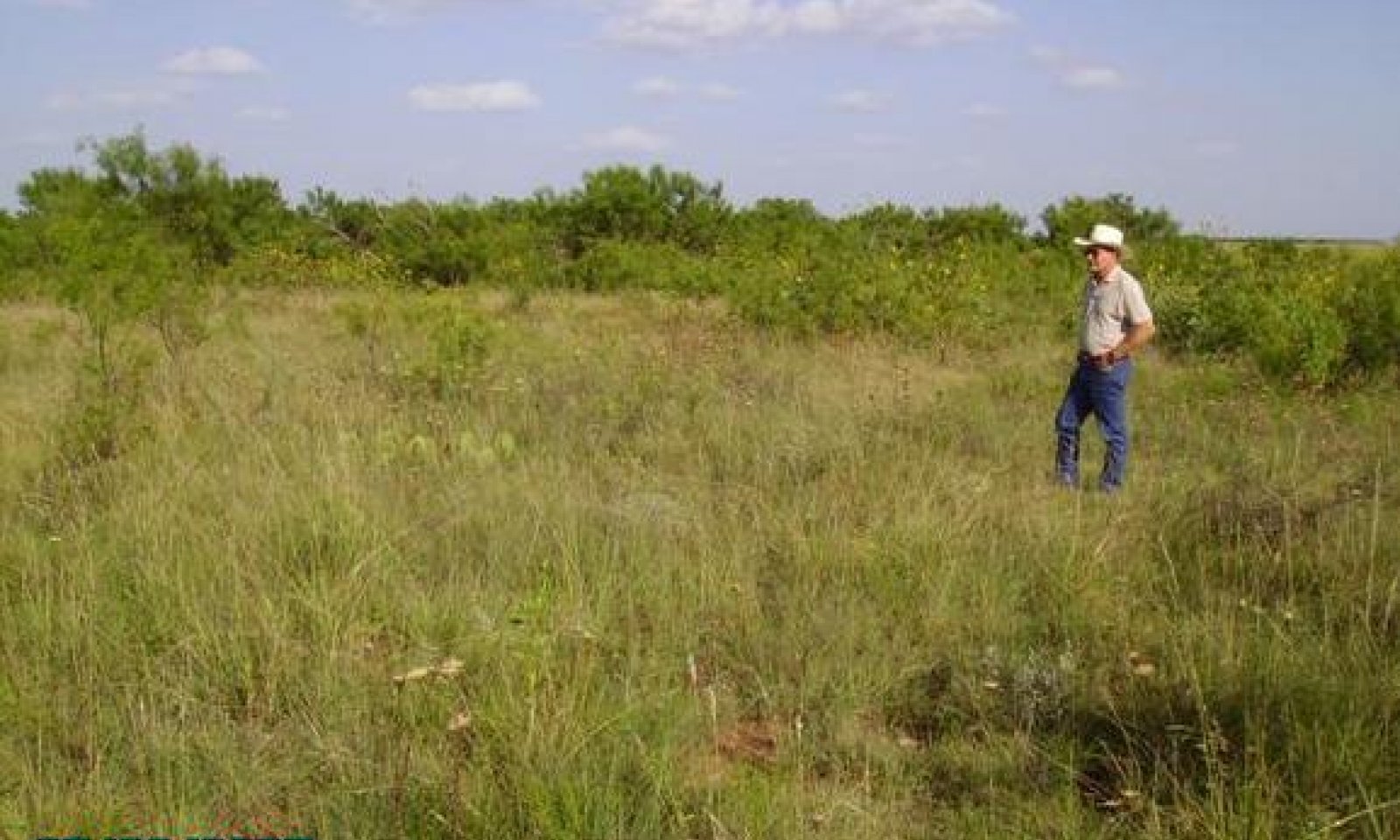
The Mixed-grass Prairie Community (1.2) is a mixed midgrass and shortgrass dominated grassland being encroached by indigenous or invading woody species that had been held at low densities by repeated fires and competition from a vigorous grass component. The preferred midgrasses, such as sideoats grama and vine-mesquite, are being replaced by the more grazing resistant midgrasses and shortgrasses such as buffalograss and tobosa. Numerous brushy species, including mesquite and pricklypear, are encroaching. The woody canopy varies between 5 and 15 percent and woody species are generally less than three feet tall. Most of the historic perennial forbs persist, but less palatable weedy species increase in the composition.
Submodel
State 2
Shrubland State


Description
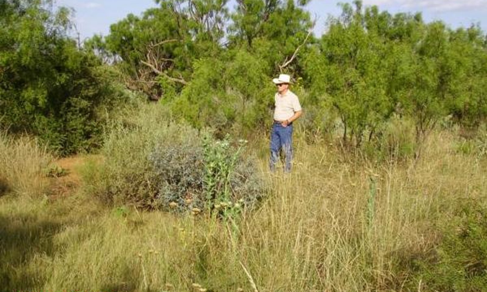
The Shortgrass/Mixed-brush Community (2.1) supports a 15 to 35% percent woody plant canopy of Mixed-brush dominated by mesquite. In this phase there is a continued decline in diversity of the grassland component and an increase in woody canopy and cool season component. All, except the more palatable woody species, have increased in size and density. Remnants of grasses and forbs and unpalatable invaders occupy the interspaces between shrubs. Characteristic grasses are buffalograss, curly mesquite, three-awn, white tridens, silver bluestem, vine mesquite and Texas wintergrass. Typical forbs include basketflower, filaree, flax wild onion, heath aster, verbena and annual broomweed.
Mesquite dominates the Mixed-brush/Shortgrass/Annuals Community (2.2) throughout the MLRA. Common understory shrubs are pricklypear, lotebush, and tasajillo. Remnants of grazing resistant climax grasses, forbs and unpalatable invaders occupy the interspaces between shrubs. Characteristic grasses are buffalograss, curly mesquite, three-awn, white tridens, silver bluestem, Texas wintergrass, and red grama.
Submodel
Description
The Clay Loam Ecological Site, with its productive soils, is often cultivated and planted to crops. When cropping is abandoned the site should be re-vegetated with adapted native plant mixtures, which include historic climax species. Cultivation and erosion may have reduced soil productivity but near climax forage production may be obtained with a native plant mix that approximates reference community species composition. Introduced species often require more care, but can also be productive as pasture.
Submodel
Mechanism
When the canopy of the woody plants becomes dense enough (15-20%) and tall enough (> 4 feet) to suppress grass growth and resist fire damage, a threshold in ecological succession is crossed from the Grassland State to Shrubland State. This threshold can also occur when the fine fuel load provided by grasses is too low to effectively control the brush with prescribed burning. Once this threshold is passed, the Mixed-grass Prairie Community (1.2) transitions into the Shortgrass/Mixed-brush Community (2.1), a stable plant community state in which normal range management practices, such as proper grazing and prescribed burning, cannot reverse the trend toward woody plant dominance.
Mechanism
The Grassland State may also transition into the Converted Land State. With the implementation of various conservation practices such as Crop Cultivation, Plowing, Range Planting, Pasture Planting, Pest Management, Nutrient Management, and Prescribed Grazing, the Coverted Land Community may be cultivated for crops, planted into permanent native or introduced pastureland grass species or let abandoned with existing native species.
Mechanism
Alternatives for restoration include brush control and range planting to return the Shrubland to Grassland State. Proper stocking, prescribed grazing and prescribed burning would then be necessary to maintain the desired community.
Relevant conservation practices
| Practice | External resources |
|---|---|
|
Brush Management |
|
|
Prescribed Burning |
|
|
Prescribed Grazing |
|
|
Range Planting |
Mechanism
The Shrubland State may also transition into the Converted Land State. With the implementation of various conservation practices such as Crop Cultivation, Plowing, Range Planting, Pasture Planting, Pest Management, Nutrient Management, and Prescribed Grazing, the Coverted Land Community may be cultivated for crops, planted into permanent native or introduced pastureland grass species or let abandoned with existing native species.
Model keys
Briefcase
Add ecological sites and Major Land Resource Areas to your briefcase by clicking on the briefcase (![]() ) icon wherever it occurs. Drag and drop items to reorder. Cookies are used to store briefcase items between browsing sessions. Because of this, the number of items that can be added to your briefcase is limited, and briefcase items added on one device and browser cannot be accessed from another device or browser. Users who do not wish to place cookies on their devices should not use the briefcase tool. Briefcase cookies serve no other purpose than described here and are deleted whenever browsing history is cleared.
) icon wherever it occurs. Drag and drop items to reorder. Cookies are used to store briefcase items between browsing sessions. Because of this, the number of items that can be added to your briefcase is limited, and briefcase items added on one device and browser cannot be accessed from another device or browser. Users who do not wish to place cookies on their devices should not use the briefcase tool. Briefcase cookies serve no other purpose than described here and are deleted whenever browsing history is cleared.
Ecological sites
Major Land Resource Areas
The Ecosystem Dynamics Interpretive Tool is an information system framework developed by the USDA-ARS Jornada Experimental Range, USDA Natural Resources Conservation Service, and New Mexico State University.

