Sandy Loam 23-31" PZ
Scenario model
Current ecosystem state
Select a state
Management practices/drivers
Select a transition or restoration pathway
-
Transition T1A
Absence of disturbance and natural regeneration over time, may be coupled with excessive grazing pressure
More details -
Transition T1B
Extensive soil disturbance followed by seeding
More details -
Restoration pathway R2A
Adequate rest from defoliation and removal of woody canopy, followed by reintroduction of historic disturbance regimes
More details -
Transition T2A
Extensive soil disturbance followed by seeding
More details -
No transition or restoration pathway between the selected states has been described
Target ecosystem state
Select a state
Description
This is the reference or diagnostic community for the site. The description is based on early range site descriptions, clipping data, professional consensus of experienced range specialists, and analysis of field work.
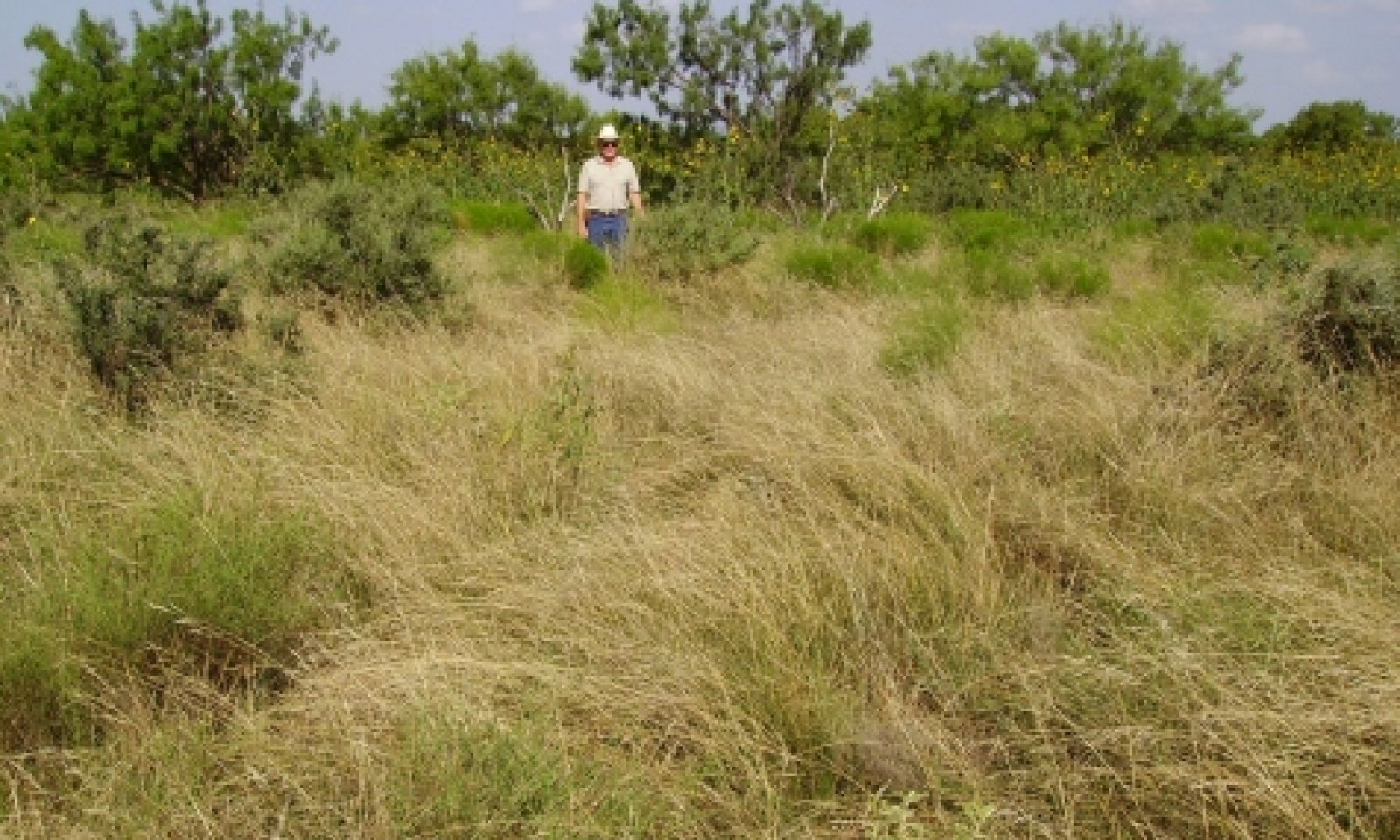
The Midgrass Prairie Community (1.1) is the interpretive plant community for the Sandy Loam Prairie Ecological Site. A variety of midgrasses comprised most of the production. The historic plant community was characterized by sideoats grama and little bluestem. Arizona cottontop, plains bristlegrass and vine-mesquite were locally abundant. Tallgrasses occurred occasionally, with sand bluestem the most common. Sand dropseed, three-awns, hairy grama, fall witchgrass, sand dropseed, blue grama and buffalograss were common shortgrasses. Yucca, catclaw acacia, lotebush, sumac, wolfberry, plum and bumelia were infrequent shrubs. Gaura, dotted gayfeather, primrose, western ragweed, trailing ratany, Mexican sagewort, guara, and Engelmann’s daisy were characteristic forbs. The Midgrass Prairie Community produced from 1,800 to 3,600 pounds of herbage annually.
The Mixed-grass Community (1.2) is mixed-grass dominated grassland. Shrubby species are increasing in density. Typically, mesquite, lotebush and pricklypear are early and persistent invaders. Juniper often invades on the western side of the MLRA. The preferred tall and midgrasses are being replaced by the more grazing resistant meadow dropseed, sand dropseed, hooded windmillgrass, silver bluestem, buffalograss, blue grama and threeawns. Most of the historic grammas, bristlegrasses and feathery bluestems persist in this phase. The perennial forbs found in the historic climax are still present, although in lesser amounts. Annual grasses and forbs invade as ground cover increases and more soil is exposed to erosion. The encroaching woody species are generally less than three feet tall and subject to suppression by prescribed burning in combination with proper grazing management. The woody canopy varies between 5 and 15 percent. Annual primary production is reduced, ranging from 1200 to 3000 pounds per acre.
Submodel
State 2
Shrubland State


Description
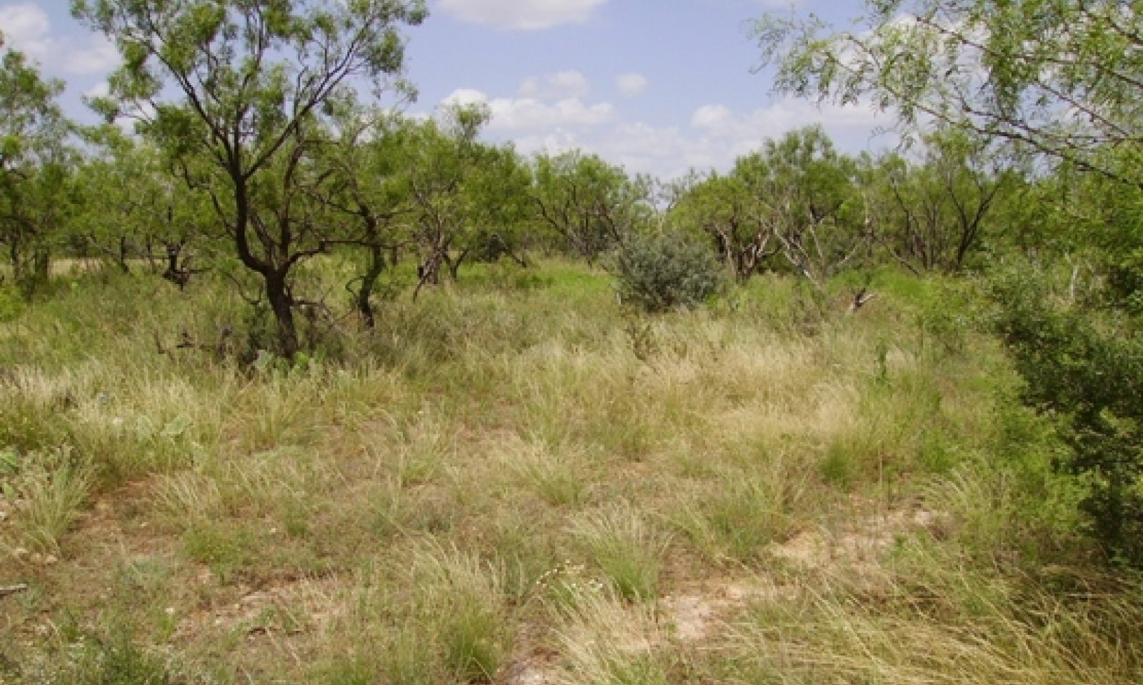
The Shortgrass/Mixed-brush Community supports a 15 to 30 percent woody plant canopy with mesquite, lotebush, pricklypear and yucca the most common shrubs. Mesquite generally dominates although juniper can be locally dominant. There is a decline in diversity of the grassland component and an increase in woody species. Annual herbage production is reduced to approximately 1000 to 2800 pounds per acre.
The Mixed-brush/Shortgrass/Annuals Community is a shrubland with mesquite generally dominates, but pricklypear, lotebush, yucca, and catclaw acacia are common. With continued heavy grazing and no brush control, the shrubs can approach 75 percent or more ground cover. Shortgrasses and low seral stage annual and perennial forbs occupy the woody plant interspaces.
Submodel
Description
The Converted Land Community has been cultivated for cropland or pastureland purposes. Small grain or forage sorghum may be cropped. Permanent native and introduce pasture may also be planted. Sometimes the community may be abandoned and let “go back” to native species encroached by woody species.
Submodel
Mechanism
Due to heavy continuous grazing, no brush management, and no fires to keep the brush species in check, the Grassland State will transition into the Shrubland State.
Mechanism
The transition to the Converted Land State occurs when crop cultivation practices, plowing, range planting, pasture planting, pest management, and nutrient management are applied to cropland, pastureland or go back land.
Mechanism
Major high cost and high energy, accelerating practices are required to restore the Shrubland State back to the Grassland State. Generally, herbicidal brush management practices such as aerial spraying and/or individual plant treatments (IPT) along with other restoration practices such as range planting, grazing deferment, prescribed grazing and prescribed burning are necessary for the ecological site to return to the reference community.
Relevant conservation practices
| Practice | External resources |
|---|---|
|
Brush Management |
|
|
Prescribed Burning |
|
|
Range Planting |
|
|
Prescribed Grazing |
Model keys
Briefcase
Add ecological sites and Major Land Resource Areas to your briefcase by clicking on the briefcase (![]() ) icon wherever it occurs. Drag and drop items to reorder. Cookies are used to store briefcase items between browsing sessions. Because of this, the number of items that can be added to your briefcase is limited, and briefcase items added on one device and browser cannot be accessed from another device or browser. Users who do not wish to place cookies on their devices should not use the briefcase tool. Briefcase cookies serve no other purpose than described here and are deleted whenever browsing history is cleared.
) icon wherever it occurs. Drag and drop items to reorder. Cookies are used to store briefcase items between browsing sessions. Because of this, the number of items that can be added to your briefcase is limited, and briefcase items added on one device and browser cannot be accessed from another device or browser. Users who do not wish to place cookies on their devices should not use the briefcase tool. Briefcase cookies serve no other purpose than described here and are deleted whenever browsing history is cleared.
Ecological sites
Major Land Resource Areas
The Ecosystem Dynamics Interpretive Tool is an information system framework developed by the USDA-ARS Jornada Experimental Range, USDA Natural Resources Conservation Service, and New Mexico State University.

