
Natural Resources
Conservation Service
Ecological site R081CY355TX
Adobe 29-35 PZ
Last updated: 9/19/2023
Accessed: 02/07/2026
General information
Provisional. A provisional ecological site description has undergone quality control and quality assurance review. It contains a working state and transition model and enough information to identify the ecological site.
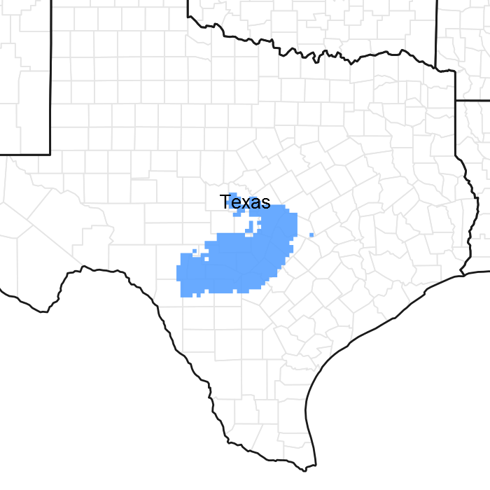
Figure 1. Mapped extent
Areas shown in blue indicate the maximum mapped extent of this ecological site. Other ecological sites likely occur within the highlighted areas. It is also possible for this ecological site to occur outside of highlighted areas if detailed soil survey has not been completed or recently updated.
MLRA notes
Major Land Resource Area (MLRA): 081C–Edwards Plateau, Eastern Part
This area represents the eastern part of the Edwards Plateau region. Limestone ridges and canyons and nearly level to gently sloping valley floors characterize the area. Elevation is 400 feet (120 meters) at the eastern end of the area and increases westward to 2,400 feet (730 meters) on ridges. This area is underlain primarily by limestones in the Glen Rose, Fort Terrett, and Edwards Formations of Cretaceous age. Quaternary alluvium is in river valleys.
Classification relationships
Major Land Resource Area (MLRA) and Land Resource Unit (LRU) (USDA-Natural Resources Conservation Service, 2006)
National Vegetation Classification/Shrubland & Grassland/2C Temperate & Boreal Shrubland and Grassland/M051 Great Plains Mixedgrass Prairie & Shrubland/ G133 Central Great Plains Mixedgrass Prairie Group.
Ecological site concept
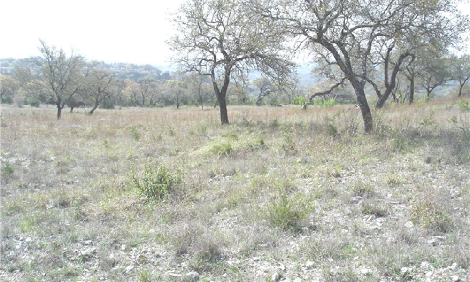
These sites occur on shallow loams and clay loams over limestone bedrock. The reference vegetation consists of an oak savannah including live oak and Texas red oak, with an understory of tall and midgrasses, shrubs and forbs. Without periodic fire or brush management, woody species may increase and dominate the site.
Associated sites
| R081CY358TX |
Deep Redland 29-35 PZ The Deep Redland ecological site is on similar positions but has a red subsoil. Post oak and Blackjack oak are found growing on this site. |
|---|---|
| R081CY359TX |
Gravelly Redland 29-35 PZ The Gravelly Redland ecological site is on similar positions but has a red subsoil. |
| R081CY362TX |
Steep Adobe 29-35 PZ The Steep Adobe ecological site is on greater slopes and has less production. |
| R081CY357TX |
Clay Loam 29-35 PZ The Clay Loam ecological site is located downslope of the Adobe ecological site and has deeper soils. |
| R081CY561TX |
Loamy Bottomland 29-35 PZ The Loamy Bottomland ecological site is located below the Adobe site with higher production. |
| R081CY361TX |
Redland 29-35 PZ The Redland ecological site is located on similar positions but has red subsoil with less carbonates. |
Similar sites
| R081CY362TX |
Steep Adobe 29-35 PZ Similar soils but greater slopes. |
|---|---|
| R081CY360TX |
Low Stony Hill 29-35 PZ Similar soils that have higher clay content, large fragments on the surface, and over indurated limestone bedrock. |
Table 1. Dominant plant species
| Tree |
(1) Quercus texana |
|---|---|
| Shrub |
Not specified |
| Herbaceous |
(1) Schizachyrium scoparium |
Physiographic features
This site is classified as upland. Slope gradient is mostly from 1 to 12 percent but range up to 20 percent. It is presumed that this site was formed in residuum from weathered limestone. Elevation for this site ranges from 1000 to 2000 feet above sea level.
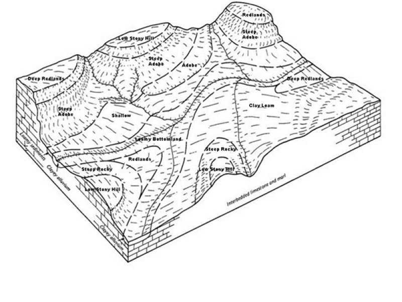
Figure 2. Geography of Adobe 29-35" Ecological Site
Table 2. Representative physiographic features
| Landforms |
(1)
Plateau
> Ridge
|
|---|---|
| Runoff class | Medium to high |
| Flooding frequency | None |
| Ponding frequency | None |
| Elevation | 1,000 – 2,000 ft |
| Slope | 1 – 12% |
| Aspect | Aspect is not a significant factor |
Table 3. Representative physiographic features (actual ranges)
| Runoff class | Not specified |
|---|---|
| Flooding frequency | Not specified |
| Ponding frequency | Not specified |
| Elevation | Not specified |
| Slope | 1 – 20% |
Climatic features
The climate is humid subtropical and is characterized by hot summers and relatively mild winters. The average first frost should occur around November 15 and the last freeze of the season should occur around March 19.
The average relative humidity in mid-afternoon is about 50 percent. Humidity is higher at night, and the average at dawn is about 80 percent. The sun shines 70 percent of the time possible during the summer and 50 percent in winter. The prevailing wind direction is southeast.
Drought is calculated as 75% below average rainfall. It should be noted that timing of rainfall may be more significant than average rainfall.
Approximately two-thirds of annual rainfall occurs during the April to September period. Rainfall during this period generally falls during thunderstorms, and fairly large amount of rain may fall in a short time. Hurricanes provide another source of extremely high rains in a short time. A review of the rainfall records suggest that rainfall is below “normal” at least 60 percent of the time. Therefore, the erratic nature of the rainfall should be considered when developing any land management plans.
The impact of droughts in the Edwards Plateau cannot be under-estimated. Not only are droughts devastating to the land but also to those that manage the land. Droughts occur roughly every 20 years but not always. A severe drought in 2012 coupled with extreme heat resulted in a die off of juniper over millions of acres as well as other native plants.
Table 4. Representative climatic features
| Frost-free period (characteristic range) | 210-260 days |
|---|---|
| Freeze-free period (characteristic range) | 227-280 days |
| Precipitation total (characteristic range) | 32-37 in |
| Frost-free period (actual range) | 187-260 days |
| Freeze-free period (actual range) | 224-332 days |
| Precipitation total (actual range) | 31-37 in |
| Frost-free period (average) | 220 days |
| Freeze-free period (average) | 257 days |
| Precipitation total (average) | 34 in |
Figure 3. Monthly precipitation range
Figure 4. Monthly minimum temperature range
Figure 5. Monthly maximum temperature range
Figure 6. Monthly average minimum and maximum temperature
Figure 7. Annual precipitation pattern
Figure 8. Annual average temperature pattern
Climate stations used
-
(1) MEDINA 1NE [USC00415742], Medina, TX
-
(2) SAN ANTONIO/SEAWORLD [USC00418169], San Antonio, TX
-
(3) KERRVILLE 3 NNE [USC00414782], Kerrville, TX
-
(4) BLANCO [USC00410832], Blanco, TX
-
(5) CANYON DAM [USC00411429], Canyon Lake, TX
-
(6) BURNET MUNI AP [USW00003999], Burnet, TX
-
(7) AUSTIN GREAT HILLS [USC00410433], Austin, TX
-
(8) GEORGETOWN LAKE [USC00413507], Georgetown, TX
-
(9) PRADE RCH [USC00417232], Leakey, TX
Influencing water features
This is an upland site and is not influenced by water from a wetland or stream. These upland sites may shed some water via runoff during heavy rain events. The presence of good ground cover and deep rooted grasses can help facilitate infiltration and reduce sediment loss.
Wetland description
N/A
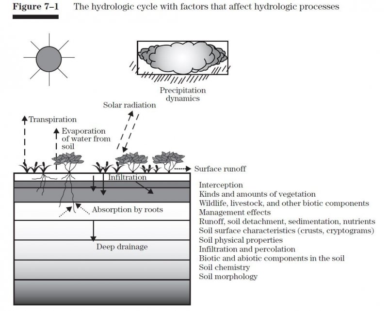
Figure 9.
Soil features
In a representative profile for the Adobe ecological site, the soils are shallow to moderately deep, usually gravelly, light-colored loam or clay loam over weakly or moderately cemented limestone with thin beds of indurated limestone. Rock fragments in the surface horizons are about 20 percent and up to 70 percent in the subsoil. There are gravelly to extremely gravelly or paragravelly to extremely paragravelly texture modifiers throughout the soil profile. The permeability of the soil is moderate and the permeability of the paralithic material is very slow to slow. On erosional sideslope positions, the organic matter development in the topsoil is low. Because of high runoff and high calcium carbonate content, the soils are droughty. They do not support a dense cover of plants, which require high amounts of water and plant nutrients. Runoff is rapid, even under good plant cover. Forage grown on the site is usually low in nutritive value and must be supplemented, especially with phosphorus as the high calcium levels tie up the phosphorus. Soils on the lower slopes of the site have organic material in the soil surface and are often characterized by the presence of Texas oaks. These sites occur on sideslopes of ridges on dissected plateaus.
Because of the scale of mapping, there are inclusions of minor components of other soils within these mapping units. Before performing any inventories, conduct a field evaluation to ensure the soils are correct for the site.
The following representative soil series associated with the Adobe ecological site are Brackett, Kerrville, and Real.
Table 5. Representative soil features
| Parent material |
(1)
Residuum
–
limestone
|
|---|---|
| Surface texture |
(1) Loam (2) Clay loam (3) Gravelly loam (4) Gravelly clay loam |
| Drainage class | Well drained |
| Permeability class | Very slow to slow |
| Depth to restrictive layer | 6 – 40 in |
| Soil depth | 6 – 40 in |
| Surface fragment cover <=3" | 12 – 40% |
| Surface fragment cover >3" | 3 – 8% |
| Available water capacity (0-40in) |
0.6 – 3.1 in |
| Calcium carbonate equivalent (0-40in) |
40 – 90% |
| Electrical conductivity (0-40in) |
2 mmhos/cm |
| Sodium adsorption ratio (0-40in) |
Not specified |
| Soil reaction (1:1 water) (0-40in) |
7.4 – 8.4 |
| Subsurface fragment volume <=3" (4-40in) |
55% |
| Subsurface fragment volume >3" (4-40in) |
15% |
Ecological dynamics
The Reference Plant Community is a fire/herbivory savannah of tall grasses, Texas live oak (Quercus fusiformis) and Texas oak (Quercus buckleyi). Little bluestem (Schizachyrium scoparium) and sideoats grama (Bouteloua curtipendula) dominate the site with big bluestem (Andropogon gerardii) and Indiangrass (Sorghastrum nutans) occurring mainly in rock crevices. Other indicator plants of this site include tall grama (Bouteloua pectinata) and seep muhly (Muhlenbergia reverchonii). The oak overstory usually covers less than 10 percent of the soil surface. Other important species include green sprangletop (Leptochloa dubia), Texas wintergrass (Nassella leucotricha) and kidneywood (Eysenhardtia texana). Small areas may exhibit water seepage or spring flow for long periods of rainfall because of small underground water-filled cavities slowly draining through the fractured rock and soil profile from the upper elevation. Muhly species (Muhlenbergia spp.) may dominate the seepy areas along with Eastern gamagrass (Tripsacum dactyloides) and will add to the mosaic pattern of the site. This site also grows a variety of forbs. Tall and mid grasses dominate much of the site, though portions of these sites often supported shrub and tree communities in mosaic patterns.
Early accounts consistently describe this region as a vast expanse of hills covered with "cedar" from San Antonio to Austin. Accounts also describe an abundance of clean, flowing water and abundant wildlife. These accounts seem to describe heavy wooded areas in mosaic patterns occurring along the highs and lows of the landscape. The shallow soils of the Adobe site are located on the footslopes of hills in the area. These adobe soils are laid over soft limestone and are predominated by open prairie grassland species in the Reference State. This site historically became more wooded as slope increased. This site was traditionally more open than the wooded sites along streams below, or the steep, rocky sites occurring above.
The plant communities of this site are dynamic and vary in relation to grazing, fire and rainfall. Studies of the pre-European vegetation of the general area suggested 47 percent of the area was wooded (Wills, 2006). Historical records are not specific on the Adobe site but do reflect area sightings from the Teran expedition in 1691 of “great quantities of buffaloes” in the area. By 1840 the Bonnell expedition reflected that “buffalo rarely range so far to the south” (Inglis, 1964). Many research studies document the interaction of bison grazing and fire (Fuhlendorf, et al., 2008.). Bison would come into an area, graze it down, leave and then not come back for many months or even years. Many times this grazing scheme by buffalo was high impact and followed fire patterns and available natural water. This usually long deferment period allowed the taller grasses and forbs to recover from the high impact bison grazing. This relationship created a diverse landscape.
Natural fires occurred on this site. However, low fine fuel and dissected slopes probably resulted in mosaic burns. Therefore at any given location, the plant community could be grass dominated or juniper dominated, depending upon fire frequency, over time. The accumulation of grasses set the stage for naturally occurring fires set by lightning or Native Americans for various purposes. This site is in an area where spring is reported as the principal fire season (Pyne, 1982). However in the summer, when fuel loads accumulate and dry weather decreases fine fuel moisture, convection storms with their associated lighting suggest a peak of burning occurring every 7 to 35 years (Frost, 1998).
The periodic fires kept Ashe juniper (Juniperus ashei), a non-sprouter, and other woody species suppressed except for the area where fuel loads were sparse or terrain precluded burning. Ashe juniper did occur on the site, but not at the level seen today because of its fire sensitivity. The degree of suppression of re-sprouting woody plants would vary in accordance with the type of fire encountered, which resulted in a mosaic of vegetation types within the same site and changing over time. Ashe juniper will increase regardless of grazing. Goat and possibly sheep will eat young juniper and when properly used, are an effective tool to maintain juniper (Taylor, 1997). The main role of excessive grazing relative to juniper is the removal of the fine fuel needed to carry an effective burn.
Ashe juniper, because of its dense low growing foliage, has the ability to retard grass and forb growth. Grass and forb growth can become nonexistent under dense juniper canopies. Many times there is a resurgence of the better grasses such as little bluestem when Ashe juniper is controlled and followed by proper grazing management. Seeds and dormant rootstocks of many plant species are contained in the leaf mulch under the junipers.
Currently, cattle, white-tailed deer, horses, and exotic animals are the primary large herbivores. At settlement, large numbers of deer occurred, but as human populations increased (with unregulated harvest) their numbers declined substantially. Eventually, laws and restrictions on deer harvest were put in place which assisted in the recovery of the species. Females were not harvested for several decades following the implementation of hunting laws, which helped create population booms. In addition, suppression of fire favored woody plants which provided additional browse and cover for the deer. Because of their impacts on livestock production, large predators such as red wolves (Canis rufus), mountain lions (Felis concolor), black bears (Ursus americanus) and eventually coyotes (Canis latrins) were reduced in numbers or eliminated (Schmidly, 2002).
The screwworm fly (Cochilomyia hominivorax) was essentially eradicated by the mid-1960s, and while this was immensely helpful to the livestock industry, this removed a significant control on deer populations (Teer, Thomas, and Walker 1965, Bushland, 1985).
Currently, because of the reduction in livestock production and a corresponding increase in land ownership for recreational purposes, predator populations are on the increase. This includes feral hogs (Sus scrofa).
Progressive management of the deer herd, because of their economic importance through lease hunting, has the objective of improving individual deer quality and improving habitat. Managed harvest based on numbers, sex ratios, condition and monitoring of habitat quality has been effective in managing the deer herd on individual properties. However, across the Edwards Plateau, excess numbers still exist which may lead to habitat degradation and significant die-offs during stress periods such as extended droughts.
The Edwards Plateau is home to a variety of non-indigenous (exotic) ungulates, mostly introduced for hunting (Schmidly, 2002). These animals are important sources of income to some landowners, but as with the white-tailed deer, their populations must be managed to prevent degradation of the habitat for themselves as well as for the diversity of native wildlife in the area. The axis (Axis axis) deer, in particular, has a competitive advantage over the native white-tailed deer as it can successfully change forage selection between different forage types whereas the white-tailed deer does not adapt well to the changes in forages. Many other species of medium and small sized mammals, birds, and insects can have significant influences on the plant communities in terms of pollination, herbivory, seed dispersal, and creation of local disturbance patches, all of which contribute to the plant species diversity. Many of the exotic species have the ability to change and modify their diets depending on forage availability. This ability to use such a diverse and broad diet of vegetation may have a direct negative impact on the native wildlife and habitat if they are not properly managed.
State and transition model
More interactive model formats are also available.
View Interactive Models
Click on state and transition labels to scroll to the respective text
| T1A | - | Absence of disturbance and natural regeneration over time |
|---|---|---|
| T1B | - | Removal of woody species coupled with range seeding |
| R2A | - | Reintroductions of natural disturbance regimes |
| T2A | - | Removal of woody vegetation coupled with range seeding |
| T2B | - | Mechanical conversion of primarily to mulch |
State 1 submodel, plant communities
State 2 submodel, plant communities
State 3 submodel, plant communities
State 4 submodel, plant communities
State 1
Reference
The reference state is considered to be representative of the natural range of variability under pre-Euro settlement conditions. It is characterized by a warm-season tallgrass savannah with scattered oak trees. Community phase changes are primarily driven by wildfire, grazing, and climatic fluctuations.
Dominant plant species
-
Texas live oak (Quercus fusiformis), tree
-
little bluestem (Schizachyrium scoparium), grass
-
sideoats grama (Bouteloua curtipendula), grass
Community 1.1
Grassland Savannah Community

Figure 10. Near reference condition. Brackett Soils, Toutan
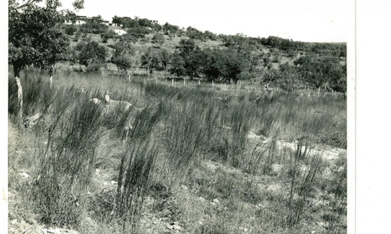
Figure 11. Adobe site in near reference condition in Kendall
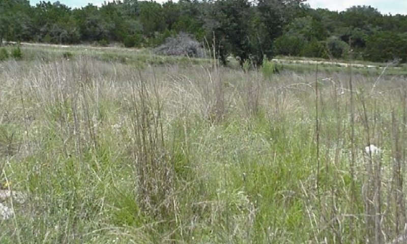
Figure 12. Near reference condition. Brackett Soils, Camp B
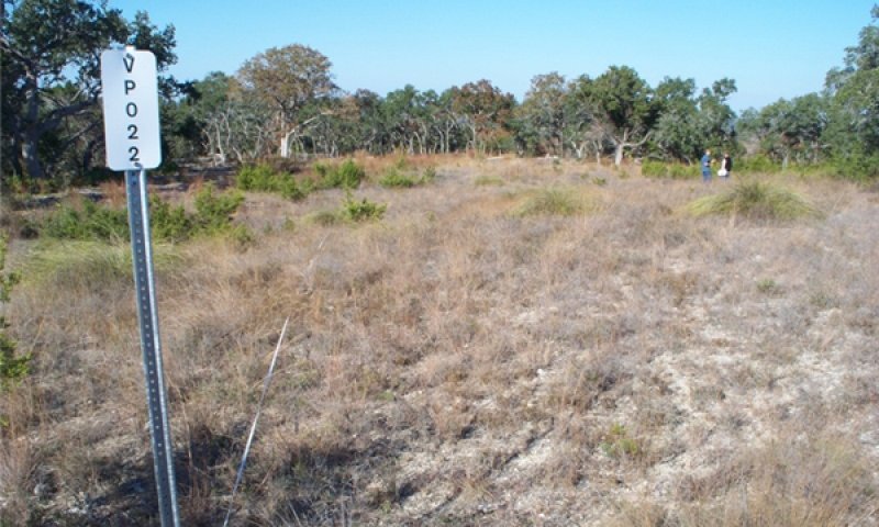
Figure 13. Near reference condition. Brackett Soils, Camp B
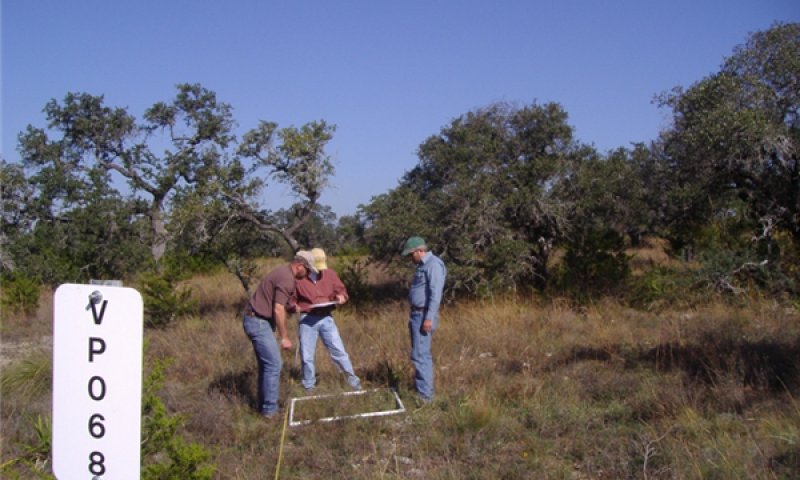
Figure 14. Photo 5. Near reference condition. Brackett Soi
This is the interpretive or representative plant community for the Adobe site. The data for this plant community is derived from field data collection, review of historical descriptions and professional interpretation of several representative locations. The reference plant community for the site is a plant community composed of tall and mid grasses plus scattered live oaks. The overstory canopy averages about 10 percent for the site and consists primarily of live oak, but may include Texas oak and sumac species (Rhus spp.). Other shrubs common to the site are algerita (Mahonia trifoliata), sotol (Dasylirion texanum), sacahuista (Nolina texana) and several associated species. Mid and tall grasses dominate much of the site, though portions of these sites often supported a shrub and tree communities in mosaic patterns along with some seeps or spring flow. The integrity of the reference plant community can be maintained with a few management practices. Hand cutting or mechanical alternatives are options to keep this site in a mosaic Grassland Savannah Community. Prescribed burning is also a natural, effective and economical practice for the flatter slopes of this site. Individual Plant Treatment (IPT) alternatives are other sources of brush management, which may be effective on the steeper slopes. When retrogression is livestock induced, the tall grasses are replaced by a dominance of mid and short grasses such as sideoats grama, hairy grama (Bouteloua hirsuta), hairy tridens (Erioneuron pilosum), and perennial threeawn (Aristida spp.). With continued abuse, the site is dominated by perennial threeawn, muhly spp. (Muhlenbergia), poverty dropseed (Sporobolus vaginiflorus), hairy tridens, cedar sedge (Carex planostachys), and rabbit tobacco (Evax prolifera). Ashe juniper will readily invade the site and become dominate when no management efforts are applied and regardless of grazing pressure except for goats.
Figure 15. Annual production by plant type (representative values) or group (midpoint values)
Table 6. Annual production by plant type
| Plant type | Low (lb/acre) |
Representative value (lb/acre) |
High (lb/acre) |
|---|---|---|---|
| Grass/Grasslike | 770 | 1750 | 3290 |
| Shrub/Vine | 110 | 250 | 470 |
| Tree | 110 | 250 | 470 |
| Forb | 110 | 250 | 470 |
| Total | 1100 | 2500 | 4700 |
Figure 16. Plant community growth curve (percent production by month). TX3770, Grassland/Oak Hillside Community. Tall and midgrasses with scattered live oak motts..
| Jan | Feb | Mar | Apr | May | Jun | Jul | Aug | Sep | Oct | Nov | Dec |
|---|---|---|---|---|---|---|---|---|---|---|---|
| J | F | M | A | M | J | J | A | S | O | N | D |
| 3 | 3 | 7 | 13 | 20 | 15 | 7 | 5 | 10 | 7 | 5 | 5 |
Community 1.2
Savannah Shrubland
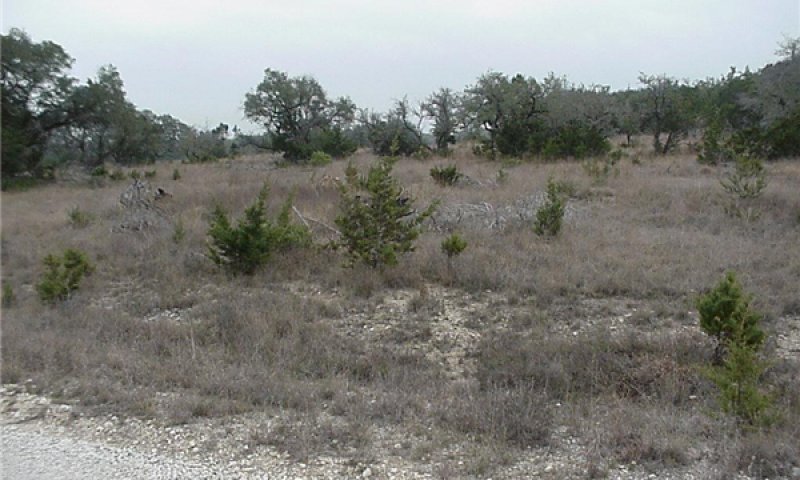
Figure 17. Savannah with small junipers establishing. Bracket
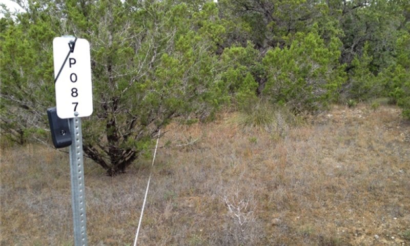
Figure 18. Savannah shrubland with juniper and oak. Bracke
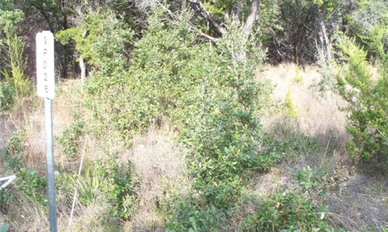
Figure 19. Savannah shrubland with young oak and some juniper
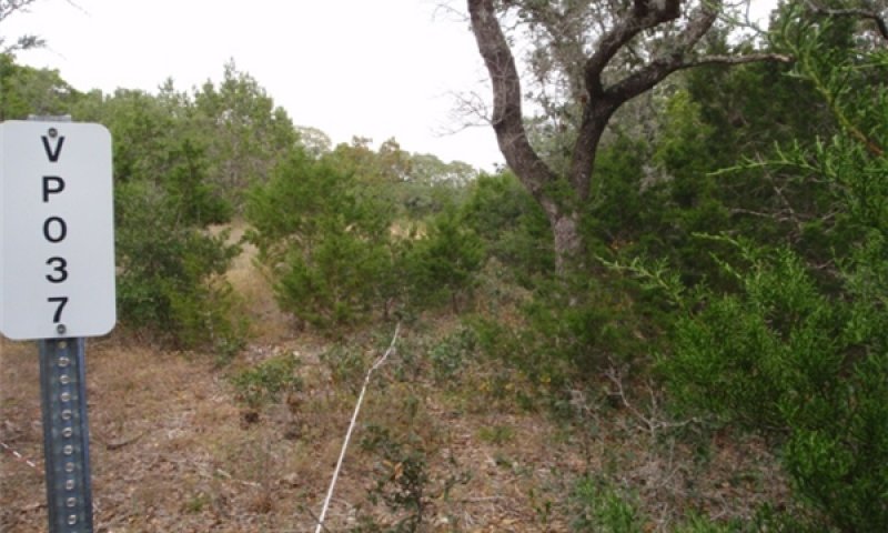
Figure 20. Juniper established underneath oak canopy. This
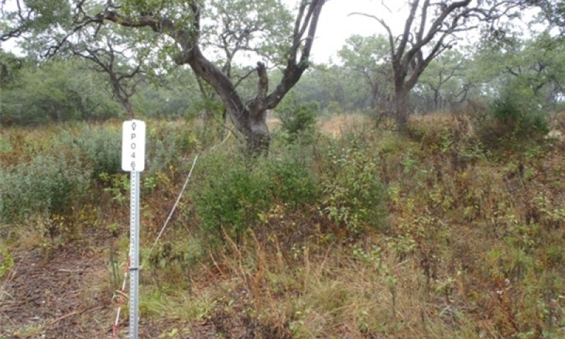
Figure 21. Oak with some juniper. Brackett Soils, Camp Bulli
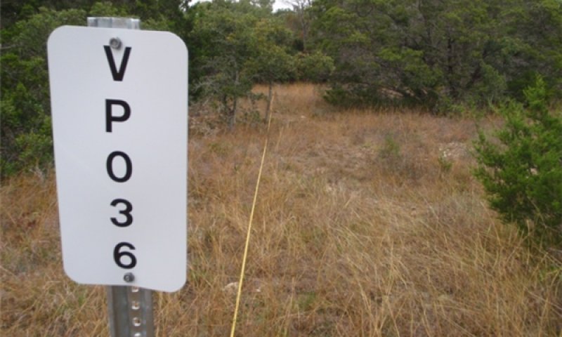
Figure 22. Oak with some juniper. Brackett Soils, Camp Bull
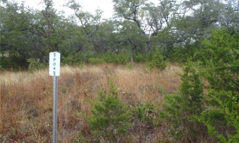
Figure 23. Savannah shrubland with juniper becoming to large
The Savannah Shrubland Community (1.2) is a result of a vegetational shift from the Reference Plant Community (1.1). The data for this plant community is derived from field data collection, review of historical descriptions and professional interpretation of several representative locations. It varies from a tall/midgrass-shrub-tree community to a moderately dense woody canopy community. Driving this shift is the suppression of fire. This site will have Ashe juniper ranging from seedling size to 6-feet tall. Live oak also increases. Canopies for this community can range as high as 25 percent. Ashe juniper may be more prevalent among hillsides and draws where historic fires would not burn. Woody cover, which is primarily live oak, may increase to form a dense canopy and suppress understory vegetation thus negatively impacting plant health and soil stability. The understory will shift to cool-season plants. Grasslike vegetation is significantly reduced when the severe competition that Ashe juniper and other woody species rob sunlight and moisture. Seepy areas and /or spring flows can be reduced by more than 20 percent over the Grassland Savannah Community. Hairy grama, sideoats grama, hairy tridens, Texas grama (Bouteloua rigidiseta), red threeawn (Aristida longiseta), puffsheath dropseed (Sporobolus neglectus) and evax (Evax spp.) are the main grasses of the site in this vegetative state. Shrubs commonly growing in the area are Texas kidneywood, sumac species, algerita (Mahonia trifoliata), Texas persimmon (Diospyros texana) and elbowbush (Forestiera pubescens). Unless management techniques of grazing management, prescribed burning, individual plant treatment (IPT) and selective brush control are applied, this plant community is at risk for transition to the Oak Juniper State (2). This transition can occur in as little as five years. Quick intervention with the proper combination of tools and management can shift this plant community back towards the Grassland Savannah Community if performed before woody cover suppresses the tall or midgrass resource. At this point as much as 25 percent of the rain that falls is trapped in the juniper and evaporate prior to reaching the soils. Even though the oak also traps some moisture in the foliage, the juniper, because of foliage density, is capturing an increasing share that is lost to evaporation. The soil itself is stable, being covered by plant litter from the juniper, live oak and herbaceous plants. Grazeable acres are decreasing rapidly and if stocking rates are not adjusted accordingly, pressure on valuable forage plants increases rapidly.
Figure 24. Annual production by plant type (representative values) or group (midpoint values)
Table 7. Annual production by plant type
| Plant type | Low (lb/acre) |
Representative value (lb/acre) |
High (lb/acre) |
|---|---|---|---|
| Grass/Grasslike | 600 | 1500 | 3150 |
| Shrub/Vine | 150 | 375 | 675 |
| Tree | 150 | 375 | 675 |
| Forb | 100 | 250 | 450 |
| Total | 1000 | 2500 | 4950 |
Figure 25. Plant community growth curve (percent production by month). TX3769, Open Grassland with Juniper. Open Grassland with Juniper Encroachment having warm season grasses with minor cool season influence..
| Jan | Feb | Mar | Apr | May | Jun | Jul | Aug | Sep | Oct | Nov | Dec |
|---|---|---|---|---|---|---|---|---|---|---|---|
| J | F | M | A | M | J | J | A | S | O | N | D |
| 1 | 1 | 5 | 15 | 25 | 20 | 7 | 5 | 13 | 5 | 2 | 1 |
Pathway 1.1A
Community 1.1 to 1.2


Heavy continuous grazing/browsing reduces leaf surfaces of tall grasses resulting in loss of sunshine energy for herbaceous plants. This results in a less frequent fire regime. Woody species become established.
Pathway 1.2A
Community 1.2 to 1.1


Prescribed grazing and a return of fire will help restore of energy capture by tall grasses and mid grasses. In some instances, IPT (Individual Plant Treatment) brush management is needed to selectively remove unwanted plants.
Conservation practices
| Brush Management | |
|---|---|
| Prescribed Burning | |
| Prescribed Grazing |
State 2
Oak/Juniper State
Juniper is dominating the site. Most of the juniper has a full mid-story making travel by people and animals difficult because of the thickness.
Dominant plant species
-
Ashe's juniper (Juniperus ashei), tree
Community 2.1
Oak/Juniper Woodland Community
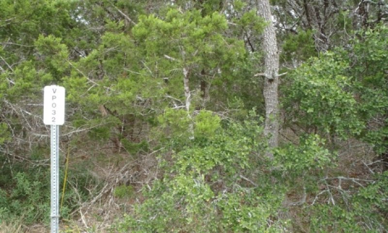
Figure 26. Large juniper under oak. Brackett Soils, Camp B
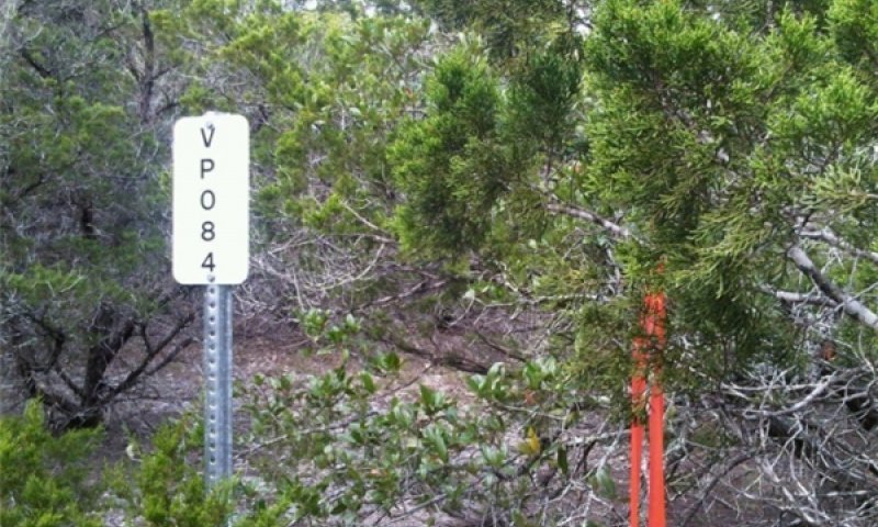
Figure 27. Photo 16. Large juniper within oak motts. Brack
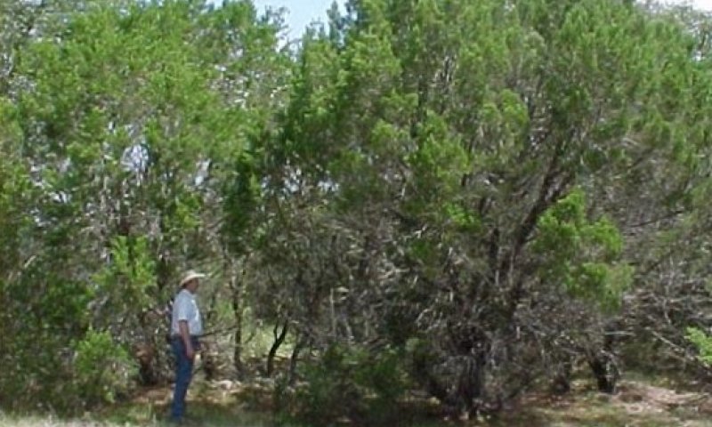
Figure 28. Juniper is dominating. Brackett Soils, Camp Bul
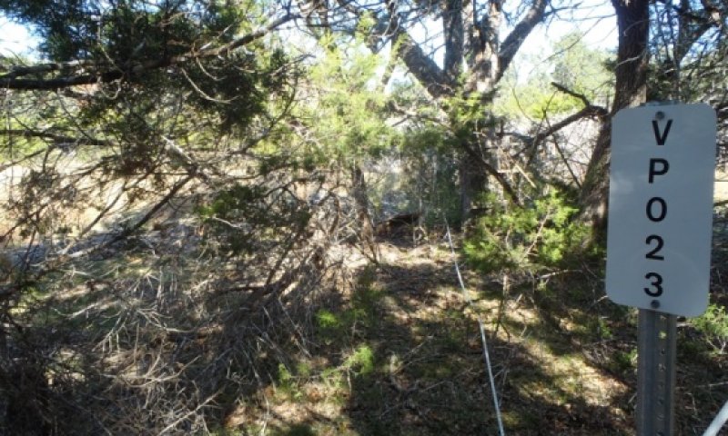
Figure 29. Large juniper under oak. Brackett Soils, Camp Bu
The Oak / Juniper Woodland Community (2.1) has crossed a threshold from the reference plant community, which was a grassland with scattered oak motts, to a plant community which is dominated by tall woody plants and limited grass vegetation. The elimination of fire plus the lack of brush management offered Ashe Juniper and other woody species the opportunity to overtake this site. At this point, deferment from grazing will do nothing to stop the increase of woody plants. This site will feature Ashe juniper 20 feet tall or taller, with canopies exceeding 30 percent. The understory of mixed aged juniper and shrubs is thick as well. This plant community will restrict accessibility for livestock and foot traffic. Grasslike vegetation is significantly reduced because of the severe competition from Ashe juniper and other woody species that rob sunlight and moisture. Large areas that were once grasslands are now covered with heavy woody cover consisting of species such as Ashe juniper, Live oak, Texas oak, algerita, Texas persimmon, elbowbush and lotebush (Ziziphus obtusifolia). Seep muhly, tall grama, tridens (Tridens spp.), threeawns (Aristida spp.) and cedar sedge (Carex spp) have increased in this community and have replaced the more palatable grasses and forbs. Seepy areas and/or spring flows are dramatically reduced and are less likely to occur. Twenty-five percent or more of the annual rainfall is trapped in the dense foliage of the juniper and evaporates before entering the soil. Dense duff under the juniper also absorbs rainfall so the hydrologic cycle is vastly altered as compared to the Grassland Savannah Community (1.1) (Thurow and Hester, 1997). Implementation of brush management programs involving heavy equipment are options that the decision-maker will need to consider if the goal is to transition this community back towards the Grassland Savannah Community (1.1). Once accelerating practices (such as brush management) are implemented, facilitating practices such as prescribed burning and prescribed grazing are needed to maintain the community as a grassland community, if this is the manager’s goal. Seeding can speed up recovery. Abusive grazing by domesticated animals and wildlife will accelerate the decline and even elimination of numerous plants from this community; especially the palatable ones. There is a very low percent of grazeable acres because of the woody cover and accessibility. Little bluestem and Indiangrass have been all but lost. Sideoats grama, tall dropseed, silver bluestem (Bothriochloa sacchariodes), Texas wintergrass and muhly’s are initial increasers on the site but are now reduced except in the few remaining openings. Woody species dominate this community with Ashe juniper being the dominant woody species. Shade tolerant species such as cedar sedge and uniola species (Uniola spp.) occupy the understory limited in sunlight. The majority of the soil surface on this densely canopied site will have a thick mat of cedar leaves and other woody tree and shrub leaf material. The open areas between canopies will produce a grass cover of low successional species such as gramas, threeawns, tridens, and dropseeds (Sporobolus spp.). The total grasslike production potential for this community is severely restricted.
Figure 30. Annual production by plant type (representative values) or group (midpoint values)
Table 8. Annual production by plant type
| Plant type | Low (lb/acre) |
Representative value (lb/acre) |
High (lb/acre) |
|---|---|---|---|
| Grass/Grasslike | 340 | 700 | 1400 |
| Tree | 300 | 600 | 1200 |
| Shrub/Vine | 200 | 400 | 800 |
| Forb | 145 | 300 | 600 |
| Total | 985 | 2000 | 4000 |
Table 9. Soil surface cover
| Tree basal cover | 1-5% |
|---|---|
| Shrub/vine/liana basal cover | 0-5% |
| Grass/grasslike basal cover | 0-5% |
| Forb basal cover | 0-5% |
| Non-vascular plants | 0% |
| Biological crusts | 0-3% |
| Litter | 15-60% |
| Surface fragments >0.25" and <=3" | 5-10% |
| Surface fragments >3" | 5-15% |
| Bedrock | 1-5% |
| Water | 0% |
| Bare ground | 20-30% |
Table 10. Canopy structure (% cover)
| Height Above Ground (ft) | Tree | Shrub/Vine | Grass/ Grasslike |
Forb |
|---|---|---|---|---|
| <0.5 | – | – | 1-5% | 0-2% |
| >0.5 <= 1 | – | – | 1-3% | 1-3% |
| >1 <= 2 | – | – | 0-3% | 1-3% |
| >2 <= 4.5 | 5-15% | 0-3% | – | – |
| >4.5 <= 13 | 30-45% | – | – | – |
| >13 <= 40 | – | – | – | – |
| >40 <= 80 | – | – | – | – |
| >80 <= 120 | – | – | – | – |
| >120 | – | – | – | – |
Figure 31. Plant community growth curve (percent production by month). TX3763, Oak/Juniper Woodland. Oak/Juniper Woodland.
| Jan | Feb | Mar | Apr | May | Jun | Jul | Aug | Sep | Oct | Nov | Dec |
|---|---|---|---|---|---|---|---|---|---|---|---|
| J | F | M | A | M | J | J | A | S | O | N | D |
| 5 | 7 | 8 | 12 | 15 | 10 | 5 | 4 | 12 | 10 | 7 | 5 |
Community 2.2
Juniper/Oak Woodland Community
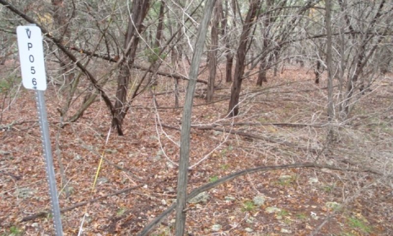
Figure 32. Large juniper with an open understory. Brackett
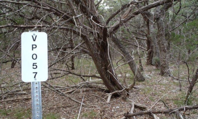
Figure 33. Large juniper with an open understory. Brackett
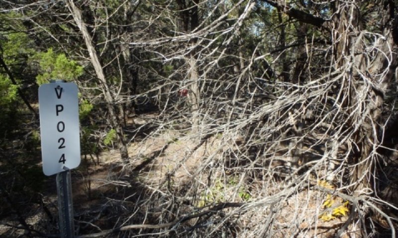
Figure 34. Large juniper with high overstory. Brackett Soil
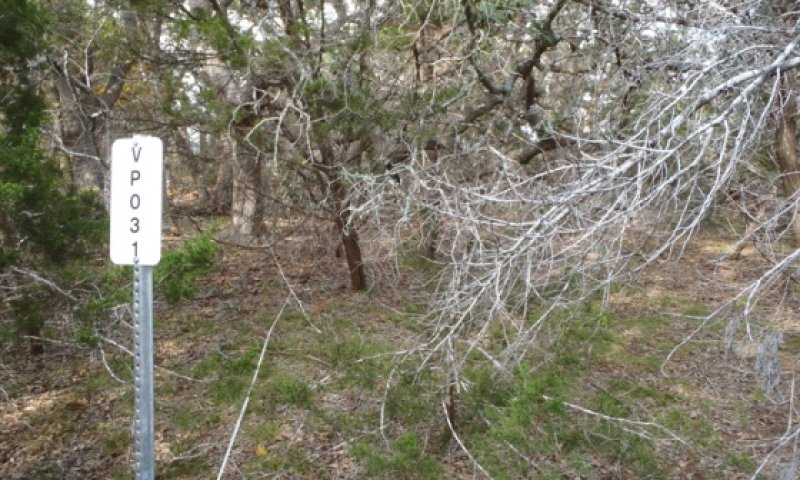
Figure 35. Large juniper with somewhat of an open understory.
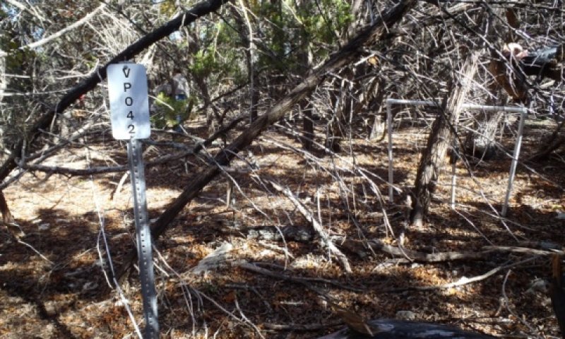
Figure 36. . Large juniper with somewhat of an open understo
The Oak / Juniper Woodland Community (2.2) is a major shift from the original plant community. The elimination of fire plus the lack of brush management offered Ashe juniper and other woody species the opportunity to overtake this site. At this point it would take a stand replacement fire when juniper leaf moisture is low and fire weather is severe to have an impact. This site will feature Ashe juniper over 20 feet tall with canopies exceeding 25 percent. It takes over 50 years of no disturbance for this mature woodland to develop. Grasslike vegetation is significantly reduced because of the severe competition from Ashe juniper and other woody species that rob sunlight and moisture. This plant community now takes on the aspect of a woodland as compared to the Oak Juniper Woodland (2.1) community. The overstory is thick and tall with an increasingly barren understory except for snags. Once the overstory becomes about 30 feet high, the shading causes the lower limbs to drop their leaves and begin to break off or stay as snags. The soil is covered by a solid layer of duff. There is usually more air movement in this understory than in the Oak/Juniper Woodland (2.1) Community. The main understory species include cedar sedge, Texas wintergrass, Indian woodoats (Chasmanthium latifolium), Scribner’s rosette grass and other cool season herbaceous plants. Interestingly, once the taller canopy has some openings, an occasional eastern gamagrass can be observed as it is a very photosynthetically efficient plant and it is on a remnant subsurface seep. Seepy areas and/or spring flows are dramatically reduced and are less likely to occur when dense stands of juniper and oak exist. Interception losses associated with canopy and litter are significant. Rainfall reaching the soil can be reduced by 20 to 34 percent with juniper and 54 percent with live oak. This will short circuit any water cycle (Thurow and Hester, 1997). Grazing management will not restore this community nor is there much grasslike forage from which to foster recovery. Implementation of brush management programs involving heavy equipment are options that the decision-maker will need to consider if the goal is to transition this community back towards other plant communities. Once accelerating practices (such as brush management) are implemented, facilitating practices such as prescribed burning and prescribed grazing are needed to maintain the community as a grassland community, if this is the manager’s goal. Seeding can speed up the recovery.
Figure 37. Annual production by plant type (representative values) or group (midpoint values)
Table 11. Annual production by plant type
| Plant type | Low (lb/acre) |
Representative value (lb/acre) |
High (lb/acre) |
|---|---|---|---|
| Tree | 600 | 1200 | 2500 |
| Shrub/Vine | 300 | 600 | 1260 |
| Forb | 50 | 100 | 200 |
| Grass/Grasslike | 50 | 100 | 200 |
| Total | 1000 | 2000 | 4160 |
Figure 38. Plant community growth curve (percent production by month). TX3763, Oak/Juniper Woodland. Oak/Juniper Woodland.
| Jan | Feb | Mar | Apr | May | Jun | Jul | Aug | Sep | Oct | Nov | Dec |
|---|---|---|---|---|---|---|---|---|---|---|---|
| J | F | M | A | M | J | J | A | S | O | N | D |
| 5 | 7 | 8 | 12 | 15 | 10 | 5 | 4 | 12 | 10 | 7 | 5 |
Pathway 2.1A
Community 2.1 to 2.2


Sunlight is now devoted almost entirely to the woody plant community. The hydrologic cycle favors the woody plant because of interception and stem flow. Lack of brush management allows this to happen.
State 3
Open Grassland State
Dominant plant species
-
kleingrass (Panicum coloratum), grass
-
Bermudagrass (Cynodon dactylon), grass
-
beardgrass (Bothriochloa), grass
Community 3.1
Open Grassland Community
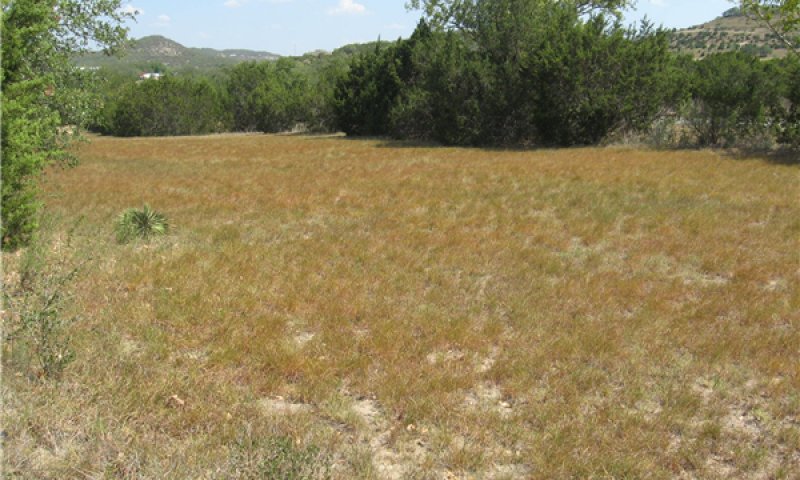
Figure 39. A small area has been mechanically cleared and see
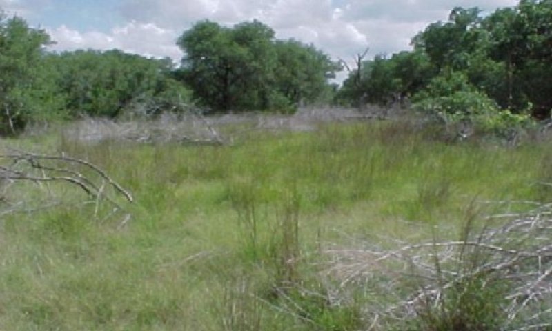
Figure 40. 3.1 Open Grassland Community
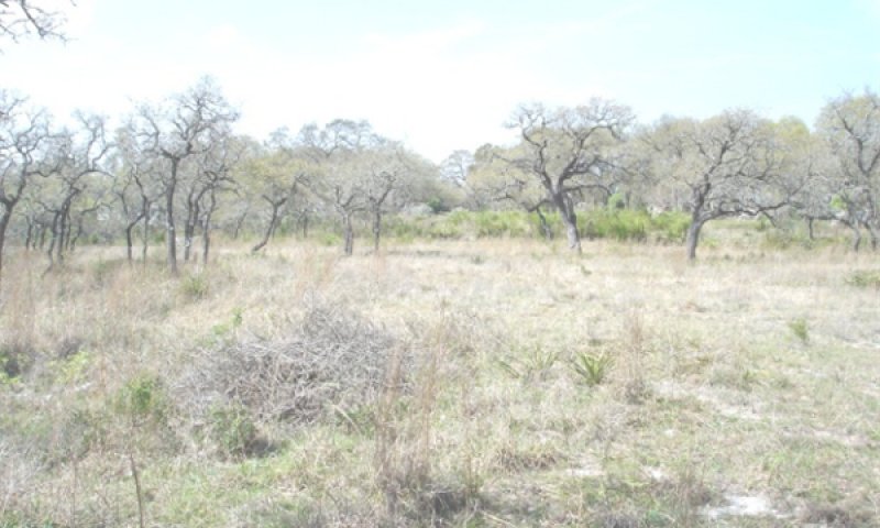
Figure 41. Juniper cleared to create open grassland. Bracke
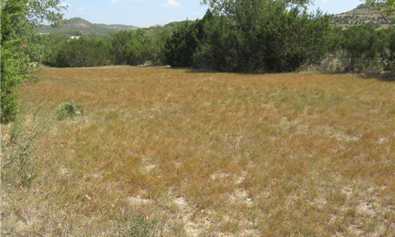
Figure 42. A small area has been mechanically cleared and see
The Open Grassland community (3.1) is created by the removal of the woody vegetation through the use of chemical and/or mechanical land clearing. Grass and forb composition may mimic that of the reference plant community as long as residual historic species exist in the seedbank or as vegetative propagules. This will be very dependent upon the past grazing management that has been applied to the particular site. In many instances, the site has been seeded to or has been invaded by non-native or introduced grasses, such as kleingrass (Panicum coloratum) and old world bluestems (Bothriochloa spp.). Seeps and spring flows will usually occur in above average quantities after the removal of woody vegetation and will be slightly reduced upon the establishment of grass species. Without seeding, if the site has a history of abuse, the site will be slow in the natural re-establishment of annual forbs and grasses. As succession continues, perennial grasses will establish. The species composition initially will be characterized by hairy tridens, Texas grama, red grama and perennial threeawns, silver bluestem, fall witchgrass (Digitaria cognata) and Hall’s panicum (Panicum hallii) scattered throughout. Over many years of proper grazing management plants such as sideoats grama and little bluestem will return. The resprouting oak will re-establish quickly as a thicket unless goats are utilized or if there are excessive numbers of wildlife species. The use of prescribed burning and IPT will be needed to keep unwanted woody species from re-invading. Not managing brush will allow the site to revert to an Oak/Juniper state with Ashe juniper being the dominant woody species. Prescribed burning on a 4 to 7 - year rotation can be a very effective tool to use to manage Ashe juniper and suppress other woody plant growth.
Figure 43. Annual production by plant type (representative values) or group (midpoint values)
Table 12. Annual production by plant type
| Plant type | Low (lb/acre) |
Representative value (lb/acre) |
High (lb/acre) |
|---|---|---|---|
| Grass/Grasslike | 960 | 2000 | 3600 |
| Forb | 180 | 375 | 675 |
| Shrub/Vine | 60 | 125 | 225 |
| Tree | 0 | 0 | 0 |
| Total | 1200 | 2500 | 4500 |
Figure 44. Plant community growth curve (percent production by month). TX3764, Open Grassland. Warm season grasses with minor cool season influence on open grassland..
| Jan | Feb | Mar | Apr | May | Jun | Jul | Aug | Sep | Oct | Nov | Dec |
|---|---|---|---|---|---|---|---|---|---|---|---|
| J | F | M | A | M | J | J | A | S | O | N | D |
| 1 | 1 | 5 | 15 | 25 | 20 | 7 | 5 | 13 | 5 | 2 | 1 |
Community 3.2
Woodland Community
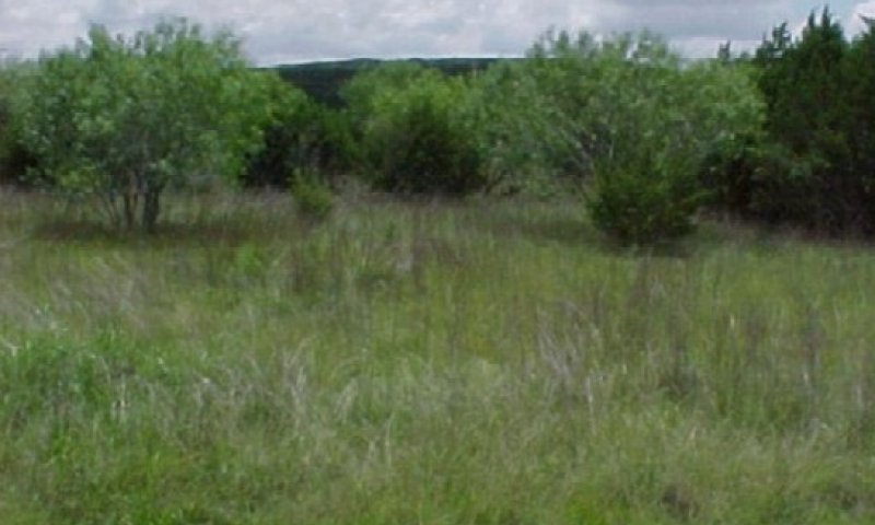
Figure 45. This area has been mechanically cleared with natur
This community has reverted to Ashe juniper and other woody plants. Willow baccharis (Baccharis salicina) may also invade on the site, especially if there is any ground disturbance. A lack of control measures will ensure that the area will move to an almost closed woody canopy. Seeps or spring flows will be severely reduced and may not be present. Recognizing this trend early allows the land manager the opportunity to change the shift back towards the open grassland at a lower cost. Prescribed grazing and prescribed burning can be utilized to control Ashe juniper and suppress the willow baccharis invasion. Individual chemical control measures can be used to control the baccharis. The production potential of this site can approach that of the historic plant community.
Figure 46. Annual production by plant type (representative values) or group (midpoint values)
Table 13. Annual production by plant type
| Plant type | Low (lb/acre) |
Representative value (lb/acre) |
High (lb/acre) |
|---|---|---|---|
| Tree | 540 | 1125 | 2025 |
| Shrub/Vine | 360 | 750 | 1350 |
| Grass/Grasslike | 240 | 500 | 900 |
| Forb | 60 | 125 | 225 |
| Total | 1200 | 2500 | 4500 |
Figure 47. Plant community growth curve (percent production by month). TX3763, Oak/Juniper Woodland. Oak/Juniper Woodland.
| Jan | Feb | Mar | Apr | May | Jun | Jul | Aug | Sep | Oct | Nov | Dec |
|---|---|---|---|---|---|---|---|---|---|---|---|
| J | F | M | A | M | J | J | A | S | O | N | D |
| 5 | 7 | 8 | 12 | 15 | 10 | 5 | 4 | 12 | 10 | 7 | 5 |
Pathway 3.1A
Community 3.1 to 3.2


The re-establishment of juniper and other woody species changes sunlight capture from herbaceous plants more to woody species. Rainfall again is captured in canopy or by stem flow to the base of woody species. Lack of intervention by IPT and fire allow this to shift. This shift can occur in as little as 5 years.
Pathway 3.2A
Community 3.2 to 3.1


If fire, brush management and prescribed grazing are implemented, sunlight will be restored to the herbaceous plant community. The hydrologic cycle will be restored more to a grassland.
Conservation practices
| Brush Management | |
|---|---|
| Prescribed Burning | |
| Prescribed Grazing |
State 4
Mulched State
The mulched state is created when heavy equipment shreds dense stands of brush, mainly juniper and reduces it to surface mulch on the soil.
Dominant plant species
-
Texas live oak (Quercus fusiformis), tree
Community 4.1
Mulched Community
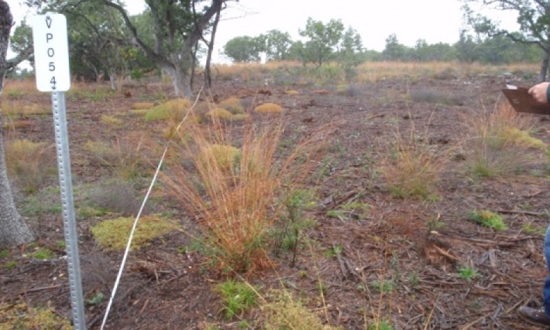
Figure 48. . Large juniper following hydro-mulching. Brack
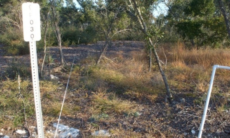
Figure 49. Large juniper following hydro-mulching. Brackett
This plant community has crossed a threshold from the Oak/Juniper State (2) using heavy equipment. There is a greater than 20 percent canopy of live oak and other trees with little understory. The structural aspect of this plant community is very similar to the Tall and Midgrass Prairie (1.1) but is missing many of the signature grasses, forbs and shrubs and usually contains non-native species such as introduced bluestems. Bare ground is less than 1 percent, while the depth of woody chips varies from 0 to 8 inches. The majority of chip coverage is 3 to 4 inches depth. The long-term recovery of this plant community to the Savannah State (1) is unknown and relies on several factors. The depth of the mulch, the availability of residual native seeds and roots and the rate of return of the mulch to the soils are factors. In terms of site function, the mulch captures most of the rainfall occurring with little or no runoff or subsequent erosion. Light penetration to the ground to foster the germination of plants is a limiting factor on the thickest areas of mulch. Over time the mulch begins to settle and will be very slow to return to the soil via ecological processes. Those plants that do germinate and protrude above the mulch are very robust because of the conservation of moisture in the rooting zone and the insulation from evaporation. It is anticipated that organisms living in the soil that digest the lignin and cellulose from the mulch will be benefited from an improved micro-habitat. However, on the deeper mulched portions of the site, it is unknown how these micro-organisms will persist, although it is assumed that they will increase along with a corresponding decrease in mulch amount as sunlight reaching the soil surface. With time the plant community will change. Juniper will reestablish as will other plants. Plants that are root and crown sprouters will have an advantage over those recovering from seed. The use of prescribed burning will not only accelerate the mineralization of the mulch but can also maintain the openness of this community. The frequency of prescribed burning is unknown on mulched sites as fire intensity will be different than a grassland. To prevent juniper from growing in stature until it is no longer manageable with fire, burning when juniper is less than 4 feet tall is recommended.
Figure 50. Annual production by plant type (representative values) or group (midpoint values)
Table 14. Annual production by plant type
| Plant type | Low (lb/acre) |
Representative value (lb/acre) |
High (lb/acre) |
|---|---|---|---|
| Tree | 1360 | 1530 | 3000 |
| Forb | 80 | 90 | 175 |
| Grass/Grasslike | 80 | 90 | 175 |
| Shrub/Vine | 80 | 90 | 175 |
| Total | 1600 | 1800 | 3525 |
Transition T1A
State 1 to 2
Sunlight energy is being captured more by woody plants than by herbaceous plants. An increasing amount of rainfall is entrapped in the juniper canopy with less entering the soil rooting zone. Continued overgrazing/browsing, lack of the fire and lack of brush management are responsible. Drought can hasten the process although a long term severe drought can result in death of juniper.
Transition T1B
State 1 to 3
Land clearing removes all of the woody species to restore the energy capture to herbaceous plants. Range seeding has been applied that includes exotic herbaceous species or they are introduced through hay, livestock or wildlife. The hydrologic cycle resembles the reference plant community.
Restoration pathway R2A
State 2 to 1
Brush management and range planting (if needed) will change the plant community back to a more herbaceous plant community to capture sunlight. The hydrology is reclaimed with a higher percentage of rainfall entering the root zone for use by herbaceous plants. Fire will be needed to maintain the recovery.
Conservation practices
| Brush Management | |
|---|---|
| Prescribed Burning | |
| Range Planting | |
| Native Plant Community Restoration and Management | |
| Prescribed Grazing |
Transition T2A
State 2 to 3
Land clearing removes all of the woody species to restore the energy capture to herbaceous plants. Range seeding has been applied that includes exotic herbaceous species or they are introduced through hay, livestock or wildlife. The hydrologic cycle resembles the reference plant community.
Transition T2B
State 2 to 4
Mechanical conversion of primarily juniper canopy to a mulch cover restores the energy flow to the remaining species, usually oak. The hydrologic cycle retains nearly all the rainfall because of the heavy mulch. Little evaporation takes place.
Additional community tables
Table 15. Community 1.1 plant community composition
| Group | Common name | Symbol | Scientific name | Annual production (lb/acre) | Foliar cover (%) | |
|---|---|---|---|---|---|---|
|
Grass/Grasslike
|
||||||
| 1 | Warm-season Midgrass | 900–1350 | ||||
| little bluestem | SCSC | Schizachyrium scoparium | 900–1350 | – | ||
| 2 | Warm-season Tallgrass | 0–300 | ||||
| Indiangrass | SONU2 | Sorghastrum nutans | 0–150 | – | ||
| 3 | Warm season mid grasses | 300–325 | ||||
| sideoats grama | BOCU | Bouteloua curtipendula | 250–350 | – | ||
| tall grama | BOHIP | Bouteloua hirsuta var. pectinata | 150–300 | – | ||
| green sprangletop | LEDU | Leptochloa dubia | 150–300 | – | ||
| cane bluestem | BOBA3 | Bothriochloa barbinodis | 75–150 | – | ||
| rough dropseed | SPCL | Sporobolus clandestinus | 50–100 | – | ||
| composite dropseed | SPCO16 | Sporobolus compositus | 50–100 | – | ||
| 4 | Warm/Cool-season Grasses | 225 | ||||
| cedar sedge | CAPL3 | Carex planostachys | 25–40 | – | ||
| Texas wintergrass | NALE3 | Nassella leucotricha | 25–40 | – | ||
| 5 | Warm Season short grasses | 100–150 | ||||
| threeawn | ARIST | Aristida | 50–100 | – | ||
| hairy grama | BOHI2 | Bouteloua hirsuta | 50–100 | – | ||
| seep muhly | MURE2 | Muhlenbergia reverchonii | 50–100 | – | ||
| slim tridens | TRMU | Tridens muticus | 25–50 | – | ||
| slim tridens | TRMUE | Tridens muticus var. elongatus | 25–50 | – | ||
|
Forb
|
||||||
| 6 | Forbs | 100–300 | ||||
| awnless bushsunflower | SICA7 | Simsia calva | 25–70 | – | ||
| queen's-delight | STSY | Stillingia sylvatica | 20–50 | – | ||
| Forb, annual | 2FA | Forb, annual | 0–50 | – | ||
| Engelmann's daisy | ENPE4 | Engelmannia peristenia | 25–50 | – | ||
| Maximilian sunflower | HEMA2 | Helianthus maximiliani | 25–50 | – | ||
| dotted blazing star | LIPU | Liatris punctata | 25–50 | – | ||
| trailing krameria | KRLA | Krameria lanceolata | 20–30 | – | ||
| velvet bundleflower | DEVE2 | Desmanthus velutinus | 20–30 | – | ||
| prairie clover | DALEA | Dalea | 10–25 | – | ||
| Indian breadroot | PEDIO2 | Pediomelum | 10–25 | – | ||
| leafflower | PHYLL | Phyllanthus | 10–20 | – | ||
| littleleaf sensitive-briar | MIMI22 | Mimosa microphylla | 10–20 | – | ||
| yellow puff | NELU2 | Neptunia lutea | 10–20 | – | ||
| vetch | VICIA | Vicia | 0–10 | – | ||
|
Shrub/Vine
|
||||||
| 7 | Shrubs/Vines | 100–150 | ||||
| Texas sotol | DATE3 | Dasylirion texanum | 25–75 | – | ||
| evergreen sumac | RHVI3 | Rhus virens | 25–75 | – | ||
| algerita | MATR3 | Mahonia trifoliolata | 25–75 | – | ||
| Texas sacahuista | NOTE | Nolina texana | 25–75 | – | ||
| fragrant sumac | RHAR4 | Rhus aromatica | 25–50 | – | ||
| Texas persimmon | DITE3 | Diospyros texana | 25–50 | – | ||
| Texas kidneywood | EYTE | Eysenhardtia texana | 25–50 | – | ||
| stretchberry | FOPU2 | Forestiera pubescens | 25–50 | – | ||
| roundleaf greenbrier | SMRO | Smilax rotundifolia | 10–25 | – | ||
| black prairie clover | DAFR2 | Dalea frutescens | 10–25 | – | ||
|
Tree
|
||||||
| 8 | Trees | 300–350 | ||||
| Texas red oak | QUBU2 | Quercus buckleyi | 250–350 | – | ||
| Texas live oak | QUFU | Quercus fusiformis | 250–350 | – | ||
| Ashe's juniper | JUAS | Juniperus ashei | 25–50 | – | ||
Interpretations
Animal community
The site is usable by cattle, sheep, Angora goats and meat goats. The high pH in the soil may tie up some of the phosphorus rendering plants like little bluestem more unpalatable than on other sites. Wildlife species utilizing this site for at least a portion of their habitat needs include white-tailed deer, raccoon, cottontail rabbit, jackrabbit, Rio Grande turkey, bobwhite quail, mourning dove, mountain lion, bobcat and other wildlife species. A field assessment of vegetation is needed to calculate carrying capacity for the animals of interest. Traditional regional average stocking rates should not be used and can be misleading because of differences in plants utilized.
With the eradication of the screwworm fly (Cochilomyia hominivorax), the increase in woody vegetation and insufficient natural predation, white-tailed deer numbers have increased drastically and are often in excess of carrying capacity. Where deer numbers are excessive, overbrowsing and overuse of preferred forbs causes deterioration of the plant community. Progressive management of deer populations through hunting can keep populations in balance and provide an economically important ranching enterprise. Achieving a balance between woodland and more open plant communities on this site is an important key to deer management. Competition among deer, sheep and goats can cause damage to preferred vegetation and is an important consideration in livestock and wildlife management. Maintaining cover and food for wildlife on the steeper slopes is extremely important to the wildlife ecology of this site and associated sites below or above it.
Smaller animals using the site include rodents, jackrabbit, cottontail rabbit, raccoon, skunks, possum and armadillo. Mammalian predators include coyote, red fox, gray fox, bobcat, and mountain lion. Many species of snakes and lizards are also native to this site.
A diversity of birds is found on this site including game birds, songbirds and birds of prey. The different species of songbirds vary in their habitat preferences. Prairie chickens (Tympanuchus spp.) were also recorded in the general area. In general, a habitat that provides a large variety of grasses, forbs, shrubs, vines and trees and a complex of grassland, savannah, shrubland and woodland will support a variety and abundance of songbirds. Birds of prey are important to keep the numbers of rodents, rabbits and snakes in balance. The different plant communities of the site will sustain different species of raptors.
Various kinds of exotic wildlife have been introduced on the site including axis, sika, fallow and red deer, auodad sheep and blackbuck antelope. Axis deer are extremely competitive with the native white-tailed deer as they have the ability to shift their diets to several different plant groups while the white-tails do not. Their numbers should be managed in the same manner as livestock and white-tailed deer to prevent damage to the plant community. Feral hogs are present and can cause damage when their numbers are not managed.
Hydrological functions
The soils on this site are well drained with very low water holding capacity. Surface runoff can be rapid because of the slope and physiography of the site. Soils correlated with this site are in Hydrologic Groups C and D. The reference plant community (1.1) is dominated by tall bunchgrass species that are correlated with high hydrologic function. When conditions degrade into States 2 and 3, the composition of desirable tall grasses decreases and mid and short grasses become more dominant. If soil conditions also degrade and management is consistent with overuse, hydrologic function decreases significantly. Hydrology and erosion dynamics are discussed below for States 1, 2, and 3.
The Savannah State, representative of the historic community, is the most productive of the plant community phases. With reference to the state and transition model, state 1 is the most hydrologically stable with the lowest runoff and soil loss. This is because of the prominence of tall grass cover. The greater foliar and basal plant cover of big and little bluestem creates many raindrop interception layers. In addition, many lower statured forbs are located in the understory. Litter cover accumulating during the winter months can provide protection from raindrop impact. The morphology of big bluestem roots is characterized by thick coarse vertical and lateral roots. Rhizomes form a rigid, coarse, open network in the upper 2 inches of soil with branching roots arising from them. Where fractures occur in the underlying rock, roots can penetrate into deeper strata. Infiltration studies have shown the bluestem, Indian grass, and switchgrass are associated with higher infiltration capacity compared to other short-statured grasses which tend to have thicker fibrous surface roots (e.g., gramas, buffalograss, dropseeds, and three-awn grasses).
Where the geologic substrate is fractured (commonly associated with oat mottes), infiltration is rapid and immediate. This water percolates deep into the substrate and largely escapes the evapotranspiration (ET) process. In the non-oak mott portions of this site, runoff often occurs during high intensity, short duration storms. This is a common occurrence, even when Similarity Index is high. In this state, runoff, on the average, displaces and erodes little soil. Water quality is high with little or no sediment. Intermittent channels and water flow paths carry runoff water without appreciable degradation in the channels. Seeps and spring flow are common on this site after high rainfall periods and may last several weeks. If adequate rainfall is received throughout the growing season, spring flow may last throughout the year. Stream channels and intermittent adjacent channels serve as recharge areas--water can percolate via fractures in the geologic substrate. As this water moves downward, it contributes to the recharge of aquifers and provides a constant source of subsurface water for sustained base flow to creeks and streams.
State 1: Savannah State
Model Predictions return periods based on 50 years climate data.
(Return)(Precip)(Runoff) (Erosion)
(Period)(in) (in) (t/ac)
---------------------------------
(50 yr) (52.7) (9.6) (2.3)
(25 yr) (49.5) (3.8) (2.0)
(10 yr) (44.5) (2.9) (1.4)
(5 yr) (40.1) (1.5) (0.7)
(2.5 yr)(35.6) (0.4) (0.2)
---------------------------------
(50 yr) (32.9) (0.8) (0.4)
(avg.)
Based on 50 years of climate data, there is an 85 percent chance there will be runoff and delivered sediment for these conditions. [Rangeland Hydrology and Erosion Model (RHEM) predictions—model calibrated from field data]. The average sediment to runoff ratio is (0.4/0.8 = 0.5). For every 1.0 inch of runoff, 0.5 tons/acre soil erosion.
Return Period Analysis
To help interpret the table, note that a 5-year value will be exceeded, on the average, about once every five years, or twice every ten. There is a one in 5 or 20 percent chance that a value equal to or greater than the 5-year value will occur in a given year. There is a (100 - 20), or 80 percent, chance that the precipitation, runoff, erosion, or sediment yield will be less than the 5-year value. In the results shown in the table, the average 50-year erosion rate is 0.4 tons/acre. There is a 20 percent chance that the annual erosion will exceed about 0.7 tons per acre. At best, any predicted runoff or erosion value, by any model, will be within plus or minus 50 percent of the true value. Erosion rates are highly variable.
Plant Community 1.2: Savannah shrubland community
This community is in an intermediate state of flux i.e., combinations of lack of fire, times of overuse, subsequent wood invasion, and increases in less desirable grasses. Grasslike vegetation is significantly reduced when Ashe juniper and other woody species preempt sunlight and moisture. Seepy areas and /or spring flows are reduced by more than 20 percent over the reference state (1). Less desirable midgrasses such as hairy grama, hairy tridens, Texas grama, red threeawn, and puffsheath dropseed (Sporobolus neglectus) predominate the stand. The rooting systems of these grasses are more fibrous with a majority of the roots in the upper 4 inches of the soil surface. Infiltration capacity is less in this state and can be viewed as significantly different compared to the reference state (1).
Model Predictions return periods based on 50 years climate data
(Return)(Precip)(Runoff)(Erosion)
(Period)(in) (in) (t/ac)
---------------------------------
(50 yr)(52.7) (9.2) (7.4)
(25 yr)(49.5) (5.8) (4.5)
(10 yr)(44.5) (3.6) (3.8)
(5 yr) (40.1) (2.5) (2.0)
(2.5 yr)(35.6) (1.1) (0.9)
---------------------------------
(50 yr) (32.9) (1.30 (1.2)
(avg.)
Based on 50 years of climate data, there is a 98 percent chance there will be runoff and delivered sediment for these conditions. [Rangeland Hydrology and Erosion Model (RHEM) predictions—model calibrated from field data]. The average sediment to runoff ratio is (1.2/1.3 = 0.92. For every 1.0 inch of runoff, 0.92 tons/acre soil erosion. This ratio is almost 2 times higher than state 1.
State 2: Oak Juniper State
The Oak juniper woodland State (2) is associated with a substantial shift to woody plants. As the juniper overstory matures, these trees can grow 20 feet or taller. Grasses and forbs in the understory are shaded and conditions gradually become depauperate as tree overstory and shading increases. Understory vegetation can be dominated by weedy forbs which generally provide less protection to the soil surface compared to grasses. The hydrologic effect is significant from a runoff and accelerated soil loss point of view. Compared to State 1, the Reference State, average runoff and erosion are 1.5 and 3 times higher, respectively.
(Return)(Precip)(Runoff)(Erosion)
(Period)(in) (in) (t/ac)
(50 yr) (52.7) (11.9) (10.5)
(25 yr) (49.5) (6.5) (5.9)
(10 yr) (44.5) (4.9) (5.4)
(5 yr) (40.1) (2.7) (3.0)
(2.5 yr)(35.6) (1.3) (1.7)
(50 yr) (32.9) (1.6) (1.8)
(avg.)
Based on 50 years of climate data, there is a 98 percent chance there will be runoff and delivered sediment for these conditions. [Rangeland Hydrology and Erosion Model (RHEM) predictions—model calibrated from field data]. The average sediment to runoff ratio is (1.8/1.6 = 1.1. For every 1.0 inch of runoff, 1.1 tons/acre soil erosion. This ratio is 2.2 times higher than that of State 1.
Recreational uses
This site has the potential for recreational use due to the diversity of wildlife, which can inhabit ecological sites above and below this site. The tall and mid grasses and scattered oaks produce beautiful fall color variations. Many native plants valuable for landscape may be found on sites nearer to climax. The area is used for hunting, hiking, birding and other nature tourism related enterprises.
The open grassland with widely scattered oaks has an open-space appeal. The mixture of live oak and Texas oak adds to the fall color variations. Early spring rains will produce a variety of flowering annual and perennial forbs.
Wood products
Oaks and Ashe juniper may be used for firewood, fencing material, and/or in the specialty wood industry.
Other information
Plant Preference by Animal Kind:
This rating system provides general guidance as to animal forage preference for plant species. It also indicates possible competition and diet overlap between kinds of herbivores. Grazing preference changes from time to time, especially between seasons, and between animal kinds and classes. An animal’s preference or avoidance of certain plants is learned over time through grazing experience and maternal learning (http://extension.usu.edu/behave/Grazing). Preference does not necessarily reflect the ecological status of the plant within the plant community. For wildlife, plant preferences for food are rated. Refer to detailed habitat guides for a more complete description of a species habitat needs.
Legend: P=Preferred D=Desirable U=Undesirable N=Not Consumed T=Toxic X=Used, but not degree of utilization unknown
Preferred – Percentage of plant in animal diet is greater than it occurs on the land
Desirable – Percentage of plant in animal diet is similar to the percentage composition on the land
Undesirable – Percentage of plant in animal diet is less than it occurs on the land
Not Consumed – Plant would not be eaten under normal conditions. It is only consumed when other forages not available. This can also include plants that are unavailable during parts of the year.
Toxic – Rare occurrence in diet and, if consumed in any tangible amounts results in death or severe illness in animal (Hart, 2003). (Note: many plants can be good forage but toxic at certain doses or at certain times of the year. Animals in poor condition are most susceptible.)
Supporting information
Inventory data references
Information provided here has been derived from limited NRCS clipping data, and from field observations of range trained personnel.
Other references
Anderson, J.R., C.A. Taylor, Jr., C.J. Owens, J.R. Jackson, D.K. Steele, and R. Brantley. 2013. Using experience and supplementation to increase juniper consumption by three different breeds of sheep. Rangeland Ecol. Management. 66:204-208. March.
Archer S. 1994. Woody plant encroachment into southwestern grasslands and savannas: rates, patterns and proximate causes. in: Ecological implications of livestock herbivory in the West, pp.13-68. Edited by M. Vavra, W. Laycock, R. Pieper, Society for Range Management Publication. , Denver, Colorado.
Bestelmeyer, B.T., J.R. Brown, K.M. Havsted, R. Alexander, G. Chavez, and J.E. Hedrick. 2003. Development and use of state-and-transition models for rangelands. Journal of Range Management. 56(2): 114-126.
Bushland, R.C. 1985. Eradication program in the southwestern United States. Symposium on eradication of the screwworm from the United States and Mexico. Misc. Pub. Entomol. Soc. Am., 62:12-15.
Foster, J.H. 1917. The spread of timbered areas in central Texas. Journal of Forestry 15:442-445.
Frost, C. C. 1998. Presettlement fire frequency regimes of the Unites States: a First Approximation. Tall Timbers Fire Ecology Conference Proceedings. No. 20. Tall Timbers Research Station. Tallahassee, FL.
Fuhlendorf, S. D., and Engle D.M., Kerby J., and Hamilton R. 2008. Pyric Herbivory: rewilding Landscapes through the Recoupling of Fire and Grazing. Conservation Biology. Volume 23, No. 3, 588-598.
Hamilton W. and D. Ueckert. 2005. Rangeland Woody Plant Control--Past, Present, and Future. Chapter 1 in: Brush Management-Past, Present, and Future. Texas A & M University Press. Pp.3-16.
Hanselka, W., R. Lyons, and M. Moseley. 2009. Grazing Land Stewardship – A Manual for Texas Landowners. Texas AgriLife Communications, http://agrilifebookstore.org.
Hart, C., R.T. Garland, A.C. Barr, B.B. Carpenter, and J.C. Reagor. 2003. Toxic Plants of Texas. Texas Cooperative Extension Bulletin B-6103 11-03.
Inglis, J. M. 1964. A History of Vegetation on the Rio Grande Plains. Texas Parks and Wildlife Department, Bulletin No. 45. Austin, Texas.
Massey, C.L. 2009. The founding of a town – The Gugger and Benke families. Helotes Echo, July 1, 2009.
Natural Resources Conservation Service. 1994. The Use and Management of Browse in the Edwards Plateau of Texas. Temple, Texas.
Plant symbols, common names, and scientific names according to USDA/NRCS Texas Plant List (Unpublished)
Pyne, S.J. 1982. Fire in America. Princeton University Press, Princeton, NJ.
Roemer, Ferdinand Von. 1983. Roemer’s Texas. Eakins Press.
Schmidly, D.J. 2002. Texas natural history: a century of change. Texas Tech University Press, Lubbock.
Scifres, C.J. and W.T. Hamilton. 1993. Prescribed Burning for Brush Management: The South Texas Example. Texas A & M University Press, 245 pp.
Smeins, F., S. Fuhlendorf, and C. Taylor, Jr. 1997. Environmental and Land Use Changes: A Long Term Perspective. Chapter 1 in: Juniper Symposium 1997. Texas Agricultural Experiment Station. Pp 1-21.
Taylor, C.A. (Ed.). 1997. Texas Agriculture Experiment Station Technical Report 97-1 (Proceedings of the 1997 Juniper Symposium), Sonora Texas, pp. 9-22.
Teer, J.G., J.W. Thomas, and E.A. Walker. 1965. Ecology and Management of White-tailed Deer in the Llano Basin of Texas. Wildlife Monographs 10: 1-62.
Thurow, T.O. and J.W. Hester. 1997. 1997 Juniper Symposium. Texas Agricultural Experiment Station, The Texas A&M University System. Tech. Rep. 97-1. January 9-10, 1997. San Angelo, Texas
USDA-NRCS (Formerly Soil Conservation Service) Range Site Description (1972)
Vines, R.A. 1984. Trees of Central Texas. University of Texas Press. Austin, Texas.
Weninger, D. 1984. The Explorer’s Texas. Eakin Press; Waco, Texas.
Wilcox. B.P. and T.L. Thurow. 2006. Emerging Issues in Rangeland Ecohydrology: Vegetation Change and the Water Cycle. Rangeland Ecol. Management. 59:220-224, March.
Wilcox, B.P., Y. Huang, and J.W. Walker. 2008. Long-term trends in stream flow from semiarid rangeland: uncovering drivers of change. Global Change Biology 14: 1676-1689, doi:10.1111/j.1365.2486.2008.01578.
Wilcox, B.P., W.A. Dugas, M.K. Owens, D.N Ueckert, and C.R. Hart. 2005. Shrub Control and Water Yield on Texas Rangelands: Current State of Knowledge. Texas Agricultural Experiment Station Research Report 05-1.
Wills, Frederick. 2006. Historic Vegetation of Camp Bullis and Camp Stanley, Southeastern Edwards, Plateau. Texas. Texas Journal of science. 58(3):219-230.
Wright, H.A. and A.W. Bailey. 1982. Fire Ecology: United States and Southern Canada. John Wiley & Sons, Inc.
Wu. B.X., E.J. Redeker, and T.L. Thurow. 2001. Vegetation and Water Yield Dynamics in an Edwards Plateau Watershed.
Journal of Range Management. 54:98-105. March 2001.
http://extension.usu.edu/behave/(Accessed 8/13/13)
Contributors
Carl Englerth
Joe Franklin, RMS, NRCS, Texas
Mark Moseley
Travis Waiser, MLRA Leader, NRCS, Kerrville, TX
Approval
Bryan Christensen, 9/19/2023
Acknowledgments
Site Development and Testing Plan:
Future work, as described in a Project Plan, to validate the information in this Provisional Ecological Site Description is needed. This will include field activities to collect low, medium and high-intensity sampling, soil correlations, and analysis of that data. Annual field reviews should be done by soil scientists and vegetation specialists. A final field review, peer review, quality control, and quality assurance reviews of the ESD will be needed to produce the final document. Annual reviews of the Project Plan are to be conducted by the Ecological Site Technical Team.
QC/QA completed by:
Bryan Christensen, SRESS, NRCS, Temple, TX
Erin Hourihan, ESDQS, NRCS, Temple, TX
Rangeland health reference sheet
Interpreting Indicators of Rangeland Health is a qualitative assessment protocol used to determine ecosystem condition based on benchmark characteristics described in the Reference Sheet. A suite of 17 (or more) indicators are typically considered in an assessment. The ecological site(s) representative of an assessment location must be known prior to applying the protocol and must be verified based on soils and climate. Current plant community cannot be used to identify the ecological site.
| Author(s)/participant(s) | |
|---|---|
| Contact for lead author | Zone Rangeland Management Specialist, NRCS, San Angelo, Texas, 325-944-0147 |
| Date | 06/29/2005 |
| Approved by | Colin Walden |
| Approval date | |
| Composition (Indicators 10 and 12) based on | Annual Production |
Indicators
-
Number and extent of rills:
None. -
Presence of water flow patterns:
None, except following extremely high intensity storms where short flow patterns may appear. -
Number and height of erosional pedestals or terracettes:
None -
Bare ground from Ecological Site Description or other studies (rock, litter, lichen, moss, plant canopy are not bare ground):
Expect no more than 10% bare ground randomly distributed throughout in small and non-connected areas. -
Number of gullies and erosion associated with gullies:
None. -
Extent of wind scoured, blowouts and/or depositional areas:
None. -
Amount of litter movement (describe size and distance expected to travel):
Under normal rainfall, little litter movement should be expected; however, litter of all sizes may move long distances. Minimal and short. -
Soil surface (top few mm) resistance to erosion (stability values are averages - most sites will show a range of values):
Soil surface is resistant to erosion. Stability class range is expected to be 5-6 -
Soil surface structure and SOM content (include type of structure and A-horizon color and thickness):
Soil surface is light brownish gray gravelly clay loam with limestone moderately fine subangular blocky and moderately fine granular structure on the surface. SOM is approximately 1-3%. See soil survey for specific soils. -
Effect of community phase composition (relative proportion of different functional groups) and spatial distribution on infiltration and runoff:
The savannah of tallgrasses, midgrasses, forbs and trees having adequate litter and little bare ground can provide for maximum infiltration and little runoff under normal rainfall events. -
Presence and thickness of compaction layer (usually none; describe soil profile features which may be mistaken for compaction on this site):
No evidence of compaction. -
Functional/Structural Groups (list in order of descending dominance by above-ground annual-production or live foliar cover using symbols: >>, >, = to indicate much greater than, greater than, and equal to):
Dominant:
Warm-season midgrassesSub-dominant:
Forbs TreesOther:
Warm-season tallgrasses Warm-season shortgrasses ShrubsAdditional:
Forbs make up 10 percent species composition, shrubs has about 5 percent species composition and trees have 15 percent annual production.n -
Amount of plant mortality and decadence (include which functional groups are expected to show mortality or decadence):
There should be little mortality or decadence for any functional groups. -
Average percent litter cover (%) and depth ( in):
Litter is primarily herbaceous -
Expected annual annual-production (this is TOTAL above-ground annual-production, not just forage annual-production):
1800 to 4100 pounds per acre -
Potential invasive (including noxious) species (native and non-native). List species which BOTH characterize degraded states and have the potential to become a dominant or co-dominant species on the ecological site if their future establishment and growth is not actively controlled by management interventions. Species that become dominant for only one to several years (e.g., short-term response to drought or wildfire) are not invasive plants. Note that unlike other indicators, we are describing what is NOT expected in the reference state for the ecological site:
Ashe Juniper is dominant, Honey mesquite, Prickly pear, Bermudagrass, Johnsongrass, King Ranch bluestem -
Perennial plant reproductive capability:
All perennial plants should be capable of reproducing, except during periods of prolonged drought conditions, heavy natural herbivory, and wildfires.
Print Options
Sections
Font
Other
The Ecosystem Dynamics Interpretive Tool is an information system framework developed by the USDA-ARS Jornada Experimental Range, USDA Natural Resources Conservation Service, and New Mexico State University.
Click on box and path labels to scroll to the respective text.
| T1A | - | Absence of disturbance and natural regeneration over time |
|---|---|---|
| T1B | - | Removal of woody species coupled with range seeding |
| R2A | - | Reintroductions of natural disturbance regimes |
| T2A | - | Removal of woody vegetation coupled with range seeding |
| T2B | - | Mechanical conversion of primarily to mulch |