Blackland 29-35 PZ
Scenario model
Current ecosystem state
Select a state
Management practices/drivers
Select a transition or restoration pathway
-
Transition T1A
Absence of disturbance and natural regeneration over time
More details -
Transition T1B
Removal of native species, extensive soil disturbance, and conversion to cropland
More details -
Restoration pathway R2A
Reintroduction of natural disturbance regimes
More details -
Transition T2B
Removal of native species, extensive soil disturbance, and conversion to cropland
More details -
Transition T2A
Removal of woody species and seeding with improved forage species
More details -
Transition T3A
Seeding with improved forage species
More details -
Transition T4A
Extensive soil disturbance and conversion to cropland
More details -
Transition T4B
Absence of disturbance and natural regeneration over time
More details - Transition T5A More details
-
No transition or restoration pathway between the selected states has been described
Target ecosystem state
Select a state
Description
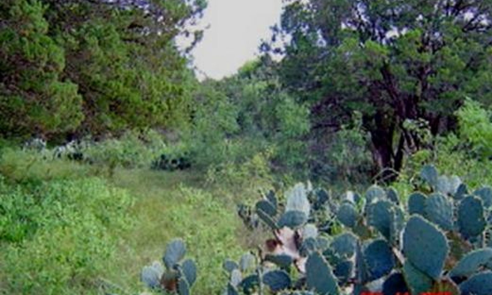
The reference state is considered to be representative of the natural range of variability under pre-Euro settlement conditions. This state was dominated by warm-season, deep-rooted, vegetation. Community phase changes are primarily driven by wildfire, grazing, and climatic fluctuations.
The overstocking by cattle, sheep and goats in the late 1800s began a change in the plant composition of the Tallgrass Prairie Community towards a mixed-grass savannah with increasing woody species. As livestock numbers increased and grazing use exceeded the preferred plants' ability to sustain defoliation year after year, the most palatable species gave way to less palatable or more grazing resistant species. Because of selective grazing, the more palatable tall grasses decreased, giving way to secondary midgrass species.
Characteristics and indicators
The considerable precipitation (28 to 38 inches per year) comes primarily from convective storms during the warm season that favors deep-rooted vegetation. Deep-rooted trees and fire resistant shrubs, however, occupied only draws and ridges where they were protected from frequently occurring fires (Bray 1904 and Foster 1917). Recent studies conclude that before European settlement in the 1800s fires occurred at 7 to 12 year intervals in the Eastern Edwards Plateau region (Frost 1998). Without frequent and intense recurring fires, the Blackland Ecological Site would likely have been woodland.
Submodel
Description
This state is characterized by a shift in the dominant functional and structural groups. Understory is reduced due to shading from woody species (oak, mesquite and/or juniper). Cool-season, shortgrasses and annual and perennial forbs occupy the tree interspaces.
Submodel
Description
Throughout MLRA 81C, many early settlers, having a farming background, cultivated small fields on the Blackland site for vegetable crops, grain, forage sorghum and winter cereals for livestock forage. Many of the Blackland sites have been converted to cropland in the past. Cropping of the site is still common for food and fiber production, livestock grazing, grain harvesting or planting for wildlife food plots on many ranches. Many fields, however, have been abandoned and let ‘go back’ to native rangeland or planted into introduced grasses for pastureland use.
Submodel
Description
Abandoned cropland areas, or cleared areas, are often seeded to native grass species or introduced grass species such as Kleingrass (Panicum coloratum), Gordo bluestem (Bothriochloa spp.) or bermudagrass (Cynodon spp.). Herbage production for adapted introduced grasses or native grasses can reach peak production within a few years after a full stand is established.
Submodel
Description
Go Back Land’ is a local name used to describe cropland fields that have been abandoned and are undergoing secondary succession. The plant community consists of a mixture of native grasses, forbs and shrubs. The ‘Go Back Land’ Community (6) results from abandoning cropland and leaving the land idle without implementing conservation practices such as range planting or brush management. Weeds and brush from the adjacent rangeland will invade the abandoned cropland. The initial invaders in abandoned fields on the Blackland site are annual, biennial and weak perennial grasses and forbs.
Submodel
Mechanism
The changes in species composition are small initially, but unless proper grazing and prescribed burning are applied the woody species continue to increase in size and density. As grazing continues, the tall and midgrasses give way to buffalograss and Texas wintergrass. When the canopy of the woody plants becomes dense enough (> 35 % canopy) and tall enough (> 5 feet height) to suppress grass growth and resist fire damage, a threshold in ecological succession is crossed. The Mixed-Grass Oak Savannah Community (1.2) transitions into the Oak/Mixed-Brush Community (2.1). Once this threshold is passed, normal range management practices, such as prescribed grazing and prescribed burning, cannot reverse the transition to woody plant dominance.
Mechanism
Many early settlers, having a farming background, cultivated small fields on the Blackland site for vegetable crops, grain, forage sorghum and winter cereals for livestock forage. Many of the Blackland sites have been converted to cropland in the past. Cropping of the site is still common for food and fiber production, livestock grazing, grain harvesting or planting for wildlife food plots on many ranches.
Mechanism
Returning the Oak/Mixed-Brush Woodland Community (2.1) back to the Grassland State (1.0) requires extensive and expensive reclamation practices. Range planting, prescribed grazing and prescribed burning, must follow mechanical and/or chemical brush control.
Relevant conservation practices
| Practice | External resources |
|---|---|
|
Brush Management |
|
|
Prescribed Burning |
|
|
Prescribed Grazing |
|
|
Range Planting |
|
|
Planned Grazing System |
|
|
Invasive Plant Species Control |
Mechanism
Land use other than livestock production such as cropland might dictate alternative reclamation approaches to create the plant community that best fits the intended use. Cropland species such as small grains and forage annual crops are planted.
Mechanism
Land use other than livestock production such as pastureland might dictate alternative reclamation approaches to create the plant community that best fits the intended use. Forage pasture species such as bermudagrass and kleingrass are planted.
Mechanism
Cropping of the site is still common for food and fiber production, livestock grazing, grain harvesting or planting for wildlife food plots on many ranches. Many fields, however, have been planted into introduced grasses for pastureland use.
Mechanism
Pastureland converted into cropland fields.
Mechanism
Invasion of pastureland by brush such as mesquite, huisache (Acacia smallii), baccharis (Baccharis spp.) and juniper is common in this MLRA. Drought and reduced soil cover due to cropping and grazing and a nearby seed source trigger the invasions. The shrub ‘seedlings’ that appear in seeded or abandoned fields are true seedlings established by seeds brought in by animals, water or wind. The invading brush must be controlled with grazing management, prescribed burning or other brush management methods or the woody invaders will again dominate.
Mechanism
In the absence of fire or brush management, abandoned fields may become dominated by woody species and resemble the woody state (2).
Relevant conservation practices
| Practice | External resources |
|---|---|
|
Brush Management |
|
|
Nutrient Management |
|
|
Integrated Pest Management (IPM) |
|
|
Planned Grazing System |
|
|
Invasive Plant Species Control |
Model keys
Briefcase
Add ecological sites and Major Land Resource Areas to your briefcase by clicking on the briefcase (![]() ) icon wherever it occurs. Drag and drop items to reorder. Cookies are used to store briefcase items between browsing sessions. Because of this, the number of items that can be added to your briefcase is limited, and briefcase items added on one device and browser cannot be accessed from another device or browser. Users who do not wish to place cookies on their devices should not use the briefcase tool. Briefcase cookies serve no other purpose than described here and are deleted whenever browsing history is cleared.
) icon wherever it occurs. Drag and drop items to reorder. Cookies are used to store briefcase items between browsing sessions. Because of this, the number of items that can be added to your briefcase is limited, and briefcase items added on one device and browser cannot be accessed from another device or browser. Users who do not wish to place cookies on their devices should not use the briefcase tool. Briefcase cookies serve no other purpose than described here and are deleted whenever browsing history is cleared.
Ecological sites
Major Land Resource Areas
The Ecosystem Dynamics Interpretive Tool is an information system framework developed by the USDA-ARS Jornada Experimental Range, USDA Natural Resources Conservation Service, and New Mexico State University.


