Shallow Ridge 25-32 PZ
Scenario model
Current ecosystem state
Select a state
Management practices/drivers
Select a transition or restoration pathway
- Transition T1A More details
- Transition T1B More details
- Restoration pathway R2A More details
- Transition T2A More details
- Restoration pathway R3A More details
- Transition T3A More details
-
No transition or restoration pathway between the selected states has been described
Target ecosystem state
Select a state
State 1
Savannah State


Description
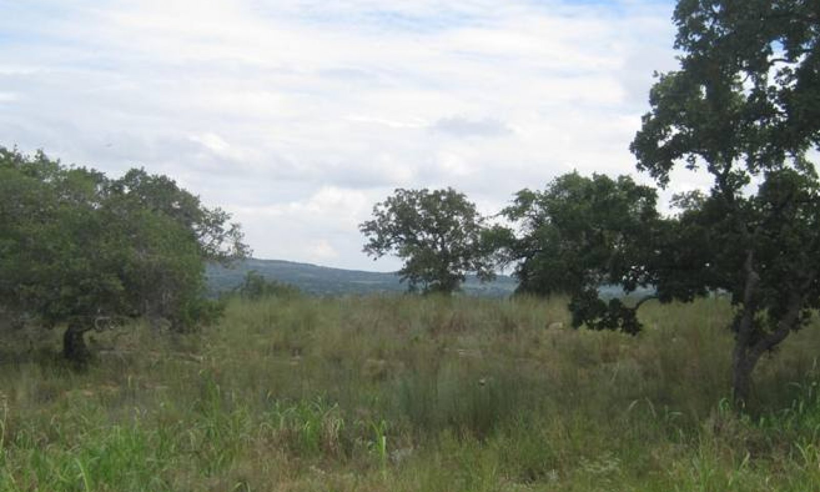
The Savannah State consists of two plant communities: the Midgrass/Oak Savannah Community (1.1) and the Oak Savannah Community (1.2). The Midgrass/Oak Savannah Community occurred on this ecological site in a dynamically shifting mosaic over time with the Oak Savannah Community. The two communities in the Savannah State shifted between one another depending on the frequency and intensity of grazing, drought, and other growing season stresses.
Unlike most other Central Basin sites, the woody component is relatively constant and not driven by fire. The understory has large gaps and limited production so that it does not provide continuous fine fuels. Without continuous fine fuels, fires rarely burn hot enough to reduce the canopy cover of single-stemmed mature trees and shrubs. Fire has some influence on this site but mainly along the “seams” where the fine fuels are found. Grazing management can drive the shift between the two communities in the Savannah State.
Prior to settlement, Shallow Ridge sites had a savannah appearance with open areas dominated by mid grasses (little bluestem and sideoats grama) interspersed with scattered mottes dominated by oaks. The Midgrass/Oak Savannah (1.1) may have up to 15 percent canopy cover while the Oak Savannah (1.2) will have up to 20 percent woody canopy. This transition to the Oak Savannah Community (1.2) is dependent on the degradation of the herbaceous community. With proper grazing and favorable climate conditions, little bluestem and other midgrasses will remain the dominant component of the understory.
Submodel
Description
This state contains a single community, the Shrubland Community (2.1). The Shrubland State (2.0) is characterized by a shortgrass-dominated understory with scattered trees and shrubs. Bare ground, erosion, and water flow patterns will increase as the understory is degraded. Forage production will decline.
The hardwoods that made up a portion of the plant community in the Savannah State will likely be present in the Shrubland State unless they were removed by brush control. The transition to the Shrubland State will probably not cause an increase in the number or biomass production of hardwoods. However, because the production of herbaceous species will decline, the relative species composition of shrubs and trees will increase. If the hardwoods were removed, they will be slow to reestablish. They are more likely to reestablish as shrubs, rather than trees.
Trees and shrubs remain a part of the community, but woody species composition may vary greatly. The woody component may be similar to the woody component in the Midgrass/Oak Savannah community (1.1). Mature oaks occur in mottes with scattered brush, though the woody component is more frequently made up of many species of widely scattered shrubs.
Submodel
Description
This state includes a single community, the Eroded Community (3.1), which is characterized by significant soil loss.
The Eroded Community is currently the most common community on Shallow Ridge sites. Unless managers practice effective, ongoing grazing management this community will remain. Because of the availability of invasives with low palatability, this site rarely stays barren. There are examples that are degraded but not dominated by brush but these examples tend to be quickly reinvaded by annual forbs and grasses as well as low-palatability shrubs.
Much of this site has been disturbed to the point that significant soil loss has occurred. Once the A Horizon is eroded (partially or completely), nutrient cycling is disrupted and difficult to restore. Loss of soil is accompanied by disruption (or loss) of soil mycorrhiza. Steeper portions of this site are subject to severe erosion when the plant cover is disturbed. Some examples of the site have eroded to the granite bedrock.
The Eroded State has the potential to be a terminal state. Due to the relatively high risk of severe soil erosion of the sandy loam soils, this site can erode to the point where there is a loss of soil functionality. When this level of erosion occurs, the site loses soil structure, soil fertility, organic matter, and/or soil microflora. There are examples of the loss of the A and B horizons and some with the soil eroded to bedrock. Once the site loses soil horizons or soil functions, it is very difficult or impossible to return the site to one of the other States, resulting in State 3 being a terminal state. Return to another state will be the result of site restoration efforts, not typical management changes.
Submodel
Mechanism
The drivers for Transition T1A are improper grazing management and lack of fire or brush control. The understory is dominated by shortgrasses, unpalatable grasses and forbs, and annual grasses and forbs. This transition is indicated by the decrease of dominant reference state midgrasses (little bluestem and sideoats grama) to less than 10 percent of species composition of the herbaceous community. Once these species are lost from the community or present only in trace amounts, grazing management alone usually cannot cause a transition to the reference state. Evidence from sites with long-term growing season deferment (30+ years) shows that recovery is possible back across this threshold unless erosion has removed the soil horizons or function.
Regardless of the composition and vigor of the herbaceous component, this community will shift to the Shrubland State without effective brush control. Without adequate brush control, it will shift to the Shrubland Community in a relatively short time (5-15 years). The open areas of the savannah will have shrubs sprout every year. As these plants mature, they will fill in the open areas. Once canopy cover of woody species reaches 20 percent, the site has shifted to the Shrubland Community.
This shift can occur even with proper grazing management and if the herbaceous component remains vigorous. Brown and Archer (1999) concluded that even with a healthy and dense stand of grasses, woody species would populate the site and eventually dominate the community. As the herbaceous understory is degraded to shortgrasses, fine fuel load declines, reducing the ability to carry a brush-killing fire. This increases the risk that the site will transition to the Shrubland State (2.0)
Mechanism
Abusive grazing or other soil-disturbing activities including rock harvest can cause severe soil degradation. In some cases, this erosion can be extreme enough to result in the loss of the entire soil layer. Long-term drought may trigger this transition from the Savannah State (1.0) or exacerbate the effects of inappropriate grazing management on the Shallow Ridge site.
When the Shallow Ridge site is subjected to inappropriate management, the effects may be seen in a loss of vegetative cover followed by a loss of soil. Soil Erosion can be extreme enough to result in the loss of the A (and even B) horizons. Severe soil degradation can be caused by abusive grazing, mismanaged brush control, or other soil-disturbing activities including rock harvest or gravel mining. This loss of soil accompanies the loss of the vegetative cover associated with this site. If soil erosion is severe enough, the return to a previous state may not be possible.
Mechanism
The driver for Restoration Pathway R2A is fire and/or brush control combined with the restoration of the herbaceous community. Establishment of native grasses is difficult and dependent upon natural seeding from remnant patches and seed banks. This site is often too shallow for effective reseeding.
A long-term prescribed fire program may sufficiently reduce brush density to a level below the threshold of the Savannah State (1.0). Proper grazing management and stocking rates maintain the herbaceous layer in this state. With proper grazing management, midgrasses can regain dominance on the site and undesirable trends in soil organic matter, fertility, temperature, and erosion can be arrested and reversed. The extent to which the original Midgrass/Oak Savannah Community (1.1) can be re-established will depend on the extent to which soil physical and chemical properties were altered during retrogression (Heitschmidt and Stuth 1991).
Relevant conservation practices
| Practice | External resources |
|---|---|
|
Brush Management |
|
|
Prescribed Burning |
|
|
Prescribed Grazing |
Mechanism
The driver for this transition is abusive management. The effects may be seen in a loss of vegetative cover followed by a loss of soil. In some cases, this erosion can be extreme enough to result in the loss of the A (and even B) horizons. Abusive grazing or other soil-disturbing activities including rock harvest can cause severe soil degradation. This loss of soil results in or accompanies the loss of the vegetative cover associated with this site. Long-term drought may also trigger this transition from the Shrubland State (2.0) or exacerbate the effects of inappropriate grazing management on the Shallow Ridge site.
Mechanism
*The likelihood of returning to the Savannah State (1.0) is improbable, and restoration would require extensive and intensive restoration efforts. Range restoration techniques can be used to restore this site on high-value lands (such as mining reclamation). This will likely require replacement of topsoil and planting of native species, though the site is often too shallow for effective reseeding. A return to reference condition should not be expected, and savannah conditions are only possible with continued inputs and management over a long period of time.
Relevant conservation practices
| Practice | External resources |
|---|---|
|
Brush Management |
|
|
Prescribed Burning |
|
|
Prescribed Grazing |
|
|
Range Planting |
Mechanism
The Eroded State is frequently a terminal state unless range restoration processes are put in place. Restorations to the Shrubland State (2.0) are uncommon when there has been a pronounced degradation of soil chemistry and structure and a severe decline of native plant communities. Without prescribed fire or brush management, woody species may repopulate and eventually dominate the site.
Relevant conservation practices
| Practice | External resources |
|---|---|
|
Brush Management |
|
|
Prescribed Burning |
|
|
Range Planting |
|
|
Prescribed Grazing |
Model keys
Briefcase
Add ecological sites and Major Land Resource Areas to your briefcase by clicking on the briefcase (![]() ) icon wherever it occurs. Drag and drop items to reorder. Cookies are used to store briefcase items between browsing sessions. Because of this, the number of items that can be added to your briefcase is limited, and briefcase items added on one device and browser cannot be accessed from another device or browser. Users who do not wish to place cookies on their devices should not use the briefcase tool. Briefcase cookies serve no other purpose than described here and are deleted whenever browsing history is cleared.
) icon wherever it occurs. Drag and drop items to reorder. Cookies are used to store briefcase items between browsing sessions. Because of this, the number of items that can be added to your briefcase is limited, and briefcase items added on one device and browser cannot be accessed from another device or browser. Users who do not wish to place cookies on their devices should not use the briefcase tool. Briefcase cookies serve no other purpose than described here and are deleted whenever browsing history is cleared.
Ecological sites
Major Land Resource Areas
The Ecosystem Dynamics Interpretive Tool is an information system framework developed by the USDA-ARS Jornada Experimental Range, USDA Natural Resources Conservation Service, and New Mexico State University.


