Natural Resources
Conservation Service
Ecological site R083DY006TX
Fresh Marsh
Last updated: 9/21/2023
Accessed: 02/08/2026
General information
Provisional. A provisional ecological site description has undergone quality control and quality assurance review. It contains a working state and transition model and enough information to identify the ecological site.

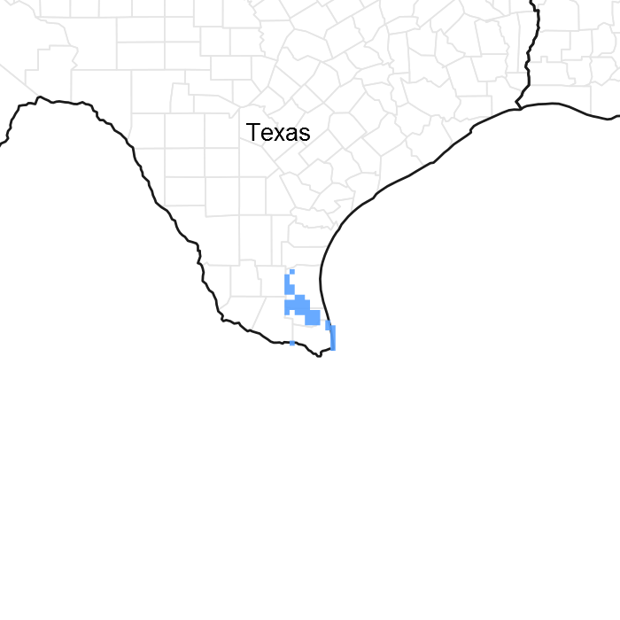
Figure 1. Mapped extent
Areas shown in blue indicate the maximum mapped extent of this ecological site. Other ecological sites likely occur within the highlighted areas. It is also possible for this ecological site to occur outside of highlighted areas if detailed soil survey has not been completed or recently updated.
MLRA notes
Major Land Resource Area (MLRA): 083D–Lower Rio Grande Plain
Major Land Resource Area (MLRA) 83D makes up about2,500 square miles (6,475 square kilometers). The towns of Brownsville, Edinburg, Harlingen, McAllen, and Raymondville are in this area. U.S. Highways 77 and 281 terminate in Brownsville and McAllen, respectively. The Santa Ana National Wildlife Area is along the Rio Grande in this area.
Classification relationships
USDA-Natural Resources Conservation Service, 2006.
-Major Land Resource Area (MLRA) 83D
Ecological site concept
The site is frequently ponded throughout the year. Vegetative species adapted to wet, inundated conditions are found throughout.
Associated sites
| R083DY007TX |
Lakebed |
|---|---|
| R083DY024TX |
Tight Sandy Loam |
| R083DY025TX |
Clay Loam |
Table 1. Dominant plant species
| Tree |
Not specified |
|---|---|
| Shrub |
Not specified |
| Herbaceous |
(1) Carex |
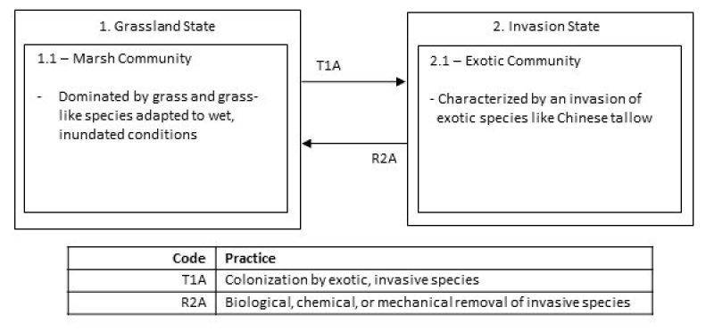
Click on box and path labels to scroll to the respective text.
Ecosystem states
| T1A | - | Introduction of non-native species |
|---|---|---|
| R2A | - | Chemical and mechanical treatment of non-native species |
