Natural Resources
Conservation Service
Ecological site R087BY001TX
Depression
Last updated: 9/21/2023
Accessed: 02/07/2026
General information
Provisional. A provisional ecological site description has undergone quality control and quality assurance review. It contains a working state and transition model and enough information to identify the ecological site.

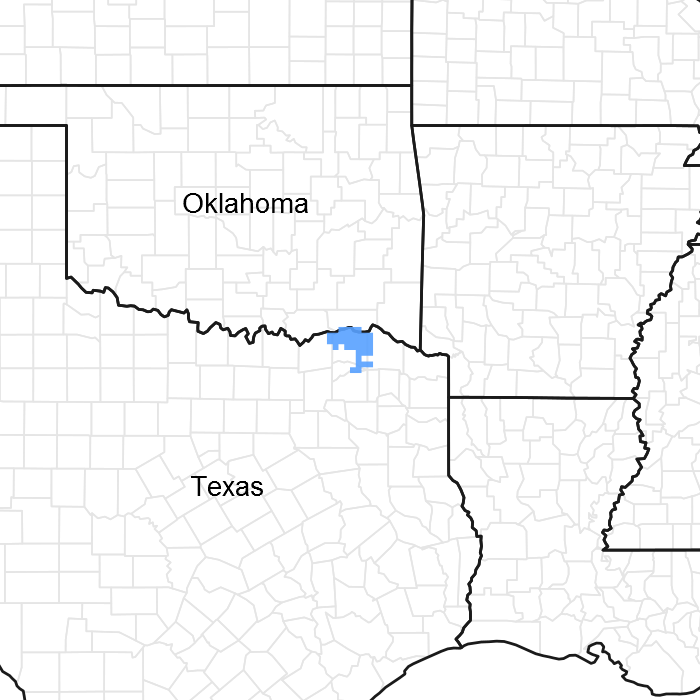
Figure 1. Mapped extent
Areas shown in blue indicate the maximum mapped extent of this ecological site. Other ecological sites likely occur within the highlighted areas. It is also possible for this ecological site to occur outside of highlighted areas if detailed soil survey has not been completed or recently updated.
MLRA notes
Major Land Resource Area (MLRA): 087B–Texas Claypan Area, Northern Part
This area is in northeastern Texas (79 percent) and southeastern Oklahoma (21 percent). It makes up about 4,480 square miles (11,610 square kilometers). The towns of Greenville, Sulphur Springs, Paris, Mount Vernon, Canton, and Athens, Texas, and Durant, Oklahoma, are in this MLRA. Interstates 30 and 20 and Highways 69, 70, 80, and 82 cross the area. The Caddo National Grasslands is in the north end of the area.
Classification relationships
USDA-Natural Resources Conservation Service, 2006.
-Major Land Resource Area (MLRA) 87B
Ecological site concept
Depressions occur on isolated flats of upland and terraces. Their drainage patterns are poor and result in long periods of water retention. Their vegetation more closely resembles wetter areas as opposed to the surrounding uplands.
Associated sites
| R087BY002TX |
Claypan Savannah |
|---|---|
| R087BY003TX |
Sandy Loam |
Similar sites
| F133BY001TX |
Depression |
|---|
Table 1. Dominant plant species
| Tree |
(1) Quercus nigra |
|---|---|
| Shrub |
Not specified |
| Herbaceous |
(1) Carex |
Click on box and path labels to scroll to the respective text.
Ecosystem states
| T1A | - | Abandonment, no fire, and/or no grazing management |
|---|---|---|
| T1B | - | Brush management, crop cultivation, pasture planting |
| R2A | - | Prescribed grazing, fire, and/or brush management |
| T2A | - | Brush management, crop cultivation, pasture planting |
| R3A | - | Prescribed grazing, fire, and/or brush management |
| T3A | - | Abandonment, no fire, and/or no grazing management |