Peat Bogs
Scenario model
Current ecosystem state
Select a state
Management practices/drivers
Select a transition or restoration pathway
- Transition 1 More details
- Transition 1.A More details
- Transition 1.B More details
- Transition 1 More details
- Restoration pathway 2.A More details
- Transition 1 More details
- Restoration pathway 3.A More details
- Transition 3.A More details
-
No transition or restoration pathway between the selected states has been described
Target ecosystem state
Select a state
State 1
Reference Community Phases


Description
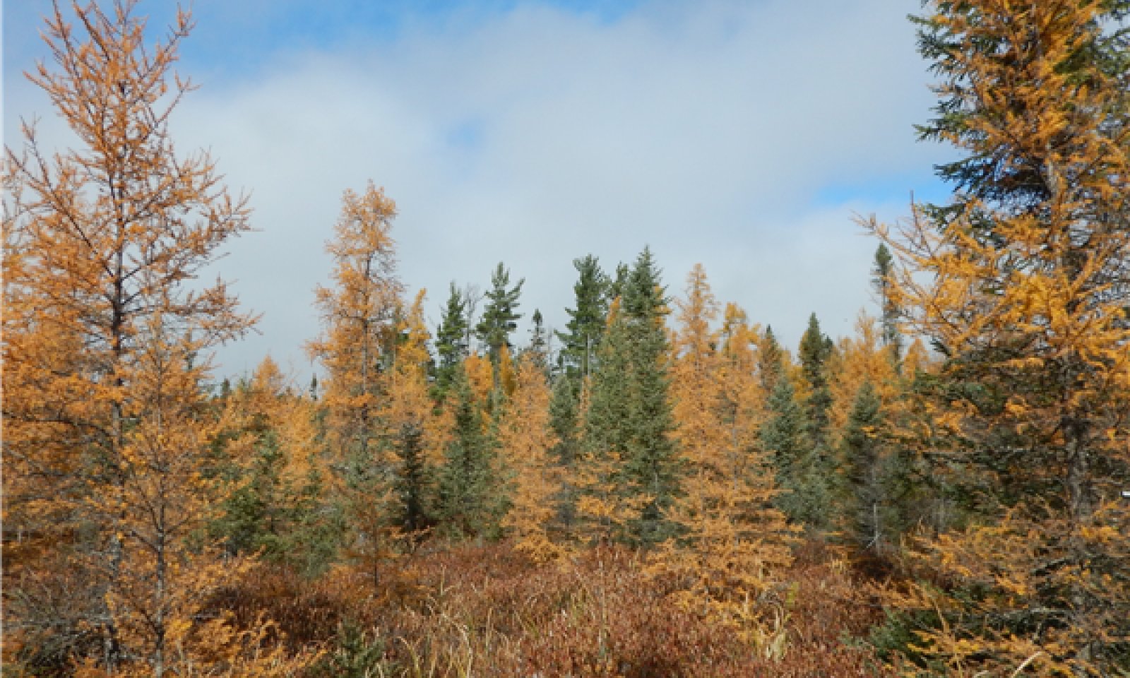
There are two distinct reference community phases of this ecological site. They are the Spruce/Sphagnum Bog phase and the Muskeg phase. The Spruce/Sphagnum Bog phase correlates to the PmLLe habitat type in the preliminary version of Habitat Type Classification. They are distinguished by the thickness of the live and dead moss ground layer and the amount of black spruce and tamarack canopy closure and whether or not the trees are growing or stagnant (i. e., site index below 20—less than 20 feet tall at age 50). There are many trees over 20 feet tall on Spruce/Sphagnum Bog sites and very few trees over 20 feet on Muskeg sites.
Submodel
State 2
Ponded Phases


Description
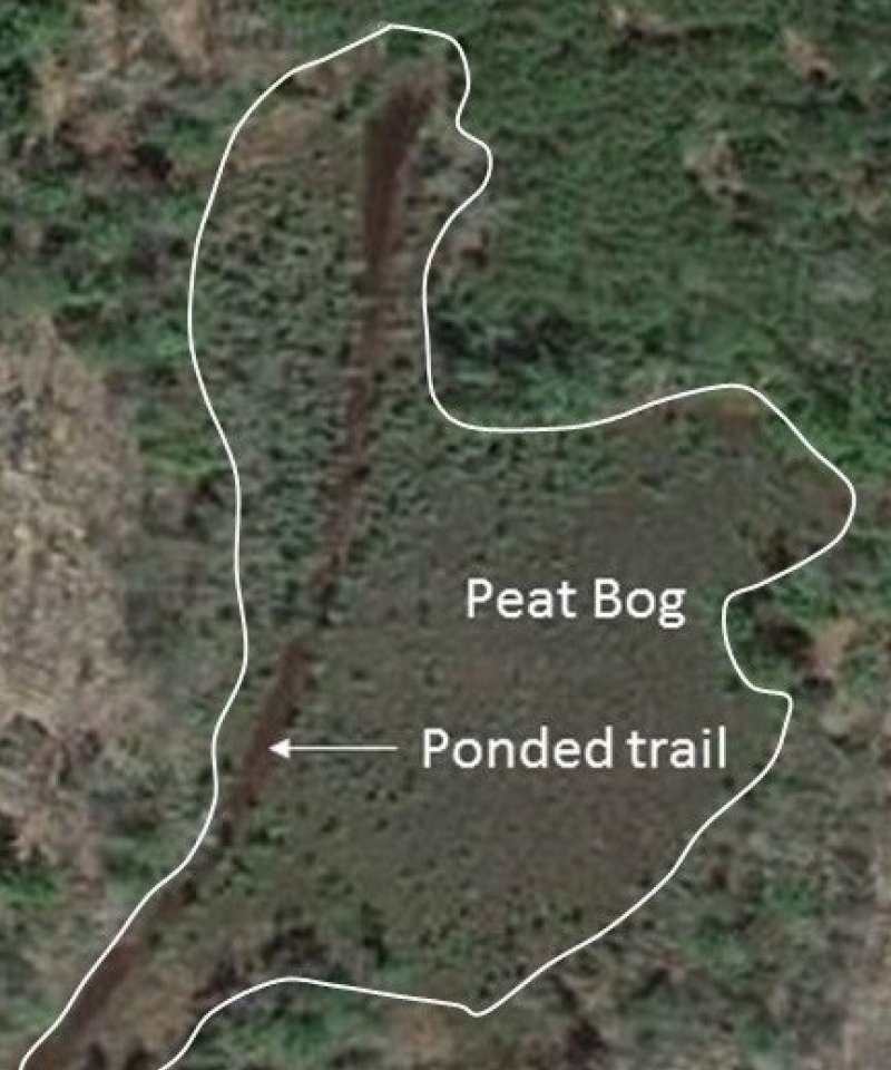
Disturbance in peatlands typically involves too much or too little water, either artificially or naturally. Too much water in a Peat Bog leads to State 2. Ponded Phases. Ponding of moderate duration is relatively common in most peatlands, even in Peat Bogs. However, ponding that leads to vegetation change is less common, especially in Peat Bogs. Such long-term ponding occurs as a result of disruption of normal outflow rates. There are both natural and man-made reasons for extended periods of ponding and these areas are highly variable in size. The most common man-made cause of ponding is road-building. Road beds prevent lateral flow in Peat Bogs that can lead water-filled road ditches that back up into the Peat Bog. Given that nutrients are lacking and acidity is high, ponded areas do not rapidly fill-in with vegetation. Some bog ponds are naturally occurring remnants of larger water bodies and never were actual Peat Bog sites (see Photo 3). Large patterned peatlands have ponded areas that were Peat Bog sites in the past; they were created by internal bog processes such as cryoturbation and remain ponded for many years (Heinselman 1963). Patterned peatlands are not common in this MLRA, but some of those natural bog processes that create ponds are replicated at a smaller scale on Peat Bog sites in this area. Peat fires, which occurred during drought periods, are another cause of excavations which lead to long-term ponding. Also, snowmobile trails through Peat Bogs are often ponded when thawed.
Submodel
Description
The drained phases are mostly artificial, however, under severe drought conditions a Peat Bog site may resemble an artificially drained site. In the past, attempts were made to drain peat bogs for agricultural purposes; some sites are still affected by old ditch-works. Currently, lake-margin Peat Bog hydrology is artificially affected by dams, and other Peat Bog sites are affected by ditches and roads that cut through them. Man-made structures like roads that create large impervious embankments inevitably alter horizontal drainage patterns. Many peatland sites, including Peat Bogs, exhibit the wet-side/dry-side effect caused by a road within the site. Peat Bogs that have been affected by drainage are more likely to be colonized by invasive species (Cohen and Kost 2008).
Submodel
Mechanism
T.1.A-prolonged inundation: This transition is not a frequent occurrence within this ecological site because peat tends to be buoyant and upper layers seem float within the water table, ultimately raising the surface above water. Prolonged inundation leads to State 2. Ponded Phases. There are cases where these sites have been ponded for an extended period, but this usually follows a major disturbance such as a fire or intentional flooding, such as from a dam and reservoir or flooding by beaver activities. Extended drought conditions lead to fire hazards, even in Peat Bogs. Peat fires can lower the surface elevation enough to make ponding inevitable when the water table returns to normal. Compaction can also lower the surface enough to cause ponding of the site, regardless of peatland buoyancy. Dams and reservoirs impound water, changing local hydrology enough to not only cause ponding is some areas but can cause subsidence or erosion in other area—mats of vegetation have been known to break off and float away in some impoundments. There are also many naturally occurring ponds in Peat Bogs in which the water level can increase due to excess precipitation and thereby increase the ponded area. These ponds are either remnants from the lake-fill process or ponded areas in larger patterned Peat Bogs that form due the freeze-thaw cryoturbation and other hydrostatic forces.
Mechanism
Prolonged inundation: This transition is not a frequent occurrence within this ecological site because peat tends to be buoyant and upper layers seem float within the water table, ultimately raising the surface above water. Prolonged inundation leads to State 2. Ponded Phases. There are cases where these sites have been ponded for an extended period, but this usually follows a major disturbance such as a fire or intentional flooding, such as from a dam and reservoir or flooding by beaver activities or road building. Extended drought conditions lead to fire hazards, even in Peat Bogs. Peat fires can lower the surface elevation enough to make ponding inevitable when the water table returns to normal. Compaction can also lower the surface enough to cause ponding of the site, regardless of peatland buoyancy. Dams and reservoirs impound water, changing local hydrology enough to not only cause ponding is some areas but can cause subsidence or erosion in other area—mats of vegetation have been known to break off and float away in some impoundments. There are also many naturally occurring ponds in Peat Bogs in which the water level can increase due to excess precipitation and thereby increase the ponded area. These ponds are either remnants from the lake-fill process or ponded areas in larger patterned Peat Bogs that form due the freeze-thaw cryoturbation and other hydrostatic forces.
Mechanism
Artificial drainage or drought: Artificial manipulation of water tables in Peat bogs is more common than a drawdown caused by prolonged drought. Either artificial drainage or drought can lead to State 3. Drained Bog Phases. However, artificial drainage of peatlands is regulated. Highway construction and cranberry bog development are the major causes of artificial drainage. Well-engineered roads are required by modern society and cranberry production is a high-value enterprise. Good designs, that cause the least disturbance, are preferred.
Mechanism
T.1.B-artificial drainage or drought: Artificial manipulation of water tables in Peat bogs is more common than a drawdown caused by prolonged drought. Either artificial drainage or drought can lead to State 3. Drained Bog Phases. However, artificial drainage of peatlands is regulated. Highway construction and cranberry bog development are the major causes of artificial drainage. Well-engineered roads are required by modern society and cranberry production is a high-value enterprise. Good designs, that cause the least disturbance, are preferred.
Mechanism
Natural drainage: Drainage can occur through long term seepage and seasonal evapotranspiration if the water inflows are reduced. Forest restoration is inherently slow on these sites. They are colder and wetter and not optimal for forest growth or rapid reforestation. There are many sites that fail to regenerate forests and merely produce open bogs or Sphagnum lawns (Terwilliger and Pastor 1999). These sites remain open for decades. Forest restoration activities occur on similar sites in Europe, but we have little incentive to convert open bogs to forests.
Mechanism
Artificial drainage: Water control structures, levees and ditches can be used to manipulate the water table on these sites. The transition from ponded state to drained state is part of the cranberry production cycle. Areas that hold water are drained to flood cranberry beds for frost protection, weed control and the annual fruit harvest.
Mechanism
Restored wetland hydrology: Restoring hydrology seems feasible, but it is only part of story, native plant communities are very slow to recover on these sites. Invasive species can be a primary concern; hybrid cattails, reed canary grass, purple loosestrife, and exotic Phragmites are prevalent and spreading. There are two varieties of Phragmites australis, they have very different characteristics yet they are the same species (Swearingen and Saltonstall 2010). The exotic strain is invasive, meaning it forms dense monocultures and crowds out native species. Whereas the native Phragmites is less aggressive and is subject to fungal infection that reduces its vigor so that stands of native Phragmites are recognizable by the lower height and density of plants as well as the morphological characteristics of stems and leaves. The native Phragmites often has black stains on its stems from the fungal infection, while the non-native subspecies is not stained.
Mechanism
Prolonged inundation: Ponds are created from drained areas for several reasons. Ponds may be needed for cranberry operations, water is held in reserve near cranberry beds and used as needed. Sometimes beds have been retired from production and these areas tend to pond as well. Otherwise the transition from a drained phase to a ponded phase might part of new impoundment area for wildlife or a wetland mitigation project.
Model keys
Briefcase
Add ecological sites and Major Land Resource Areas to your briefcase by clicking on the briefcase (![]() ) icon wherever it occurs. Drag and drop items to reorder. Cookies are used to store briefcase items between browsing sessions. Because of this, the number of items that can be added to your briefcase is limited, and briefcase items added on one device and browser cannot be accessed from another device or browser. Users who do not wish to place cookies on their devices should not use the briefcase tool. Briefcase cookies serve no other purpose than described here and are deleted whenever browsing history is cleared.
) icon wherever it occurs. Drag and drop items to reorder. Cookies are used to store briefcase items between browsing sessions. Because of this, the number of items that can be added to your briefcase is limited, and briefcase items added on one device and browser cannot be accessed from another device or browser. Users who do not wish to place cookies on their devices should not use the briefcase tool. Briefcase cookies serve no other purpose than described here and are deleted whenever browsing history is cleared.
Ecological sites
Major Land Resource Areas
The Ecosystem Dynamics Interpretive Tool is an information system framework developed by the USDA-ARS Jornada Experimental Range, USDA Natural Resources Conservation Service, and New Mexico State University.

