
Natural Resources
Conservation Service
Ecological site F095XB010WI
Loamy and Clayey Upland
Last updated: 11/16/2023
Accessed: 01/02/2025
General information
Provisional. A provisional ecological site description has undergone quality control and quality assurance review. It contains a working state and transition model and enough information to identify the ecological site.
MLRA notes
Major Land Resource Area (MLRA): 095X–Eastern Wisconsin, Northern Illinois, and Upper Michigan Drift Plain
This MLRA is characterized by nearly level to rolling till plains, outwash plains, drumlin fields, and glacial lake plains. It is used to produce cash crops, feed grain, and livestock. It includes the shorelines of Lake Winnebago and Lake Michigan. This area is in Wisconsin (85 percent), Illinois (10 percent), and Michigan (5 percent). It makes up about 17,255 square miles (44,690 square kilometers). This area is in the Central Lowland province of the Interior Plains. Most of the area is in the Eastern Lake section. A narrow strip along the southwestern edge of the area is in the Wisconsin Driftless section. The southwestern quarter is in the Till Plains section. The nearly level to rolling till plains, glacial lake plains, and outwash plains are mixed with drumlin fields, ground moraines, end moraines, flood plains, lake terraces, beaches, dunes, swamps, and marshes. Most of the southern part of this area has belts of morainic hills and ridges and nearly level outwash terraces. Drumlins are prominent features in the central part of the area. Glaciokarst topography occurs in the east-central parts of the area influenced by underlying Niagara Dolomite. Lakes and streams are numerous, and streams generally form a dendritic drainage pattern. Elevation ranges from 530 to 1,580 feet (160 to 480 meters). Local relief is mainly 25 feet (8 meters), but the moraines, drumlins, and bedrock escarpments rise 80 to 330 feet (25 to 100 meters) above the adjacent valleys.
The annual precipitation ranges from 28 to 37 inches (700 to 950 millimeters) with a mean of 33 inches (840 millimeters). The annual temperature ranges from 41 to 48 degrees F (5.1 to 9.2 degrees C) with a mean of 46 degrees F (7.7 degrees C). The freeze-free period ranges from 115 to 185 days with a mean of 155 days. It decreases in length from south to north and from the shore of Lake Michigan inland. Lake Michigan helps to moderate the climate of the area.
This MLRA is mostly covered with glacial drift of Wisconsin age. Some of the higher areas are moraines that appear as arc-shaped ridges representing the retreat of the ice from south to north. Most of the bedrock in the area consists of Silurian, Ordovician, and Cambrian sandstone, limestone, and dolomite. Some igneous and metamorphic rocks underlie the northwestern edge of the area. Devonian limestone and shale occur at the far eastern edge in the Milwaukee area.
The dominant soil orders in this MLRA are Alfisols, Entisols, Histosols, Mollisols, and Spodosols. The soils in the area dominantly have a mesic or frigid temperature regime, an aquic or udic moisture regime, and mixed mineralogy. They are very deep, excessively drained to very poorly drained, and sandy to clayey. Areas of Spodosols and soils with a frigid soil temperature regime occur in the northern part of the MLRA.
The northern part of this MLRA supports natural stands of mixed northern hardwoods and pine. Sugar maple, oak, white ash, elm, yellow birch, white pine, red pine, and American beech are the principal species. Low-lying areas support both mixed hardwoods and conifers. Elm, soft maple, black ash, and northern white cedar are the major species. Brush and sedge meadows also occur in the low-lying areas.
The southern part of this MLRA supports hardwoods and prairie vegetation. Uplands support natural stands of oak, sugar maple, and hickory, and natural prairie vegetation is characterized by little bluestem and big bluestem. Many of the prairies have scattered oak and hickory trees. Low-lying areas support sedge and grass meadows and mixed stands of hardwoods and conifers. Elm, ash, eastern cottonwood, soft maple, and white cedar are the major species in the low-lying areas. (USDA-NRCS, 2022)
LRU notes
The Southern Wisconsin and Northern Illinois Drift Plain LRU (Land Resource Unit) (95XB) corresponds closely to the Central Sand Hills and Southeast Glacial Plains Ecological Landscapes. Some of the following brief overview is borrowed from the Wisconsin Department of Natural Resources Ecological Landscape publication (2015).
The Southern Wisconsin and Northern Illinois Drift Plain MLRA is found in southeast Wisconsin and extends into northern Illinois. The Wisconsin portion of this LRU is approximately 6.3 million acres (9,900 square miles). This LRU was entirely glaciated – mostly formed by the Green Bay and Lake Michigan Lobes of the Wisconsin Glaciation except the southern part, which was covered by an earlier glaciation. The landscape is dominated by till plains with drumlins, but also has large areas of outwash, pitted outwash, and glaciolacustrine deposits. The LRUcontains the Kettle Interlobate Moraine—the end moraine system formed where the Green Bay and Lake Michigan lobes met. The thickness of glacial deposits is typically less than 15 meters deep throughout the LRU, but the eastern portion can reach up to 60 meters thick. Nearly all the LRU is covered in a loess cap ranging from 1.2 meters (in the west) to 15 centimeters (in the east).
The northwest portion of LRU 95XB is part of the Central Sand Hills Ecological Landscape. The area from Portage County south through Marquette is dominated by till plains covered in outwash. The Green Bay Lobe deposited the till and created a morainal system along the west margin. The Johnstown moraine is the terminal moraine, but smaller, lateral moraines are also prominent on the landscape. As the glacier receded, meltwaters covered the intermorainal till plain with sand and gravel outwash sediments, sometimes covering blocks of ice. As the temperatures rose, the ice melted and collapsed the surface, creating an extensive area of pitted outwash. Till in this area is sandy and lacks dolomite found in other tills of this LRU. It may be hard to distinguish from the sandy outwash of the area. The rest of the northwest portion is dominated by till plains and glacial lake sediments. Glacial Lake Wisconsin covered a portion of this LRU, but the Lewiston Basin is the most significant glacial lake in this region. The Lewiston Basin formed when glacial meltwaters were impounded behind the Johnstown Moraine. Most of the lake drained after a catastrophic breach of an ice dam that supported it. The rest of this region is a till plain covered in a thin layer of loess. This till is a sandy loam with dolomite from the Niagara Escarpment. The till plain is covered with drumlins and bedrock-cored knolls and hills where the overlying till has been eroded. Wetlands are common in the low-lying outwash and the fine-textured lake sediments.
The central portion of this LRU is dominated by a rolling till plain covered in drumlins. Terminal and recessional moraines show the extent of the Green Bay Lobe. The topography of the moraines is hummocky because the supraglacial till was deposited unevenly along the ice margin and the surface collapsed after buried ice melted. Glacial lakes formed on the ice margin from ice dams, bedrock ridges, and moraines. Glacial Lakes Scuppernong and Yahara were two significant lakes that deposited clay and silty clay in deep basins. Meltwater streams deposited outwash sediments over some areas of the till plain, creating pockets of outwash and pitted outwash. The till deposited here is gravelly, clayey, and silty sand with dolomite pebbles.
The Kettle Interlobate Moraine is a unique and significant feature along the eastern border this LRU. The Kettle Moraine is a complex range of ridges and hills that formed by the end moraine systems where the Green Bay and Lake Michigan lobes met. The area ranges from 1 to 30 miles wide and landforms up to 300 feet in elevation. The area experienced massive volumes of meltwater from the two glacial lobes, which deposited primarily sand and gravel, but morainal till is also present. There are two distinct portions for the Kettle Moraine. The south potion formed as the lobes receded and deposited a series of level outwash fans between the lobes. Buried ice melted and parts of the fan collapsed to form kettles—round depressions on the surface that often fill with water to become lakes when the water table is near the surface. In the northern section, debris collected in the ice where the two lobes flowed together. As the glaciers receded, meltwaters deposited outwash materials on top of ice. As the ice melted, the surface collapsed and created a mixture of collapsed outwash and till materials. The till was in and beneath the buried ice.
West of the Kettle Moraine lies a landscape dominated by till plains with drumlins and areas of outwash formed by the Lake Michigan Lobe. Braided proglacial streams deposited outwash and pitted outwash plains. A small extent of lake plains is present. Wetlands are abundant because of impeded drainage from the underlying till and lake sediments.
The southern portion of this LRU is comprised of older glacial sediment deposited before the Wisconsin Glaciation. In the east lie broad, flat to rolling till plains. In the west, an eroded and dissected, hilly bedrock-controlled landscape is present; this area is similar in appearance to the Driftless region. Some low areas have outwash deposited by proglacial streams from Green Bay Lobe meltwater. In some areas in the west, dissolution of bedrock has created karst topography. There is a small extent of lake plain sediments.
Historically, the vegetation in this LRU was dominated in the northwest by oak forest and opening with interspersed marsh and sedge wetlands. The southern portion was dominated by oak and mesic forests with abundant wetlands. Black oak (Quercus velutina), white oak (Quercus alba), and bur oak (Quercus macrocarpa) were significant tree species in all of the LRU. There were also many areas of prairie, maple-basswood upland forest, and small areas of tamarack (Larix laricina), northern white-cedar (Thuja occidentalis), and black spruce (Picea mariana) in the lowlands. Conifers were not significant in this LRU. Wetlands covered up to 17% of land area.
Classification relationships
Relationship to Established Framework and Classification Systems:
Biophysical Settings (Landfire, 2014): This ES is largely mapped as North-Central Interior Dry-Mesic Oak Forest and Woodland, North-Central Interior Dry Oak Forest and Woodland, North-Central Interior Maple-Basswood Forest, Eastern Cool Temperate Row Crop, Eastern Cool Temperate Pasture and Hayland, Eastern Cool Temperate Urban Shrubland, Developed-Low Intensity, and Developed-Medium Intensity
Habitat Types of N. & S. Wisconsin (Kotar, 2002, 1996): The sites of this ES keyed out to Acer saccharum-Tilia-Fraxinus/Viburnum(Cornus racemose) [ATiFrVb(Cr)], Acer saccharum-Tilia-Fraxinus/Caulophyllum(Osmorhiza) [ATiFrCa(O)], Acer saccharum-Tilia-Fraxinus/Circaea [ATiFrCi], Acer saccharum-Tilia-Fraxinus/Caulophyollum [ATiFrCa], and Acer rubrum/Desmodium [ArDe].
WDNR Natural Communities (WDNR, 2015): This ES is most similar to the Southern Mesic Forest described by the WDNR.
Hierarchical Framework Relationships:
Major Land Resource Area (MLRA): 095X–Eastern Wisconsin, Northern Illinois, and Upper Michigan Drift Plain
USFS Subregions: Central Wisconsin Moraines and Outwash (222Kb), South Central Wisconsin Prairie and Savannah (222Kd), Southern Green Bay Lobe (222Ke), Rock River Old Drift Country (222Kh), Kickapoo-Wisconsin River Ravines (222Ld)
DNR Ecological Landscapes: Southeastern Glacial Plains, Central Sand Hills
Ecological site concept
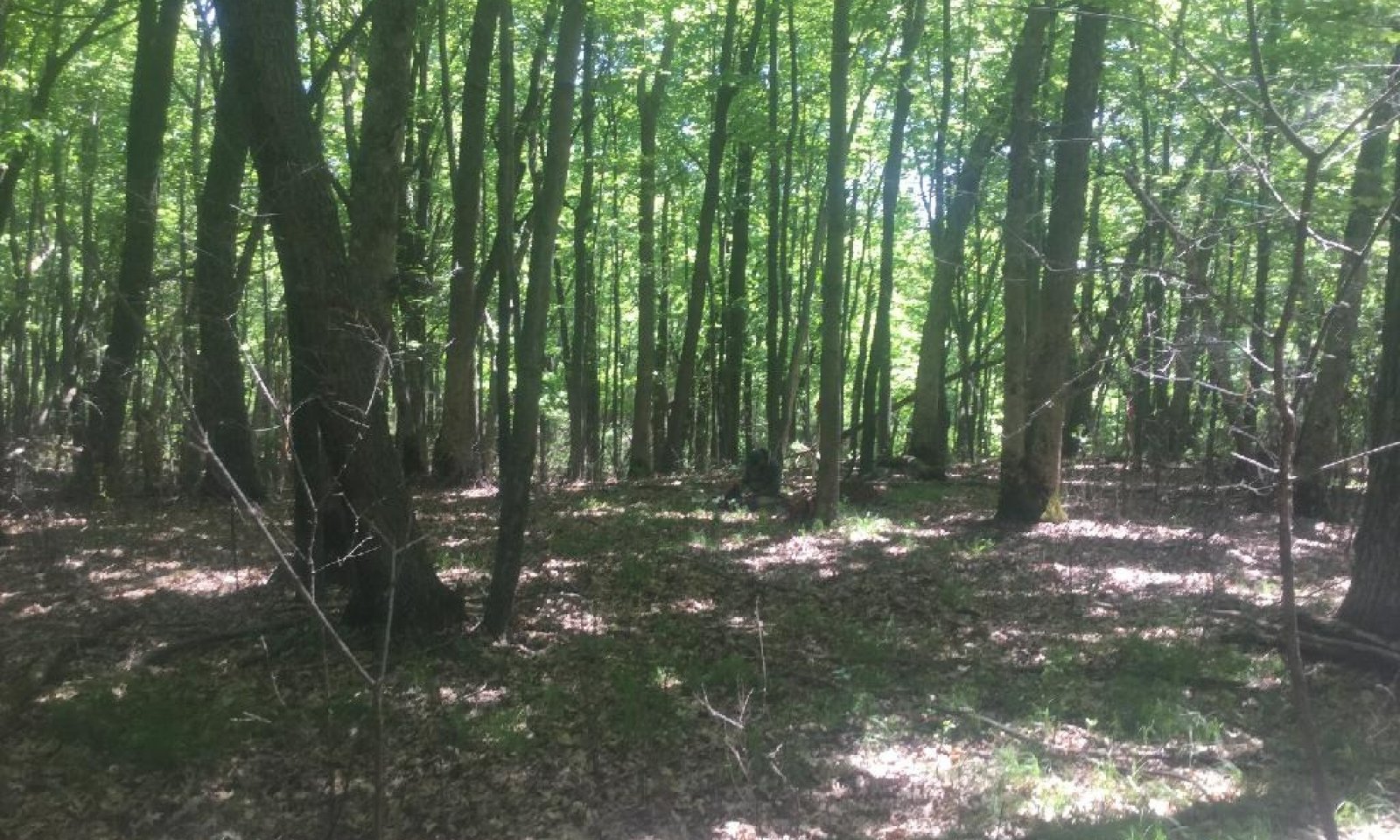
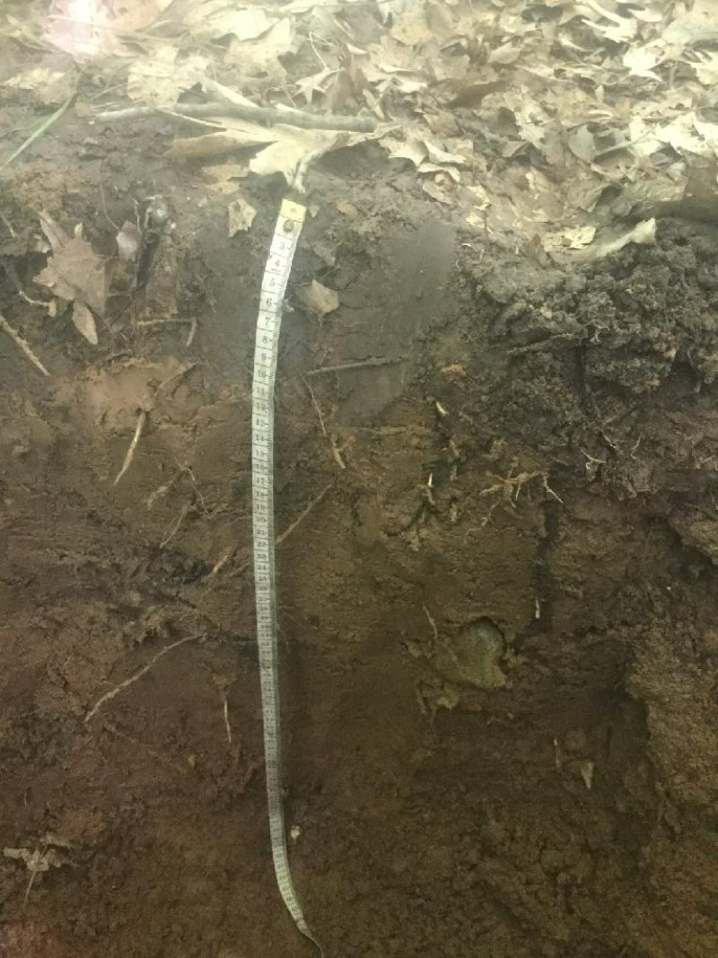
The Loamy and Clayey Upland ecological site occurs throughout LRU 95XB, but is less common in the eastern reaches of the LRU. This is the second-most extensive site in LRU 95XB, occupying over one million acres (20% of the total land area). These are upland sites but may occur on a wide variety of landforms. These soils formed in very deep, sandy to clayey deposits of till, outwash, alluvium, colluvium, and lacustrine materials. Many of these sites have a silty loess mantle. These soils are strongly acid to moderately alkaline and are moderately well to somewhat excessively drained. They do not meet hydric soil requirements.Typical vegetation includes Acer saccharum, Acer rubrum, Tilia americana, and Fraxinus americana with a varied, but thin shrub layer, and rich site plants such as Desmodium glutinosum, Parthenocissus quinquefolia, and Circaea lutetiana in the understory.
Associated sites
| F095XB004WI |
Wet Loamy or Clayey Lowland These sites occur on depressions within loamy glacial landscapes including till plains and lake plains. They form in very deep, loamy alluvium, till, outwash, or lacustrine materials. They are sometimes underlain by clayey lacustrine deposits or sandy outwash. They are very poorly to poorly drained. They are found on the same landforms as Loamy and Clayey Upland in lower, wetter landscape positions. |
|---|---|
| F095XB005WI |
Moist Loamy or Clayey Lowland These sites consist of very deep, loamy or clayey materials deposited by flowing water, glacial ice, or ancient glacial lakes. Some sites are overlain or underlain by sandy outwash. They are somewhat poorly drained. They are found adjacent to Loamy and Clayey Upland in slightly lower, wetter landscape positions. |
Similar sites
| F095XB006WI |
Shallow Upland These sites consist of shallow to deep, sandy to clayey deposits of various origin. They are moderately well to excessively drained. Some sites may be share particle size classes with Loamy and Clayey Upland, but they have root-restrictive bedrock contact within 150 cm. |
|---|---|
| F095XB007WI |
Loamy Upland with Carbonates These sites consist of very deep, loamy materials deposited by flowing water, glacial ice, or ancient glacial lakes. Many are underlain by clayey lacustrine materials or sandy outwash. They have secondary carbonates, generally occupying at least 10% by volume, within the upper 100cm. They are moderately well to somewhat excessively drained. Loamy and Clayey Uplands are found on similar landforms and have similar drainage capabilities as Loamy Uplands with Carbonates. Some sites also share their particle size classes, but Loamy Uplands with Carbonates have higher volumes of secondary carbonates. |
| F095XB008WI |
Clayey Upland with Carbonates These sites consist of very deep, clayey till or lacustrine deposits, sometimes mantled with sandy outwash. Secondary carbonates usually occupy at least 10% volume in the upper 100cm. They are moderately well to well drained. Loamy and Clayey Upland are found on similar landforms and have similar drainage capabilities as Clayey Upland with Carbonates. Some sites also share their particle size classes, but Clayey Upland with Carbonates have higher volumes of secondary carbonates. |
| F095XB009WI |
Sandy Upland These sites consist of very deep, sandy outwash, till, or eolian deposits. Some are mantled with loamy outwash or alluvium. They are primarily found in the Central Sand Hills in the northwestern portion of the MLRA. They are moderately well to excessively drained. They are found in similar landscape positions and have similar drainage capabilities as Loamy and Clayey Upland but have coarser particle size classes. |
Table 1. Dominant plant species
| Tree |
(1) Acer saccharum |
|---|---|
| Shrub |
(1) Tilia |
| Herbaceous |
(1) Circaea ×intermedia |
Click on box and path labels to scroll to the respective text.
| T1A | - | Clear cutting or stand-replacing fire. |
|---|---|---|
| T1B | - | Removal of forest cover and tilling for agricultural crop production. |
| R2A | - | Disturbance-free period 70+ years. |
| T2A | - | Removal of forest vegetation and tilling. |
| R1A | - | Cessation of agricultural practices, natural or artificial afforestation. |
State 1 submodel, plant communities
| 1.1A | - | Light to moderate intensity fires, blow-downs, snow-ice breakage. |
|---|---|---|
| 1.2A | - | Disturbance-free period 30+ years |
State 2 submodel, plant communities
| 2.1A | - | Immigration and establishment of red oak and red maple. |
|---|---|---|
| 2.2A | - | Immigration and establishment of red oak and red maple. |
| 2.3A | - | Clear cutting or stand-replacing fire. |


