Loamy Wet Prairies
Scenario model
Current ecosystem state
Select a state
Management practices/drivers
Select a transition or restoration pathway
- Transition 1B More details
- Transition 1C More details
- Transition 1A More details
- Restoration pathway 2A More details
- Transition 2A More details
- Transition 2B More details
- Restoration pathway 3A More details
- Transition 3A More details
- Transition 3B More details
- Transition 4A More details
-
No transition or restoration pathway between the selected states has been described
Target ecosystem state
Select a state
State 1
Reference State


Description
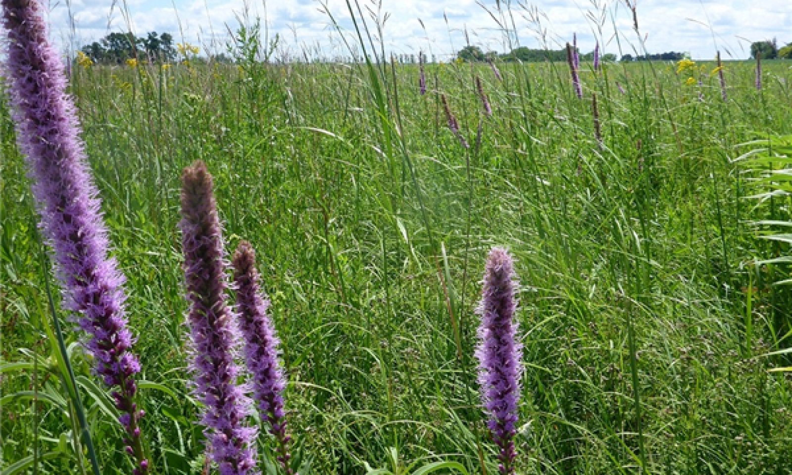
Community phases within the Reference State are dependent upon the frequency, intensity, and diversity of fire events, usually associated with climatic trends. Fires promote continued herbaceous vegetation dominance and remove dense thatch. Removal of the litter helps cycle nutrients in the dead plant material and allows light to reach the soil surface and the seedbed. Fire return intervals mostly ranged from one to four years, usually during spring or fall. During times of drought these sites historically burned more frequently and with higher intensity, including during the growing season. In turn, the consistent removal of built-up thatch would provide increased light and regeneration opportunities for a diversity of prairie forbs, including short-lived annual and biennial species. However, with increasing fire frequency and intensity, it is likely many forb species will give way to dominance by grasses which can handle repeated disturbances over longer time periods. More commonly, historic fires were slower moving, creeping fires with flame lengths three to ten feet, resulting in a variety of conditions that increased habitat diversity and provided refugia for wildlife (MN DNR 2005a, Gleason 1913). However, some species would not have been able to compete with the competitive grasses if recurrent fires were too low in intensity (Landfire 2009). Grazing by native ungulates would have also affected the diversity of vegetation by creation of microsites for certain plant species. The combination of fire and grazing was generally sufficient to keep woody species from proliferating. However, in times of higher than average precipitation, some areas may accumulate significant woody cover, although historically this was rare.
In addition to fire and grazing, high water tables are needed to maintain plant communities within the Reference State. In natural conditions, at least some part of the top ten inches of the rooting zone is saturated for several weeks during the early growing season. Longer-term, inter-annual changes in precipitation can shift these boundaries and create conditions favorable to species tolerant of wetter or drier conditions. This also contributes to the diversity of species present. As a result, the mesic prairie-wet prairie-sedge meadow continuum can range somewhat, with upland prairie species expanding during dry cycles, and sedges and wetland obligate species expanding during wet cycles.
Areas in the Reference State currently are likely degraded to some extent. Undoubtedly remaining natural areas were grazed and/or hayed at one time. And with no source populations nearby it is very likely some plant species have been extirpated. Others likely benefited. For example, Virginia mountainmint, one of the most common forbs encountered, may be more common today because of its ability to persist in the face of heavy grazing (Eggers and Reed 2015).
Submodel
State 2
Grassland State


Description
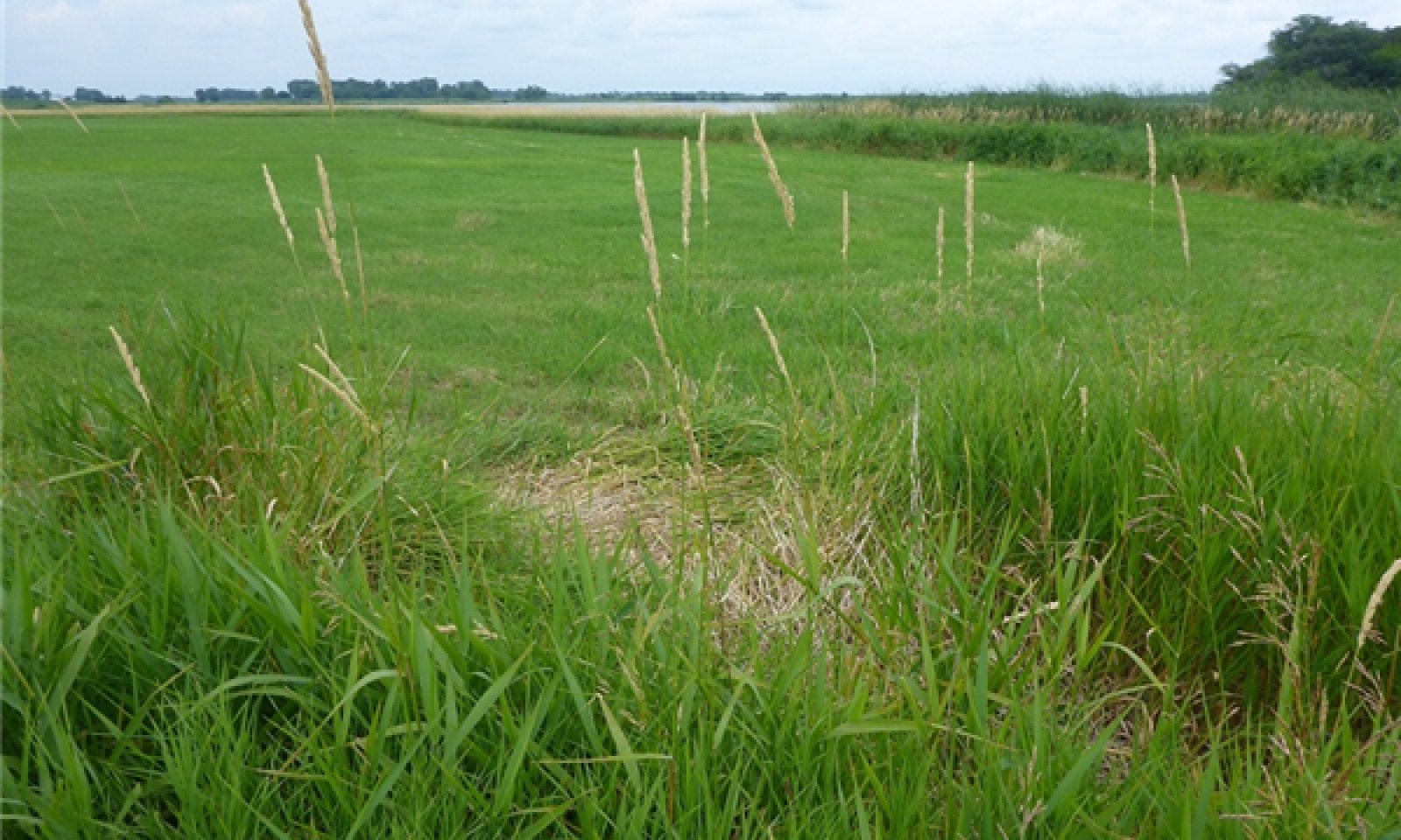
Community phases within this state are essentially simplified grassland plant communities. Beginning in the late 1800s, many Loamy Wet Prairies were transitioning to this state resulting from the removal of fire, cattle grazing, and haying practices. The reduction in fire frequency led to more uniform habitat conditions over time which reduced species diversity. The dominant species were both native warm season grasses and nonnative cool season grasses. At first, native prairie grasses and various shrubs increased, while the majority of other species decreased. During this time, Kentucky bluegrass and smooth brome were introduced to extend the grazing season of prairie pastures (Smith 1998). These nonnative grasses increased following intense over-grazing, at the expense of native vegetation. At some point nonnative cultivars of reed canarygrass (Phalaris arundinacea) were introduced due to its ability to grow in wet areas. Over time it became extremely aggressive and is now one of the most common grasses in the region. Sites that haven’t been drained and converted to agriculture are often hayed or grazed.
Most restoration sites in the MLRA fit into this state. With active vegetation management, it is possible for remnant sites to be restored to the Reference State. However, due to broad scale ditching and tile drainage, in most locations the regional groundwater tables are unnaturally low which makes it challenging to truly restore hydrology. Currently, the majority of sites in the Grassland State are a result of WRP and CRP vegetation establishment. Vegetation establishment in Loamy Wet Prairie areas is often overlooked due to the focus being on pothole marshes and the perception that ponded water is the only important habitat waterfowl use. Consequently, wetland restorations typically focus on the development of submergent and emergent vegetation in ponded areas (Galatowitsch and van der Valk 1994). Reed canarygrass is almost always a dominant and aggressive invader. In addition, it has been found that sites with greater than 20 years of agriculture will have depleted native seed banks (Weinhold and van der Valk 1989). On Loamy Wet Prairie soils, slope wash from adjacent cultivated uplands may bury the existing seedbank if one exists (Gilbert et al. 2006). Thus, effective restoration will require artificial regeneration of vegetation and intensive management of invasive vegetation. Ultimately, vegetation zonation associated with the wet prairie-sedge meadow continuum will take decades (or more) of active management along with complete hydrologic restoration. If prairie restoration is a management goal, careful selection and establishment of a variety of species in addition to the typical CRP grasses is essential. Too often, forb species are overlooked due to a focus on establishment of warm season grasses. True restoration of a Loamy Wet Prairie site should include roughly half grass/grasslike and half forb cover.
Although these plant communities are not considered prairies, grasslands share many of the same important ecological benefits, such as grassland structure for bird species and various soil health qualities.
Submodel
State 3
Scrub Woodland State


Description
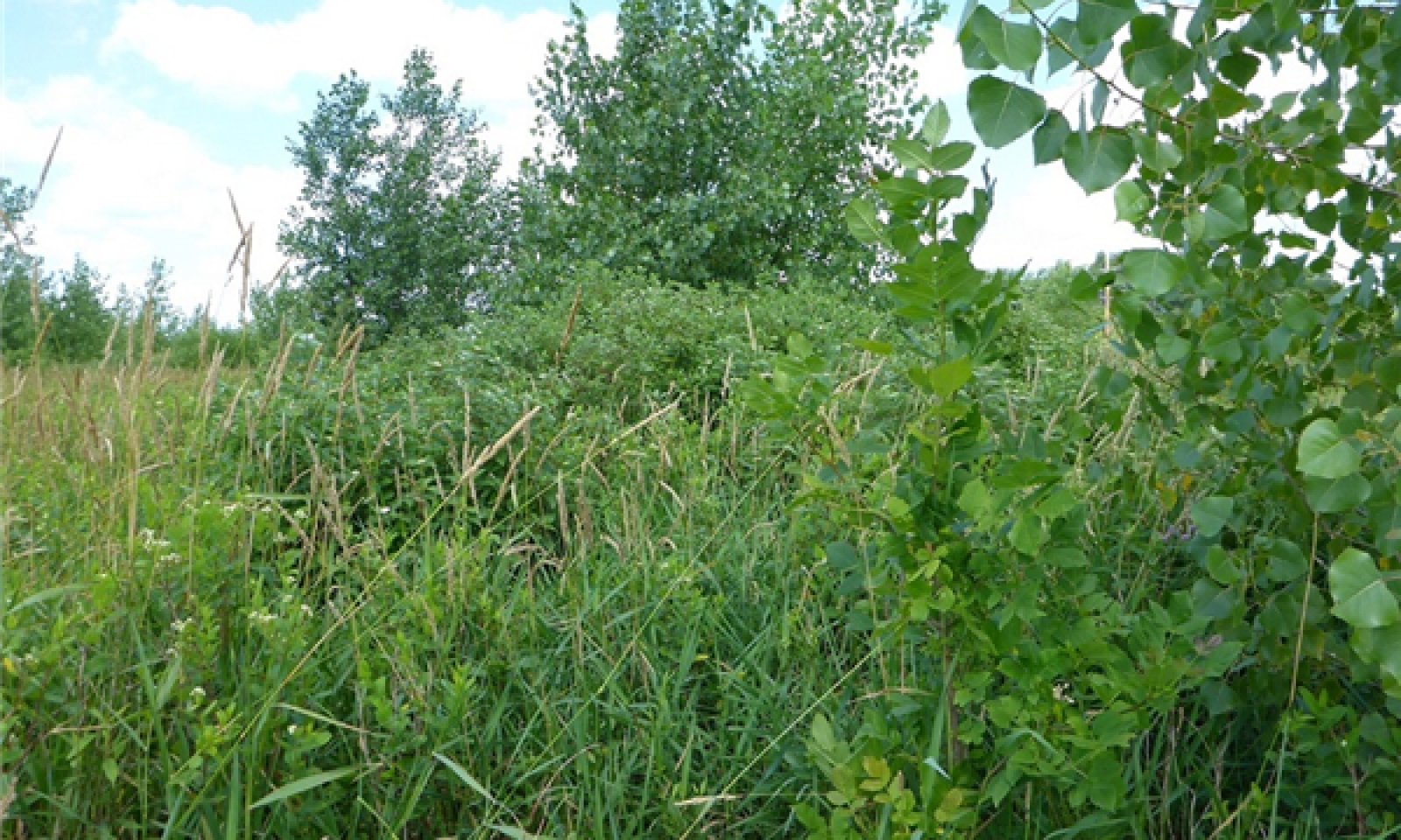
Without fire to kill woody vegetation, trees and tall shrubs can become established and spread, potentially converting the site to a closed woodland. In general, community phases in this state have greater than 25 percent cover with a dense herbaceous, usually grass-dominated, understory. Trees range from short to medium height (15 to 30 feet). Eastern cottonwood (Populus deltoides), black willow (Salix nigra), green ash (Fraxinus pennsylvanica) boxelder (Acer negundo), quaking aspen (Populus tremuloides), and peachleaf willow (Salix amygdaloides) are the most common trees. Common shrubs are redosier dogwood (Cornus sericea), meadow willow (Salix petiolaris), Bebb willow (Salix bebbiana), pussy willow (Salix discolor), Missouri River willow (Salix eriocephala), and possibly others. In areas without complete canopy closure, the understory is similar to Community Phase 2.1, dominated by reed canarygrass and smooth brome. Kentucky bluegrass, redtop, and quackgrass may also be present. Giant ragweed (Ambrosia trifida) is often a major weed issue, along with stinging nettle (Urtica dioica). Areas with higher tree and shrub canopies typically have less herbaceous cover. Fires are essentially absent. High quality remnant prairies transitioning to this state are likely to develop into quaking aspen stands, with open areas retaining native prairie vegetation. Sites that are part of a pasture may receive heavy use by domestic livestock for grazing, access to water in deeper wetlands, and shelter provided by woody vegetation. From a shrub-free prairie or grassland, it may take as little as 10 years to transition to this state.
Very little acreage is in this state. In fact, wooded vegetation doesn’t show up at all in landcover analyses. Sites in this state may be poorly managed CRP or WRP easements. Areas not in a conservation program are assumed to be jurisdictional wetlands, making it very unlikely they will be transitioned to the Crop Production State due to various wetland programs and laws, including Swampbuster and the Minnesota Wetland Conservation Act.
Submodel
State 4
Crop Production State


Description
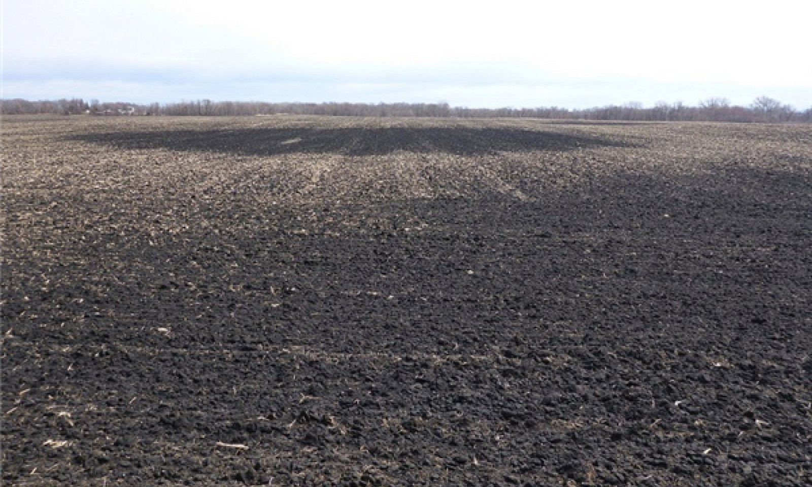
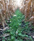
The vast majority (>90%) of modern Wet Loamy Prairie sites are in the Crop Production State. Most, but not all ecological functions have been destroyed, converted, reverted, or otherwise removed from the system. In farmed conditions, dynamic soil properties can change quickly as a result of various agricultural practices and are the best way to understand the effects of these practices on the condition of individual fields. The vast majority of these sites are and will likely continue to be in corn and soybean production. There are certain management practices that are proven to be destructive, not only to the individual field, but to the watershed as a whole. Collectively, excessive tillage, the pervasive use of fertilizers and other chemicals, and many modern farming practices have unwanted effects that are neither good for the future of the site nor for the ecosystem as a whole. Subsurface tile drainage and tillage are the two primary factors affecting transition to this state. Counties in MLRA 103 are estimated to have had 64 to 100 percent of all wetlands converted to agricultural uses (Gleason et al. 2004). However, it is assumed that virtually all Loamy Wet Prairie sites in the Crop Production State have been completely drained. The main purpose of tile drainage is to produce drier and warmer conditions in the spring so growers can enter fields as soon as possible. In a natural condition, these wetlands are not directly connected to riverine systems. However, modern drainage activities transfer water through drainage tile and ditch networks directly into riverine systems, effectively overriding the hydrogeomorphic classification of this ecological site. Due to their high inherent fertility and largely non-erodible landforms, when drained these soils epitomize a naturally healthy soil. As a result, these soils tend to not be managed using soil health practices, and they are becoming damaged, primarily by excessive tillage. Overall, drainage and tillage has altered dynamic soil properties (and likely even inherent soil properties) and homogenized much of the historic microtopography associated with these sites.
Submodel
Mechanism
Seeding or invasion of cool season grasses; lack of fire; some hydrologic alteration; possible over-grazing.
Mechanism
Lack of fire and grazing; time (>10 years without disturbance).
Mechanism
Tillage; artificial drainage; removal of fire and native grazers.
Mechanism
Long term ecological restoration, including establishment of typical wet prairie vegetation composition and structure, complete restoration of hydrology, and reintroduction of a diversity of disturbances, including multi-season burning and grazing.
Mechanism
Lack of fire and grazing for greater than 10 years.
Mechanism
Tillage; artificial drainage; removal of fire and native grazers. The majority of early post-settlement areas within the Grassland State were drained and transitioned to crop production.
Mechanism
Removal of overstory; long term restoration; uncommon.
Mechanism
Removal of overstory; seeding of grasses.
Mechanism
Removal of overstory; tillage; artificial drainage; conversion to row crop agriculture.
Model keys
Briefcase
Add ecological sites and Major Land Resource Areas to your briefcase by clicking on the briefcase (![]() ) icon wherever it occurs. Drag and drop items to reorder. Cookies are used to store briefcase items between browsing sessions. Because of this, the number of items that can be added to your briefcase is limited, and briefcase items added on one device and browser cannot be accessed from another device or browser. Users who do not wish to place cookies on their devices should not use the briefcase tool. Briefcase cookies serve no other purpose than described here and are deleted whenever browsing history is cleared.
) icon wherever it occurs. Drag and drop items to reorder. Cookies are used to store briefcase items between browsing sessions. Because of this, the number of items that can be added to your briefcase is limited, and briefcase items added on one device and browser cannot be accessed from another device or browser. Users who do not wish to place cookies on their devices should not use the briefcase tool. Briefcase cookies serve no other purpose than described here and are deleted whenever browsing history is cleared.
Ecological sites
Major Land Resource Areas
The Ecosystem Dynamics Interpretive Tool is an information system framework developed by the USDA-ARS Jornada Experimental Range, USDA Natural Resources Conservation Service, and New Mexico State University.


