Saline Subirrigated

Scenario model
Current ecosystem state
Select a state
Management practices/drivers
Select a transition or restoration pathway
-
Transition T1A
Heavy grazing or haying with inadequate growing season recovery periods.
More details -
Transition T1B
Tillage to facilitate production agriculture.
More details -
Transition T2A
Tillage to facilitate production agriculture.
More details -
No transition or restoration pathway between the selected states has been described
Target ecosystem state
Select a state
State 1
Reference State
Description
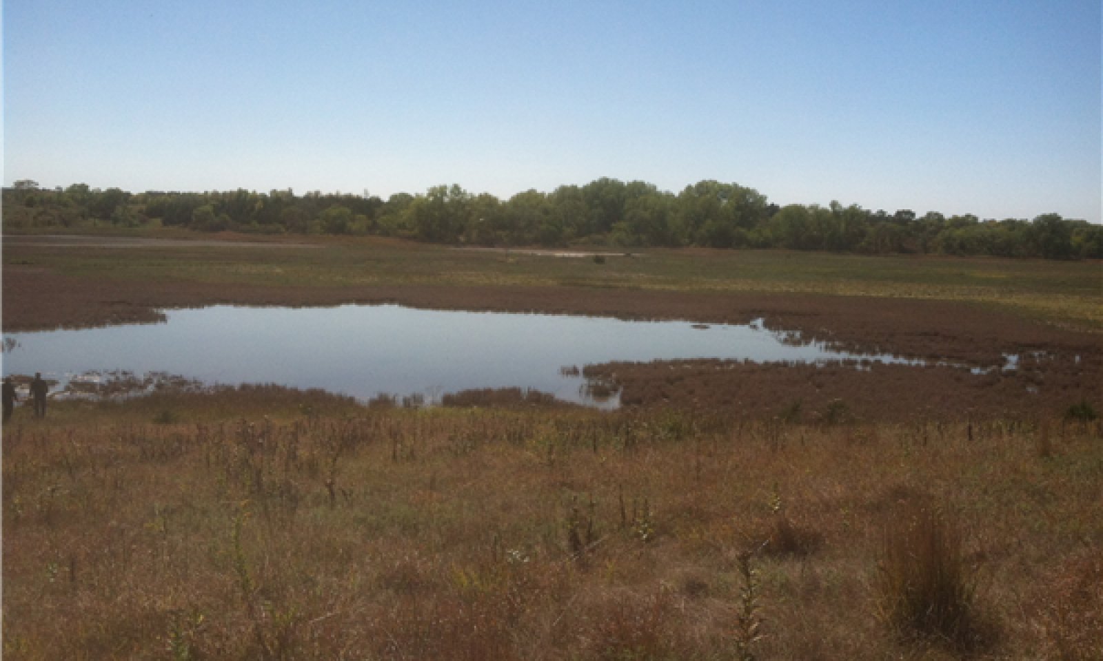
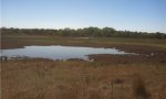
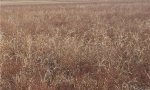
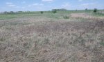
The Reference State (1) describes the range of vegetative community phases that occur on the Saline Subirrigated ecological site where the natural processes are mostly intact. Under natural conditions, vegetation in the Reference State (1) fluctuates between a Marsh Community (1.1), a Salt Flat Community (1.5), and a Wet Meadow Community (1.2). In wetter years, the site is dominated by the Reference or Marsh Community (1.1) which is semi-permanently flooded and dominated by grass-likes and dominated by forbs including cosmopolitan (saltmarsh) bulrush, narrowleaf cattail, broadleaf cattail, and sago pondweed. In dryer years, the predominant zone is the Wet Meadow Community (1.2) which is a seasonally wet meadow zone dominated by salt tolerant grasses including saltgrass, prairie cordgrass, and western wheatgrass.
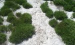
As the flooded areas recede a Salt-Flat Community (1.5) which is dominated by forbs will develop. The plant composition of the Salt Flat Community (1.5) is often in concentric rings around the flooded portion of the site with the inner ring being dominated by Pursh seepweed and saltwort, the next ring dominated by marsh elder, spikerush, spearscale, and foxtail barley, and the outer ring is dominated by saltgrass. This is followed by a transition area that is diverse and includes panicled aster, saltmarsh aster, silver-scale saltbush, spearscale, spikerush, seaside heliotrope, marsh elder, and grasses including Texas dropseed, bearded sprangletop, plains bluegrass, and western wheatgrass.
Depending upon local conditions, at any point in time, a site may be exclusively marsh zone, exclusively wet meadow zone, or a combination of the two zones and with the Salt Flat Community (1.5) acting as a bridge between the Reference or Marsh (1.1) and Wet Meadow (1.2) Communities. All three communities are a representation of the native plant community phases that occupy the site when it has been minimally altered by management. The At-Risk (1.4) and the Excessive Litter (1.5) Communities are the phases that result from management decisions that are unfavorable for a healthy Reference Community (1.1). High perennial grass cover and production allows for increased soil moisture retention, vegetative production, and overall soil quality.
Submodel
States 1, 5 and 2 (additional transitions)
1.1. Reference Community
1.5. Salt Flat Community
1.2. Wet Meadow Community
Description
This Reference State (1) has crossed a major ecological threshold and transitioned to the Native/Invaded Grass State (2). This transition is the result of long-term management strategies that cause a major and almost irreversible shift in the species composition of the vegetative community. Native tall and mid grasses and grass-likes have been replaced by warm-season, sod forming short grasses, primarily inland saltgrass, and salt tolerant forbs. Non-native grasses may also be subdominant or dominant. The Native/Invaded Grass State (2) includes the Shortgrass Sod/Non-Native Grass Community (2.1) community phase.
Submodel
Description
The threshold to the Sod-busted State (3) is crossed as a result of mechanical disturbance to facilitate production agriculture. Extensive areas of this ecological site were plowed and converted to crop production by early European settlers and their subsequent generations. In addition to permanently altering the existing vegetative community, repeated tillage negatively impacted soil properties. Reductions in organic matter, mineral levels, soil structure, oxygen levels, and water holding capacity along with increased runoff and erosion as well as shifts in the populations of soil dwelling organisms were common on these sites. The extent of these changes depended upon the duration of cropping as well as crops grown and other management practices.
If farming operations are suspended, the site can be abandoned or seeded to permanent vegetation. Seedings are either a tame pasture forage mixture, the Seeded Pasture Community (3.2), or a mixture of native grasses and forbs, the Reseeded Native Grass Community (3.1). Abandonment results in the Natural Reclamation Community (3.3). Permanent alterations of the soil, plant community, and the hydrologic cycle make restoration to the Reference State (1) extremely difficult, if not impossible.
Submodel
Mechanism
Heavy grazing or haying without adequate growing season recovery periods will cause a significant loss of warm-season, tall and mid grass species and cause the Reference State (1) to cross a threshold to the Native/Invaded Grass State (2). Water infiltration and other hydrologic functions will be reduced due to the root matting presence of sod forming grasses. With the decline and loss of deeper penetrating root systems, soil structure and biological integrity are catastrophically degraded to the point that recovery is unlikely. Once this occurs, it is highly unlikely that grazing management alone will return the community to the Reference State (1).
Mechanism
The Reference State (1) is significantly altered by mechanical tillage converting site to the Sod-Busted State (3) to facilitate production agriculture. The disruption to the plant community, the soil, and the hydrology of the system make restoration to a true reference state unlikely.
Mechanism
The Native/Invaded Grass State (2) is significantly altered by mechanical tillage converting site to the Sod-Busted State (3) to facilitate production agriculture. The disruption to the plant community, the soil, and the hydrology of the system make restoration unlikely.
Model keys
Briefcase
Add ecological sites and Major Land Resource Areas to your briefcase by clicking on the briefcase (![]() ) icon wherever it occurs. Drag and drop items to reorder. Cookies are used to store briefcase items between browsing sessions. Because of this, the number of items that can be added to your briefcase is limited, and briefcase items added on one device and browser cannot be accessed from another device or browser. Users who do not wish to place cookies on their devices should not use the briefcase tool. Briefcase cookies serve no other purpose than described here and are deleted whenever browsing history is cleared.
) icon wherever it occurs. Drag and drop items to reorder. Cookies are used to store briefcase items between browsing sessions. Because of this, the number of items that can be added to your briefcase is limited, and briefcase items added on one device and browser cannot be accessed from another device or browser. Users who do not wish to place cookies on their devices should not use the briefcase tool. Briefcase cookies serve no other purpose than described here and are deleted whenever browsing history is cleared.
Ecological sites
Major Land Resource Areas
The Ecosystem Dynamics Interpretive Tool is an information system framework developed by the USDA-ARS Jornada Experimental Range, USDA Natural Resources Conservation Service, and New Mexico State University.