Natural Resources
Conservation Service
Ecological site R110XY023IL
Organic Interdunal Fen
Last updated: 4/22/2020
Accessed: 04/02/2025
General information
Provisional. A provisional ecological site description has undergone quality control and quality assurance review. It contains a working state and transition model and enough information to identify the ecological site.
MLRA notes
Major Land Resource Area (MLRA): 110X–Northern Illinois and Indiana Heavy Till Plain
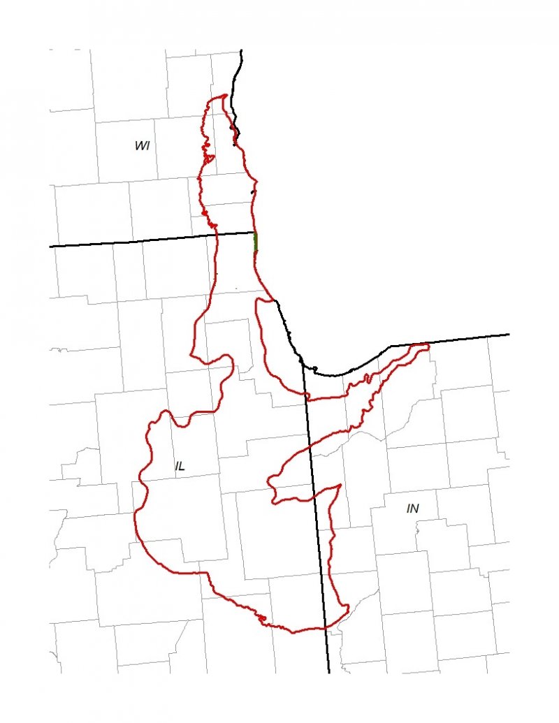
The Northern Illinois and Indiana Heavy Till Plain (MLRA 110) encompasses the Northeastern Morainal, Grand Prairie, and Southern Lake Michigan Coastal landscapes (Schwegman et al. 1973, WDNR 2015). It spans three states – Illinois (79 percent), Indiana (10 percent), and Wisconsin (11 percent) – comprising about 7,535 square miles (Figure 1). The elevation is about 650 feet above sea level (ASL) and increases gradually from Lake Michigan south. Local relief varies from 10 to 25 feet. Silurian age fractured dolomite and limestone bedrock underlie the region. Glacial drift covers the surface area of the MLRA, and till, outwash, lacustrine deposits, loess or other silty material, and organic deposits are common (USDA-NRCS 2006).
The vegetation in the MLRA has undergone drastic changes over time. At the end of the last glacial episode – the Wisconsinan glaciation – the evolution of vegetation began with the development of tundra habitats, followed by a phase of spruce and fir forests, and eventually spruce-pine forests. Not until approximately 9,000 years ago did the climate undergo a warming trend which prompted the development of deciduous forests dominated by oak and hickory. As the climate continued to warm and dry, prairies began to develop approximately 8,300 years ago. Another shift in climate that resulted in an increase in moisture prompted the emergence of savanna-like habitats from 8,000 to 5,000 years before present (Taft et al. 2009). Forests maintained footholds on steep valley sides, morainal ridges, and wet floodplains. Fire, droughts, and grazing by native mammals helped to maintain the prairies and savannas until the arrival of European settlers, and the forests were maintained by droughts, wind, lightning, and occasional fire (Taft et al. 2009; NatureServe 2018).
Classification relationships
USFS Subregions: Southwestern Great Lakes Morainal (222K) and Central Till Plains and Grand Prairies (251D) Sections; Kenosha-Lake Michigan Plain and Moraines (222Kg), Valparaiso Moraine (Kj), and Eastern Grand Prairie (251Dd) Subsections (Cleland et al. 2007)
U.S. EPA Level IV Ecoregion: Kettle Moraines (53b), Illinois/Indiana Prairies (54a), and Valparaiso-Wheaton Morainal Complex (54f) (USEPA 2013)
National Vegetation Classification – Ecological Systems: Northern Great Lakes Interdunal Wetland (CES201.034) (NatureServe 2018)
National Vegetation Classification – Plant Associations: Dasiphora fruticosa/Cladium mariscoides – juncus arcticus ssp. littoralis – (Rhynchospora capillacea) Fen (CEGL005105) (Nature Serve 2018)
Illinois Natural Areas Inventory: Panne (White and Madany 1978)
Wisconsin Natural Communities: Interdunal wetland (WDNR 2015)
Ecological site concept
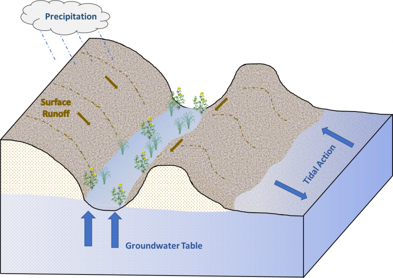
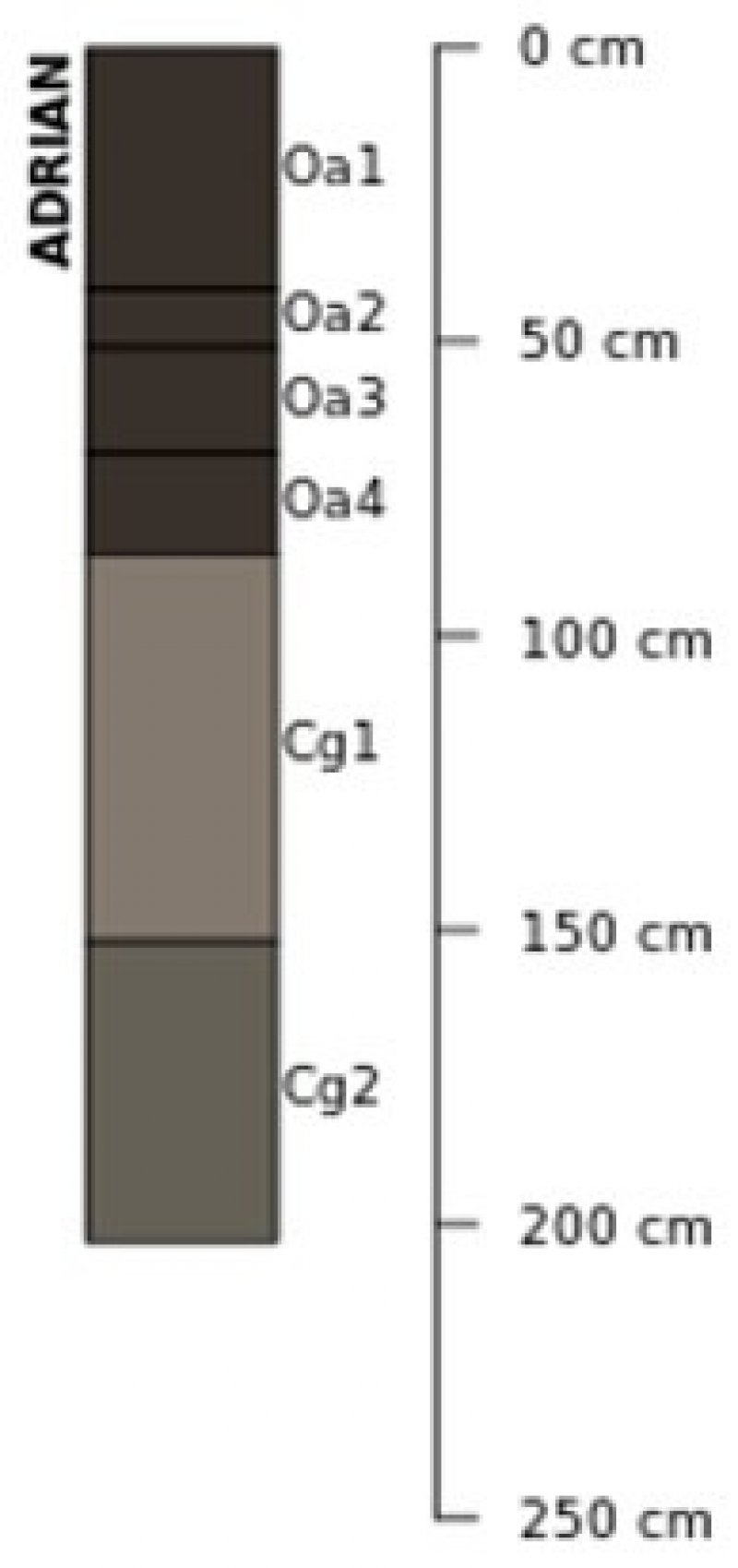
Organic Interdunal Fens are located within the green areas on the map. They occur on depressions in wind-deposited dune fields. The soils are Histosols that are very poorly drained and very deep, formed in organic material over outwash.
The historic pre-European settlement vegetation on this ecological site was dominated by hydrophytic vegetation. Shrubby cinquefoil (Dasiphora fruticosa (L.) Rydb.) is the dominant shrub and smooth sawgrass (Cladium mariscoides (Muhl.) Torr.), mountain rush (Juncus arcticus Willd. ssp. littoralis (Engelm.) Hultén), and bluejoint (Calamagrostis canadensis L.) are the are the dominant herbaceous species on the site. Species characteristic of an undisturbed plant community associated with this ecological site include little green sedge (Carex viridula Michx.), bright green spikerush (Eleocharis olivacea Torr.), stiff yellow flax (Linum medium (Planch.) Britton var. texanum (Planch.) Fernald), seaside arrowgrass (Triglochin maritima L.), marsh arrowgrass (Triglochin palustris L.), and horned bladderwort (Utricularia cornuta Michx.) (White and Madany 1978; Taft et al. 1997). Depth of groundwater or to the water table is the dominant disturbance factor that maintains this ecological site (Hiebert et al. 1986).
Associated sites
| R110XY015IL |
Wet Sand Prairie Outwash that is shallow to a high-water table including Fieldon, Gilford, Granby, Granby variant, Hooppole, and Mussey soils |
|---|---|
| R110XY014IL |
Moist Sand Prairie Eolian deposits and outwash that have a high-water table within 15 to 18 inches including Bonfield, Hoopeston, Ridgeville, Watseka, and Wesley soils |
Similar sites
| R110XY022IL |
Organic Sand Seep Organic Sand Seeps are in similar interdunal swales, but the water seepage is acidic and the site is restricted to the Kankankee Sand Area |
|---|
Table 1. Dominant plant species
| Tree |
Not specified |
|---|---|
| Shrub |
(1) Dasiphora fruticosa |
| Herbaceous |
(1) Cladium mariscoides |
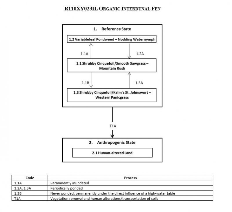
Click on box and path labels to scroll to the respective text.


