Natural Resources
Conservation Service
Ecological site F111XB302IN
Mesic Bedrock Forest
Last updated: 9/11/2024
Accessed: 04/29/2025
General information
Provisional. A provisional ecological site description has undergone quality control and quality assurance review. It contains a working state and transition model and enough information to identify the ecological site.
MLRA notes
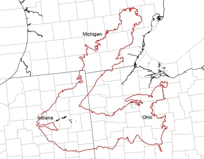
Major Land Resource Area (MLRA): 111X–Indiana and Ohio Till Plain
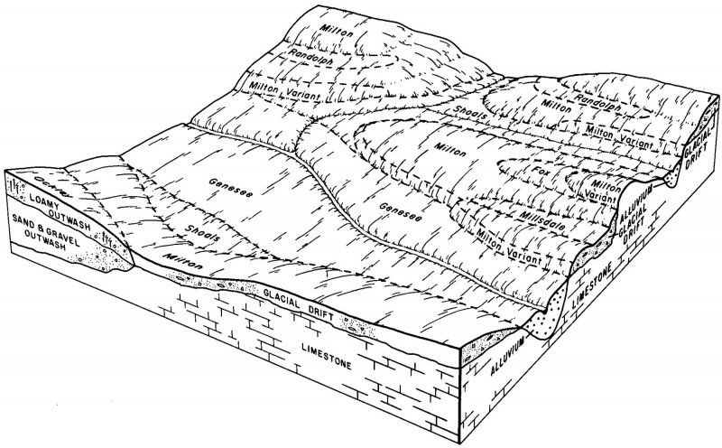
111B – Indiana and Ohio Till Plain, Northeastern Part. This area is in the Eastern Lake and Till Plains Sections of the Central Lowland Province of the Interior Plains. The entire MLRA is glaciated, and most areas are dominated by ground moraines that are broken in places by lake plains, outwash plains, flood plains, and many recessional moraines. The ground moraines and lake plains in front of the recessional moraines are flat to undulating. In many places stream valleys occur at the leading edge of the recessional moraines. Narrow, shallow valleys commonly are along the major rivers and streams in this MLRA, and some areas along the major rivers and streams have deposits of sand. Elevation ranges from 630 to 1,550 feet (190 to 470 meters), increasing gradually from west to east. Relief is mainly a few meters, but in some areas hills rise as much as 100 feet (30 meters) above the adjoining plains.
The extent of the major Hydrologic Unit Areas (identified by four-digit numbers) that make up this MLRA is as follows: Western Lake Erie (0410), 41 percent; Wabash (0512), 28 percent; Scioto (0, 28 percent; Scioto (0506), 10 percent; St. Clair-Detroit (0409), 9 percent; Great Miami (0508), 6 percent; Southeastern Lake Michigan (0405), 5 percent; and Southwestern Lake Huron (0408), 1 percent. The Huron River in Michigan, Cedar Creek in Indiana, and the Sandusky River in Ohio have been designated as National Wild and Scenic Rivers in this MLRA.
The surficial materials in this area include glacial deposits of till, outwash, and lacustrine sediments from Wisconsin and older glacial periods. A thin mantle of loess occurs in some areas. Most of the MLRA is underlain by Silurian and Devonian limestone and dolostone. Middle Devonian to Early Mississippian black shale and Early to Middle Mississippian siltstone and shale are in some areas of the northern part of the MLRA.
Classification relationships
Major Land Resource Area (USDA-Natural Resources Conservation Service, 2006)
USFS Ecological Regions (USDA, 2007):
Sections –Central Till Plains, Beech Maple (222H), South Central Great Lakes (222J)
Subsections – Bluffton Till Plains (222Ha), Bluffton-Ann Arbor Till Plains (222Je), Jackson Interlobate Moraine (222Jg), Steuben Interlobate Moraines (222Ji)
NatureServe Systems anticipated (NatureServe, 2011): Agriculture - Cultivated Crops and Irrigated Agriculture, Agriculture – Pasture/Hay, North-Central Interior Dry-Mesic Oak Forest and Woodland, Northeastern Interior Dry-Mesic Oak Forest, Ruderal Forest
LANDFIRE Biophysical Settings anticipated (USGS, 2010): Northeastern Interior Dry-Mesic Oak Forest, North-Central Interior Dry-Mesic Oak Forest and Woodland
Ecological site concept
This site is an upland site generally formed on residuum weathered from sandstone overlain with till or loess. The depth to the restrictive layer is between 20 to 40 inches. Drainage is somewhat poorly drained with slopes generally from 0-3%. The characteristic vegetation of this site is that of a forest comprised largely of fire sensitive, shade tolerant species. The dominant canopy level species include sugar maple, American beech, and tulip tree. Gap phase regeneration is the most common disturbance dynamic on the site and allows these species to reach the canopy. Wind throw and ice storms are larger scale disturbance mechanisms, but they incur very infrequently. The site can be susceptible to the establishment and dominance of the understory by woody, invasive, non-native species. Most of this historically woodland site is now being for agriculture to include hay, pasture, and row crops.
Associated sites
| R111XB301IN |
Dark Bedrock Prairie Soil surfaces are dark in color |
|---|---|
| F111XB303IN |
Dry Bedrock Forest Soils are moderately well drained or drier |
Similar sites
| F111XB102IN |
Lacustrine Forest Lacustrine Forest |
|---|---|
| F111XB403IN |
Outwash Upland Outwash Upland |
| F111XB502IN |
Wet Till Ridge Wet Till Ridge |
| F111XE503IN |
Till Ridge Till Ridge |
Table 1. Dominant plant species
| Tree |
(1) Acer saccharum |
|---|---|
| Shrub |
Not specified |
| Herbaceous |
Not specified |
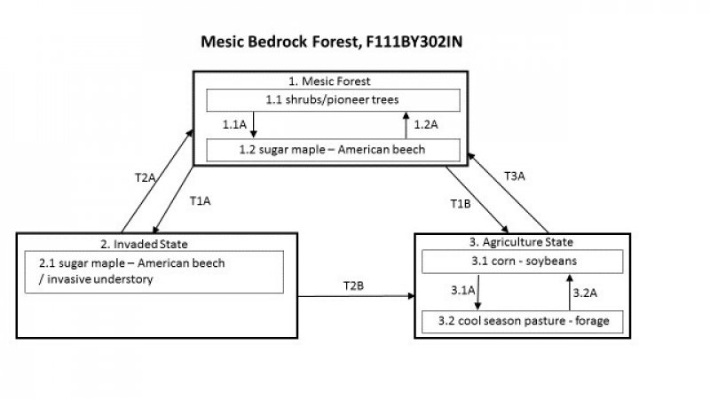
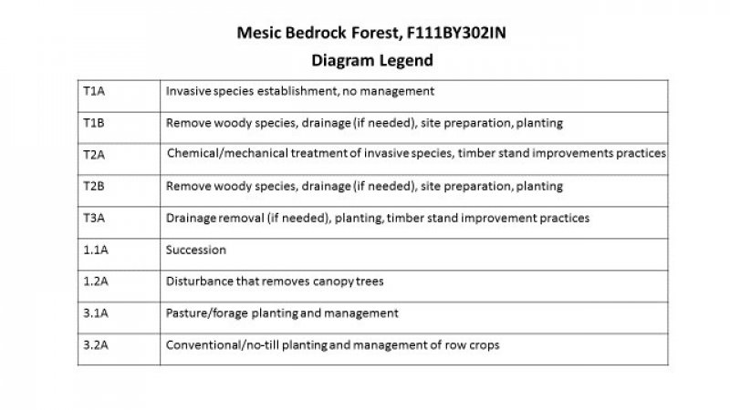
Click on box and path labels to scroll to the respective text.


