Natural Resources
Conservation Service
Ecological site F111XE201OH
Wet Alluvium Floodplain
Last updated: 9/11/2024
Accessed: 02/09/2026
General information
Provisional. A provisional ecological site description has undergone quality control and quality assurance review. It contains a working state and transition model and enough information to identify the ecological site.
MLRA notes
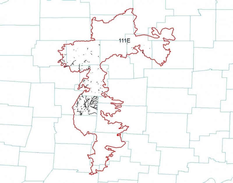
Major Land Resource Area (MLRA): 111X–Indiana and Ohio Till Plain
111E – Indiana and Ohio Till Plain, Eastern Part. Most of this area is in the Till Plains Section of the Central Lowlands Province of the Interior Plains. The northeast tip of the area is in the Southern New York Section of the Appalachian Highlands. The entire area has been glaciated. It is dominated by ground moraines that are broken in places by kames, lake plains, outwash plains, terraces, and stream valleys. Narrow, shallow valleys commonly are along the few large streams in the area. Elevation ranges from 580 to 1,400 feet (175 to 425 meters), increasing gradually from west to east. Relief is mainly a few meters, but in some areas hills rise as much as 100 feet (30 meters) above the adjoining plain.
The extent of the major Hydrologic Unit Areas (identified by four-digit numbers) that make up this MLRA is as follows: Scioto (0506), 33 percent; Muskingum (0504), 31 percent; and Western Lake Erie (0410), 28 percent; Upper Ohio (0503), 5 percent; and Southern Lake Erie (0411), 3 percent. The headwaters of many rivers in central Ohio, including the Vermillion, Black Fork, Sandusky, Little Scioto, and Olentangy Rivers, are in this MLRA.
This MLRA is underlain by late Devonian shale and sandstone. Surficial materials include glacial deposits of till, glaciolacustrine sediments, and outwash from Wisconsin and older glacial periods.
Classification relationships
Major Land Resource Area (USDA-Natural Resources Conservation Service, 2006)
USFS Ecological Regions (USDA, 2007):
Sections –Central Till Plains, Beech Maple (222H), Western Glaciated Allegheny Plateau (221F)
Subsections – Allegheny Plateau (221Fa), Bluffton Till Plains (222Ha), Miami-Scioto Plain – Tipton Till Plain (222Hb)
NatureServe Systems anticipated (NatureServe, 2011): Agriculture - Cultivated Crops and Irrigated Agriculture, Agriculture – Pasture/Hay, North-Central Interior Beech-Maple Forest, North-Central Interior Wet Flatwoods, North-Central Interior Floodplain
LANDFIRE Biophysical Settings anticipated (USGS, 2010): Central Interior and Appalachian Floodplain Systems, North-Central Interior Beech-Maple Forest
Ecological site concept
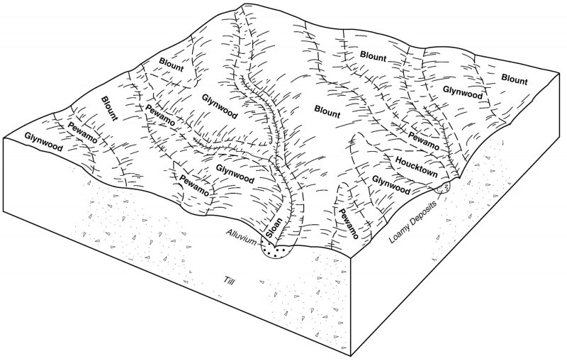
This site is a riparian site formed on alluvial parent materials that are very poorly drained. It is located along the floodplain of lotic systems in loamy alluvial deposits often overlaying coarser materials. As such the site is often constrained to a narrow landscape that is influenced by the adjacent uplands and riparian areas.
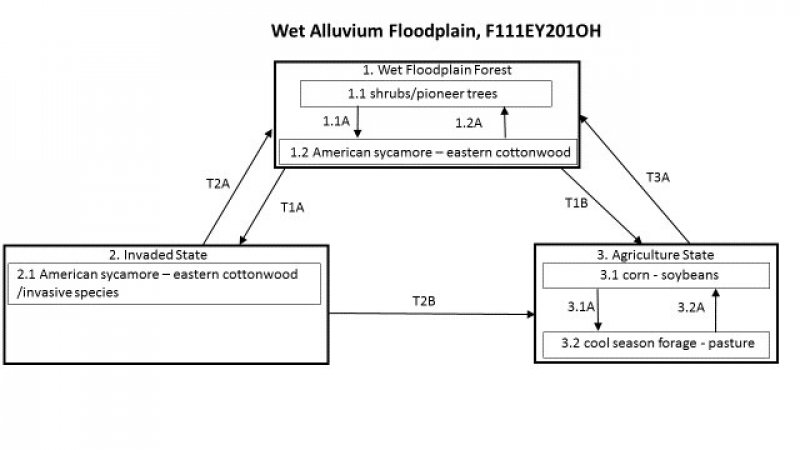
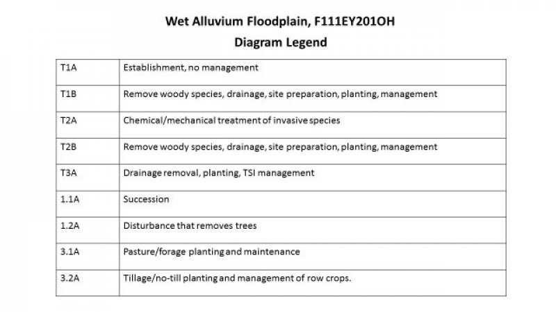
The characteristic vegetation of the site is that of a floodplain forest dominated principally by eastern cottonwood and American sycamore. Additional canopy level species include silver maple, swamp white oak, and walnut. Active hydrologic and geomorphic process, along with windthrow of established trees, drive the long interval disturbance regime of this tree dominated site. These macro and micro scale disturbance events creates mixed-aged forests that contains both late and early seral species. These dynamics have been drastically changed due to the installation of levees, dams, and channelization of the lotic systems. Establishment of woody non-native, invasive species, followed by no management to control them, can alter the state of the site. The invasive species can persist in the understory as a component and then spread rapidly with an opening in the canopy. They can come to dominate the understory of the site. The canopy level species are not in direct competition with the invasive species, but over time their dominance in the understory can change the canopy level species composition. Removal of the woody species, installation of tile, and agricultural practices move this site to a new state. Much of the historic acres of this site have been transitioned to agriculture with the bulk of those acres being in corn and soybean rotations.
Associated sites
| F111XE203OH |
Wet Alluvium Forest Wet Alluvium Forest. Soils surface light in color; poorly to somewhat poorly drained |
|---|---|
| F111XE202OH |
Dry Alluvium Floodplain Dry Alluvium Floodplain. Soils are moderately well to well drained |
| F111XE204OH |
Dry Alluvium Forest Dry Alluvium Forest. Soils surface light in color; moderately well to well drained |
Similar sites
| F111XE203OH |
Wet Alluvium Forest Wet Alluvium. Soils surface light in color; poorly to somewhat poorly drained |
|---|---|
| F111XE501OH |
Till Depression Till Depression. Located on glacial till parent materials; soil surface lighter than 3/2 Munsell. |
Table 1. Dominant plant species
| Tree |
(1) Platanus occidentalis |
|---|---|
| Shrub |
Not specified |
| Herbaceous |
Not specified |
Click on box and path labels to scroll to the respective text.


