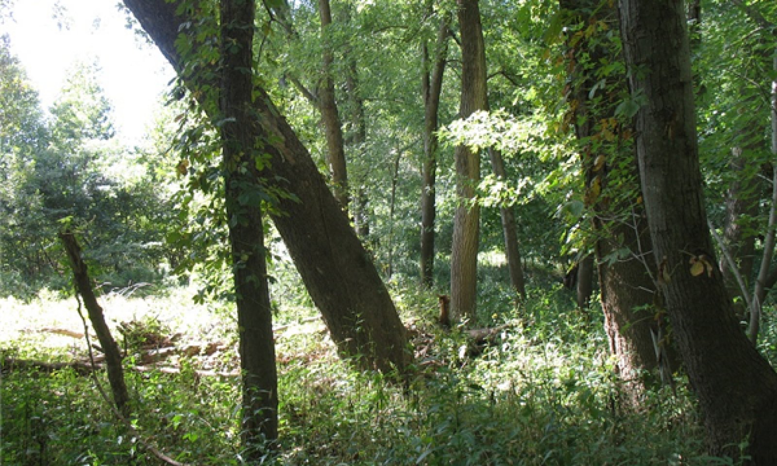
Sandy/Gravelly Floodplain Forest
Scenario model
Current ecosystem state
Select a state
Management practices/drivers
Select a transition or restoration pathway
- Transition T1B More details
- Transition T1A More details
- Restoration pathway R2A More details
- Transition T2B More details
- Restoration pathway R3A More details
- Restoration pathway T3A More details
-
No transition or restoration pathway between the selected states has been described
Target ecosystem state
Select a state
Description
Sandy/Gravelly Floodplain Forests are dominated by mature sycamore and/or eastern cottonwood. While these species can occur together, sycamores tend to dominate the smaller, higher energy streams with more gravel, while cottonwoods are more dominant on larger rivers with less gravel. Maximum tree age, historically, was probably about 100 years.
However, patches of younger, early successional trees and shrubs occur mainly along the flood-prone edges or interior high-water channels of the mature forest. Willows are common in the younger patches and persist along the edges of the mature forest where there is more light. Younger patches tend to occur on recently deposited sands and gravels, and have a sparse understory.
These gravel bars and intermittent stream channels are in the early stages of ecological succession, and are typically on point bar deposits. They are characterized by a sparse to abundant ground cover of grasses and forbs. Shrubs such as coastal plain willow, Ozark witchhazel and common ninebark can create a 100 percent cover in places, and tree seedlings of cottonwood are common. Frequent, high-velocity flood events deposit fresh sand and gravel in places, often derived from stream bank erosion of upstream sites in States 2 or 3. Other places are scoured by these flood events. As the stream meanders farther away from these sites, flooding events decrease in frequency and intensity, and the state will gradually develop into the early seral Sandy/Gravelly Floodplain Forest community.
Mature forest phases have a more stable surface with a dense ground flora of wildrye, spikegrass and nettle. Dense tangles of vines can also occur, especially associated with canopy gaps. Slippery elm, green ash and hackberry also succeed into the canopy gaps.
Submodel
Description
Sandy/Gravelly Floodplain Forest reference sites subjected to repeated, high-graded timber harvests and domestic grazing transition to this state. This state exhibits an over-abundance of less desirable tree species, and weedy understory species such as coralberry. The vegetation offers little nutritional value for cattle, and excessive stocking damages tree boles, degrades understory species composition, destabilizes stream banks and results in soil compaction and accelerated erosion and runoff during flood events. Restoration of the riverfront forest can be facilitated by exclusion of cattle coupled with tree planting.
Submodel
Description
Conversion of Sandy/Gravelly Floodplain Forest ecological sites to planted, non-native pasture species such as tall fescue can occur in the Ozark highlands. Frequent flooding and low available water capacity make non-native pastures difficult to maintain in a healthy, productive state on this ecological site. Restoration of the Sandy/Gravelly Floodplain Forests can be achieved over time by discontinuing grazing and active pasture management and allowing natural woody succession to occur. Tree planting, especially to bring in desired species, may be necessary.
Submodel
Mechanism
Clearing; pasture planting; prescribed grazing; hayland management
Mechanism
The Riverfront Forest can be restored if cattle are excluded from the forest, timber harvest is discontinued and timber stand improvement, including tree planting, is implemented.
Mechanism
This transition is the result of clearing the forest community and planting pasture species or crops.
Mechanism
The Early Seral Riverfront Forest can be restored if pasture management and grazing are terminated and tree planting is implemented.
Model keys
Briefcase
Add ecological sites and Major Land Resource Areas to your briefcase by clicking on the briefcase (![]() ) icon wherever it occurs. Drag and drop items to reorder. Cookies are used to store briefcase items between browsing sessions. Because of this, the number of items that can be added to your briefcase is limited, and briefcase items added on one device and browser cannot be accessed from another device or browser. Users who do not wish to place cookies on their devices should not use the briefcase tool. Briefcase cookies serve no other purpose than described here and are deleted whenever browsing history is cleared.
) icon wherever it occurs. Drag and drop items to reorder. Cookies are used to store briefcase items between browsing sessions. Because of this, the number of items that can be added to your briefcase is limited, and briefcase items added on one device and browser cannot be accessed from another device or browser. Users who do not wish to place cookies on their devices should not use the briefcase tool. Briefcase cookies serve no other purpose than described here and are deleted whenever browsing history is cleared.
Ecological sites
Major Land Resource Areas
The Ecosystem Dynamics Interpretive Tool is an information system framework developed by the USDA-ARS Jornada Experimental Range, USDA Natural Resources Conservation Service, and New Mexico State University.
