Weathered Shale Upland
Scenario model
Current ecosystem state
Select a state
Management practices/drivers
Select a transition or restoration pathway
-
No transition or restoration pathway between the selected states has been described
Target ecosystem state
Select a state
State 1
Knobs Norman Weathered Shale Oak-Hickory Forest


Description
Development of this ecological site description first started with the identification and analyses of existing ecological studies and mapping. One of the key elements utilized in identifying possible work area boundaries for this project was the Ecoregions of Kentucky dataset developed by US Environmental Protection Agency (EPA). Ecoregions are areas that exhibit similarities in ecosystems including the type of environmental resources. These boundaries where delineated to serve as a spatial framework for environmental research, ecological assessments, natural resource management, and ecosystem monitoring throughout the United States. (Bryce and others, 1999). EPAs ecoregion boundaries were developed through the analysis of environmental spatial patterns including geology, soils, physiography, vegetation, climate, hydrology, and land use. (Wiken, 1986; Omernick, 1987).
Two ecoregions make up the distinctive geologic area of Kentucky known as “the Knobs”. Consisting of a relatively narrow band of conical hills surrounding the Outer Bluegrass Ecoregion in a horseshoe shape, the Knobs form a horseshoe shape around the Bluegrass Regions. The vegetation of the Knobs is influenced by geology and soils -and the ecoregions that area adjacent. The eastern portion of the Knobs – referred to as the Knobs-Lower Scioto Dissected Plateau Ecoregion- reflects a combination of plants from both the Outer Bluegrass Region to the west and the Cumberland Plateau ecoregions to the east. The western portion of the Knobs – referred to as the Knobs-Norman Upland- is also influenced by the Outer Bluegrass Ecoregion (to the east) but has characteristics of the Eastern Highland Rim and the Mitchell Plain ecoregions. The noted ecologist Lucy Braun (1950) separated the Knobs area of the Mixed Mesophytic Forest adjacent to the Cumberland Plateau from the Knobs region located in the western and southern parts of the State. EPA has also separated the Knobs into two distinct ecoregions.
Although the Knobs region extends into Ohio, no Ohio sites were visited for this project. Previous studies have showed that the vegetation throughout the Ohio Knobs areas can be locally distinctive and vary sharply based upon parent material. (Anderson and Vankat, 1978). For these reasons, this ecological site description is focused on sites and soils within the Knobs-Norman Upland Ecoregion of Kentucky.
Many experts describe the Knobs region as exhibiting a blending of mixed mesophytic and Western Mesophytic forest types. Pre-settlement vegetation of the Knobs contained mixed mesophytic forest species such as sugar maple (Acer saccharum), Tilia spp., yellow buckeye [Aesculus octandra (SYN= Aesculus flava Aiton)], and tulip poplar (Liriodendron tulipifera). (Muller and McComb). It also contained elements of the Western Mesophytic forest including forest communities dominated by oaks. (Burroughs 1926; Braun 1950). Past ecological studies have resulted in confirming a strong relationship between soil and site conditions and the distribution of vegetation in the Knobs. It is sometimes difficult to identify vegetation community boundaries in the field or to delineate communities via soil mapping. The sideslopes are a mix of different soils with varying parent materials and soil boundaries are difficult to immediately identify. On hillsides, the substrate changes can happen sharply or on a long gradient depending on the individual site.
There have been relatively few previous detailed studies of the vegetation or vegetation and soil relationships in the Knobs region. Wharton (1945) did identified five upland forest types based on her field observation in the region. These were mixed mesophytic forest, white oak, oak-pine, pine, and chestnut oak-scarlet oak. Wharton’s hypothesis was that the distribution of these forest types was based on aspect, slope position, soils/geology, and the successional phase of the community; however, no direct or detailed correlations were identified or field tested in her works.
This ecological site description described findings of one year of field work. Public land was utilized for reference sites due to the lower quality of forests found on most private lands. Disturbances, including livestock, clear cutting, and selective harvest had occurred on most of the private lands visited within the last 20 years. The public lands monitored for this project reference site had been protected for over 50 years. The majority of field visits occurred in Bullitt, Jefferson, Marion and Nelson Counties.
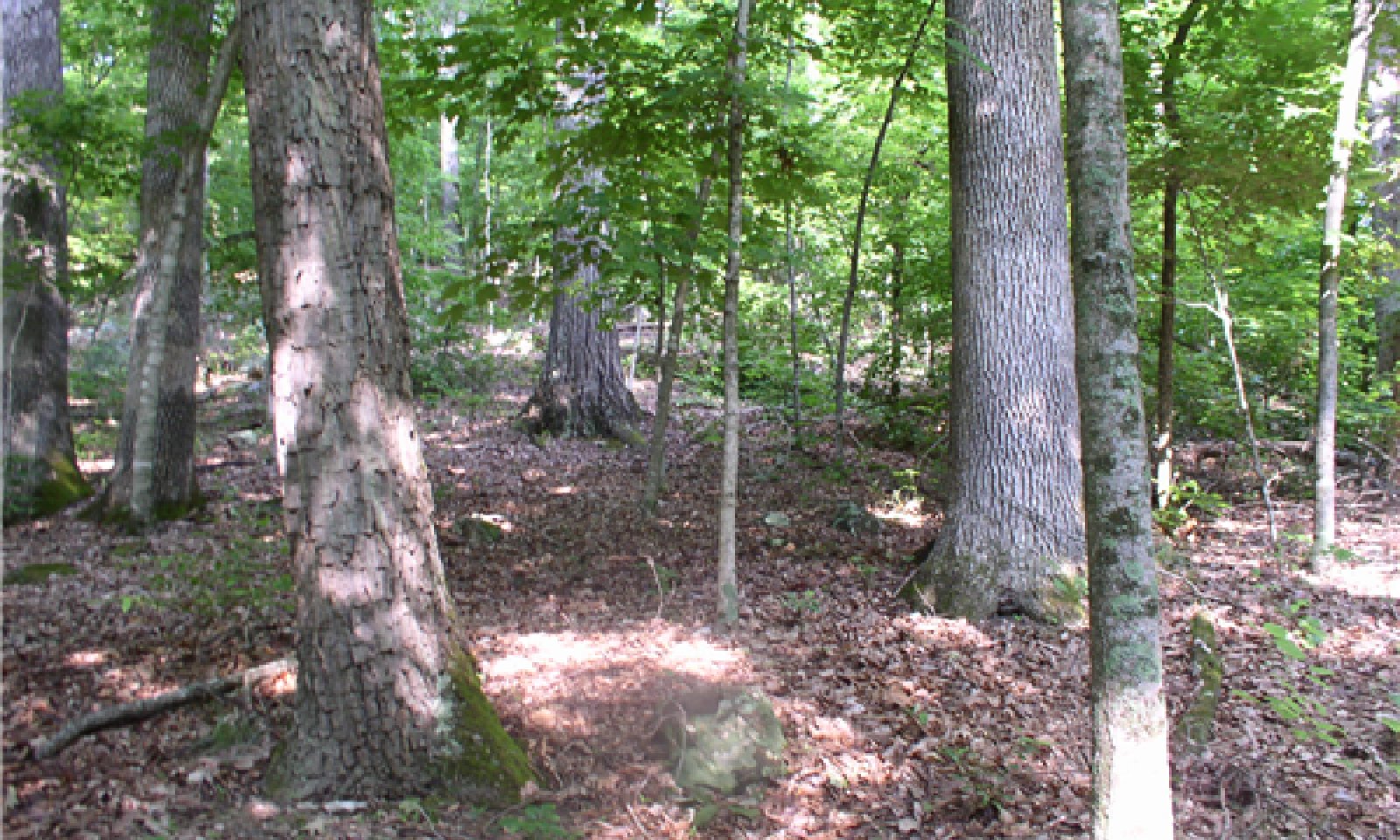
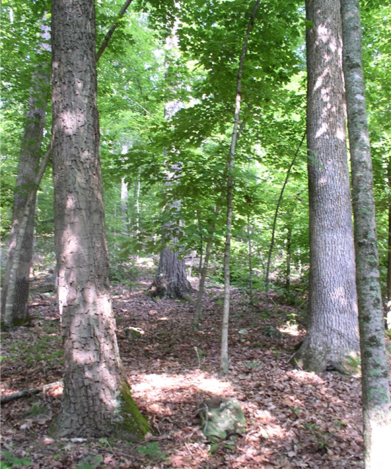
This ecological site is a dry- mesic oak forest located in the western Knobs region of Kentucky. Depending on slope, soil depth, and soil characteristics, individual trees vary in size with larger specimens generally 70-90 feet in height. Overstory canopy closure on plots was 70-90% and dominant overstory trees included white oak (Quercus alba), chestnut oak (Quercus prinus), black oak (Quercus velutina), scarlet oak (Quercus coccinea), pignut hickory (Carya glabra), and shagbark hickory (Cary ovata). Understory communities were lightly developed, especially on south and western hillsides. Aspect, soil depth, and micro-topography influenced herbaceous cover and species density.
Submodel
Submodel
Description
The majority of sites included within this ecological site description are not appropriate for pastures or hay due to slope, shallow soil or rock content. This State is included in this ecological site description to include those few sites that are have suitable soils and site conditions for agricultural production. All of the pasture sites visited during this project consisted mainly of tall fescue and other non-native grasses.
Submodel
Model keys
Briefcase
Add ecological sites and Major Land Resource Areas to your briefcase by clicking on the briefcase (![]() ) icon wherever it occurs. Drag and drop items to reorder. Cookies are used to store briefcase items between browsing sessions. Because of this, the number of items that can be added to your briefcase is limited, and briefcase items added on one device and browser cannot be accessed from another device or browser. Users who do not wish to place cookies on their devices should not use the briefcase tool. Briefcase cookies serve no other purpose than described here and are deleted whenever browsing history is cleared.
) icon wherever it occurs. Drag and drop items to reorder. Cookies are used to store briefcase items between browsing sessions. Because of this, the number of items that can be added to your briefcase is limited, and briefcase items added on one device and browser cannot be accessed from another device or browser. Users who do not wish to place cookies on their devices should not use the briefcase tool. Briefcase cookies serve no other purpose than described here and are deleted whenever browsing history is cleared.
Ecological sites
Major Land Resource Areas
The Ecosystem Dynamics Interpretive Tool is an information system framework developed by the USDA-ARS Jornada Experimental Range, USDA Natural Resources Conservation Service, and New Mexico State University.
