Yazoo - Old Moderately Wet Natural Levee and Meander Scroll Ridge Forest
Scenario model
Current ecosystem state
Select a state

Management practices/drivers
Select a transition or restoration pathway
-
Transition T1A
Manipulate composition and manage for production (Community 2.1); Heavy timber cutting/high-grading (Community 2.2)
More details -
Transition T1B
Vegetation/stump removal (mechanical/chemical); preparation for cultivation
More details -
Transition T1C
Vegetation/stump removal (mechanical/chemical); seedbed preparation; establishment of desired forage; manage for grazing
More details -
Transition T2A
Re-establish missing species; control exotics (mechanical/chemical); timber stand improvement; natural stand dynamics
More details -
Transition T2B
Vegetation/stump removal (mechanical/chemical); preparation for cultivation
More details -
Transition T2C
Vegetation/stump removal (mechanical/chemical); seedbed preparation; establishment of desired forage; manage for grazing
More details -
Transition T3A
Precision land leveling
More details -
Transition T3B
Establish desired forage species; manage for grazing.
More details -
Transition T3C
Natural succession (Community 6.1) or site prep (plow pan breakup, fertilizing, etc.); planting species appropriate for site (Community 6.2)
More details -
Transition T3D
Establish select native species suitable for site; prepare for planting (herbicide and/or mechanical)
More details -
Transition T5A
Vegetation/stump removal (mechanical/chemical); preparation for cultivation
More details -
Transition T5B
Natural succession (Community 6.1) or site prep (plow pan breakup, fertilizing, etc.); planting species appropriate for site (Community 6.2)
More details -
Transition T5C
Establish select native species suitable for site; prepare for planting (herbicide and/or mechanical)
More details -
Transition T6A
Vegetation/stump removal (mechanical/chemical); preparation for cultivation
More details -
Transition T6B
Vegetation/stump removal (mechanical/chemical); seedbed preparation; establishment of desired forage; manage for grazing
More details -
Transition T7A
Vegetation/stump removal (mechanical/chemical); preparation for cultivation
More details -
Transition T7B
Vegetation/stump removal (mechanical/chemical); seedbed preparation; establishment of desired forage; manage for grazing
More details -
Transition T7C
Natural succession (Community 6.1) or site prep; planting species appropriate for site (Afforestation – Community 6.2).
More details -
No transition or restoration pathway between the selected states has been described
Target ecosystem state
Select a state
Description
Removal of the pre-settlement natural communities of this site occurred long before thorough studies and investigations were conducted. Accordingly, reference conditions for this site have yet to be confirmed. Once assigned, that vegetation community will not represent the pre-settlement forest association, but it should identify an assemblage of naturally occurring species that reflects and contributes to the regional biodiversity and local forest ecology. The reference state will be based on decades of forest inventories and expert knowledge and opinion.
The return or transition pathway from the altered states back to the reference state is intended to represent the suite of hardwood species favored in management on this site.
Submodel
Description
This state consists of two very different community phases and management approaches. Community Phase 2.1 represents forest management and production on this site. A distinguishing feature of this phase is the level of management intensity designed to maximize merchantable goals. Various silvicultural methods are available for selection, and these are generally grouped into even-aged (e.g., clearcutting, seed-tree, and shelterwood) and uneven-aged (e.g., single tree, diameter-limit, basal area, and group selection) approaches (Meadows and Stanturf, 1997). Depending on the method selected, different structural and compositional characteristics of the stand may result. Removal and control of community associates are typically a critical element of production goals. These actions may result in different community or “management phases” (and possibly alternate states) depending on the methods used and desired results. Finding the appropriate approach for a given stand and environment necessitates close consultation with trained, experienced, and knowledgeable forestry professionals. If there is a desire to proceed with this state, it is strongly urged and advised that professional guidance be obtained and a well-designed silvicultural plan developed in advance of any work conducted.
Community Phase 2.2 represents conditions of many stands that have incurred indiscriminate timber harvests (e.g., heavy cutting, diameter-limit harvests of select species) and opportunistic regrowth following such harvests (i.e., no management at any period). Some stands may continue to support a few desirable species and quality stems, but in many instances, affected stands will be comprised of mostly shade tolerant species or trees of desirable species that fail to meet their maximum potential.
Although this site is well suited for forest production, seasonal wetness imposes moderate to severe limitations for some forest operations. Heavy equipment usage on wet soils can cause compaction, which may reduce site productivity. If possible, equipment operations are best conducted during drier periods of the year, which minimizes soil damage, erosion, and helps to maintain productivity.
An important caveat of this state is its representation of forest conditions that have retained full site production potential. Currently, transitional pathways to this state originate from another forested state (State 1), only. Former landuses (alternate states) that result in soil compaction (increased bulk densities), lower soil organic matter content, altered fertility, and smaller available rooting volume can reduce forest site production by 10 to 20 percent for some species (Groninger et al., 1999). These are conservative percentage reductions. The model from the Baker and Broadfoot (1979) method of site evaluation have produced site index values of over 20 percent lower than trees measured on non-impacted, forest soils. These impacts, however, can be ameliorated through various “afforestation” techniques such as plow pan breakup (subsoil or deep plowing), fertilization, and fallowing fields before stand establishment (Emile Gardiner, USFS Research Forester, personal communication with Rachel Stout Evans, contributing author). State 6 (Forest Recovery) is representative of forest establishment and growth on locations where soil compaction and reduction of nutrients have occurred. Once a previously affected location has recovered its site potential, transition to this state may be possible. That potential transition is still under review and is currently not shown or addressed in the state and transition model.
Submodel
State 3
Cropland
Description
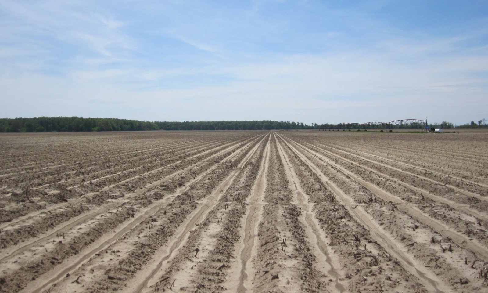
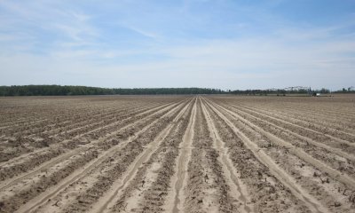
This state is representative of the dominant landuse activity on this ecological site, agriculture production. The dominant crops grown on this site are cotton (Gossypium hirsutum), corn (Zea mays), soybeans (Glycine max), and potentially small grains such as wheat (Triticum aestivum). Minor crops, such as some specialty crops (e.g., fruits, vegetables, and tree nuts such as pecans), may be grown locally.
The soils of this site are well suited to agriculture production. Management concerns are centered on seasonal wetness, soil compaction from heavy equipment operations, and the development of a plow pan. Pringle et al. (2017) emphasized that a “fairly impermeable crust” tends to develop following a heavy rain or an irrigation event. Each of these factors could affect yields or impede optimum operation. Management measures to ameliorate some of these issues may include implementation of a drainage system or network in problematic areas; implementing a conservation tillage or management system; subsoiling to breakup plow pans (USDA-NRCS, 2006b). Major components that producers generally develop and plan are proper selection of crop cultivar, pest control, cropping system, tillage methods, nutrient management, and water management. Key practices of some cropping systems often include two or more crops grown in a multiyear rotation, which has been documented to disrupt pest cycles. Leaving crop residue on the surface can help to maintain tilth, fertility, and organic matter content – all critical elements of soil quality and health. For monoculture cropping systems, the implementation of well-designed pest and nutrient management systems are imperative (Pringle et al., 2017). (For assistance, interested parties are advised to visit their local NRCS Field Office.)
Three separate management phases comprise this state: Conservation Management (3.1), Transitional Conservation Management (3.2), and Conventional Management (3.3). The three phases consist of varying tillage methods and approaches to soil health management systems.
Submodel
Description
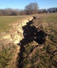
This gently sloping to undulating ecological site typically adjoins nearly level to level landscapes. It is bordered by soils of varying textures and drainage characteristics. Accordingly, inconsistencies in wetness, ease of operation, and production or yields may occur across a cropped location. An increasingly common practice on this site consists of land forming or leveling surface irregularities into a predetermined and engineered, uniform slope. This practice removes the drier and higher features of this site, which are then used to fill wetter and lower positions (e.g., depressions or swales) across the targeted area. Advantages of land leveling may include reduced hazards of erosion and runoff rates, improved surface drainage, and enhanced distribution and conservation of irrigation water. Disadvantages of the practice is a churning of various surface and subsurface materials (former soil horizons) that no longer occur in a predictable or regular pattern. Organic matter content in the surface layer is generally low, and the surface tends to crust and pack after heavy rains (USDA-NRCS, 2006b). One potential hazard that appears to be emerging in some areas is an effective management of surface water runoff. As both irrigated and stormwater runs off leveled fields at uniform rates, surface water tends to collect cumulatively and simultaneously, which places tremendous demands on local drainage networks. Without “in field” structures (natural or artificial) to stagger runoff, the downslope (or lower) ends of some fields tend to back flood thereby contributing to more flooding overall in local watersheds (personal observations).
Immediately following land leveling, the constituent elements of soil health are likely to be absent. In some areas, producers have initiated practices such as applying organic residues (e.g., poultry litter) or growing rice crops for one to two years to rapidly boost fertility and introduce organic matter (via rice biomass) in the surface layer. Over time, the full complement of the management phases of State 3 may be possible on land leveled fields. They are not repeated here.
Currently, this state serves as an endpoint in the state and transition model because the ability to predict vegetation response when transitioning to a different state is no longer possible without soil-site investigations for each area of interest. The former soils of this ecological site, including surface and subsurface horizons, will have been redistributed as particles among other former soils.
Submodel
Description
This state is representative of sites that have been converted to and maintained in pasture or grassland. In 1991, the soils of this site were placed in Pasture Suitability Group 11b for the State of Mississippi. The Dundee soils are generally considered well suited to most commonly grown forage species. However, there are some wetness limitations due to a seasonally high water table. Management concerns are mainly centered on soil compaction due to grazing, which may be improved or avoided by restricting grazing during wetter periods (USDA-NRCS, 2006b). Of caution, some annual winter plants naturally growing in wet locations (e.g., sedges and rushes) may be hazardous if consumed. Production is considered moderately high when adequately fertilized and properly managed.
Given that this ecological site adjoins lower, wetter sites, some forage operations may experience multiple wetness events in a single year, especially in pastures where wetter soils occur in complex or in close contact with those of this site. Flood-prone areas may limit the type of forage suited for this site. A system of artificial drainage or water control structures may be in place to facilitate continued forage production and grazing during wetter periods. Additionally, adjacent higher elevation or protected areas may be needed for the storage of harvested forage or holding of livestock when wet or flooded conditions occur.
Establishing an effective pasture management program can help minimize degradation of the site and assist in maintaining growth of desired forage. An effective pasture management program includes selecting well-adapted grass and/or legume species that will grow and establish rapidly; maintaining proper soil pH and fertility levels; using controlled grazing practices; mowing at proper timing and stage of maturity; allowing new seedings to become well established before use; and renovating pastures when needed (Rhodes et al., 2005; Green et al., 2006).
This state consists of four community phases that represent a range of forage management options and pasture/hayland condition scenarios. Options range from establishing a forage monoculture for haying to a broad mixture of forage species for production and grazing. It is strongly advised that consultation with local NRCS Service Centers be sought when assistance is needed in developing management recommendations or prescribed grazing practices.
Submodel
Description
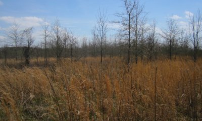
This state is representative of forest recovery in areas that were once under former intensive landuse such as long-term row crop cultivation. Characteristics that distinguish this state from other forest states on this site include a suite of soil-site properties that reportedly affect tree growth such as higher soil bulk density due to compaction, presence of a plow pan, lower organic matter content, and reduced fertility (Baker and Broadfoot, 1979; Groninger et al., 1999). Two community phases are provisionally recognized for this state. Community Phase 6.1 represents natural colonization of tree and shrub species without management. Community Phase 6.2 is representative of intentional forest establishment by artificial regeneration or planting.
For Community Phase 6.2, determining the objectives and goals of the future stand is imperative to increase the probability of successful establishment and production of the afforested area. These decisions will ultimately determine the species to be established, preparation requirements, planting density, and post-planting operations (e.g., competitor control, future improvement cuttings and thinnings, regeneration methods, and overall stand health). Since each area targeted for afforestation may have unique or different landuse histories, having a clear understanding of the soil-site conditions are essential. Some areas may necessitate a series of soil improvement actions prior to planting. These actions may include subsoiling or deep plowing to breakup plow pans and fertilizing the targeted area. An additional option is to allow the area to undergo fallowing for a predetermined period (Community Phase 6.1) to potentially increase soil organic matter content, enhance soil aggregate stability, increase soil biological activity, and improve water holding capacity and infiltration rates. Controlling competing vegetation (chemical and mechanical treatment) will most likely be critical. Post-planting operations and maintenance of the stand can enhance survival, future development, and achieve goals and objectives (see Gardiner et al., 2002).
Finding the appropriate approach for a given environment necessitates close consultation with trained, experienced, and knowledgeable forestry professionals. If there is a desire to proceed with this state, it is strongly urged and advised that professional guidance be obtained and a well-designed afforestation and silvicultural plan developed in advance of any work conducted. For an exceptional review and summarization of the afforestation literature, techniques, and practices within the Southern Mississippi River Alluvium, interested parties are directed to Gardiner et al. (2002).
Submodel
Description
This state is representative of the range of conservation actions that may be implemented and established on this ecological site. Apart from planting trees and managing for forest, one may elect to establish native herbaceous species and manage for predominantly a native grassland; a complex mixture of native grasses and forbs; or a pollinator planting whereby native forbs dominate the mix. In each of these options, it is strongly advised (and possibly a programmatic requirement) that the species comprising the planting or seed mix consist of spring, summer, and fall flowering species. Depending on goals and objectives, various conservation programs and practices may be available. For additional information and assistance, please contact or visit the local NRCS Field Office.
Submodel
Mechanism
Stand composition is heavily altered and managed to favor select species for production (Community 2.1). This transitional pathway also includes heavy timber cutting and/or high-grading leading to Community 2.2.
Mechanism
Actions include mechanical removal of vegetation and stumps; herbicide treatment of residual plants; and preparation for cultivation.
Mechanism
Actions include mechanical removal of vegetation and stumps; herbicide treatment of residual plants; seedbed preparation; and establishment of desired forage.
Mechanism
This transition represents a return to perceived reference conditions and involves the re-establishment of missing species; the control/removal of exotic species (herbicide and mechanical); stand improvement practices that favors a return of more shade intolerant components.
Mechanism
Actions include mechanical removal of vegetation and stumps; herbicide treatment of residual plants; and preparation for cultivation.
Mechanism
Mechanical removal of vegetation and stumps; herbicide treatment of residual plants; seedbed preparation; and establishment of desired forage.
Mechanism
Natural succession (Community 6.1) or site prep (plow pan breakup, fertilizing, etc.); planting species appropriate for site (Community 6.2)
Mechanism
Establish select native species suitable for site; prepare site for planting (herbicide and/or mechanical)
Mechanism
Cropland establishment: vegetation removal (mechanical/chemical) and preparation for cultivation
Mechanism
Natural succession (Community 6.1) or site prep (plow pan breakup, fertilizing, etc.); planting species appropriate for site (Community 6.2)
Mechanism
Establish select native species suitable for site; prepare for planting (herbicide and/or mechanical)
Mechanism
Cropland establishment: vegetation removal (mechanical/chemical) and preparation for cultivation
Mechanism
Actions include mechanical removal of vegetation and stumps; herbicide treatment of residual plants; establish desired forage species and manage for grazing.
Mechanism
Cropland establishment: vegetation removal (mechanical/chemical) and preparation for cultivation
Mechanism
Removal of vegetation; herbicide treatment of residual plants; establish desired forage species and manage for grazing
Model keys
Briefcase
Add ecological sites and Major Land Resource Areas to your briefcase by clicking on the briefcase (![]() ) icon wherever it occurs. Drag and drop items to reorder. Cookies are used to store briefcase items between browsing sessions. Because of this, the number of items that can be added to your briefcase is limited, and briefcase items added on one device and browser cannot be accessed from another device or browser. Users who do not wish to place cookies on their devices should not use the briefcase tool. Briefcase cookies serve no other purpose than described here and are deleted whenever browsing history is cleared.
) icon wherever it occurs. Drag and drop items to reorder. Cookies are used to store briefcase items between browsing sessions. Because of this, the number of items that can be added to your briefcase is limited, and briefcase items added on one device and browser cannot be accessed from another device or browser. Users who do not wish to place cookies on their devices should not use the briefcase tool. Briefcase cookies serve no other purpose than described here and are deleted whenever browsing history is cleared.
Ecological sites
Major Land Resource Areas
The Ecosystem Dynamics Interpretive Tool is an information system framework developed by the USDA-ARS Jornada Experimental Range, USDA Natural Resources Conservation Service, and New Mexico State University.